Datasheet
Year, pagecount:2007, 30 page(s)
Language:English
Downloads:2
Uploaded:October 10, 2019
Size:2 MB
Institution:
-
Comments:
Attachment:-
Download in PDF:Please log in!
Comments
No comments yet. You can be the first!


Content extract
Source: http://www.doksinet Source: http://www.doksinet Contents Introduction 2 Background 4 Chronology 9 Surface Water Development 10 Groundwater 13 Rural Water Issues 16 Indian Water 18 Water Quality 19 Environmental Issues 22 Stretching Supplies 24 Summary 27 Published 2007 On the Cover: The Central Arizona Project canal winds through Scottsdale. Directors: The Layperson’s Guide to Arizona Water is prepared and distributed by the Water Education Foundation and The University of Arizona’s Water Resources Research Center as a public information tool. It is part of a series of Layperson’s Guides that explore pertinent water issues in an objective, easyto-understand manner. The mission of the Water Education Foundation, an impartial, nonprofit organization, is to create a better understanding of water issues and help resolve water resource problems through educational programs. The mission of The University of Arizona’s Water Resources Research Center
is to promote understanding of critical state and regional water management and policy issues through research, community outreach and public education. Water Education Foundation 717 K Street, Suite 317 Sacramento, CA 95814 Phone: (916) 444-6240 Fax: (916) 448-7699 Internet: www.watereducationorg Rita Schmidt Sudman, Water Education Foundation Sharon B. Megdal, Water Resources Research Center Editor: Sue McClurg, Water Education Foundation Writers: Gary Pitzer, Water Education Foundation Susanna Eden, Water Resources Research Center Joe Gelt, Water Resources Research Center Editorial Assistance: Robin Richie, Water Education Foundation Design: Curtis Leipold, Graphic Communications Photo Credits: Arizona Department of Water Resources Arizona State Archives Arizona Office of Tourism Central Arizona Project Cline Library Kingman Daily Miner City of Mesa Salt River Project U.S Bureau of Reclamation Water Resources Research Center College of Agriculture and Life Sciences The
University of Arizona 350 North Campbell Avenue Tucson, AZ 85721 Phone: (520) 792-9591 Fax: (520) 792-8518 Internet: http://ag.arizonaedu/AZWATER Map: Water Resources Research Center and Arizona NEMO ISBN: 1-893246-22-1 1 Source: http://www.doksinet Introduction A precious resource everywhere, water has shaped much of Arizona’s past and present, and water will certainly figure prominently in Arizona’s future. From the Tohono O’odham’s rain ritual to the elaborate irrigation canals built by the Hohokam and the Snake Dance rain ritual of the Hopi, securing a life-sustaining water supply has been an integral part of life in what is now Arizona for thousands of years. From ancient times to the present, capturing and moving water has enabled people living in Arizona’s semi-arid climate to survive and flourish. As elsewhere in the Southwest, Arizona’s water story is largely about moving water from where it originates to where it is needed by a thirsty human population.
Large-scale water diversion occurred in Arizona with the development of the Salt River Project and Central Arizona Project; however, Arizona’s history has also been marked by reliance on groundwater and localized impoundment and diversion of surface water. For long stretches, many of Arizona’s rivers are dry channels that flow only when it rains, while some have year-round flows and nurture important riparian ecosystems. 2 More than a thousand years ago, the Hohokam Indians built miles of irrigation ditches with stone hoes to bring water to their crops in the Salt River Valley. Archeologists’ estimates vary, but it is generally agreed that this ancient civilization flourished with as many as 250,000 inhabitants at its peak. Some 200,000 acres were irrigated by a network of 185 miles of canals. Today, Arizona uses about 8 million acre-feet, or 2.3 trillion gallons, of water each year. Approximately 75 percent of that water goes to agriculture, the rest to residents and
industry. The state’s major surface water resources include the Colorado River, as well as the Salt, Verde, Gila, San Pedro, Bill Williams, Santa Cruz, Little Colorado and Agua Fria rivers. Surface water provides 54 percent of water used in the state. The state’s other major source of water can be found in vast groundwater aquifers that provide about 43 percent of its water supply. (Recycled water, which is wastewater treated to suitable reuse standards, comprises 3 percent of the Arizona’s water supply and its use is growing.) Estimates of total groundwater in the state range as high as 900 million acre-feet – a seemingly endless supply. But estimates of total groundwater say nothing about how much water is really available, which depends on location, depth and quality. Arizona’s groundwater accumulated during hundreds of thousands of years before humans developed the technology to pump it, and Arizona has historically pumped more water from the ground than nature can
recharge through rain and snowmelt. As important as water has been so far in Arizona, its value is likely to grow in the future as a changing climate – including the distinct possibility of longterm droughts – combined with increasing residential demands will require water planners to devise new ways to stretch limited supplies and to carefully manage the state’s water resources. With nearly 1 million new residents in the state in the past five years, and with population projections of as many as 9.5 million people by 2025, serious new challenges await. One of those challenges is ensuring enough water is allocated for environmental purposes, given the many demands for riparian restoration and maintaining habitat for endangered species. A surge of residential development in Arizona’s rural regions has created challenges as state and local officials seek to balance economic viability with the necessities of groundwater management and local control. The stakes are high in the
debate, where questions abound regarding the availability of water to sustain the wave of new homes that is envisioned. This Layperson’s Guide provides an overview of Arizona’s complex and evolving water story – its history as well as the state’s future challenge of providing water from a limited supply to a rapidly growing population – and some of the unique management strategies Arizona has developed to protect and extend its most precious resource. It is part of a series of guides published by the Water Education Foundation. Source: http://www.doksinet 3 Source: http://www.doksinet Background GEOGRAPHY AND WATER The topic of water often begins with rain. Arizona’s three distinct geographic regions have dramatically different rainfall: average annual rainfall ranges from 3 inches in Yuma to over 36 inches in the higher elevations along the Mogollon Rim and in the White Mountains. The Sonoran Desert, famous for the stately Saguaro and harsh, dry climate, is home to
the majority of Arizona’s population. Annual rainfall in this region ranges between 3 and 15 inches. Both Tucson and Phoenix lie within this region, and receive an annual average 11 and 7.5 inches of rain respectively, with much of it falling during the summer monsoons from July through September. The Lower Colorado River region of the Sonoran Desert receives even less rain, an average of 5 inches each year. The lowest, driest place in the state is Yuma – at an elevation of 140 feet and located on the eastern bank of the Colorado River – it receives a scant 3.4 inches annually The Grand Canyon 4 This desert landscape was formed over millions of years. The geologic setting is represented by wide, gently sloping plains cut at intervals by small, steeply rising mountain ranges. During hundreds of thousands of years, runoff from the mountains has carried sediments, eventually filling the valleys, thousands of feet thick in some areas. The water percolating down through this porous
soil filled the ancient aquifers that now lie under the desert floor. Protecting these groundwater resources is the focus of much of Arizona’s current water management strategy. In north central Arizona, the rugged mountain range with the Mogollon Rim as its distinctive northern boundary defines the state’s mountainous region. Upwards of 25 to 30 inches of precipitation fall each year in this range, much of it as snow. Snow is important for water management because it stores water, free of charge and without human effort, through the winter. It melts in the spring, providing runoff to the state’s river systems. Just north of the Mogollon Rim lies the 5,000 to 7,000-foot Colorado Plateau with the majestic, 5,000foot deep Grand Canyon carved into the landscape. The Grand Canyon was formed about 6 million years ago through the erosive forces of water – both from the Colorado River and runoff from rain and melting snow. The Painted Desert and Petrified National Forest are located
in this awe-inspiring region of the state, and atop the Colorado Plateau stand the state’s highest mountain peaks: Humphreys at 12,655 feet and Mount Baldy at 11,590 feet. During wet years these towering giants receive ample rainfall and wintertime snow. At 113,909 square miles, Arizona is the sixth largest state in the union, and despite its relatively dry nature, it contains 28 major rivers. For long stretches, many of these rivers are dry channels that flow only when it rains; while some, like the Little Colorado, Verde, Bill Williams, San Pedro, White and Black rivers, have significant, year-round flows and nurture important riparian ecosystems. Source: http://www.doksinet WATER RIGHTS In Arizona, allocation of surface water is determined by the “doctrine of prior appropriation,” otherwise known as “first in time, first in right.” Those who put the water to use first are senior water rights holders and those who come later hold junior rights. If a junior user is
upstream from a senior user, the junior user must leave enough water in the stream to fulfill the senior user’s rights. Water law in Arizona is different from the Spanish and English canon that preceded it. Spanish water law was well established by the time it was exported to the Americas and a key tenant was that water could only be allocated to an individual after sufficient supplies had been established for the community. English water law, which evolved in a part of the world with high humidity and ample rainfall, was based almost solely on riparian rights, which means the water running through an individual’s property is theirs to use, within certain limits. Water law in the West developed in the context of these quite different historical influences until the late 1840s and the California Gold Rush. Miners moved water from streams to use on nearby mountains and hillsides, and it was these early diversions that led to the development of appropriative rights, with two major
differences from the riparian rights system. First, an individual did not have to own the land adjacent to a river to get a right to the water – water could be taken from the river to a distant point of use. Second, the date the right was established became important. Disputes over water inevitably arose, and miners decided that first-come, first-served was a fair rule to apply. As farmers settled the West and the mining days waned, irrigators became the primary users of water, and they too transported it from streams to their fields, adopting the water laws established during the mining days. Prior appropriation was officially written into law in Arizona when it was still a territory in 1864 under the Howell Code. In 1888, the rule was upheld by the Arizona Territorial Supreme Court in Clough v. Wing The Arizona Constitution further clarified the state’s adherence to the prior appropriation doctrine by stating, “The common law doctrine of riparian rights shall not obtain or be
of force or effect in the State.” Today, the Arizona Department of Water Resources (DWR) manages a water permit program that records surface water rights, including the rights established before adoption of the Howell Code. Although a great many individual surface water permits exist, most of the state’s surface water is controlled by a relatively small number of public and semi-public organizations. About 30 years ago a process was initiated aimed at resolving all the water rights on an entire river system, a judicial process called a general stream adjudication. Two major adjudications are ongoing: the Little Colorado River and the Gila River. The Little Colorado River adjudication concerns the claims of 3,100 water users in northeastern Arizona. The Gila River adjudication encompasses the Gila River watershed, including the watersheds of the Salt, Verde, Agua Fria, San Pedro and Santa Cruz rivers, where more than 85 percent of Arizona’s population lives. It contains 83,500
claims by more than 24,000 claimants and has been ongoing since 1979. Because of the complexity and number of claims, resolution is not expected for many years. Arizona miners circa 1890 While most surface water in the state has been appropriated, a new contender for official water rights has emerged – the environment. In 1990, DWR issued its first “instream” flow permit, which granted the right to keep water in a stream to support fish and other wildlife habitat to The Nature Conservancy of Arizona for Ramsey and O’Donnell creeks in Southeastern Arizona. The groundbreaking decision granted instream rights of up to 2,856 acrefeet of water in Ramsey Creek, a perennial stream bounded by canyon walls that provides a moist, cool and stable environment for five major biotic communities. DWR’s legal authority to approve such rights was challenged when Phelps Dodge objected to the U.S Forest Service’s application on behalf of the Tonto National Forest for instream flow rights to
Cherry Creek, a tributary of the Salt River above Roosevelt 5 Source: http://www.doksinet Dam. In 2005, the Arizona Court of Appeals held that DWR does have the right to issue instream flow permits, and in March 2006, the Arizona Supreme Court upheld the decision. To date, the state has issued 28 certificates to various agencies and organizations for instream flows, with junior rights based on the date the applications were filed. Some environmental organizations are working to acquire senior appropriative rights and convert them to instream rights that retain the senior priority. It wasn’t until 1933 that the state defined and established a set of laws governing groundwater rights. In simple terms, groundwater can be used by the person whose land covers it. This law, based on the common law doctrine of “reasonable use,” perpetuated the assumption that groundwater and surface water were physically separate systems. But in many cases, groundwater and surface water are
connected. In these locations, groundwater pumping can significantly diminish above-surface stream flow; conversely, extensive upstream surface water diversions can reduce the recharge of downstream aquifers. The Groundwater Management Act (GMA) of 1980 substantially changed groundwater law for most people in Arizona and laid the foundation for managing Arizona’s water resources in a coherent way (See page 13). WATER USES In its Water Atlas, DWR defines the water uses for which it collects data as “cultural demand” to distinguish them from instream uses of water, such as for support of fish and riparian ecosystems. The largest cultural use of water is by agriculture – approximately 75 percent or about 5.8 million acrefeet per year Agriculture’s share of water use has been declining during the past 30 years from its peak of more than 8 million acre-feet in 1976, but some areas of the state have seen much larger decreases than others. The largest long-term declines overall
have come in central and south- Hoover Dam 6 east Arizona due to urbanization. Farms along the Lower Colorado and Gila rivers have continued to use an average of 3 million acre-feet of water per year to produce cotton, citrus, other fruits and vegetables, grain and alfalfa hay. Industry uses about 5 percent of the state’s total water. Water use for mining is substantial in some areas of the state. Arizona is the nation’s leading producer of copper, responsible for about 60 percent of total U.S mine production The state also is a leading producer of molybdenum, sand and gravel and gemstones. Source: http://www.doksinet Power generation is a growing industry in the Southwest and, on average, 1 kilowatt hour of electricity requires about 25 gallons of water to produce. Where possible, Arizona power plant operators use saline groundwater and recycled wastewater rather than potable supplies to generate electricity. For example, the Palo Verde Nuclear Generating Station, located
about 50 miles west of Phoenix, uses about 20 billion gallons of treated wastewater from several area municipalities each year to meet its cooling water needs. Even so, about 30 percent of the water used by Arizona power plants is potable groundwater. Total municipal use is estimated at 20 percent or 1.6 million acre-feet. Most of this water – 60 percent – is used outdoors to irrigate landscaping. In an effort to reduce outdoor irrigation water, many new homes and commercial buildings in Arizona are xeriscaped – landscaped with desert plants and little or no lawn. Conservation practices, such as desert landscaping, have reduced the average amount of water each person uses, but as population grows, so does municipal water use. (See page 24) As with power producers, many golf courses in Arizona irrigate with recycled water because the use of potable water on golf courses is considered wasteful by some Arizonans. In some areas, the use of groundwater for new golf courses is
prohibited. FLOODS AND DROUGHTS Arizona, like the rest of the Southwest, is known for its fluctuating weather patterns and climatic extremes – severe regional floods or droughts are common but unpredictable. While modern climate records have only been kept for a little more than 100 years in northern Arizona, tree-ring data and other paleorecords extend climate information back more than 1,000 years. Flooding is an inevitable part of the water cycle and it is now recognized that a particularly wet period followed a drought in the early 1900s. But the largest recorded flood in Arizona history occurred February 18-26, 1891 on the Salt River at Phoenix, where the river became 2 to 3 miles wide with a flow of 300,000 cubic feet-per-second. During another wet period between October 1977 and February 1980, seven regional floods occurred, affecting nearly the entire population of Arizona and causing $80 million in damage. In December 1978, almost every river in Arizona overflowed its
banks. When a dike on the Gila River in eastern Arizona broke, the town of Duncan was inundated with 7 feet of water and 75 houses were destroyed. In February 1980, a major storm dumped nearly a foot of water in the upper portions of the watershed that drains into the Salt and Verde rivers. Coupled with the stored runoff from a wet winter, flows threatened to overwhelm the capacity of the dams on the Salt River. Even though the dams held, flood-related damage in metropolitan Phoenix exceeded $70 million. Agriculture uses approximately 75 percent of the state’s water each year. Popular crops include cotton, citrus, other fruits and vegetables, grain and alfalfa hay. Arizona’s most destructive flood occurred in October 1983 when torrential rains caused flooding over the entire southeastern quarter of the state. Three thousand homes were damaged or destroyed, 10,000 people were displaced and 13 people were killed. The most extreme drought in the 20th century occurred in the 1950s
and the longest drought recorded in Arizona lasted for 76 months in the early 1900s when rainfall averages fell statewide by 7 Source: http://www.doksinet Flooding along the Salt River in Maricopa County, circa 1978 8 2 inches. The most extreme drought of the previous millennium occurred in the 1500s; tree ring records indicate that the 1579 to 1600 drought in the Colorado River Basin reduced the river’s flow nearly a third. Since 2000, the Colorado River Basin has experienced the driest eight-year period on record, reducing storage in the two major reservoirs (Lakes Powell and Mead) to about 50 percent as of mid-2007. Given past climate variability, it is hard to know what the impacts of climate change might mean for the Southwest’s future water supplies. Scientific research has found that during the 20th century, average temperatures in the Southwest rose by 2 to 3 degrees Fahrenheit. Average temperatures are predicted to rise as much as 9 degrees Fahrenheit or more during
the 21st century, a magnitude of change as great as the end of the Ice Age 10,000 years ago. Scientists and public officials are concerned that water in the Colorado River will run short much sooner than previously predicted because of drought, booming population growth and the river’s overallocated status. Water officials say there is a 25 percent chance the river will not be able to meet all the anticipated demands between 2020 and 2025. With that in mind, state managers have been banking excess supplies of Colorado River water in groundwater basins throughout central Arizona. Global warming-induced climate change already is altering climate patterns worldwide and the implications for local and regional water supplies are uncertain. Higher precipitation during El Niño winters and autumnal tropical cyclones could lead to greater recharge of local surface waters and aquifers. However, the warmer average surface and air temperatures will result in less snow pack and cause higher
rates of evaporation, which might lead to less surface and groundwater recharge. Source: http://www.doksinet Chronology 1000 Hohokam and Anasazi build irrigation canals in the Salt River Valley. 1528 Spanish arrive in Arizona. 1821 Mexico achieves independence from Spain; claims Arizona as its territory. 1848 The Treaty of Guadalupe Hidalgo ends U.SMexican War Texas, California and New Mexico – which then included Arizona north of the Gila River – are awarded to the U.S 1852 Americans begin navigating the Colorado River by steamer. 1853 Gadsden Purchase extends Arizona boundary from the Gila River to the present boundary. 1863 Congress declares Arizona a territory. 1868 Salt River Valley Canal built atop remnants of Hohokam canals. 1869 John Wesley Powell explores Grand Canyon. 1892 The Kibbey Decision states that surface water belongs to the land and is not a separate commodity. 1902 U.S Reclamation Service (later Bureau of Reclamation) established by the federal Reclamation
Act. 1903 Salt River Valley Water Users Association formed to fund construction of Roosevelt Dam on the Salt River. It is the first multipurpose reclamation project started under the federal Reclamation Act. 1904 Construction begins on Roosevelt Dam on the Salt River at confluence with Tonto Creek. 1910 Kent Decree establishes the basis for water rights in the Salt River Valley. 1911 Roosevelt Dam is completed. 1912 Arizona becomes the 48th state on Feb. 14 1919 Grand Canyon National Park founded. 1922 Colorado River Compact, signed in Santa Fe, New Mexico, allocates 7.5 million acrefeet of water each to the upper and lower basins of the Colorado River. 1928 Boulder Canyon Project authorized by Congress allocates 2.8 million acre-feet of water to Arizona, 4.4 million acre-feet to California and 300,000 acre-feet to Nevada. 1935 Hoover Dam on the Colorado River dedicated by President Franklin D. Roosevelt. Arizona National Guard and militia units sent to Parker Dam construction site on
the Colorado River to protest future diversions of water to California. 1944 Arizona Legislature ratifies the Colorado River Compact. 1946 1963 1964 1965 1968 1969 1971 1973 1980 1985 1986 1987 1988 1992 1993 1995 1996 2000 2001 2003 2004 2005 U.S and Mexico sign treaty allocating 15 million acre-feet of Colorado River water to Mexico. Central Arizona Project Association formed. Arizona wins Supreme Court decision in contest with California over share of Colorado River water. The decision confirms Arizona’s 2.8 million acre-feet allocation and clears way for construction of the Central Arizona Project (CAP). Supreme Court decree ends 12 years of litigation between California and Arizona over the Colorado River. Upper and Lower Basin states reach agreement on Colorado River legislation. Colorado River Basin Project Act authorizes construction of CAP. National Environmental Policy Act enacted. Central Arizona Water Conservation District formed. CAP construction begins. Federal
Endangered Species Act enacted. Groundwater Management Act passed; Active Management Areas (AMA) formed. First CAP water flows through the HaydenRhodes Aqueduct. Arizona Environmental Quality Act passed; Arizona Department of Environment Quality created. Construction on New Waddell Dam begins. CAP deliveries begin on Santa Rosa Canal section of project. Assured Water Supply program requires developers and water providers in AMAs to demonstrate a 100-year water supply. CAP completed; water delivered to Tucson. Central Arizona Groundwater Replenishment District (CAGRD) created. Roosevelt Dam expansion completed, raising the height of the dam to 357 feet and expanding the lake’s storage capacity by 20 percent. Arizona Water Banking Authority created. Federal government and states adopt Colorado River Interim Surplus Guidelines. First year of extreme drought conditions in Upper and Lower Colorado River Basins. First water stored for Nevada in Arizona groundwater basins. California signs
Colorado River water delivery agreement. Arizona Water Settlement Act enacted. Lower Colorado River Multi-Species Conservation Plan is adopted and funded. John Wesley Powell The Salt River Valley circa 1900 Franklin D. Roosevelt at Hoover (Boulder) Dam dedication 9 Source: http://www.doksinet Surface Water Development From its beginning, the story of Arizona water has been one of adaptation. By the 1500s, the Hohokam Indians abandoned large central settlements and centralized water systems in the Salt River Valley near present day Phoenix. Small groups dispersed throughout the region. When Spanish explorers arrived in the region in the 1600s, they expanded the use of small dams and ditches to support their livestock and domestic animals, and like the Hohokam, they moved surface water through canals to irrigate their crops. Two centuries later, when the central Arizona gold rush brought settlers to the area, they found descendents of the Hohokam irrigating their fields along the
Gila River. In 1888 an ex-Confederate cavalryman named Jack Swilling judged the Hohokam canals worthy of resurrection and built the Swilling Irrigation and Canal Co. atop these abandoned structures. Other entrepreneurs followed suit and soon hundreds of miles of canals delivered water to a small, thriving agricultural community. When drought brought this canal-building to an end and most settlers had fled to more hospitable climes, the settlers who remained focused their efforts on developing more extensive water storage as a protection against future droughts. Roosevelt Dam By the beginning of the 20th century, numerous canals wound through the landscape surrounding the Phoenix area, delivering water to crops and the burgeoning settlement. Large-scale storage facilities did not yet exist, however, and settlers in the region realized that demand for water would soon outgrow the seasonal supply. In 1903 a group of landowners formed the Salt River Valley Water Users Association and in
a collabora- 10 tive effort with the federal government began construction on the first major water storage facility in the state. With funds available from the recently passed National Reclamation Act, the first Salt River Project (SRP) water storage facility was built, Roosevelt Dam. Begun in 1903, the dam was completed in 1911 at a cost of $10.3 million Considered a technological marvel at the time, the dam stood 284 feet high, 184 feet thick at the base and 16 feet wide at the crest. The 30-mile-long, 4-mile-wide reservoir that formed behind the dam held enough water to serve the growing Phoenix area for five years. Roosevelt Dam was the first of a series of projects that would eventually store some 5 million acrefeet of surface water in reservoirs within the state. (The U.S Bureau of Reclamation (Reclamation) controlled the dam and its irrigation systems until 1917 when the SRP association took over). This reliable supply of surface water allowed agriculture, mining, industry
and population to rapidly expand in the Phoenix area. Less than a decade after Roosevelt Dam was built, however, Phoenix found itself in need of new supplies, and this time water managers turned their attention 28 miles away to the Verde River. In 1920 the city built a redwood pipeline from the Verde to Phoenix, and with the help of gravity, water began flowing to the city later that same year. Water users soon decided storing Verde River water would help ensure reliable supplies. Following completion of Bartlett Dam in 1939, Horseshoe Dam, with a storage capacity of 131,400 acre-feet, was completed in 1946. Today, seven dams on the Salt and Verde rivers and East Clear Creek make up the SRP. On average the SRP supply consists of about two-thirds surface water and one-third groundwater. (Roosevelt Dam was enlarged in 1996 and now holds 1.6 million acrefeet of water) In 1903 Congress also authorized construction of the Yuma Project to divert and distribute Colorado River water for
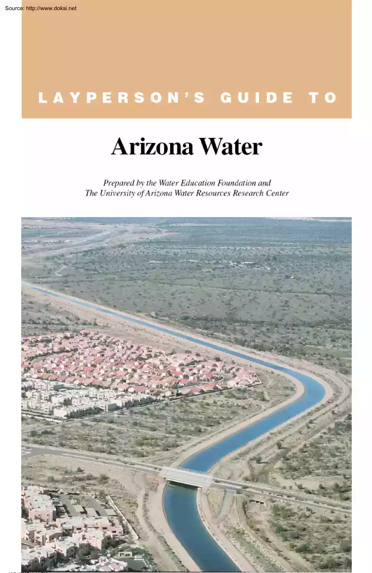
irrigation. A diversion dam and canals were constructed between 1905 and 1909 to irrigate crops in the Yuma area. The Yuma Auxiliary Project was added in 1920 and irrigates an additional 3,100 acres on Yuma Mesa. Just east of Yuma, along both sides of the Gila River, the Gila River Project provides irrigation water for a range of crops from citrus to Bermuda grass seed. Together, these projects deliver more than 1.5 million acre-feet of irrigation water each year to approximately 153,000 acres of farmland in Arizona, as well as to a residential, commercial and industrial customer base of more than 100,000 people. Source: http://www.doksinet THE CENTRAL ARIZONA PROJECT Arizona’s largest water storage and distribution project is the CAP, a 336-mile canal that extends from the Colorado River to central and southern Arizona to a terminus south of Tucson. The CAP is a complex system of aqueducts, tunnels, pumping plants and pipelines. Along the way the CAP lifts the water about 2,900
feet, using 14 pumping plants powered mostly by electricity from the coal-fired Navajo Generating Station near Page. The CAP delivers Colorado River water to cities and water utilities, agricultural users, Indian communities and underground water storage (recharge) projects. More than 4 million people and 300,000 acres of irrigated farmland in Central Arizona depend on the CAP for delivery of over half their water supply. The Colorado River is a major source of water for the West. In its flow toward the Gulf of California, the Colorado River passes through parts of seven states (Wyoming, Colorado, Utah, New Mexico, Arizona, Nevada and California) and the Republic of Mexico, with each entitled to a supply of the river’s water. To manage the river and ensure delivery of its waters to its various users, an interconnected system of dams and diversions has been built. The history of Colorado River negotiations among these states to determine shares of river water is complicated. Realizing
the need to settle their water rights, delegates from the seven Colorado River Basin states met in New Mexico in 1922 to discuss, negotiate and ultimately work out Colorado River water rights. The result was the Colorado River Compact that apportioned water between the Upper and Lower Basins. It was signed by all the states except Arizona on Nov. 24 The Compact was the founding document of what is known as the “Law of the River.” The “Law of the River” refers to a collection of compacts, agreements, contracts, an international treaty, state and federal legislation, U.S Supreme Court decisions and federal administrative actions that apportion and regulate the use and management of Colorado River water among the seven states and Mexico. Many regard the major components of the Law of the River as a constitution because it establishes a framework for managing the river’s resources. During the 1922 Compact discussions, representatives from the states and the federal government
agreed to divide the basin into upper and lower regions with each having rights to 7.5 million acrefeet of water annually The allocations were based on hydrologic data from Reclamation that indicated annual Colorado River flow at Lees Ferry at 16.4 million acre-feet. Later studies have shown this figure to be based on wetter-than-average data, with tree ring data from 300 years ago indicating an average flow as low as about 13.5 million acre-feet Further, The CAP is a 336-mile canal that extends from the Colorado River to central and southern Arizona to a terminus south of Tucson. 11 Source: http://www.doksinet annual flows are highly erratic, ranging from 4.4 million acre-feet to more than 22 million acre-feet annually. Congress in 1928 divided the Lower Basin allocation by giving California 4.4 million acre-feet, Arizona 2.8 million acre-feet and Nevada 300,000 acre-feet of water. Initially, Arizona legislators were divided over the wisdom of ratifying the Compact because it did
not allocate water to each state and did not address Arizona’s claim to the Gila River. The ink had barely dried on the Compact when Arizona and Nevada began to worry that California was going to take more than its already large share of the water. Arizona’s concern grew to alarm when just a few months later, the U.S Supreme Court ruled that the doctrine of prior appropriation applied across state lines. The decision opened the door for California to claim senior water rights on the Colorado River if it were to use more than its allocation before Arizona began using its share. In protest, Arizona refused to ratify the Compact and fought to have limits placed on California’s share. Congress, meanwhile, passed the Boulder Canyon Project Act in 1928 with the stipulation that it would become binding when six of the seven states agreed, provided that California was among them. In 1929, six of the seven Basin States approved the compact and the Boulder Canyon Project Act was declared
effective June 25. While the act authorized construction of Boulder (Hoover) Dam, it also limited California to no more than one-half of any surplus river water in a given year and gave the other half of any surplus to Arizona, as well as rights to all water in the Gila River that flowed through Arizona and into the Colorado River. In 1935, the last concrete was poured to build what was then the largest dam on earth, Hoover Dam. Throughout, Arizona remained wary that California might still claim senior rights to some of Arizona’s water. When construction began on a second dam at Parker, also on the lower Colorado River, and the point from which urban California would take its allocation through the Colorado River Aqueduct, Arizona objected. This time, taking matters into its own hands, it sent the Arizona National Guard to stop construction on Parker Dam from the Arizona side of the river. Cooler heads prevailed and California got the dam and aqueduct it needed to bring Colorado
River water to Los Angeles and inland southern California. 12 While California was busy building its aqueduct (completed in 1941), Arizona was building its own water infrastructure within the state. The state’s population grew dramatically after World War II, and groundwater pumping increased at an alarming rate. Water leaders decided to focus on getting the state’s own canal system to bring Colorado River water to the central and southern part of the state. This posed a considerable political challenge in getting Congress to approve and fund the CAP. Political leaders, such as Arizona Rep. John Rhodes and Sen Carl Hayden, who were instrumental in getting the project approved, have achieved legendary status in Arizona water affairs. In an attempt to win support for the CAP, Arizona ratified the Colorado River Compact in 1944. This move did not win federal approval for the CAP, in part because of remaining legal uncertainty: California could still win a prior appropriation claim
in court that would make construction of the CAP superfluous. To resolve the allocation dispute once and for all, Arizona sued California and in 1963 finally prevailed in the U.S Supreme Court The case lasted 11 years and cost nearly $5 million. In the end, the court confirmed Arizona’s 2.8 million acre-feet allocation, as well as its rights to tributaries to the Colorado within Arizona. It further established that during years when the river provided a surplus of water to the Lower Basin states that the surplus would be split evenly between Arizona and California. Most significantly, the court ruled that California could not stake a permanent claim to more water simply by using it first. After the verdict, the next step was obtaining congressional approval for the CAP. Arizona was successful, but at a price. To obtain the necessary California support, Arizona had to accept junior priority status for CAP Colorado River water. This means if a shortage is declared on the lower Colorado
River, Arizona theoretically could lose its entire 1.5 million acre-feet CAP allocation before California loses any of its allocation. Nevada also holds junior priority status. Congress approved construction of the CAP in 1968. Construction began in 1973 and lasted 20 years, with the first water deliveries celebrated in 1985 in the Harquahala Valley. Upon its completion in 1993 at a terminus 14 miles south of Tucson, the system cost $4 billion. Today the CAP delivers about 15 million acre feet of water annually to Pima, Pinal and Maricopa counties. Source: http://www.doksinet Groundwater Groundwater is stored in the ground in materials such as gravel or sand. Water also can move through porous rock formations such as sandstone or through cracks in rocks. A geologic formation that is saturated with water and can be pumped with a well is called an aquifer. Wells pump groundwater from the aquifer and then pipes or canals deliver the water to homes and businesses, to industry or to
crops. Early Arizona law was based on established legal principles rather than principles of geology and hydrology. With increased knowledge and information came the realization that the interconnection of groundwater and surface water is a complex phenomenon. THE GROUNDWATER MANAGEMENT ACT Prior to 1980, Arizona’s groundwater was governed by the “American Rule” of reasonable use, which basically meant a landowner had the right to pump and use groundwater, almost without question. Under this rule, productive agricultural areas developed that were largely or entirely dependent on groundwater. By the 1970s, the farm country of Pinal County was already experiencing land subsidence and earth fissuring because of over-pumping for agricultural irrigation. Although the state is known for its desert landscape and wide open spaces, Arizona is one of the most urbanized states in the country. About 80 percent of its 6 million people live in the metropolitan areas of Phoenix and Tucson.
Before the CAP was completed, Tucson had become the largest metropolitan area in the country solely dependent on groundwater The Phoenix area also was drawing down groundwater aquifers, despite its rivers and system of surface water storage reservoirs. The use of groundwater had grown to the point that in some basins the amount of water withdrawn from aquifers exceeded the amount of recharge by a factor of three or more. Before the federal government would approve funding for the construction of the CAP, it insisted that Arizona address its groundwater overdraft problem. With federal CAP funding in the balance, the various interested parties met in a series of sessions convened by Gov. Bruce Babbitt and in 1980 agreed to the legislation that became the Groundwater Management Act (GMA). The GMA remains one of the most innovative and effective strategies for managing water supplies in the nation. drafted groundwater basins were designated Active Management Areas (AMAs) and management
divisions of DWR were established in each AMA to develop long-term plans, conservation strategies, regulations and enforcement mechanisms to reduce overdraft. Four AMAs were created – Phoenix, Tucson, Pinal and Prescott. (In 1994 the Santa Cruz AMA split from the Tucson AMA.) The GMA also established Irrigation Non-Expansion Areas (INAs), where the amount of irrigated acreage could not increase. There are now three INAS The goal of the GMA was to eliminate severe groundwater overdraft in areas of the state where overuse of groundwater was considered a problem. It provided a new set of management tools to DWR and created a structure in which water management strategies could be tailored to local conditions. Over- Almost 85 percent of Arizona’s population resides within the five AMAs and this percentage is expected to increase as overall population increases. People and enterprises in the AMAs account for about half of the state’s water withdrawals although AMAs comprise only
about 13 percent of Arizona’s land. Interior Secretary Don Hodel, left, and Arizona Gov. Bruce Babbitt, right, at the 1985 celebration of the Central Arizona Project canals first water deliveries to the Harquahala Irrigation District. 13 Source: http://www.doksinet The GMA mandated conservation by agricultural, industrial and municipal users in AMAs. Conservation requirements were specified in a series of 10-year management plans that established maximum annual groundwater allotments for irrigated agriculture based on historical acreage and crop type. Farmers were not permitted to increase the number of acres they irrigated beyond their calculated maximum and their annual water allotments decreased as time passed, encouraging them to adopt conservation measures. Municipal water providers were required to develop conservation programs that reduced their customers’ water use. Water use targets were based on the concept of gallons per capita per day – the total amount of water
used by the provider in a day divided by the number of people in the provider’s service area. These targets were replaced with best management practices for many providers. An innovative feature of the law is the Assured Water Supply (AWS) Program, which requires that new residential developments demonstrate sufficient water, including substantial supplies from renewable sources, to meet the needs of the new residents for 100 years. Prior to plotting a new subdivision, a potential developer must demonstrate its supplies will meet applicable water quality standards and water must be “physically, continuously and legally available for 100 years.” In addition, the applicant must show the financial capability to construct the necessary infrastructure. RECHARGE AND AQUIFER STORAGE Today Arizona has one of the nation’s largest groundwater recharge programs. It was only fairly recently, however, that the state passed laws specifically designed to encourage groundwater storage.
Indeed, if someone stored water underground prior to 1986, there was no guarantee that that individual or entity would be able to establish and retain the right to use that water, even in AMAs. The Underground Water Storage, Savings and Replenishment Act addressed this issue for projects within AMAs, providing legislative protection to the people who stored the groundwater. Since the first underground storage facility was built in 1994, Arizona has developed approximately 2 million acre-feet of annual storage capacity in permitted recharge facilities. Because AWS rules require that a substantial portion of an assured water supply be renewable (not groundwater), communities and developers need access to renewable water supplies. For developments that do not have physical access to renewable water such as the CAP, Arizona created legal mechanisms for developers and growing communities to comply with the law. If they store water from a renewable source in a recharge facility, they earn
credits that they can then use to pump additional groundwater. The recharge facility must be in the same AMA as the residential development, but it can be anywhere within that area. DWR oversees the recharge and recovery program. In addition, the state Legislature created the Central Arizona Groundwater Replenishment District (CAGRD). The CAGRD has become a popular vehicle for meeting the AWS requirement that the 14 assured water supply include renewable water. Developers and water providers can join the CAGRD and pay for the district to replenish groundwater used with renewable water. It then becomes the obligation of the CAGRD to offset pumping by its members with groundwater replenishment anywhere in the same AMA. Under this system of recharge and replenishment credits, groundwater, surface water and recycled water can be managed together, making for much more flexible and adaptable water management. Conjunctive management, as it is called, allows surface water to be used when and
where it is plentiful, saving groundwater for times and places of shortage. It also provides an incentive to manage wastewater as a resource to be reused. Current rules that allow storage in one place and recovery in another, however, have been criticized for having inadequate safeguards against potential impacts such as increased pumping costs, damage to or loss of riparian ecosystems, land subsidence and water quality degradation. The Arizona Water Banking Authority (AWBA) was created in 1996 to save Arizona’s unused Colorado River water entitlement, and the bank stores this water in groundwater storage facilities within the CAP service area. DWR maintains a credit account for the bank that shows how much water is available for recovery. Most of the funds used to buy the water and store it underground come from a tax on property and fees charged for pumping groundwater in areas served by the CAP. Other states have operated Source: http://www.doksinet Recharge ponds at the Lower
Santa Cruz and Aura Valley recharge sites. water banks that essentially broker trades between entities with excess water and others who do not have enough. In Arizona, the water bank operates more like a savings account in which excess water is deposited and may be withdrawn in time of need. pay for storage. By the end of 2005, Nevada had a water bank account balance of 237,066 acre-feet and by the end of 2007, 42 percent of the Nevada water will be stored. Nevada has asked for recovery beginning in 2010. In 2001, Arizona entered into an agreement with Nevada to bank excess CAP water for use in Nevada. Under terms of the agreement, the AWBA promised its “best effort” to build up a water storage account of 1.25 million acre-feet of long-term storage credits for Nevada. Nevada would pay the full price of water delivery and storage, as well as costs to recover the water and deliver it to CAP customers in Arizona. Nevada would then be entitled to water from Arizona’s share of the
Colorado River in exchange for its banked credits. An amendment agreed to in 2005 replaces the term “best effort” with “guarantee” of annual delivery amounts. The upper limit of annual withdrawal under the amended agreement is 20,000 acre-feet until 2008 and 40,000 acre-feet thereafter, except during shortage years. Under the terms of a 1992 storage agreement between the Metropolitan Water District of Southern California (MWD) and the CAP, MWD paid the costs to store 89,000 acre-feet of Arizona’s water in the state’s groundwater storage system. In 2007, MWD began a five-year process of recovering that water. Beginning in January 2009, Arizona also will receive 10 annual payments of $23 million from Nevada to Interstate banking activities have accelerated the need to develop plans for recovering banked water. Concerns that complicate recovery planning are related to issues of cost, jurisdictional authority and control. For example, it costs the AWBA less in general to use
groundwater storage available in the Pinal AMA (Pinal County) than facilities in the Tucson AMA. Local water managers are concerned that the risks and costs of recovery could be greater for the Tucson area, and so far, ABWA has rejected this strategy. 15 Source: http://www.doksinet Rural Water Issues Smaller cities such as Flagstaff and Yuma, small towns, farm fields and large expanses of undeveloped land are all found in the remaining 87 percent of the state beyond AMA borders. Limited water and financial resources, uncertain authority and lack of technical information make effective water management difficult for local governments. Some rural communities are growing dramatically and residential developments are being built on previously undeveloped deserts. In some areas, growing populations – seasonal and permanent – are straining existing infrastructure and developed Rural communities adjacent to the borders of Utah, Nevada, Arizona and California are developing at record
rates and their expansion is moving into the neighboring states. Mohave County, in northwestern Arizona, is one example Plans are in the works to build more than 200,000 homes in the county over the next several decades. The reason for this planned boom is the construction of the Hoover Dam bypass route on U.S 93 The bypass will reduce the commute time from Las Vegas, Nev., across the state border to Arizona, and could mean the creation of a bedroom community for Las Vegas in Kingman and other parts of Mohave County. As demands on Arizona’s water supply continue to increase, water leaders are focusing on statewide water management concerns. One such effort is the Growing Smarter and Growing Smarter Plus acts that require populous counties and fast-growing communities to develop comprehensive plans that include a water supply element. These water elements are supposed to match available supplies with the estimated demand for water. Where demand is expected to grow beyond current
supplies, the plan is supposed to show what new water supplies the county or community will pursue. Other statewide water resources initiatives have focused on conservation and drought planning. Legislation passed in 2005 requires community water systems to develop plans that include a water supply plan, a drought preparedness plan and a water conservation plan. It also requires these systems to report annual water withdrawals, diversion and deliveries. Some rural communities are growing dramatically and residential developments are being built on previously undeveloped deserts. 16 water supplies. Residential development plans are often caught up in questions regarding adequate water supplies and local officials are facing tough challenges without the tools available within AMAs. In parts of rural Arizona people sometimes have to haul water to their homes because they are not close to a local water source and live outside of the reach of community water systems. It is unknown how
many people have to haul water, but state officials say water hauling is not uncommon in northern Arizona. More than half of the people who live on the Navajo Reservation haul water, as do hundreds of people in areas surrounding Flagstaff, Williams and Kingman. The pressures of growth on of existing mechanisms for water planning and management in the rural areas of the sate has sparked statewide water policy discussions. An issue getting increased attention is what kind of water management would be appropriate for non-AMA areas. Residents in these areas are wary of the AMA approach with its centralized authority and standardized plans. Complicating the issue is the fact that government boundaries rarely match hydrogeographic boundaries. This can sometimes lead to conflicts and frequently hampers efforts to solve problems that affect entire watersheds. In 1999, the Rural Arizona Watershed Initiative (RWI) was launched to help groups outside of AMAs in their water resource planning
efforts. These groups are encouraged to develop the management strategies suitable for their watersheds with input from local citizens and stakeholders. DWR provides non-regulatory technical Source: http://www.doksinet assistance and the Arizona Department of Environmental Quality has funded water quality planning efforts. Seventeen rural watershed groups were established under the RWI. DWR carried out hydrologic studies in several areas, including the Coconino Plateau and the Upper San Pedro watershed. Some groups have produced substantial results in the form of studies and plans, while the lack of technical and financial resources has limited the activity of others. The Upper San Pedro Partnership (USPP) is one of the most active watershed groups. Formed in 1998, the USPP – a coalition of nearly two dozen organizations – coordinates and cooperates in the identification, prioritization and implementation of comprehensive policies and projects to assist in meeting the area’s
water needs in a manner that protects the San Pedro Riparian National Conservation Area (SPRNCA.) The need for collaborative planning here is strong because of the environmental importance of the SPRNCA and rapid growth in the watershed. In 2006, the Statewide Water Advisory Group (SWAG) was formed, a panel of more than 50 stake- holders charged with crafting recommendations for improved water policy. SWAG recommendations led to a bill that was passed in the 2007 legislative session allowing rural (non-AMA) cities, towns and counties to restrict development if adequate water supplies are not available. However, the law requires the unanimous approval of the county board of supervisors. Another SWAG recommendation led to legislative authorization of a new special district in the San Pedro watershed, which gives the area additional water management tools. Most of Arizona’s residents receive water from public water providers, however, there are many private water companies serving
customers throughout the state. Many of the planned developments in rural areas are proposing that private water companies supply the new residents. These private companies are regulated by the Arizona Corporation Commission (ACC), an independent branch of government created by the Arizona Constitution. In 2007 the ACC focused its attention on issues of adequate water supply, wastewater reuse and conservation. In the cases that come before it, the ACC is asserting its authority to consider these water management issues in its decisions. San Pedro riparian area at Sierra Vista 17 Source: http://www.doksinet Indian Water More than one-fourth of the state’s land is held in trust as reservations for the benefit of American Indians. The determination of water rights and use by Indian communities could have a significant impact on water supplies in Arizona. The Gila River, which runs through the center of the Gila River Indian Community, is Arizona’s largest tributary to the
Colorado River. The Arizona Water Settlements Act of 2004 represents a significant accomplishment in settling a number of difficult issues involving the Gila River Indian Community (GRIC) and the Tohono O’odham Nation. 18 Very little information is available on Indian water use in Arizona. Domestic use is probably much lower than for urban areas and non-Indian rural areas. Use on the Navajo reservation, for example, has been estimated as low as 10 gallons per person per day. This low amount results from a lack of potable supplies for much of the population (approximately 40 percent). The Arizona Water Atlas estimated total Indian water use in the AMAs at 420,600 acre-feet, but does not break out the usage for areas outside AMAs where most tribal lands are located. Currently, Arizona’s Indians use only a small fraction of the water to which they are or may be entitled. Although Indian water rights defined through adjudications and settlements are large, unresolved claims may be
even larger, possibly amounting to more than the state’s total surface water supply. Until these claims are resolved, they introduce enormous uncertainty into water planning for Indian and non-Indian communities in Arizona. The priority of tribal claims to water in the West was established in 1908 with the “Winters Doctrine.” Under this doctrine, an Indian reservation’s water right is linked to the date the reservation was established and its purpose. Since the Arizona v California decision in 1963, an agricultural purpose has been assumed and the quantity of tribal water rights has been calculated based on a reservation’s “practicably irrigable acreage (PIA)”: land that could be farmed with irrigation at reasonable costs. This standard is significant in Arizona where Indian reservation lands encompass 28 percent of the state. A 2001 Arizona Supreme Court decision, however, substituted a “homeland” standard for PIA, with water rights based on a tribe’s uses for the
water – actual and planned. Arizona was the first state to successfully settle a tribal claim with the Ak-Chin settlement in 1978. So far, eight tribal settlements have been completed and several others are in various stages of development. Although they are preferable to adjudication in many respects, settlement processes are demanding and time-consuming activities. Legal and financial obstacles have hampered Indian water development. However, recent settlements were reached that have provided Indian tribes and communities with the needed legal and financial capabilities to make use of their water. Some tribal water settlements have included long-term water leases to Arizona cities, which provide a long-term water supply for growing cities and much-needed revenues for tribal governments. Thirty years ago, tribes were not authorized to lease water for uses outside the reservation. The Arizona Water Settlements Act of 2004 represents a significant accomplishment in settling a number
of difficult issues involving the Gila River Indian Community (GRIC) and the Tohono O’odham Nation. The Gila River, which runs through the center of the Gila River Indian Community, is Arizona’s largest tributary to the Colorado River. Disputes between tribes and non-Indian water users over claims to water in the Gila River system had gone on largely unresolved for more than 100 years. The largest claim came from the GRIC – a combination of members from the Pima and Maricopa Indians of Arizona. The signing of the Arizona Water Settlements Act of 2004 was a major milestone in Arizona’s history and one that could ultimately prove as important to the state’s future as authorization of the CAP. In it, significant funding is provided to enable the GRIC and Tohono O’odham tribe to build water infrastructure to meet the needs of their reservations. In fact, all tribes in Arizona that can use CAP water can benefit, as the law created a fund to pay the yearly operation and
maintenance costs for water delivered to tribes through 2045. The law also set aside $250 million that tribes may use to settle their water-rights claims in the future. The Act allows tribes to use water rights that previously existed only on paper. In addition, it brings longsought certainty to cities and communities as they plan their growth and development and is a major component of a long-term water plan for Arizona. Source: http://www.doksinet Water Quality Water quality protection programs in Arizona are based on federal and state law and are administered by the U.S Environmental Protection Agency (EPA) or Arizona Department of Environmental Quality (ADEQ). The state Legislature established the ADEQ in 1986 to develop a comprehensive groundwater quality protection program; by the 1980s, groundwater contamination had caused numerous wells to be shut down because of possible threats to human health. The ADEQ also administers the state’s environmental protection programs.
Drinking water, groundwater and surface water all are protected through various permitting, monitoring and reporting, remediation, inspection and compliance assurance programs. The principal water quality protection programs in Arizona are the Safe Drinking Water Act (SDWA), the Aquifer Protection Permit program, the Water Quality Assurance Revolving Fund program and the Clean Water Act (CWA). Those who discharge pollutants directly to an aquifer, a land surface or the area between groundwater and the land surface are required to obtain an Aquifer Protection Permit. This state program, established in 1986, requires that all aquifers be protected for drinking water use. Discharges are required to meet Arizona’s aquifer water quality standards – the equivalent of the maximum contaminant level for pollutants set by the federal SDWA. Arizona’s Water Quality Assurance Revolving Fund authorizes the ADEQ to identify, assess and clean up soil, groundwater and surface water contaminated
with hazardous substances. Most Arizonans receive their drinking water from large municipal water delivery systems, but many people depend on private water suppliers, small public utilities or domestic wells. The quality of water provided by municipal and private water systems (that meet the “public water system” definition) is protected by water quality regulators who work to ensure the quality of tap water meets SDWA standards. Meeting new SDWA standards can be a financial challenge, especially for smaller providers. Drinking water quality is directly affected by the quality of the source water. In many instances, water that would otherwise be put to beneficial use is left in the ground because it is too contaminated to be economically treated. Water use practices, such as irrigation drainage and wastewater disposal – particularly on-site wastewater systems or septic tanks – have impacted drinking water from underground sources. Large areas of groundwater have been
contaminated with high levels of nitrogen from agricultural fertilizers and residential wastewater. Mining and other industrial waste also has escaped to contaminate streams and aquifers. As a result, the amount of high quality water available in these areas is reduced and water users can expect to pay increased costs for treatment when these degraded waters are needed in the future. In addition, these contaminants can hurt plants and wildlife. Arizona water quality is affected by a wide range of contaminants, some of which occur naturally; others are synthetic or introduced to water sources by human activities. One widespread naturally occurring contaminant is arsenic, which is found in soil and rocks and is present in a large portion of the state’s groundwater. Long-term exposure to high levels of arsenic in drinking water causes skin, lung, urinary bladder and kidney cancer. Recent changes to federal standards reduced the amount of arsenic allowable in drinking water. According
to ADEQ, about 145 public water systems in Arizona have one or more sources that do not meet the new arsenic drinking water standard of 10 parts per billion. However, more than 94 percent of the state’s population receives drinking water that meets the new stringent standard. Salinity is a large and growing water quality problem in Arizona surface water and groundwater. Measured as total dissolved solids (TDS), salinity is composed of salts, minerals and metals. A natural component of all surface water and groundwater, low levels of salinity have negligible or even positive impacts. Above 500 milligrams per liter (mg/L) TDS, water may take on a salty taste but there are generally no health effects until concentrations exceed 3,000 mg/L. About 9 million tons of salt per year are carried by the Colorado River and cause an estimated $300 million in damage annually in Southwestern states, according to Reclamation. Maricopa, Pinal and Pima counties accumulate 1.75 million tons of salt per
year from the Colorado, Salt and Verde rivers. Some Phoenix area wells pump water with more than 3,000 parts per million TDS. Southern Arizona’s salt load will rise by about 200,000 tons per year when Tucson reaches full use of its CAP water allocation over the next few years, according to a draft report of the Central Arizona Salinity Study. The Colorado River Basin Salinity Control Program, a collaboration of federal agencies, Colorado River states and farming interests, has been working to keep salt out of the river through improved irrigation 19 Source: http://www.doksinet techniques, crop management and diversion of salty groundwater. Estimates are that preventing salt from entering the river costs about $30 per ton of salt blocked. Conversely, salt removal can cost more than 20 times that. standards and permits are based on effluent limits designed to protect the use of the water – for example, drinking water, aquatic life, irrigation and, in some cases, on the adoption
of the best available pollution reduction technology. In Scottsdale, decades of groundwater contamination by the cancer-causing chemical trichloroethylene (TCE) have led to cleanup efforts to tackle one of the largest cases of contamination in the country. In 2002, a court-ordered $61 million settlement was awarded to about 22,000 south Scottsdale residents and people in parts of Phoenix for medical monitoring, personal injuries and property damage. Residents had sued a handful of industries in 1992 for improperly disposing of TCE since 1957, creating two plumes in Phoenix and one in Scottsdale. According to EPA, with the treatment system in place, cleaning up the contamination in the Indian Bend Wash site will take between 30 and 50 years. Included in the CWA are total maximum daily loads (TMDLs), which are pollutant measurements by which regulators seek to maintain the health of rivers, lakes and streams. Arizona’s TMDL program is designed to address nonpoint source pollution –
pollution from a broad or diffuse area caused by increased urbanization, agricultural practices, abandoned mine sites, forestry activities, home septic system failure and construction site activities. These pollution sources cannot be controlled at a single location and can only be curbed through activities at the watershed level. Passed in 1972, the federal CWA established a national commitment to restoring and maintaining national waters in “fishable, swimmable” quality. Under the act, wastewater treatment standards were set that have vastly improved the nation’s water quality. Since 2003, Arizona has administered the National Pollution Elimination Discharge System (NPDES). Under the NPDS, permits are issued for discharges that come from a discreet location such as a pipe. Point source discharge Continuing challenges remain, such as the prevalence of mercury in lakes and rivers. Emanating from both natural and industrial sources, mercury in water bodies is taken up by
organisms and accumulates in fish, including food fish. High mercury levels in fish present a health risk when consumed by people. Mercury is toxic to the nervous system, including the brain. It is especially harmful to the babies and unborn children of mothers who consume fish containing mercury during pregnancy or while nursing. The state has issued fish consumption advisories at more than a dozen sites. CROSS-BORDER WATER QUALITY The international border with Mexico presents special challenges for water management because even problems that are considered local can require the involvement of national level agencies. A special bi-national commission, the International Boundary and Water Commission (IBWC) has jurisdiction on matters involving cross-border waters. As a result, local water matters have at times been enmeshed in international negotiations. Compared with the United States, Mexico has fewer economic resources, and the disparity is perhaps most apparent at the border –
where water quality problems have persisted for years. At the twin cities of Nogales, Ariz., and Nogales, Sonora, for example, sewage mixed with stormwater runoff often overwhelms the inadequate collector system and flows into Nogales Wash. This cross-border tributary to the Santa Cruz River flows into Arizona. Chlorine tablets supplied by the IBWC have reduced health 20 risks from these flows, but they are only a stop-gap measure. Sewage that leaks from the system also contaminates the international groundwater aquifer that provides drinking water to both cities. The 50-year-old Nogales International Wastewater Treatment Plant, located in Nogales, Ariz., treats sewage from both countries. (The plant is owned by the city of Nogales and operated by the U.S section of the IBWC). The plant was last upgraded in 1992 and it is in need of a new upgrade to reduce ammonia and nitrates and to replace older technologies. A lawsuit challenging the facility’s compliance with EPA standards
resulted in court-ordered reductions of contaminant levels in the treated wastewater. Discussions between officials in both countries about solving the problem resulted in a $62 million upgrade to the treatment plant that began in May 2007. Much of the funding was provided by the North American Development Bank, a bi-national financial institution that Source: http://www.doksinet supports environmental projects along the U.SMexico border Recent federal legislation will help address the groundwater issues in the border region. The U.S-Mexico Transboundary Aquifer Assessment Act calls for a collaborative effort to conduct hydrologic studies of such aquifers, including Arizona’s Santa Cruz River Valley and San Pedro aquifers. Management of Colorado River salinity has created recurrent cross-border problems for generations. The 1944 United States-Mexico Treaty for Utilization of Waters of the Colorado and Tijuana rivers and of the Rio Grande provides Mexico a guaranteed annual
quantity of water from these sources. The treaty doesn’t provide specifically for water quality, but this did not constitute a problem until the late 1950s. In 1957 Reclamation built a conveyance channel to return highly saline drainage water from the WelltonMohawk Irrigation District along the Colorado River back into the river itself. However, the drainage water increased salinity in the river to levels that were unacceptable to Mexico. Mexico protested and entered into bilateral negotiations with the United States. In 1974, these negotiations resulted in an international agreement, Minute 242, that guaranteed a specific level of water quality to Mexico. Federal agencies were directed by Congress to implement programs to reduce salinity on both sides of the border. The most controversial salinity control alternative is the Yuma Desalting Plant constructed near Yuma, Ariz. The plant, completed in 1992, was built to desalt drainage return flows from the WelltonMohawk Irrigation and
Drainage District prior to the water entering to the Colorado River. But it was operated for only a few months before operations were halted when flooding on the Gila River washed out the canal delivering irrigation drainage water to the plant. Subsequent high flows in the Colorado River made desalting the drainage uneconomical or even unneeded. When the plant was shut down, the drainage flows were diverted to the Ciénega de Santa Clara in Mexico, where they support a substantial wetlands ecosystem. Talk of reopening the plant alarmed environmentalists on both sides of the border, worried about impacts on the wetlands. But in April 2005, an unlikely collaboration of environmentalists, CAP officials and state and federal representatives announced agreement on a set of recommendations under which the YDP could be operated and the current bypass flows that sustain the Ciénega replaced by water from other sources. In March 2007, the plant began desalting water for the first time in 14
years. The plant ran at 10 percent capacity for 90 days to test its operation capabilities and study its effects on the Ciénega. The plant desalted about 4,200 acre-feet of irrigation water during the demonstration run with the desalted water returned to the river. The test run allowed Reclamation to gather data on potential operating costs and the results are currently being analyzed. The Yuma Desalting Plant, constructed near Yuma, Ariz., was completed in 1992. 21 Source: http://www.doksinet Environmental Issues For many years development of Arizona’s water was virtually unimpeded as dams were built and water diversions were made for use in cities and on farms. But by the 1970s, environmental awareness had grown to an extent that environmental considerations began to be factored into the water supply equation. With the affirmation of water rights dedicated to maintain fish and wildlife – “instream uses” – the needs of the environment are being considered. Fossil
Creek’s Fossil full flow was recently restored after nearly 100 years when a hydroelectric dam, the first in Arizona, was decommissioned. One consequence of water diversions and groundwater pumping is the loss of rich riparian areas of cottonwood-willow forests and bosques of mesquite once found along such waterways as the Salt, Gila and Santa Cruz rivers. These plants provided habitat for muskrats, beaver, fish and many species of migratory birds. The loss of this native vegetation allowed invasive and exotic plant species to take over in many instances, reducing habit for many native species. Any discussion about adverse environmental consequences must consider dams. Uncontrolled rivers and streams in the semi-arid West are risky sources of water. A dusty riverbed can turn into a destructive flood in just a few hours. Once water flows past, it is beyond reach and use. Dams are built to protect against floods and to store water for use when it is needed. Water development in the
West responded to the two related needs of regulating and increasing the supply of water. A stream, however, needs more than water to form a healthy riparian area. A stream in its natural state tends to meander, over time changing its course through a wide flood plain. These shifts of a waterway, along with intermittent flood flows, are vital to the germination, growth and spread of riparian vegetation. Alterations made to streams for flood control and water storage purposes have impaired these natural processes. While there is general agreement that the era of big dam building is over in the western United States, efforts have arisen to create new storage projects to offset the uncertain conditions brought about by climate change. Nonetheless, the authorization, funding and construction of new dams face considerable obstacles. Orme Dam is a case in point. Intended to be part of the CAP, the dam would have been built at the confluence of the Salt and Verde rivers. Orme’s supporters
said the state needed the dam for increased water storage and better flood control, as well as for hydroelectric power. In 1981, after years of opposition by environmental groups and the Fort McDowell Yavapai Nation, the federal government decided to scrap the Orme Dam concept and moved instead to increase water storage and flood control by raising the height of Roosevelt Dam and constructing a new dam for a larger Lake Pleasant on the Agua Fria River. A different kind of river-and-dam story involves Fossil Creek. Its full flow was recently restored after nearly 100 years when a hydroelectric dam, the first in Arizona, was decommissioned and a biologically important watershed restored. With the creek restored, Arizona gains 14 miles of wetland ecosystem valuable for wildlife and creek-side recreation. Another impetus for greater consideration of environmental impacts of water management is the federal Endangered Species Act (ESA), which has changed the method of water operations since
its passage more than 30 years ago. When a project 22 Source: http://www.doksinet needs federal approval, the law requires consultation with federal biologists to “insure that any action authorized, funded, or carried out is not likely to jeopardize the continued existence of any endangered species or threatened species or result in the destruction or adverse modification of habitat of such species.” The ESA has provided for detailed consultation, project modifications and mitigation for many waterrelated activities, including those conducted by Reclamation. One example is the construction of fish barriers on Aravaipa Creek to reduce encroachment on native fish habitat from the CAP aqueduct system. Another example concerns the Southwestern willow flycatcher When Roosevelt Dam was enlarged, the 15-foot difference between the old and new high-water provided significant new storage capacity to Phoenix-area cities at a cost of about $44 million. Unfortunately, the new high-water
mark at Roosevelt Lake inundated a nesting area of this endangered species. Mitigation measures required under the ESA led Reclamation to fund habitat restoration and maintenance in perpetuity elsewhere in Arizona. Efforts have been made to mitigate the effect of dams on the environment, including modification of operations at Glen Canyon Dam on the Colorado River to help protect endangered fish and other downstream resources. Built in the 1960s to provide water storage in Lake Powell and for power generation, Glen Canyon Dam altered the river ecosystem downstream by regulating and smoothing out its highly variable flows. Natural water temperatures decreased, and sediment that provided security, nutrients and habitat for endangered fish was trapped behind the dam. The Grand Canyon Protection Act of 1992 directed Reclamation to ensure its operations are adequately protecting Grand Canyon resources in a manner compatible with other established uses of the dam. Since 1996, Reclamation has
experimented with various flow regimes to partially mitigate the adverse effects of the dam’s operations on the downstream river ecology. Initiated in 1994 by Arizona, California and Nevada, the Lower Colorado River Multi-Species Conservation Program (MSCP) is another noteworthy effort to balance the use of lower Colorado River resources with the need to conserve native species and their habitats as required by the ESA. The MSCP is an ambitious, 50-year commitment to conserve at least 26 species along the Lower Colorado River from Lake Mead to the international border with Mexico. The MSCP goals include conserving habitat, taking action to recover threatened and endangered species, reducing the likelihood of additional species listings, accommodating current water diversions and power production, and optimizing opportunities for future water and power development. It is a multi-state, multi-agency effort with Reclamation, the National Park Service, Bureau of Land Management, Bureau
of Indian Affairs, and Western Area Power Administration participating. The program calls for creating 8,132 acres of new habitat – 5,940 acres of cottonwoodwillow; 1,320 acres of honey mesquite; 512 acres of marsh; and 360 acres of backwaters. Also, 660,000 sub-adult razorback suckers and 620,000 boneytail are to be produced to augment existing populations of these fish in the lower Colorado River. In addition to working to mitigate the effects of dams, efforts also are underway to protect the state’s remaining free-flowing streams, including the San Pedro and Upper Verde that attract thousands of visitors each year. Tourism is an important economic sector in many areas of Arizona, and a substantial percentage of tourists enjoy riparian activities such as kayaking, fishing and birdwatching, which the National Park Service determined is the top nature tourism activity in the U.S The results of a survey carried out by the US Fish and Wildlife Service identified bird watching as
“bigger than golf as a tourism and economic impact in Southern Arizona.” An estimated 75 percent or more of Arizona’s wildlife are dependent upon riparian areas during some part of their life cycles. Efforts to boost populations of the razorback sucker are included in the Lower Colorado River MultiSpecies Conservation Program. In Arizona’s cities, efforts are underway to restore urban river ecosystems. Significant investments have been made on many projects such as the Rio Salado in Phoenix and the Yuma East Restoration Project. 23 Source: http://www.doksinet Stretching Supplies Scholars believe that when the Hohokam population grew beyond its ability to stretch its limited water supplies, the civilization failed. But these early desert dwellers lacked the technological resources of contemporary water managers, and Arizona is now developing new ways to manage and extend this scarce resource. Arizona’s population has grown from about 750,000 in 1950 to more than 6
million in 2006. The pace of growth has been such that Arizona in 2006 eclipsed Nevada’s 19-year reign as the fastest-growing state in the country. The largest population growth has occurred mostly in the Phoenix area. Expansion between Phoenix and Tucson is on course toward being a continuous metropolitan region. The city of Phoenix 24 By some accounts, there already is enough water to support mega-growth in Arizona. Assuming the water used to irrigate one acre of cotton is enough to support four households for a year; it is obvious that transferring a relatively small percentage of water from agricultural production to municipal use could support a substantial increase in population. Voluntary water transfers are seen as an important tool in the overall water supply picture, particularly during periods of drought. However, because moving water from one use to another frequently can affect many people besides the parties directly involved in the transfer, such transfers often
require extensive negotiations among multiple parties. Realizing the need to employ as many strategies as possible in the diversification of water supply sources, officials in Arizona and other Colorado River Basin states are looking to technology to help. One technology is cloud seeding. Cloud seeding injects chemicals such as silver iodide into clouds to allow water droplets or ice crystals to form more easily, increasing precipitation. Officials emphasize that cloud seeding is a tool designed to get more water out of existing storms but would not be useful during a serious drought when storm fronts are nonexistent. Officials also are looking at desalination as a means to increasing potable water supplies. While some coastal communities in the nation seek additional water supply through desalinated seawater, application of the technology in Arizona is confined to brackish groundwater. The substantial energy costs of desalination have limited its implementation. As improvements in the
technology push costs down, desalination will become more feasible. Officials are looking into potential arrangements where Arizona would pay to desalinate ocean water in California or Mexico in exchange for Colorado River water. Reclamation is considering options for using the Yuma Desalting Plant such as for potable, domestic supplies. Source: http://www.doksinet WATER RECYCLING Reuse or recycling is the collection and treatment of wastewater from homes and businesses and subsequent distribution for use. Highly treated wastewater can be used for landscape irrigation, decorative water features, and in various industrial processes. Arizona was the first state to recognize wastewater as a separate, growing source of water. Today, treated wastewater constitutes about 3 percent of the state’s supplies, with more being used to recharge groundwater aquifers for future use. As the only source of water that grows with the population, recycled water will likely become a larger percentage
in the decades to come. Recycled water conserves potable water and provides a readily available and reliable source of water, even during times of shortage. Arizona statute defines effluent as that which is collected in a sanitary sewer and treated in a water treatment facility (also defined by statute). Legally, effluent is not groundwater or surface water and therefore is not governed by groundwater or surface water law. With a few limited exceptions, the entity that produces recycled water can use it in any way, as long as its use meets water quality regulations. There are incentives for using recycled water in place of groundwater because it is considered a renewable supply. Many golf courses are irrigated with recycled water and a large number of recharge projects accrue storage credits for using it for recharge. The idea of marketing recycled water has been talked about and may come about in the future. The use of recycled water has growing public acceptance, but public
attitudes are limiting how it can be used. Controversy erupted regarding plans to produce artificial snow using recycled water at the Arizona Snowbowl, about seven miles northwest of Flagstaff. Ski operators said the move is necessary to remain competitive, particularly in years when natural snow is minimal. American Indian tribes and environmental organizations opposed the plans because a number of local tribes consider the peaks holy and continue to practice ceremonies there. The issue was decided recently when the federal Appeals Court agreed with the Tribes. Many golf courses are irrigated with recycled water. 25 Source: http://www.doksinet CONSERVATION At one time water conservation was viewed as only a short term response to drought, which necessitated across-the-board temporary reductions by commercial, industrial, agricultural and municipal users. Today, conservation measures are a regular part of doing business and have become incorporated as a permanent source of the
overall water budget at the state and local levels. Outdoor water use represents the lion’s share of urban water demands and Arizona cities encourage residents to landscape with native plants that require less irrigation. Conservation initiatives, including revisions to plumbing codes and water saving requirements for new construction, have been implemented by cities, towns and counties. Conservation programs are most advanced in areas already experiencing some water stress, such as Payson and Flagstaff. These programs include a public education component along with ordinances requiring low-water-use landscaping and temporary drought restrictions. Local conservation officials continue to stress wise water use, emphasizing measures such as repairing leaky appliances as a means of achieving reduced use with minimal effort. Beyond that, there are behavioral changes that take longer to instill. By far, the largest potential for savings exists outdoors, where more than 60 percent of
Phoenix’s residential water use occurs. In addition to encouraging people not to use as much water on their grass, or to forego having turf, municipal conservation programs also provide assistance on installing landscape features such as native plants that require much less water to maintain. In Tucson, where low water use landscaping is more common, outdoor watering accounts for only about 40 percent of residential water use. Other methods to achieve water conservation include rebate programs to replace old, wasteful appliances and sprinkler systems with newer, more efficient models. School educational programs are helping to ensure future generations are mindful of the need to use water wisely. In the past, evaporative cooling was commonplace in Arizona homes and businesses. Water absorbs heat when it evaporates and evaporative cooling provided a low cost and energy efficient method of dealing with Arizona’s summer heat. The tradeoff between water and energy is obvious; and as
water conservation has become important and refrigeration has become more efficient, more homes and businesses are air conditioned. In an effort to conserve water, some Arizona counties and municipalities have been looking into ordinances to restrict or eliminate evaporative cooling, including the use of misting technologies to cool exterior spaces such as restaurant patios. Some utilities are taking a closer look at the complex connections between water and energy conservation because water use consumes sizable amounts of energy for treatment, transportation and heating. Water providers use energy to produce and deliver drinking water. Once the water is delivered, consumers burn energy to heat, cool and use the water After the water heads down the drain, energy is used to treat wastewater. On the other hand, producing energy consumes water. The second greatest US water user after agriculture is the electric industry. Although thermoelectric power generation makes up only about 15
percent of Arizona’s total water use, power plants are significant water users in certain areas. Nearly one-third of all water used in Apache County and nearly one-half of all water used in Coconino County is used in power generation. 26 Source: http://www.doksinet Summary Arizona has made significant strides in water management to ensure sustainability for the future. Part of that progress can be seen through changes to groundwater law such as the GMA, which focused on a long-term water supply. The creation of new institutions for underground storage, aquifer replenishment, and conjunctive management of water resources demonstrates the ingenuity and commitment of Arizonans to address the issue of sustainability. Come deluge or drought, population growth is inextricably linked to water supply. Several issues must be confronted as Arizona charts its more populous future, and the ramifications of the choices made spread across the economic, environmental and social landscape. The
AWS program is significant in that it establishes the vital connection between water supply and municipal demand. Implementing the recommendations of the SWAG could establish that connection for the rest of the state, and the 2007 Water Adequacy Act for Rural Arizona could be an important step. Challenges remain, not the least of which is a changing climate. Although the extensive invest- ments in water supply infrastructure for the Phoenix and Tucson areas have provided substantial protection from the current drought, there are concerns about the future in the case of continued droughts simultaneously affecting the Salt River-Verde River system and the Colorado River system. As Arizona looks to the future, several questions must be considered regarding a sustainable water supply, including the needs of the environment and riparian protection, the continued discussion of Indian water rights and the means by which the needs of a growing population are met. Questions remain about what
water management strategies will be most effective in the future for growing urban communities and rural areas. As the shift from agricultural to urban water use intensifies, questions are raised about facilitating the transfer of water without harming agricultural communities. On all these matters, solutions will likely be achieved through the cooperation, innovation and partnerships that have marked much of Arizona’s water legacy. 27 Source: http://www.doksinet RESOURCES As Arizona contemplates what approaches to apply to its water resource challenges, the knowledge and involvement of its citizens will be crucial. The voice of the water-informed citizen – or “layperson” – can make a significant difference in state water affairs in various ways. Citizens can get involved through local watershed groups, or advisory groups involving a mix of citizens, water professionals and public officials created to address specific issues. More information about local and statewide
Arizona water issues can be found at these web sites: Arizona Department of Water Resources www.azwatergov Arizona Department of Environmental Quality http://www.azdeqgov/environ/water Central Arizona Groundwater Replenishment District http://www.cagrdcom Central Arizona Project http://www.cap-azcom University of Arizona Water Resources Research Center http://cals.arizonaedu/AZWATER Water Education Foundation http://www.watereducationorg GLOSSARY acre-foot – common measurement for water; 325,851 gallons, or enough water to cover an acre of land (about the size of a football field) one foot deep. instream use – use of water within a river or stream, such as providing habitat for aquatic and riparian life, sport fishing, river rafting or scenic beauty. appropriative right – a water right based on moving water from a stream to a point of use for beneficial use. nonpoint source pollution – water pollution caused by diffuse sources of runoff from farm fields, urban areas,
construction sites and other sources. aquifer – a geologic formation saturated with water that can be pumped by a well. conjunctive use – the planned and coordinated use of surface water and groundwater supplies to improve water supply reliability. desalination – specific treatment processes to demineralize sea water or brackish (saline) water for use. groundwater – water that has seeped beneath the earth’s surface, is stored in aquifers, and is drawn to the earth’s surface through wells. hydrologic cycle – the natural recycling process in which water flows over and through the surface of the earth; collects in groundwater aquifers, lakes and oceans; evaporates into the atmosphere; condenses; and returns to the earth as rain and snow. 28 point source pollution – water pollution with a distinct, identifiable source point, such as discharge from a pipe. riparian right – a water right based on the ownership of land bordering a river or waterway. surface water –
water that remains on the earth’s surface, in rivers, streams, lakes and reservoirs. water recycling – the treatment and reuse of wastewater to produce water of suitable quality for additional use. watershed – region or land area drained by a river. Also called a drainage basin Source: http://www.doksinet
is to promote understanding of critical state and regional water management and policy issues through research, community outreach and public education. Water Education Foundation 717 K Street, Suite 317 Sacramento, CA 95814 Phone: (916) 444-6240 Fax: (916) 448-7699 Internet: www.watereducationorg Rita Schmidt Sudman, Water Education Foundation Sharon B. Megdal, Water Resources Research Center Editor: Sue McClurg, Water Education Foundation Writers: Gary Pitzer, Water Education Foundation Susanna Eden, Water Resources Research Center Joe Gelt, Water Resources Research Center Editorial Assistance: Robin Richie, Water Education Foundation Design: Curtis Leipold, Graphic Communications Photo Credits: Arizona Department of Water Resources Arizona State Archives Arizona Office of Tourism Central Arizona Project Cline Library Kingman Daily Miner City of Mesa Salt River Project U.S Bureau of Reclamation Water Resources Research Center College of Agriculture and Life Sciences The
University of Arizona 350 North Campbell Avenue Tucson, AZ 85721 Phone: (520) 792-9591 Fax: (520) 792-8518 Internet: http://ag.arizonaedu/AZWATER Map: Water Resources Research Center and Arizona NEMO ISBN: 1-893246-22-1 1 Source: http://www.doksinet Introduction A precious resource everywhere, water has shaped much of Arizona’s past and present, and water will certainly figure prominently in Arizona’s future. From the Tohono O’odham’s rain ritual to the elaborate irrigation canals built by the Hohokam and the Snake Dance rain ritual of the Hopi, securing a life-sustaining water supply has been an integral part of life in what is now Arizona for thousands of years. From ancient times to the present, capturing and moving water has enabled people living in Arizona’s semi-arid climate to survive and flourish. As elsewhere in the Southwest, Arizona’s water story is largely about moving water from where it originates to where it is needed by a thirsty human population.
Large-scale water diversion occurred in Arizona with the development of the Salt River Project and Central Arizona Project; however, Arizona’s history has also been marked by reliance on groundwater and localized impoundment and diversion of surface water. For long stretches, many of Arizona’s rivers are dry channels that flow only when it rains, while some have year-round flows and nurture important riparian ecosystems. 2 More than a thousand years ago, the Hohokam Indians built miles of irrigation ditches with stone hoes to bring water to their crops in the Salt River Valley. Archeologists’ estimates vary, but it is generally agreed that this ancient civilization flourished with as many as 250,000 inhabitants at its peak. Some 200,000 acres were irrigated by a network of 185 miles of canals. Today, Arizona uses about 8 million acre-feet, or 2.3 trillion gallons, of water each year. Approximately 75 percent of that water goes to agriculture, the rest to residents and
industry. The state’s major surface water resources include the Colorado River, as well as the Salt, Verde, Gila, San Pedro, Bill Williams, Santa Cruz, Little Colorado and Agua Fria rivers. Surface water provides 54 percent of water used in the state. The state’s other major source of water can be found in vast groundwater aquifers that provide about 43 percent of its water supply. (Recycled water, which is wastewater treated to suitable reuse standards, comprises 3 percent of the Arizona’s water supply and its use is growing.) Estimates of total groundwater in the state range as high as 900 million acre-feet – a seemingly endless supply. But estimates of total groundwater say nothing about how much water is really available, which depends on location, depth and quality. Arizona’s groundwater accumulated during hundreds of thousands of years before humans developed the technology to pump it, and Arizona has historically pumped more water from the ground than nature can
recharge through rain and snowmelt. As important as water has been so far in Arizona, its value is likely to grow in the future as a changing climate – including the distinct possibility of longterm droughts – combined with increasing residential demands will require water planners to devise new ways to stretch limited supplies and to carefully manage the state’s water resources. With nearly 1 million new residents in the state in the past five years, and with population projections of as many as 9.5 million people by 2025, serious new challenges await. One of those challenges is ensuring enough water is allocated for environmental purposes, given the many demands for riparian restoration and maintaining habitat for endangered species. A surge of residential development in Arizona’s rural regions has created challenges as state and local officials seek to balance economic viability with the necessities of groundwater management and local control. The stakes are high in the
debate, where questions abound regarding the availability of water to sustain the wave of new homes that is envisioned. This Layperson’s Guide provides an overview of Arizona’s complex and evolving water story – its history as well as the state’s future challenge of providing water from a limited supply to a rapidly growing population – and some of the unique management strategies Arizona has developed to protect and extend its most precious resource. It is part of a series of guides published by the Water Education Foundation. Source: http://www.doksinet 3 Source: http://www.doksinet Background GEOGRAPHY AND WATER The topic of water often begins with rain. Arizona’s three distinct geographic regions have dramatically different rainfall: average annual rainfall ranges from 3 inches in Yuma to over 36 inches in the higher elevations along the Mogollon Rim and in the White Mountains. The Sonoran Desert, famous for the stately Saguaro and harsh, dry climate, is home to
the majority of Arizona’s population. Annual rainfall in this region ranges between 3 and 15 inches. Both Tucson and Phoenix lie within this region, and receive an annual average 11 and 7.5 inches of rain respectively, with much of it falling during the summer monsoons from July through September. The Lower Colorado River region of the Sonoran Desert receives even less rain, an average of 5 inches each year. The lowest, driest place in the state is Yuma – at an elevation of 140 feet and located on the eastern bank of the Colorado River – it receives a scant 3.4 inches annually The Grand Canyon 4 This desert landscape was formed over millions of years. The geologic setting is represented by wide, gently sloping plains cut at intervals by small, steeply rising mountain ranges. During hundreds of thousands of years, runoff from the mountains has carried sediments, eventually filling the valleys, thousands of feet thick in some areas. The water percolating down through this porous
soil filled the ancient aquifers that now lie under the desert floor. Protecting these groundwater resources is the focus of much of Arizona’s current water management strategy. In north central Arizona, the rugged mountain range with the Mogollon Rim as its distinctive northern boundary defines the state’s mountainous region. Upwards of 25 to 30 inches of precipitation fall each year in this range, much of it as snow. Snow is important for water management because it stores water, free of charge and without human effort, through the winter. It melts in the spring, providing runoff to the state’s river systems. Just north of the Mogollon Rim lies the 5,000 to 7,000-foot Colorado Plateau with the majestic, 5,000foot deep Grand Canyon carved into the landscape. The Grand Canyon was formed about 6 million years ago through the erosive forces of water – both from the Colorado River and runoff from rain and melting snow. The Painted Desert and Petrified National Forest are located
in this awe-inspiring region of the state, and atop the Colorado Plateau stand the state’s highest mountain peaks: Humphreys at 12,655 feet and Mount Baldy at 11,590 feet. During wet years these towering giants receive ample rainfall and wintertime snow. At 113,909 square miles, Arizona is the sixth largest state in the union, and despite its relatively dry nature, it contains 28 major rivers. For long stretches, many of these rivers are dry channels that flow only when it rains; while some, like the Little Colorado, Verde, Bill Williams, San Pedro, White and Black rivers, have significant, year-round flows and nurture important riparian ecosystems. Source: http://www.doksinet WATER RIGHTS In Arizona, allocation of surface water is determined by the “doctrine of prior appropriation,” otherwise known as “first in time, first in right.” Those who put the water to use first are senior water rights holders and those who come later hold junior rights. If a junior user is
upstream from a senior user, the junior user must leave enough water in the stream to fulfill the senior user’s rights. Water law in Arizona is different from the Spanish and English canon that preceded it. Spanish water law was well established by the time it was exported to the Americas and a key tenant was that water could only be allocated to an individual after sufficient supplies had been established for the community. English water law, which evolved in a part of the world with high humidity and ample rainfall, was based almost solely on riparian rights, which means the water running through an individual’s property is theirs to use, within certain limits. Water law in the West developed in the context of these quite different historical influences until the late 1840s and the California Gold Rush. Miners moved water from streams to use on nearby mountains and hillsides, and it was these early diversions that led to the development of appropriative rights, with two major
differences from the riparian rights system. First, an individual did not have to own the land adjacent to a river to get a right to the water – water could be taken from the river to a distant point of use. Second, the date the right was established became important. Disputes over water inevitably arose, and miners decided that first-come, first-served was a fair rule to apply. As farmers settled the West and the mining days waned, irrigators became the primary users of water, and they too transported it from streams to their fields, adopting the water laws established during the mining days. Prior appropriation was officially written into law in Arizona when it was still a territory in 1864 under the Howell Code. In 1888, the rule was upheld by the Arizona Territorial Supreme Court in Clough v. Wing The Arizona Constitution further clarified the state’s adherence to the prior appropriation doctrine by stating, “The common law doctrine of riparian rights shall not obtain or be
of force or effect in the State.” Today, the Arizona Department of Water Resources (DWR) manages a water permit program that records surface water rights, including the rights established before adoption of the Howell Code. Although a great many individual surface water permits exist, most of the state’s surface water is controlled by a relatively small number of public and semi-public organizations. About 30 years ago a process was initiated aimed at resolving all the water rights on an entire river system, a judicial process called a general stream adjudication. Two major adjudications are ongoing: the Little Colorado River and the Gila River. The Little Colorado River adjudication concerns the claims of 3,100 water users in northeastern Arizona. The Gila River adjudication encompasses the Gila River watershed, including the watersheds of the Salt, Verde, Agua Fria, San Pedro and Santa Cruz rivers, where more than 85 percent of Arizona’s population lives. It contains 83,500
claims by more than 24,000 claimants and has been ongoing since 1979. Because of the complexity and number of claims, resolution is not expected for many years. Arizona miners circa 1890 While most surface water in the state has been appropriated, a new contender for official water rights has emerged – the environment. In 1990, DWR issued its first “instream” flow permit, which granted the right to keep water in a stream to support fish and other wildlife habitat to The Nature Conservancy of Arizona for Ramsey and O’Donnell creeks in Southeastern Arizona. The groundbreaking decision granted instream rights of up to 2,856 acrefeet of water in Ramsey Creek, a perennial stream bounded by canyon walls that provides a moist, cool and stable environment for five major biotic communities. DWR’s legal authority to approve such rights was challenged when Phelps Dodge objected to the U.S Forest Service’s application on behalf of the Tonto National Forest for instream flow rights to
Cherry Creek, a tributary of the Salt River above Roosevelt 5 Source: http://www.doksinet Dam. In 2005, the Arizona Court of Appeals held that DWR does have the right to issue instream flow permits, and in March 2006, the Arizona Supreme Court upheld the decision. To date, the state has issued 28 certificates to various agencies and organizations for instream flows, with junior rights based on the date the applications were filed. Some environmental organizations are working to acquire senior appropriative rights and convert them to instream rights that retain the senior priority. It wasn’t until 1933 that the state defined and established a set of laws governing groundwater rights. In simple terms, groundwater can be used by the person whose land covers it. This law, based on the common law doctrine of “reasonable use,” perpetuated the assumption that groundwater and surface water were physically separate systems. But in many cases, groundwater and surface water are
connected. In these locations, groundwater pumping can significantly diminish above-surface stream flow; conversely, extensive upstream surface water diversions can reduce the recharge of downstream aquifers. The Groundwater Management Act (GMA) of 1980 substantially changed groundwater law for most people in Arizona and laid the foundation for managing Arizona’s water resources in a coherent way (See page 13). WATER USES In its Water Atlas, DWR defines the water uses for which it collects data as “cultural demand” to distinguish them from instream uses of water, such as for support of fish and riparian ecosystems. The largest cultural use of water is by agriculture – approximately 75 percent or about 5.8 million acrefeet per year Agriculture’s share of water use has been declining during the past 30 years from its peak of more than 8 million acre-feet in 1976, but some areas of the state have seen much larger decreases than others. The largest long-term declines overall
have come in central and south- Hoover Dam 6 east Arizona due to urbanization. Farms along the Lower Colorado and Gila rivers have continued to use an average of 3 million acre-feet of water per year to produce cotton, citrus, other fruits and vegetables, grain and alfalfa hay. Industry uses about 5 percent of the state’s total water. Water use for mining is substantial in some areas of the state. Arizona is the nation’s leading producer of copper, responsible for about 60 percent of total U.S mine production The state also is a leading producer of molybdenum, sand and gravel and gemstones. Source: http://www.doksinet Power generation is a growing industry in the Southwest and, on average, 1 kilowatt hour of electricity requires about 25 gallons of water to produce. Where possible, Arizona power plant operators use saline groundwater and recycled wastewater rather than potable supplies to generate electricity. For example, the Palo Verde Nuclear Generating Station, located
about 50 miles west of Phoenix, uses about 20 billion gallons of treated wastewater from several area municipalities each year to meet its cooling water needs. Even so, about 30 percent of the water used by Arizona power plants is potable groundwater. Total municipal use is estimated at 20 percent or 1.6 million acre-feet. Most of this water – 60 percent – is used outdoors to irrigate landscaping. In an effort to reduce outdoor irrigation water, many new homes and commercial buildings in Arizona are xeriscaped – landscaped with desert plants and little or no lawn. Conservation practices, such as desert landscaping, have reduced the average amount of water each person uses, but as population grows, so does municipal water use. (See page 24) As with power producers, many golf courses in Arizona irrigate with recycled water because the use of potable water on golf courses is considered wasteful by some Arizonans. In some areas, the use of groundwater for new golf courses is
prohibited. FLOODS AND DROUGHTS Arizona, like the rest of the Southwest, is known for its fluctuating weather patterns and climatic extremes – severe regional floods or droughts are common but unpredictable. While modern climate records have only been kept for a little more than 100 years in northern Arizona, tree-ring data and other paleorecords extend climate information back more than 1,000 years. Flooding is an inevitable part of the water cycle and it is now recognized that a particularly wet period followed a drought in the early 1900s. But the largest recorded flood in Arizona history occurred February 18-26, 1891 on the Salt River at Phoenix, where the river became 2 to 3 miles wide with a flow of 300,000 cubic feet-per-second. During another wet period between October 1977 and February 1980, seven regional floods occurred, affecting nearly the entire population of Arizona and causing $80 million in damage. In December 1978, almost every river in Arizona overflowed its
banks. When a dike on the Gila River in eastern Arizona broke, the town of Duncan was inundated with 7 feet of water and 75 houses were destroyed. In February 1980, a major storm dumped nearly a foot of water in the upper portions of the watershed that drains into the Salt and Verde rivers. Coupled with the stored runoff from a wet winter, flows threatened to overwhelm the capacity of the dams on the Salt River. Even though the dams held, flood-related damage in metropolitan Phoenix exceeded $70 million. Agriculture uses approximately 75 percent of the state’s water each year. Popular crops include cotton, citrus, other fruits and vegetables, grain and alfalfa hay. Arizona’s most destructive flood occurred in October 1983 when torrential rains caused flooding over the entire southeastern quarter of the state. Three thousand homes were damaged or destroyed, 10,000 people were displaced and 13 people were killed. The most extreme drought in the 20th century occurred in the 1950s
and the longest drought recorded in Arizona lasted for 76 months in the early 1900s when rainfall averages fell statewide by 7 Source: http://www.doksinet Flooding along the Salt River in Maricopa County, circa 1978 8 2 inches. The most extreme drought of the previous millennium occurred in the 1500s; tree ring records indicate that the 1579 to 1600 drought in the Colorado River Basin reduced the river’s flow nearly a third. Since 2000, the Colorado River Basin has experienced the driest eight-year period on record, reducing storage in the two major reservoirs (Lakes Powell and Mead) to about 50 percent as of mid-2007. Given past climate variability, it is hard to know what the impacts of climate change might mean for the Southwest’s future water supplies. Scientific research has found that during the 20th century, average temperatures in the Southwest rose by 2 to 3 degrees Fahrenheit. Average temperatures are predicted to rise as much as 9 degrees Fahrenheit or more during
the 21st century, a magnitude of change as great as the end of the Ice Age 10,000 years ago. Scientists and public officials are concerned that water in the Colorado River will run short much sooner than previously predicted because of drought, booming population growth and the river’s overallocated status. Water officials say there is a 25 percent chance the river will not be able to meet all the anticipated demands between 2020 and 2025. With that in mind, state managers have been banking excess supplies of Colorado River water in groundwater basins throughout central Arizona. Global warming-induced climate change already is altering climate patterns worldwide and the implications for local and regional water supplies are uncertain. Higher precipitation during El Niño winters and autumnal tropical cyclones could lead to greater recharge of local surface waters and aquifers. However, the warmer average surface and air temperatures will result in less snow pack and cause higher
rates of evaporation, which might lead to less surface and groundwater recharge. Source: http://www.doksinet Chronology 1000 Hohokam and Anasazi build irrigation canals in the Salt River Valley. 1528 Spanish arrive in Arizona. 1821 Mexico achieves independence from Spain; claims Arizona as its territory. 1848 The Treaty of Guadalupe Hidalgo ends U.SMexican War Texas, California and New Mexico – which then included Arizona north of the Gila River – are awarded to the U.S 1852 Americans begin navigating the Colorado River by steamer. 1853 Gadsden Purchase extends Arizona boundary from the Gila River to the present boundary. 1863 Congress declares Arizona a territory. 1868 Salt River Valley Canal built atop remnants of Hohokam canals. 1869 John Wesley Powell explores Grand Canyon. 1892 The Kibbey Decision states that surface water belongs to the land and is not a separate commodity. 1902 U.S Reclamation Service (later Bureau of Reclamation) established by the federal Reclamation
Act. 1903 Salt River Valley Water Users Association formed to fund construction of Roosevelt Dam on the Salt River. It is the first multipurpose reclamation project started under the federal Reclamation Act. 1904 Construction begins on Roosevelt Dam on the Salt River at confluence with Tonto Creek. 1910 Kent Decree establishes the basis for water rights in the Salt River Valley. 1911 Roosevelt Dam is completed. 1912 Arizona becomes the 48th state on Feb. 14 1919 Grand Canyon National Park founded. 1922 Colorado River Compact, signed in Santa Fe, New Mexico, allocates 7.5 million acrefeet of water each to the upper and lower basins of the Colorado River. 1928 Boulder Canyon Project authorized by Congress allocates 2.8 million acre-feet of water to Arizona, 4.4 million acre-feet to California and 300,000 acre-feet to Nevada. 1935 Hoover Dam on the Colorado River dedicated by President Franklin D. Roosevelt. Arizona National Guard and militia units sent to Parker Dam construction site on
the Colorado River to protest future diversions of water to California. 1944 Arizona Legislature ratifies the Colorado River Compact. 1946 1963 1964 1965 1968 1969 1971 1973 1980 1985 1986 1987 1988 1992 1993 1995 1996 2000 2001 2003 2004 2005 U.S and Mexico sign treaty allocating 15 million acre-feet of Colorado River water to Mexico. Central Arizona Project Association formed. Arizona wins Supreme Court decision in contest with California over share of Colorado River water. The decision confirms Arizona’s 2.8 million acre-feet allocation and clears way for construction of the Central Arizona Project (CAP). Supreme Court decree ends 12 years of litigation between California and Arizona over the Colorado River. Upper and Lower Basin states reach agreement on Colorado River legislation. Colorado River Basin Project Act authorizes construction of CAP. National Environmental Policy Act enacted. Central Arizona Water Conservation District formed. CAP construction begins. Federal
Endangered Species Act enacted. Groundwater Management Act passed; Active Management Areas (AMA) formed. First CAP water flows through the HaydenRhodes Aqueduct. Arizona Environmental Quality Act passed; Arizona Department of Environment Quality created. Construction on New Waddell Dam begins. CAP deliveries begin on Santa Rosa Canal section of project. Assured Water Supply program requires developers and water providers in AMAs to demonstrate a 100-year water supply. CAP completed; water delivered to Tucson. Central Arizona Groundwater Replenishment District (CAGRD) created. Roosevelt Dam expansion completed, raising the height of the dam to 357 feet and expanding the lake’s storage capacity by 20 percent. Arizona Water Banking Authority created. Federal government and states adopt Colorado River Interim Surplus Guidelines. First year of extreme drought conditions in Upper and Lower Colorado River Basins. First water stored for Nevada in Arizona groundwater basins. California signs
Colorado River water delivery agreement. Arizona Water Settlement Act enacted. Lower Colorado River Multi-Species Conservation Plan is adopted and funded. John Wesley Powell The Salt River Valley circa 1900 Franklin D. Roosevelt at Hoover (Boulder) Dam dedication 9 Source: http://www.doksinet Surface Water Development From its beginning, the story of Arizona water has been one of adaptation. By the 1500s, the Hohokam Indians abandoned large central settlements and centralized water systems in the Salt River Valley near present day Phoenix. Small groups dispersed throughout the region. When Spanish explorers arrived in the region in the 1600s, they expanded the use of small dams and ditches to support their livestock and domestic animals, and like the Hohokam, they moved surface water through canals to irrigate their crops. Two centuries later, when the central Arizona gold rush brought settlers to the area, they found descendents of the Hohokam irrigating their fields along the
Gila River. In 1888 an ex-Confederate cavalryman named Jack Swilling judged the Hohokam canals worthy of resurrection and built the Swilling Irrigation and Canal Co. atop these abandoned structures. Other entrepreneurs followed suit and soon hundreds of miles of canals delivered water to a small, thriving agricultural community. When drought brought this canal-building to an end and most settlers had fled to more hospitable climes, the settlers who remained focused their efforts on developing more extensive water storage as a protection against future droughts. Roosevelt Dam By the beginning of the 20th century, numerous canals wound through the landscape surrounding the Phoenix area, delivering water to crops and the burgeoning settlement. Large-scale storage facilities did not yet exist, however, and settlers in the region realized that demand for water would soon outgrow the seasonal supply. In 1903 a group of landowners formed the Salt River Valley Water Users Association and in
a collabora- 10 tive effort with the federal government began construction on the first major water storage facility in the state. With funds available from the recently passed National Reclamation Act, the first Salt River Project (SRP) water storage facility was built, Roosevelt Dam. Begun in 1903, the dam was completed in 1911 at a cost of $10.3 million Considered a technological marvel at the time, the dam stood 284 feet high, 184 feet thick at the base and 16 feet wide at the crest. The 30-mile-long, 4-mile-wide reservoir that formed behind the dam held enough water to serve the growing Phoenix area for five years. Roosevelt Dam was the first of a series of projects that would eventually store some 5 million acrefeet of surface water in reservoirs within the state. (The U.S Bureau of Reclamation (Reclamation) controlled the dam and its irrigation systems until 1917 when the SRP association took over). This reliable supply of surface water allowed agriculture, mining, industry
and population to rapidly expand in the Phoenix area. Less than a decade after Roosevelt Dam was built, however, Phoenix found itself in need of new supplies, and this time water managers turned their attention 28 miles away to the Verde River. In 1920 the city built a redwood pipeline from the Verde to Phoenix, and with the help of gravity, water began flowing to the city later that same year. Water users soon decided storing Verde River water would help ensure reliable supplies. Following completion of Bartlett Dam in 1939, Horseshoe Dam, with a storage capacity of 131,400 acre-feet, was completed in 1946. Today, seven dams on the Salt and Verde rivers and East Clear Creek make up the SRP. On average the SRP supply consists of about two-thirds surface water and one-third groundwater. (Roosevelt Dam was enlarged in 1996 and now holds 1.6 million acrefeet of water) In 1903 Congress also authorized construction of the Yuma Project to divert and distribute Colorado River water for
irrigation. A diversion dam and canals were constructed between 1905 and 1909 to irrigate crops in the Yuma area. The Yuma Auxiliary Project was added in 1920 and irrigates an additional 3,100 acres on Yuma Mesa. Just east of Yuma, along both sides of the Gila River, the Gila River Project provides irrigation water for a range of crops from citrus to Bermuda grass seed. Together, these projects deliver more than 1.5 million acre-feet of irrigation water each year to approximately 153,000 acres of farmland in Arizona, as well as to a residential, commercial and industrial customer base of more than 100,000 people. Source: http://www.doksinet THE CENTRAL ARIZONA PROJECT Arizona’s largest water storage and distribution project is the CAP, a 336-mile canal that extends from the Colorado River to central and southern Arizona to a terminus south of Tucson. The CAP is a complex system of aqueducts, tunnels, pumping plants and pipelines. Along the way the CAP lifts the water about 2,900
feet, using 14 pumping plants powered mostly by electricity from the coal-fired Navajo Generating Station near Page. The CAP delivers Colorado River water to cities and water utilities, agricultural users, Indian communities and underground water storage (recharge) projects. More than 4 million people and 300,000 acres of irrigated farmland in Central Arizona depend on the CAP for delivery of over half their water supply. The Colorado River is a major source of water for the West. In its flow toward the Gulf of California, the Colorado River passes through parts of seven states (Wyoming, Colorado, Utah, New Mexico, Arizona, Nevada and California) and the Republic of Mexico, with each entitled to a supply of the river’s water. To manage the river and ensure delivery of its waters to its various users, an interconnected system of dams and diversions has been built. The history of Colorado River negotiations among these states to determine shares of river water is complicated. Realizing
the need to settle their water rights, delegates from the seven Colorado River Basin states met in New Mexico in 1922 to discuss, negotiate and ultimately work out Colorado River water rights. The result was the Colorado River Compact that apportioned water between the Upper and Lower Basins. It was signed by all the states except Arizona on Nov. 24 The Compact was the founding document of what is known as the “Law of the River.” The “Law of the River” refers to a collection of compacts, agreements, contracts, an international treaty, state and federal legislation, U.S Supreme Court decisions and federal administrative actions that apportion and regulate the use and management of Colorado River water among the seven states and Mexico. Many regard the major components of the Law of the River as a constitution because it establishes a framework for managing the river’s resources. During the 1922 Compact discussions, representatives from the states and the federal government
agreed to divide the basin into upper and lower regions with each having rights to 7.5 million acrefeet of water annually The allocations were based on hydrologic data from Reclamation that indicated annual Colorado River flow at Lees Ferry at 16.4 million acre-feet. Later studies have shown this figure to be based on wetter-than-average data, with tree ring data from 300 years ago indicating an average flow as low as about 13.5 million acre-feet Further, The CAP is a 336-mile canal that extends from the Colorado River to central and southern Arizona to a terminus south of Tucson. 11 Source: http://www.doksinet annual flows are highly erratic, ranging from 4.4 million acre-feet to more than 22 million acre-feet annually. Congress in 1928 divided the Lower Basin allocation by giving California 4.4 million acre-feet, Arizona 2.8 million acre-feet and Nevada 300,000 acre-feet of water. Initially, Arizona legislators were divided over the wisdom of ratifying the Compact because it did
not allocate water to each state and did not address Arizona’s claim to the Gila River. The ink had barely dried on the Compact when Arizona and Nevada began to worry that California was going to take more than its already large share of the water. Arizona’s concern grew to alarm when just a few months later, the U.S Supreme Court ruled that the doctrine of prior appropriation applied across state lines. The decision opened the door for California to claim senior water rights on the Colorado River if it were to use more than its allocation before Arizona began using its share. In protest, Arizona refused to ratify the Compact and fought to have limits placed on California’s share. Congress, meanwhile, passed the Boulder Canyon Project Act in 1928 with the stipulation that it would become binding when six of the seven states agreed, provided that California was among them. In 1929, six of the seven Basin States approved the compact and the Boulder Canyon Project Act was declared
effective June 25. While the act authorized construction of Boulder (Hoover) Dam, it also limited California to no more than one-half of any surplus river water in a given year and gave the other half of any surplus to Arizona, as well as rights to all water in the Gila River that flowed through Arizona and into the Colorado River. In 1935, the last concrete was poured to build what was then the largest dam on earth, Hoover Dam. Throughout, Arizona remained wary that California might still claim senior rights to some of Arizona’s water. When construction began on a second dam at Parker, also on the lower Colorado River, and the point from which urban California would take its allocation through the Colorado River Aqueduct, Arizona objected. This time, taking matters into its own hands, it sent the Arizona National Guard to stop construction on Parker Dam from the Arizona side of the river. Cooler heads prevailed and California got the dam and aqueduct it needed to bring Colorado
River water to Los Angeles and inland southern California. 12 While California was busy building its aqueduct (completed in 1941), Arizona was building its own water infrastructure within the state. The state’s population grew dramatically after World War II, and groundwater pumping increased at an alarming rate. Water leaders decided to focus on getting the state’s own canal system to bring Colorado River water to the central and southern part of the state. This posed a considerable political challenge in getting Congress to approve and fund the CAP. Political leaders, such as Arizona Rep. John Rhodes and Sen Carl Hayden, who were instrumental in getting the project approved, have achieved legendary status in Arizona water affairs. In an attempt to win support for the CAP, Arizona ratified the Colorado River Compact in 1944. This move did not win federal approval for the CAP, in part because of remaining legal uncertainty: California could still win a prior appropriation claim
in court that would make construction of the CAP superfluous. To resolve the allocation dispute once and for all, Arizona sued California and in 1963 finally prevailed in the U.S Supreme Court The case lasted 11 years and cost nearly $5 million. In the end, the court confirmed Arizona’s 2.8 million acre-feet allocation, as well as its rights to tributaries to the Colorado within Arizona. It further established that during years when the river provided a surplus of water to the Lower Basin states that the surplus would be split evenly between Arizona and California. Most significantly, the court ruled that California could not stake a permanent claim to more water simply by using it first. After the verdict, the next step was obtaining congressional approval for the CAP. Arizona was successful, but at a price. To obtain the necessary California support, Arizona had to accept junior priority status for CAP Colorado River water. This means if a shortage is declared on the lower Colorado
River, Arizona theoretically could lose its entire 1.5 million acre-feet CAP allocation before California loses any of its allocation. Nevada also holds junior priority status. Congress approved construction of the CAP in 1968. Construction began in 1973 and lasted 20 years, with the first water deliveries celebrated in 1985 in the Harquahala Valley. Upon its completion in 1993 at a terminus 14 miles south of Tucson, the system cost $4 billion. Today the CAP delivers about 15 million acre feet of water annually to Pima, Pinal and Maricopa counties. Source: http://www.doksinet Groundwater Groundwater is stored in the ground in materials such as gravel or sand. Water also can move through porous rock formations such as sandstone or through cracks in rocks. A geologic formation that is saturated with water and can be pumped with a well is called an aquifer. Wells pump groundwater from the aquifer and then pipes or canals deliver the water to homes and businesses, to industry or to
crops. Early Arizona law was based on established legal principles rather than principles of geology and hydrology. With increased knowledge and information came the realization that the interconnection of groundwater and surface water is a complex phenomenon. THE GROUNDWATER MANAGEMENT ACT Prior to 1980, Arizona’s groundwater was governed by the “American Rule” of reasonable use, which basically meant a landowner had the right to pump and use groundwater, almost without question. Under this rule, productive agricultural areas developed that were largely or entirely dependent on groundwater. By the 1970s, the farm country of Pinal County was already experiencing land subsidence and earth fissuring because of over-pumping for agricultural irrigation. Although the state is known for its desert landscape and wide open spaces, Arizona is one of the most urbanized states in the country. About 80 percent of its 6 million people live in the metropolitan areas of Phoenix and Tucson.
Before the CAP was completed, Tucson had become the largest metropolitan area in the country solely dependent on groundwater The Phoenix area also was drawing down groundwater aquifers, despite its rivers and system of surface water storage reservoirs. The use of groundwater had grown to the point that in some basins the amount of water withdrawn from aquifers exceeded the amount of recharge by a factor of three or more. Before the federal government would approve funding for the construction of the CAP, it insisted that Arizona address its groundwater overdraft problem. With federal CAP funding in the balance, the various interested parties met in a series of sessions convened by Gov. Bruce Babbitt and in 1980 agreed to the legislation that became the Groundwater Management Act (GMA). The GMA remains one of the most innovative and effective strategies for managing water supplies in the nation. drafted groundwater basins were designated Active Management Areas (AMAs) and management
divisions of DWR were established in each AMA to develop long-term plans, conservation strategies, regulations and enforcement mechanisms to reduce overdraft. Four AMAs were created – Phoenix, Tucson, Pinal and Prescott. (In 1994 the Santa Cruz AMA split from the Tucson AMA.) The GMA also established Irrigation Non-Expansion Areas (INAs), where the amount of irrigated acreage could not increase. There are now three INAS The goal of the GMA was to eliminate severe groundwater overdraft in areas of the state where overuse of groundwater was considered a problem. It provided a new set of management tools to DWR and created a structure in which water management strategies could be tailored to local conditions. Over- Almost 85 percent of Arizona’s population resides within the five AMAs and this percentage is expected to increase as overall population increases. People and enterprises in the AMAs account for about half of the state’s water withdrawals although AMAs comprise only
about 13 percent of Arizona’s land. Interior Secretary Don Hodel, left, and Arizona Gov. Bruce Babbitt, right, at the 1985 celebration of the Central Arizona Project canals first water deliveries to the Harquahala Irrigation District. 13 Source: http://www.doksinet The GMA mandated conservation by agricultural, industrial and municipal users in AMAs. Conservation requirements were specified in a series of 10-year management plans that established maximum annual groundwater allotments for irrigated agriculture based on historical acreage and crop type. Farmers were not permitted to increase the number of acres they irrigated beyond their calculated maximum and their annual water allotments decreased as time passed, encouraging them to adopt conservation measures. Municipal water providers were required to develop conservation programs that reduced their customers’ water use. Water use targets were based on the concept of gallons per capita per day – the total amount of water
used by the provider in a day divided by the number of people in the provider’s service area. These targets were replaced with best management practices for many providers. An innovative feature of the law is the Assured Water Supply (AWS) Program, which requires that new residential developments demonstrate sufficient water, including substantial supplies from renewable sources, to meet the needs of the new residents for 100 years. Prior to plotting a new subdivision, a potential developer must demonstrate its supplies will meet applicable water quality standards and water must be “physically, continuously and legally available for 100 years.” In addition, the applicant must show the financial capability to construct the necessary infrastructure. RECHARGE AND AQUIFER STORAGE Today Arizona has one of the nation’s largest groundwater recharge programs. It was only fairly recently, however, that the state passed laws specifically designed to encourage groundwater storage.
Indeed, if someone stored water underground prior to 1986, there was no guarantee that that individual or entity would be able to establish and retain the right to use that water, even in AMAs. The Underground Water Storage, Savings and Replenishment Act addressed this issue for projects within AMAs, providing legislative protection to the people who stored the groundwater. Since the first underground storage facility was built in 1994, Arizona has developed approximately 2 million acre-feet of annual storage capacity in permitted recharge facilities. Because AWS rules require that a substantial portion of an assured water supply be renewable (not groundwater), communities and developers need access to renewable water supplies. For developments that do not have physical access to renewable water such as the CAP, Arizona created legal mechanisms for developers and growing communities to comply with the law. If they store water from a renewable source in a recharge facility, they earn
credits that they can then use to pump additional groundwater. The recharge facility must be in the same AMA as the residential development, but it can be anywhere within that area. DWR oversees the recharge and recovery program. In addition, the state Legislature created the Central Arizona Groundwater Replenishment District (CAGRD). The CAGRD has become a popular vehicle for meeting the AWS requirement that the 14 assured water supply include renewable water. Developers and water providers can join the CAGRD and pay for the district to replenish groundwater used with renewable water. It then becomes the obligation of the CAGRD to offset pumping by its members with groundwater replenishment anywhere in the same AMA. Under this system of recharge and replenishment credits, groundwater, surface water and recycled water can be managed together, making for much more flexible and adaptable water management. Conjunctive management, as it is called, allows surface water to be used when and
where it is plentiful, saving groundwater for times and places of shortage. It also provides an incentive to manage wastewater as a resource to be reused. Current rules that allow storage in one place and recovery in another, however, have been criticized for having inadequate safeguards against potential impacts such as increased pumping costs, damage to or loss of riparian ecosystems, land subsidence and water quality degradation. The Arizona Water Banking Authority (AWBA) was created in 1996 to save Arizona’s unused Colorado River water entitlement, and the bank stores this water in groundwater storage facilities within the CAP service area. DWR maintains a credit account for the bank that shows how much water is available for recovery. Most of the funds used to buy the water and store it underground come from a tax on property and fees charged for pumping groundwater in areas served by the CAP. Other states have operated Source: http://www.doksinet Recharge ponds at the Lower
Santa Cruz and Aura Valley recharge sites. water banks that essentially broker trades between entities with excess water and others who do not have enough. In Arizona, the water bank operates more like a savings account in which excess water is deposited and may be withdrawn in time of need. pay for storage. By the end of 2005, Nevada had a water bank account balance of 237,066 acre-feet and by the end of 2007, 42 percent of the Nevada water will be stored. Nevada has asked for recovery beginning in 2010. In 2001, Arizona entered into an agreement with Nevada to bank excess CAP water for use in Nevada. Under terms of the agreement, the AWBA promised its “best effort” to build up a water storage account of 1.25 million acre-feet of long-term storage credits for Nevada. Nevada would pay the full price of water delivery and storage, as well as costs to recover the water and deliver it to CAP customers in Arizona. Nevada would then be entitled to water from Arizona’s share of the
Colorado River in exchange for its banked credits. An amendment agreed to in 2005 replaces the term “best effort” with “guarantee” of annual delivery amounts. The upper limit of annual withdrawal under the amended agreement is 20,000 acre-feet until 2008 and 40,000 acre-feet thereafter, except during shortage years. Under the terms of a 1992 storage agreement between the Metropolitan Water District of Southern California (MWD) and the CAP, MWD paid the costs to store 89,000 acre-feet of Arizona’s water in the state’s groundwater storage system. In 2007, MWD began a five-year process of recovering that water. Beginning in January 2009, Arizona also will receive 10 annual payments of $23 million from Nevada to Interstate banking activities have accelerated the need to develop plans for recovering banked water. Concerns that complicate recovery planning are related to issues of cost, jurisdictional authority and control. For example, it costs the AWBA less in general to use
groundwater storage available in the Pinal AMA (Pinal County) than facilities in the Tucson AMA. Local water managers are concerned that the risks and costs of recovery could be greater for the Tucson area, and so far, ABWA has rejected this strategy. 15 Source: http://www.doksinet Rural Water Issues Smaller cities such as Flagstaff and Yuma, small towns, farm fields and large expanses of undeveloped land are all found in the remaining 87 percent of the state beyond AMA borders. Limited water and financial resources, uncertain authority and lack of technical information make effective water management difficult for local governments. Some rural communities are growing dramatically and residential developments are being built on previously undeveloped deserts. In some areas, growing populations – seasonal and permanent – are straining existing infrastructure and developed Rural communities adjacent to the borders of Utah, Nevada, Arizona and California are developing at record
rates and their expansion is moving into the neighboring states. Mohave County, in northwestern Arizona, is one example Plans are in the works to build more than 200,000 homes in the county over the next several decades. The reason for this planned boom is the construction of the Hoover Dam bypass route on U.S 93 The bypass will reduce the commute time from Las Vegas, Nev., across the state border to Arizona, and could mean the creation of a bedroom community for Las Vegas in Kingman and other parts of Mohave County. As demands on Arizona’s water supply continue to increase, water leaders are focusing on statewide water management concerns. One such effort is the Growing Smarter and Growing Smarter Plus acts that require populous counties and fast-growing communities to develop comprehensive plans that include a water supply element. These water elements are supposed to match available supplies with the estimated demand for water. Where demand is expected to grow beyond current
supplies, the plan is supposed to show what new water supplies the county or community will pursue. Other statewide water resources initiatives have focused on conservation and drought planning. Legislation passed in 2005 requires community water systems to develop plans that include a water supply plan, a drought preparedness plan and a water conservation plan. It also requires these systems to report annual water withdrawals, diversion and deliveries. Some rural communities are growing dramatically and residential developments are being built on previously undeveloped deserts. 16 water supplies. Residential development plans are often caught up in questions regarding adequate water supplies and local officials are facing tough challenges without the tools available within AMAs. In parts of rural Arizona people sometimes have to haul water to their homes because they are not close to a local water source and live outside of the reach of community water systems. It is unknown how
many people have to haul water, but state officials say water hauling is not uncommon in northern Arizona. More than half of the people who live on the Navajo Reservation haul water, as do hundreds of people in areas surrounding Flagstaff, Williams and Kingman. The pressures of growth on of existing mechanisms for water planning and management in the rural areas of the sate has sparked statewide water policy discussions. An issue getting increased attention is what kind of water management would be appropriate for non-AMA areas. Residents in these areas are wary of the AMA approach with its centralized authority and standardized plans. Complicating the issue is the fact that government boundaries rarely match hydrogeographic boundaries. This can sometimes lead to conflicts and frequently hampers efforts to solve problems that affect entire watersheds. In 1999, the Rural Arizona Watershed Initiative (RWI) was launched to help groups outside of AMAs in their water resource planning
efforts. These groups are encouraged to develop the management strategies suitable for their watersheds with input from local citizens and stakeholders. DWR provides non-regulatory technical Source: http://www.doksinet assistance and the Arizona Department of Environmental Quality has funded water quality planning efforts. Seventeen rural watershed groups were established under the RWI. DWR carried out hydrologic studies in several areas, including the Coconino Plateau and the Upper San Pedro watershed. Some groups have produced substantial results in the form of studies and plans, while the lack of technical and financial resources has limited the activity of others. The Upper San Pedro Partnership (USPP) is one of the most active watershed groups. Formed in 1998, the USPP – a coalition of nearly two dozen organizations – coordinates and cooperates in the identification, prioritization and implementation of comprehensive policies and projects to assist in meeting the area’s
water needs in a manner that protects the San Pedro Riparian National Conservation Area (SPRNCA.) The need for collaborative planning here is strong because of the environmental importance of the SPRNCA and rapid growth in the watershed. In 2006, the Statewide Water Advisory Group (SWAG) was formed, a panel of more than 50 stake- holders charged with crafting recommendations for improved water policy. SWAG recommendations led to a bill that was passed in the 2007 legislative session allowing rural (non-AMA) cities, towns and counties to restrict development if adequate water supplies are not available. However, the law requires the unanimous approval of the county board of supervisors. Another SWAG recommendation led to legislative authorization of a new special district in the San Pedro watershed, which gives the area additional water management tools. Most of Arizona’s residents receive water from public water providers, however, there are many private water companies serving
customers throughout the state. Many of the planned developments in rural areas are proposing that private water companies supply the new residents. These private companies are regulated by the Arizona Corporation Commission (ACC), an independent branch of government created by the Arizona Constitution. In 2007 the ACC focused its attention on issues of adequate water supply, wastewater reuse and conservation. In the cases that come before it, the ACC is asserting its authority to consider these water management issues in its decisions. San Pedro riparian area at Sierra Vista 17 Source: http://www.doksinet Indian Water More than one-fourth of the state’s land is held in trust as reservations for the benefit of American Indians. The determination of water rights and use by Indian communities could have a significant impact on water supplies in Arizona. The Gila River, which runs through the center of the Gila River Indian Community, is Arizona’s largest tributary to the
Colorado River. The Arizona Water Settlements Act of 2004 represents a significant accomplishment in settling a number of difficult issues involving the Gila River Indian Community (GRIC) and the Tohono O’odham Nation. 18 Very little information is available on Indian water use in Arizona. Domestic use is probably much lower than for urban areas and non-Indian rural areas. Use on the Navajo reservation, for example, has been estimated as low as 10 gallons per person per day. This low amount results from a lack of potable supplies for much of the population (approximately 40 percent). The Arizona Water Atlas estimated total Indian water use in the AMAs at 420,600 acre-feet, but does not break out the usage for areas outside AMAs where most tribal lands are located. Currently, Arizona’s Indians use only a small fraction of the water to which they are or may be entitled. Although Indian water rights defined through adjudications and settlements are large, unresolved claims may be
even larger, possibly amounting to more than the state’s total surface water supply. Until these claims are resolved, they introduce enormous uncertainty into water planning for Indian and non-Indian communities in Arizona. The priority of tribal claims to water in the West was established in 1908 with the “Winters Doctrine.” Under this doctrine, an Indian reservation’s water right is linked to the date the reservation was established and its purpose. Since the Arizona v California decision in 1963, an agricultural purpose has been assumed and the quantity of tribal water rights has been calculated based on a reservation’s “practicably irrigable acreage (PIA)”: land that could be farmed with irrigation at reasonable costs. This standard is significant in Arizona where Indian reservation lands encompass 28 percent of the state. A 2001 Arizona Supreme Court decision, however, substituted a “homeland” standard for PIA, with water rights based on a tribe’s uses for the
water – actual and planned. Arizona was the first state to successfully settle a tribal claim with the Ak-Chin settlement in 1978. So far, eight tribal settlements have been completed and several others are in various stages of development. Although they are preferable to adjudication in many respects, settlement processes are demanding and time-consuming activities. Legal and financial obstacles have hampered Indian water development. However, recent settlements were reached that have provided Indian tribes and communities with the needed legal and financial capabilities to make use of their water. Some tribal water settlements have included long-term water leases to Arizona cities, which provide a long-term water supply for growing cities and much-needed revenues for tribal governments. Thirty years ago, tribes were not authorized to lease water for uses outside the reservation. The Arizona Water Settlements Act of 2004 represents a significant accomplishment in settling a number
of difficult issues involving the Gila River Indian Community (GRIC) and the Tohono O’odham Nation. The Gila River, which runs through the center of the Gila River Indian Community, is Arizona’s largest tributary to the Colorado River. Disputes between tribes and non-Indian water users over claims to water in the Gila River system had gone on largely unresolved for more than 100 years. The largest claim came from the GRIC – a combination of members from the Pima and Maricopa Indians of Arizona. The signing of the Arizona Water Settlements Act of 2004 was a major milestone in Arizona’s history and one that could ultimately prove as important to the state’s future as authorization of the CAP. In it, significant funding is provided to enable the GRIC and Tohono O’odham tribe to build water infrastructure to meet the needs of their reservations. In fact, all tribes in Arizona that can use CAP water can benefit, as the law created a fund to pay the yearly operation and
maintenance costs for water delivered to tribes through 2045. The law also set aside $250 million that tribes may use to settle their water-rights claims in the future. The Act allows tribes to use water rights that previously existed only on paper. In addition, it brings longsought certainty to cities and communities as they plan their growth and development and is a major component of a long-term water plan for Arizona. Source: http://www.doksinet Water Quality Water quality protection programs in Arizona are based on federal and state law and are administered by the U.S Environmental Protection Agency (EPA) or Arizona Department of Environmental Quality (ADEQ). The state Legislature established the ADEQ in 1986 to develop a comprehensive groundwater quality protection program; by the 1980s, groundwater contamination had caused numerous wells to be shut down because of possible threats to human health. The ADEQ also administers the state’s environmental protection programs.
Drinking water, groundwater and surface water all are protected through various permitting, monitoring and reporting, remediation, inspection and compliance assurance programs. The principal water quality protection programs in Arizona are the Safe Drinking Water Act (SDWA), the Aquifer Protection Permit program, the Water Quality Assurance Revolving Fund program and the Clean Water Act (CWA). Those who discharge pollutants directly to an aquifer, a land surface or the area between groundwater and the land surface are required to obtain an Aquifer Protection Permit. This state program, established in 1986, requires that all aquifers be protected for drinking water use. Discharges are required to meet Arizona’s aquifer water quality standards – the equivalent of the maximum contaminant level for pollutants set by the federal SDWA. Arizona’s Water Quality Assurance Revolving Fund authorizes the ADEQ to identify, assess and clean up soil, groundwater and surface water contaminated
with hazardous substances. Most Arizonans receive their drinking water from large municipal water delivery systems, but many people depend on private water suppliers, small public utilities or domestic wells. The quality of water provided by municipal and private water systems (that meet the “public water system” definition) is protected by water quality regulators who work to ensure the quality of tap water meets SDWA standards. Meeting new SDWA standards can be a financial challenge, especially for smaller providers. Drinking water quality is directly affected by the quality of the source water. In many instances, water that would otherwise be put to beneficial use is left in the ground because it is too contaminated to be economically treated. Water use practices, such as irrigation drainage and wastewater disposal – particularly on-site wastewater systems or septic tanks – have impacted drinking water from underground sources. Large areas of groundwater have been
contaminated with high levels of nitrogen from agricultural fertilizers and residential wastewater. Mining and other industrial waste also has escaped to contaminate streams and aquifers. As a result, the amount of high quality water available in these areas is reduced and water users can expect to pay increased costs for treatment when these degraded waters are needed in the future. In addition, these contaminants can hurt plants and wildlife. Arizona water quality is affected by a wide range of contaminants, some of which occur naturally; others are synthetic or introduced to water sources by human activities. One widespread naturally occurring contaminant is arsenic, which is found in soil and rocks and is present in a large portion of the state’s groundwater. Long-term exposure to high levels of arsenic in drinking water causes skin, lung, urinary bladder and kidney cancer. Recent changes to federal standards reduced the amount of arsenic allowable in drinking water. According
to ADEQ, about 145 public water systems in Arizona have one or more sources that do not meet the new arsenic drinking water standard of 10 parts per billion. However, more than 94 percent of the state’s population receives drinking water that meets the new stringent standard. Salinity is a large and growing water quality problem in Arizona surface water and groundwater. Measured as total dissolved solids (TDS), salinity is composed of salts, minerals and metals. A natural component of all surface water and groundwater, low levels of salinity have negligible or even positive impacts. Above 500 milligrams per liter (mg/L) TDS, water may take on a salty taste but there are generally no health effects until concentrations exceed 3,000 mg/L. About 9 million tons of salt per year are carried by the Colorado River and cause an estimated $300 million in damage annually in Southwestern states, according to Reclamation. Maricopa, Pinal and Pima counties accumulate 1.75 million tons of salt per
year from the Colorado, Salt and Verde rivers. Some Phoenix area wells pump water with more than 3,000 parts per million TDS. Southern Arizona’s salt load will rise by about 200,000 tons per year when Tucson reaches full use of its CAP water allocation over the next few years, according to a draft report of the Central Arizona Salinity Study. The Colorado River Basin Salinity Control Program, a collaboration of federal agencies, Colorado River states and farming interests, has been working to keep salt out of the river through improved irrigation 19 Source: http://www.doksinet techniques, crop management and diversion of salty groundwater. Estimates are that preventing salt from entering the river costs about $30 per ton of salt blocked. Conversely, salt removal can cost more than 20 times that. standards and permits are based on effluent limits designed to protect the use of the water – for example, drinking water, aquatic life, irrigation and, in some cases, on the adoption
of the best available pollution reduction technology. In Scottsdale, decades of groundwater contamination by the cancer-causing chemical trichloroethylene (TCE) have led to cleanup efforts to tackle one of the largest cases of contamination in the country. In 2002, a court-ordered $61 million settlement was awarded to about 22,000 south Scottsdale residents and people in parts of Phoenix for medical monitoring, personal injuries and property damage. Residents had sued a handful of industries in 1992 for improperly disposing of TCE since 1957, creating two plumes in Phoenix and one in Scottsdale. According to EPA, with the treatment system in place, cleaning up the contamination in the Indian Bend Wash site will take between 30 and 50 years. Included in the CWA are total maximum daily loads (TMDLs), which are pollutant measurements by which regulators seek to maintain the health of rivers, lakes and streams. Arizona’s TMDL program is designed to address nonpoint source pollution –
pollution from a broad or diffuse area caused by increased urbanization, agricultural practices, abandoned mine sites, forestry activities, home septic system failure and construction site activities. These pollution sources cannot be controlled at a single location and can only be curbed through activities at the watershed level. Passed in 1972, the federal CWA established a national commitment to restoring and maintaining national waters in “fishable, swimmable” quality. Under the act, wastewater treatment standards were set that have vastly improved the nation’s water quality. Since 2003, Arizona has administered the National Pollution Elimination Discharge System (NPDES). Under the NPDS, permits are issued for discharges that come from a discreet location such as a pipe. Point source discharge Continuing challenges remain, such as the prevalence of mercury in lakes and rivers. Emanating from both natural and industrial sources, mercury in water bodies is taken up by
organisms and accumulates in fish, including food fish. High mercury levels in fish present a health risk when consumed by people. Mercury is toxic to the nervous system, including the brain. It is especially harmful to the babies and unborn children of mothers who consume fish containing mercury during pregnancy or while nursing. The state has issued fish consumption advisories at more than a dozen sites. CROSS-BORDER WATER QUALITY The international border with Mexico presents special challenges for water management because even problems that are considered local can require the involvement of national level agencies. A special bi-national commission, the International Boundary and Water Commission (IBWC) has jurisdiction on matters involving cross-border waters. As a result, local water matters have at times been enmeshed in international negotiations. Compared with the United States, Mexico has fewer economic resources, and the disparity is perhaps most apparent at the border –
where water quality problems have persisted for years. At the twin cities of Nogales, Ariz., and Nogales, Sonora, for example, sewage mixed with stormwater runoff often overwhelms the inadequate collector system and flows into Nogales Wash. This cross-border tributary to the Santa Cruz River flows into Arizona. Chlorine tablets supplied by the IBWC have reduced health 20 risks from these flows, but they are only a stop-gap measure. Sewage that leaks from the system also contaminates the international groundwater aquifer that provides drinking water to both cities. The 50-year-old Nogales International Wastewater Treatment Plant, located in Nogales, Ariz., treats sewage from both countries. (The plant is owned by the city of Nogales and operated by the U.S section of the IBWC). The plant was last upgraded in 1992 and it is in need of a new upgrade to reduce ammonia and nitrates and to replace older technologies. A lawsuit challenging the facility’s compliance with EPA standards
resulted in court-ordered reductions of contaminant levels in the treated wastewater. Discussions between officials in both countries about solving the problem resulted in a $62 million upgrade to the treatment plant that began in May 2007. Much of the funding was provided by the North American Development Bank, a bi-national financial institution that Source: http://www.doksinet supports environmental projects along the U.SMexico border Recent federal legislation will help address the groundwater issues in the border region. The U.S-Mexico Transboundary Aquifer Assessment Act calls for a collaborative effort to conduct hydrologic studies of such aquifers, including Arizona’s Santa Cruz River Valley and San Pedro aquifers. Management of Colorado River salinity has created recurrent cross-border problems for generations. The 1944 United States-Mexico Treaty for Utilization of Waters of the Colorado and Tijuana rivers and of the Rio Grande provides Mexico a guaranteed annual
quantity of water from these sources. The treaty doesn’t provide specifically for water quality, but this did not constitute a problem until the late 1950s. In 1957 Reclamation built a conveyance channel to return highly saline drainage water from the WelltonMohawk Irrigation District along the Colorado River back into the river itself. However, the drainage water increased salinity in the river to levels that were unacceptable to Mexico. Mexico protested and entered into bilateral negotiations with the United States. In 1974, these negotiations resulted in an international agreement, Minute 242, that guaranteed a specific level of water quality to Mexico. Federal agencies were directed by Congress to implement programs to reduce salinity on both sides of the border. The most controversial salinity control alternative is the Yuma Desalting Plant constructed near Yuma, Ariz. The plant, completed in 1992, was built to desalt drainage return flows from the WelltonMohawk Irrigation and
Drainage District prior to the water entering to the Colorado River. But it was operated for only a few months before operations were halted when flooding on the Gila River washed out the canal delivering irrigation drainage water to the plant. Subsequent high flows in the Colorado River made desalting the drainage uneconomical or even unneeded. When the plant was shut down, the drainage flows were diverted to the Ciénega de Santa Clara in Mexico, where they support a substantial wetlands ecosystem. Talk of reopening the plant alarmed environmentalists on both sides of the border, worried about impacts on the wetlands. But in April 2005, an unlikely collaboration of environmentalists, CAP officials and state and federal representatives announced agreement on a set of recommendations under which the YDP could be operated and the current bypass flows that sustain the Ciénega replaced by water from other sources. In March 2007, the plant began desalting water for the first time in 14
years. The plant ran at 10 percent capacity for 90 days to test its operation capabilities and study its effects on the Ciénega. The plant desalted about 4,200 acre-feet of irrigation water during the demonstration run with the desalted water returned to the river. The test run allowed Reclamation to gather data on potential operating costs and the results are currently being analyzed. The Yuma Desalting Plant, constructed near Yuma, Ariz., was completed in 1992. 21 Source: http://www.doksinet Environmental Issues For many years development of Arizona’s water was virtually unimpeded as dams were built and water diversions were made for use in cities and on farms. But by the 1970s, environmental awareness had grown to an extent that environmental considerations began to be factored into the water supply equation. With the affirmation of water rights dedicated to maintain fish and wildlife – “instream uses” – the needs of the environment are being considered. Fossil
Creek’s Fossil full flow was recently restored after nearly 100 years when a hydroelectric dam, the first in Arizona, was decommissioned. One consequence of water diversions and groundwater pumping is the loss of rich riparian areas of cottonwood-willow forests and bosques of mesquite once found along such waterways as the Salt, Gila and Santa Cruz rivers. These plants provided habitat for muskrats, beaver, fish and many species of migratory birds. The loss of this native vegetation allowed invasive and exotic plant species to take over in many instances, reducing habit for many native species. Any discussion about adverse environmental consequences must consider dams. Uncontrolled rivers and streams in the semi-arid West are risky sources of water. A dusty riverbed can turn into a destructive flood in just a few hours. Once water flows past, it is beyond reach and use. Dams are built to protect against floods and to store water for use when it is needed. Water development in the
West responded to the two related needs of regulating and increasing the supply of water. A stream, however, needs more than water to form a healthy riparian area. A stream in its natural state tends to meander, over time changing its course through a wide flood plain. These shifts of a waterway, along with intermittent flood flows, are vital to the germination, growth and spread of riparian vegetation. Alterations made to streams for flood control and water storage purposes have impaired these natural processes. While there is general agreement that the era of big dam building is over in the western United States, efforts have arisen to create new storage projects to offset the uncertain conditions brought about by climate change. Nonetheless, the authorization, funding and construction of new dams face considerable obstacles. Orme Dam is a case in point. Intended to be part of the CAP, the dam would have been built at the confluence of the Salt and Verde rivers. Orme’s supporters
said the state needed the dam for increased water storage and better flood control, as well as for hydroelectric power. In 1981, after years of opposition by environmental groups and the Fort McDowell Yavapai Nation, the federal government decided to scrap the Orme Dam concept and moved instead to increase water storage and flood control by raising the height of Roosevelt Dam and constructing a new dam for a larger Lake Pleasant on the Agua Fria River. A different kind of river-and-dam story involves Fossil Creek. Its full flow was recently restored after nearly 100 years when a hydroelectric dam, the first in Arizona, was decommissioned and a biologically important watershed restored. With the creek restored, Arizona gains 14 miles of wetland ecosystem valuable for wildlife and creek-side recreation. Another impetus for greater consideration of environmental impacts of water management is the federal Endangered Species Act (ESA), which has changed the method of water operations since
its passage more than 30 years ago. When a project 22 Source: http://www.doksinet needs federal approval, the law requires consultation with federal biologists to “insure that any action authorized, funded, or carried out is not likely to jeopardize the continued existence of any endangered species or threatened species or result in the destruction or adverse modification of habitat of such species.” The ESA has provided for detailed consultation, project modifications and mitigation for many waterrelated activities, including those conducted by Reclamation. One example is the construction of fish barriers on Aravaipa Creek to reduce encroachment on native fish habitat from the CAP aqueduct system. Another example concerns the Southwestern willow flycatcher When Roosevelt Dam was enlarged, the 15-foot difference between the old and new high-water provided significant new storage capacity to Phoenix-area cities at a cost of about $44 million. Unfortunately, the new high-water
mark at Roosevelt Lake inundated a nesting area of this endangered species. Mitigation measures required under the ESA led Reclamation to fund habitat restoration and maintenance in perpetuity elsewhere in Arizona. Efforts have been made to mitigate the effect of dams on the environment, including modification of operations at Glen Canyon Dam on the Colorado River to help protect endangered fish and other downstream resources. Built in the 1960s to provide water storage in Lake Powell and for power generation, Glen Canyon Dam altered the river ecosystem downstream by regulating and smoothing out its highly variable flows. Natural water temperatures decreased, and sediment that provided security, nutrients and habitat for endangered fish was trapped behind the dam. The Grand Canyon Protection Act of 1992 directed Reclamation to ensure its operations are adequately protecting Grand Canyon resources in a manner compatible with other established uses of the dam. Since 1996, Reclamation has
experimented with various flow regimes to partially mitigate the adverse effects of the dam’s operations on the downstream river ecology. Initiated in 1994 by Arizona, California and Nevada, the Lower Colorado River Multi-Species Conservation Program (MSCP) is another noteworthy effort to balance the use of lower Colorado River resources with the need to conserve native species and their habitats as required by the ESA. The MSCP is an ambitious, 50-year commitment to conserve at least 26 species along the Lower Colorado River from Lake Mead to the international border with Mexico. The MSCP goals include conserving habitat, taking action to recover threatened and endangered species, reducing the likelihood of additional species listings, accommodating current water diversions and power production, and optimizing opportunities for future water and power development. It is a multi-state, multi-agency effort with Reclamation, the National Park Service, Bureau of Land Management, Bureau
of Indian Affairs, and Western Area Power Administration participating. The program calls for creating 8,132 acres of new habitat – 5,940 acres of cottonwoodwillow; 1,320 acres of honey mesquite; 512 acres of marsh; and 360 acres of backwaters. Also, 660,000 sub-adult razorback suckers and 620,000 boneytail are to be produced to augment existing populations of these fish in the lower Colorado River. In addition to working to mitigate the effects of dams, efforts also are underway to protect the state’s remaining free-flowing streams, including the San Pedro and Upper Verde that attract thousands of visitors each year. Tourism is an important economic sector in many areas of Arizona, and a substantial percentage of tourists enjoy riparian activities such as kayaking, fishing and birdwatching, which the National Park Service determined is the top nature tourism activity in the U.S The results of a survey carried out by the US Fish and Wildlife Service identified bird watching as
“bigger than golf as a tourism and economic impact in Southern Arizona.” An estimated 75 percent or more of Arizona’s wildlife are dependent upon riparian areas during some part of their life cycles. Efforts to boost populations of the razorback sucker are included in the Lower Colorado River MultiSpecies Conservation Program. In Arizona’s cities, efforts are underway to restore urban river ecosystems. Significant investments have been made on many projects such as the Rio Salado in Phoenix and the Yuma East Restoration Project. 23 Source: http://www.doksinet Stretching Supplies Scholars believe that when the Hohokam population grew beyond its ability to stretch its limited water supplies, the civilization failed. But these early desert dwellers lacked the technological resources of contemporary water managers, and Arizona is now developing new ways to manage and extend this scarce resource. Arizona’s population has grown from about 750,000 in 1950 to more than 6
million in 2006. The pace of growth has been such that Arizona in 2006 eclipsed Nevada’s 19-year reign as the fastest-growing state in the country. The largest population growth has occurred mostly in the Phoenix area. Expansion between Phoenix and Tucson is on course toward being a continuous metropolitan region. The city of Phoenix 24 By some accounts, there already is enough water to support mega-growth in Arizona. Assuming the water used to irrigate one acre of cotton is enough to support four households for a year; it is obvious that transferring a relatively small percentage of water from agricultural production to municipal use could support a substantial increase in population. Voluntary water transfers are seen as an important tool in the overall water supply picture, particularly during periods of drought. However, because moving water from one use to another frequently can affect many people besides the parties directly involved in the transfer, such transfers often
require extensive negotiations among multiple parties. Realizing the need to employ as many strategies as possible in the diversification of water supply sources, officials in Arizona and other Colorado River Basin states are looking to technology to help. One technology is cloud seeding. Cloud seeding injects chemicals such as silver iodide into clouds to allow water droplets or ice crystals to form more easily, increasing precipitation. Officials emphasize that cloud seeding is a tool designed to get more water out of existing storms but would not be useful during a serious drought when storm fronts are nonexistent. Officials also are looking at desalination as a means to increasing potable water supplies. While some coastal communities in the nation seek additional water supply through desalinated seawater, application of the technology in Arizona is confined to brackish groundwater. The substantial energy costs of desalination have limited its implementation. As improvements in the
technology push costs down, desalination will become more feasible. Officials are looking into potential arrangements where Arizona would pay to desalinate ocean water in California or Mexico in exchange for Colorado River water. Reclamation is considering options for using the Yuma Desalting Plant such as for potable, domestic supplies. Source: http://www.doksinet WATER RECYCLING Reuse or recycling is the collection and treatment of wastewater from homes and businesses and subsequent distribution for use. Highly treated wastewater can be used for landscape irrigation, decorative water features, and in various industrial processes. Arizona was the first state to recognize wastewater as a separate, growing source of water. Today, treated wastewater constitutes about 3 percent of the state’s supplies, with more being used to recharge groundwater aquifers for future use. As the only source of water that grows with the population, recycled water will likely become a larger percentage
in the decades to come. Recycled water conserves potable water and provides a readily available and reliable source of water, even during times of shortage. Arizona statute defines effluent as that which is collected in a sanitary sewer and treated in a water treatment facility (also defined by statute). Legally, effluent is not groundwater or surface water and therefore is not governed by groundwater or surface water law. With a few limited exceptions, the entity that produces recycled water can use it in any way, as long as its use meets water quality regulations. There are incentives for using recycled water in place of groundwater because it is considered a renewable supply. Many golf courses are irrigated with recycled water and a large number of recharge projects accrue storage credits for using it for recharge. The idea of marketing recycled water has been talked about and may come about in the future. The use of recycled water has growing public acceptance, but public
attitudes are limiting how it can be used. Controversy erupted regarding plans to produce artificial snow using recycled water at the Arizona Snowbowl, about seven miles northwest of Flagstaff. Ski operators said the move is necessary to remain competitive, particularly in years when natural snow is minimal. American Indian tribes and environmental organizations opposed the plans because a number of local tribes consider the peaks holy and continue to practice ceremonies there. The issue was decided recently when the federal Appeals Court agreed with the Tribes. Many golf courses are irrigated with recycled water. 25 Source: http://www.doksinet CONSERVATION At one time water conservation was viewed as only a short term response to drought, which necessitated across-the-board temporary reductions by commercial, industrial, agricultural and municipal users. Today, conservation measures are a regular part of doing business and have become incorporated as a permanent source of the
overall water budget at the state and local levels. Outdoor water use represents the lion’s share of urban water demands and Arizona cities encourage residents to landscape with native plants that require less irrigation. Conservation initiatives, including revisions to plumbing codes and water saving requirements for new construction, have been implemented by cities, towns and counties. Conservation programs are most advanced in areas already experiencing some water stress, such as Payson and Flagstaff. These programs include a public education component along with ordinances requiring low-water-use landscaping and temporary drought restrictions. Local conservation officials continue to stress wise water use, emphasizing measures such as repairing leaky appliances as a means of achieving reduced use with minimal effort. Beyond that, there are behavioral changes that take longer to instill. By far, the largest potential for savings exists outdoors, where more than 60 percent of
Phoenix’s residential water use occurs. In addition to encouraging people not to use as much water on their grass, or to forego having turf, municipal conservation programs also provide assistance on installing landscape features such as native plants that require much less water to maintain. In Tucson, where low water use landscaping is more common, outdoor watering accounts for only about 40 percent of residential water use. Other methods to achieve water conservation include rebate programs to replace old, wasteful appliances and sprinkler systems with newer, more efficient models. School educational programs are helping to ensure future generations are mindful of the need to use water wisely. In the past, evaporative cooling was commonplace in Arizona homes and businesses. Water absorbs heat when it evaporates and evaporative cooling provided a low cost and energy efficient method of dealing with Arizona’s summer heat. The tradeoff between water and energy is obvious; and as
water conservation has become important and refrigeration has become more efficient, more homes and businesses are air conditioned. In an effort to conserve water, some Arizona counties and municipalities have been looking into ordinances to restrict or eliminate evaporative cooling, including the use of misting technologies to cool exterior spaces such as restaurant patios. Some utilities are taking a closer look at the complex connections between water and energy conservation because water use consumes sizable amounts of energy for treatment, transportation and heating. Water providers use energy to produce and deliver drinking water. Once the water is delivered, consumers burn energy to heat, cool and use the water After the water heads down the drain, energy is used to treat wastewater. On the other hand, producing energy consumes water. The second greatest US water user after agriculture is the electric industry. Although thermoelectric power generation makes up only about 15
percent of Arizona’s total water use, power plants are significant water users in certain areas. Nearly one-third of all water used in Apache County and nearly one-half of all water used in Coconino County is used in power generation. 26 Source: http://www.doksinet Summary Arizona has made significant strides in water management to ensure sustainability for the future. Part of that progress can be seen through changes to groundwater law such as the GMA, which focused on a long-term water supply. The creation of new institutions for underground storage, aquifer replenishment, and conjunctive management of water resources demonstrates the ingenuity and commitment of Arizonans to address the issue of sustainability. Come deluge or drought, population growth is inextricably linked to water supply. Several issues must be confronted as Arizona charts its more populous future, and the ramifications of the choices made spread across the economic, environmental and social landscape. The
AWS program is significant in that it establishes the vital connection between water supply and municipal demand. Implementing the recommendations of the SWAG could establish that connection for the rest of the state, and the 2007 Water Adequacy Act for Rural Arizona could be an important step. Challenges remain, not the least of which is a changing climate. Although the extensive invest- ments in water supply infrastructure for the Phoenix and Tucson areas have provided substantial protection from the current drought, there are concerns about the future in the case of continued droughts simultaneously affecting the Salt River-Verde River system and the Colorado River system. As Arizona looks to the future, several questions must be considered regarding a sustainable water supply, including the needs of the environment and riparian protection, the continued discussion of Indian water rights and the means by which the needs of a growing population are met. Questions remain about what
water management strategies will be most effective in the future for growing urban communities and rural areas. As the shift from agricultural to urban water use intensifies, questions are raised about facilitating the transfer of water without harming agricultural communities. On all these matters, solutions will likely be achieved through the cooperation, innovation and partnerships that have marked much of Arizona’s water legacy. 27 Source: http://www.doksinet RESOURCES As Arizona contemplates what approaches to apply to its water resource challenges, the knowledge and involvement of its citizens will be crucial. The voice of the water-informed citizen – or “layperson” – can make a significant difference in state water affairs in various ways. Citizens can get involved through local watershed groups, or advisory groups involving a mix of citizens, water professionals and public officials created to address specific issues. More information about local and statewide
Arizona water issues can be found at these web sites: Arizona Department of Water Resources www.azwatergov Arizona Department of Environmental Quality http://www.azdeqgov/environ/water Central Arizona Groundwater Replenishment District http://www.cagrdcom Central Arizona Project http://www.cap-azcom University of Arizona Water Resources Research Center http://cals.arizonaedu/AZWATER Water Education Foundation http://www.watereducationorg GLOSSARY acre-foot – common measurement for water; 325,851 gallons, or enough water to cover an acre of land (about the size of a football field) one foot deep. instream use – use of water within a river or stream, such as providing habitat for aquatic and riparian life, sport fishing, river rafting or scenic beauty. appropriative right – a water right based on moving water from a stream to a point of use for beneficial use. nonpoint source pollution – water pollution caused by diffuse sources of runoff from farm fields, urban areas,
construction sites and other sources. aquifer – a geologic formation saturated with water that can be pumped by a well. conjunctive use – the planned and coordinated use of surface water and groundwater supplies to improve water supply reliability. desalination – specific treatment processes to demineralize sea water or brackish (saline) water for use. groundwater – water that has seeped beneath the earth’s surface, is stored in aquifers, and is drawn to the earth’s surface through wells. hydrologic cycle – the natural recycling process in which water flows over and through the surface of the earth; collects in groundwater aquifers, lakes and oceans; evaporates into the atmosphere; condenses; and returns to the earth as rain and snow. 28 point source pollution – water pollution with a distinct, identifiable source point, such as discharge from a pipe. riparian right – a water right based on the ownership of land bordering a river or waterway. surface water –
water that remains on the earth’s surface, in rivers, streams, lakes and reservoirs. water recycling – the treatment and reuse of wastewater to produce water of suitable quality for additional use. watershed – region or land area drained by a river. Also called a drainage basin Source: http://www.doksinet
 When reading, most of us just let a story wash over us, getting lost in the world of the book rather than paying attention to the individual elements of the plot or writing. However, in English class, our teachers ask us to look at the mechanics of the writing.