Datasheet
Year, pagecount:2011, 1 page(s)
Language:English
Downloads:1
Uploaded:March 11, 2019
Size:877 KB
Institution:
-
Comments:
Attachment:-
Download in PDF:Please log in!
Comments
No comments yet. You can be the first!


Content extract
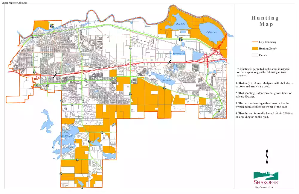
Source: http://www.doksinet Hunting Map Blue Lake 7 6 5 4 101 Fisher Lake 69 7 6 5 4 7 6 5 4 101 City Boundary 83 4 7 6 5 Hunting Zone* Quarry Lake Parcels 17 4 7 6 5 ( / 169 7 6 5 4 15 21 4 7 6 5 ( / 169 16 4 7 6 5 16 4 7 6 5 *- Hunting is permitted in the areas illustrated on the map as long as the following criteria are met: Dean Lake 77 7 6 5 4 1. That only BB Guns, shotguns with shot shells, or bows and arrows are used. 16 4 7 6 5 2. That shooting is done on contiguous tracts of at least 40 acres. 83 4 7 6 5 79 4 7 6 5 3. The person shooting either owns or has the written permission of the owner of the tract. 78 7 6 5 4 18 4 7 6 5 4. That the gun is not discharged within 500 feet of a building or public road. 42 7 6 5 4 Lake ODowd 17 7 6 5 4 14 4 7 6 5 s 79 7 6 5 4 72 7 6 5 4 Map Created: 11-10-11