Datasheet
Year, pagecount:2019, 1 page(s)
Language:English
Downloads:4
Uploaded:March 16, 2020
Size:802 KB
Institution:
-
Comments:
Attachment:-
Download in PDF:Please log in!
Comments
No comments yet. You can be the first!Most popular documents in this category


Content extract
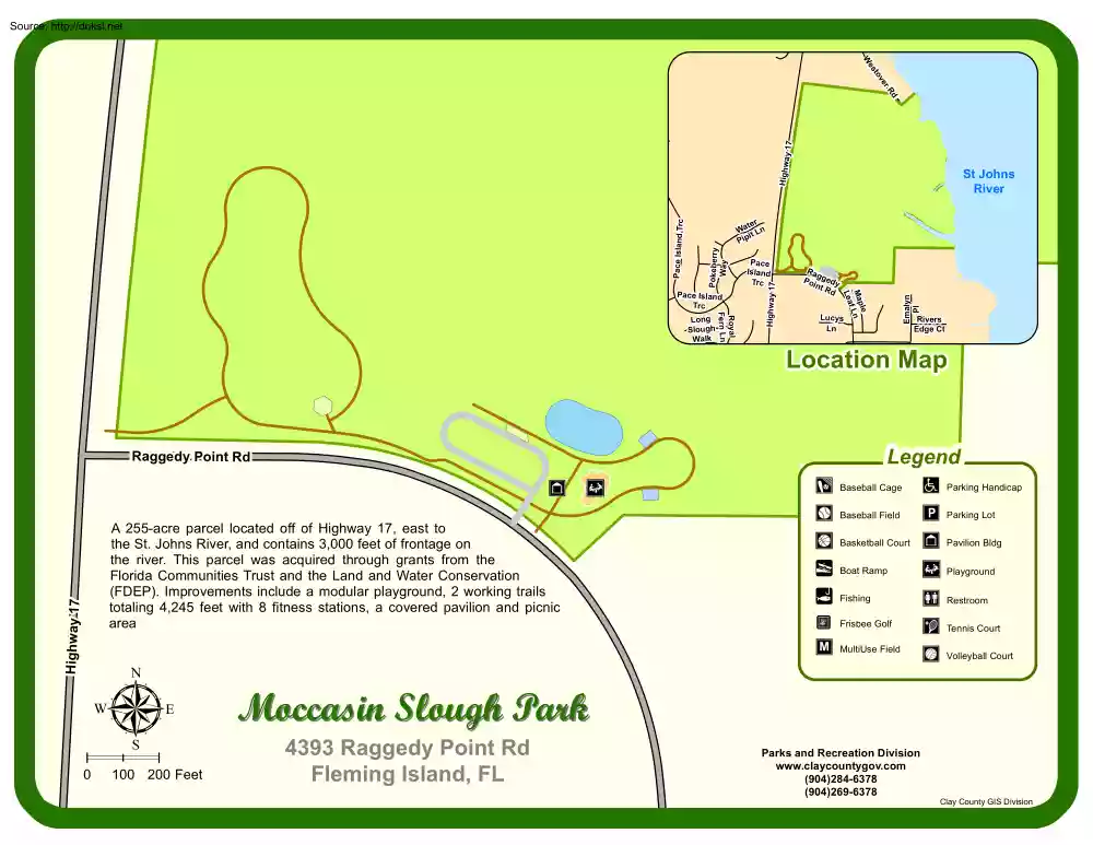
Source: http://doksi.net es W v to er ter Wa t Ln i p i P Lucys Ln Highway 17 0 Legend A 255-acre parcel located off of Highway 17, east to the St. Johns River, and contains 3,000 feet of frontage on the river. This parcel was acquired through grants from the Florida Communities Trust and the Land and Water Conservation (FDEP). Improvements include a modular playground, 2 working trails totaling 4,245 feet with 8 fitness stations, a covered pavilion and picnic area 100 200 Feet Rivers Edge Ct Location Map Raggedy Point Rd µ Emalyn Pl Royal Fern Ln Long Slough Walk Ra g Po gedy in t Rd le Map Ln f Lea Pace Island Trc Pace Island Trc Highway 17 Pokeberry Way Pace Island Trc Highwa y1 7 Rd St Johns River Moccasin Slough Park 4393 Raggedy Point Rd Fleming Island, FL Baseball Cage T Baseball Field P Parking Handicap Parking Lot Basketball Court Pavilion Bldg y ! Boat Ramp Playground l ! Fishing Restroom ¾ Frisbee Golf Tennis Court M MultiUse
Field Parks and Recreation Division www.claycountygovcom (904)284-6378 (904)269-6378 Volleyball Court Clay County GIS Division
Field Parks and Recreation Division www.claycountygovcom (904)284-6378 (904)269-6378 Volleyball Court Clay County GIS Division