Datasheet
Year, pagecount:2016, 4 page(s)
Language:English
Downloads:3
Uploaded:January 15, 2018
Size:776 KB
Institution:
-
Comments:
Attachment:-
Download in PDF:Please log in!
Comments
No comments yet. You can be the first!Most popular documents in this category


Content extract
Source: http://www.doksinet Sunny Dunbar Visiting Dunbar The Dunbar Geology Walk is 4 km along the shore from East Beach to Belhaven Bay, from where you can return to the town centre along Back Road. It will take you about 2 hours to do the whole walk. What makes Dunbar special? Why was this a good place for a town? Dunbar owes its location to the local geology. Explore the rocky coastline and discover how different rock types combine to provide the sheltered harbour and the defensive position of the castle, backed by flat, rich agricultural land. Dunbar’s geological history is varied. There are different types of rock here, all more than 300 million years old, including an array of sedimentary rocks that record the changing climate as Scotland drifted northwards across the Equator. There were impressive volcanic eruptions too, with many small volcanoes that erupted explosively, darkening the skies with clouds of volcanic ash and flying rocks. An unimaginable amount of time has
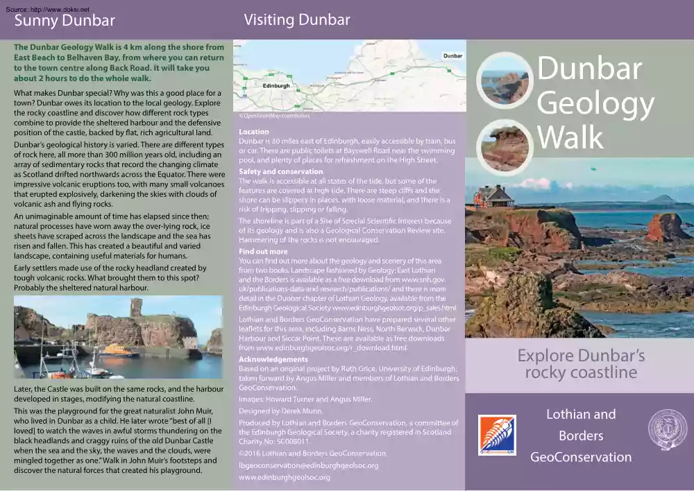
elapsed since then; natural processes have worn away the over-lying rock, ice sheets have scraped across the landscape and the sea has risen and fallen. This has created a beautiful and varied landscape, containing useful materials for humans. Early settlers made use of the rocky headland created by tough volcanic rocks. What brought them to this spot? Probably the sheltered natural harbour. Later, the Castle was built on the same rocks, and the harbour developed in stages, modifying the natural coastline. This was the playground for the great naturalist John Muir, who lived in Dunbar as a child. He later wrote “best of all [I loved] to watch the waves in awful storms thundering on the black headlands and craggy ruins of the old Dunbar Castle when the sea and the sky, the waves and the clouds, were mingled together as one.” Walk in John Muir’s footsteps and discover the natural forces that created his playground. OpenStreetMap contributors Location Dunbar is 30 miles east of
Edinburgh, easily accessible by train, bus or car. There are public toilets at Bayswell Road near the swimming pool, and plenty of places for refreshment on the High Street. Safety and conservation The walk is accessible at all states of the tide, but some of the features are covered at high tide. There are steep cliffs and the shore can be slippery in places, with loose material, and there is a risk of tripping, slipping or falling. The shoreline is part of a Site of Special Scientific Interest because of its geology and is also a Geological Conservation Review site. Hammering of the rocks is not encouraged. Find out more You can find out more about the geology and scenery of this area from two books. Landscape fashioned by Geology: East Lothian and the Borders is available as a free download from www.snhgov uk/publications-data-and-research/publications/ and there is more detail in the Dunbar chapter of Lothian Geology, available from the Edinburgh Geological Society
www.edinburghgeolsocorg/p saleshtml Lothian and Borders GeoConservation have prepared several other leaflets for this area, including Barns Ness, North Berwick, Dunbar Harbour and Siccar Point. These are available as free downloads from www.edinburghgeolsocorg/r downloadhtml Acknowledgements Based on an original project by Ruth Grice, University of Edinburgh; taken forward by Angus Miller and members of Lothian and Borders GeoConservation. Images: Howard Turner and Angus Miller. Designed by Derek Munn. Produced by Lothian and Borders GeoConservation, a committee of the Edinburgh Geological Society, a charity registered in Scotland Charity No: SC008011. 2016 Lothian and Borders GeoConservation lbgeoconservation@edinburghgeolsoc.org www.edinburghgeolsocorg Dunbar Geology Walk Explore Dunbar’s rocky coastline Lothian and Borders GeoConservation Source: http://www.doksinet Types of rock found at Dunbar The story of Dunbar’s rocks Sedimentary rocks Sedimentary rocks form at or
near the surface, from loose material. They are usually created in horizontal layers. As sediment continues to accumulate, older Sandstone layers get buried and are slowly transformed into rock. Sedimentary rocks can tell us about the surface conditions, environment and life at the time they formed. Dunbar is a good place to see the different rocks that underlie the central belt of Scotland. Geologically, this region is known as the Midland Valley, and you will find the same types of rocks across the area, from Tayside to Ayrshire. Most of these rocks formed at a time when this section of the Earth’s crust was close to the equator, between 420 and 300 million years ago (the Devonian and Carboniferous Periods). Away back in the mists of time . The geological foundations of this area date back to a period of mountain building and tectonic plate convergence, known as the Caledonian Orogeny, that lasted about 100 million years. This formed the Caledonian mountains (of which the present
day Scottish Highlands are just a small and much-eroded part), as well as the Southern Uplands – see our Siccar Point leaflet. The rocks we see around Dunbar formed later. The great fault lines that were active during and after the orogeny define the edges of the Midland Valley and form major junctions between different rock units. Erosion of the Caledonian mountains provided most of the sediment that would eventually form the sedimentary rocks of this area. Continued tectonic instability caused downwards movement of the crust, creating ideal conditions for sediment to accumulate and form sedimentary rocks. At the same time, volcanoes formed igneous rocks, and it is this mix of igneous and sedimentary rocks that creates Dunbar’s varied coastline. Desert conditions – the Devonian red sandstone In harsh, hot conditions south of the equator, sand and silt were transported southwards from the mountains and began to accumulate in layers. Atmospheric oxygen interacted with iron as the
rock formed, creating a red cement that helped bind the grains together. All this happened above sea level. The land was hot and mostly dry, but seasonal rainfall in the distant mountains created temporary rivers that moved and redeposited the sediment. Igneous rocks All igneous rocks come from magma, molten rock that rises towards the surface and cools. At Dunbar, you can see fine examples of the two different forms. Crystalline rocks, Basalt such as basalt, form when the magma cools and crystallises until all the liquid has solidified, forming a rock composed of interlocking crystals. The crystalline igneous rocks of Dunbar all formed by magma intrusion Agglomerate underground, but elsewhere in this area you can see rocks created by lava flows. Fragmental rocks, such as agglomerate, have a much more violent origin, formed by explosive volcanic eruptions at the surface when magma and existing rock is fragmented and erupted as loose material – bombs and ash. At Dunbar, much of this
material accumulated in water, was washed around and redeposited. Scotland on the equator – the Carboniferous Period As the continent drifted north, the climate changed, with more rainfall and permanent rivers. Sediment accumulating under water is less likely to contain oxidised iron, and so the rocks are more variable in colour, often cream or grey. Much of the Carboniferous sedimentary rock formed in river deltas and it often contains plant fossils and coal layers. As the land subsided, the sea sometimes invaded from the south; the warm, shallow seawater was an ideal environment for life, and the resulting limestone is rich in fossils. You can visit Barns Ness to the east of Dunbar to see layers of limestone. It is used to make cement There was extensive volcanic activity in this area in the Carboniferous Period, about 345 million years ago. Fluid, basaltic magma erupted vigorously, often interacting with surface water in explosive eruptions that produced a lot of volcanic ash and
showered the surrounding area with flying blocks and lava bombs. Magma also collected below ground, and crystallised to form basalt and dolerite, making features such as the rocks around the harbour and Doo Rock. Erosion: rivers, ice and the sea The rocks of this area have undergone 300 million years of erosion, which has stripped away the layers and exposed a variety of rocks at the surface today. Over the last two million years, ice sheets have covered this area many times. During these glacial periods, the weight of the ice pushed the land down, but there was so much ice that sea level was much lower too. At the peak of the last glacial period 20000 years ago, the North Sea was almost dry. When the ice melted, the sea initially came back to a high level against the land, but the land began to rise quite rapidly. Around Dunbar you can see a raised beach created 9000 to 6000 years ago, when the land and sea were rising at about the same rate. The sea cut a beach with a low cliff
behind it. Since then the land has continued to rise, creating the raised beach that is now several metres above high tide. Source: http://www.doksinet Geology walk along the shore Stop 1: East Beach Look for layered beds. This is a good clue to these being sedimentary rocks. These grains of sand were washed along in temporary rivers around 370 million years ago, south of the equator and under a tropical climate with wet and dry seasons. This is Devonian red sandstone, but why are the layers tilted? They were originally flat, but later tectonic movements have resulted in a slope to the east. Generally, older rocks are more prone to tectonic disruption than younger ones; that’s certainly the case around Dunbar, when you get to Belhaven Bay you’ll find younger sedimentary rocks with less of a tilt (lower angle of dip). Examine the beach sand closely (you can use a magnifier). There are some shell fragments, but most of the sand comes from the erosion of local rocks. The sand and
the rocks are a different colour, because the red colour of the rocks comes from thin layers of ironrich cement that bind the grains together. The grains themselves are clear or white quartz. Stop 2: On the edge of the volcano Look out to sea, the ridge of rock in front of you is the edge of the Harbour volcanic vent. On the right are layers of red sandstone that were here long before the volcano started to erupt. On the left, the eroded, lumpy rock under the boulders is agglomerate from within the volcano – you’ll see more of this later in the walk, so you don’t need to take a closer look now. It is worth going to examine the ridge though, for its left-hand (west) face has been grooved and fluted during the volcanic eruptions around 345 million years ago. At that time, this point was deep underground and magma was rushing past violently on its way to erupt at the surface. Stop 3: Dunbar Harbour You are standing inside an ancient volcano. The rocks here are a messy mix of
different rocks, both sedimentary and volcanic (igneous). There are several different parts of the ‘volcano’ and the connection between them is not obvious. Some of the volcanic rocks, like the lumpy agglomerate at Stop 2, were formed by explosive eruptions that threw fragments into the air. But there are also some solid, crystalline rocks formed when magma cooled within the volcano. The most impressive of these is the red columnar basalt beside the Battery. Stop 4: Dunbar Castle Take the path towards the swimming pool and stop for the view. The Castle headland is composed of a solid basalt intrusion, and it is surrounded by fractured and altered sedimentary rocks. You can see some of the black basaltic rocks to the south of the remains of the Castle. The intricate mix of small volumes of rocks of different hardness has created a varied, natural coastal landscape, exploited by people for the sheltered anchorages and vantage points. Stop 5: the Old Bathing Pool Bay Go past the
swimming pool, and take the steps down into the next bay. The prominent dark sea stack in the middle of this bay is called Doo Rock. It is another outcrop of tough igneous rock surrounded by softer sedimentary rocks. Source: http://www.doksinet Stop 6: Braided rivers and early land plants Continue on the paved path above the beach until you come to the cliff beneath the hotel. This shows an interesting succession of red sandstone layers. Run your fingers across the rock and feel the grains, they have been in this rock for 360 million years! The prominent red layers show how iron dissolves and is reprecipitated to form red concretions. Look for the red ironstone tubes in some places. These probably mark the positions of roots of land plants that were growing in the sand. This is some of the earliest evidence of life on land in Scotland. Close up of red ironstone tubes in sandstone at Stop 6 Continue to the path junction and turn right onto the low headland at the end of the bay.
Here you can walk across gently tilted layers of the same sandstone, just as if you were paddling through the rivers that deposited the sand. This is a good place to see cross-bedding in the sandstone: layers of sand deposited on gentle slopes. This is due to the way the sand accumulates within braided channels, creating these fine examples of trough crossbedding. Stop 7: More volcanic debris Rejoin the path and follow it through the tunnel and into the next bay. Stop on the path and look at both ends of the bay – it is all red rock, but can you spot the difference? Why are the cliff and stack on the left higher and more massive than the cliff on the right? Go down to the beach for a closer look, and you’ll discover the stack and cliffs to the left are all made of volcanic rock, about 345 million years old. Look for blocks of basalt and other coarse fragments laid down in layers. As you follow the path along the Esplanade for the next 700 metres, you’ll see much more of this
rock, the remains of a carpet of debris that probably erupted from several local volcanoes in many individual, small-scale eruptions. Stop 8: Wave-cut platform and dykes Stop before the path descends to the beach to enjoy the view of the cliffs and shore. This section of coast is a superb example of a wave-cut platform. The level you see here is just one of four different levels found locally, which show that the sea has been at different heights relative to the land. You’ll see that the high tide level comes up to the base of the cliffs, and they are still being eroded. There are several ravines cut into the volcanic rock. These show the positions of basalt dykes formed after the main phase of volcanic activity, when magma seeped upwards along cracks. Dykes are found world wide, and were named after Scottish dykes since they often form walls when surrounded by softer rocks. The dykes here have usually been easier to erode than the agglomerate, creating ravines cut into an otherwise
fairly flat rocky beach. Look out to sea and you’ll spot another dyke, forming a line of small islands. This is a later dyke (about 305 million years old) that runs east-west, one of many similar dykes of about the same age in the Midland Valley and southern Highlands. Since this dyke formed by slow cooling of magma deep underground (forming dolerite), it has larger crystals and is very tough. Stop 9: Belhaven Bay & raised beach The path continues to Belhaven Point, where you can see another small outcrop of volcanic rock. The Point marks a major transition on the coast, going west from here there is no more volcanic rock until you reach St Baldred’s Cradle on the other side of the Tyne Estuary. Instead, this area is dominated by softer sedimentary rocks, mostly eroded and covered in beach sand. The flat-lying layers here are younger than the sandstone to the east. They date from the Carboniferous Period, about 350 million years ago, and formed on coastal flood plains and
lagoons. Carry on along the path until you come to some good examples of the layered Carboniferous sedimentary rocks. You’ll see that they are more varied than the Devonian sandstone of Stop 6, with different rock types and colours forming the different layers. Have a close look at the soft layer beneath the grass and soil, where shells are abundant. This layer formed on the sea bed and shows that sea level used to be higher here. About 6000 years ago this was underwater, and the sea extended further inland. Since then, sea level has dropped as the land has continued to rise slowly, after being depressed by the weight of the last ice sheet. This formed a raised beach. The shells on the raised beach are the same types as you find on local beaches today