Értékelések
Nincs még értékelés. Legyél Te az első!
Mit olvastak a többiek, ha ezzel végeztek?


Tartalmi kivonat
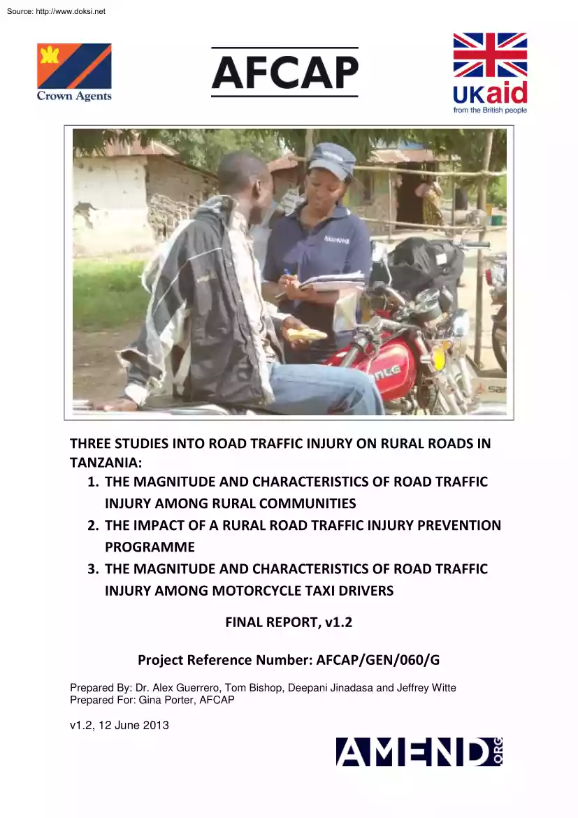
Source: http://www.doksinet THREE STUDIES INTO ROAD TRAFFIC INJURY ON RURAL ROADS IN TANZANIA: 1. THE MAGNITUDE AND CHARACTERISTICS OF ROAD TRAFFIC INJURY AMONG RURAL COMMUNITIES 2. THE IMPACT OF A RURAL ROAD TRAFFIC INJURY PREVENTION PROGRAMME 3. THE MAGNITUDE AND CHARACTERISTICS OF ROAD TRAFFIC INJURY AMONG MOTORCYCLE TAXI DRIVERS FINAL REPORT, v1.2 Project Reference Number: AFCAP/GEN/060/G Prepared By: Dr. Alex Guerrero, Tom Bishop, Deepani Jinadasa and Jeffrey Witte Prepared For: Gina Porter, AFCAP v1.2, 12 June 2013 Source: http://www.doksinet This project was funded by the Africa Community Access Programme (AFCAP) which promotes safe and sustainable access to markets, healthcare, education, employment and social and political networks for rural communities in Africa. Launched in June 2008 and managed by Crown Agents, the five year-long, UK government (DFID) funded project, supports research and knowledge sharing between participating countries to enhance the uptake of low
cost, proven solutions for rural access that maximise the use of local resources. The programme is currently active in Ethiopia, Kenya, Ghana, Malawi, Mozambique, Tanzania, Zambia, South Africa, Democratic Republic of Congo and South Sudan and is developing relationships with a number of other countries and regional organisations across Africa. This material has been funded by UKaid from the Department for International Development, however the views expressed do not necessarily reflect the department’s or the managing agent’s official policies. For further information visit https://www.afcaporg This project was carried out by Amend, a non-governmental organisation focussed on road safety in sub-Saharan Africa. Established in 2005, our mission is ‘To create a sustainable, measureable reduction in the incidence of road traffic injury (RTI) in the developing world via the development, implementation, evaluation and scaling of data-backed public health initiatives’. Sub-Saharan
Africa has the world’s most dangerous roads. And as economies grow, road networks are being improved and expanded, and the way people travel is changing. In light of this, efforts are needed to ensure that the economic and social benefits that roads bring are not undermined by an increase in road deaths and injuries. This research found high and increasing rates of RTI among rural communities, especially among drivers of motorcycle taxis. Analysis of the impact of a short community-based RTI prevention programme suggests that interventions were insufficient to reduce injury rates, though the severity of injuries sustained reportedly declined. Increasing rates of RTI may be due, at least in part, to an increase in traffic on the study roads. We are grateful for the support of everybody involved in this project, in particular AFCAP, DFID, Crown Agents, the Prime Minister’s Office for Regional Administration and Local Government, the National Institute for Medical Research, and the
Local Government Authorities and community members of the areas where the project was implemented. For further information about Amend visit www.amendorg Source: http://www.doksinet Table of Contents EXECUTIVE SUMMARY 5 INTRODUCTION 7 BACKGROUND TO THE RESEARCH 8 OBJECTIVES OF THE RESEARCH CHANGES FROM THE ORIGINAL PROPOSAL ETHICAL CLEARANCE 8 8 8 STUDY 1: THE MAGNITUDE AND CHARACTERISTICS OF ROAD TRAFFIC INJURY ON RURAL ROADS 9 STUDY METHODOLOGY IDENTIFICATION OF SITES DESCRIPTION OF SITES FINDINGS 9 12 13 20 STUDY 2: IMPACT OF COMMUNITY-BASED RTI PREVENTION PROGRAMME ON RURAL RTI RATES 27 STUDY METHODOLOGY IDENTIFICATION OF SITES DESCRIPTION OF SITES INTERVENTION: RTI PREVENTION PROGRAMME FINDINGS 27 28 29 29 31 STUDY 3: ROAD CRASHES AMONG COMMERCIAL MOTORCYCLE DRIVERS 35 STUDY METHODOLOGY IDENTIFICATION OF SITES DESCRIPTION OF SITES FINDINGS 35 36 36 38 DISCUSSION ON FINDINGS 45 HIGH RATES OF RTI INCREASING RATES OF RTI CAUSES OF ROAD CRASHES IMPACT OF RTI
PREVENTION PROGRAMME BODA-BODAS PEDESTRIANS LOW LEVELS OF REPORTING OF RTIS LOCATION 45 46 46 46 50 51 51 51 RECOMMENDATIONS 52 FOCUS ON MOTORCYCLE SAFETY RECOGNISE CRITICAL ROLE OF ENGINEERING AND EDUCATION UNDERSTAND THE IMPACT OF IMPROVED RURAL ROADS ON RTI RATES PRIORITISE HIGH-RISK ROADS AND COMMUNITIES MAXIMISE COST-EFFECTIVENESS WORK WITH GOVERNMENT AND SECURE POLITICAL WILL 52 52 53 53 53 54 DISSEMINATION OF THE RESULTS 55 Source: http://www.doksinet TO THE GENERAL PUBLIC IN THE STUDY AREAS TO THE GENERAL PUBLIC IN TANZANIA AT LARGE TO TANZANIAN ROAD SAFETY STAKEHOLDERS TO THE GLOBAL ROAD SAFETY COMMUNITY TO THE PUBLIC HEALTH AND DEVELOPMENT COMMUNITIES 55 57 58 60 60 APPENDICES 61 APPENDIX A – CLEARANCE CERTIFICATE FOR CONDUCTING MEDICAL RESEARCH APPENDIX B – HOUSEHOLD SURVEY DATA COLLECTION SHEETS FOR STUDY 1 AND STUDY 2 APPENDIX C – ROAD USE SURVEY DATA COLLECTION SHEETS APPENDIX D – REPORTS ON IMPLEMENTATION OF RTI PREVENTION PROGRAMMES APPENDIX E –
BODA-BODA DRIVER DATA COLLECTION SHEETS FOR STUDY 3 APPENDIX F – PRESS RELEASE APPENDIX G – EXAMPLE NEWSPAPER ARTICLES APPENDIX H – NOTES ON DISCUSSION FOLLOWING PRESENTATION ON PRELIMINARY FINDINGS APPENDIX I – FACT SHEET 61 63 69 72 131 136 138 141 145 4|Page Source: http://www.doksinet Executive Summary By 2030, road traffic injury (RTI) is forecast to be the fifth largest killer worldwide. The majority of those deaths will be in low- and middle-income countries. Sub-Saharan Africa already has the world’s most dangerous roads, with a road traffic fatality rate of 24.1 per 100,000 people, and yet as Africa’s economy grows, supported by expanded road infrastructure, and as more and more vehicles are imported into the continent, the risk of RTI increases every day. Tanzania is typical of many African countries: its economy is booming thanks to natural resources such as oil, gas and gold; motorisation rates are rapidly increasing; motorcycles are revolutionising
mobility; RTI rates are increasing year-on-year; and the government and donor partners are developing ambitious programmes to upgrade rural roads to improve access to markets, education and healthcare. It is well established that improving rural roads can bring economic and social benefits. However, these benefits must not be offset by an increase in road deaths and injuries and the associated negative economic and social consequences. Effective, evidence-based RTI prevention interventions must be designed and implemented. But other than the broad figures collected by the Traffic Police, which are widely assumed to underrepresent the real figures (an assumption which is supported by this research), and a small number of academic papers mostly based on hospital and police data, very little is known about RTI in Tanzania. Though lessons can be learned from research conducted in other regions, there is very little evidence from Tanzania (or elsewhere in Africa) on which to base RTI
prevention interventions. This research begins to address this issue, with a focus on low-volume rural roads. It is divided into three separate studies: • Study 1 aims to quantify the magnitude and describe the characteristics of RTI on rural roads • Study 2 is ‘action research’ aiming to evaluate the impact of a rural road RTI prevention programme on RTI rates • Study 3 aims to quantify the magnitude and describe the characteristics of RTI among motorcycle taxi (‘boda-boda’) drivers, a particularly high-risk population Headline findings of the research include: • Study 1 revealed that the overall rural RTI rate is 40.0 per 1,000 person-years This means that of any group of 1,000 members of the study population, 40 can be expected to suffer an RTI in one year. In comparison, the RTI rate for Great Britain is 33 per 1,000 person-years – more than twelve times less than the RTI rate for rural Tanzania • Study 1 also revealed that rural RTI rates are increasing. At all
sites involved in the study, rates were found to be higher in the later of two RTI data collection exercises, which were carried out between eight and nine months after the first data collection exercises • Rates of RTI among boda-boda drivers are particularly high. Study 3 revealed the boda-boda driver RTI rate to be 633.4 per 1,000 person-years, which means that at least six out of ten members of the study population can be expected to suffer an RTI in one year. At one of the study locations, the figure was as high as ten out of ten. In comparison, the motorcyclist RTI rate for Great Britain is 17.0 per 1,000 person-years – more than 37 times less than the boda-boda driver RTI rate for rural Tanzania 5|Page Source: http://www.doksinet • • Injuries to the legs were most common, and Study 3 identified two leg amputations among boda-boda drivers The average number of days that RTI victims spent unable to work or go about their normal daily activities was 22. And RTIs also
have a wider impact on families, with the average combined number of days lost by victims and caregivers being 37. Immediate action is required to identify effective interventions to reduce RTI rates, especially those among boda-boda drivers. This research is essential reading for all stakeholders involved in the design, construction, operation, management and funding of rural roads in Tanzania and elsewhere in sub-Saharan Africa. 6|Page Source: http://www.doksinet Introduction About 1.24 million people die on the world’s roads each year Sub-Saharan Africa has the world’s most dangerous roads, with the road traffic fatality rate standing at 24.1 per 100,000 people Fifty percent of fatalities in Africa are of so-called ‘vulnerable road users’ – pedestrians, cyclists and motorcyclists.1 It is forecast that the situation in Africa will become worse in the upcoming years. By 2050, the population of Africa will grow by more than a billion people. Africa’s rate of
motorisation is one of the fastest in the world, with thousands of vehicles added to the roads every day. Globally, the number of private motor vehicles is forecast to triple by 2050. Two-thirds of this explosive growth will take place in non-OECD countries such as those in sub-Saharan Africa.2 Currently, there is only very limited data on the causes and effects of RTI in Africa, or of the impact of measures to improve road safety. This is especially the case for rural areas Without data, it is not possible to develop programmes to reduce injury rates with confidence that they will be successful. While the global road safety community has identified five specific risk factors that should be addressed to improve road safety – helmet use, drinking and driving, over-speeding, seat belts and child restraints – it is essential to understand these in an African context. In Tanzania, for example, it is essential to understand how the rapid growth in the use of motorcycles, which are
revolutionising rural accessibility, can provide social and economic benefits without causing serious negative public health side effects in the form of increased RTI. Official statistics from the Tanzanian Traffic Police show that in 2012, there was a total of 3,969 deaths and 20,802 injuries on Tanzania’s roads. However, due to the lack of a comprehensive data collection system, it is possible that these numbers are considerably lower than the actual figures. The Tanzanian government, with support from donor partners, is embarking on a major programme of improvements to low-volume rural roads, including through the second phase of the Local Government Transport Programme. Between 2012 and 2015, thousands of kilometres of rural roads will be upgraded from poor to fair standard, unblocking bottlenecks and providing year-round access. Through this programme, millions of people will have improved access to markets, schools and healthcare facilities, with the aim of improving lives and
lifting people out of poverty. However, in improving rural roads, consideration must be given to the potential negative impact of increasing the risk of RTI. This research: • Aims to increase understanding of the key issues relating to rural road safety in Tanzania, and of measures that can be taken to reduce road deaths and injuries • Will assist the Tanzanian government, AFCAP and other road safety stakeholders in Africa to develop strategies for ensuring the safety of rural communities • Supports the goal and objectives of the UN-endorsed Decade of Action for Road Safety, 2011 to 2020, and Tanzania’s National Road Safety Strategy 1 2 Global Status Report on Road Safety, World Health Organization, 2013 Energy Technology Perspectives, International Energy Agency, 2008 7|Page Source: http://www.doksinet Background to the Research Objectives of the Research The high-level objectives of this research are: 1. To quantify the magnitude and describe the characteristics of RTI
among communities living alongside low-volume rural roads in Tanzania 2. To understand the impact of community-based road safety interventions on RTI rates among communities living alongside low-volume rural roads 3. To quantify the magnitude and describe the characteristics of road crashes among motorcycle drivers Changes from the Original Proposal The original proposal for this research included only Objective 1 and Objective 2. Objective 3 was added during the early stages of our research, when we identified that a large proportion of the vehicles using low-volume rural roads were motorcycles, and that many of these motorcycles were carrying passengers or goods. As much of our work to carry out the other elements of this research involved talking to the drivers of these motorcycles, we decided to record the information that we learned from them, and so further the understanding of this group of road users. A further objective was added following the submission of our Inception
Report: ‘To identify the impact of improvements to rural roads on RTI rates’. However, due to reasons which will be explained in the section on Study 2 later in this report, it was not possible for this objective to be met. Essentially, while under our original proposal we intended to carry out only one study, this overall research project can in fact be divided into three separate studies: Study 1: A Population-Based Study to Quantify the Magnitude and Describe the Characteristics of RTI on Rural Roads in Tanzania. This study addressed Objective 1 of the overall research Study 2: A Population-Based Control Study to Assess the Impact of an RTI Prevention Programme on RTI Rates on Rural Roads in Tanzania. This study addressed Objective 2 of the overall research Study 3: A Cross-Sectional Study of Road Crashes among Commercial Motorcycle Drivers in Tanzania. This study addressed Objective 3 of the overall research In this final report of the overall research, these three studies are
addressed separately. Ethical Clearance For all public health research in Tanzania, ethical clearance is required from the National Institute for Medical Research (NIMR). NIMR issued the Clearance Certificate for this research on 4th May 2012, a copy of which is included in Appendix A of this report. 8|Page Source: http://www.doksinet Study 1: The Magnitude and Characteristics of Road Traffic Injury on Rural Roads The full title of Study 1 is ‘A Population-Based Study to Quantify the Magnitude and Describe the Characteristics of RTI on Rural Roads in Tanzania’. The objective of this study was to quantify the magnitude and describe the characteristics of RTI among communities living alongside low-volume rural roads. Study Methodology This study involved the systematic collection of data on RTIs from the populations living alongside three different low-volume rural roads in Tanzania (referred to collectively either as the ‘study sites’ and the ‘study roads’). At each of
the three sites, data was collected twice, with between eight and nine months separating the first data collection exercise from the second. It should be noted that the data collected from two of the sites were also used for Study 2 of this research, which looked for change in the magnitude and characteristics of RTI either side of implementation of an RTI prevention programme. Study 2 is described in detail in the next section of this report. Here in Study 1, the data from all three sites and from both data collection exercises are combined to give an overall picture of the magnitude and characteristics of rural RTI in Tanzania. RTI data was collected through a household survey, using orally-administered questionnaires to capture information on all RTIs which had been suffered by any member of all households living along the roads within the three months prior to the questionnaire being completed. It is important to note that data was collected on all RTIs suffered by people living
along the study roads, whether the injury was suffered on the study road itself or elsewhere. As such, this is not a study of RTIs suffered only on the study roads themselves. At each of the three study sites, the same data was collected using the same methodology. Supplementary data was collected on road use through road use surveys. This data allowed changes in RTI rates and characteristics to be understood within the context of any differences in road use between the sites or between the times of the first and second data collection exercises. Study Team The household surveys and road use surveys were carried out by a study team comprising Amend’s Study Associate and a team of eight Study Assistants. Recruitment of Study Assistants was through a competitive recruitment process targeting health science students from Tanzanian universities. Applicants were judged based on relevant experience, a written examination and a face-to-face interview. All Study Assistants were Tanzanian
citizens, with Kiswahili – the most widely-used language in Tanzania – as their mother tongue. Half of the Study Assistants were female and the other half male, as Amend’s past data collection experience has shown that mixed teams are more likely to be welcomed by households and so are better able to collect data. The Study Assistants received training on the data collection tools and methodology from the Principal Investigator of this research, Dr. Alejandro Guerrero, and the Study Associate The Study Assistants were involved in pilot testing the tools and methodology, and contributed to ensuring 9|Page Source: http://www.doksinet that they were appropriate to the environments and populations involved in the study, including translating the questionnaire from English into Kiswahili. Study Methodology for Household Survey The household survey used a questionnaire to obtain basic demographic information from all members of all households along the study roads, and detailed
information from victims of any members of those households who had suffered an RTI within the three months prior to the date of completing the questionnaire. A copy of this questionnaire, entitled ‘Amend/AFCAP Road Traffic Injury Study: Injury Worksheet’ is included at Appendix B of this report. Picture 1: Study Assistants carrying out a household RTI questionnaire The survey covered all households within 200 metres of each of the study roads. The study methodology and questionnaire were pilot-tested by the Principal investigator, Study Associate and Study Assistants on two separate occasions and at two separate locations prior to commencement of data collection. To undertake the household surveys, the Study Assistants were divided into pairs, with one male and one female in each pair. Walking along the road, the pairs would identify each household within 200 metres of the road, and they would approach and call out to determine if a household member was present. If a household
member was present, the Study Assistants would briefly introduce themselves, Amend and the purpose of the research, and would request permission to ask questions related to demographics and RTI. All communication was in the Kiswahili language If permission was granted, the Study Assistants would first ask for basic demographic information, specifically: the number of people living in that household; the gender and age of each member; and whether any of them had suffered an RTI within the three months prior to that date. If the Study Assistants identified that any member of the household had suffered an RTI, the detailed questionnaire included in Appendix B was administered to obtain detailed information about the characteristics of the RTI. 10 | P a g e Source: http://www.doksinet If no household members were present when the Study Assistants first approached, the household would be marked as ‘missing’ and located on a hand-drawn map. That household was then revisited within a
few days at a different time of day. If no household members were present during the second attempt, that household would be marked as a ‘non-participating household’. Some household members requested equested more information before they consented to being interviewed. For those members, the Amend team provided them with a copy of the Participant Information Leaflet, including a ‘Resources for Victims of Road Traffic Injuries’ Injuries’ information sheet, a copy of the NIMR Clearance Certificate for Conducting Medical Research, a copy of a letter from the District Engineer approving our research activities, and a copy of a letter from the relevant Local Government Authority asking for cooperation from household members members with our research activities. Exactly the same questionnaire and survey methodology were used at all sites and during all data collection exercises. The first data collection exercises were carried out in June and July 2012 and the second were carried
out in February and March 2013. As data was collected from all households along each road, the same households were visited during both data collection exercises. Study Methodology for Road Use Survey Road use surveys were used to gain an understanding of road use at the study sites. Pedestrian and motorised and non-motorised vehicular traffic was observed from a station situated approximately 1.5 kilometres from the busier end of each of the three study roads Picture 2: Study Assistants Assistants carrying out the road use surveys At the road use observation stations, the Study Team undertook the road use survey for a total of twelve continuous hours, from 6am to 6pm. The 12-hour survey was carried out at each study road on two different days of the week, one being a market day and the other being a non-market day. (Note - A market day is defined as a day on which a market is held in a village or town along or close to the road, thereby creating road use patterns different from
those seen on a non-market day.) During each survey, the study team counted both pedestrian and vehicular traffic and recorded observations in one-hour intervals (see Traffic Count Survey and Pedestrian Count Survey in Appendix C). 11 | P a g e Source: http://www.doksinet Exactly the same survey and methodology was used at both sites and during both the baseline and follow-up data collection exercises. The road use survey was carried out during the same time periods as the household surveys, in June and July 2012 and February and March 2013. Study Limitations The study team encountered some challenges related to collecting data for the household survey. Firstly, it was not always straightforward to be able to define a household. In a rural Tanzanian setting, there is much overlap between families and households, and sometimes it was difficult to determine which household a person belonged to. In all of the study locations, we conducted data audits as a way of double-checking the
quality of the information we received from household members. The Study Team randomly selected households that had already been interviewed, visited them again, and asked again for the same information. When this was done, data for a household sometimes differed, depending on the household member completing the questionnaire, and even differed when the same person was asked on two different days. The differences were more noticeable in the study areas where education levels were lower, specifically at the sites in Bagamoyo District. Also, there was no way to check the accuracy of recall, either about whether a crash had occurred within the three months prior to the questionnaire, or whether the details of the crash were accurate. Especially in rural areas where people do not think of time in weeks and months, it could be difficult for them to correctly recall how long ago a crash had taken place. Data Analysis The Study Associate, assisted by two Study Assistants, used Statistical
Package for the Social Sciences (SPSS) version 17.0 to enter and analyse the household survey and road use survey data Demographics were tabulated for the household survey data, and RTI rates were calculated. Values and averages were calculated for other variables related to injury and crash characteristics. If an individual was still recovering from an RTI at the time of interview, the time from the RTI was used as the number of disability days. For the purposes of analysis, children under the age of one were considered to be one year old. Identification of Sites The three sites included in this study were: • The Bago to Talawanda road, Bagamoyo District, Coast Region • The Kikaro3 to Mihuga road, Bagamoyo District, Coast Region • The Lawate to Kibong’oto road, Siha District, Kilimanjaro Region Initially only two sites were selected – the Bago to Talawanda and Lawate to Kibong’oto roads – with the intention being that these would be used for both Study 1 and Study 2.
These two sites were initially selected in consultation with AFCAP, for the following reasons: • They were already being used for a separate AFCAP project (the Surfacing Demonstration Project, which was being carried out by Roughton International), and so it was assumed that the relevant permissions, contacts and information would be easy to access • They were thought to be comparable in terms of population demographics and density, road type and number of vehicles per day, which was a requirement for Study 2 3 Note that in previous reports, Kikaro was wrongly referred to as ‘Kikalo’ 12 | P a g e Source: http://www.doksinet However, during our initial visits to the two sites, we recognised that they were not suitable for Study 2. The Lawate to Kibong’oto road was dropped from Study 2, and replaced by the Kikaro to Mihuga road. This will be explained further in the Study 2 section of this report For Study 1, we proceeded to collect data from the Lawate to Kibong’oto
road, as well as the Bago to Talawanda and Kikaro to Mihuga roads, to provide a wider understanding of the magnitude and characteristics of RTI on low-volume rural roads. Description of Sites The Bago to Talawanda Road The Bago to Talawanda road runs between the villages of Bago and Talawanda, in Bagamoyo District, Coast Region. It is approximately 90 kilometres north-west of Dar es Salaam and 30 kilometres west of Bagamoyo town. The location of the road is shown in the map below Figure 1: Location of the Bago to Talawanda road (Source: Sociology Report, Roughton International) The road is approximately 20 kilometres in length, and passes through three small villages and additional two to three small settlements in between Bago and Talawanda. The total population living within 200 metres of the road, including in Bago and Talawanda villages, is approximately 2,500 people, as identified through this research. Bago is a medium-sized village with a population of an estimated 3,000
people. It is situated on a regional highway, managed by the national roads agency (TANROADS), which links Bagamoyo town to the town of Msata and the main highway between Dar es Salaam and northern Tanzania and Kenya. This road was undergoing improvements, to upgrade it from an unpaved to a paved surface, for the duration of this research. Bago village contains a number of small businesses, such as food and fruit vendors, vendors of petrol for motorcycles, a vendor of mobile telephone accessories, a tyre mechanic, a pharmacy, a basic 13 | P a g e Source: http://www.doksinet movie theatre, a milling machine, and a motorcycle taxi stand. There is a small primary school and the Bago Village Executive Officer, lives in the village. Bago village does not have a market. The closest market is in the town of Kiwangwa, two kilometres east of Bago along the regional highway. The market is held every Friday, and the town is extremely busy on market days, with people travelling from surrounding
villages to buy and sell food, clothing and household goods. Kiwangwa also has a bus stand for local buses, and is a very popular location for motorcycle taxis. Talawanda is a medium-sized village with a population of around 6,500 people. It is situated at the junction of three roads: the road to Bago which is the subject of this study, a road running west to the small town of Lugoba on the main highway to northern Tanzania, and a road running south-west to the large town of Chalinze at the junction of the two highways to central/western and northern Tanzania. The two other roads, to Lugoba and Chalinze, are in poor condition, meaning that the Bago to Talawanda road does not serve as a ‘through road’ to either of these larger towns. It serves mainly as an access road to Talawanda and the villages along its length. Talawanda village has a few small food vending businesses, a motorcycle taxi stand, and a primary school. Tuesday is market day in Talawanda A few vendors gather to sell
vegetables, tobacco, and clothing items. The area that the Bago to Talawanda road serves is rural and the economic status of most inhabitants is low. Most of the houses along the road are traditional mud huts, with no running water or electricity. The predominant tribe in the area is Kwere and the predominant religion is Islam. Literacy levels are low, as are school attendance rates among children Traditional culture is strong in the area, and belief in witchcraft is common. The road passes through a rolling landscape with gentle hills. Farming is the predominant economic activity, mostly at a subsistence level or only a little higher. Crops include cotton, maize, sesame, sunflowers, pineapples and oranges. Long stretches of the road, between villages, are bordered on both sides by agricultural land. Many households keep livestock, such as goats and chickens 14 | P a g e Source: http://www.doksinet Picture 3: An unsealed section of the Bago to Talawanda road Due to the rural nature
of the area, only basic services are available along the Bago to Talawanda road. There are a total of six schools along the length of the road: five primary schools and one secondary. A few small businesses are found along the road, such as small shops and dispensaries There are also four government offices, and two religious buildings. The only public transport services are motorcycle taxis. Motorcycles are the most common form of transport along the road, with far more motorcycles than 4-wheel motorised vehicles. Bicycles and pedestrians are also frequently seen The Bago to Talawanda road is being used as part of another AFCAP-funded project - the Surfacing Demonstration Project, carried out by Roughton International. This project involved the upgrading of certain stretches of the road using different surface types, to test the surfaces’ appropriateness for providing year-round access. The surface improvement work was completed before the collection of any data for this research.
By the time of the first data collection exercise, the different surface types which made up the road were: • Concrete geo-cells • Parallel concrete strips • Double sand-seal • Double surface dressing • Engineered natural earth • Hand-packed stone • Natural gravel • Single Otta seal with sand seal cover • Slurry seal 15 | P a g e Source: http://www.doksinet The improved sections of the road make up approximately 5.5km out of 20km of its length The improved road is a single lane along its full length, with intermittent passing places. There are no designated footpaths for pedestrians. The data for this research was collected along the Bago to Talawanda between 8th and 17th June 2012, and between 17th and 28th March 2013. As part of this research, in September and October 2012, an RTI prevention programme was carried out for the people living alongside and using the Bago to Talawanda road. The Kikaro to Mihuga Road The Kikaro to Mihuga road runs between the villages
of Kikaro and Mihuga, in Bagamoyo District, Coast Region. It is approximately 120 kilometres north-west of Dar es Salaam and 40 kilometres north-west of Bagamoyo town. The location of the road is shown in the map below Figure 2: Location of the Kikaro to Mihuga road The road is approximately 13 kilometres in length, and passes through five small settlements in between Kikaro and Mihuga. The total population living within 200 metres of the road, including in Kikaro and Mihuga villages, is approximately 2,000 people, as identified through this research. Kikaro village is a medium-sized village with a population of an estimated 3,000 people. It is situated at the junction of a district-level paved road heading from the town of Mandera to Saadani National Park, and the unpaved road heading to Mihuga. Kikaro village contains a dispensary / maternity clinic, a police station, a local government office and a number of small businesses, such as food vendors, stationary shops and mechanics. It
also has a primary school and a secondary school. There is no market in Kikaro village. The closest market is in the town of Miono, one kilometre west of Kikaro heading back towards Mandera on the paved road. The market is held every Wednesday, and the town is extremely busy on market days, with people travelling from surrounding villages to buy and sell food, clothing and household goods. Miono also has a small bus stand for local buses, and is a very popular location for motorcycle taxis. 16 | P a g e Source: http://www.doksinet Mihuga is a large village with a population of an estimated 1,000 people. It is situated approximately 13 kilometres north of Kikaro along the road that is the focus of this study. Beyond Mihuga, the road becomes a narrow pedestrian footpath, impassable to 4-wheel vehicles. There are no other roads to or from Mihuga. Mihuga village contains a small number of businesses, including food and fruit vendors, dry goods vendors, a milling machine and a local
movie theatre. There is a primary school and a water tower, and the Mihuga Village Executive Officer lives in the village. There is no market in Mihuga village. The closest market is in Miono, close to Kikaro, approximately 14 kilometres from Mihuga. The area that the Kikaro to Mihuga road serves is rural and the economic status of most inhabitants is low. Most of the houses along the road are traditional mud huts, with no running water or electricity. The predominant tribes in the area are Kwere and Zigua, with others being Masai and Mang’ati. The predominant religion is Islam Literacy levels are low, as are school attendance rates among children. There are a total of four primary schools and one secondary school along the length of the road. Traditional culture is strong in the area, and belief in witchcraft is common Picture 4: A typical house along the Kikaro to Mihuga road The road passes through a rolling landscape and has some hilly sections. Farming and livestock are the
predominant economic activities, mostly at a subsistence level or only a little higher. Crops include cotton, maize, sesame, sunflowers, pineapples and oranges. Cattle-grazing is common, and many households keep a few livestock like goats, chickens, cows, sheep, and donkeys. Motorcycles and bicycles are the most common types of vehicles using the road. 4-wheel vehicles are uncommon. The Kikaro to Mihuga road is unpaved along its full length. The Kikaro to Mihuga road was not involved in the AFCAP Surfacing Demonstration Project, and no improvements were made to the road during the course of this research. Many sections of the road butt up against vegetation and 17 | P a g e Source: http://www.doksinet have no shoulders for pedestrians. The road passes through clusters of small villages, separated by long stretches of dense, wild vegetation, cultivated fields, or open uncultivated fields. The data for this research was collected along the Kikaro to Mihuga between 22nd and 28th June
2012, and between 13th and 20th February 2013. Following this research, in April 2013, an RTI prevention programme was carried out for the people living alongside and using the Kikaro to Mihuga road. The Lawate to Kibong’oto Road The Lawate to Kibong’oto road runs between the villages of Lawate and Kibong’oto, in Siha District (previously part of Hai District), Kilimanjaro Region. It is approximately 25 kilometres north-west of the city of Moshi. The location of the road is shown in the map below Figure 3: Location of the Lawate to Kibong’oto road (Source: Sociology Report, Roughton International) The road is approximately 13.5 kilometres in length, and running in a loop up and down the foothills of Mount Kilimanjaro, between the villages of Lawate and Kibong’oto, passing through six small villages. The total population living within 200 metres of the road, including in Lawate and Kibong’oto villages, is approximately 2,600 people, as identified through this research.
Lawate village is a medium-sized village with a population of an estimated 5,000 people. It is situated at the junction of a district-level paved road running between the main Arusha to Moshi highway and the town of Sanya Juu, and the road which is the subject of this study. Lawate contains a number of small businesses like restaurants, bars, hair salons, a petrol station, home goods shops, clothing shops, a tailor, dry goods, a pharmacy and a stationery shop. There are also two primary schools and a local government office. 18 | P a g e Source: http://www.doksinet A mid-sized, vibrant market takes place at Lawate every Monday and Thursday. On these days, the town is very busy and is well served by public transport, with a local bus stand and a motorcycle taxi stand. Kibong’oto is a small town with a population of an estimated 4,000 people. The town is most notable for its National Tuberculosis Hospital, which treats patients with drug-resistant forms of tuberculosis. Because of
the presence of the hospital, the town is served by a good quality paved road because of the tuberculosis hospital. Small businesses such as restaurants, stationeries, and fruit vendors are available in Kibong’oto, although there is no large market. The town has one primary school The Lawate to Kibong’oto road is not a ‘through road’. It only provides access to the villages along its length. It passes through very hilly terrain with steep slopes and tight bends The climate is cold at the highest point of the road, and all along the road the vegetation is lush and green. Picture 5: A typical stretch of the Lawate to Kibong’oto road There are a total of seven schools along the length of the road: six primary schools and one secondary. There are also local government offices, small businesses, and churches situated along the road. The area that the road serves is rural, but the population living along the road is well-off economically compared to the people living along the
Bago to Talawanda and Kikaro to Mihuga roads. Many of the houses are constructed out of cement blocks and have tin roofs Some of the more well-to-do houses are gated in, with lawns and flowering shrubs and satellite television dishes. The predominant tribe is Chagga, and the predominant religion is Christian. Literacy and school attendance levels are higher than those along the two roads in Bagamoyo District. Many households keep animals such as chickens, goats, cows, pigs, sheep and bees, and have large farming plots near to where they live. Crops that are grown include sunflower, maize, beans, peas, bananas, and avocado. Other supplemental economic activities include owning small businesses, selling milk, and producing and selling ‘mbege’, the local alcoholic brew. 19 | P a g e Source: http://www.doksinet Motorcycles and bicycles are the most common types of vehicles using the road. 4-wheel vehicles are uncommon. The Lawate to Kibong’oto road is being used as part of the
AFCAP Surfacing Demonstration Project, the same project as was carried out at the Bago to Talawanda road. Construction of the surface types similar to those piloted at the Bago to Talawanda road was being carried out during both the first and second data collection exercises of this study. The improved sections of the road make up approximately 6.5km out of 135km of its length The improved road is a single lane along its full length, with intermittent passing places. There are no designated footpaths for pedestrians. The data for this research was collected along the Lawate to Kibong’oto between 22nd and 28th June 2012, and between 13th and 20th February 2013. Following this research, in April 2013, an RTI prevention programme was carried out for the people living alongside and using the Lawate to Kibong’oto road. Findings Here we present the findings of the study. Overall RTI Rates Data was collected from a total of 5,869 people during the first data collection exercise and 6,039
people during the second data collection exercise, making a total of 11,908 for the two separate data collection exercises at all three sites. Of these 11,908 people, 119 had suffered an injury within the three months prior to data collection. In order to enable comparison of data between studies, in the road safety field RTIs are commonly presented as rates in terms of 1,000 person-years. Put simply, an RTI rate per 1,000 person-years translates to the number of people, out of any group of 1,000 members of the study population, who can be expected to suffer an RTI in a 12-month period. For this study, data on RTIs was collected for a three-month recall period. The figure of 119 RTIs in the three-month period was multiplied by four to obtain the yearly RTI rate. The total of 119 RTIs identified through this study among a total number of 11,908 people equates to an overall RTI rate of 40.0 per 1,000 person-years Demographics of Study Participants and RTI Victims Of the total 11,908
study participants, 49% were male and 51% were female, and the overall average age was 26 years. Of the 119 people who had suffered an RTI, 90 (76%) were male and 29 (24%) were female, as shown in the chart below. 20 | P a g e Source: http://www.doksinet 24% Male Female 76% Figure 4: RTI victims by gender The average age of those who had suffered an RTI was 29 years. Broken down by gender, the average age of males who had suffered an RTI was 27 years, and the average age of females was 35 years. Figure 5 below shows the age distribution of male and female RTI victims. 12 10 8 Age of Males 6 Age of Females 4 2 0 2 6 10 14 18 22 26 30 34 38 42 46 50 54 58 62 66 70 74 78 82 86 90 Figure 5: Age distribution of male and female RTI victims at all sites For males, there is a peak in RTIs at ages 18 and 19, and RTI numbers continue to be high through the early and mid-20s. There is no similar peak for females; RTIs are more or less evenly distributed throughout all ages for
females. 21 | P a g e Source: http://www.doksinet Crash and Injury Characteristics Of the 119 RTIs identified, the majority (69%) were suffered in crashes which involved a motorcycle. One-fifth (20%) were suffered in crashes which involved a bicycle. Only 11% of RTIs were suffered in crashes which involved a 4-wheel vehicle. The majority (81%) of people who suffered an RTI did so while as an occupant (either driver or passenger) of a vehicle (including motorised and non-motorised). The remainder (19%) were injured as pedestrians. Of those who were involved in an RTI as a vehicle occupant, 79% were male and 21% were female. Of those who were injured as a pedestrian, 61% were male and 39% were female Nowhere to Go At all three of the study roads, there are long stretches with no safe place for pedestrians to walk, due, for example, to dense scrub, ditches or steep banks. Pedestrians, including children, told us about how vehicle speeds have increased on the improved roads, and that
they have to be very careful. They have no choice other than to walk on the road, but they have to keep their eyes and ears open at all times, ready to squeeze into a bush, jump into a ditch or scramble up a bank. Legs were the part of the body most commonly injured, being injured in 62 (52%) of the 119 RTIs, followed by head/face (22%) and arms (19%). Using the number of days household members were unable to return to normal daily activity as a proxy for injury severity based on body part injured, injuries to the head/face led to an average of 31 days lost, and injuries to the legs led to an average of 30 days lost. Bruising was the most common type of injury suffered (47%), followed by cuts (22%) and fractures/dislocations (20%), with the remaining 11% being made up of other types of injuries such as burns and concussion. 22 | P a g e Source: http://www.doksinet Of the 119 RTIs, seven (6%) of the victims reported being permanently disabled as a result, meaning that they were no
longer able to work or go about their normal daily activities. Of these victims: • Three suffered broken or wounded legs in motorcycle injuries • One suffered a concussion to the head when injured while working as a motorcycle taxi driver • One suffered an arm amputation when injured while travelling in a car • One suffered a wounded leg in a bicycle injury • One suffered a facial injury after being hit by a motorcycle Consequences of Crashes and Injuries Of the total 119 RTIs identified, 112 (94%) of the victims sought medical attention. Of those who sought medical attention, just over half (51%) went to a hospital, 30% to a clinic, 14% to a pharmacy, and 5% to a traditional healer. Of the 57 people who sought medical attention at a hospital, 29 (51%) spent one or more nights in the hospital, with the longest hospital stay being 65 days. Following an RTI, 92% of RTI victims spent one or more days unable to work or go about their normal daily activities as a result of the
RTI. The average number of days that victims spent unable to work or go about their daily activity as a result of the RTI was 22 days. As well as the consequences for the victims themselves, the study revealed that RTIs also resulted in knock-on effects for other household members, who were required to give up their time to care for the victim. Between injured persons and their caregivers combined, the amount of time they were unable to engage in normal daily activity as a result of the RTI was an average of 37 days per RTI. The results of the study also revealed that RTIs have economic consequences as well as health and social consequences. Among those injured, 105 (88%) reported their household losing income due to the injury, either losing potential earnings through inability to work, or expenditure on medical treatment. This is shown in the chart below 12% Lost income No lost income 88% Figure 6: RTI victims who lost income as a result Few RTIs were reported to the police.
Among those who were injured in the study population, only 26 (22%) filed a police report. 23 | P a g e Source: http://www.doksinet Location Of all 119 RTIs, 86 (72%) were described by the victims as having been suffered on an unpaved road, with the remaining 33 (28%) having been suffered on a paved road. Of all 119 RTIs, 74 (62%) were suffered on the study roads – the roads that the victims lived alongside. The remaining 38% of RTIs were suffered on roads elsewhere Road Use The data on RTIs can be set in the context of road use. The road use surveys revealed that motorcycles and bicycles were by far the most common types of vehicles using the study roads, making up 58% and 33% respectively, as shown in the chart below. 9% Motorcycles 33% Bicycles 4-Wheel Motorised Vehicles 58% Figure 6: Vehicles using the study roads Of all motorised vehicles, motorcycles made up 88%, and 4-wheel motorised vehicles made up only 12%. The average number of motorcycles using the roads in a
12-hour period was 250, while the average number of 4-wheel motorised vehicles was only 29. The number of vehicles using the road differed depending on whether the count was taken on a market day or a non-market day. For all sites, the total number of motorised vehicles was greater on market days. The average number of pedestrians seen per 12-hour count period at all three sites was 260. The largest category of pedestrians was adult females (33%), followed by adult males (30%), male children (15%) and female children (12%), elderly females (6%) and elderly males (4%). Over one-third (37%) of pedestrians carried loads as they walked along the study roads. Of those pedestrians carrying loads adult females made up the majority (52%), followed by adult males (18%), female children (9%), male children (9%), elderly females (8%), and elderly males (4%). Differences between Two Data Collection Periods Of the 119 RTIs identified at all three sites during both data collection periods, 49 (41%)
were suffered in the three months prior to the earlier data collection period (June and July 2012), with the remaining 70 (59%) being identified during the later data collection period (February and March 2013). 24 | P a g e Source: http://www.doksinet The overall RTI rate for all sites identified during the June and July 2012 data collection period was 33.4 per 1,000 person-years, while the rate identified during the February and March 2013 was 464 per 1,000 person-years. At each of the three sites, RTI rates identified during the February and March 2013 data collection exercise were higher than those identified during the June and July 2012 data collection exercise. The table below shows the RTI rates for each site during each data collection exercise. Study Site Bago to Talawanda road Kikaro to Mihuga road Lawate to Kibong’oto road June and July 2012 RTI Rate (per 1,000 person-years) 36.3 38.7 27.6 February and March 2013 RTI Rate (per 1,000 person-years) 55.3 47.9 37.2
Table 1: RTI rates for study sites for both data collection periods Differences between the Sites Of the total of 119 RTIs identified through this study, 48 (40%) were suffered by members of the communities living along the Bago to Talawanda road, 37 (31%) along the Lawate to Kibong’oto road, and the remaining 34 (29%) along the Kikaro to Mihuga road. The RTI rates per 1,000 person-years were 45.4 along the Bago to Talawanda road, 439 along the Kikaro to Mihuga road, and 32.3 along the Lawate to Kibong’oto road More motorcycles were observed using the Bago to Talawanda road than using the other two roads. The average number of motorcycles observed during the 12-hour count periods at the Bago to Talawanda road was 339, compared to 210 at the Kikaro to Mihuga road and 203 at the Lawate to Kibong’oto road. These motorcycle numbers equate to 935% of all motorised vehicles for the Bago to Talawanda road, 94.3% for the Kikaro to Mihuga road, and 758% for the Lawate to Kibong’oto
road. The higher number of motorcycles using the Bago to Talawanda road is reflected in the higher number and proportion of RTIs involving motorcycles, which was 35 RTIs, making up 73% of all RTIs identified along the road. Far fewer pedestrians were observed along the Bago to Talawanda road than along the other two roads. The average number of pedestrians observed during the 12-hour count periods at the Bago to Talawanda road was only 87, compared to 388 along the Lawate to Kibong’oto road and 306 along the Kikaro to Mihuga road. However, this was not reflected in the percentage of RTIs that were suffered by pedestrians at each site. Despite having the highest number of pedestrians, only 8% of all RTIs identified along the Lawate to Kibong’oto road were suffered by pedestrians. This compares to 15% along the Bago to Talawanda road and 24% along the Kikaro to Mihuga road. 25 | P a g e Source: http://www.doksinet Community Efforts to Improve Road Safety Before the Surfacing
Demonstration Project, dust kicked up by motorcycles used to disturb the residents of Ludiga village, on the Bago to Talawanda road. To reduce this, one of the improvements made to the road was to pave an approximately 500 metre-long stretch where it passes through the village. While the paved surface successfully reduced disturbance from dust, it allowed motorcycles to pass through the village at higher speeds than before the road was improved. One day, a fiveyear old boy was hit by a speeding motorcycle while he was crossing the road He suffered a broken leg. After that, the residents of the village decided that they had to do something to reduce the speeds of motorcycles passing through their village. They each contributed 300 Tanzanian shillings (about 12 British pence) to buy some cement. They then dug three strips through the newly-paved surface, and mixed the cement with stones that they gathered to build three evenly-spaced speed bumps. This is an example of communities
working together to identify road safety issues and develop solutions to address them. 26 | P a g e Source: http://www.doksinet Study 2: Impact of Community-Based RTI Prevention Programme on Rural RTI Rates The full name of Study 2 is ‘A Population-Based Control Study to Assess the Impact of an RTI prevention programme on RTI Rates on Rural Roads in Tanzania’. The objective of this study was to understand the impact of a community-based road safety intervention on RTI rates among communities living alongside low-volume rural roads. Study Methodology This study involved the systematic collection of data on RTIs from the populations living alongside two comparable low-volume rural roads in Tanzania – the Bago to Talawanda and Kikaro to Mihuga roads. Data was collected twice at both sites, either side of the implementation of a community RTI prevention programme (the ‘intervention’) at one of the sites, with the aim being to understand the impact of the intervention on RTI
rates. For control studies on RTI, the study sites must be comparable so that any changes that might be seen in the rate and characteristics of RTIs at the intervention site when compared with the control site can be attributed to the RTI prevention programme, rather than to other factors. The site at which the RTI prevention programme was carried out is referred to as the ‘intervention site’, and the site where the RTI prevention programme was not carried out is referred to as the ‘control site’. Together, they are referred to as either the ‘study sites’ or ‘study roads’ The RTI rates and characteristics among both populations were determined, to set a baseline by which to measure any future changes. Then, the population living along one of the roads – the intervention site – received the intervention, while the population living along the other road – the control site – did not. Finally, follow-up data was collected to again determine the RTI rates and
characteristics at both sites after implementation of the RTI prevention programme at the intervention site. Follow-up data was collected between eight and nine months after baseline data, and five months after completion of the RTI prevention programme at the intervention site. It should be noted that the two sites used for this study were also included in Study 1. RTI data was collected through household surveys, using a questionnaire to capture information on all RTIs which had been suffered by any member of all households living along the roads within the three months prior to the questionnaire. It is important to note that data was collected on all RTIs suffered by people living along the study roads, whether the injury was suffered on the study road itself or elsewhere. At each of the two study sites, the same data was collected using the same methodology. Supplementary data was collected on road use through road use surveys. This data would allow changes in RTI rates and
characteristics to be understood within the context of any differences in road use between the sites and within the context of any changes in road use between the time of baseline and follow-up data collection exercises. Study Team Data collection was carried out by the same team which collected data for Study 1. 27 | P a g e Source: http://www.doksinet Study Methodology for Household Survey Data collection used the same survey and methodology as were used for Study 1. The questionnaire is included at Appendix B. At the intervention site, baseline data was collected between 8th and 17th June 2012, and follow-up data was collected between 17th and 28th March 2013. At the control site, baseline data was collected between 22nd and 28th June 2012, and follow-up data was collected between 13th and 20th February 2013. Exactly the same survey and methodology was used at both sites and during both the baseline and follow-up data collection exercises. As data was collected from all
households along each road, the same households were visited during both data collection exercises. Study Methodology for Road Use Survey Data collection used the same survey and methodology as were used for Study 1. The Traffic Count Survey and Pedestrian Count Survey are included at Appendix C. At the intervention site, baseline data was collected on Tuesday 12th (market day) and Saturday 16th (non-market day) June 2012, and follow-up data was collected on Tuesday 19th (market day) and Saturday 23rd (non-market day) March 2013. At the control site, baseline data was collected on Wednesday 27th (market day) and Sunday 24th (non-market day) June 2012, and follow-up data was collected on Wednesday 20th (market day) and Saturday 16th (non-market day) February 2013. Exactly the same survey and methodology was used at both sites and during both the baseline and follow-up data collection exercises. Study Limitations The study team encountered some challenges related to collecting data for
the household survey. These are described above in the section related to Study 1. Data Analysis The Study Associate, assisted by two Study Assistants, used Statistical Package for the Social Sciences (SPSS) version 17.0 to enter and analyse the household survey and road use survey data Demographics were tabulated for the household survey data, and RTI rates were calculated. Values and averages were calculated for other variables related to injury and crash characteristics. If an individual was still recovering from an RTI at the time of interview, the time from the RTI was used as the number of disability days. For the purposes of analysis, children under the age of one were considered to be one year old. Identification of Sites The two sites included in this study were: • The Bago to Talawanda road, Bagamoyo District, Coast Region • The Kikaro to Mihuga road, Bagamoyo District, Coast Region As described above in the section on Study 1, the Bago to Talawanda and Lawate to
Kibong’oto roads were initially identified for this study. But the Lawate to Kibong’oto road was dropped after our initial visits to the two roads identified that they were not comparable. As part of the project being carried out by Roughton International, surface upgrading work had been completed at the 28 | P a g e Source: http://www.doksinet Bago to Talawanda road but was ongoing at the Lawate to Kibong’oto road. As a result, road use, road user behaviour and road safety risks would have been different on the two roads during the course of the research, making them incomparable, and therefore unsuitable for the study. In addition, the Lawate to Kibong’oto road’s population was socio-economically more advanced than that living along the Bago to Talawanda road. It was considered that differences in terms of land-use and education may result in differences in road use and so in RTI rates and characteristics. In order for us to understand the impact of road safety
interventions, it was necessary for us to remove the Lawate to Kibong’oto road from the study and identify an alternative site, which was comparable to the Bago to Talawanda road. In agreement with AFCAP, the Lawate to Kibong’oto road was dropped from Study 2. With advice from the Bagamoyo District Engineer, we identified the Kikaro to Mihuga road as its replacement. Having dropped the Lawate to Kibong’oto road from Study 2, it was agreed with AFCAP that, rather than remove this site from the whole research, it should be used to achieve a separate objective: ‘To identify the impact of improvements to rural roads on RTI rates’. The intention was for RTI data to be collected from communities living alongside this road before and after surfacing improvements carried out as part of the AFCAP Surfacing Demonstration Project, by Roughton International. However, due to delays to the road improvements and the timing constraints of this project, it was not possible for us to collect
‘clean’ before and after data. In agreement with AFCAP, the separate ojective related to the Lawate to Kibong’oto road was dropped. Description of Sites The Bago to Talawanda and Kikaro to Mihuga roads are described in the section on Study 1, above. Their proximity to each other can be seen in the location map in the section on Study 3, below. Intervention: RTI Prevention Programme The intervention which this study aimed to understand the impact of was an RTI prevention programme for the people living alongside and using the Bago to Talawanda road. The RTI prevention programme was designed based on the findings of the baseline data collection, which identified the characteristics of RTIs suffered by people living along the road, and a needs assessment, which provided an understanding of what measures might be appropriate to be included in the programme and how best they might be implemented. As will be described in the Findings section below, the baseline data collection and
needs assessment found motorcycle drivers to be at particularly high risk of injury, and so a large part of the RTI prevention programme focussed on them. Motorcycles were found to be the most common form of motorised transportation using the road, with the majority of these being identified as motorcycle taxis (‘boda-bodas’). From the baseline data and the needs assessment, we identified that the majority of boda-boda drivers using the Bago to Talawanda road did not have a driving licence and had received no formal training. The RTI prevention programme included the training and licensing of boda-boda drivers, as well as the distribution of helmets, reflective vests and back supports to those who successfully completed the training course and received their licence. 29 | P a g e Source: http://www.doksinet Picture 6: One of the trainee boda-boda drivers The baseline data revealed that, after motorcycle drivers, pedestrians and cyclists were the groups of road users who were
most at risk of suffering an RTI. The road use survey and needs assessment identified that pedestrians, including schoolchildren, and cyclists use the road at dawn and dusk, when visibility is poor, and that motorcycles sometimes do not use their headlights at these times. To address this, another element of the RTI prevention programme involved distribution of reflective materials to pedestrians and cyclists. The needs assessment also identified that the majority of people living alongside and using the Bago to Talawanda road lacked an understanding of basic road safety concepts, as well as having generally low levels of education and literacy. To address this, another element of the RTI prevention programme was the provision of verbal theoretical and practical education, and the distribution of very simple printed materials with visual messages. The RTI prevention programme at the Bago to Talawanda road was implemented during September and October 2012, although distribution of the
motorcycle helmets was delayed until January 2013. A full report detailing the implementation of the road safety programme at the Bago to Talawanda road is included in Appendix D. Note that this is an updated version of the report submitted to AFCAP on 31st January 2013 – it includes information on usage and retention of the motorcycle helmets, which was not available at the time of preparation of the previous version. Following completion of the study, after the follow-up data had been collected at both the Bago to Talawanda and Kikaro to Mihuga roads, a similar RTI prevention programme was implemented at the Kikaro to Mihuga road. The reason for this was ethical – so that the people living alongside and using the Kikaro to Mihuga road also benefited from their involvement in the research. A full report detailing the implementation of the RTI prevention programme at the Kikaro to Mihuga road is included in Appendix D. No evaluation was carried out to understand the impact of this
RTI prevention programme. While the Lawate to Kibong’oto road was not included in Study 2, because of its inclusion in Study 1, an RTI prevention programme was also implemented at this site, for the same ethical reasons as the implementation of the RTI prevention programme at the Kikaro to Mihuga road. A full report 30 | P a g e Source: http://www.doksinet detailing the implementation of the RTI prevention programme at the Lawate to Kibong’oto road is included in Appendix D. No evaluation was carried out to understand the impact of this RTI prevention programme. Unintended Consequences The intention of the boda-boda driver training and licensing exercise was to reduce the risk of RTI among drivers and other road users. However, we heard that one of the drivers who received the training paid a small bribe to the official issuing the licences and, rather than being given a Class A motorcycle licence, was given a Class B and D car licence. This driver may now be out on Tanzania’s
roads driving a car, having never undertaken the appropriate training or testing. Unintended consequences like this are difficult to predict. It is only through gaining experience of overseeing RTI prevention programmes that such consequences can be identified the chances of them occurring can be minimised. Findings Impact of Intervention on RTI Numbers and Rates Data was collected from a total of 3,546 people during the baseline data collection exercise and 3,780 people during the follow-up data collection exercise, making a combined total of 7,326 for the two separate data collection exercises at the two sites. Of these 7,326 people, 82 had suffered an RTI within the three months prior to data collection. Understanding the impact of the intervention – the RTI prevention programme at the Bago to Talawanda road – involves comparing the baseline and follow-up RTI numbers, rates and characteristics at the intervention site with the same data at the control site – the Kikaro to
Mihuga road. Table 2, below, shows the number of people who were surveyed, the number of RTIs which were identified, and the calculated RTI rate, for both sites at both baseline and follow-up. Site and Data Period Number of People Surveyed Bago to Talawanda road at baseline Bago to Talawanda road at follow-up Kikaro to Mihuga road at baseline Kikaro to Mihuga road at follow-up 2,203 2,027 1,343 1,753 Number of RTIs (within last 3 months) 20 28 13 21 RTI rate (per 1,000 person-years) 36.3 55.3 38.7 47.9 Table 2: People surveyed, number of RTIs and RTI rates The results in Table 2 show that the number of RTIs was greater at follow-up than at baseline for both sites. For the Bago to Talawanda road (the intervention site), the number of RTIs increased from 20 at baseline to 28 at follow-up. For the Kikaro to Mihuga road (the control site), the number of RTIs increased from 13 to 21. These numbers translate to an increase in the RTI rate at the Bago to Talawanda road from 36.3 to
55.3 per 1,000 person-years, and an increase at the Kikaro to Mihuga road from 387 to 479 per 1,000 person-years. The results of the study show that, contrary to the desired impact of the intervention, both RTI numbers and rates increased at the intervention site, rather than decreased. RTI numbers and rates 31 | P a g e Source: http://www.doksinet also increased at the control site, although the proportional increase in the RTI rate was greater at the intervention site (over 50% increase) than at the control site (23% increase), despite the control site not receiving the intervention. This will be discussed further in the Discussion section, below. While the primary indicator of the impact of the RTI prevention programme is the RTI rates at the intervention site in comparison with the control site, there are also secondary indicators which can be used to understand the impact. These relate to the characteristics and the consequences of the crashes and RTIs. Impact of Intervention
on Crash and Injury Characteristics The table below shows the number and percentage of RTIs involving different vehicle types at the intervention and control sites, as identified through the baseline and follow-up data collection. Vehicle Type involved in RTI Motorcycle Bicycle 4-wheel motorised vehicle Total Bago to Talawanda (Intervention Site) Baseline Follow-up 13 (65%) 22 (79%) 3 (15%) 6 (21%) 4 (20%) 0 (0%) 20 (100%) 28 (100%) Kikaro to Mihuga (Control Site) Baseline Follow-up 8 (62%) 15 (71%) 4 (31%) 6 (29%) 1 (7%) 0 (0%) 13 (100%) 21 (100%) Table 3: RTIs by vehicle type The table shows that at the intervention site, the number and proportion of RTIs involving motorcycles was greater after implementation of the RTI prevention programme (follow-up data) than before (baseline data). The same was true for RTIs involving bicycles At the control site, the number and proportion of RTIs involving motorcycles was also identified to be higher during the follow-up data collection than
during the baseline data collection. The proportion of RTIs involving bicycles was identified to be lower during the follow-up data collection than during the baseline data collection. At both the intervention site and the control site, the numbers and proportions of RTIs involving 4wheel motorised vehicles was lower in the follow-up data than in the baseline data, with no RTIs involving 4-wheel motorised vehicles being identified at either site during the follow-up data collection. At the intervention site, 25% of all RTIs identified during baseline data collection were suffered by pedestrians, while this percentage reduced to 18% for the RTIs identified during the follow-up data collection. Meanwhile at the control site, pedestrians accounted for 46% of RTIs in the baseline data collection and 19% in the follow-up data collection. Children of 17 years and under were identified to have suffered 25% of all RTIs at the intervention site during the baseline data collection exercise, and
28% during the follow-up data collection exercise. At the control site, the proportion of children as RTI victims was the same (38%) in both the baseline and follow-up data. The proportion of motorcyclists at the intervention site who were wearing a helmet at the time when they suffered an RTI was approximately the same both before (66%) and after (63%) implementation of the intervention. At the control site, the proportion of motorcyclists wearing a helmet at the time when they suffered an RTI was identified to be greater in the follow-up data (63%) than in the baseline data (50%). 32 | P a g e Source: http://www.doksinet ‘Might is Right’ and the Dangers of Parallel Concrete Strips In Tanzania, ‘might is right’ is the unofficial No. 1 Rule of the Road – the bigger vehicle has right of way, and everyone else has to move. This rule was clearly in force at all of the three study sites involved in this research. Clearly this has consequences for safety, and is one of the
reasons why so many of the people who are killed and injured on Tanzania’s roads are vulnerable road users – pedestrians, cyclists and motorcyclists. However, we heard from many boda-boda drivers that the concrete strips piloted as part of the Surfacing Demonstration Project exacerbate this problem. The strips are laid parallel to each other, aligned with the wheels of 4-wheel vehicles. This enforces the perception of drivers of 4wheel vehicles that ‘the road is mine’, meaning that they make no effort to move over to allow motorcycles to pass safely. Boda-boda drivers are often forced off the side of the road, either into the scrub or an uneven shoulder, where they are likely to lose control and fall. And if they are successful in not falling in the scrub or on the shoulder, we heard of boda-boda drivers who clip the uneven edge of the strip, causing them to fall when trying to come back onto the road. In general, boda-boda drivers like the concrete strips when they have them
to themselves, but when they encounter a 4-wheel vehicle, they can cause crashes. Impact of Intervention on Consequences of Crashes and Injuries Of the total of 82 RTIs, three of the victims reported being permanently disabled as a result, meaning that they were no longer able to work or go about their normal daily activities. The baseline data collection exercises identified two of these permanently disabled victims – one being at each of the two sites. The follow-up data collection exercise identified the third permanently disabled victim at 33 | P a g e Source: http://www.doksinet the control site. The follow-up data collection identified no permanently disabled RTI victims at the intervention site after implementation of the RTI prevention programme. Of the total 82 RTIs, 79 (96%) sought medical attention. The number of RTI victims who sought medical attention decreased slightly between baseline and follow-up at both sites. At the Bago to Talawanda road, 100% of victims
sought medical attention at baseline while 93% sought medical attention for at follow-up. At the Kikaro to Mihuga road, 100% of RTI victims sought medical attention at baseline, compared to 95% at follow-up. Of the 82 victims who suffered an RTI, 19 (23%) spent one night or more in hospital. The number of RTI victims who spent one or more nights in a hospital decreased at both the intervention and control sites from baseline to follow-up. At the Bago to Talawanda road, the baseline data identified that 35% of RTI victims spent one or more nights in hospital, compared to 14% at follow-up. At the Kikaro to Mihuga road, the baseline data identified that 31% of victims spent one or more nights in hospital compared to 19% at follow-up. Using one or more nights’ stay in hospital as a proxy for severity of injury, it can be seen that injury severity associated with RTIs decreased at both sites between baseline and follow-up. At the intervention site, RTIs resulting in an overnight stay in
hospital decreased by a factor of 2.5, and by a factor of 1.6 at the control site Impact of Intervention on Road Use The average speed of motorcycles using the Bago to Talawanda road was seen to be slightly lower after implementation of the RTI prevention programme, being 33.9 kph at baseline and 329kph at follow-up. Meanwhile at the control site, the Kikaro to Mihuga road, motorcycle speeds were seen to be more than 10% higher during the follow-up data collection compared to the baseline. And overall, during both data collection exercises, average speeds were seen to be higher at the control site than at the intervention site. 34 | P a g e Source: http://www.doksinet Study 3: Road Crashes among Commercial Motorcycle Drivers The full title of Study 3 is ‘A Cross-Sectional Study of Road Crashes among Commercial Motorcycle Drivers in Tanzania’. The objective of this study was to quantify the magnitude and describe the characteristics of road crashes among commercial motorcycle
drivers. Study Methodology During the early stages of our research, we identified that a large proportion of the vehicles using low-volume rural roads were motorcycles, and that many of these motorcycles were carrying passengers or farm produce. In Tanzania, motorcycles are commonly used commercially, carrying passengers and goods for a fee. These motorcycles are known as ‘boda-bodas’ Crashes among boda-bodas drivers were the focus of this study. As boda-boda drivers are recognised as a high-risk population for RTI, and as much of our work during Study 1 and Study 2 of this research involved talking to them, we designed this study to learn more about their experiences of road crashes and RTI. A cross-sectional study was designed to understand the magnitude and characteristics of road crashes among boda-boda drivers. A cross-sectional study is a method of research in which observations of a population are taken during a specific period of time. This method is used to assess the
prevalence of a certain condition or characteristic within a population. Study Team The same Study Team who carried out the data collection exercises of Study 1 and Study 2 also carried out the data collection for Study 3. Study Protocol for Boda-Boda Driver Survey The study used a questionnaire to obtain basic demographic information from all boda-boda drivers included in the study. Detailed information was obtained from all boda-boda drivers who had suffered an RTI within the three months prior to the survey. A copy of the questionnaire, entitled ‘AMEND 2- and 3-wheeled Taxi Driver Crash Worksheet’ is included at Appendix E of this report. Boda-boda drivers commonly congregate in easily visible groups at informal boda-boda stands. The Study Team visited boda-boda stands along or near to the study roads to recruit and interview a convenience sample of boda-boda drivers. Convenience sampling refers to selecting participants for a study from a part of the study population that is
convenient to access and readily available. Since boda-bodas are often not formally registered, drivers included in the study population ranged from those who provide the service casually to friends and neighbours, to those who provide the service as a full-time occupation. To collect the data, the Study Team approached boda-boda drivers in pairs. Drivers were given a brief introduction to the nature of the research and were asked for their consent to be interviewed. For all boda-boda drivers who were interviewed, information was collected on age, sex and whether or not they had been involved in a road crash within the three months prior to the survey. A road crash was defined as an event occurring to a moving vehicle that led to bodily harm to the motorcycle driver, the motorcycle passenger, the driver or passenger of another vehicle (including 35 | P a g e Source: http://www.doksinet both motorised and non-motorised vehicles), or a pedestrian, or an event that led to vehicle
damage. For those who had been involved in a crash, the full questionnaire was administered to obtain information including the crash and injury characteristics and the health and economic consequences of the injury. The boda-boda drivers who had been injured within the three months prior were given a copy of the information leaflet ‘Resources for Victims of Road Traffic Injuries’, which contained the phone numbers of organizations advocating on behalf of those suffering from RTIs. Data for the boda-boda driver study was collected between 8th June and 16th July 2012. Data was only collected once, coinciding with the baseline data collection of Study 1 and Study 2. Study Limitations The study team encountered some challenges related to collecting data for the boda-boda survey. Firstly, there was no way to check the accuracy of recall, either about whether a crash had occurred within the three months prior to the questionnaire, or whether the details of the crash were accurate. Also,
there is a possibility that some boda-boda drivers exaggerated about the occurence and severity of crashes and RTIs, as they may have thought that they would receive some form of benefit such as compensation for damages or assistance with medical or repair costs. Data Analysis The Study Associate, assisted by two Study Assistants, used Statistical Package for the Social Sciences (SPSS) version 17.0 to enter and analyse the boda-boda driver survey data Demographics were tabulated, and RTI rates were calculated. Values and averages were calculated for other variables related to injury and crash characteristics. If an individual was still recovering from an RTI at the time of interview, the time from the RTI was used as the number of disability days. For the purposes of analysis, children under the age of one were considered to be one year old. The data analysed was only that which related to crashes and RTIs suffered by the boda-boda drivers who were interviewed. Data on RTIs suffered by
passengers and other road users was not analysed Identification of Sites As this study was carried out concurrently with Study 1 and Study 2, data was collected at locations where the activities of the other studies took the Study Team. We identified boda-boda stands that were along or near to the roads included in Study 1 and Study 2, or which were close to other places regularly visited during the course of the research, such as the guest houses where the Study Team was accommodated. Description of Sites The Study Team obtained information from drivers at boda-boda stands at a total of six sites: • Boda-boda stands along the Bago to Talawanda road (for a description of this location, refer to Study 1) • Boda-boda stands at the bus station in Kiwangwa, a large village about three kilometres east of Bago along the paved regional highway between Bagamoyo town and Msata (for a description of this location, refer to Study 1) 36 | P a g e Source: http://www.doksinet • • •
• Boda-boda stands in Mihuga village, along the Kikaro to Mihuga road (for a description of this location, refer to Study 1) Boda-boda stands in Miono village, 1 kilometre from the Kikaro to Mihuga road from the junction at Kikaro. Miono is a large village, with an estimated population of 8,000 people Boda-boda stands in Lawate village, at the junction of the Lawate to Kibong’oto road (for a description of this location, refer to Study 2) Boda-boda stands along a 30-kilometre section of the paved regional highway between Boma Ng’ombe and Arusha, south of Lawate. This is part of the main highway between Dar es Salaam and Nairobi in Kenya These six locations are shown in the maps in Figures 7 and 8 below. Figure 7: Location of Study 3 data collection locations in Coast Region (Source: Google Maps) 37 | P a g e Source: http://www.doksinet Figure 8: Location of Study 3 data collection locations in Arusha Region and Kilimanjaro Region (Source: Google Maps) These six locations
are served by varying levels of transport services, which create differences in the levels of demand for boda-boda transportation. Much of the Bago to Talawanda road is very rural and there are no public transport services. Here, many people rely on boda-bodas as their only means of motorised transport. Bago village itself is on a paved regional highway, with public transport services including long-distance buses and local minibuses, and so is well-connected to other places. The highway carries large long-distance buses, local mini-buses, trucks, cars, and other motorised and non-motorised vehicles. Kiwangwa village is situated on the same paved regional highway as Bago. The village has a bus station and a busy market. Mihuga village is very rural and has no public transport services. Many people rely on boda-bodas as their only means of motorised transport. Miono village is a busy stop-over for trucks and other vehicles serving the agricultural areas along the road to Saadani
National Park. It has a loca bus station and a many boda-bodas Lawate village is situated on a paved district road, where transport services include local mini-buses. The 30-kilometre stretch of the main regional highway between Boma Ng’ombe and Arusha has many public transportation options, including long-distance buses, local minibuses, taxis, rickshaws, and boda-bodas. Findings Here we present the findings of the study. Overall RTI Rates From the six locations included in the study, data was collected from a total of 341 boda-boda drivers. These drivers reported a total of 68 crashes within the three months prior to the survey, and 38 | P a g e Source: http://www.doksinet 54 drivers had suffered some form of RTI. One-fifth (20%) of drivers had been involved in a crash in the last three months and 16% had suffered an RTI. These findings equate to a crash rate of 797.7 per 1,000 person-years and an RTI rate of 6334 per 1,000 person-years. They also show that drivers suffered an
RTI in 79% of crashes Demographics of Boda-Boda Drivers and RTI Victims All of the 341 boda-boda drivers included in this study were male. Their average age was 28 years, with a range of 16 to 64 years. Their average length of work experience as a boda-boda driver was 2.4 years The figure below shows the age distribution of injured boda-boda drivers who had suffered an RTI. 9 8 7 6 5 4 3 2 1 0 16 18 20 22 24 26 28 30 32 34 36 38 40 42 44 46 48 50 52 54 56 58 60 Figure 9: Age distribution of boda-boda drivers who had suffered an RTI Figure 7 shows that the youngest age of drivers suffering an RTI was 19 and the oldest was 50. RTI frequency is the highest between the ages of 19 and 32. Of the 68 drivers involved in a crash, 44 (65%) reported not having a motorcycle driver license. Crash Characteristics Of the 68 crashes identified, over half (56%) of drivers described the crash as a fall, without hitting anything. 17% described it as their motorcycle being hit by another vehicle, and
16% described it as them driving into another vehicle. 7% said that they crashed into a stationary object, and 4% said that they crashed into a pedestrian. Negligence of the other driver was described as the cause of the crash by 22% of drivers. Personal negligence or distracted driving was blamed in 16% of crashes. Weather conditions were blamed in 19% of crashes, with other causes being described as loss of control due to high speed (14%), road 39 | P a g e Source: http://www.doksinet surface conditions (13%), attempting to avoid hitting another vehicle or pedestrian (7%), and other reasons (9%), as shown in Figure 10 below. 9% Negligence of driver 16% 7% Negligence of other driver High speed 13% 22% Weather conditions Road surface Evasive action 19% 14% Other Figure 10: Causes of crashes, as described by drivers 74% of drivers who were involved in a crash said that they had been wearing a helmet at the time, while the remaining 26% said they had not been. Of all 69
crashes, 55% were described by the drivers as having occurred on an unpaved road, with the remaining 45% having occurred on a paved road. Of the 54 RTIs, 52% were described by the drivers as having occurred on an unpaved road, with the remaining 48% having occurred on a paved road. Injury Characteristics Legs were the part of the body most commonly injured, being injured in 52% of all RTIs identified. This was followed by arms (32%) and head/face (13%). Bruising was the most common type of injury suffered (48%), followed by cuts (19%) and fractures/dislocations (19%). The most severe RTIs identified among our study population were two amputations and one head injury which resulted in the driver not being able to return to work. One amputation and the head injury were identified during boda-boda driver interviews in Kiwangwa, close to the Bago to Talawanda road, while the other amputation was identified along the Arusha highway. Consequences of Road Crashes and Injuries Of the total 54
RTIs identified, 46 (85%) of the drivers sought medical attention. Of those who sought medical treatment, over half (54%) went to a hospital, 26% to a clinic, 15% to a pharmacy, and only 2% to a traditional healer. Of the 25 people who sought medical treatment at a hospital, 48% spent one or more nights in the hospital. A leg amputation required the longest hospital stay, being 80 days Of the 54 who had suffered an RTI, 47 (85%) reported that they missed days of work or other normal activities as a result. The average amount of time away from work or other normal activities was 23 days. 40 | P a g e Source: http://www.doksinet Of the 54 who had suffered an RTI, 45 (83%) reported having also suffered a negative financial impact. 83% incurred medical expenses 76% spent money on motorcycle repair, with the average amount spent reported as being Tsh 78,000, and the maximum amount being Tsh 910,000. The True Impact of Road Traffic Injury Immanuel Mushi's story really hits home the
impact that RTI can have on families. In his mid-twenties, Immanuel used to make his living working as a boda-boda driver. He plied the high-traffic main highway between Moshi and Arusha on a daily basis for work, as well as the smaller rough roads leading to villages close by, picking up and dropping off passengers. He earned enough to support his family, allowing his young wife to stay at home to look after their home, animals, and small garden. But one day, as he was riding along the Arusha highway as usual to look for passengers, a huge lorry coming from the other direction turned without signaling and cut across his path of travel. He was fortunate to have had other boda-boda drivers around who saw the crash and were able to rush him to hospital. His injuries were severe, and in the end he lost his right leg Since losing his leg, he can only move around on crutches, and has been unable to work. His wife, who was pregnant at the time of his crash, gave birth to their first child
within a few weeks. What should have been a joyous occasion now means an extra member of the family who needs resources and attention. While they have nearby family and neighbours who can help with a little bit of money here and there, living is now a constant struggle. His wife, who is caring for him and the newborn baby, isn't trained with the skills that she would need to find good employment to support the family. Immanuel doesn't know what other work he could do himself. Nobody knows what the future holds Location Of all 341 drivers interviewed during this study, the majority (48%) were interviewed at stands alongside the Arusha highway. One-third (33%) were interviewed close to the Bago to Talawanda road – either at stands along the road itself, or in Kiwangwa village. 12% were interviewed close to the Kikaro to Mihuga road – either in Mihuga village or in Miono village. Only 7% were interviewed in Lawate village. 41 | P a g e Source: http://www.doksinet Table
4 below shows the number of crashes, of the total 68, which were identified through interviews at each of these locations, and the percentage of all drivers interviewed who had been involved in a crash at each site within the last three months. Location No. of drivers interviewed No. of crashes identified Arusha highway Bago to Talawanda road and Kiwangwa village Mihuga village and Miono village Lawate village Total 163 21 % of drivers involved in crash 13% 113 34 30% 41 7 17% 24 341 6 68 25% 20% Table 4: Number of boda-boda crashes and percentage of drivers involved in a crash, per location The information in Table 4 above shows that 30% of the drivers interviewed along or close to the Bago to Talawanda road had been involved in a crash within the three months prior to the survey. 34 crashes out of 113 drivers equates to a crash rate of 1,203.5 per 1,000 person-years, which means that, on average, each driver can be expected to be involved in at least one crash per
year. The location which had the lowest proportion of drivers having been involved in a crash was the Arusha highway. Table 5 below shows the number of RTIs, of the total 54, which were identified through interviews at each of these locations, including the percentage of all drivers interviewed who had suffered an RTI at each site within the last three months. Location Arusha highway Bago to Talawanda road and Kiwangwa village Mihuga village and Miono village Lawate village Total No. of drivers interviewed 163 No. of RTIs identified 19 % of drivers suffered RTI 12% 113 26 23% 41 3 7% 24 341 6 54 25% 16% Table 5: Number of boda-boda RTIs and percentage of drivers who suffered an RTI, per location Comparing Tables 4 and 5, it can be seen that while 30% of boda-boda drivers interviewed along or close to the Bago to Talawanda road had been involved in a crash, only 23% of them had suffered an RTI. While the crash rate for the Bago to Talawanda road was 1,2035 per 1,000
person-years, the RTI rate was 920.3 per 1,000 person-years Similarly for the Mihuga and Miono villages, many of those involved in a crash had not been injured. This site had the lowest RTI rate, at 292.7 per 1,000 person-years The opposite is true for the Arusha highway and Lawate village, at which almost all drivers who had been involved in a crash had suffered an RTI. The RTI rate for the Arusha highway was 4663 per 1,000 person-years. The RTI rate in Lawate village was the highest of any location, at 1,000 per 1,000 person-years, meaning that each driver at that location can be expected to suffer one RTI per year. Severity of RTIs by Location While Tables 4 and 5 above show the numbers of crashes and RTIs, Tables 6, 7 and 8 below show the amount of money spent repairing the driver’s motorcycle after a crash, the number of drivers who spent more than two nights in hospital and the number who spent more than five days away from 42 | P a g e Source: http://www.doksinet normal
activity. These indicators are used as proxies to understand the severity of the crashes and RTIs, to compare severity between sites. Location Arusha highway Bago to Talawanda road and Kiwangwa village Mihuga village and Miono village Lawate village Total No. of drivers involved in a crash No. of drivers spending money on vehicle repair 21 21 Average amount of money spent on vehicle repair after a crash Tsh 153,524 34 32 Tsh 20,890 7 7 Tsh 30,429 6 68 6 66 Tsh 30,000 Tsh 64,931 Table 6: Average amount spent on repairs following a crash, per location Table 6 shows that almost all boda-boda drivers (97%) spent money on vehicle repair following a crash. Broken down by location, the highest average amount of money spent for vehicle repair was at the Arusha highway, with an average amount of Tsh 153,524 spent per repaired motorcycle. The lowest amount spent was at or near the Bago to Talawanda road, with an average of Tsh 20,890 spent per motorcycle. The overall average
amount spent on vehicle repair across all sites was Tsh 64,931. 19 No. of injured drivers who spent 2 or more nights in hospital 7 % of injured drivers who spent 2 or more nights in hospital 36% 26 3 12% 3 1 33% 6 54 1 9 17% 17% Location No. of RTIs identified Arusha highway Bago to Talawanda road and Kiwangwa village Mihuga village and Miono village Lawate village Total Table 7: Number and percentage of drivers who spent two nights or more in hospital, per location Table 7 shows that most motorcycle drivers who suffered an RTI did not spend two nights or more in hospital. It can be assumed that those who did stay two nights or more in hospital had more severe injuries than those who did not. The location where the greatest proportion of injured drivers spent two or more nights in a hospital was the Arusha highway. The location where the smallest proportion of injured drivers spent two or more nights in hospital was at or near the Bago to Talawanda road. Location
Arusha highway Bago to Talawanda road and Kiwangwa village Mihuga village and Miono village Lawate village Total 21 No. of injured drivers who lost 5 or more days of normal activity 15 % of drivers involved in a crash who lost 5 or more days of normal activity 71% 34 17 50% 7 3 43% 6 68 4 39 67% 57% No. of drivers involved in a crash Table 8: Number and percentage of drivers who spent five days or more away from normal activity, per location Table 8 shows that the highest proportion of drivers losing five or more days of normal activity was among drivers along the Arusha highway, at 71%. This was higher than the average of 57% 43 | P a g e Source: http://www.doksinet The location where the smallest proportion of injured drivers lost five or more days of normal activity was at Mihuga and Miono villages, close to the Kikaro to Mihuga road. Using amount of money spent on repairs, number of nights spent in hospital and number of days lost from normal activity as proxies
for severity of crashes and RTIs, Tables 6, 7 and 8 suggest that the most severe impact is felt by boda-boda drivers at stands along the Arusha highway. The least severe impact is felt by drivers at the two locations in Bagamoyo District – at and close to the Bago to Talawanda road and in Mihuga and Miono villages. However, factors other than severity of crash and injury may also explain these findings. For example, it could be that as socio-economic levels close to Arusha are higher than those in rural Bagamoyo District, drivers and their families have access to and can afford to pay for hospital treatment and to buy new parts to repair their motorcycles. 44 | P a g e Source: http://www.doksinet Discussion on Findings In this section we discuss in further detail the most important findings of the three studies. High Rates of RTI The overall rates of RTI identified through this research are high. Study 1 revealed the average RTI rate at all three sites, and during both data
collection periods, to be 40.0 per 1,000 person years This means that of any group of 1,000 people living along the study roads, it can be expected that forty will be injured in any one year. In comparison with a developed country, these RTI rates are incredibly high. In Great Britain, for example, the overall RTI rate is 3.3 per 1,000 person-years (2011 figures)4 The rural RTI rate for Tanzania, as identified through Study 1 of this research, is around twelve times greater than the overall RTI rate for Great Britain, despite Tanzania having a much lower number of vehicles. A study carried out by Amend in Dar es Salaam in 20105 revealed an RTI rate of 32.7 per 1,000 person-years. Comparing this 2010 urban RTI rate with the 2013 rural RTI rate may suggest that RTI is as serious a problem in rural areas as it is in urban areas. This would be consistent with the findings of a Ghanaian study6, which found, through reviewing police data, that 52.3% of all RTIs occurred on rural roads. Study
3 revealed even higher RTI rates for boda-boda drivers, with the RTI rate standing at 633.4 per 1,000 person-years. This rate is over fifteen times higher than the average rate of 400 per 1,000 person-years among the general populations living alongside the study roads. Again comparing this to a developed country, the overall RTI rate for motorcyclists in Great Britain is 17.0 per 1,000 person-years7 (2011 figures) The rural RTI rate for boda-boda drivers in Tanzania is more than thirty-seven times greater than the overall RTI rate for motorcyclists in Great Britain. Boda-boda crashes and RTIs will be discussed in more detail later in this section. It is young males who are most at risk of being injured. The proportion of people for whom data was collected for Study 1 was approximately even between males and females, but more than threequarters (76%) of all RTIs identified were suffered by males. The average age of injured males is 27 years, which is lower than the overall average age
of people included in Study 1 (29 years). The data from Study 1 shows a very clear spike in RTIs among young males at the age of 18 years and continuing through the early and mid-20s. This may be related to young men starting to drive boda-bodas at around this age. Efforts are needed to reduce the rates of rural RTI, especially RTI related to motorcycles, and in particular targeting young men. 4 Department for Transport, 2012 ‘Reported Road Casualties Great Britain: 2011. Annual Report’ Available online at https://www.govuk/government/uploads/system/uploads/attachment data/file/9280/rrcgb2011completepdf 5 Zimmerman et al, ‘Road Traffic Injury Incidence and Crash Characteristics in Dar es Salaam: A PopulationBased Study’, Accident Analysis and Prevention, 2012 Mar; 45:204-210. 6 Afukaar, F.K, et al (2003) Pattern of road traffic injuries in Ghana: implications for controlInj Control Saf Promot, Mar-Jun; 10(1-2):69-76 7 Ibid and Department for Transport, 2012. Vehicle licensing
statistics Accessed May 28, 2013 Available online at: <https://www.govuk/government/statistical-data-sets/veh03 45 | P a g e Source: http://www.doksinet Increasing Rates of RTI Study 1 found that at all three of the study sites the RTI rates identified through the second data collection exercise were higher than those identified during the first data collection exercise. Of all RTIs, 59% had been suffered in the three months before the later data collection exercise. This suggests that there may be an overall trend of increasing RTI rates among people living alongside low-volume rural roads. This would be consistent with information presented in the World Health Organization’s Global Status Report on Road Safety, 2013, which states: ‘RTIs are increasing, notably in low- and middle-income countries, where rates are twice those in high-income countries. This is partly attributable to the rapid rate of motorization in many developing countries.without investment in road safety
strategies’ It continues ‘Current trends suggest that RTIs will become the fifth leading cause of death [worldwide] by 2030, with the disparity between high-and low-income countries further accentuated.’ Efforts are needed to slow and stop the trend of increasing RTI in rural areas. This is especially important as programmes are being prepared to upgrade rural road infrastructure. Causes of Road Crashes The objectives of this research did not include looking in detail at the causes of crashes and RTIs on low-volume rural roads, although Study 3 did partially look at the causes of boda-boda crashes and RTIs. Study 3 revealed that the most common cause, as described by the boda-boda drivers who had been involved in a crash, was some form of human error (64%), being either negligence on the part of the driver or another road user, or loss of control due to high speed. Other causes were weather conditions and road surface conditions. However, because the research was not designed to
extract the in-depth details of the causes of crashes and RTIs from participants, this information may not be reliable. The study methodology involved speaking to boda-boda drivers up to three months after the data of the crash, and at a location remote from the scene of the crash. This may mean that details key to understanding the causes of the crash had been forgotten or had not been realised. A separate study is needed to obtain in-depth information on the causes of crashes and RTIs on lowvolume rural roads. Impact of RTI Prevention Programme Overall Impact Study 2 revealed that the RTI rates among the population living alongside the Bago to Talawanda road were greater after implementation of the intervention than before. This would suggest that the intervention was not effective at preventing RTIs. Secondary Indicators of Impact Some secondary indicators showed positive impacts of the RTI prevention programme, including: 46 | P a g e Source: http://www.doksinet • RTIs
suffered by pedestrians. At the intervention site, the proportion of RTIs suffered by pedestrians was lower after the intervention, making up 25% of all RTIs identified during the baseline data collection but only 18% during the follow-up data collection • Severity of RTIs. After the RTI prevention programme, the follow-up data for the intervention site showed that fewer RTI victims sought medical attention, fewer RTI victims spent one or more nights in hospital, and no RTI victims were permanently disabled as a result. This may suggest that the RTIs suffered at the intervention site after the RTI prevention programme were less severe than those suffered before the intervention • Motorcycle speeds. Average motorcycle speeds were seen to be very slightly lower at the intervention site after implementation of the RTI prevention programme. At the control site, however, where boda-boda drivers had not received training, speeds were more than 10% greater during the later data
collection exercise. This may suggest that the boda-boda driver training encouraged drivers to control and even reduce the speeds at which they drive • Helmet use among motorcycle drivers. Motorcycle helmets have been proven to reduce the severity of RTI. A survey of more than one-third of the boda-boda drivers who received a helmet revealed that all of them wore their helmet all of the time. Also, traffic counts showed that the percentage of all motorcycle drivers using the Bago to Talawanda road who were wearing helmets increased from 9% at the time of the baseline data collection to 35% one week after the distribution of helmets to the boda-boda drivers. Three months after distribution of the helmets, 16% of drivers were wearing helmets • Use of reflective jackets among boda-boda drivers. A survey of the boda-boda drivers who received high-visibility vests as part of the RTI prevention programme revealed that none of them owned such a vest before the programme, but three
months after the programme 91% responded ‘most of the time’ when asked if they wear it while riding their motorcycle • Knowledge of boda-boda drivers related to road safety. Knowledge retention surveys carried out three months after completion of the boda-boda driver training showed that the majority of the drivers had retained the lessons that they were taught • Boda-boda drivers’ perceptions of training. In questionnaires completed by drivers after the boda-boda driver training and licensing exercise, all drivers indicated that they felt positively about the exercise and recommended that it be spread more widely throughout Tanzania • Knowledge of basic road safety lessons among school children. Results of knowledge retention surveys, which were carried out in line with the road safety education provided in schools, revealed how the majority of children’s scores were ‘average’ before the education and ‘very good’ after • Use of reflector-enhanced school
bags among school children. A survey of use of the reflector-enhanced school bags by children in five of the six schools along the Bago to Talawanda road revealed that between 83% and 98% of children were still using their bags three months after distribution 47 | P a g e Source: http://www.doksinet • Receipt of information on how to reduce risk of suffering an RTI. The household survey revealed that of all household members living along the Bago to Talawanda road, the percentage who said that they had received information on how to reduce the risk of suffering an RTI was 126% greater during the follow-up data collection than during the baseline data collection. At both the Lawate to Kibong’oto and Kikaro to Mihuga roads, the percentage was also greater at follow-up, but by a far smaller proportion (13% at each site) Comparison between Intervention Site and Control Site While the RTI rate were higher at the intervention site after the RTI prevention programme than before, the
RTI rate was also found to be higher at the control site during the follow-up data collection exercise. Both the intervention site and the control site had higher numbers of motorcycles using the roads during the follow-up data collection exercise, and both also had a higher proportion of RTIs involving motorcycles. Both sites also saw a reduction in the proportion of pedestrians being injured during the follow-up data collection. Follow-up data at both sites identified a reduction in the severity of RTIs in comparison with baseline data. For all three of the indicators used to judge severity (permanent disability, seeking medical attention and nights spent in hospital) the reduction in severity was greater at the intervention site than at the control site. Possible Explanations for Increase in RTI Rate at Intervention Site It is necessary to consider possible reasons why the intervention was not successful in reducing the RTI rate, and why the RTI rate in fact increased during the
course of the research. As well as the possibility that some of the measures of the RTI prevention programme were of limited effectiveness, which will be discussed below, there are a number of other reasons which may explain why RTI numbers and rates were greater after the implementation of the RTI prevention programme. These are: • A general increase in RTIs on low-volume rural roads across Tanzania. While the number and rate of RTIs was greater after implementation of the RTI prevention programme at the intervention site than before, RTIs also increased at the control site and at the third site included in Study 1. This may suggest a general trend of increasing RTIs among communities living alongside low-volume rural roads • A general increase in the use of motorcycles on low-volume rural roads in Tanzania. At all sites involved in Study 1, the average daily number of motorcycles seen using the road was greater during the follow-up data collection than during the baseline data
collection. At both the Bago to Talawanda and Kikaro to Mihuga roads, the increase was a little over 20%. At the Lawate to Kibong’oto road, the increased was 45%, although this may have been influenced by the timing of the construction taking place as part of the Surfacing Demonstration Project. However, the fact that there was an increase at all three sites may suggest a general trend of increasing motorcycle use on low-volume rural roads, which in turn, as such a high proportion of all RTIs have been seen to be motorcycle-related, may lead to an increased risk of RTI 48 | P a g e Source: http://www.doksinet • Seasonality. Agriculture is the main economic activity along the Bago to Talawanda road As agricultural activity, such as planting, harvesting and selling, is related to seasons, the behaviour, including road use behaviour, of members of the local community is closely connected to these. Ideally, to account for seasonality, the baseline and follow-up data collection
exercises would be twelve months apart. However, because of the time constraints applied to this study, follow-up data was collected only eight to nine months after the baseline data. It is possible that during the time of the follow-up data collection, local communities were engaged in activities which required more or riskier road use, such as carrying goods to market using boda-bodas • Increased awareness of RTI issues among communities living along the Bago to Talawanda road. Community members became aware of Amend’s presence during data collection and the implementation of road safety measures. Amend staff spent a lot of time at the intervention site in particular, and community members came to associate Amend with the RTI prevention programme and distribution of free items like helmets and reflector vests. It is possible that the community members who were more exposed to Amend’s presence might have thought that mentioning the experience of an RTI might make them eligible
for some benefits from Amend. There is a possibility that community members at the Bago to Talawanda road were exaggerating their experiences of RTI due to this, which could contribute to explaining the greater increase in RTIs recorded at the intervention site compared to the control site between baseline and follow-up Possible Explanations for Ineffectiveness of Road Safety Measures at Reducing RTI Numbers and Rates It is also necessary to consider why the road safety measures of the RTI prevention programme implemented at the Bago to Talawanda road were not effective in reducing the RTI rate. During the course of implementing the RTI prevention programme, we identified a number of reasons which may have limited the impact of the road safety measures. These are: • Poor quality boda-boda driver training. The training was managed by the Tanzanian Vocational Education and Training Authority, and delivered by the Centre for Practical Development Training. It was largely
classroom-based theory, with very limited practical elements, and the classroom sessions were fairly disorganised and chaotic • Poor quality boda-boda driver testing and licensing. The driving test that the drivers were required to take before receiving their licences was generally of low quality – it was not demanding, not consistent and not rigorous. This is evidenced by the fact that all 100 drivers who attended the training course and took the test passed and received their licences. As a comparison, in the United Kingdom, the average motorcycle test pass rate is 70.6%8 • Limited exposure to road safety messages. Reducing RTI risk through community-based measures is about attempting to change behaviour, largely through education and training. Changing behaviour through education and training can take a long time, and requires 8 UK Driving Standards Agency, ‘DRT04 – Practical Motorcycle Test Pass Rates’, 2012. Accessed May 28, 2013 Available online at
https://www.govuk/government/publications/motorcycle-practical-riding-testoperational-statistics 49 | P a g e Source: http://www.doksinet sustained efforts. The education and training delivered through the RTI prevention programme was delivered over a short period of time • High levels of mobility among boda-boda drivers. A large part of the RTI prevention programme targeted boda-boda drivers, including through training, licensing and provision of safety equipment. However, it is possible that having received these benefits, the drivers did not continue to operate along the Bago to Talawanda road, which could mean that the improved behaviour and protective equipment of the drivers who participated in the training did not benefit the communities living alongside the study road Efforts are needed to develop effective community-based RTI prevention programmes. Boda-Bodas Perhaps the most important findings of this research relate to boda-bodas. Boda-bodas are by far the most
common form of motorised transport on low-volume rural roads in Tanzania, and their drivers are by far the most likely group of road users to be involved in a crash and to suffer an RTI. The road use surveys of Studies 1 and 2 found that the vast majority (88%) of all motorised vehicles using the study roads were motorcycles, with only the remaining 12% being 4-wheel vehicles. Study 1 revealed that more than two-thirds (69%) of RTIs suffered by the populations living alongside the study roads were caused in an incident involving a motorcycle. And Study 3 revealed that the RTI rate of boda-boda drivers is sixteen times greater than the average RTI rate of the general populations living alongside the roads included in Studies 1 and 2. Study 3 revealed that, of an average group of 1,000 boda-boda drivers, 798 can be expected to be involved in a crash in a year, and 633 can be expected to suffer an RTI. These rates were even higher for drivers operating along and close to the Bago to
Talawanda road, of whom each can be expected to be involved in at least one crash per year and 920 out of 1,000 can be expected to suffer an RTI. Study 3 also revealed that at the Bago to Talawanda road each driver can be expected to be involved in at least one crash per year, and at Lawate, each boda-boda driver can expect to suffer one RTI per year. It is difficult to imagine another profession in which the chance of being injured in the course of a year’s work is 100%. Overspeeding was described by boda-boda drivers as being the cause of the crash in 14% of RTIs, although it is considered that this may be under-reported as drivers may not have want to admit to this. A separate study in Kenya identified high speed as being a key factor in motorcycle RTIs9 Of the seven RTI victims who described themselves of being permanently disabled as a result, five (71%) had been driving a motorcycle at the time of the incident that caused the injury. Comparing the general rural populations of
Study 1 with the boda-boda drivers of Study 3, bodaboda drivers have a slightly higher average number of days lost from work or normal activity as a result of their injury. The majority (64%) of boda-boda drivers do not have driving licences. 9 Bachani, A.M, et al (2012) Road Traffic Injuries in Kenya: The Health Burden and Risk Factors in Two Districts, Traffic Injury Prevention, 13:sup1, 24-30 50 | P a g e Source: http://www.doksinet Efforts are needed to develop effective interventions to reduce RTI rates among boda-boda drivers. Pedestrians While motorcycles were identified as being easily the most common form of motorised transport, rural roads are also commonly used by pedestrians. The road use surveys revealed that the number of pedestrians using the study roads was greater than the number of motorcycles. Study 1 revealed that almost one-fifth of all RTIs identified at the three study sites were suffered by a pedestrian. Anecdotes obtained during the research suggest that
pedestrians are at increased risk when a rural road is upgraded. Improved roads allow motorised vehicles to travel faster, leaving less time for pedestrians to react. And often there is nowhere safe for pedestrians, other than in a bush or a ditch or up or down a steep slope. Efforts are needed to improve the safety of pedestrians, and they must be considered as a high-risk group, especially on upgraded rural roads. Low Levels of Reporting of RTIs Study 1 revealed that only 22% of RTIs identified among the communities living alongside the study roads were reported to the Traffic Police. Just under half (48%) of RTI victims sought attention at a hospital, while others went to local clinics, pharmacies, traditional healers, or simply went home. Similarly, Study 3 showed very low levels of reporting, with only 27% of RTIs suffered by boda-boda drivers being reported to the Traffic Police. Under half (46%) of injured boda-boda drivers sought attention at a hospital, while others went to
local clinics, pharmacies, traditional healers, or simply went home. These very low levels of RTI reporting may suggest that the official RTI statistics, which are compiled by the Traffic Police, are under-represented nationally. Similarly, with less than half of RTI victims seeking attention at a hospital, data collected by analysing hospital admissions records are likely to grossly under-estimate RTI rates. Currently, the only way to obtain accurate data on RTI is through population-based studies. Location The two different districts where we conducted our household research – Bagamoyo District and Siha District – were observed to have clear social and economic differences. While it was not formally captured on our survey questionnaire, Siha District had higher socioeconomic levels, higher education and literacy levels, and more sophisticated and varied land use than Bagamoyo District. It may be that higher levels of education, wealth, and exposure to information act as
protective factors when it comes to road traffic crashes and injuries. This is corroborated by the fact that overall, motorcycle drivers at Siha were more likely to wear protective equipment such as helmets, and household members had heard more information about road safety and RTI prevention compared to people in Bagamoyo. And indeed, the Siha District site saw a lower RTI rate than the sites in Bagamoyo District. 51 | P a g e Source: http://www.doksinet Recommendations Based on the findings of this research, this section provides recommendations for action needed to address the road safety issues that have been identified. Focus on Motorcycle Safety While RTI rates are high among the general population and all groups of road user, those road users who have been identified to be at highest risk are boda-boda drivers. It is imperative that this group is targeted with interventions to reduce RTI risk. All stakeholders involved in the design, construction, operation and management
of rural roads in Tanzania must work together to improve safety and for motorcycles and to reduce the risks that boda-boda drivers face. At this important time for the development of Tanzania’s rural road network, with thousands of kilometres of roads set to be upgraded, the engineers and contractors who design and build these roads need to do so with motorcycle safety as their primary concern. Recommended Action: Research is needed into the specific causes of crashes on rural roads, to determine which elements of design and construction increase crash risk for motorcycles. Recommended Action: Research is needed into known and innovative rural road design to reduce the risk of motorcycle crashes and the severity of related RTIs. This research has shown that the current boda-boda driver training and licensing process in Tanzania is of questionable quality and may not be sufficient to ensure that trained and licensed drivers are safe drivers. In recognition of this, efforts are needed
to improve the training and licensing process Recommended Action: Stakeholders should work together to improve the quality of boda-boda driver training, testing and licensing. This research has also shown low levels of usage of essential safety equipment, such as helmets, by motorcycle drivers using rural roads. And observation and anecdotes have shown that the helmets that are being used are often of low quality. Recommended Action: Action research is needed to identify how to get high-quality safety equipment to motorcycle drivers in rural areas and how to advocate for improved road safety laws and enforcement. Motorcycle taxis are proliferating across sub-Saharan Africa, and the lessons learned from more extensive boda-boda driver RTI prevention programme development in Tanzania will resonate continent-wide. Recognise Critical Role of Engineering and Education While enforcement is very important to any efforts to improve road safety, it must be recognised that the upgrading planned
for Tanzania’s rural road network over the next few years will further stretch the already-overstretched enforcement and regulation agencies. Without being able to rely on the Traffic Police, SUMATRA and others to enforce speed limits, helmet use, overloading and licensing, it must be recognised that engineering, as well as education and training, will need to play a key role in addressing motorcycle safety. 52 | P a g e Source: http://www.doksinet Recommended Action: In all road design projects, engineers should work with communities and organisations to understand RTI risks, design for the safety of all road users and develop community-based RTI prevention programmes. However, the financial constraints of designing safe roads must also be recognised. All parties involved in the upgrading of Tanzania’s rural roads are working with restricted budgets, and compromises have to be struck between the number of kilometres of roads that can be upgraded, and the economic and social
benefits this can bring, and safety-related infrastructure. In recognition of this, efforts are needed to improve the behaviour of road users to reduce their risks of suffering an RTI, or causing an RTI to a third party. Recommended Action: Action research is needed to pilot and evaluate the impact of behaviour change programmes that reduce RTI risk to rural road users and communities living alongside rural roads. Any impact of these programmes will only be seen if their delivery and evaluation is sustained over a longer period and a wider geographical area than in this research. Understand the Impact of Improved Rural Roads on RTI Rates An initial objective of this research was to identify the impact of improvements to rural roads on RTI rates. However, due to delays in the Surfacing Demonstration Project and the time constraints of this research, it was not possible for us to collect ‘clean’ before and after data. As Tanzania embarks on a major programme of upgrading rural
roads, it is important to be able to estimate the impact that this programme may have on RTI rates. Understanding this will enable an estimation of the resources required to ensure that the benefits of the road upgrading programme are not outweighed by the negative RTI impacts. Recommended Action: Research is required to understand the impact of improvements to rural roads on RTI rates. Prioritise High-Risk Roads and Communities As mentioned above, it is necessary to recognise that budgets are limited and that a balance must be struck between the cost of engineering and educating for safety, and upgrading more and longer roads. As such, it may be that not every road to be upgraded will be of the safest possible design or will have the most comprehensive and sustained programme of RTI prevention measures. As rural roads are upgraded, it may be necessary to prioritise some to have more funds allocated to funding in comparison to others. If this is the case, decisions on prioritisation
will need to be based on evidence. Recommended Action: Research is required to identify the characteristics of rural roads, areas and communities that contribute to high RTI risk, for example based on terrain, incomes and literacy. Maximise Cost-Effectiveness To understand whether an intervention to improve road safety has provided value for money, an impact evaluation should be combined with a cost-benefit analysis. 53 | P a g e Source: http://www.doksinet Cost-benefit analyses compare the costs of implementing the intervention with the resultant economic benefits, for example reduced loss of earnings due to injury and reduced cost to the government for healthcare. Recommended Action: All research into interventions to improve the safety of rural roads must include an analysis of cost-effectiveness. Work with Government and Secure Political Will It is only through working with the government that significant long-term improvements will be made in road safety. Real political will
to address the issue is needed at the highest level, as well as development of skills, capacity and ownership within ministries, agencies and local government authorities. Recommended Action: Research is required into the financial cost of road crashes and injuries to Tanzania. Research from other countries has shown that around 3% of total Gross Domestic Product could be lost. This could be a powerful case to be used to increase political will The establishment of a National Road Safety Agency is expected to be complete within three months. This is something that the donor partners in Tanzania have been pushing for many years, as they see the current lack of central responsibility for road safety to be a key obstacle to addressing the issue. Recommended Action: All non-government road safety stakeholders, including donor partners and civil society, should coordinate to assist with the establishment of an effective National Road Safety Agency. Currently, neither the Prime Minister’s
Office for Regional Administration and Local Government (PMORALG), nor Regional Secretariats (RSs), nor Local Government Authorities (LGAs), have dedicated resources for road safety. This includes in terms of skills, manpower and funding If a marked and sustained improvement in road safety is to be achieved, this will need to change. Recommended Action: Road safety capacity building in the form of training and technical assistance should be provided to PMORALG, RSs and LGAs. This would include: • Developing the capacity for LGA staff to implement RTI prevention programmes at the local level, working with communities • Training LGA engineers to be able to design, audit and oversee construction of rural roads that are safe for all types of road use, especially vulnerable road users 54 | P a g e Source: http://www.doksinet Dissemination of the Results The results of the project have been disseminated through the following five channels. To the General Public in the Study Areas
Dissemination of the findings of the research to the communities of the areas which were involved in the studies was achieved in two ways: 1. A ‘Long Short Walk’ to promote road safety and encourage discussion 2. Posting of community fact sheets in public locations The Long Short Walk The Long Short Walk is an initiative of the Zenani Mandela Campaign, which was set up in memory of Nelson Mandela’s great-granddaughter, who was killed in a car crash in South Africa in 2010. The campaign aims to improve road safety for children, particularly in developing countries. In support of the United Nations Global Road Safety Week in May 2013 and the Decade of Action for Road Safety 2011-2020, the Long Short Walk aims to raise awareness of the dangers faced by child pedestrians. It campaigns for the rights of pedestrians and children on the road to be recognised and urges greater investment in safe footpaths, cycle-ways and crossing points, on streets with lower speed limits, especially
around schools. To achieve this globally, the campaign is calling for road safety to become part of the new Sustainable Development Goals (SDGs). More information on the Long Short Walk can be found at: http://www.makeroadssafeorg/longshortwalk/Pages/homepageaspx To disseminate the results of our research into RTI on rural roads, we arranged a Long Short Walk at each of the three sites involved in the research. Participants in the Walks included school children, teachers, local leaders, police officers and members of the community. Following the Walks, community meetings were held at which the findings of the research were discussed and members of the community gave their feedback. Motorcycle drivers spoke about how they had obtained licenses and safety equipment through the project and how this had helped them to feel safer and attract more customers. They spoke about the opportunity they had been given to travel away from their home village and network with other drivers. School
children spoke about how they had received reflector school bags to help them stay visible while walking on the road at night Local leaders and police officers spoke about the added responsibility the community and in particular motorcycle drivers have following the programme. The Traffic Police Commander in Kikaro, for example, stated that drivers now have no excuse to break the law as they now had the knowledge and materials to keep themselves and their passengers safe. He stated that he would be using all possible means to catch drivers who drive recklessly and hold them accountable. 55 | P a g e Source: http://www.doksinet Picture 7: Children from Kiwangwa Secondary School participating in the Long Short Walk Community Fact Sheets We designed community fact sheets with messages of the key findings of the research, together with related road safety messages. Messages were in Swahili and were kept very simple, as the literacy levels of the communities are not high, especially at
the two Bagamoyo sites. A total of fifty fact sheets were distributed at key locations, for example in government offices, schools and clinics, along each of the three roads involved in the project. An example of one of the community fact sheets, translated into English, is shown below. 56 | P a g e Source: http://www.doksinet Picture 8: A community fact sheet, which was distributed along the Bago to Talawanda road To the General Public in Tanzania At Large Dissemination of the findings of the research to the general public in Tanzania was achieved through the media: television, radio, newspapers and online. In order to achieve maximum media coverage and public interest in the research, we combined our dissemination activities with the United Nations Global Road Safety Week, which ran from 6th to 12th May 2013. Television On Friday 10th May, Amend’s General Manager in Tanzania, Joshua Palfreman, appeared as a panellist on the Tanzania Broadcasting Corporation’s ‘This Week in
Perspective’ talk show. The hourlong weekly show covers a different social issue each week, and the theme of the show on 10th May was ‘UN Global Road Safety Week’. The three other panellists were the Commander of the Traffic Police, the Chairman of the National Road Safety Council, and the Executive Secretary of the Tanzania Public Health Association. During the discussion, Joshua stressed that RTI is not only a problem in urban areas and on the big up-country highways, but also in rural areas. He explained about the research that we were undertaking into RTI on rural roads, and about the RTI prevention programmes that we had carried out. He highlighted the finding that the majority of RTIs on rural roads involve motorcycles, and that boda-boda drivers are a key group to target with road safety interventions. He stressed the need for all stakeholders to work together to find effective measures to improve road safety. 57 | P a g e Source: http://www.doksinet Radio, Newspapers
and Online Before the start of Global Road Safety Week we held a short press conference for Tanzanian journalists from national and Dar es Salaam-based radio stations and newspapers, and for high profile internet ‘bloggers’. At the press conference we disseminated information on both our research into RTI on rural roads, and our Long Short Walk activities planned for the end of the week. We distributed press releases to journalists in both English and Swahili. The English version of the press release related to our research into RTI on rural roads is included in Appendix F of this report. During Global Road Safety Week, we tracked the media closely to identify any broadcasts, articles or blog posts that related to our research. We identified the following: • Broadcast on the evening news on TBC1 television channel, 3rd May • Broadcast on the evening news on Clouds FM and Times FM radio stations, 3rd May • Post on the popular Full Shangwe blog, 3rd May • Article in the Daily
News newspaper, 4th May • Broadcast on the evening news on ITV television channel, 5th May • Article in The Citizen newspaper, 6th May • Article in the Habari Leo newspaper, 6th May Unfortunately, we found that all of the articles did not accurately cover the information included in the press release, misrepresenting the findings of the research. A sample of the newspaper articles and blog posts are included in Appendix G of this report. To Tanzanian Road Safety Stakeholders Dissemination of the results of the research to Tanzanian road safety stakeholders was achieved in two ways: 1. Presentation and participation in AFCAP Workshops 2. Distribution of a fact sheet AFCAP Workshops Between the 6th and 10th May, we participated in the workshops organised by Roughton International at Bagamoyo and Siha. Other attendees at the workshops included representatives from: • AFCAP • Crown Agents • The Tanzanian Prime Minister’s Office for Regional Administration and Local
Government • The Tanzanian Roads Fund Board • Bagamoyo District Council • Siha District Council • The European Union Delegation to Tanzania • Consultants, including Roughton International, TRL and SMEC During the first workshop at Bagamoyo, Tom Bishop and Deepani Jinadasa distributed and presented a summary of the methodology and the results of the research, answered questions and led a discussion with the other participants. The notes on the discussion are included in Appendix H of this report. 58 | P a g e Source: http://www.doksinet These workshops also included site visits to the Bago to Talawanda and Lawate to Kibong’oto roads, during which road safety issues identified during our research were discussed. Fact Sheet We developed a brief (four-page) fact sheet describing the results of the project. The fact sheet was written with the aim of being both intelligible to the layman and informative to those with RTI expertise. The fact sheet is included at Appendix I of
this report. Note that in the fact sheet the results are presented as two studies rather than three, as in this report, in order to facilitate presentation and enhance clarity in such a brief document. Also note that the version of the fact sheet (v1.1) in Appendix I differs slightly from a previous version that was distributed to some stakeholders (v.10) and presents the figures slightly differently This fact sheet has been distributed to the following road safety stakeholders in Tanzania: • Prime Minister’s Office for Regional Administration and Local Government (Infrastructure Development Unit and Urban Unit) • Ministry of Works • Ministry of Transport • Ministry of Home Affairs • Ministry of Health • Surface and Maritime Transport Regulatory Authority • TANROADS • Roads Fund Board • Tanzania Police Force, Traffic Division • Regional Commissioners of Coast and Kilimanjaro Regions • Regional Administrative Secretaries of Coast and Kilimanjaro Regions •
Regional Medical Officers of Coast and Kilimanjaro Regions • District Commissioners for Bagamoyo District and Siha District • District Administrative Secretaries for Bagamoyo District and Siha District • District Medical Officers for Bagamoyo District and Siha District • District Engineers for Bagamoyo District and Siha District • National Institute of Transport • Vocational Education and Training Authority • University of Dar es Salaam • Tanzania Transportation Technology Transfer Centre • Tanzania Public Health Association • World Health Organization, Tanzania office • World Bank, Tanzania office • UK Department for International Development, Tanzania office • European Union Delegation to Tanzania • Millennium Challenge Corporation, Tanzania office • USAID, Tanzania office • Japanese International Cooperation Agency, Tanzania office • Consultants operating in Tanzania • NGOs operating in Tanzania 59 | P a g e Source: http://www.doksinet To the
Global Road Safety Community Dissemination of the results of the research to the global road safety community has been and will be achieved in two ways: 1. Distribution of the fact sheet via personal emails and an email “blast” to Amend’s list of over 500 RTI stakeholders worldwide 2. Presentation at United Nations Road Safety Collaboration Fact Sheet The fact sheet described above and included as Appendix I of this report has been and will be distributed to the following global road safety stakeholders: • World Health Organization • World Bank Global Road Safety Facility • World Bank Sub-Saharan Africa Transport Policy Program • FIA Foundation • Johns Hopkins University • Global Alliance of NGOs for Road Safety • USAID • Millennium Challenge Corporation • Various consultants United Nations Road Safety Collaboration Amend is a member of the United Nations Road Safety Collaboration (UNRSC), the coordinating body for road safety issues across the UN system. UNRSC
holds meetings twice per year (once in Geneva, Switzerland, and once elsewhere). At UNRSC meetings, approximately 100 road safety professionals from the World Health Organization, governments, NGOs, educational institutions, and private sector actors gather to present updates about their work and plan activities such as the United Nations Decade of Action for Road Safety. The next UNRSC meeting will be held in Abu Dhabi in November 2013. Amend Executive Director Jeffrey Witte will attend this meeting and present an update on Amend’s work, including the findings from this project to the full UNRSC assembly. To the Public Health and Development Communities We have prepared two scientific papers related to this research, one focussing on the household survey and RTI prevention programme and the other focussing on boda-boda crashes and injuries. These will be submitted for publication in the peer-reviewed journals ‘Injury Prevention’ and ‘Development in Practice’. The papers are
currently awaiting permission for publication to be granted by the Tanzania National Institute for Medical Research. 60 | P a g e Source: http://www.doksinet Appendices Appendix A – Clearance Certificate for Conducting Medical Research Source: http://www.doksinet Source: http://www.doksinet Appendix B – Household Survey Data Collection Sheets for Study 1 and Study 2 Source: http://www.doksinet Amend/AFCAP Road Traffic Injury Study: Injury Worksheet Mahali/Location: 13-Kikaro-Mihuga 14-LawateKibong’oto, 15-Bago-Talawanda Tarehe/Date: “Unit” namba ya barabara/Road unit number: Namba ya pekee ya dodoso/Unique sheet number: Namba ya utambulisho/ ID number: Jina la msaili/Interviewer name: Jina la katibu/ Secretary name: Lugha ambayo utafiti umetumia/Language survey conducted in: 6 – Kiswahili/Swahili, 5-Nyingine/Other Umri wa muhanga/Age of crash victim: Q1. Tukio hili lilitokea lini?/When did the incident occur? 2. Ndani ya miezi 3 iliyopita/Within
the past 3 months Q2. Ni nani anajibu utafiti huu?/Who is answering the survey? 0. Muhanga wa ajali/Person involved in incident 1. Si muhanga wa ajali kwa sababu muhanga ni mtoto/Person not involved in incident because injured person is a child 2. Si muhanga wa ajali kwa sababu muhanga hayupo nyumbani kwa sasa/Person not involved in incident because the person is out of the house currently 3. Si muhanga wa ajali kwa sababu muhanga amefariki/Person not involved in the incident because the person involved has died Q3. Jinsia ya mtu anayejibu tafiti hii/Sex of person answering the survey: 0. Mwanaume/Male 1. Mwanamke/Female Q4. Jinsia ya majeruhi/Sex of injured person: 0. Mwanaume/Male 1. Mwanamke/Female Q5. Shughuli za kila siku za majeruhi kabla ya kujeruhiwa/Daily activity of injured person before the injury: 0. Kazi/Work 1. Anasoma shule/Attend school 2. Anashughulika na kazi za nyumbani/Asiye na ajira rasmi/Tend to the household/Unemployed 3. Kilema wa maisha/Permanently disabled 4.
Mstaafu/Retired 5. Hajaanza shule/Pre-school Q6. Shughuli za kila siku za majeruhi baada ya kujeruhiwa/Daily activity of injured person after the injury: 0. Kazi/Work 1. Anasoma shule/Attend school 2. Anashughulika na kazi za nyumbani/Asiye na ajira rasmi/Tend to the household/Unemployed 3. Kilema wa maisha/Permanently disabled 4. Mstaafu/Retired 5. Hajaanza shule/Pre-school 7. Amefariki/Died Q7. Sehemu ya mwili iliyoumia zaidi/Body part most severely injured: 0. Kichwa/Head 1. Uso/Face 2. Shingo/Neck 3. Kifua/Chest 4. Tumbo/Abdomen 5. Mgongo/Back 6. Mkono/Mfupa wa bega/Arms/Collar bone 7. Miguu/Legs 8. Maumivu ya mwili kwa ujumla/General body pain Source: http://www.doksinet 9. Hakuna/None 10. Amefariki/Died Q8. Ulipatwa na aina gani ya majeraha? (Chagua jereha baya zaidi)/What type of injury was sustained? (Pick only the most serious one) 0. Mpasuko/Cut 1. Michubuko/Maumivu/Bruise/Pain 2. Mfupa ulivunjika/Kujitenga/Broken bone/Dislocation 3. Kuondolewa kiungo/Amputation 4.
Kuungua/Burn 8. Mtikisiko ubongo/Concussion 5. Majeraha madogo, hakuna jibu kati ya hayo/Very minor, none of the above 9. Hakuna/None 6. Amefariki/Died Q9. Je, kutokana na tukio hili, mjeruhiwa ameshindwa kufanya kazi kabisa, kutembeza mikono/mkono yake, kutembea, au kupoteza miguu/mikono?/As a result of the incident is the injured person permanently unable to work, move one of their hands, walk, or missing a limb? 0. Hapana/No 1. Ndio/Yes 2. Hajui/Do not know Q10. Aina ya tukio/Type of incident: 0. Aligongwa na dala-dala/Hit by a dala-dala 1. Aligongwa na gari la mtu binafsi/Hit by a private car 2. Aligongwa na taksi/Hit by a car taxi 3. Aligongwa na pikipiki ya mtu binafsi/Hit by a private motorcycle 15. Aligongwa na boda-boda/Hit by a motorcycle taxi 4. Aligongwa na baiskeli/Hit by bicycle 5. Aligongwa na chombo kisichotumia ingini/Hit by non-motorized vehicle 13. Aligongwa na bajaji/Hit by bajaj (3-wheeled car) 17. Aligongwa na basi/basi la shule/Hit by a bus/school bus 6.
Alijeruhiwa akiwa kwenye dala-dala/Injured while riding in a dala- dala 7. Alijeruhiwa akiwa kwenye gari/Injured while riding in a car 8. Alijeruhiwa akiwa kwenye taksi/Injured while riding in a car taxi 9. Alijeruhiwa akiwa kwenye pikipiki binafsi/Injured while riding on a motorcycle 16. Alijeruhiwa akiwa kwenye boda-boda/Injured while riding on a motorcycle taxi 10. Alijeruhiwa akiwa kwenye baiskeli/Injured while riding a bicycle 11. Alijeruhiwa akiwa kwenye chombo kisichotumia ingini/Injured while on a non-motorized vehicle 14. Alijeruhiwa akiwa kwenye bajaj/Injured while riding in a bajaj 18. Alijeruhiwa akiwa kwenye basi/basi la shule/Injured while riding in a bus/school bus 12. Mengineyo Bainisha/Other Specify: Q11. Majeruhi alikuwa anafanya nini wakati ajali inatokea?/What was the injured person doing when the injury happened? 0. Anacheza/Playing 1. Anatembea akielekea shule/Walking to school 2. Anatembea akitoka shule/Walking from school 3. Anatembea
akielekea kazini/Walking to work 4. Anatembea akitoka kazini/Walking from work 5. Anatembea sehemu nyinginezo/Walking elsewhere 16. Anatembea akielekea sokoni/Walking to market 17. Anatembea akitoka sokoni/Walking from market 6. Anaelekea shule na usafiri/Riding to school 7. Anatokea shule na usafiri/Riding from school 8. Anaelekea kazini na usafiri/Riding to work 9. Anatokea kazini na usafiri/Riding from work 18. Anaelekea sokoni na usafiri/Riding to market 19. Anatokea sokoni na usafiri/Riding from market 10. Anaelekea sehemu nyinginezo na usafiri/Riding elsewhere 11. Mfanya kazi (kama dereva wa taksi au dala – dala)/Working (as a taxi or dala – dala driver) 12. Mfanya kazi (kama mfanyabiashara ndogondogo)/Working (as a seller) 13. Anaenda/Anatoka mahali pa ibada/Going to/from place of worship 15. Msafiri wa mikoani/Intercity travel Source: http://www.doksinet Q12. Je, ajali ilitokea kwenye barabara ya utafiti?/Did the injury occur on a study road? 0. Hapana/No 1. Ndio/Yes
Q13. Ni eneo gani ajali imetokea? Aina ya barabara?/Where did the injury occur? What type of road? 0. Barabara kuu/Highway 1. Barabara ndogo ya lami/Paved non-highway road 8. Barabara ya changarawe/ Gravel 9. Barabara ya matope/vumbi/Dirt 10. Barabara yenye mishazari miwili ya zege/Parallel concrete tracks 11. Barabara yenye vitofali vidogo/Paving blocks 4. Eneo la maegesho/Parking lot 5. Hakumbuki/Do not remember 6. Kiwanja cha michezo/Playground Q14. Je, ajali hii ilitokea wakati wa kwenda au kutoka shule au kazini?/Did this injury occur going to or from school or work? 0. Hapana/No 1. Ndio/Yes Q15. Tukio lilitokea muda gani?/What time was the incident? 0. Asubuhi/In the morning 1. Wakati wa mchana/During the day/afternoon 2. Wakati jua linazama/Jioni/At sunset/evening 3. Usiku/At night Q16. Je, matibabu yalifanyika baada ya kujeruhiwa?/Was medical attention sought for the injury? 0. Hapana/No 1. Ndio/Yes 2. Hajui/Do not know Q17. Matibabu yalitolewa wapi?/Where was attention sought?
0. Hospitali/Hospital 1. Zahanati/Kituo cha afya/Dispensary/health centre 2. Duka la dawa/Pharmacy 3. Waganga wa jadi/Traditional healer 4. Polisi/Police 99. N/A Q18. Je, mgonjwa alilazwa hospitali kwa muda gani?/ How many nights did the patient stay in the hospital? Usiku/Nights ((haijulikani /unknown code 999) Q19. Je, msaada ulitolewa mahala pa ajali?/Was roadside assistance provided? 0. Hapana/No 1. Ndio/Yes Q20. Je, kuna pesa zozote zilizotumika kumtibu majeruhi?/Was any money spent on treatment of the injured person? 0. Hapana/No 1. Ndio/Yes Q21. Je, majeruhi hawezi kabisa kufanya shughuli zake za kila siku kwa sababu ya majeraha?/Is the injured person permanently unable to perform their normal daily activities because of this injury? 0. Hapana/No 1. Ndio/Yes Q22. Je, majeruhi au mwanakaya yeyote amepoteza kipato chake kwa sababu ya majeraha?/Did the injured person, or any household members lose any income as a result of the injury? 0. Hapana/No 1. Ndio/Yes Source:
http://www.doksinet Q23. Ni siku ngapi za shughuli za kawaida ikiwa ni pamoja na kazi, shule, kuabudu au safari zilipotea kwa kila mwanakaya, pamoja na muhanga, kwa sababu ya kujeruhiwa? How many days of normal activity including work, school, worship, or travel were missed by each household member, including the crash victim, due to the injury? ID # Umri/ Age Jinsia/ Sex Siku zilizopotea/ Days missed Majeruhi?/ Injury? 0=No 1=Yes Jumla ya siku/Total Days Q24. Je, muhanga amefariki kutokana na ajali?/Did the person die out of the crash? 0. Hapana/No 1. Ndio/Yes Q25. Je, taarifa rasmi ilitolewa kwa polisi?/Was a police report filed? 0. Hapana/No 1. Ndio/Yes 2. Hajui/Do not know Q26. Je, kulikuwa na tahadhari binafsi zilizochukuliwa kabla ya tukio (kofia ngumu, mkanda wa kiti cha gari, kiakisi)?/Was any personal protective action taken prior to the incident (helmet, seat belt, reflectors)? 0. Hapana/No 1. Ndio/Yes Q27. Hatua gani ya kujikinga ilitumika kabla ya
ajali?/What kind of personal protective action was taken prior to the incident? 0. Kofia ngumu/ Helmet 1. Mkanda wa kiti/Seat belt 2. Viakisi mwanga/Reflectors 3. Zaidi ya mmoja/More than one 4. Nyingine/Other 5. Hakuna hatua ya kujikinga iliyochukuliwa/No personal protective action was taken Q28. Je, mjeruhiwa alipata taarifa zozote juu ya kuzuia ajali za barabarani? (kama mashuleni, kwenye redio au televisheni, n.k)/Did the injured person receive any information about preventing road traffic injuries? (In school, on the radio or television, etc.) 0. Hapana/No 1. Ndio/Yes 2. Hajui/Do not know Q29. Mjeruhiwa alipata wapi habari kuhusu kuzuia ajali za barabarani?/ Where did the injured person receive information about preventing road traffic injuries? 0. Shuleni/In school 1. Redioni/Radio 2. Televisheni/Television 3. Gazetini/Newspaper Source: http://www.doksinet 4. Kwenye bango; alama; kipeperushi/Billboard; sign; poster 5. Wazazi/Parents 6. Ndugu wengine/Other relatives 7.
Marafiki/Friends 8. Chanzo zaidi ya kimoja/More than one source 9. Nyingine/Other 10. Sikupata taarifa/Did not receive information 11. Haifahamiki/Unknown Q30. Je, simu ya mkononi ilitumika kuomba msaada baada ya tukio?/Was a mobile phone used to call for assistance at the time of injury? 0. Hapana/No 1. Ndio/Yes 2. Hajui/Do not know Q 31. Kama simu ya mkononi ilitumika kuomba msaada, nani aliyepigiwa?/If a mobile phone was used to call for assistance, who was contacted? 0. Hakuna simu ya mkononi iliyotumika kwa sababu haikuwepo/No phone was used because none was available 1. Hakuna simu ya mkononi iliyotumika ingawa ilikuwepo/No phone was used despite being available 2. Hakuna simu iliyotumika kwa sababu zisizojulikana/No phone was used for unknown reasons 3. Polisi/Mwanasheria/ Police/legal 4. Gari la kubeba wagonjwa/Ambulance 5. Hospitali/Hospital 6. Ndugu wa familia/Family member 12. Rafiki/mfanyakazi mwenzangu/Friend/Co-worker 7. Huduma ya taksi/Taxi service 8. Huduma ya kuvuta
magari mabovu/Towing service 9. Zahanati/Local health clinic 10. Hajui/Do not know Source: http://www.doksinet Appendix C – Road Use Survey Data Collection Sheets Source: http://www.doksinet Source: http://www.doksinet Source: http://www.doksinet Appendix D – Reports on Implementation of RTI Prevention Programmes Source: http://www.doksinet Road Traffic Injury on Rural Roads in Tanzania: A populationbased control study assessing Road Traffic Injury on rural roads in Tanzania and the effectiveness of road safety measures at reducing injury rates Project Reference Number: AFCAP/GEN/060/G Implementation of the Road Safety Programme for the Bago to Talawanda Road v1.1, 2 May 2013 Prepared By: Tom Bishop, Deepani Jinadasa and Josh Palfreman Prepared For: Gina Porter, AFCAP Source: http://www.doksinet This project was funded by the Africa Community Access Programme (AFCAP) which promotes safe and sustainable access to markets, healthcare, education, employment and social
and political networks for rural communities in Africa. Launched in June 2008 and managed by Crown Agents, the five year long, UK government (DFID) funded project, supports research and knowledge sharing between participating countries to enhance the uptake of low cost, proven solutions for rural access that maximise the use of local resources. The programme is currently active in Ethiopia, Kenya, Ghana, Malawi, Mozambique, Tanzania, Zambia, South Africa, Democratic Republic of Congo and South Sudan and is developing relationships with a number of other countries and regional organisations across Africa. This material has been funded by UKaid from the Department for International Development, however the views expressed do not necessarily reflect the department’s or the managing agent’s official policies. For further information visit https://www.afcaporg Table of Contents INTRODUCTION 75 CONTEXT PROJECT BACKGROUND PURPOSE OF THIS REPORT 75 76 76 IMPLEMENTATION OF ROAD SAFETY
PROGRAMME FOR THE BAGO TO TALAWANDA ROAD 77 MEASURE 1: COMMUNITY ROAD SAFETY AWARENESS WEEK MEASURE 2: EMPLOYMENT OF LOCAL ROAD SAFETY CHAMPIONS MEASURE 3: MOTORCYCLE DRIVER TRAINING AND LICENSING MEASURE 4: DISTRIBUTION OF MOTORCYCLE DRIVER SAFETY EQUIPMENT MEASURE 5: INCREASING CONSPICUITY MEASURE 6: ROAD SAFETY EDUCATION IN SCHOOLS MEASURE 7: COMMUNITY ROAD SAFETY EDUCATION 77 78 79 82 86 90 94 CONCLUSION 96 ANNEXES 97 ANNEX A – KNOWLEDGE RETENTION SURVEY FOR MOTORCYCLE TAXI DRIVERS ANNEX B – KNOWLEDGE RETENTION SURVEY FOR PRIMARY SCHOOL PUPILS 97 99 Source: http://www.doksinet Introduction Context Over 90% of the world’s traffic fatalities occur in low- and middle-income countries. Sub-Saharan Africa has some of the most dangerous roads in the world, with a road fatality rate of 28.3 per 100,000 people. It is estimated that the situation in sub-Saharan Africa will become worse in the upcoming years. By 2050, the population of Africa will grow by more than a
billion people Africa’s rate of motorisation is one of the fastest in the world, with thousands of vehicles added to the roads every day. Globally, the number of private motor vehicles is forecast to triple by 2050 Two-thirds of this explosive growth will take place in non-OECD (Organisation for Economic Cooperation and Development) countries such as those in sub-Saharan Africa. With more vehicles, there will be a greater risk of injury and death, unless proper measures are taken to improve road safety. Official statistics from the Tanzanian Traffic Police show that in 2011, there was a total of 3,981 deaths and 20,802 injuries on Tanzania’s roads. However, due to the lack of a comprehensive data collection system, it is possible that these numbers are considerably lower than the actual figures. Amend conducts a variety of activities relating to road safety in Africa including: scientific studies, advocacy for road safety, its School Area Road Safety Assessment and Implementation
programme, the production of road safety events, road safety media campaigns, road safety education, the social marketing of reflector-enhanced schoolbags, project design and management, and more. The Africa Community Access Programme’s (AFCAP) goal is to provide reliable access for poor communities in sub-Saharan Africa. This includes the construction and upgrading of low-volume roads designed to alleviate poverty in rural areas. So as to not undermine this work, these roads must not have a negative safety impact on communities. Currently, there is little evidence available about the impact that rural roads have on injury rates in sub-Saharan African countries. While it is possible that rural roads pose safety risks to those who use them and the communities who live along them, the outcomes of this project will allow these road users and community members to be educated about the risks and adapt to the changes. This project will enable AFCAP to develop a strategy for ensuring the
safety of rural communities. The results of this research will be of use to those responsible for rural roads, transport, and public health in Tanzania, as well as contributing valuable data to the currently under-stocked library of sub-Saharan African road safety knowledge. The results will be shared directly with the Tanzanian Prime Minister’s Office for Regional Administration and Local Government, and the ministries of Works, Transport and Health, and will be submitted for publication in peer-reviewed public health journals. The research will support the goal and objectives of the UN-endorsed Decade of Action for Road Safety, 2011 to 2020, and Tanzania’s National Road Safety Strategy. Source: http://www.doksinet Project Background Amend is currently undertaking a research study into road traffic injury (RTI) on rural roads in Tanzania, under the African Community Access Programme (AFCAP). The title of the research study is ‘A population-based control study assessing road
traffic injury on rural roads in Tanzania and the effectiveness of road safety measures at reducing injury rates’. It investigates road traffic injury rates on three low-volume rural roads: Bago to Talawanda, Kikaro to Mihuga and Lawate to Kibong’oto. The study methodology is comprised of the following tasks: Task 1 – Identification of Sites Task 2 – Obtain Ethical Clearance Task 3 – Pilot Testing of Data Collection Task 4 – Collection and Analysis of Baseline Data Task 5 – Identification and Implementation of Road Safety Measures at the Bago to Talawanda Road Task 6 – Collection of Follow-Up Data Task 7 – Identification and Implementation of Road Safety Measures at Other Sites Task 8 – Data Analysis and Preparation of Final Report and Study Papers Task 9 – Dissemination of Results Tasks 1 to 4 have been completed, and are detailed in the study’s Interim Report and Baseline Report. Through the analysis of the baseline data collected during Task 4, and through
community feedback sessions, we identified appropriate road safety measures to make up a community road safety programme for the Bago to Talawanda road. On 5th September 2012, we submitted to AFCAP a proposal for these road safety measures. This proposal was accepted by AFCAP on 13th September The identification of the road safety measures for the Bago to Talawanda road, and their subsequent implementation, comprise Task 5 of the study methodology. Purpose of this Report This report details the implementation of the road safety programme for the Bago to Talawanda road. As well as providing information on each of the measures carried out during the programme, it also presents results of an evaluation of the usage and retention of the materials distributed and knowledge taught during the programme, three months later. Source: http://www.doksinet Implementation of Road Safety Programme for the Bago to Talawanda Road The road safety programme was implemented during September and
October 2012. It comprised seven different measures, in line with the proposal accepted by AFCAP. Each of these measures is detailed below. Measure 1: Community Road Safety Awareness Week Implementation Analysis of this study’s baseline data identified that general levels of road safety awareness are low among road users and community members of the Bago to Talawanda road. The road safety programme was launched through a week of activities designed to raise awareness of road safety in the communities along the road and to promote the programme’s measures. These activities included: • • • • • Enrolment of motorcycle drivers in a training course Community meetings to discuss road safety, including at public places such as markets and places of worship Promotional events in schools Initial distribution of some of the materials detailed in this proposal, such as the reflectorenhanced school bags Recruitment and training of Local Road Safety Champions Picture 1 –
Community sensitisation during Road Safety Awareness Week Source: http://www.doksinet Measure 2: Employment of Local Road Safety Champions Implementation Two members of the local communities (one Christian female and one Muslim male) were employed to be Road Safety Champions, to assist Amend staff with the implementation of the road safety programme. We provided training to the Road Safety Champions, giving them an understanding of rural road safety, and enabling them to assist us with the implementation of specific measures of the road safety programme. Tasks performed by the Road Safety Champions during the course of the programme included: • • • • • • Day-to-day communication with motorcycle drivers participating in the training programme Assisting with training school teachers on road safety education Assisting with teaching school children road safety education, including teaching a road safety song Helping to distribute reflector-enhanced bags to school children
Distributing posters and calendars in local communities Talking to members of the local communities about the importance of safe road behaviour Having given them an understanding of rural road safety, we encouraged the Road Safety Champions to continue speaking to local people about the importance of safe road behaviour beyond the end of road safety programme. Source: http://www.doksinet Picture 2: Road Safety Champion, Siaba, mounting a teaching poster Measure 3: Motorcycle Driver Training and Licensing Implementation The baseline data showed that those road users at greatest risk of being injured on the Bago to Talawanda road are drivers and passengers of motorcycles. Of all injuries identified in our baseline data for the three study sites, 65% were sustained by either the driver or passenger of a motorcycle. The majority of motorcycle drivers who we spoke to during the baseline data collection exercise had received no formal training and had no driving licence. In
collaboration with the Tanzanian Vocational Education and Training Authority (VETA) and the Centre for Practical Development and Training, we provided motorcycle driver training to 100 ‘bodaboda’ (motorcycle taxi) drivers who regularly use the Bago to Talawanda road. The training course included theoretical and practical elements, and covered the following topics: • Road signs, signals and markings • Road traffic law and regulations • Defensive driving • Motorcycle documentation • Practical driving • Customer care and entrepreneurship • Preventive maintenance Picture 3: Boda-boda drivers during theoretical training Source: http://www.doksinet Having completed the training course, we provided transport and accommodation for all of the drivers to enable them to undertake the necessary administrative tasks to obtain their driving licence from the nearest testing and licensing centre in Kibaha. All 100 drivers passed the training course and obtained their driving
licence. Picture 4 – A motorcycle driver trainee displaying his new licence Usage and Retention In order to evaluate how effectively the drivers retained the lessons they were taught during the training course, a sample of eleven drivers was selected to take a simple knowledge retention survey. This survey assessed the knowledge of the drivers shortly after completing the course and again three months later, by administering a simple written test in the local language, Swahili, using the same questions both times. A copy of the test, translated into English, is included in Annex A. The test was scored out of 29 points. The results of the survey are shown in the table below. Source: http://www.doksinet Driver Name Test Score – Immediately After Training Test Score – 3 Months After Training Change Rajabu Ramadhani Fungo 22 23 +1 Herman Albert Bugia 22 18 -4 Selemani Kassamba Kaunganya 26 22 -4 Eugen Paschal Mazuma 27 24 -3 Mwanahamisi Omary Saidi 25 23 -2
Hamisi J. Kimeza 23 22 -1 Mrisho Ally Makelele 17 20 +3 Ramadhani M. Samdeli 20 22 +2 Denis Joseph Mwingwa 22 20 -2 Idd Shida Amani 24 22 -2 Ally Omary Kisina 22 4 -18 Table 1 – Results of boda-boda driver knowledge retention surveys The majority of the drivers (7 out of 11) scored between 60% and 85% on the knowledge retention survey given immediately after the training, with 3 out of 11 scoring above 85% correct, and one scoring below 60% correct. Three months later, most drivers had retained their knowledge at approximately the same level (within 10%), suggesting good retention of the information. For those drivers whose scores did not remain at approximately the same level, the scores decreased, which can be expected due to memory loss over time. As well as the knowledge retention survey, we asked 50 of the drivers who completed the training course to fill in a simple questionnaire, to obtain their perceptions of the course. A selection of questions and
answers from drivers’ perceptions are given here. -Q: How relevant was the content of the training to your daily activities? Source: http://www.doksinet A: This has helped me to take extra precaution regarding safety while on the road and for my passengers as well. -Q: Did the training improve your knowledge of safety on the roads? If yes, how? A: Yes. Now I follow road traffic laws for example using indicators, how to and how not to overtake -Q: How would you rate the quality of the programme: good, average or poor? What did you like/not like? A: This programme is good and should continue to other drivers, you did well to train 100 drivers but what about all the other drivers that are causing the accidents and problems for us? -Overall perceptions from the drivers were positive, with indications that this training could also be useful for other boda-boda drivers in Tanzania. Measure 4: Distribution of Motorcycle Driver Safety Equipment Motorcycle Helmets Implementation The
helmet-use surveys of the baseline data collection showed that over 50% of motorcycle drivers and passengers did not wear a helmet while riding along the Bago to Talawanda road. Of the 100 motorcycle drivers who participated in the training, only ten said that they owned a helmet themselves. 73 of the 100 said that they never wore a helmet, and all 100 said that their passengers never wore helmets. As an incentive to the boda-boda drivers who participated in the motorcycle training, two helmets – one for themselves and one for a passenger – were distributed to each of the drivers who completed the course and obtained their licence. The helmets distributed were the ‘Disco’ model, manufactured by the not-for-profit company Protec (www.proteccomvn/web/en), in Vietnam These helmets are specially designed for tropical countries, and several million have been distributed in South-East Asia. Several hundred have previously been distributed to the Tanzanian Police Force by the NGO
Helmet Vaccine Initiative (Tanzania). The Disco conforms to international design and safety standards, and is currently being assessed by the Tanzanian Bureau of Standards as it writes the Tanzanian national standards for motorcycle helmets. Source: http://www.doksinet As well as distributing the helmets, Amend staff explained to the drivers the importance of using them and encouraging their passengers to do likewise. Our staff demonstrated how to adjust and attach the chin and head straps and how to remove the inner lining, so as to be able to wash it. Upon receiving the helmets, drivers were required to sign to say that they would keep them and not sell them. It should be noted that due to the length of time needed to have these helmets manufactured in Vietnam, shipped to Tanzania and cleared through the port in Dar es Salaam, they were not available for distribution during the course of the road safety programme. They were distributed later, on 16th and 17th January 2013.
Picture 5 – Motorcycle drivers and passengers wearing their helmets Usage and Retention Traffic counts were also conducted to obtain information on helmet usage. The table below shows helmet wearing rates among motorcycle drivers as a percentage of all motorcycle drivers observed during each of three different counts – before helmet distribution, four days after helmet distribution, and again three months after helmet distribution. Drivers Wearing Helmets Rate Before Distribution Rate Four Days After Distribution Rate Three Months After Distribution 9% 35% 16% Table 2 – Motorcycle Helmet Wearing Rates Source: http://www.doksinet Table 2 reveals that the percentage of motorcycle drivers wearing helmets increased four-fold from before to shortly after distribution of the helmets. By three months after distribution, the percentage wearing helmets had more than halved, although was still almost double the initial percentage before distribution. However, it should be noted
that, as motorcycle drivers are a very mobile population, it is uncertain whether those drivers seen in the traffic counts are the same as those to whom we distributed helmets. It is also unknown which roads the drivers who did receive helmets use most frequently To better understand helmet usage and retention among the motorcycle drivers who received helmets through our road safety programme, we carried out a survey of 37 of the total 100 drivers. Motorcycle drivers were asked how often they wore a helmet when riding a motorcycle, with possible responses being “never”, “some of the time”, “half of the time”, “most of the time”, and “all of the time”. This same question was asked both before distribution of the helmets and three months after distribution. The table below shows the findings Response Before Distribution Three Months After Distribution Never 19% 0% Some of the Time 65% 0% Half of the Time 0% 0% Most of the Time 16% 0% All of the Time 0%
100% Table 3 – Use of Motorcycle Helmets among Sample of Trained Boda-Boda Drivers All drivers who were surveyed told us that, after having received their helmet, they wore it all of the time when riding a motorcycle. At the time of the follow-up survey, all 37 surveyed drivers had their helmets with them, showing us in person that they had retained their helmet. The 37 drivers surveyed were also asked about the quality of the helmets. In the three months between helmet distribution and the time of the follow-up usage and retention survey, six drivers said that the visor of one of their helmets had broken. In addition, one driver told us that one of his helmets had been stolen. Back Supports Implementation During focus groups and key informant interviews carried out to identify the measures of the road safety programme, boda-boda drivers and passengers told us about injuries sustained when Source: http://www.doksinet passengers, often trying to carry heavy loads, lose balance
and either fall off the back of the motorcycle or cause the driver to lose control, causing the motorcycle to crash. Back supports are designed to provide stability for motorcycle passengers, to help them to maintain balance. In the proposal for the Bago to Talawanda road safety programme, we included the purchase and installation of 100 back supports. After having initially bought one as a trial, we bought a further 60 for the first round of distribution. However, when we distributed back supports to boda-boda drivers, we encountered two problems. Firstly, many drivers, having previously told us that back supports would help them, in fact did not want them attached to their motorcycles, primarily because they thought that they would reduce their ability to carry multiple passengers or bulky loads. Secondly, due either to design or damage to the motorcycles, back supports could not be fitted to many of the motorcycles. In total, we distributed and fitted only 26 back supports. Picture
6 – A back support being fitted to a boda-boda Usage and Retention During follow-up usage and retention data collection three months after the road safety programme, all 26 drivers who had received a back support confirmed still having their back support attached to their motorcycles. Source: http://www.doksinet However, traffic counts carried out three months after the programme identified only one out of 123 motorcycles using the Bago to Talawanda road had a back support. This could be explained by the fact that motorcycle drivers are a highly mobile population, and the 26 who had received back supports perhaps did not pass along the road during the time of the traffic counts. Measure 5: Increasing Conspicuity Reflector-Enhanced School Bags Implementation Pedestrians are common along the Bago to Talawanda road, and with no designated footway, they share road space with motorcycles and other vehicles. The pedestrian counts of our baseline data collection showed that pedestrians
use the road before dawn and after dusk, travelling between their homes and, for example, farms, water sources and schools. In the dark, pedestrians can be difficult for other road users to see. Reflectors have been proven to make pedestrians up to 400% more visible, reducing their risk of being struck by other road users, including motorcycles. Studies have shown that reflectors improve visibility during daylight hours, as well as at dawn, dusk and night. As part of the road safety programme, we distributed a total of 2,150 reflector-enhanced school bags – one to each pupil at the following six schools along the Bago to Talawanda road: School Name Number of Bags Distributed Bago Primary School 599 Kiwangwa Secondary School 693 Ludiga Primary School 186 Msigi Primary School 288 Msinune Primary School 231 Talawanda Primary School 153 Total 2,150 Table 4 – Bags Distributed at Schools These bags are specially-designed for Africa – they are durable and attractive to children, and
have reflectors on the back, the straps and the webbing to increase the visibility of children. The bags were distributed at each school on the same day as road safety education lessons were delivered to pupils, and these lessons included teaching about the importance of using the bags at all times when walking along the roads, but especially at dawn, dusk and during the night. Source: http://www.doksinet Picture 7 – Pupils at Ludiga Primary with their reflector-enhanced school bags Usage and Retention Three months after the distribution of the reflector-enhanced school bags, we went back to the primary schools to count the number of bags that had been retained by the pupils. Although we found that many pupils were not present at school during the time of our follow-up, of those who were present there were very high retention rates of the bags. This is shown in Table 3 below Note that we were unable to collect this data for Kiwangwa Secondary School. School Name Number of Bags
Distributed Number of Bags Retained / Number of Pupils Present Percentage Retention Bago Primary School 153 50 / 53 94% Ludiga Primary School 186 111 / 113 98% Msigi Primary School 231 93 / 112 83% Msinune Primary School 599 284 / 326 87% Talawanda Primary School 288 172 / 174 99% Table 5 – Retention of Reflector-Enhanced School Bags Source: http://www.doksinet We identified that several of the bags were dirty and damaged. This was especially the case for the bags of younger children, in Standards 1 to 3. The bags distributed to most of the older children, in Standards 4 to 7, were still in good condition. Reflective Stickers Implementation While school bags are appropriate for distribution to children, bags are not commonly used by adults using the Bago to Talawanda road. For other types of vulnerable road user, including adults pedestrians and cyclists, we considered reflective stickers to be more appropriate and so included these within our proposal.
During the course of the road safety programme, we distributed a total of over 1,000 reflective stickers to pedestrians and cyclists. As well as distributing the stickers, Amend staff helped people to identify suitable places to stick them, such as on water buckets and on bicycle frames and handles. While doing so, we also explained the benefits of using reflective stickers. Usage and Retention In following up to check the condition of stickers distributed, we found them still stuck to many of the bicycles. We found no evidence of stickers stuck to other materials, such as plastic buckets Picture 8 – Yellow reflective stickers on a bicycle, three months after the road safety programme High-Visibility Vests for Motorcycles Source: http://www.doksinet Implementation Through the vehicle counts conducted during our baseline data collection, we identified that motorcycle drivers use the Bago to Talawanda road both before dawn and after dusk. Adding to this the dust thrown up by
vehicles and tall grasses at the sides of the road, the vision and visibility of road users can often be impaired. As part of the road safety programme, we distributed 100 high-visibility reflective vests to the bodaboda drivers who completed the driver training activity. Picture 9 – A high-visibility vest being given to a boda-boda driver Source: http://www.doksinet Picture 10 – A High-Visibility Vest Being Used By a Boda-Boda Driver Usage and Retention A survey of the 100 motorcycle drivers who participated in the training course identified that none of them owned or used high-visibility vests prior to the road safety programme. Three months after the distribution of the vests, we asked the drivers if they still owned and used them, to which 91% responded that they used them ‘most of the time’. However, the traffic count carried out on the Bago to Talawanda road three months after the road safety programme was implemented, identified that none of 123 drivers was wearing a
high-visibility vest. But, as with the helmets and back supports, this can perhaps be explained by the fact that motorcycle drivers are a highly mobile population and perhaps those who received the vests did not pass along the Bago to Talawanda road during the time of the traffic count. Measure 6: Road Safety Education in Schools Implementation Our baseline data collection revealed that members of the communities living along the Bago to Talawanda road, including children, do not regularly practice safe road behaviour. Road safety education is especially important for children, as their small stature and incomplete cognitive development makes them particularly vulnerable to road traffic injury. As part of the road safety programme, Amend designed a road safety lesson plan tailored to the specific environment and risks faced by children who go to school along or close to the Bago to Talawanda road. This lesson plan included: Source: http://www.doksinet • • • • • • How
to walk safely along a rural road, including walking facing the traffic How to identify safe and dangerous places to cross the road How to identify blind corners How to herd animals safely How to be seen by other road users, especially drivers How and why to use the reflector-enhanced school bags distributed as part of the road safety programme Amend trained a total of 56 teachers at the six schools along the Bago to Talawanda road in how to teach this lesson plan to pupils. These teachers, supervised by experienced Amend staff, then taught a total of 2,150 pupils – the same pupils who received the reflector-enhanced school bags. Teaching used both theoretical lessons in the classroom and practical lessons in the school yards. All teaching was carried out in the local language, Swahili. Picture 11 – A Teacher Teaching Road Safety at Msinune Primary School To support the road safety education, we designed and printed small road safety posters and larger teaching banners. These
featured drawings demonstrating safe and dangerous behaviour, produced by local artists. Examples of these drawings and their use are shown below Source: http://www.doksinet Picture 12 – Drawing demonstrating the importance of walking off the road, where possible Picture 13 – Drawing demonstrating how to be seen at night Picture 14 – Road safety teaching poster Source: http://www.doksinet Picture 15 – Large teaching banner being used during a teacher training session at Msigi Primary School A total of 200 small posters and six larger banners were distributed at the six schools. Usage and Retention In order to assess the effectiveness of the road safety education, a sample of 141 pupils from across the five primary schools took part in a simple knowledge retention survey. The same questions were asked shortly before, immediately after and again three months after the lessons were taught. A copy of this survey is included in Annex B of this report. The test was scored out
of 10 points The results of the survey are shown in the table below. Number of Questions Answered Correctly Immediately Before Lesson Immediately After Lesson Three Months After Lesson 0-4 (poor to fair) 8 3 6 5-7 (good) 80 19 26 8-10 (very good) 53 119 109 Table 6 – Results of Road Safety Education Knowledge Retention Surveys It can be seen from these test results that the road safety lessons substantially improved the pupils’ knowledge of road safety. The majority of scores fell in the average range prior to the road safety lessons, and increased to the very good range after the lessons were taught. In addition, many pupils had retained much of their knowledge three months later. Source: http://www.doksinet Picture 16 – Children at Talawanda Primary School completing the knowledge retention survey During the collection of data on usage and retention of the road safety programme’s materials, we observed that many of the small teaching posters which had been
put up in the classrooms were missing or damaged. Teachers told us that some had fallen down because the surfaces of the walls they were applied to were dirty, and others had been damaged by pupils. We found that all schools had retained their large teaching banners, and that these were in good condition. However, we found little evidence that these had been used for further teaching beyond the end of the road safety programme. Measure 7: Community Road Safety Education Implementation In order to increase general road safety awareness among adults living alongside the Bago to Talawanda road, we held a series of ten community road safety events at five different locations. These sessions reached a total of 195 people. Many of the messages taught focused on boda-boda safety, as motorcycle taxis are one of the most common modes of transport for people using the Bago to Talawanda road, and also one of the most dangerous. To support the community road safety education, we produced and
distributed 300 calendars for 2012/13, which displayed road safety messages. The reason for producing calendars rather than simple posters, was to give them extra value in the eyes of the community members, and so increase the likelihood that they will be kept, not discarded. Source: http://www.doksinet Examples of the images used on the calendars are shown below. Picture 17 – Drawing demonstrating safe boda-boda use Picture 18 – Drawing demonstrating dangerous boda-boda use Picture 19 – Drawing demonstrating dangerous boda-boda use Source: http://www.doksinet Picture 20 – A calendar given to a woman living along the Bago to Talawanda road Usage and Retention We did not evaluate usage and retention of any element of the community road safety education. Conclusion The road safety programme at the Bago to Talawanda road is complete, and so Task 5 of the research study’s methodology has now been completed. Task 6, the collection of follow-up data on road traffic
injuries and road use, will be carried out in February and March 2013. Source: http://www.doksinet Annexes Annex A – Knowledge Retention Survey for Motorcycle Taxi Drivers Source: http://www.doksinet Source: http://www.doksinet Annex B – Knowledge Retention Survey for Primary School Pupils - - END - - Source: http://www.doksinet Road Traffic Injury on Rural Roads in Tanzania: A populationbased control study assessing Road Traffic Injury on rural roads in Tanzania and the effectiveness of road safety measures at reducing injury rates Project Reference Number: AFCAP/GEN/060/G Implementation of the Road Safety Programme for the Kikaro to Mihuga Road v1.0, 5th April 2013 Prepared By: Tom Bishop, Deepani Jinadasa and Josh Palfreman Prepared For: Gina Porter, AFCAP Source: http://www.doksinet This project was funded by the Africa Community Access Programme (AFCAP) which promotes safe and sustainable access to markets, healthcare, education, employment and social and
political networks for rural communities in Africa. Launched in June 2008 and managed by Crown Agents, the five year long, UK government (DFID) funded project, supports research and knowledge sharing between participating countries to enhance the uptake of low cost, proven solutions for rural access that maximise the use of local resources. The programme is currently active in Ethiopia, Kenya, Ghana, Malawi, Mozambique, Tanzania, Zambia, South Africa, Democratic Republic of Congo and South Sudan and is developing relationships with a number of other countries and regional organisations across Africa. This material has been funded by UKaid from the Department for International Development, however the views expressed do not necessarily reflect the department’s or the managing agent’s official policies. For further information visit https://www.afcaporg Table of Contents INTRODUCTION 102 CONTEXT PROJECT BACKGROUND PURPOSE OF THIS REPORT 102 103 103 IMPLEMENTATION OF ROAD SAFETY
PROGRAMME FOR THE KIKARO TO MIHUGA ROAD 104 MEASURE 1: COMMUNITY ROAD SAFETY AWARENESS WEEK MEASURE 2: EMPLOYMENT OF LOCAL ROAD SAFETY CHAMPIONS MEASURE 3: MOTORCYCLE DRIVER TRAINING AND LICENSING MEASURE 4: DISTRIBUTION OF MOTORCYCLE DRIVER SAFETY EQUIPMENT MEASURE 5: INCREASING CONSPICUITY MEASURE 6: ROAD SAFETY EDUCATION IN SCHOOLS MEASURE 7: COMMUNITY ROAD SAFETY EDUCATION 104 105 106 107 109 111 114 CONCLUSION 116 Source: http://www.doksinet Introduction Context Over 90% of the world’s traffic fatalities occur in low- and middle-income countries. Sub-Saharan Africa has some of the most dangerous roads in the world, with a road fatality rate of 28.3 per 100,000 people. It is estimated that the situation in sub-Saharan Africa will become worse in the upcoming years. By 2050, the population of Africa will grow by more than a billion people Africa’s rate of motorisation is one of the fastest in the world, with thousands of vehicles added to the roads every day. Globally,
the number of private motor vehicles is forecast to triple by 2050 Two-thirds of this explosive growth will take place in non-OECD (Organisation for Economic Cooperation and Development) countries such as those in sub-Saharan Africa. With more vehicles, there will be a greater risk of injury and death, unless proper measures are taken to improve road safety. Official statistics from the Tanzanian Traffic Police show that in 2011, there was a total of 3,981 deaths and 20,802 injuries on Tanzania’s roads. However, due to the lack of a comprehensive data collection system, it is possible that these numbers are considerably lower than the actual figures. Amend conducts a variety of activities relating to road safety in Africa including: scientific studies, advocacy for road safety, its School Area Road Safety Assessment and Implementation programme, the production of road safety events, road safety media campaigns, road safety education, the social marketing of reflector-enhanced
schoolbags, project design and management, and more. The Africa Community Access Programme’s (AFCAP) goal is to provide reliable access for poor communities in sub-Saharan Africa. This includes the construction and upgrading of low-volume roads designed to alleviate poverty in rural areas. So as to not undermine this work, these roads must not have a negative safety impact on communities. Currently, there is little evidence available about the impact that rural roads have on injury rates in sub-Saharan African countries. While it is possible that rural roads pose safety risks to those who use them and the communities who live along them, the outcomes of this project will allow these road users and community members to be educated about the risks and adapt to the changes. This project will enable AFCAP to develop a strategy for ensuring the safety of rural communities. The results of this research will be of use to those responsible for rural roads, transport, and public health in
Tanzania, as well as contributing valuable data to the currently under-stocked library of sub-Saharan African road safety knowledge. The results will be shared directly with the Tanzanian Prime Minister’s Office for Regional Administration and Local Government, and the ministries of Works, Transport and Health, and will be submitted for publication in peer-reviewed public health journals. The research will support the goal and objectives of the UN-endorsed Decade of Action for Road Safety, 2011 to 2020, and Tanzania’s National Road Safety Strategy. Source: http://www.doksinet Project Background Amend is currently undertaking a research study into road traffic injury (RTI) on rural roads in Tanzania, under the African Community Access Programme (AFCAP). The title of the research study is ‘A population-based control study assessing road traffic injury on rural roads in Tanzania and the effectiveness of road safety measures at reducing injury rates’. It investigates road
traffic injury rates on three low-volume rural roads: Bago to Talawanda, Kikaro to Mihuga and Lawate to Kibong’oto. The study methodology is comprised of the following tasks: Task 1 – Identification of Sites Task 2 – Obtain Ethical Clearance Task 3 – Pilot Testing of Data Collection Task 4 – Collection and Analysis of Baseline Data Task 5 – Identification and Implementation of Road Safety Measures at the Bago to Talawanda Road Task 6 – Collection of Follow-Up Data Task 7 – Identification and Implementation of Road Safety Measures at Other Sites Task 8 – Data Analysis and Preparation of Final Report and Study Papers Task 9 – Dissemination of Results Tasks 1 to 6 have been completed. Through the analysis of the baseline data collected during Task 4, through community feedback sessions, and through the experience of implementing the road safety programme for the Bago to Talawanda road, we developed a road safety programme for the Kikaro to Mihuga road. On 7th February
2013, we submitted to AFCAP a proposal for these road safety measures. This proposal was accepted by AFCAP on 15th February. The identification of the road safety measures for the Kikaro to Mihuga road, and their subsequent implementation, comprise Task 7 of the study methodology. Purpose of this Report This report details the implementation of the road safety programme for the Kikaro to Mihuga road. Source: http://www.doksinet Implementation of Road Safety Programme for the Kikaro to Mihuga Road The road safety programme was implemented during February and March 2013. It comprised seven different measures, in line with the proposal accepted by AFCAP. Each of these measures is detailed below. Measure 1: Community Road Safety Awareness Week Implementation Analysis of this study’s baseline data identified that general levels of road safety awareness are low among road users and community members of the Kikaro to Mihuga road. The road safety programme was launched through a week of
activities designed to raise awareness of road safety in the communities along the road and to promote the programme’s measures. These activities included: • • • • • • Enrolment of motorcycle drivers in a training course Community meetings to discuss road safety, including at public places such as markets and places of worship Promotional events in schools Initial distribution of some of the materials detailed in this proposal, such as the reflectorenhanced school bags Recruitment and training of Local Road Safety Champions Clearing of footpaths Picture 1 – Footpath clearing during Road Safety Awareness Week Source: http://www.doksinet Measure 2: Employment of Local Road Safety Champions Implementation Two members of the local communities (one Muslim female and one Christian male) were employed to be Road Safety Champions, to assist Amend staff with the implementation of the road safety programme. We provided training to the Road Safety Champions, giving them an
understanding of rural road safety, and enabling them to assist us with the implementation of specific measures of the road safety programme. Tasks performed by the Road Safety Champions during the course of the programme included: • • • • • • Day-to-day communication with motorcycle drivers participating in the training programme Assisting with training school teachers on road safety education Assisting with teaching school children road safety education, including teaching a road safety song Helping to distribute reflector-enhanced bags to school children Distributing posters and calendars in local communities Talking to members of the local communities about the importance of safe road behaviour Having given them an understanding of rural road safety, we encouraged the Road Safety Champions to continue speaking to local people about the importance of safe road behaviour beyond the end of road safety programme. Picture 2 – Road Safety Champions, preparing to mount a
teaching poster Source: http://www.doksinet Measure 3: Motorcycle Driver Training and Licensing Implementation The baseline data showed that those road users at greatest risk of being injured on the Kikaro to Mihuga road are drivers and passengers of motorcycles. Of all injuries identified in our baseline data for the three study sites, 65% were sustained by either the driver or passenger of a motorcycle. The majority of motorcycle drivers who we spoke to during the baseline data collection exercise had received no formal training and had no driving licence. In collaboration with the Tanzanian Vocational Education and Training Authority (VETA) and the Centre for Practical Development and Training, we provided motorcycle driver training to 100 ‘bodaboda’ (motorcycle taxi) drivers who regularly use the Kikaro to Mihuga road. The training course included theoretical and practical elements, and covered the following topics: • Road signs, signals and markings • Road traffic law
and regulations • Defensive driving • Motorcycle documentation • Practical driving • Customer care and entrepreneurship • Preventive maintenance Picture 3 – Boda-boda drivers during theoretical training Source: http://www.doksinet Having completed the training course, we provided transport and accommodation for all of the drivers to enable them to undertake the necessary administrative tasks to obtain their driving licence from the nearest testing and licensing centre in Kibaha. All 100 drivers passed the training course and obtained their driving licence. Picture 4 – Motorcycle driver trainees board a bus to Kibaha to obtain their licenses Measure 4: Distribution of Motorcycle Driver Safety Equipment Motorcycle Helmets Implementation As an incentive to the boda-boda drivers who participated in the motorcycle training, two helmets – one for themselves and one for a passenger – were distributed to each of the drivers who completed the course and obtained their
licence. The helmets distributed were the ‘Disco’ model, manufactured by the not-for-profit company Protec (www.proteccomvn/web/en), in Vietnam These helmets are specially designed for tropical countries, and several million have been distributed in South-East Asia. Several hundred have previously been distributed to the Tanzanian Police Force by the NGO Helmet Vaccine Initiative (Tanzania). The Disco conforms to international design and safety standards, and is currently being assessed by the Tanzanian Bureau of Standards as it writes the Tanzanian national standards for motorcycle helmets. Source: http://www.doksinet As well as distributing the helmets, Amend staff explained to the drivers the importance of using them and encouraging their passengers to do likewise. Our staff demonstrated how to adjust and attach the chin and head straps and how to remove the inner lining, so as to be able to wash it. Picture 5 – Motorcycle driver trainee wearing his helmet Back Supports
Implementation During focus groups and key informant interviews carried out to identify the measures of the road safety programme, boda-boda drivers and passengers told us about injuries sustained when passengers, often trying to carry heavy loads, lose balance and either fall off the back of the motorcycle or cause the driver to lose control, causing the motorcycle to crash. Back supports are designed to provide stability for motorcycle passengers, to help them to maintain balance. In the proposal for the Bago to Talawanda road safety programme, we included the purchase and installation of 100 back supports. After having initially bought one as a trial, we bought a further 60 for the first round of distribution. However, when we distributed back supports to boda-boda drivers, we encountered two problems. Firstly, many drivers, having previously told us that back supports would help them, in fact did not want them attached to their motorcycles, primarily because they thought that they
would reduce their ability to carry multiple passengers or bulky loads. Secondly, due either to design or damage to the motorcycles, back supports could not be fitted to many of the motorcycles. Source: http://www.doksinet In total, we distributed only 17 back supports to drivers along the Kikaro to Mihuga Road. Measure 5: Increasing Conspicuity Reflector-Enhanced School Bags Implementation Pedestrians are common along the Kikaro to Mihuga road, and with no designated footway, they share road space with motorcycles and other vehicles. The pedestrian counts of our baseline data collection showed that pedestrians use the road before dawn and after dusk, travelling between their homes and, for example, farms, water sources and schools. In the dark, pedestrians can be difficult for other road users to see. Reflectors have been proven to make pedestrians up to 400% more visible, reducing their risk of being struck by other road users, including motorcycles. Studies have shown that
reflectors improve visibility during daylight hours, as well as at dawn, dusk and night. As part of the road safety programme, we distributed a total of 2,800 reflector-enhanced school bags – one to each pupil at the following four schools along the Kikaro to Mihuga road: School Name Number of Bags Distributed Mihuga Primary School 385 Miono Primary School 827 Misufini Primary School 590 Kikaro Secondary School 998 Total 2,800 Table 1 – Bags Distributed at Schools These bags are specially-designed for Africa – they are durable and attractive to children, and have reflectors on the back, the straps and the webbing to increase the visibility of children. The bags were distributed at each school on the same day as road safety education lessons were delivered to pupils, and these lessons included teaching about the importance of using the bags at all times when walking along the roads, but especially at dawn, dusk and during the night. Source: http://www.doksinet Picture 6 –
Bag distribution at Miono Primary School Reflective Stickers Implementation While school bags are appropriate for distribution to children, bags are not commonly used by adults using the Kikaro to Mihuga road. For other types of vulnerable road user, including adults, pedestrians and cyclists, we considered reflective stickers to be more appropriate and so included these within our proposal. Source: http://www.doksinet Picture 7 – Yellow reflective stickers on buckets During the course of the road safety programme, we distributed a total of over 1,000 reflective stickers to pedestrians and cyclists. As well as distributing the stickers, Amend staff helped people to identify suitable places to stick them, such as on water buckets and on bicycle frames and handles. While doing so, we also explained the benefits of using reflective stickers. High-Visibility Vests for Motorcycles Implementation Through the vehicle counts conducted during our baseline data collection, we identified
that motorcycle drivers use the Kikaro to Mihuga road both before dawn and after dusk. Adding to this the dust thrown up by vehicles and tall grasses at the sides of the road, the vision and visibility of road users can often be impaired. As part of the road safety programme, we distributed 100 high-visibility reflective vests to the bodaboda drivers who completed the driver training activity. Measure 6: Road Safety Education in Schools Implementation Our baseline data collection revealed that members of the communities living along the Kikaro to Mihuga road, including children, do not regularly practice safe road behaviour. Road safety Source: http://www.doksinet education is especially important for children, as their small stature and incomplete cognitive development makes them particularly vulnerable to road traffic injury. As part of the road safety programme, Amend designed a road safety lesson plan tailored to the specific environment and risks faced by children who go to
school along or close to the Kikaro to Mihuga road. This lesson plan included: • • • • • • How to walk safely along a rural road, including walking facing the traffic How to identify safe and dangerous places to cross the road How to identify blind corners How to herd animals safely How to be seen by other road users, especially drivers How and why to use the reflector-enhanced school bags distributed as part of the road safety programme Amend trained a total of 18 teachers at the four schools along the Kikaro to Mihuga road in how to teach this lesson plan to pupils. These teachers and Amend staff then taught a total of 2,800 pupils – the same pupils who received the reflector-enhanced school bags. Source: http://www.doksinet Picture 8 – An Amend staff member teaching road safety Teaching used both theoretical lessons in the classroom and practical lessons in the school yards. All teaching was carried out in the local language, Swahili. To support the road safety
education, we designed and printed small road safety posters and larger teaching banners. These featured drawings demonstrating safe and dangerous behaviour, produced by local artists. Examples of these drawings and their use are shown below Picture 9 – Drawing demonstrating the importance of walking off the road, where possible Picture 10 – Drawing demonstrating how to be seen at night Source: http://www.doksinet Picture 11 – Road safety teaching poster A total of 300 small posters and four larger banners were distributed at the four schools. Measure 7: Community Road Safety Education Implementation In order to increase general road safety awareness among adults living alongside the Kikaro to Mihuga road, we held a series of seven community road safety events at five different locations. These sessions reached a total of 200 people. Many of the messages taught focused on boda-boda safety, as motorcycle taxis are one of the most common modes of transport for people using
the Kikaro to Mihuga road, and also one of the most dangerous. To support the community road safety education, we produced and distributed 300 calendars for 2013, which displayed road safety messages. The reason for producing calendars rather than simple posters, was to give them extra value in the eyes of the community members, and so increase the likelihood that they will be kept, not discarded. Examples of the images used on the calendars are shown below. Source: http://www.doksinet Picture 12 – Drawing demonstrating safe boda-boda use Picture 13 – Drawing demonstrating dangerous boda-boda use Picture 14 – Drawing demonstrating dangerous boda-boda use Source: http://www.doksinet Picture 15 – A child holding a calendar Conclusion The road safety programme at the Kikaro to Mihuga road is complete. Together with the completion of the road safety programme at the Lawate to Kibong’oto road, Task 7 of this project’s methodology has now been completed. - - END - -
Source: http://www.doksinet Road Traffic Injury on Rural Roads in Tanzania: A populationbased control study assessing Road Traffic Injury on rural roads in Tanzania and the effectiveness of road safety measures at reducing injury rates Project Reference Number: AFCAP/GEN/060/G Implementation of the Road Safety Programme for the Lawate to Kibong’oto Road v1.0, 5th April 2013 Prepared By: Tom Bishop, Deepani Jinadasa and Josh Palfreman Prepared For: Gina Porter, AFCAP Source: http://www.doksinet This project was funded by the Africa Community Access Programme (AFCAP) which promotes safe and sustainable access to markets, healthcare, education, employment and social and political networks for rural communities in Africa. Launched in June 2008 and managed by Crown Agents, the five year long, UK government (DFID) funded project, supports research and knowledge sharing between participating countries to enhance the uptake of low cost, proven solutions for rural access that maximise
the use of local resources. The programme is currently active in Ethiopia, Kenya, Ghana, Malawi, Mozambique, Tanzania, Zambia, South Africa, Democratic Republic of Congo and South Sudan and is developing relationships with a number of other countries and regional organisations across Africa. This material has been funded by UKaid from the Department for International Development, however the views expressed do not necessarily reflect the department’s or the managing agent’s official policies. For further information visit https://www.afcaporg Table of Contents INTRODUCTION 119 CONTEXT PROJECT BACKGROUND PURPOSE OF THIS REPORT 119 119 120 IMPLEMENTATION OF ROAD SAFETY PROGRAMME FOR THE LAWATE TO KIBONG’OTO ROAD 120 MEASURE 1: COMMUNITY ROAD SAFETY AWARENESS WEEK MEASURE 2: EMPLOYMENT OF LOCAL ROAD SAFETY CHAMPIONS MEASURE 3: MOTORCYCLE DRIVER TRAINING AND LICENSING MEASURE 4: DISTRIBUTION OF MOTORCYCLE DRIVER SAFETY EQUIPMENT MEASURE 5: INCREASING CONSPICUITY MEASURE 6:
ROAD SAFETY EDUCATION IN SCHOOLS MEASURE 7: COMMUNITY ROAD SAFETY EDUCATION 120 121 122 124 125 127 129 CONCLUSION 130 118 | P a g e Source: http://www.doksinet Introduction Context Over 90% of the world’s traffic fatalities occur in low- and middle-income countries. Sub-Saharan Africa has some of the most dangerous roads in the world, with a road fatality rate of 28.3 per 100,000 people. It is estimated that the situation in sub-Saharan Africa will become worse in the upcoming years. By 2050, the population of Africa will grow by more than a billion people Africa’s rate of motorisation is one of the fastest in the world, with thousands of vehicles added to the roads every day. Globally, the number of private motor vehicles is forecast to triple by 2050 Two-thirds of this explosive growth will take place in non-OECD (Organisation for Economic Cooperation and Development) countries such as those in sub-Saharan Africa. With more vehicles, there will be a greater risk of injury
and death, unless proper measures are taken to improve road safety. Official statistics from the Tanzanian Traffic Police show that in 2011, there was a total of 3,981 deaths and 20,802 injuries on Tanzania’s roads. However, due to the lack of a comprehensive data collection system, it is possible that these numbers are considerably lower than the actual figures. Amend conducts a variety of activities relating to road safety in Africa including: scientific studies, advocacy for road safety, its School Area Road Safety Assessment and Implementation programme, the production of road safety events, road safety media campaigns, road safety education, the social marketing of reflector-enhanced schoolbags, project design and management, and more. The Africa Community Access Programme’s (AFCAP) goal is to provide reliable access for poor communities in sub-Saharan Africa. This includes the construction and upgrading of low-volume roads designed to alleviate poverty in rural areas. So as
to not undermine this work, these roads must not have a negative safety impact on communities. Currently, there is little evidence available about the impact that rural roads have on injury rates in sub-Saharan African countries. While it is possible that rural roads pose safety risks to those who use them and the communities who live along them, the outcomes of this project will allow these road users and community members to be educated about the risks and adapt to the changes. This project will enable AFCAP to develop a strategy for ensuring the safety of rural communities. The results of this research will be of use to those responsible for rural roads, transport, and public health in Tanzania, as well as contributing valuable data to the currently under-stocked library of sub-Saharan African road safety knowledge. The results will be shared directly with the Tanzanian Prime Minister’s Office for Regional Administration and Local Government, and the ministries of Works, Transport
and Health, and will be submitted for publication in peer-reviewed public health journals. The research will support the goal and objectives of the UN-endorsed Decade of Action for Road Safety, 2011 to 2020, and Tanzania’s National Road Safety Strategy. Project Background Amend is currently undertaking a research study into road traffic injury (RTI) on rural roads in Tanzania, under the African Community Access Programme (AFCAP). The title of the research study is ‘A population-based control study assessing road traffic injury on rural roads in Tanzania and the effectiveness of road safety measures at reducing injury rates’. It investigates road traffic injury rates on three low-volume rural roads: Bago to Talawanda, Kikaro to Mihuga and Lawate to Kibong’oto. Source: http://www.doksinet The study methodology is comprised of the following tasks: Task 1 – Identification of Sites Task 2 – Obtain Ethical Clearance Task 3 – Pilot Testing of Data Collection Task 4 –
Collection and Analysis of Baseline Data Task 5 – Identification and Implementation of Road Safety Measures at the Bago to Talawanda Road Task 6 – Collection of Follow-Up Data Task 7 – Identification and Implementation of Road Safety Measures at Other Sites Task 8 – Data Analysis and Preparation of Final Report and Study Papers Task 9 – Dissemination of Results Tasks 1 to 6 have been completed. Through the analysis of the baseline data collected during Task 4, through community feedback sessions, and through the experience of implementing the road safety programme for the Bago to Talawanda road, we developed a road safety programme for the Lawate to Kibong’oto road. On 7th February 2013, we submitted to AFCAP a proposal for these road safety measures. This proposal was accepted by AFCAP on 15th February. The identification of the road safety measures for the Lawate to Kibong’oto road, and their subsequent implementation, comprise Task 7 of the study methodology. Purpose
of this Report This report details the implementation of the road safety programme for the Lawate to Kibong’oto road. Implementation of Road Safety Programme for the Lawate to Kibong’oto Road The road safety programme was implemented during March and April 2013. It comprised seven different measures, in line with the proposal accepted by AFCAP. Each of these measures is detailed below. Measure 1: Community Road Safety Awareness Week Implementation Analysis of this study’s baseline data identified that general levels of road safety awareness are low among road users and community members of the Lawate to Kibong’oto road. Source: http://www.doksinet The road safety programme was launched through a week of activities designed to raise awareness of road safety in the communities along the road and to promote the programme’s measures. These activities included: • • • • • • Enrolment of motorcycle drivers in a training course Community meetings to discuss road
safety, including at public places such as markets and places of worship Promotional events in schools Initial distribution of some of the materials detailed in this proposal, such as the reflectorenhanced school bags Recruitment and training of Local Road Safety Champions Clearing of footpaths Picture 1 – Community Road Safety Education Measure 2: Employment of Local Road Safety Champions Implementation Two members of the local communities (one Muslim female and one Christian male) were employed to be Road Safety Champions, to assist Amend staff with the implementation of the road safety programme. We provided training to the Road Safety Champions, giving them an understanding of rural road safety, and enabling them to assist us with the implementation of specific measures of the road safety programme. Tasks performed by the Road Safety Champions during the course of the programme included: • • • • • Day-to-day communication with motorcycle drivers participating in the
training programme Assisting with training school teachers on road safety education Assisting with teaching school children road safety education, including teaching a road safety song Helping to distribute reflector-enhanced bags to school children Distributing posters and calendars in local communities Source: http://www.doksinet • Talking to members of the local communities about the importance of safe road behaviour Having given them an understanding of rural road safety, we encouraged the Road Safety Champions to continue speaking to local people about the importance of safe road behaviour beyond the end of road safety programme. Picture 2 – Road Safety Champion, putting reflective stickers on a bicycle Measure 3: Motorcycle Driver Training and Licensing Implementation The baseline data showed that those road users at greatest risk of being injured on the Lawate to Kibong’oto road are drivers and passengers of motorcycles. Of all injuries identified in our baseline
data for the three study sites, 65% were sustained by either the driver or passenger of a motorcycle. The majority of motorcycle drivers who we spoke to during the baseline data collection exercise had received no formal training and had no driving licence. In collaboration with the Tanzanian Vocational Education and Training Authority (VETA) and the Centre for Practical Development and Training, we provided motorcycle driver training to 100 ‘bodaboda’ (motorcycle taxi) drivers who regularly use the Lawate to Kibong’oto road. The training course included theoretical and practical elements, and covered the following topics: • Road signs, signals and markings • Road traffic law and regulations • Defensive driving • Practical driving • Customer care and entrepreneurship • Motorcycle documentation • Preventive maintenance Source: http://www.doksinet Picture 3 – Boda-boda drivers during practical training Having completed the training course, we provided transport
and accommodation for all of the drivers to enable them to undertake the necessary administrative tasks to obtain their driving licence from the nearest testing and licensing centre in Moshi. All 100 drivers passed the training course and obtained their driving licence. Source: http://www.doksinet Picture 4 – Motorcycle driver trainee presenting his license to a group of people in the village centre Measure 4: Distribution of Motorcycle Driver Safety Equipment Motorcycle Helmets Implementation As an incentive to the boda-boda drivers who participated in the motorcycle training, two helmets – one for themselves and one for a passenger – were distributed to each of the drivers who completed the course and obtained their licence. The helmets distributed were the ‘Disco’ model, manufactured by the not-for-profit company Protec (www.proteccomvn/web/en), in Vietnam These helmets are specially designed for tropical countries, and several million have been distributed in
South-East Asia. Several hundred have previously been distributed to the Tanzanian Police Force by the NGO Helmet Vaccine Initiative (Tanzania). The Disco conforms to international design and safety standards, and is currently being assessed by the Tanzanian Bureau of Standards as it writes the Tanzanian national standards for motorcycle helmets. As well as distributing the helmets, Amend staff explained to the drivers the importance of using them and encouraging their passengers to do likewise. Our staff demonstrated how to adjust and attach the chin and head straps and how to remove the inner lining, so as to be able to wash it. Picture 5 – Motorcycle driver wearing his helmet Back Supports Implementation Source: http://www.doksinet During focus groups and key informant interviews carried out to identify the measures of the road safety programme, boda-boda drivers and passengers told us about injuries sustained when passengers, often trying to carry heavy loads, lose balance
and either fall off the back of the motorcycle or cause the driver to lose control, causing the motorcycle to crash. Back supports are designed to provide stability for motorcycle passengers, to help them to maintain balance. In the proposal for the Bago to Talawanda road safety programme, we included the purchase and installation of 100 back supports. After having initially bought one as a trial, we bought a further 60 for the first round of distribution. However, when we distributed back supports to boda-boda drivers, we encountered two problems. Firstly, many drivers, having previously told us that back supports would help them, in fact did not want them attached to their motorcycles, primarily because they thought that they would reduce their ability to carry multiple passengers or bulky loads. Secondly, due either to design or damage to the motorcycles, back supports could not be fitted to many of the motorcycles. In total, we distributed and fitted only 26 back supports at the
Bago to Talawanda road, leaving in our inventory 34 back supports. We decided to divide these equally between the two additional sites, the Lawate to Kibong’oto road and the Kikaro to Mihuga road, distributing 17 back supports to drivers along the Lawate to Kibong’oto road. Measure 5: Increasing Conspicuity Reflector-Enhanced School Bags Implementation Pedestrians are common along the Lawate to Kibong’oto road, and with no designated footway, they share road space with motorcycles and other vehicles. The pedestrian counts of our baseline data collection showed that pedestrians use the road before dawn and after dusk, travelling between their homes and, for example, farms, water sources and schools. In the dark, pedestrians can be difficult for other road users to see. Reflectors have been proven to make pedestrians up to 400% more visible, reducing their risk of being struck by other road users, including motorcycles. Studies have shown that reflectors improve visibility during
daylight hours, as well as at dawn, dusk and night. As part of the road safety programme, we distributed a total of 1,600 reflector-enhanced school bags – one to each pupil at the following four schools along the Lawate to Kibong’oto road: School Name Number of Bags Distributed Kitahemwa Primary School 252 Lawate Primary School 273 Kyengia Primary School 196 Kibong'oto Primary School 119 Kirisha Primary School 252 Suumu Secondary School 378 Suumu Primary School 130 TOTAL 1,600 Table 1 – Bags Distributed at Schools Source: http://www.doksinet These bags are specially-designed for Africa – they are durable and attractive to children, and have reflectors on the back, the straps and the webbing to increase the visibility of children. The bags were distributed at each school on the same day as road safety education lessons were delivered to pupils, and these lessons included teaching about the importance of using the bags at all times when walking along the roads, but
especially at dawn, dusk and during the night. Picture 6 – Bag distribution at Kyengia Primary School Reflective Stickers Implementation While school bags are appropriate for distribution to children, bags are not commonly used by adults using the Lawate to Kibong’oto road. For other types of vulnerable road user, including adults, pedestrians and cyclists, we considered reflective stickers to be more appropriate and so included these within our proposal. During the course of the road safety programme, we distributed a total of over 1,000 reflective stickers to pedestrians and cyclists. As well as distributing the stickers, Amend staff helped people to identify suitable places to stick them, such as on water buckets and on bicycle frames and handles. While doing so, we also explained the benefits of using reflective stickers. High-Visibility Vests for Motorcycles Implementation Through the vehicle counts conducted during our baseline data collection, we identified that motorcycle
drivers use the Lawate to Kibong’oto road both before dawn and after dusk. Adding to this the dust thrown up by vehicles and tall grasses at the sides of the road, the vision and visibility of road users can often be impaired. Source: http://www.doksinet As part of the road safety programme, we distributed 100 high-visibility reflective vests to the bodaboda drivers who completed the driver training activity. Picture 7 – Trainees wearing their reflector vests Measure 6: Road Safety Education in Schools Implementation Our baseline data collection revealed that members of the communities living along the Lawate to Kibong’oto road, including children, do not regularly practice safe road behaviour. Road safety education is especially important for children, as their small stature and incomplete cognitive development makes them particularly vulnerable to road traffic injury. As part of the road safety programme, Amend designed a road safety lesson plan tailored to the specific
environment and risks faced by children who go to school along or close to the Lawate to Kibong’oto road. This lesson plan included: • • • • • • How to walk safely along a rural road, including walking facing the traffic How to identify safe and dangerous places to cross the road How to identify blind corners How to herd animals safely How to be seen by other road users, especially drivers How and why to use the reflector-enhanced school bags distributed as part of the road safety programme Amend trained a total of 45 teachers at the four schools along the Lawate to Kibong’oto road in how to teach this lesson plan to pupils. These teachers and Amend staff then taught a total of 1,600 pupils – the same pupils who received the reflector-enhanced school bags. Source: http://www.doksinet Teaching used both theoretical lessons in the classroom and practical lessons in the school yards. All teaching was carried out in the local language, Swahili. Picture 8 – An
Amend staff member teaching road safety in Kitahemwa Primary School To support the road safety education, we designed and printed small road safety posters and larger teaching banners. These featured drawings demonstrating safe and dangerous behaviour, produced by local artists. Examples of these drawings and their use are shown below Picture 9 – Drawing demonstrating the importance of walking off the road, where possible Source: http://www.doksinet Picture 10 – Drawing demonstrating how to be seen at night Picture 11 – Road safety teaching poster A total of 200 small posters and seven larger banners were distributed at the seven schools. Measure 7: Community Road Safety Education Implementation In order to increase general road safety awareness among adults living alongside the Lawate to Kibong’oto road, we held a series of five community road safety events at three different locations. These sessions reached a total of 150 people. Many of the messages taught focused on
boda-boda safety, as motorcycle taxis are one of the most common modes of transport for people using the Lawate to Kibong’oto road, and also one of the most dangerous. To support the community road safety education, we produced and distributed 300 calendars for 2013, which displayed road safety messages. The reason for producing calendars rather than simple posters, was to give them extra value in the eyes of the community members, and so increase the likelihood that they will be kept, not discarded. Source: http://www.doksinet Examples of the images used on the calendars are shown below. Picture 13 – Drawing demonstrating safe boda-boda use Picture 14 – Drawing demonstrating dangerous boda-boda use Picture 15 – Drawing demonstrating dangerous boda-boda use Conclusion The road safety programme at the Lawate to Kibong’oto road is complete. Together with the completion of the road safety programme at the Kikaro to Mihuga road, Task 7 of this project’s methodology has
now been completed. - - END - - Source: http://www.doksinet Appendix E – Boda-Boda Driver Data Collection Sheets for Study 3 131 | P a g e Source: http://www.doksinet AMEND 2- and 3-wheeled Taxi Driver Crash Worksheet Mahali/Location: “Unit” namba ya barabara/Road unit number: Namba ya pekee ya dodoso/Unique sheet number: 8=Siha, 9=Bago-Talawande, 10=Bagamoyo 2 Namba ya utambulisho/ID number: Tarehe/Date: Jina la msaili/ Interviewer name: Jina la katibu/ Secretary name: Lugha ambazo utafiti umetumia/ Language survey conducted in: 6 – Kiswahili/Swahili 5 - Nyingine/Other: Q1. Tukio hili lilitokea lini?/When did the crash occur? 3. Ndani ya miezi 3 iliyopita/Within the past 3 months Q 2. Aina ya usafiri wa kulipia/Type of taxi 2. Boda-boda/Motorcycle taxi 3. Bajaji/Bajaj 4. Usafiri mwingine wa magurudumu matatu/Other 3-wheeled vehicle 5. Baiskeli/Bicycle Q3. Je kulitokea madhara ya mwili?/Did a bodily injury occur? 0. Hapana/No 1. Ndiyo/Yes Q4. Nani
aliyejeruhiwa?/Who was injured? 0. Dereva/Taxi driver (msailiwa/interviewee) 1. Abiria/A passenger 2. Muenda kwa miguu/A pedestrian 3. Abiria wa chombo kingine cha usafiri/Passenger in another vehicle 4. Hukuna aliyejeruhiwa/Nobody was injured 5. Wengine/Other Q5. Jinsia ya muhanga wa ajali/Sex of crash victim: 0. Mwanaume/Male 1. Mwanamke/Female Q6. Umri wa muhanga wa ajali/Age of crash victim: Q7. Kazi za kila siku za mahanga wa ajali kabla ya tukio/Daily activity of crash victim before incident: 0. Dereva wa taksi/Work as taxi driver 1. Sio dereva taksi/Work as non-taxi driver 2. Anasoma shule/Attend school 3. Anashughulika na kazi za nymbani/Asiye na ajira rasmi/Tend to the household/Unemployed 4. Kilema wa maisha/Permanently disabled 5. Mstaafu/Retired 6. Hajaanza shule/Pre-school 7. Haijulikani/Unknown Q8. Kazi za kila siku za mahanga wa ajali baada ya tukio/Daily activity of crash victim after incident: 0. Dereva wa taksi/Work as taxi
driver 1. Sio dereva taksi/Work as non-taxi driver 2. Anasoma shule/Attend school 3. Anashughulika na kazi za nymbani/Asiye na ajira rasmi/Tend to the household/Unemployed 4. Kilema wa maisha/Permanently disabled 5. Mstaafu/Retired 6. Hajaanza shule/Pre-school 7. Haijulikani/Unknown Q9. Sehemu ya mwili iliyoumia zaidi/Body part most severely injured: 0. Kichwa/Head 1. Uso/Face 2. Shingo/Neck 3. Kifua/Chest 4. Tumbo/Abdomen 5. Mgongo/Back 6. Mkono/Mfupa wa bega/Arms/Collar bone 7. Miguu/Legs 8. Maumivu ya mwili kwa ujumla/General body pain 9. Hakuna/None 10. Amekufa/Died Q10. Ulipatwa na aina gani ya majeraha? (chagua jereha baya zaidi)/What type of injury was sustained? (Pick only the most serious one) 0. Mpasuko/Cut 1. Michubuko/Maumivu/Bruise/Pain 132 | P a g e Source: http://www.doksinet 2. Mfupa ulivunjika/Kujitenga/Broken bone/Dislocation 3. Kuondolewa kiungo/Amputation 4. Kuungua/Burn 8. Mtikiso ubongo/Concussion 5. Majeraha madogo, hakuna jibu kati ya hayo/Very minor, none
of the above 6. Amefariki/Died 9. Hakuna/None Q11. Aina ya tukio/Type of incident: 0. Usafiri wa biashara ulianguka bila kugonga chochote/Taxi crashed accidentally without hitting something 1. Usafiri wa biashara ulianguka kwa kukusudia bila kugonga chochote/ Taxi crashed intentionally without hitting something 2. Usafiri wa biashara uligongana na pikipiki ya mtu binafsi/bodaboda/Taxi crashed into a motorcycle/motorcycle taxi 3. Usafiri wa biashara uligongana na usafiri wa magurudumu matatu/Taxi crashed into a 3-wheeled vehicle 4. Usafiri wa biashara uligongana na dala-dala/Taxi crashed into a dala-dala 5. Usafiri wa biashara uligongana na taksi/Taxi crashed into a 4 wheeled taxi 6. Usafiri wa biashara uligongana na gari binafsi/Taxi crashed into a private car 7. Usafiri wa biashara uligongana na baiskeli/Taxi crashed into a bicycle 8. Usafiri wa biashara uligonga kitu barabarani/Taxi crashed into a stationary object 9. Usafiri wa biashara uligongana gari la mizigo/Taxi crashed into a
lorry/truck 17. Usafiri wa biashara uligongana na basi/basi la shule/Taxi crashed into a bus/school bus 10. Usafiri wa biashara uligongwa na pikipiki ya mtu binafsi/bodaboda /Taxi was hit by a motorcycle/motorcycle taxi 11. Usafiri wa biashara uligongwa na usafiri wa magurudumu matatu /Taxi was hit by a 3-wheeled vehicle 12. Usafiri wa biashara uligongwa na dala-dala/Taxi was hit by a dala-dala 13. Usafiri wa biashara uligongwa na taksi/Taxi was hit by a 4-wheeled taxi 14. Usafiri wa biashara uligongwa na gari la mtu binafsi/Taxi was hit by a private car 18. Usafiri wa biashara uligongwa na basi/basi la shule/ Taxi was hit by a bus/school bus 19. Usafiri wa biashara uligongwa na gari la mizigo/Taxi was hit by a lorry/truck 15. Usafiri wa biashara ulimgonga mtembea kwa miguu/Taxi hit a pedestrian 16. Usafiri wa biashara uligonga chombo kingine cha usafiri na kusababisha majeruhi wa chombo hicho/Taxi hit another vehicle which caused injury to the other vehicle’s occupants Q12. Chanzo
cha ajali ni nini?/What was the cause of the crash? 0. Uoni hafifu kwa sababu ya ukungu/Poor visibility due to fog 1. Uoni hafifu kwa sababu ya mvua/Poor visibility due to rain 2. Uoni hafifu kwa sababu ya giza/Poor visibility due to darkness 3. Utelezi kutokana na mvua/Rain causing slippery conditions 4. Utelezi kutokana na mchanga/Sand causing slippery conditions 5. Ubovu wa barabara/Road disrepair 6. Usafiri wa biashara ulibeba mzigo zaidi ya kiwango chake/Overloaded with weight 7. Mwendo kasi/Taxi was going too fast 8. Gari lingine lilikuwa linakwenda kasi sana/Other vehicle was going too fast 9. Uzembe wa dereva/Dereva alijisahau/Driver negligence/driver distracted 10. Uzembe wa dereva mwingine/ Negligence of other driver 11. Dereva alikuwa anamkwepa mtembea kwa miguu au gari lingine/To avoid hitting a pedestrian or another vehicle 12. Alikuwa amelewa/Drinking and driving 13. Aligongwa na gari jingine, sababu haijulikani/Struck by another vehicle, Reason unknown Q13. Muhanga wa
ajali alikuwa anafanya nini wakati wa tukio limetokea?/What was the crash victim doing when the incident happened? 0. Anacheza/Playing 1. Alikuwa anatembea kuelekea shule/Walking to school 2. Alikuwa anatembea kutokea shule/Walking from school 3. Alikuwa anatembea kuelekea kazini/Walking to work 4. Alikuwa anatembea kutokea kazini/Walking from work 5. Alikuwa anatembea sehemu nyinginezo/Walking elsewhere 16. Alikuwa anatembea kuelekea sokoni/Walking to market 17. Alikuwa anatembea kutokea sokoni/Walking from market 6. Alikuwa kwenye usafiri kuelekea shule/Riding to school 7. Alikuwa kwenye usafiri kutokea shule/Riding from school 8. Alikuwa kwenye usafiri kuelekea kazini/Riding to work 9. Alikuwa kwenye usafiri kutokea kazini/Riding from work 18. Alikuwa kwenye usafiri kuelekea sokoni/Riding to market 19. Alikuwa kwenye usafiri kutokea sokoni/Riding from market 10. Alikuwa kwenye usafiri (nyinginezo)/Riding (other) 11. Mfanyakazi (kama dereva)/Working (as a driver) 12. Mfanyakazi (kama
mchuuzi)/Work (as a seller) 13. Nenda/tokea mahali pa kuabudu/Going to/from place of worship 15. Safari wa mikoani/Intercity travel 20. Haijulikani/Unknown Q14. Je, tukio lilitokea kati ya moja ya barabara ya utafiti?(Siha, Bagamoyo au Control Bagamoyo)/Did the incident occur on one of the study roads? (Siha, Bagamoyo or Control Bagamoyo) 0. Hapana/No 1. Ndiyo/Yes Q15. Ni eneo gani tukio imetokea? Aina ya barabara?/Where did the incident occur? What type of road? 0. Barabara kuu/Highway Source: http://www.doksinet 1. Barabara ya lami sio kuu/Paved non-highway road 2. Barabara ya changarawe/Gravel 3. Barabara ya matope/vumbi/Dirt road 8. Barabara yenye mishazari ya zege /Parallel concrete tracks 9. Barabara yenye vitofali vidogo/Paving blocks 4. Eneo la maegesho/Parking lot 5. Sikumbuki/Do not remember 6. Kiwanja cha michezo/Playing ground Q16. Tukio hili lilitokea wakati wa kwenda au kutoka shule au kazini?/Did this incident occur going to or from school or work? 0. Hapana/No 1.
Ndiyo/Yes Q17. Tukio hili lilitokea wakati wa kwenda au kutoka sokoni?/Did this incident occur going to or from the market? 0. Hapana/No 1. Ndiyo/Yes Q18. Wakati wa ajali usafiri wa biashara ulikuwa umebeba mizigo ya sokoni? /Was the taxi loaded with goods for the market at the time of the crash? 0. Hapana/No 1. Ndiyo/Yes Q19. Tukio lilitokea muda gani?/What time was the incident? 0. Wakati wa asubuhi/In the morning 1. Wakati wa mchana/During the day/afternoon 2. Wakati jua linazama/jioni /At sunset/evening 3. Usiku/At night Q20. Majeruhi alipata matibabu yoyote?/Was medical attention sought for the injury? 0. Hapana/No 1. Ndiyo/Yes 2. Hapakuwa na majeruhi/There was no injury Q21. Ni mahali gani matitabu yalitolewa?/Where was attention sought? 0. Hospitali/Hospital 1. Zahanati/Kituo cha afya/Dispensary/Health centre 2. Duka la dawa/Pharmacy 3. Mganga wa kienyeji/Traditional healer 4. Polisi/Police 99. N/A Q22. Mgonjwa alilazwa kwa siku ngapi hospitalini?/How many nights did the patient
stay in the hospital? Usiku/Nights (N/A code 999) Q23. Je, msaada wowote ulitolewa barabarani?/Was roadside assistance provided? 0. Hapana/No 1. Ndiyo/Yes Q24. Je, kuna pesa yeyote iliyotumika kwa ajili ya matibabu ya majeruhi?/Was any money spent on the treatment of the injured person? 0. Hapana/No 1. Ndiyo/Yes 2. Haihusiki/N/A Q25. Majeruhi au mwanakaya yeyote alipoteza kipato kutokana na ajali?/Did the injured person or any household members lose any income as a result of the injury? 0. Hapana/No 1. Ndiyo/Yes 2. Haijulikani/Unknown 3. Hapakuwa na majeruhi/There was no injured person Q26. Je, kuna mtu yeyote aliyetumia pesa zozote kwa ajili ya matengenezo ya usafiri?/Was any money spent by any person on vehicle repair? 0. Hapana/No 1. Ndiyo -Pesa ilitumika kwa matengenezo ya usafiri wa mjibu maswali tu/Yes-Money was spent to repair the respondent’s vehicle only 2. Ndiyo-Pesa ilitumika kwa matengenezo ya usafiri mwingine tu/Yes-money was spent to repair the other
vehicle only 3. Ndiyo-Pesa ilitumika kwa matengenezo ya usafiri wa mjibu maswali na muhanga wa pande ya pili./Yes-Money was spent to repair both the respondent’s vehicle and other vehicle. Source: http://www.doksinet Q27. Ni kiasi gani kilitumika kwa matengenezo ya usafiri wa biashara kutoka kwa mtu yeyote?/How much was spent on repair of taxi, by any person? (haijulikani /unknown code 999) Q28. Ni kiasi gani kilitumika na mtu yeyote kwa ajili ya matengenezo ya usafiri mwingine?/How much was spent, by any person, on repair of other vehicle? ( haijulikani /unknown code 999) Q29. Siku ngapi za shughuli za kawaida ikiwa ni pamoja na kazi,shule, kuabudu au kusafiri zimepotea kutokana na ajali ?/How many days of normal activity including work, school, worship, or travel were missed as a result of the injury? Siku/Days (haijulikani/ unknown code 999) Q30. Je, majeruhi amepata kilema kiasi cha kumsababishia kutoweza kufanya
shughuli zake?/Was the injured person permanently unable to perform their normal activities because of injury? 0. Hapana/No 1. Ndiyo/Yes 2. Haijulikani/Unknown Q31. Muhanga wa ajali amefariki kutokana na ajali?/Did the person die out of the crash? 0. Hapana/No 1. Ndiyo/Yes 2. Haijulikani/Unknown Q32. Je, kuna taarifa yoyote ilipelekwa polisi?/Was a police report filed? 0. Hapana/No 1. Ndiyo/Yes 2. Haijulikani/Unknown Q33. Kabla ya ajali kulikuwa na tahadhari binafsi zilizochukuliwa kuzuia kujeruhiwa barabarani?(kofia ngumu, mkanda wa kiti , viakisi mwanga, muangalifu na vizuizi mwendo kasi) ?/Was any personal protective action taken prior to the incident (helmet, seat belt, reflectors,observing speed limit) ? 0. Hapana/No 1. Ndiyo/Yes 2. Haihusiki/N/A Q34. Ulipata taarifa yoyote kuhusu kujikinga na kujeruhiwa barabarani? (Shuleni, redioni, kwenye luninga, nk)/Have you received any information about preventing road traffic injuries? (In school, on the radio, or television, etc) 0.
Hapana/No 1. Ndiyo/Yes 2. Haifahamiki/Uknown Q35. Je, simu ya mkononi ilitumika kuomba msaada baada ya kujeruhiwa?/Was a mobile phone used to call for assistance at the time of injury? 0. Hapana/No 1. Ndiyo/Yes 2. Haifahamiki/Uknown Q36. Kama simu ya mkononi ilitumika kuomba msaada, nani alipigiwa?/If mobile phone was used to call for assistance who was contacted? 0. Hakuna simu iliyotumika kwa sababu haikuwepo/No phone was used because none was available 1. Hakuna simu iliyotumika ingawa ilikuwepo/No phone was used despite being available 2. Hakuna simu iliyotumika kwa sababu zisizojulikana)/No phone was used for unknown reasons 3. Polisi/Police 4. Gari la kubeba wagonjwa/Ambulance 5. Hospitali/Hospital 6. Ndugu wa familia/Family member 7. Usafiri wa biashara/Taxi 8. Huduma ya kuvuta magari mabovu/Towing services 9. Zahanati/Local Health clinic 12. Rafiki/mfanyakazi mwenzangu/Friend/Co-worker 10. Sifahamu/Do not know Q37. Je, dereva wa usafiri wa biashara alikuwa na leseni ya kutumia
chombo hicho?/Does taxi driver have a driver’s license? 0. 1. 2. Hapana/No Ndiyo/Yes Sifahamu/Do not know Source: http://www.doksinet Appendix F – Press Release 136 | P a g e Source: http://www.doksinet 137 | P a g e Source: http://www.doksinet Appendix G – Example Newspaper Articles 138 | P a g e Source: http://www.doksinet 139 | P a g e Source: http://www.doksinet Source: http://www.doksinet Appendix H – Notes on Discussion following Presentation on Preliminary Findings 141 | P a g e Source: http://www.doksinet Discussion Note Participants: • Deepani Jinadasa, Study Associate, Amend • Tom Bishop, Africa Director, Amend • Elina Kayanda, Director, Infrastructure Development Unit, PMORALG • Gilbert Mwoga, Engineer, Infrastructure Development Unit, PMORALG • Joseph Haule, Chief Executive, Roads Fund Board • Sam Kalesi, District Engineer, Bagamoyo District Council • Maleck Silaa, District Engineer, Siha District Council • Emmanuel Raphael,
Engineer, Alternative Technology Training Institute • Rob Geddes, Technical Services Manager, AFCAP / Crown Agents • Nkululeko Leta, Technical Manager, AFCAP / Crown Agents • Mike Pinard, Advisor, AFCAP • Simon Gillett, Director, Roughton International • Ramsey Neseyif , Technical Manager, Roughton International • Victor Rogers, Engineer, Roughton International • John Rolt, Consultant, TRL • Kenneth Mukura, Regional Manager, TRL • John Jarvis, Project Director, SMEC • Dawit Asress, Deputy Team Leader, SMEC Notes from Bagamoyo Date: 7th May 2013 Location: Travellers’ Lodge, Bagamoyo, Tanzania Topic: Findings of Amend’s AFCAP Research into Road Traffic Injury (RTI) on Rural Roads The results of the research have shown that RTI is increasing on rural roads. All three sites at which we collected baseline and follow-up data showed an increase in both the numbers and the rates of injuries. These was the case at the Bago-Talawanda site, where the road safety programme
was carried out, as well as at the other two sites, where road safety programmes were not carried out until after the end of the research. It seems that community-based road safety measures, such as the training, education and distribution of materials, which made up our road safety programme at Bago-Talawanda, are not sufficiently effective at preventing the increase in injury rates. This is especially the case when the programme is only implemented over a short period. Perhaps over a longer period, such communitybased measures could be effective, but before they start to have an impact, it seems that injury rates will continue to rise. In order to reduce the risk of RTI, safety should be considered in the design and construction of rural roads. In particular, we need to consider motorcycle safety What we do not know from this research is exactly what the causes of the injuries are. Are injuries caused by something to do with the design of the road – the surfaces, the alignment,
etc? Or are they caused by driver error, with the road not being a contributory factor? And if the road is a contributory factor, exactly what element of the design of the road is causing the problem? We need to identify black spots. We need to understand the cause and frequency of injuries 142 | P a g e Source: http://www.doksinet We have to take cost into consideration. Normally, engineers are able to justify designing in safety features when a road exceeds a certain volume of traffic. With so few vehicles on these roads, it is not easy to justify the extra cost of designing for safety. The vehicle numbers are low when you look at 4-wheel vehicles, but when you include motorcycles, the vehicle numbers are high. We need to be considering motorcycle safety in the designs But we need to recognise that Bago-Talawanda was upgraded from what was effectively a track, to how it is now with year-round all weather accessibility. Budgets do not allow for full geometric design, and largely
these low-volume rural roads will follow existing tracks – we are therefore restricted in to what extent it is possible to design in safety. We need to think very carefully about what could be done in terms of road design to improve safety, especially in terms of motorcycles. Speed control measures like speed bumps and rumble strips can be dangerous for motorcycles, and often they will leave the road to drive around them rather than go over them, potentially increasing the risk of losing control further. We need to consider some innovative design. For example, flat sections for motorcycles to pass through speed bumps or rumble strips, meaning that they slow down to fit through the gap, but do not actually have to go over the raised sections. And chicanes ‘Cushions’ are used in the UK, which slow cars but not wider-axled vehicles or motorcycles. Are there lessons about motorcycle safety to be learned from South East Asia, for example SEACAP? We should consider a road safety audit
of the designs of low-volume rural roads, with particular consideration given to motorcycles. For example, no hard objects at the side of sections of the roads where motorcycle drivers are more likely to lose control, such as on the outside of bends. Engineering can play its part, but behaviour change is also needed. All road users, including pedestrians and communities living along the roadside, need to be taught how to use the road safely. Any education and awareness programmes need to be delivered over sustained periods of time. Short-term community-based programmes will have limited impact. Notes from Siha Date: 9th May 2013 Location: Machame Protea, Moshi, Tanzania Topic: Road-Safety Related Discussions regarding road surfaces on the Lawate-Kibong’oto Road To begin the workshop discussions, all the different road surfaces that were engineered on the BagoTalawande and Lawate-Kibong’oto Road were listed. The group then rated each surface in terms of: • Ease of Construction
• Ease of Maintenance, and • Road Safety As the road safety conversation developed, it became clear that it was difficult to talk about the safety of a section of road due to its particular kind of surface. The context of the road was arguably more important than its particular surface. For example, if a section of road has speeds bumps to slow down traffic, then differences in the type of road surface will be negligible in terms of road safety. In another example, even though we saw that parallel concrete strip do not seems safe for Source: http://www.doksinet motorcyclists because their wheels have to come off the track if a 4-wheeled vehicle passes in the opposite direction, that road surface could actually be safe if the rest of the road was completely flush with the concrete and if that material had a good non-slippery surface. If, however, there was a lot of soil erosion next to the concrete, it would be very unsafe because it would create a bump for motorcycle drivers at
an awkward angle that would be difficult to negotiate. Thus, the point was hit home that any road surface could be alternately safe or unsafe depending on the conditions or context. While discussing road safety aspects of road surfaces, some said it was the roughness of the road that mattered, because more roughness creates greater friction and a better ability for wheels to grip the road, thus making roads safer. Others said it was the speed that mattered Whatever it was about a section of road that allows for less speed would make the road safer. When thinking about rural roads, the road safety of both the road users and the communities living along the road needs to be considered. Source: http://www.doksinet Appendix I – Fact Sheet 145 | P a g e Source: http://www.doksinet Fact Sheet Road Traffic Injury in Tanzania: Two Population-Based Studies (V. 11, 29 May 2013) Summary The Tanzanian government is about to embark on a major rural road improvement programme. This includes
aiming to upgrade all 14,600 kilometres of road currently classified as ‘poor’ or ‘nonmotorable’ condition, to ‘fair’ or ‘passable’ condition. In this programme, as with any road improvement programme, consideration must be given to the potential impact of increasing road traffic injury (RTI). Amend, a road safety NGO, designed and executed the research studies and road safety initiatives outlined in this fact sheet in order to increase knowledge in this area, to foster responsible rural road improvement programmes and to guide injury prevention efforts. This research was carried out between May 2012 and March 2013 and is comprised of two separate studies. Study 1: A Population-Based Community Control Study to Quantify RTIs on Rural Roads and to Assess the Effectiveness of Road Safety Measures at Reducing Injury Rates Design This study attempted to survey all individuals living in all households within 200 metres of two low-volume rural roads, to collect baseline data
on RTIs. Local communities and users of one of the two roads received an intensive programme of road safety measures tailored using the crash characteristics of the baseline sample. This road is referred to as the ‘intervention site’. Nine months later follow-up sampling was carried out The other road served as a community control (the ‘control site’) and had the follow-up sampling eight months after baseline data collection. Of note a similar road safety programme was implemented after the follow-up sampling in the control community. Demographic data was collected on all household members, and comprehensive information about crash characteristics and socioeconomic impact was collected from those individuals who had suffered an RTI in the previous three months. 146 | P a g e Source: http://www.doksinet Results 3,546 individuals were sampled for the baseline and 3,780 for the follow-up, identifying a total of 82 RTIs, equivalent to an incidence of 44.7 RTIs per 1,000
person-years RTI incidence on rural roads was as high as 55.3 RTIs per 1,000 person-years in one community In comparison, the overall RTI rate for Great Britain is 3.3 per 1,000 person-years Other results from Study 1 include: # of RTIs RTI rate • The majority (71%) of crashes Site Sampled (within last (per 1,000 that caused an RTI involved a 3 months) person-years) Bago to Talawanda road motorcycle, and the majority of 2203 20 36.3 (Baseline Intervention Site) victims were male (82%) with Bago to Talawanda road 2027 28 55.3 (Follow-up Intervention Site) an average age of 27. • • • Kikaro to Mihuga road (Baseline Control Site) Kikaro to Mihuga road (Follow-up Control Site) 1343 13 38.7 Injuries to legs (55%) were 1753 21 47.9 most common, followed by head/face (22%). Table 1: The number of people surveyed at each study location during the data Almost a quarter (23%) of RTI collection, the total number of RTIs reported as being suffered within the three victims spent one
or more nights months prior to data collection, and the RTI rate per 100 person-years in hospital, with the average number of nights spent there being 6. RTI incidence at the intervention site increased by a statistically significant amount during the course of the study (p=0.004) but not in the community control (p=072) Conclusion Rural roads in Tanzania have a high RTI incidence and unique crash characteristics associated with motorcycle use, a long disability time and predominantly involve workingage males. Discussion: potential explanations for an increase in RTI incidence at the intervention site after the road safety intervention • Seasonality in road use – due to the requirements of the study timing, follow-up data had to be collected only eight to nine months after the baseline data rather than the ideal twelve months. Therefore the collection periods were not equivalent and may have been biased by seasonal variation in travel behaviour and climate conditions. • RTI
sensitisation – the programme implementation along the intervention road made people more aware of RTIs than they had previously been, and thus they may have been more likely to recall and report RTIs. • Increased motorcycle numbers – our parallel study of road use found an increase of over 20% in the number of motorcycles using the road at the intervention site from the time of baseline data collection to the time of follow-up data collection. This may have contributed to the increased RTI rate. Source: http://www.doksinet Summary of Road Safety Measures Quantity Road Safety Measures at the Intervention Site 100 Motorcycle taxi drivers who received training and licensing 100 Motorcycle taxi drivers who received reflective vests 26 Motorcycle taxi drivers who received motorcycle back supports 100 Motorcycle taxi drivers who received two motorcycle helmets each 2,150 Children who received reflector-enhanced school bags 1,000 Reflective stickers distributed to
cyclists and pedestrians 2,150 Children who received road safety education 56 Teachers who received training in road safety education 195 Adults living along the road who received road safety education 300 Calendars including road safety messages distributed among the communities living along the road Study 2: A Cross-Sectional Study of Road Crashes involving Commercial Motorcycle Taxis (‘Boda-Bodas’) Design A survey of drivers of commercial motorcycle taxis (‘boda-bodas’) operating in Arusha, Kilimanjaro and Pwani regions was undertaken which compiled basic demographic information on all drivers as well as detailed information on any crashes within the previous three months. Results 341 boda-boda drivers were interviewed. Sixty-eight drivers (19%) had been involved in a crash within the last three months, and 54 drivers (16%) had suffered an injury as a result of a crash. These figures equate to a boda-boda driver crash rate of 7977 per 1,000 person-years and an
injury rate of 633.4 per 1,000 person-years In comparison, Great Britain has an overall motorcyclist RTI rate of 17.0 per 1,000 person-years Other results from Study 2 include: • Three drivers were permanently disabled due to their injuries, one due to a head injury and two of whom required a lower extremity amputation. • The average length of time drivers who had suffered an RTI were unable to work or go about normal activities was 23 days. Source: http://www.doksinet • • • • • • The most commonly injured part of the body was the legs (52%), followed by the arms (32%) and head/face (13%). 52% of the incidents that resulted in an injury took place on unpaved roads and the remaining 48% took place on paved roads. 83% of those individuals who were injured lost income through inability to work, 83% incurred medical expenses, and 76% spent money for motorcycle repair. The average age of all boda-boda drivers surveyed was 28, all were male and their average length of
work experience was 2.4 years Of the boda-boda drivers who had suffered an injury, only 37% had a driving licence. Only 26% of boda-boda drivers reported the injury-causing incident to the police. Conclusion RTI rates among boda-boda drivers are more than fourteen times greater than the rates among other members of the communities included in Study 1. RTI prevention efforts may have the most cost-effective impact by focusing on this cohort. Contacts In-depth results of this research are available in a full report for the Africa Community Access Programme. For further information, please contact: Dr. Alejandro Guerrero, Principal Investigator, Amend, aguerrero@amendorg Jeffrey Witte, Executive Director, Amend, jwitte@amend.org Tom Bishop, Africa Director, Amend, tbishop@amend.org Source: http://www.doksinet END This page is left deliberately blank