A doksi online olvasásához kérlek jelentkezz be!
A doksi online olvasásához kérlek jelentkezz be!
Nincs még értékelés. Legyél Te az első!
Legnépszerűbb doksik ebben a kategóriában


Tartalmi kivonat
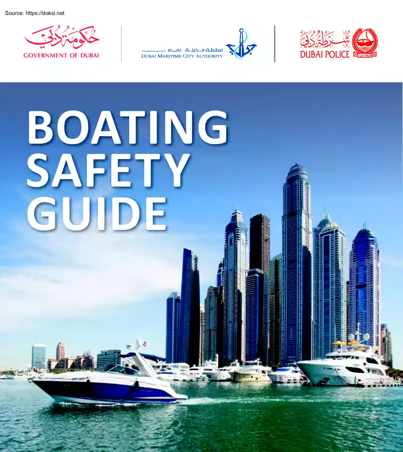
BOATING SAFETY GUIDE 1 Welcome The Government of Dubai seeks the development of the maritime sector and to ensure maximum maritime safety to maintain the integrity of life, facilities and the environment; to this end, this guideline has been developed by the Dubai Maritime City Authority in cooperation with the General Command of Dubai Police. We recommend all operators of marine crafts to refer to this guide and keep it handy at all the marine craft at all times. The marine craft is affected during its cruise by a number of natural factors such as wind direction, water depth and vision, therefore the marine craft operator must render effective monitoring by means of good vision and listening during the course of sailing, and he/she must also be familiar with the conditions of sailing, particularly in adverse climatic conditions, limited visibility and darkness, as it was found that most collisions between the marine craft result from negligence. The marine craft operator is
responsible for taking all appropriate measures to ensure navigation safety. Your cooperation to abide by these preventive guidelines and follow best practice procedures at sea will help you and those around to have a safe and enjoyable experience. 1 Table of Contents Boating Safety Guide Welcome 1 Preparing for a trip 3 Presailing General checklist Safety equipments checklist Supplies, clothing and documents Preparing your marine craft Departure Safe speed Safety while cruising Returning to the marina Safe Navigation 5 Manoeuvring between marine crafts Power driven marine crafts Head on Situation Crossing Overtaking Sailing marine crafts Sailing and power driven marine craft Navigation in Narrow channels Joined action to avoid collision Anchoring Navigational lights Power driven marine crafts Sailing marine craft Marine crafts day shapes Buoys and navigation signs Buoys shapes and types Emergencies 17 Types of emergencies Grounding Man overboard Sinking marine craft
Collision Fire Visual & sound Distress signals Safety equipment 19 Life jackets Life Buoys Fire extinguisher equipment Distress signals (flares) Marine environment 22 Maritime Knots 23 Marinas in Dubai 27 Speed Limits in Dubai Waters 43 2 Chapter one: Preparing for a trip Before you begin any trip on the water, make the following checks to ensure the safety of your marine craft, crew, passengers and the environment. You should insure that: • your marine craft is well serviced, all machinery and life saving equipment are operational, the batteries are operational and charged. • make sure that the fuel is enough for the whole trip (getting to your destination and all the way back) in addition to an extra amount for emergencies. • to read the metrological report and make sure that the weather is suitable for sailing. • to report your trip to the relevant authorities and gain a sailing permit. • insure that all crew are licensed and that they have their license
on board ready to present it to the authorities. • Test and operate the navigation equipment, like Radar, VHF, ect. 1.Presailing General checklist • Ensure navigation lights are operational • Look for cracks or wear and tear in the hull • Make sure the engine cooling system is fully functioning • Make sure that the fuel is enough for the whole trip • Inspect the fuel system for cracks or leakage • Check the level of distilled water in the battery • Check the battery is properly installed and power cables are well secured and clean • Check the level of engine oil • Make sure that the oil filter is clean • Ensure ropes are in good condition and ready for use • Check the steering system • Make sure that there is a toolbox for maintenance on board • Make sure that there is a First Aid box on board • Engine is service and operational • Inspect electrical wiring • Avoid sailing with old fuel. Safety equipment checklist: • Are life jackets in good
condition and are there enough for everybody? 3 • Are life buoys in good condition and in their correct locations? • Are fire extinguishers in good condition, ready to use and easily accessible? • Check the meter on fire extinguishers • Are distress signals in good condition, are they ready to use and are they easily accessible? • Do communication equipment operate properly? • All equipment on board are serviced according to manufacturer. • Are the anchor, knife, mobile and hand torch available on board • Are the battery charging cable and trash bags on board . Supplies, clothing and documents • Take clothing to protect you from different weather conditions and don’t limit your movement. • Be careful not to expose yourself to the sun, wind or rain for long periods • Check the amount of water and food on board is enough for the journey and that there is an emergency supply • Do not overload the marine craft - take into account baggage and heavy equipment •
Ensure all certificates and documents of the marine craft and the crew are up-to-date and in order 2.Sailing Procedures Departure • Notify the relevant authorities to acquire sailing permit • Make sure you have sufficient information on the area you want to go to, how to reach it and the duration of the trip • Investigate the condition of the sea and the weather • Ensure orderly boarding of the passengers from the pier to the marine craft • Make sure that all the passengers are sitting in their allocated places • Make sure that no ropes are entangled with the propeller • Make sure that all children under 10 are wearing their life jacket • Check the number of passengers and do not exceed the official number specified for the marine craft • Inform those who are on board of the type of safety equipment on the marine craft, its location and how to use it Chapter one: Preparing for a trip • Comply with the speed restrictions during departure • Make sure there is
no other marine craft close by during the manoeuvring process • The horn must be blown to alert other marine craft Safe speed Excessive speed and alcohol are the two main causes of accidents involving recreational marine crafts. Official authorities have the powers to use speed detection equipment to detect marine crafts exceeding the speed limit. We advice always with the following: • Driving with caution and attention and not exceed the speed limit • Put the kill switch lanyard in the operator wrist, if the marine craft provided with this system. The marine craft should at all times maintain safe speed, which is determined by operational and safety factors, speed is measured by knots and according to the following: 1. A speed limit of 5 knots is to be complied with in the ports of Dubai. 2. A speed limit of 7 knots is to be complied with in Khor Dubai and Memzer. 3. A speed limit of 7 knots is to be complied with when passing through any waterway of which width is not more than
600m; a waterway separates between two islands, or an island and the coast of the Emirate. 4. A speed limit of 7 knots is to be complied with in the following cases: (a) When compelled to enter within 300m of the beach area in the case of an emergency. (b) When passing within 50m of any boat moorage, diving platform, loading dock or ship moorage. (c) When passing through an anchoring area of small marine crafts. Speed conversion chart Knots 1 5 10 20 30 Mile/hour 1.15 5.57 11.51 23.02 34.52 Km/hour 1.85 9.26 18.52 37.04 55.56 Mentioned speed are implemented on all areas except for special areas with speed limits marked otherwise. Safety while cruising • Avoid crossing in front of any marine craft that has traffic priority • Use a series of short horn blasts to alert other marine crafts and avoid collision • In cases of restricted visibility , reduce your speed to the minimum and proceed with caution and alertness • Do not obstruct the passage of another marine craft • Do
not navigate close to large ships during manoeuvring, or in narrow channel or high traffic zone • It is your responsibility to maintain an effective lookout at all times and in all directions. • The power driven marine crafts shall avoid passageway of large ships, or ships restricted by their draft and ability for manoeuvring. • in case of witnessing a thunder storm, watch its direction carefully, for it is known to change their direction often, and it might cause strong wind , so it is advice to get back to shore directly. • Be aware of low dark clouds, it might be an indication of a storm. • Be flexible and change your plans when necessary • Do not moor the boat to any floating object in the sea and then leave it, as it will cause danger to the safety and lives of other sailors and their property • Do not use navigational buoys to moor the boat, this could damage them and impede navigation and risk the safety and lives of other sailors or damage their property
3.Returning to the marina • Reduce your speed when approaching the port • Do not overtake any marine craft inside the port. • Maintain attention, cautiousness and a look out in all directions. • Do not approach the manoeuvring areas of other marine crafts • Ensure that you do not attempt to moor at the pier during the departure of another marine craft • Passengers are disembarked only after the marine craft has completely moored. • Aware of the status of the tides and water current due to their effect on the manoeuvring inside the channels and ports. 4 Chapter two: Safe Navigation Manoeuvring between marine crafts: Overtaking Power driven marine crafts Any marine craft overtaking any other shall keep out of the way of the marine craft being overtaken, and keep a safe distance until the other marine craft can be seen clearly on her astern. Head - on situation When two power-driven marine crafts are meeting on a reciprocal or nearly reciprocal courses so as to
involve risk of collision each shall alter her course to starboard so that each shall pass on the port side of the other (at night the side lights green and red can be seen). Crossing When two power-driven marine craft are crossing so as to involve risk of collision, the marine craft which has the other on her own starboard side shall keep out of the way and shall, turn to starboard to allow the marine craft to pass on his port side(at night the side red light can be seen on his starboard). Sailing marine crafts approaching each other When two sailing marine crafts are approaching one another , so as to involve a risk of collision, one of them shall keep out of the way of the other as follows : when each has the wind on a different side, the marine craft which has the wind on the port side shall keep out of the way of the other. WIND 5 WIND Chapter two: Safe Navigation When both have the wind on the same side, the marine craft which is to windward shall keep out of the way of
the marine craft which is to leeward. D IN W W IN D If a marine craft with the wind on the port side sees a marine craft to windward and cannot determine with certainty wether the other marine craft has the wind on the port or on the starboard side, she shall keep out of the way of the other. Navigation in narrow channels • A marine craft proceeding along the course of a narrow channel of fairway shall keep as near to the outer limit of the channel or fairway which lies on her starboard side as is safe and practicable. • All marine crafts must not impede the passage of any other marine craft in the channel or narrow waterway. • Do not cross the channel or narrow waterway horizontally if such crossing could impede the passage of another marine craft . • All marine crafts should maintain safe speed at all times in order to give enough time for the marine craft to effectively stop within a safe distance with consideration of: • The area traffic • State of visibility •
Marine craft ability to manoeuvre. • Sea state, current, wind, and proximity of navigational hazards. Important Guidance Sailing and power driven marine crafts Motor marine crafts shall always give way to sailing and rowing marine crafts as is safe and practicable. • When manoeuvring between marine crafts, the operator that he does not sure of manoeuvre to be far a way and keep safe distance. • If you intend to overtake or approach a marine craft towing people practicing water skiing, stat away at least 50 meters from the skaters and the marine craft together. ALTERNATIVES: Slow down or stop or reverse 6 Chapter two: Safe Navigation • Joint actions to avoid collision • The marine craft that gives way must take early measures to avoid accidents; change your speed or your direction so that it is apparent to other marine crafts, avoid crossing in front of a marine craft that has traffic priority; if necessary, stop or go back. • You can sound a series of short
whistles or horn sounds (five or more horns) to indicate that no sufficient action has been taken to avoid collision. • The marine craft that has traffic priority (stand by marine craft) must maintain the same speed and direction, but the operator of the marine craft must avoid the other marine craft only if he finds that the measures taken by other marine craft are not sufficient; and, if necessary, he must act to take any action necessary to move away and avoid a collision. Responsibilities of cruising marine crafts Power driven marine crafts underway must keep out of the way of: • Marine crafts not under command • Marine crafts restricted in her ability to manoeuvre Large vessels cannot change course quickly and cannot stop quickly 7 • Fishing marine crafts using fishing gear, such as nets, which limit their ability to manoeuvre • Sailing marine craft Sailing marine crafts underway must keep out of the way of: • Marine crafts not under command • Marine crafts
restricted in her ability to manoeuvre • Fishing marine crafts using fishing gear, such as nets, which limit their ability to manoeuvre Small marine crafts operator must aware a bout the following: • Large marine crafts are not able to alter their course or stop suddenly. • Small marine crafts might not be visible to larger marine crafts. • Large marine craft may not be able to alter their course in narrow channels due to their draft restrictions, therefore the small marine crafts must be ready to alter their courses a way from the large marine crafts. It is illegal and dangerous to tie up to navigational aids and to anchor in channels Chapter two: Safe Navigation Anchoring A proper anchoring process is essential for maintaining the safety of your marine craft. To achieve the highest level of anchor security, follow these steps: • Anchor, chain and/or rope are to be selected in proportion with the requirements of marine craft and with the depth of the water it cruising
in. • The anchor must be dropped into the water slowly and not thrown from the deck of the. • The chain must be lowered at a length equal to a minimum of three times the depth of the water, to be increased to five times in rough seas. • Regularly check that the rope or chain is not dragging from its position and always secured. • It is advised not to anchor the marine craft from the middle or from the rear as it may lead to risk of capsizing . ANCHOR CHAIN AT LEAST 3 METRES ANCHOR • It is prohibited to anchor the marine craft in areas that cause navigational obstruction to other marine crafts, such as in channels. • When you throw the anchor you must make sure that nobody nearby to avoid wrapping of the rope around his leg. • Lay the palm of the hand on the anchor rope to ensure that is steady and not dragging SCOPE 3:1 WIND BOW ROLLER BITTER END SANDY SEABED 8 Chapter two: Safe Navigation In marine crafts that are 12m long or more but less than 50m . •
Mast light 5 miles, except marine crafts that less than 20m, 3 miles. • Sidelights 2 miles. • Stern light 2 miles. • Towing light 2 miles. • All round light ( white, red, green, yellow) 2 miles. In marine marine crafts that are less than 12 meters long : Navigational lights The navigation lights are used at night or at restricted visibility ant day time. Operation of these lights on the marine craft will identify the direction, size, type and nature of their work. The lights consist of a green light on the starboard side and a red light on the port side. Both of these must illuminate an arc of 112.5 degrees (see the diagram) A forward white light illuminate 225 degrees from the horizon., And a aft white light illuminating 135 degrees from the horizon. In addition to special lights (towing, piloting, ect.) The illumination range of the lights should not be less than : • mastlight 2 miles. • sidelight 1 mile. • sternlight 2 miles. • towing light 2 miles. • all round
light (white, red, green, yellow) 2 miles The invisible towed marine craft must show all round light that can be seen from 3 miles. Navigation lights for various marine crafts (ships, sailing and power driven marine crafts Power driven marine crafts that are less than 12 meters long must show any of the following: • Side lights, mast lights, stern lights, • Side lights (or combined lights) and a all round white light • All round light for marine crafts that are less than 7 meters in length and has speed of less than 7 knots In marine crafts that are 50m long or more, • Mast lights 6 miles. • Sidelights 3 miles. • Stern lights 3 miles. • Towing lights 3 miles. • All-around lights (white, red, green, yellow) must be visible from at least 3 miles. length less than 12m 9 length less than 7m Chapter two: Safe Navigation Marine crafts that are less than 50m in length , should have navigation lights as shown in the picture. side astern above 50m seen from starboard
ahead below 50m seen from starboard AHEAD above 50m • a second mast light is optional for marine crafts with length of less than 50m. Towing Any marine craft engaged in towing must show two mast lights; however, if the length of the tow from the Aft of the towing marine craft to the Aft of the towed marine craft exceeds 200 meters, then three lights must be shown in an upright position using side lights, stern lights and the towing light (yellow) in a vertical line above the stern light. above 50m seen from starboard below 50m seen from starboard • Marine crafts less than 12 meters in length, however, may use a combined light on the centre line of the Forward -Aft in the place of side lights. AHEAD above 50m less than 200m 10 Chapter two: Safe Navigation Anchored marine craft Marine craft constrained by their draught An anchored marine craft of 50m or longer in length should show two all round lights, with the front light higher than the rear. If less than 50m, the
lower light at the rear is optional. • In a narrow channel which is not capable of altering its course must show three all round red lights. Marine craft restricted in her ability to manoeuvre • Must show three all round lights, red for the top and bottom and white for the middle, while always sail with absolute caution. • When underway, the marine craft must shows the mast lights, side and stern lights; upon anchoring, the marine craft • Must show the anchoring lights. 11 A marine craft not under command • Must show two all round red lights and, when underway, it must show the side and rear lights. Chapter two: Safe Navigation A pilot marine craft For non-commercial fishing marine crafts, • Must show two spherical lights, white on the top and red at the bottom. • Two all round lights must be shown, red on the top and white at the bottom. • If the fishing nets( in commercial fishing marine crafts) are horizontally 150 metres or more from the boat, then a
white spherical light towards the nets must be shown. Any fishing marine craft • Must show two all round lights, green on the top and white at the bottom in addition to the side and Aft lights when underway. Notes All marine crafts should adhear to the ministry of environment laws in regards to fishing. STERN AHEAD Take extra caution when approaching passenger ships and commercial marine crafts as there are frequently bright lights on their decks making it difficult to distinguish between these lights and navigational lights, advice to be always away of them. 12 Chapter two: Safe Navigation Sailing and rowing marine crafts All sailing marine crafts should show side and Aft lights or, if the length of the marine craft is less than 20 metres, a combined light could be fixed on the top of the mast or near to the mast where it can be clearly seen. Sailing marine crafts of less than 7m in length and rowing marine crafts should simply show one white all round light as depicted.
In addition, the marine craft may use two all round lights in a vertical position so as the red light will be on top of the green light; these are to be placed at the top of the mast or close to it in a location where it may be clearly seen. The mast headlight should not use with combination light. ROWING VESSEL MASTHEAD LIGHTS OPTIONAL 13 OR COMBINATION MASTHEAD LIGHT SAILING VESSEL Chapter two: Safe Navigation Marine craft day shapes In order to avoid collisions, there are a series of shapes raised by a marine crafts during the day to alert other or operation, danger, or manoeuvring restrictions. Any skipper heading out into Dubai’s waters would do well to learn all of these before heading out. Marine craft not under command Two black balls are used for marine crafts longer than 12 meters as a sign of their inability to manoeuvre or cruise Towing and towed marine craft A Black diamond form shall be used for each towing marine craft and for the towed marine craft if
the length of the two is more that (200) two hundred meters. Marine craft constrained by their draught One cylinder is used as a sign of inability to alter the course of the marine craft Marine craft restricted in her ability to manoeuvre Two black balls with a black diamond in between shall be used for marine crafts with limited manoeuvring ability Power driven sailing marine craft A head-down black cone-shape is used. Fishing marine craft Head-down black cone-shapes are used. Anchored marine craft A Black Ball shall be used for anchored marine craft of which length is less than (7) seven metres. Marine crafts engaged in underwater operations Black Balls are used on both sides as a sign that the navigation path is closed and that the marine craft must wait for directions. Moreover to the two black balls with the diamond in between that are used to denote the presence of an obstacle at the side, another two black balls along with two diamonds are used on the side which is free
for the marine crafts to pass through as shown in the picture annexed. Marine crafts with divers under water An international signal that must be placed in a visible location as shown in the picture is used for marine marine crafts having divers under water. 14 Chapter two: Safe Navigation Buoys and signs Buoys are metal floating objects, usually made of iron, which can take a variety of forms in order to maintain balance in the water. Anchored to the seabed by chain and Anchor, they are used as navigational aids to indicate the entrances and exits of ports and waterways. Buoy shapes SPAR PILLAR CAN CONE SPHERE Buoy types 1. Lateral Marks Lateral marks are used to indicate the right (starboard) and left (port side) of the waterway when heading into a port or a channel, where the green (cone shape) will determine the right side into the port and the red (cylinder shape) will determine the left side of the port 2. Cardinal Marks These buoys are used for the identification of
the four basic directions (North, South, East and West) and each buoy identifies one of the four basic directions in the area. The direction that the buoy indicates tells marine crafts from which direction they should pass the buoy to avoid danger such as ( shallow water, wrecks, rockets, etc.) NORTH = ARROWS POINT UPWARDS WEST = A CURVED BALLLIKE SHAPE DANGER! N SOUTH = ARROWS POINT DOWNWARDS The marine craft entering navigation channel must be aligned with green buoys. 15 EAST = SHAPED LIKE AN EGG Chapter two: Safe Navigation North Cardinal Mark Passing it from the North side of the sign Its upper half is black; its lower half is yellow. It has two cones with their heads directed upwards and shows a continuous fast or very fast white flash. East Cardinal Mark Passing it from the East side of the sign Divided into three parts, the upper and the lower are black and the middle is yellow, at its peak it has two cones of which bases are black and are opposite to each
other; they show a white flash in a form of a group of three fast or very fast flashes. 3. Safe Water Mark This buoy indicates that the waters around it are safe from all directions. It is also used to determine the limits of the port when coming from the sea. They are also placed temporarily after an isolated danger buoy (see below) has been removed so that marine crafts do not become confused. Colour: White and red longitudinal stripes. Has at its top a red ball and it gives a long white flash. 4. Isolated Danger Mark Used to indicate the presence of risk directly under the buoy – such as a sinking ship, or a navigational obstacle beneath the surface of the water . South Cardinal Mark Passing it from the South side of the sign Its upper half is yellow; its lower half is black, and has two cones with their base directed upwards. It shows a set of six light flashes followed by one long fast or very fast flash. West Cardinal Mark Passing it from the West side of the sign
Divided into three parts, the upper and the lower are yellow and the middle is black. At its peak it has two black cones It show a white flash in a form of a group of nine fast or very fast flashes. Colour: Black with one or more red stripes. Has two black balls on its top and gives two white flashes. 5. Special Marks These determine a special area unfit for navigation – like a military training area – or to determine construction in a port or around an oil platform. They are typically used vin close sets to prevent the entry of marine crafts. Colour: Yellow with a yellow X mark at its top. The colour of the light is also yellow. 16 Chapter three: Emergencies Types of emergencies Grounding The collision of the marine craft with the sea bed as a result of the marine craft diverting from its course. Since such a situation is not expected, the crew must take the following steps: • Turn off the engines • Close all water tight hatches • Request for assistance • Supply
passengers with life saving equipment • Start to pump water outside the marine craft using available pumps • Make sure there are no injuries • Start any temporary repairs, if possible • Make a rapid initial damage report • Take the appropriate decision regarding a method to re-float the marine craft based on the amount of damage • Notify the official authorities of all the details Man over board When a person falls over board you should take the following steps: • Shout out man over board and raise the alarm • Throw a life buoy toward the fallen person • Keep (or dedicate a person to keep) a constant lookout for the person in water and ask him to not to take his eyes off him • Use low speed to approach the person in the water, keep the propeller away from him • When you are close enough, stop engines and pull him on board • Report to the authorities the accident with all its details. • When you are not able to rescue him, ask for assistance and wait the
rescue team to guide them to the location of the person. Sinking Marine craft When the floating ability of the marine craft is affected by water entering into the marine craft, the following procedure must be taken: • Provide all personnel on board with lifesaving appliances. • Request assistance and inform the official authorities of the details • Operate necessary pumps in an attempt to remove 17 water in the marine craft • If you should go into the water, keep away from the marine craft • Gather the passengers in one place and do not move until the arrival of the rescue team Collision In the event of a collision, the following actions must be taken: • Stop the engines. If part of the marine craft has penetrated the body of another marine craft, the skippers must decide if pulling away from the other might result in it sinking; this is the decision of the skipper as required by the accident circumstances. • Request assistance and inform the official authorities of
the details. • Operate necessary pumps in an attempt to remove water from the marine craft. • Provide passengers with life saving equipment. • Close all water tight hatches. • Determine the defect and rate of water ingress to estimate the temporary repair. • Operators of colliding marine crafts must exchange assistance. • If the marine crafts stay afloat, every effort must be made to limit the damage and ensure no further damage occurs. • Depending on the circumstances, the decision to abandon the marine craft depends on : 1. The expected time that the marine craft will remain afloat, 2. Weather conditions (both immediate and expected), 3. The potential risk of fire or explosion in the event of not abandoning the marine craft. Fire If a fire breaks out on board, the following actions must be taken: • Stop the engines and take care not to expose any nearby marine crafts to any risks • Request assistance and inform the official authorities of the details • Operate the
pumps to fight the fire • Close fire hatches to surround the fire • Provide passengers with life saving equipment • Start a cooling operation around the fire • Start fire fighting using available means until the arrival of official teams Chapter three: Emergencies Visual and Sound Distress Signals There are many visual and audio distress signals that can be used to request immediate and necessary assistance when needed. 1. Raise and lower arms up and down slowly and repeatedly 3. Raise an orange piece of cloth painted with a black box and a ball 6. Use a mirror to reflect sunlight 7. Use international flags November - N Charly - C 4. Use of fog horn in clear weather, emitting a continuous or intermittent sound 5. Make the SOS signal using a torch light 6. Use Distress signals of all varieties (hand flare, parachute rocket, floating smoke signals) according to the maker instructions. 18 Chapter four: Safety Equipment Safety equipment Life jackets An approved
life jacket must be provided for every person on the marine craft according to SOLAS 74 -the convention of safety of life at sea in addition to 10% for children. Children under 10 must wear life jackets at all times during the sailing of the marine craft. There are two types of approved life jackets (or Personal Flotation Devices – PFDs). The first: has a high level of floatation that allows the wearer to stay in a safe floating position. These come in highly visible bright colours and have reflective strips. The second: are life vest that just keep the head above the water. Again, these come in easily visible bright colours. Specification of life jackets: • Can be put on within one minute • Comfortable when use • Remain intact and undamaged when jumping into the water from a height of 4.5 metres • Float above the water surface. • Provided with a whistle and light and retroflection tape When to use life jackets 1. In case of Emergencies 2. In case of bad weather, 3. In
case of restricted visibility 4. At all times for children under 10 years old Fire Extinguishing Equipment Portable fire extinguishers (Dry Powder) These are used by anyone present to fight fires at an early stage. There are several types available and the type you should use differs according to the type of fire. Fire extinguishers consist of: • Extinguisher body • Carrying handle • Pressure gauge • Operating lever • Safety pin • Fire extinguisher hose Extinguisher hose Pressure gauge Safety pin Carrying handle Operating lever Fire Extinguisher body Life buoys These are distributed on both sides of a marine craft so that they are ready for immediate use, and can be accessed easily and quickly when required, such as in the case of a person falling overboard: • Throw the life buoy towards the person in the water. • Reduce the speed of the marine craft. • Visual look out to keep the person in sight. • Stop the marine craft near the person at a safe distance
and pull him in with the life buoy. 19 Chapter four: Safety Equipment Burning Process Using a fire extinguisher: 1. Go to the scene of the fire carrying the appropriate extinguisher 2. Pull the pin from the fire extinguisher 3. Direct the ejector towards the base of the fire 4. Press the operating lever fight fire with your back to the wind 2. 3. How to fight fire: 4. OX YG E AT HE N 1. It is a chemical phenomenon that takes place as a result of the union of inflammable substance with oxygen in the air with a certain temperature for each of the materials factor impact and such temperature is different for each substance and is called (the ignition point), so for a fire to take place, three elements must be available: fuel, heat and oxygen, a so-called triangle of fire. FUEL Fire Most fire starts due to negligence and not maintaining a proper fire prevention system, once the fire starts, its very hard to control it leaving behind life and financial casualties, and due
to the existence of flammable materials on board, extreme precautions must be set and taken into consideration to avoid starting up a fire and eliminate any chance of its occurrence, and controlling it in case it starts. Causes of fire The main causes of a fire aboard a marine craft are: • Ignorance, indifference, negligence and sabotage • Poor storage of flammable or explosive materials • A spark • Electrical faults • Discarding cigarette butts near hazardous areas To fight and stop fire, you should eliminate one or more than one factor in the fire triangle and to brake the fire triangle you should do one of the following: 1.Cooling It is to cool down the temperature of the burning material which relays on the ability of the flaming material to absorb water on cool down, yet if the flammable material will not absorb the water, it will turn in to water vapor which will decrease the oxygen percentage to smother the fire 2.Smothering To smother the fire, you should cover or
isolate it which will preventing oxygen reaching and feeding the fire to smother the fire, you should: Closing all vents where the fire is cover the flamable material with extinguishing foam smothering fire with (water vapor of CO2 or Dry Chemical Powder) extinguishing equipments. 3.starving Starfing fire will be achived by preventing it from the burning material such as: Move away flamable material from the proximity of the fire to move the flamable material to an isolated area away from any combustables. 20 Chapter four: Safety Equipment Distress signals These include hand flares, floating smoke distress signals and parachute rocket signals. The orange smoke signals can be seen from 4km (10km from an aeroplane) and should be used during daylight hours in order to accurately determine your location. hand flare distress signals have been designed to have a range of 10km and are ideally for use during the night but can also be seen during daylight hours. The Parachute Shell (or
Distress Shell) launches a red star that rises to approximately 300m. The star then ignites during its fall for a period of no less than 40 seconds. These can be seen from great distances due to both their intensity and their elevation above sea level. You should refrain from using such distress signals, however, until aircraft appear on the horizon or you make certain that you are within sight of shore or another marine craft. You should always make sure than your distress signals are stored in a dry but easily accessible place, away from fuel or flammable materials. Make sure all the crew are familiar of the storage place, as well as the signals and how to use them. 1. Check instructions 2. Remove cap Compass Always carry a compass on board the boat if your journey takes you more than two nautical miles away from shore. Anchor The anchor is one of the most important pieces of equipment on the whole marine craft and the length of the anchor, chain, rope and strength must be
adequate for the area that is being used to anchor in. The rope should be tightened to the anchor at all times. It is also recommended to use a chain between the anchor and rope in order to maintain the girder of the anchor or part of it as parallel as possible to the bottom of the sea. The length of the chain must reach approximately the length of the boat. Marine Radio 3. Pull yellow knob upward and outward 4. Hold flare out and leeward 21 Your marine radio is the single most effective means for asking for help if your marine craft finds itself in danger. Any marine craft sailing two miles (3.2km) or more from shore should have a maritime radio. Chapter five: Marine Environment The marine environment The word environment in general refers to the relationship of the organism, whether a human or a plant or an animal with the environment in which they live, as well as their mutual relationship. The relationship between the organism’s relationships to its environment include
members of its kind and other species that share the same habitat. The pollution is any adverse change in the natural, biological or chemical of the environment, which cause effect on human health or animal resources or vegetable or mineral or on various activities affect, though pollution is a global problem affected by all continents and seas of the world, because the land closed system and contaminants do not degrade, it will have to behave a tracks and move from one place to another and cause damage in any way to any place of the Earth’s surface on land, water or in the air. As the body of water represents three-quarters of the Earth’s surface, so the size of the pollution in the hydrosphere problem equal to three times higher in the land, and there are several pollutants affected by the marine environment are as follows: • Crude oil and its products • Sewage • Industrial waste residue (heavy metals) • Thermal pollution • Radioactive contamination • Pesticide
pollution • Floating and suspended waste • Sediments and solids Since any leakage of fuel used to run the Marine marine crafts or waste oils or any waste in the sea waters even in small quantities, will have a detrimental effect on the natural environment. Therefore, the disposal of oil, chemicals, sewage or waste in the marine environment is absolutely prohibited and any example of noncompliance is a clear violation of the regulations protecting the environment in the Emirate of Dubai. There are certain actions you should take in order to preserve the marine environment: • Do not throw any solid or liquid waste in the water. • Do not pump oil waste to the water. • Ensure that there is no oil leakage from engines in the engine room of your marine craft. • Conduct periodic maintenance of the marine craft engine. • Tie the marine craft to the pier before starting to refuel supply fuel. • Turn off the engine when the boat is fuelling. • Have fire fighting and pollution
fighting equipment on standby during refuelling. • Monitor the process of refuelling to prevent any leakage to the marine environment during the process. • Close all hatches on the deck of the marine craft to ensure no fuel leakage to the surface of the sea. • Thoroughly clean the supply area after finishing using oil absorbent. In the event of a leak, you must immediately notify the authorities and do the following: 1. Stop and isolate the source of the pollution by stopping the operation process. 2. Ensure that all openings on the deck of the marine craft are closed. 3. Use oil absorbent paper sections 4. Manually collect the equipment oil 5. Collect the cleaning materials used for cleaning in oil-leak proof bags to be disposed of in an approved area. Common marine pollutants • Petroleum and petroleum products • Sewage • Industrial waste (Heavy Metals) • Thermal pollution • Radioactive contamination • Pesticide pollution • Floating and suspended waste •
Sediments and solids 22 Chapter six: Knots Types of marine knots and methods of their use Knowing how to tie a marine knot that is appropriate for the situation at hand is essential for safe boating and yachting. Although dozens of knot types exist, marine knots can be divided to the following eight main categories – each one of which has a specific use and purpose. 23 Handle knot This knot is useful for creating a temporary loop in ropes of all types and measurements. Reef knot Also known as Square Knot, this combination of two simple knots is used to connect two ropes of equal measurements. Sheet bend Also known as a weaver’s hitch, this knot is used to connect the ends of two ropes together. Figure of 8 knot Used to prevent ropes from slipping out of a loop; a simple knot can be used for the same purpose. Double sheet bend Similar to a sheet bend, this knot is used when maximum strength of connection is required. Clove hitch Useful for connecting a rope to a pole;
can be formed at the end or in the middle of a rope. Anchor bend Also known as fisherman’s bend, this knot is used to connect a rope to an anchor ring. Rolling hitch Used to attach a rope to a pole when hauling is expected to stay constant and not change directions. 24 Chapter seven: Anchor in Dubai 25 Anchor Services Marinas vary considerably due to the market they are catering for, meaning that facilities can range from a simple floating dock with cleats to fully fledged marinas and yacht clubs that offer satellite television, phone lines and internet connections. Increasingly, new marinas, especially here in the UAE, are offering fullservice facilities, with concrete floating docks and an extensive range of amenities. change prices and conditions on an annual basis. The simplest form of charging is per foot or per metre of a boat’s LOA (length overall), charged per day/week/ month or longer. This is the simplest matrix to work out Another option is charging per
square metre of space, where a boat’s outer dimensions are calculated into a rectangular area to determine the actual space taken up by the boat on the water. All Dubai marinas offer comprehensive packages that include water and electricity provision within the set price. They all also have the ability to charge electricity per unit, which they may well decide to move towards as commercial electricity costs increase. Most marinas in Dubai also offer boat cleaning as part of their comprehensive package. This is done as a service to boat owners, but also to ensure that all boats within the marina look clean and presentable, a point to note due to the fine dust in the air. In addition to the services that marinas offer, many owners also employ specialist companies to keep their boats cleaned, polished and serviced. Larger yachts are often cared for by a fulltime skipper, whose job it is to pilot the boat when the owner is on board, and ensure it is well maintained and polished
throughout the year. A third system is borrowed from the hotel industry, and splits up all the available berth spaces into the maximum dimensions available, and then charges per berth size. In such a system, the boat size is irrelevant, providing it fits within the berth dimensions, as there is a set price charged for the berth Both petrol and diesel are often available within or near marina facilities, as is a range of lubricants, including two-stroke oil for running two-stroke outboards. CHARGES Depending on their shape and management structure, marinas can charge for mooring in a variety of different ways. The biggest variation between marinas is the tenure of contract. From short-term leases to annual contracts, leasehold and freehold tenures, the length of berth ownership is dependent on the philosophy of the marina management and the amount of control they wish to have over the berth space. In Dubai, most marinas run an annual renewal system, which retains the ownership of the
berth and allows the marina to WATER OR DRY? For high performance speedboats and sports boats, keeping the boat out of the water after use is preferable to an in-water berth. Many marinas and private companies offer ‘dry berthing’. By keeping a boat onshore, the hull does not have to be anti fouled and it is easier to ensure proper maintenance of all mechanical parts and to wash the boat thoroughly. With land still at a premium in Dubai, however, there are very few places where dry berthing is currently possible, so the alternative to taking a boat completely out of the water is to use an air berth – a flotation device that is fitted into a berth and lifts the boat out of the water. Air berths come in many forms of design and engineering complexity, from mechanical arms that lift boats on slings, to sinking ramps and fixed hydraulic cradles. In theory, the air berth concept offers the best of both worlds, by keeping a boat as close to the water as possible, but also enjoying the
advantages of being out of the water. Many more deluxe manufacturers also offer customised designs that can be tailored to a variety of different craft, from jet skis to fishing boats and even sailing yachts. However, not all marinas allow air berths, so you are advised to check beforehand. 26 Marinas Palm Jumeirah Marina PALM JUMEIRAH MARINA Tel no 04 375 9590 Fax no 04 453 4066 VHF channel 12 email nmg@nakheel.com Website www.nakheelcom LOCATION & NAVIGATION INFORMATION City/Town Dubai District Palm Jumeirah GPS 25°07.110’N 55°08380’E (East Marina); 25°06.720’N 55°08060’E (West Marina) Chart numbers 3176, 3412 Minimum depth at entrance 8-10m BERTHS Total number of berths Size range Berths under 10m Berths 10-20m Berths 20-30m Berths over 30m 522 10-30m 0 572 18 0 FACILITIES Electricity, water, car parking, showers, security. 27 Marinas Palm Jumeirah Marina ,; ,; ,; . .,; ,'/ "' ~ Anchor Marina West ~~ I 0 J Anchor Marina East I
fji;a Oceana • Apartm/ nts Spa,ulc) , el / . Residence I /; . · TheGoldtn MileApts PALM JUMEIRAH Tl4£TRUNK . ThtGoldJ MileApts @ 0 Scale 1:1000 200m . 28 Marinas Dubai Creek Marina (Dubai Creek Golf & Yacht Club) DUBAI CREEK MARINA (DUBAI CREEK GOLF & YACHT CLUB) Tel no 04 205 4646 Fax no 04 295 6081 VHF channel 16 Email mshop@dubaigolf.com Website www.dubaigolfcom LOCATION & NAVIGATION INFORMATION City/town District GPS Chart numbers Minimum depth at entrance BERTHS Total number of berths Size range Berths under 10m Berths 10-20m Berths 20-30m Berths over 30m Dubai Deira/Garhoud 25°14.630’N 55°19890’E 3176, 3412 5-6m 125 4-45m 54 49 21 7 Facilities FACILITIES Electricity, water, fuel dock, slipway, clubhouse, showers, chandlery, maintenance, 50 ton Travelift, restaurants & bars, car parking. Deira City, Centre shopping mall is across the road 29 Marinas Dubai Creek Marina (Dubai Creek Golf & Yacht Club) ~ o. ~ s c • t e
1:3 000~~~ 1oom Dubai Creek Dubai Creek Marina Dubai Creek Golf& Yacht Club ParkHyarr 30 Marinas Dubai International Marine Club DUBAI INTERNATIONAL MARINE CLUB Tel no 04 399 5777 Fax no 04 399 5672 VHF channel 16 Email marissa@dimc.ae Website www.dimcae LOCATION & NAVIGATION INFORMATION City/town Dubai District GPS Chart numbers Minimum depth at entrance Mina Seyahi 25°05.420’N 55°08480’E 3176, 3412 8-9m BERTHS Total number of berths Size range Berths under 10m Berths 10-20m 280 15ft upwards 50 154 Berths 20-30m Berths over 30m 46 25 FACILITIES Electricity, water, boatyard, slipway (members only), clubhouse, showers, maintenance, chandlery, restaurants & bars, boat cleaning, car parking. 31 Marinas Dubai International Marine Club ~ o~~~~-S-ca 1e 1 :S ooo~~~-2---'oom -Mina Seyaht $ailing Club LeMeridien J J · AL SUFOUHRD 32 Marinas Dubai Marina Yacht Club DUBAI MARINA YACHT CLUB Tel no 04 362 7900 Fax no 04 430 9766 VHF
channel 16 Email info@dubaimarinayachtclub.com Website www.dubaimarinayachtclubcom LOCATION & NAVIGATION INFORMATION City/Town District Dubai Dubai Marina GPS Chart numbers 25°04.362’N 55°08150’E (Yacht Club – see notes for other marinas) 3176, 3412 Minimum depth at entrance 5m 33 Marinas Dubai Marina Yacht Club FACILITIES Electricity, water, internet, boatyard, clubhouse, showers, maintenance chandlery, restaurant, bar, supermarket, boat cleaning, car parking, pharmacy. BERTHS Total number of berths Size range Berths under 10m 567 8-35m 57 Berths 10-20m Berths 20-30m Berths over 30m 314 117 6 Guide price Visitor rate Dhs.245 per m per month Dhs.25 per m per day 34 Marinas Dubai Offshore Sailing Club DUBAI OFFSHORE SAILING CLUB Tel no 04 394 1669 Fax no 04 394 1596 VHF channel 22 Email manager@dosc.uaecom Website www.doscae LOCATION & NAVIGATION INFORMATION City/town District Dubai Jumeira GPS Chart numbers Minimum depth at entrance
25°10.470’N 55°12930’E 3176, 3412, 3739 na BERTHS Total number of berths Size range Berths under 10m 85 5-50ft 25 Berths 10-20m Berths 20-30m Berths over 30m 75 3 0 FACILITIES Electricity, water, slipway (members only), internet (Wi-Fi in the club), fuel dock, boatyard, slipway, clubhouse, showers, restaurant, bar, boat cleaning, car parking. 35 Marinas Dubai Offshore Sailing Club @ 0 Scale 1:4000 lOOm Arabian Gulf /,,.,,, /l . -~-y /~~ > J =1 , I ·. ·-"":J~ ··:.i To Dubai ~ ~--.: ~=:t:~======------======== -+ ~ JUMEIRARD JUMEIRARD ~ 36 Marinas Festival Marina FESTIVAL MARINA Tel no 04 232 9316 Fax no 04 232 9317 VHF channel na Email marina@dubaifestivalcity.com LOCATION & NAVIGATION INFORMATION City/Town District GPS Chart numbers Minimum depth at entrance Dubai Dubai Festival City 25°13.282’N 55°21020’E 3176, 3412 6m BERTHS Total number of berths Size range Berths under 10m Berths 10-20m 72 10-35m 8 50
Berths 20-30m Berths over 30m 26 2 FACILITIES Electricity, water, chandlery, restaurants, bars, supermarket, car parking, pharmacy. Festival Marina is adjacent to the Intercontinental and Crowne Plaza hotels, and Festival Centre shopping mall. 37 Marinas Festival Marina @ o". : Scale 1:3000 1OOm . I • I RTAWater Tari Station / Dubai Creek ~ • J . ' ~~ if# . /?) ,,f() (!;;;' J.""'"""' ' / • # '&~' .~~ #p ~ ~ ~ ~ #~ . ~ Mar lj/ ina Offic . / ·" ~ . . . . The Hub & Pavilion 1 . Pp . ~ ~· ~ {) Qua,.1d<Vi>rtor Berths DJ~~A ~ /SJ lf Promenade ·. ) J ~:i . ~ ,! ydJ, / 'f . • -. E 1~ste .,, T & Qp ·.· Festival Centre 38 Marinas Jebel All Golf Resort Marina JEBEL ALI GOLF RESORT MARINA Tel no 04 814 5020 Fax no 04 883 7084 VHF channel na Email andy.savill@jaresortscom Website www.jaresortshotelscom LOCATION
& NAVIGATION INFORMATION City/town District GPS Dubai Jebel Ali 24°59.325’N 55°01519’E Chart numbers Minimum depth at entrance 3176, 3739 3.5m BERTHS Total number of berths Guide price Size range Visitor rate Berths under 10m 87 On request 10-40m AED 100 per movement and AED 10 per foot per 24hr hrs 60 Berths 10-20m Berths 20-30m Berths over 30m 10 10 5 FACILITIES Electricity, water, fuel dock, boatyard, slipway, clubhouse, showers, maintenance, restaurants, bars, boat cleaning (additional cost), car parking 39 Marinas Jebel All Golf Resort Marina Scale 1:4000 1OOm ~ Ar a b a n Gu I f . ·r Jebe/Ali GolfCourse • 40 Marinas Jumeirah Beach Hotel Marina JUMEIRAH BEACH HOTEL MARINA Tel no 050 880 0692 Fax no 04 406 8813 VHF channel na Email JBHMarina@jumeirah.com Website www.jumeirahbeachhotelcom LOCATION & NAVIGATION INFORMATION City/Town District Dubai Umm Suqeim GPS Chart numbers Minimum depth at entrance 25°08.633’N 55°11372’E 3176,
3412 6m BERTHS Total number of berths Size range Berths under 10m Berths 10-20m 50 40-200ft 03 38 Berths 20-30m Berths over 30m 5 4 FACILITIES Electricity, water, is charged as per the consumption. Wi-Fi internet, slipway (members only), clubhouse, gym, squash & tennis courts, swimming pools, showers, massage service on board, basic maintenance, chandlery (opening 2009), hull cleaning service by qualified divers, 22 restaurants and bars (including complete F&B service delivered to the vessel), florist services, 24hr security, boat cleaning (included in berthing charge), car parking, grocery shopping service delivered to the boat, pharmacy. 41 Marinas Jumeirah Beach Hotel Marina @ o'----- s ca 1e 1:4 ooo 1 ~ 00m / / ·.~ Arabian Gulf . ,> ·~tor ; Berths Private Beach Pavilion Marina & ~rtsf=a ~ (;e ) Wild Wadi Water Park Dubai City JebelAli +- ~ . JUMEIRARD-+ JUMEIRARD JUMEIRA RD London& Paris lnrl Nursery 42 Speed
Limits in Dubai Waters • The speed limit in Khor is 7 knots and all other areas i.e Approach to marinas or near beach or public places is 5 knots. • Here this is to be noted that speed in number is not the criteria for safe speed. In confined waters and where there is proximity of the other marine craft or near beaches the speed shall be such that no wake is generated by the marine craft speed, as wake generated with the speed of 5 knots by 10 meters boat will be not the same as that of 100 meters Yacht. 43 Speed Limits in Dubai Waters Fishing Port Jumeirah 2 The area within the yellow buoys are strictly prohibited for all types of power driven marine crafts Speed limit 5 Knots 44 Speed Limits in Dubai Waters Fishing Port Umm Suqeim 1 The area within the yellow buoys are strictly prohibited for all types of power driven marine crafts Speed limit 5 Knots 45 Speed Limits in Dubai Waters Fishing Port Umm Suqeim 2 The area within the yellow buoys are strictly
prohibited for all types of power driven marine crafts Speed limit 5 Knots 46 Speed Limits in Dubai Waters Umm Suqeim Beach 3 The area within the yellow buoys are strictly prohibited for all types of power driven marine crafts Speed limit 5 Knots 47 Speed Limits in Dubai Waters Sufouh Beach The area within the yellow buoys are strictly prohibited for all types of power driven marine crafts 48 Speed Limits in Dubai Waters Palm Jumeirah Speed limit 5 Knots 49 Speed Limits in Dubai Waters Dubai Marina The area within the yellow buoys are strictly prohibited for all types of power driven marine crafts Speed limit 5 Knots 50 Emergencies Emergency procedures Accidents procedures Marine crafts can encounter a wide variety of incidents that require quick action to preserve the safety of crew and passengers, as well as the marine environment. If an accident does happen, you have to comply with the following: If you subject to accident you have to comply
the following: 1. You should always have on your personal life saving equipments 2. Trigger the alarm and ask for emergency on 3. Ask for assistance by: VHF channel 16 marine radio : • 999 / Police Operations in Dubai. • 996 / Coast Guard Operations • 04/ 3459999 Ports Police Station 4. Use Distress signals Use it only if can be seen by any rescuer 5. Stay on board: • Locating the marine craft is much easier from locating a stray person • Try to anchor the boat to maintain a position if it is safe to. 1. Inform the operation rooms • 999 / Police Operations in Dubai. • 996 / Coast Guard Operations • 04/ 3459999 Ports Police Station 2. Before reporting please consider the following: • The exact location • The nature of the incident • The scene • Number of injuries, if any • Number of crew • The type of marine crafts involved • The number of marine crafts involved 3. The following cases to be reported to maintain maritime safety : • Any foreign
floating objects • Navigational buoys with lighting that is out of order • Marine marine crafts with lighting that is out of order • All types of marine pollution 4. General Information • Do not approach the foreign objects. • Do not fishing near the oil rigs • Do not fish inside the navigation channels. • Do not dive near the oil rigs. For more information, please visit the website of the Dubai Maritime City Authority: For more information, please visit the website of the Dubai Police: www.dmcaae www.dubaipolicegovae and social media channels: and social media channels: DMAuthority 51 DMAuthority DMAuthority dubaipolicehq dubaipolicehq dubaipolicehq