A doksi online olvasásához kérlek jelentkezz be!
A doksi online olvasásához kérlek jelentkezz be!
Nincs még értékelés. Legyél Te az első!
Legnépszerűbb doksik ebben a kategóriában


Tartalmi kivonat
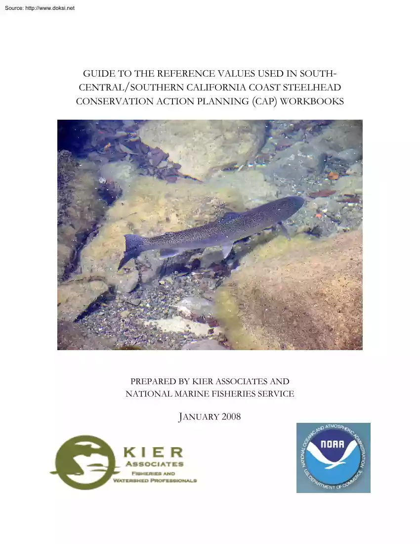
Source: http://www.doksinet GUIDE TO THE REFERENCE VALUES USED IN SOUTHCENTRAL/SOUTHERN CALIFORNIA COAST STEELHEAD CONSERVATION ACTION PLANNING (CAP) WORKBOOKS PREPARED BY KIER ASSOCIATES AND NATIONAL MARINE FISHERIES SERVICE JANUARY 2008 Source: http://www.doksinet GUIDE TO THE REFERENCE VALUES USED IN SOUTHCENTRAL/SOUTHERN CALIFORNIA COAST STEELHEAD CONSERVATION ACTION PLANNING (CAP) WORKBOOKS PREPARED BY THE STAFF OF THE NATIONAL MARINE FISHERIES SERVICE/ LONG BEACH, CALIFORNIA, AND KIER ASSOCIATES, FISHERIES AND WATERSHED PROFESSIONALS, ARCATA JANUARY 2008 COVER PHOTO CREDIT : SAN CARPOFORO CREEK STEELHEAD, APRIL 17, 2007 MARK CAPELLI, NATIONAL MARINE FISHERIES SERVICE Source: http://www.doksinet CONTENTS INTRODUCTION.1 HOW THIS CAP HAS BEEN ADAPTED.1 CAUTIONARY NOTE ON USE OF THE KIER ASSOCIATES SCCC AND SCC CAP.2 REFERENCES FOR CAP AQUATIC INDICATORS.5 SOURCES OF STRESS.21 SCCC AND SCC CAP ARE ONLY ONE TOOL FOR RECOVERY PLANNING.29 COORDINATING DATA COLLECTION AND
SHARING CAN DECREASE COSTS AND IMPROVE RESULTS.29 REFERENCES.30 APPENDICES A. KIER ASSOCIATES RESPONSE TO NMFS COMMENTS B. NMFS COMMENTS ON OCTOBER 2007 DRAFT CAP WORKBOOKS C. NMFS ESTUARINE WETLANDS BIBLIOGRAPHY Source: http://www.doksinet INTRODUCTION The National Marine Fisheries Service (NMFS) is using the Conservation Action Planning (CAP) workbook model to support the development of recovery plans for the South Central California Coast (SCCC) and Southern California Coast (SCC) steelhead trout (Oncorhynchus mykiss) Distinct Population Segments (DPS). The workbook is a regional adaptation of a tool used worldwide by The Nature Conservancy (TNC, 2005) and it is similar to a previous application by NMFS for the Southern Oregon/Northern California coastal coho (SONCC) salmon ESU (Kier Associates and NMFS, 2007). NMFS has contracted for this project with Kier Associates scientists to gather regional field and remote sensing data concerning aquatic habitat and upland conditions
into a Microsoft Access database to inform a set of 55 CAP workbooks. This effort is intended to provide a broad assessment of SCCC and SCC steelhead freshwater habitat quality and the risk of upland contributions to habitat and water quality impairment. By using pre-existing data from a variety of sources, and by drawing reference values primarily from the scientific literature, NMFS can provide a tool for governmental agencies and a variety of stakeholders. Programs potentially served by the SCCC and SCC CAP include steelhead recovery plans mandated under the federal and State Endangered Species Acts; implementation of the federal and State Clean Water Acts: the California Salmon, Steelhead Trout, and Anadromous Fisheries Act; California Trout and Steelhead Conservation and Management Planning Act of 1979, California Riparian Habitat Conservation Program; and compliance monitoring required by the Act, National Forest Management Act. The geographic areas of the SCCC and SCC steelhead
DPSs encompass four State regional water quality control boards. Improving conditions for steelhead will help these agencies attain their Basin Plan objectives. The data sources used here include those from the National Marine Fisheries Service (NMFS), California Department of Fish and Game (CDFG), U.S Forest Service Region 5 (R5), California State Water Resources Control Board (SWRCB), California Department of Forestry and Fire Protection (CDF), U.S Environmental Protection Agency (EPA), US Fish and Wildlife Service (USFWS), U.S Geological Survey (USGS), Resource Conservation Districts (RCDs), Utah State University’s (USU) “Bug Lab”, Central Coast Salmon Enhancement, Stoecker Ecological, the Southern California Coastal Water Research Project (SCCWRP), as well as other contributors. The Kier Associates science team previously assisted NMFS by adapting the data from the Klamath Resources Information System (KRIS www.kriswebcom) projects in the SONCC area to support salmon recovery
plan development (Kier Associates and NMFS, 2007). The master database developed by Kier Associates in Microsoft Access for the SONCC project has been used to support SCCC and SCC steelhead recovery planning. It captures the data acquired from all of the contributors and is used to compute summary values for a set of automated Excel CAP workbooks. The purpose of this document is to: 1) provide information on how the CAP has been adapted, 2) present a brief discussion of the reference values used in ranking aquatic and upland conditions relevant to SCCC and SCC steelhead recovery. Some of the reference values are drawn from the general scientific literature, some from specific field investigations and others from the conventions of the agency or entity that provided the data. HOW THE CAP HAS BEEN ADAPTED The SCCC and SCC consist of a collection of 55 automated CAP Excel workbooks, one for each steelhead population identified by NMFS (2007d), with some modifications (Figure 1). The
analytical tools used in this project for data management were developed under the previous KIER ASSOCIATES AND NATIONAL MARINE FISHERIES SERVICE: GUIDE TO THE REFERENCE VALUES USED IN THE SOUTH-CENTRAL AND SOUTHERN CALIFORNIA COAST CONSERVATION ACTION PLANNING WORKBOOK 1 Source: http://www.doksinet contract supporting NMFS’ southern Oregon and northern California coastal coho salmon recovery plan and include: 1. A customized Microsoft Access database, 2. A set of custom open-source Python computer programs for data preparation, and 3. An adapted Excel CAP workbook The Access database stores region-wide data for all indicator- and sources-of-stress data. The data are tagged with spatial coordinates and/or stream names so that SCCC and SCC CAP summary workbooks for sub-basins or other spatial units can be produced. All indicator and sources-of-stress data for the SCCC and SCC DPS watersheds
were entered directly into the Access database rather than into the individual workbooks. For each of the 55 steelhead populations, the Python scripts summarize the Indicator and Source of Stress data contained in the Access database. The scripts then insert these summary values into a separate CAP workbook for each population. This methodology ensures that all 55 workbooks are using the same criteria and protocols. To ensure transparency, all data in the Access database have been tagged with their source information. These metadata are accessible for each database The array of results can also be viewed as box plots (see the Readme file on CAP DVD for an explanation of what a boxplot is), so that outliers can be identified and patterns in the data can be easily determined. A summary chart is also generated so that the number of factors used for scores in each of the 55 basins can be reviewed. What follows is a discussion on the bases for the reference values for aquatic integrity
(“Indicators” in CAP terminology) and for “Threats” or “Sources of Stress”, CAP terms for upland conditions and the risks for impacting steelhead trout habitat associated with them. Life history stages of steelhead are chosen as conservation “Targets” within the SCCC and SCC CAP areas. CAUTIONARY NOTE ON USE OF THE KIER ASSOCIATES SCCC AND SCC CAP Kier Associates’ SCCC and SCC CAP project is not the sole source of information upon which NMFS relies for recovery plan development, but it is rather an auxiliary tool. The current exercise is driven only by data sets that cover large geographic areas, because of the limited time and resources available to the project. NMFS is also producing a parallel CAP project for each of the 55 DPS databases being done manually (Hunt, in preparation) based on detailed knowledge, including field reports and small databases that were not practical for integration into the Kier Associates CAP. There are no data for many Indicators and
Sources of Stress that significantly limit steelhead productivity in SCCC and SCC DPS watersheds. Scoring watershed suitability for steelhead based on incomplete data is one source of error that can lead to inaccurate overall characterization. The Kier Associates CAP workbooks come with a separate summary Excel database that provides a chart displaying the number of Indicators that drive CAP scores (Figure 2). Users can, in this way, see at a glance which CAP workbooks are based on rich or sparse data. KIER ASSOCIATES AND NATIONAL MARINE FISHERIES SERVICE: GUIDE TO THE REFERENCE VALUES USED IN THE SOUTH-CENTRAL AND SOUTHERN CALIFORNIA COAST CONSERVATION ACTION PLANNING WORKBOOK 2 Source: http://www.doksinet Steelhead Population Boundaries # Steelhead Population Boundaries Pajaro River South-Central California Coast DPS Carmel River Gabilan Creek Southern California Coast DPS San Jose Creek
Lower Salinas River California Outline Garrapata Creek Pacific Ocean Bixby Creek Arroyo Seco Little Sur River 25 0 25 50 75 Miles Big Sur River Upper Salinas River Willow Creek N Salmon Creek San Carpoforo Creek Arroyo de la Cruz Santa Maria River Little Pico Creek Santa Clara River Big Pico Creek San Simeon Creek Los Angeles River Santa Rosa Creek Morro Creek San Gabriel River Chorro Creek Santa Ana River Los Osos Creek San Luis Obispo Creek Pismo Creek Arroyo Grande Creek Santa Ynez River Big Gaviota Creek Sycamore Arroyo Hondo Creek Canyon San Juan Creek Tecolote Creek Goleta Slough San Mateo Creek Mission Creek San Onofre Creek Arroyo Sequit Santa Margarita River Montecito Creek Malibu Creek San Luis Rey River Las Flores Canyon Carpinteria Creek San Dieguito River San Diego River Topanga Canyon Rincon Creek Sweetwater River Otay River Ventura River Tijuana River # # # # # # # # # # # # # # # # # # # # # # # # # # # # # # # # # # # # # # # # #
# # # # # # # # # # # # # Figure 1. Boundaries of the 55 Steelhead populations in the SCC and SCCC DPS KIER ASSOCIATES AND NATIONAL MARINE FISHERIES SERVICE: GUIDE TO THE REFERENCE VALUES USED IN THE SOUTH-CENTRAL AND SOUTHERN CALIFORNIA COAST CONSERVATION ACTION PLANNING WORKBOOK Arroyo Seco Arroyo Sequit Arroyo de la Cruz Big Pico Creek Rincon Creek Salmon Creek San Carpoforo Creek San Diego River SOUTHERN CALIFORNIA COAST CONSERVATION ACTION PLANNING WORKBOOK Lower Salinas River Malibu Creek Mission Creek Montecito Creek Morro Creek Otay River Tijuana River Topanga Canyon Upper Salinas River Ventura River Willow Creek Los Osos Creek Sweetwater River Tecolote Creek Los Angeles River Little Sur River Little Pico Creek Las Flores Canyon Goleta Slough Gaviota Creek Garrapata Creek Gabilan Creek Chorro Creek Carpinteria Creek Santa Ynez River Santa Rosa Creek Santa
Maria River Santa Margarita River Santa Clara River Santa Ana River San Simeon Creek San Onofre Creek San Mateo Creek San Luis Rey River Carmel River Bixby Creek very good San Luis Obispo Creek San Juan Creek San Jose Creek Big Sycamore Canyon good San Gabriel River fair Big Sur River Arroyo Hondo Creek Pismo Creek poor San Dieguito River Arroyo Grande Creek 18 17 16 15 14 13 12 11 10 9 8 7 6 5 4 3 2 1 0 Pajaro River Source: http://www.doksinet 18 17 16 15 14 13 12 11 10 9 8 7 6 5 4 3 2 1 0 Number of Indicators Figure 2. This summary chart shows the number of indicator parameters driving SCCC and SCC CAP scores Note that some basins are relatively data rich, such as the Santa Clara River (15 indicators), but that some small streams may have as few as four. Colors represent the relative aquatic health based on the reference values described here. KIER ASSOCIATES AND
NATIONAL MARINE FISHERIES SERVICE: GUIDE TO THE REFERENCE VALUES USED IN THE SOUTH-CENTRAL AND Source: http://www.doksinet The location and timing of collection of water quality data used in the CAP may make the data of limited utility in analyzing patterns of pollution that affect steelhead trout. Data tend to be collected in very impaired reaches or in waterbodies that are the targets of water quality programs and policies, while relatively less data may be collected in the less impaired streams inhabited by steelhead. Most water quality data comes from discrete samples, rather than from continuous data recorders. As a result sampling may not reflect seasonal extremes and actual worst-case conditions at various sites, skewing results high. The indicators pH, dissolved ammonia, and periphyton have been excluded from the Kier Associates CAP workbooks because these data do not accurately reflect conditions for SCCC and SCC DPS steelhead streams (see details below). Discussion of
these parameters remains in the reference paper because these data types can potentially explain nutrient pollution that impacts steelhead. The Kier Associates CAP workbooks are driven largely by data and associated reference values drawn from scientific literature. NMFS (2007c) staff provided detailed comments on earlier draft Kier Associates CAP workbooks and noted instances where incomplete data lead to mischaracterization of several SCCC and SCC DPS watersheds (complete comments are provided here as Appendix B). Although additional data (gravel extraction, estuarine wetland conditions, and channelization/diking) were added since these earlier draft workbooks, discrepancies still remain. Kier Associates has provided written responses to these comments that lists the following potential explanations for such discrepancies (see Appendix A for complete details): 1. The spatial distribution of the available data 2. The temporal resolution of the available data 3. Reliance on water
quality due to data gaps for other indicators 4. Local steelhead adaptations and natural water quality variability 5. Data gaps for critical limiting factors 6. Limitations of large-scale analyses based on remote sensing 7. Internal programming within CAP Excel increases threat ranks in some populations Therefore, the NMFS CAP workbooks to be generated using more detailed data (Hunt et al., in preparation) should be considered a more accurate reflection of SCCC and SCC DPS stream and watershed conditions than the CAP workbooks discussed here. Once both sets of workbooks are completed, NMFS plans to compare and reconcile the outputs from the two independent threat assessment efforts to create a single threats assessment REFERENCES FOR CAP AQUATIC INDICATORS The reference values for aquatic health (Indicators) are based on the best currently available scientific literature, though it needs to be emphasized that much of this literature has been developed on more northern populations of
steelhead trout and may not in every case represent the environmental conditions in which the southern (or inland) populations have evolved. Targets represent values characteristic of reference streams, with the long-term objective being to bring impaired streams back to a “natural range of variability” capable of supporting all life history phases of steelhead (Spence et al., 1996; Rieman et al, 1993) Quantitative data for the SCCC and SCC steelhead habitat are sparse, so water quality data are used as an auxiliary tool to characterize suitability of regional streams for this species. Some types of data described below have been eliminated from final CAP workbooks because of the problems with sampling noted above, however, they are still discussed here because of their potential utility, should water quality management agencies choose to measure them in stream reaches inhabited by steelhead in the future (see Cooperative Monitoring Potential below). Table 1 provides a summary of
the Indicators and reference values used in the SCCC and SCC steelhead CAP database. KIER ASSOCIATES AND NATIONAL MARINE FISHERIES SERVICE: GUIDE TO THE REFERENCE VALUES USED IN THE SOUTH-CENTRAL AND SOUTHERN CALIFORNIA COAST CONSERVATION ACTION PLANNING WORKBOOK 5 Source: http://www.doksinet Table 1. Attributes and Indicators of aquatic habitat suitability for southern California steelhead SCCC and SCC DPS population CAP reference values Attribute Target* E F J S A Indicators Poor Fair Good Very Good Aquatic Insects (EPT) Aquatic IBI Reservoir volume as % of precipitation Fish Passage (% of Area Accessible) Embeddedness <10 <40 >40 <60% >35% 10-14 40-60 10-40 60-80% 25-35% 14-17 60-80 0-10 80-95% 20-25% >17 >80 0 95-100% <20 % Pool Depths (feet) <2 2-3 3-3.3 > 3.3 x x x Pool Frequency (length) <35% 35-40% 40-50% >50 x x x Pool
Abundance (category) 1-1.99 2-2.99 3-3.99 4 x x x Fish Passage (% of Dry Habitat Types) Canopy Cover Riparian Condition (% Forest, Wetlands, or Shrub) Estuarine Wetland Area (current as percent of historic) Water Temperature (MWMT)* pH* Dissolved Oxygen (max dev. % saturation) Ammonia (% of CCC chronic criterion)* >5% <60% <50% <50% >25 1-5% 60-70% 50-70% 50-70% 22.5-25 <1% 70-80% 70-80% 70-80% 17-22.5 0% >80% >80% >80% <17 >20 % 14-20 % 10-14 % <10 % <10% x x x x x x x x x x x x x x x x x x x x x x x x x x x x Periphyton (annual max Chl a/m2)* >150 125-150 100-125 <100 x x x Water Quality Water Quality Floodplain and Channel Structure Total Nitrogen (mg/L) Total Phosphorus (mg/L) >1.5 >0.15 0.4-08 0.02-006 Impaired <0.4 <0.02 Properly Functioning x x x x x x Floodplain Connectivity (USFS Judgment) Hydrologic Function Water Quantity/Flow (USFS Judgment) Altered Stream Corridor Vegetation (USFS
Judgment) Impaired 0.8-15 0.06-015 Functioning At-risk Partially Altered Functioning At-risk Water Quality Water Quality Hydrologic Function Barriers Sediment Supply Floodplain and Channel Structure Floodplain and Channel Structure Floodplain and Channel Structure Barriers Riparian Forest Conditions Riparian Forest Conditions Estuarine Function Water Quality Water Quality Water Quality Water Quality Water Quality Riparian Forest Conditions Disease and Predation x x x x x x x x x x x x x x x x x x x x x x x Unaltered x x x x Properly Functioning x x x [No available data] * List of conservation Targets (life stages) that the indicator applies to (E = Egg, F = Fry, J = Juvenile, S = Smolt, A = Adult) * Data for these indicators were integrated into the Access database but are not included in the final CAP workbooks due to the data’s limited temporal and spatial scope * No suitable water temperature data were available, so none are included in the Access database, boxplot
summary workbook, or individual CAP workbooks KIER ASSOCIATES AND NATIONAL MARINE FISHERIES SERVICE: GUIDE TO THE REFERENCE VALUES USED IN THE SOUTH-CENTRAL AND SOUTHERN CALIFORNIA COAST CONSERVATION ACTION PLANNING WORKBOOK 6 Source: http://www.doksinet Aquatic Macroinvertebrates: Aquatic macroinvertebrates are an important food source for steelhead trout fry, juveniles and smolts. While availability of aquatic food sources are not generally a natural limiting factor in inland and more southern coastal watersheds (Moore, 1980; Smith and Li, 1983; Rundio and Lindley, In press), aquatic macroinvertebrates are an important tool for evaluating water quality (Barbour et al. 1999), which frequently is a limiting factor due to the extensive land use modifications within many South-Central and Southern California watersheds (Barbour et al. 2007, Keeley 1993, Stephenson and Calcarone 1999). Aquatic
macroinvertebrates often dwell in interstitial spaces between stream cobble and gravel where steelhead eggs are also deposited. Consequently, sediment pollution can decrease macroinvertebrate abundance and diversity and reduce the success of steelhead egg incubation. The use of aquatic macroinvertebrates in the SCCC and SCC steelhead DPS streams is based on regional studies that have established patterns of diversity and identified reference streams. Ode et al. (2005) were able to analyze hundreds of samples in cooperation with four southern California regional water quality control boards, the U.S Forest Service, Bureau of Land Management, Environmental Protection Agency, and the Utah State University “Bug Lab” (Figure 2). This enabled a ranking of stream health based on a locally-calibrated index of biotic integrity (IBI). Additional IBI data were obtained from the San Diego Regional Water Quality Control Board. Figure 2. Map from Ode et al (2005) showing the geographic extent
of the southern California sampling area for the aquatic macro-invertebrates that are the basis of the regional IBI. The IBI ratings for southern California varied slightly between streams in high elevation forested areas and those in lower elevation oak woodland and chaparral (Ode et al., 2005) Since the KIER ASSOCIATES AND NATIONAL MARINE FISHERIES SERVICE: GUIDE TO THE REFERENCE VALUES USED IN THE SOUTH-CENTRAL AND SOUTHERN CALIFORNIA COAST CONSERVATION ACTION PLANNING WORKBOOK 7 Source: http://www.doksinet differences are so slight and are not likely to affect CAP scores significantly, the same rating curve is applied to all locations. Proposed CAP interim reference values for IBI in the SCCC and SCC are: Very Good = >80, Good = 60-80, Fair = 40-60, Poor = <40. Ode et al (2005) distinguish between Poor and Very Poor (<20), but all waters with scores below 40 are assumed to be
unsuited to steelhead survival. IBI scores are not available for post-2002 “Bug Lab” data points. The Ephemeroptera-PlecopteraTrichoptera (EPT) Index is, therefore, also used in the CAP The EPT index is the number of species present in a sample of these pollution-intolerant Orders. EPT reference values from Ode et al. (2005) are used to rate southern California streams Proposed CAP interim reference values fore EPT for the SCCC and SCC are: Very Good = >18, Good = 14-17, Fair = 10-14, Poor = <10. Reservoir Impacts on Hydrology: Highly migratory species such as steelhead depend on connectivity of stream flows to complete the fresh-water phase of their life-cycle. Dams and reservoirs can create major alterations to the hydrology of watersheds and their channel forming and maintenance processes. Such alterations are complex and difficult to quantify Detailed analyses of reservoir inflows and outflows are beyond the scope of this project, and are likely not possible in all
watersheds due to data gaps. Therefore, an alternative system was devised to assess the general effects of dams and reservoirs in watersheds. For each of the 55 steelhead population watersheds, the total storage volume of reservoirs1 was calculated as a percent of total annual precipitation volume2. While this does not take into account how the dams are operated (e.g what time of year water is being stored/released, the final destination of impounded water), it does provide a useful approximation of the potential degree of hydrologic alteration attributable to dams/reservoirs. Proposed CAP interim reference values for reservoir impacts to hydrology for the SCCC and SCC are: Very Good = 0%, Good = 0-10%, Fair = 10- 50%, Poor = >50%. Fish Passage (Percent of Area Accessible): NMFS (1996a) noted previous work describing impediments to steelhead passage in southern California. Boughton et al 2005 concluded that “a large majority (68%) of the extirpations of steelhead populations in
the 88 coastal watersheds between Monterey Bay and the U.S Mexico Border are strongly associated with anthropogenic barriers such as dams, flood control structures, and culverts which block access to fish migration to upstream spawning and rearing habitats.” Barriers are well recorded for many southern California streams and accessible in electronic form either as basin-specific datasets (i.e Stoecker and Stoecker, 2003; CA Coastal Conservancy, 2004; Cachuma RCD and Carpinteria CWA, 2005; Stoecker and Kelley, 2005; Stoecker Ecological, 2005; Love and Stoecker, 2007) or as part of the CDFG Passage Assessment Database (PAD). The PAD 8 1 Reservoir storage volume data obtained from the Dams 2005 GIS dataset assembled from multiple sources by NMFS that included all major dams as well as many smaller dams 2 Precipitation data were obtained as a GIS dataset from the Oregon Climate Service at Oregon State University, which modeled mean annual precipitation by combining rain gage data with
physical rules such as the orographic effect and rain shadows. To obtain annual precipitation volume for a watershed, watershed area was multiplied by average annual precipitation across the watershed. 8 KIER ASSOCIATES AND NATIONAL MARINE FISHERIES SERVICE: GUIDE TO THE REFERENCE VALUES USED IN THE SOUTH-CENTRAL AND SOUTHERN CALIFORNIA COAST CONSERVATION ACTION PLANNING WORKBOOK Source: http://www.doksinet also contains information on barrier type, so that defined areas can be differentiated by the particular causes of inaccessibility, such as dams and culverts. The watershed above each total (complete) barrier to fish passage was delineated using GIS software. The indicator reference values in the CAP are based on the percentage of watershed area accessible (i.e, not blocked by total barriers to migration). The categories of inaccessible area are compared within each steelhead population
regarding Sources of Stress as well (see below). Future versions of the CAP could refine this metric to incorporate the quality of blocked habitats, such as percent of stream miles of high potential habitat that are inaccessible due to barriers. The proposed CAP interim reference values for fish passage (percent of basin accessible) for the SCCC and SCC are: <60% = Poor, 60-80% = Fair, 80-95% = Good, and 95-100% = Very Good Embeddedness: The degree to which cobbles or gravel at pool tail crests are buried in fine sediment or sand is known as embeddedness, a parameter used routinely in salmonid habitat typing surveys (CDGF, 2004). Pool tail crests are often chosen as locations for steelhead redd construction. Streambed embeddedness at these locations is, therefore, a measure of spawning habitat quality. Female steelhead trout may expend considerably more energy excavating redds, for example, if embeddedness is high. High levels of embeddedness are indicative of high fine sediment
supplies, which can resettle after redd construction to smother eggs and decrease egg and alevin survival (Chapman, 1988). Steelhead trout fry and juveniles may also need to hide within the interstitial spaces of a cobbled stream, making embeddedness an inverse index of available cover for steelhead fry and juveniles. Some southern California habitat typing data includes measurement of embeddedness at locations other than pool tail crests, which is inconsistent with CDFG (2004) protocols. Steelhead are also known to spawn in riffles; therefore, riffle embeddedness scores are included. Since glides, runs and other habitats are not usually selected by steelhead for spawning, embeddedness measurements from these locations are not used in SCCC and SCC CAP scores. The SCC and SCCC CAP uses habitat typing data from the following sources: Central Coast Salmon Enhancement, Inc. (Close and Smith, 2004) for Arroyo Grande Creek; Stoecker and Conception Coast Project (2002) for Southern Santa
Barbara County; Stoecker and Kelley (2005) for the Santa Clara River watershed; and CDFG (2004) for Bear Creek (tributary to Ventura River) and San Mateo Creek. CDFG has surveyed many streams from Santa Cruz, Monterey, and San Luis Obispo Counties, but these data were not available to the SCC and SCCC CAP project. Various targets for embeddness have been proposed. Armentrout et al (1998) set targets for embeddedness in volcanic watersheds west of Mt Lassen, in Mill, Deer and Antelope creeks as follows: less than 10% for mainstems, less than 15% for tributaries without highly erodible soils (rhyolite), and less than 20% for tributaries in watersheds with rhyolitic soils. CDFG (2004) rated embeddedness scores of less than 25% as good, while NMFS (1996) rated embeddedness of less than 20% as “properly functioning”. NMFS also gave an “at risk” rating of 20-30% and a “not properly functioning” value to embeddedness greater than 30%. Proposed CAP interim reference values for
embeddedness for the SCCC and SCC are: <20% = Very Good, 20-25% = Good, 25-35% = Fair, and >35% = Poor. KIER ASSOCIATES AND NATIONAL MARINE FISHERIES SERVICE: GUIDE TO THE REFERENCE VALUES USED IN THE SOUTH-CENTRAL AND SOUTHERN CALIFORNIA COAST CONSERVATION ACTION PLANNING WORKBOOK 9 Source: http://www.doksinet Pool Depth: CDFG (2004) habitat typing surveys always capture data on pool depth, which is the best replicable metric for trend monitoring that comes from such surveys. Greater pool depth provides more cover and rearing space for older age (1+ and 2+) steelhead juveniles. Deeper pools also create better shelter for migrating and spawning adults (Bean 2007, Spina 2003, Harrison et al. 2005). Spina et al (2005) studied use of pools in the lower mainstem of San Luis Obispo Creek in the SCC DPS region and found that: “The large, deep pools in the lower main stem probably contribute
to steelhead survival, especially that of larger juveniles, based on the relationship between the counts of steelhead and mean pool depth (and area) documented in our study” Boughton et al. (2006) noted the significance of pool depth in streams within the SCC and SCCC DPS area: “Of notable importance is pool depth. We have occasionally observed distinct summer thermoclines in pools deeper than 2 m, in places such as San Mateo Creek (San Diego Co.), the Santa Margarita River between Fallbrook and Temecula, and in Topanga Creek. In each case the colder bottom water appeared to provide refuge for steelhead and also deter predatory warm-water exotics such as largemouth bass.” Maximum pool depth is partly a function of watershed size and geological formation, but pool depths and volume can be compromised by sediment over-supply or increased peak discharges related to upstream or upslope land management (Montgomery and Buffington, 1993). Barnhart (1986) states that “excessive
sediment inputs that fill pools can greatly reduce a stream's capacity to rear steelhead to smolt size.” Harrison and Keller (2005) note the importance of boulders in pool formation in steep and confined southern California steelhead streams, although scour was sometimes offset by deposition when high bedload transport of fine sediment was occurring. Bean (2007) noted that sandstone bedrock formations may also create hydraulics that lead to pool formation. Pool depths of three feet, or one meter, are commonly used as a reference for fully functional salmonid habitat (Overton et al., 1993; USFS, 1998; Bauer and Ralph, 1999; Brown et al, 1994) The California Salmonid Stream Habitat Restoration Manual Third Edition (CDFG, 2004) defines primary pools for 1st and 2nd order streams as having a maximum residual depth of at least two feet, occupying at least half the width of the low flow channel, and being as long as the low flow channel width. For 3rd and 4th order streams, CDFG
criterion is a maximum residual depth of at least three feet. Because there are insufficient data to understand the relationship between pool depth and stream size, the CAP does not use different pool depth reference values for streams of different sizes; however it is recognized that larger watersheds, particularly in their headwaters, contain larger and deeper pools controlled by geomorphic factors. Proposed CAP interim reference values for pool depth for the SCCC and SCC are: Very Good = > 3.3, Good = 3-33, Fair = 2-3, Poor = <2 Pool Frequency: Habitat typing surveys (CDFG, 2004) also provide data on the percentage of stream reaches represented by pools, which are preferred habitat for yearling and older juvenile steelhead. Pool frequency by percent length is preferable to pool frequency by occurrence because the latter may give a false impression of health if there are numerous, shallow, short pools as a result of aggradation. The Washington State Fish and Wildlife Commission
(1997) recommend the following pool frequencies by length: KIER ASSOCIATES AND NATIONAL MARINE FISHERIES SERVICE: GUIDE TO THE REFERENCE VALUES USED IN THE SOUTH-CENTRAL AND SOUTHERN CALIFORNIA COAST CONSERVATION ACTION PLANNING WORKBOOK 10 Source: http://www.doksinet "For streams less than 15 meters wide, the percent pools should be greater than 55%, greater than 40% and greater than 30% for streams with gradients less than 2%, 2-5% and more than 5%, respectively." California habitat typing surveys are rarely conducted in channels of greater than 2% gradient; therefore, no screen for gradient is used for California SCC and SCCC data. Peterson et al (1992) used 50% pools as a reference for good salmonid habitat and recognized streams with less than 38% pools by length as impaired. Values from Peterson et al (1992) are those adapted for use in the SCC and SCCC CAP. Some habitat
surveys for southern California streams (Stoecker and Conception Coast Project, 2002; Stoecker and Kelley, 2005) include aerial reconnaissance for rough approximations of habitat types and lengths, but no aerial data were used in calculating pool frequency in the CAP. Proposed CAP interim reference values pool frequency for the SCCC and SCC are: Very Good = > 50%, Good = 4-50%, Fair = 35-40%, Poor = <35%. Pool Abundance: In habitat surveys of small streams in southern Santa Barbara County, Stoecker and Conception Coast Project (2002) estimated relative pool abundance on a five-category scale. These values were converted to a four-category scale for incorporation into the SCCC and SCC CAP. Proposed CAP interim reference values pool abundance for the SCCC and SCC are: Poor = 1 “Pools scarce or absent” or “Relatively low abundance of pools present”, Fair = 2 “Relatively moderate abundance of pools present”, Good = 3 “Relatively high abundance of pools present”, Very
Good = 4 “Relatively high abundance of pools present with multiple ‘refuge pools’ (greater than 5 feet deep)”. Dry Stream Segments: Habitat typing surveys note reaches of streams that lack surface flow as “dry” (CDFG, 2004). Intermittent stream flow patterns or alternating reaches of surface and nonsurface flow can occur naturally in many central and southern California stream systems due to arid climatic conditions (Boughton et al, 2005; Spina et al., 2006) However, loss of surface flow can also be the result of stream diversions, ground water withdrawal or aggradation of the streambed (Kier Associates, 1999; Nielsen et al., 1994) The lack of connectivity of rearing habitats can prevent the movement of juvenile steelhead trout, and thus is used in the CAP as a fish passage indicator. Surveys of dry habitats using aerial reconnaissance (i.e, Stoecker and Kelley, 2005; Stoecker and Conception Coast Project, 2002) are considered useful for generating CAP scores. The total
length of aerial and ground surveys were summed and the dry reaches from both survey types used to calculate percent dry. Proposed CAP interim reference values dry stream segments for the SCCC and SCC are: > 5% dry = Poor, 1-5% = Fair, <1% = Good, and no dry reaches = Very Good. Canopy Cover: CDFG (2004) habitat typing surveys measure canopy closure from the middle of streams, which is a good index of shade. Shade is an important influence on water temperature and CDFG (2004) recognizes 80% canopy as optimal for salmon streams. In some reaches of central and southern California streams vegetation may be naturally sparse and large instream boulders or KIER ASSOCIATES AND NATIONAL MARINE FISHERIES SERVICE: GUIDE TO THE REFERENCE VALUES USED IN THE SOUTH-CENTRAL AND SOUTHERN CALIFORNIA COAST CONSERVATION ACTION PLANNING WORKBOOK 11 Source: http://www.doksinet canyon walls may provide shade
and cover. Consequently, standard canopy cover could be low, but adequate cover for steelhead juveniles from boulders may exist. Proposed CAP interim reference values for canopy cover for the SCCC and SCC are: Very Good = > 80%, 70-80% = Good, 60-70-% = Fair, and <60% = Poor Riparian Condition: Stream side vegetation and the plant community within the adjacent wet area constitute the riparian zone. Healthy riparian vegetation can help filter nutrients and pollutants, create a cool microclimate over a stream, provide food for aquatic organisms, maintain bank stability and provide hard points around which pools are scoured (Spence et al., 1996) NMFS (1996a) noted that “studies indicate that in Western states, about 80 to 90 percent of the historic riparian habitat has been eliminated.” Urbanization and agricultural development have caused major changes in riparian zones of southern California steelhead streams (Boughton et al., 2005, 2006; NMFS 2007a, 2007b) The National Land
Cover Database (NLCD) 2001 (Homer et al., 2004) was used to derive riparian condition score for the CAP. The NLCD does not provide detailed information such as age and species composition (e.g balance of native vs non-native species); it just classifies each 30x30 meter pixel as one of 16 land cover types. Three hundred foot (90 m) buffers on each side of streams were applied to the land cover dataset. Final CAP scores are the combined percentage of area within the buffer composed of six feature classes: deciduous forest, evergreen forest, mixed forest, Shrub/Scrub, woody wetlands, or herbaceous emergent wetlands. Proposed reference values are “Very Good” for greater than 80% of the riparian buffer assessed in woodlands or wetlands, whereas less than 50% woodlands and wetlands would constitute “Poor” conditions (Table 1). Proposed CAP interim reference values riparian condition for the SCCC and SCC are: > 80% = Very Good, 70-80% = Good, 50-70% = Fair, <50% = Poor.
Estuarine Wetland Extent: The importance of coastal lagoons in supporting steelhead life-cycle (rearing, acclimating between the marine and freshwater environments, accessing both marine and freshwater environments) is widely recognized, but many aspects of this habitat feature are not understood in detail. Boughton et al (2006) state that productivity of SCCC and SCC Evolutionarily Significant Units (ESUs) steelhead streams “depends in part on lagoon size, which is readily measured, but it also depends on primary productivity of the lagoon ecosystem itself, and key driving variables such as the degree of mixing between salt- and freshwater during the summer.” NMFS (1996a) estimated “that during the last 200 years, the lower 48 United States have lost approximately 53 percent of all wetlands. Washington and Oregon's wetlands have been estimated to have diminished by one third, while it is estimated that California has experienced a 91 percent loss of its wetland habitat.”
Several projects have produced data on SCCC and SCC coastal lagoons: • • • The Coastal Commission digitized and geo-referenced boundaries of Southern California coastal wetlands from 1850s Coast and Geodetic Survey maps (T-sheets). U.S Fish and Wildlife Service National Wetland Inventory (NWI) data Southern California Wetlands Mapping Project (SCWMP) The SCWMP is producing highly detailed maps of current and historic wetlands, but will not finish SCCC and SCC until spring 2008. Pending completion of SCWMP, NMFS (2007e) has compiled an 12 KIER ASSOCIATES AND NATIONAL MARINE FISHERIES SERVICE: GUIDE TO THE REFERENCE VALUES USED IN THE SOUTH-CENTRAL AND SOUTHERN CALIFORNIA COAST CONSERVATION ACTION PLANNING WORKBOOK Source: http://www.doksinet inventory of original and current estimate of estuarine wetland acreages for each of the 55 populations to be used as a general indicator of the
current level of wetland functions for the CAP, based on the assumption that a relatively intact open water and contiguous wetland system will remain productive, while filling or conversion of these areas results in lesser carrying capacity for steelhead. See Appendix C for a complete listing of documents used for the NMFS estuary/wetland assessment. Proposed CAP interim reference values for the percent of historic estuarine wetland habitat that remains are: Very Good for >80%, Good = 70-80%, Fair = 50-70%, and Poor = <50%. Temperature: Spence et al. (1996) ranked water temperature as the most important salmonid habitat variable: “Stream temperatures influence virtually all aspects of salmonid biology and ecology, affecting development, physiology, and behavior of fish, as well as mediating competitive, predator-prey and disease-host relationships.” There are a number of literature summaries concerning the water temperature requirements of Pacific salmon (McCullough, 1999;
Sullivan et al., 2000; US EPA, 2003) The US EPA (2003) Region 10 Guidance for Pacific Northwest State and Tribal Temperature Water Quality Standards sets standards by life stage for Pacific salmon species. According to Boughton et al (2006), the hypothesis that southern California steelhead are adapted to warm water has not been proved conclusively by scientific evidence; “researchers have not found local genetic adaptation in the thermal tolerances of O. mykiss” However, there are widespread field data from SCCC and SCC DPS streams where steelhead have been found despite water temperatures considered lethal to more northern stocks. For example, whereas Sullivan et al. (2000) characterized water temperatures over 25º C as lethal for Pacific salmon species, Spina (2006) found that juvenile steelhead residing in lower Topanga Canyon Creek continued feeding actively despite maximum water temperatures of up to 24.8º C Conversely, Matthews and Berg (1997) monitored two adjacent pools
in Sespe Creek, Ventura County and found that steelhead juveniles left one pool after surface water reached 28.9 C and stratified bottom waters increased to 21.5 C The adjacent pool had similar surface temperatures (27.9 C) in late August, but retained steelhead juveniles at depth where bottom waters were cooler (mean=18.3 C) Tobias (2006) found that juvenile steelhead favored spring fed habitats in upper Topanga Creek from April-September where water temperatures were cooler, but dispersed in October-December. Questions remain as to what degree fish rely on thermal refugia that result from springs, topographic shading or hyporheic flow (Poole and Berman, 2000). Boughton et al. (2007) performed a controlled experiment using southern California steelhead trout juveniles in Lion Creek (a tributary to Sespe Creek) that tested whether they grew at a higher rate in warmer water temperatures. They found that, despite increased feeding of steelhead juveniles, fish did not increase growth with
increased water temperatures as expected, but Moore (1980) found fish exhibited elevated growth rates. The complexity of the thermal regime and the lack of adequate data prevented Kier Associates SCC and SCCC CAP workbooks from using stream temperature as an Indicator. Available data were mostly from hand-held temperature spot readings as opposed to data sets from continuous data recorders. Discrete samples are often not in reaches inhabited by steelhead or may be taken during seasons when temperatures are not limiting. Continuous recorder data allow calculation of the duration of stressful conditions for steelhead and suitability for salmonids (U.S EPA, 2003; Lewis et KIER ASSOCIATES AND NATIONAL MARINE FISHERIES SERVICE: GUIDE TO THE REFERENCE VALUES USED IN THE SOUTH-CENTRAL AND SOUTHERN CALIFORNIA COAST CONSERVATION ACTION PLANNING WORKBOOK 13 Source: http://www.doksinet al., 1999; Welsh
et al, 2001) Welsh et al (2001) suggest that the maximum weekly maximum temperature (MWMT) be used as a summary statistic to gauge salmonid stress. Temperature thresholds in Table 1 are set to reflect findings that steelhead in the region may persist in water temperatures above 25º C (Spina, 2006; 2007). As more water temperature data are collected from steelhead streams in the SCCC and SCC area, tolerance values for steelhead suitability can be refined. Proposed CAP interim reference values for MWMT for the SCCC and SCC are: < 17 = Very Good, 17-22.5 = Good, 225-25 = Fair, >250 = Poor pH: The pH of water is the standard measure of its acid or alkaline condition and, while high pH can be directly stressful to salmonids, this metric is also useful for unmasking nutrient pollution that can affect steelhead; however, as discussed below, the combination of limited available data and natural geologically-driven variability precluded the use of pH as a CAP indicator. Both acid
(<6.5) or alkaline conditions (>85) can cause salmonid stress (Spence et al, 1996), but a pH of over 9.5 is lethal to salmonids (Wilkie and Wood, 1995) Prolonged exposure to pH levels of 8.5 or greater may exhaust the ion exchange capacity at gill membranes and lead to increased alkalinity in the bloodstream of salmonids (Wilkie and Wood 1995). If water temperatures are high (e.g 25˚C), then high pH may also cause conversion of ammonium ions to highly toxic dissolved ammonia (Goldman and Horn, 1983). Point-source and non-point-source pollution can result in high nutrient concentration in streams, triggering excessive growth of algae and aquatic plants. This photosynthetic activity increases pH as OH- ions go into suspension as part of the associated chemical reactions. Thus, high pH is recognized as limiting water quality and suitability for fish life in water bodies that suffer from nutrient pollution (U.S EPA, 2001) The Central Coastal (CCRWQCB, 1994), Los Angeles (LARWQCB,
1994), San Diego (SDRWQCB, 1994), and Santa Ana (SARWQCB, 1995) Regional Water Boards set maximum pH standard of 8.5 to maintain beneficial uses, including cold water fish species. In South-Central and Southern California coastal watersheds pH is strongly influenced by geologic formations (many of which are dominated by poorly consolidated marine sediments which leech calcium carbonate and other alkaline compounds), and are therefore highly variable. For example, in a recent study of feeding habitats of O. mykiss (both resident and anadromous) in a South-Central Coast steelhead creek, the pH in two tributaries ranged from 8.6-88 and 85-86 without any apparently adverse affect on the native O. mykiss (Rundio 2008 in press) The lower portion of the study area was located within the University of California Landels-Hills Big Creek Reserve, and the upper portion in the Los Padres National Forest Ventana Wilderness Area and not subject to anthropogenic activities which would elevate pH. The
reported pH values from this study all exceed the value of 8.5 in the noted by Wilkie and Wood (1995) as causing stress to salmonids In another study of rearing juvenile steelhead in a Southern California steelhead river pH ranged from 7.7 to 80 and the fish exhibited elevated growth rates (Moore 1980). These site-specific studies point up the limitations of using standards derived from more northern or generalized (laboratory) studies of physical parameters for South-Central and Southern California steelhead. Similar to temperature and dissolved oxygen, available data for pH in the SCCC and SCC are discrete field and laboratory measurements collected at varying times of day at a limited number of KIER ASSOCIATES AND NATIONAL MARINE FISHERIES SERVICE: GUIDE TO THE REFERENCE VALUES USED IN THE SOUTH-CENTRAL AND SOUTHERN CALIFORNIA COAST CONSERVATION ACTION PLANNING WORKBOOK 14 Source:
http://www.doksinet locations. Due to hourly and seasonal variations in pH, existing samples may not adequately capture worst-case critical conditions. If longer term monitoring of pH in SCCC and SCC steelhead streams included automated probe data that measurements on a continuous basis, statistics like the moving 7-day average of daily maximum could aid greatly in understanding suitability for steelhead and the effects of upstream nutrient pollution. An examination of available pH data in the SCCC and SCC showed that the combination of limited data and natural geologically-driven variability resulted in pH not being a useful indicator for diagnosing eutrophication. Hence, while the pH data remain in the Access database, they were excluded from the final version of the Kier Associates CAP workbooks. Dissolved Oxygen (D.O): Salmonids evolved in cold, oxygen-rich streams The effects of low D.O varies according to life history phase Juvenile salmonid swimming capability diminishes at
less than 7 mg/l of D.O (Reiser and Bjornn, 1979) The egg is the most sensitive of all life stages and the NCRWQCB (2005) recommends 8 mg/l for egg development. A loss of 3 mg/l, however, between surface water and water in the redd is assumed. Therefore, the surface water standard during spawning periods (“SPAWN”) is 11 mg/l. Low DO can be an indicator of a number of water quality impairments to water quality (e.g nutrient loading, algal blooms, and elevated water temperatures) and can have a variety of direct adverse impacts on steelhead (Spence et al., 1996) The four Regional Water Board’s have slightly varying standards for D.O (Table 2) to protect steelhead and other cold water fish species. Table 2. Dissolved oxygen standards from the four water quality control boards in the SCCC and SCC steelhead DPS watershed areas. Region Central Coast (CCWQCB, 1994) Los Angeles (LARWQCB, 1994) Santa Ana (SARWCB, 1995) San Diego (SDRWQCB, 1994) D.O Standard 7.0 mg/L coldwater fish
rearing beneficial use (“COLD”) 7.0 mg/L supporting both COLD and spawning (“SPWN”) beneficial use 6.0 mg/L for COLD beneficial use 6.0 mg/L for COLD beneficial use Similar to pH, almost all dissolved oxygen data available for the SCCC and SCC DPS area is from grab samples and locations are likely in reaches recognized as impaired, not necessarily those inhabited by steelhead. Nocturnal and diurnal DO in water may fluctuate considerably in nutrient rich waters where photosynthesis is high, with D.O supersaturated during the day and depressed as plants respire at night. Because grab samples are usually taken during the day, DO sags may not be detected. Low saturation during the day can be driven by biological oxygen demand (ie dying algae) or sediment oxygen demand. Matthews and Berg (1997) found waters of cold water springs to be naturally low in D.O in Sespe Creek, an undisturbed SCC steelhead DPS control stream While the use of automated continuously recording probes would
increase the temporal resolution of the data, automated D.O probes require frequent (ie approximately weekly) maintenance to prevent fouling Super-saturated D.O is considered a sign of impairment because it reflects high photosynthetic rates. Consequently, DO percent saturation is used in the CAP, with reference values reflecting impairment when conditions indicate either low saturation or super-saturation. Ratings were adjusted after observing the frequency distribution in the draft SCCC and SCC workbooks. KIER ASSOCIATES AND NATIONAL MARINE FISHERIES SERVICE: GUIDE TO THE REFERENCE VALUES USED IN THE SOUTH-CENTRAL AND SOUTHERN CALIFORNIA COAST CONSERVATION ACTION PLANNING WORKBOOK 15 Source: http://www.doksinet Proposed CAP interim reference values dissolved oxygen (% deviation from saturation) for the SCCC and SCC are: <10% = Very Good, 10-14% = Good, 14-20% = Fair, and > 20% = Poor.
Nitrogen, Phosphorus, and Periphyton Chlorophyll a: Nutrients do not directly affect salmonids, but impact them indirectly by stimulating the growth of algae and aquatic macrophytes to nuisance levels that can adversely impact water quality (dissolved oxygen and pH) in streams as well as reducing living space for rearing juvenile steelhead or in extreme cases restrict the movement of adults. Excessive nutrient concentrations can be caused by point-source discharges such as the direct discharge of treated sewage into coastal rivers and streams, and/or by nonpoint-source discharges such as storm runoff from urban and agricultural areas. The concentration of nutrients required to cause nuisance levels of periphyton varies widely from one stream to another (U.S EPA, 2000c; Tetra Tech, 2004) Detailed data analyses are required to determine relationships. Due to uncertainties in nutrient-algal relationships and the complex and variable life history strategies of South-Central and Southern
California steelhead, identifying a single reference value or a range of reference values for all streams in the large areas covered by the SCCC and SCC must rely on the exercise of professional judgment; the SCC and SCCC CAP reference values for nutrients (Table 1) are therefore based on a synthesis of the literature presented below. The San Diego Regional Water Quality Control Board (1994) is the only regional board in Southern California to adopt criteria for nutrient concentrations in Southern California streams, stipulating that: “A desired goal in order to prevent plant nuisance in streams and other flowing waters appears to be 0.1 mg/l total P These values are not to be exceeded more than 10% of the time unless studies of the specific water body in question clearly show that water quality objective changes are permissible and changes are approved by the Regional Board. Analogous threshold values have not been set for nitrogen compounds; however, natural ratios of nitrogen to
phosphorus are to be determined by surveillance and monitoring and upheld. If data are lacking, a ratio of N:P = 10:1, on a weight to weight basis shall be used.” U.S EPA (2000a, 2000b) has provided guidance regarding nutrient criteria (Tables 3,4) Most of the SCC and SCCC are located in the portion of U.S EPA’s Aggregated Ecoregion III (Xeric West), further classified as Level III Sub-Ecoregion 6 (Southern and Central California Chaparral and Oak Woodlands). The highest elevations areas of the SCC are located in the Level III Sub-Ecoregion 8 (Southern California Mountains) of Aggregated Ecoregion II (Western Forested Mountains). Using 25th percentiles, U.S EPA (2000a) calculated reference conditions for the Level III Sub-Ecoregions in Aggregated Ecoregion II, and Level III Sub-Ecoregions in Aggregated Ecoregion III. EPA also calculated references conditions for the Aggregated Ecoregion II and III as a whole (Table 3) and Sub-Ecoregion 6 (Table 4); there were not enough data for
Sub-Ecoregion 8 to adequately analyze. Tetra Tech (2004) proposed a tiered approach where instead of establishing a single regional standard, three tiers are set: Tier I. Impacts unlikely (use is supported) Tier II. Probably sustaining (but potentially threatened) Tier III. Impacts likely (use is not supported or highly threatened) KIER ASSOCIATES AND NATIONAL MARINE FISHERIES SERVICE: GUIDE TO THE REFERENCE VALUES USED IN THE SOUTH-CENTRAL AND SOUTHERN CALIFORNIA COAST CONSERVATION ACTION PLANNING WORKBOOK 16 Source: http://www.doksinet Tier II waterbodies then need detailed data analysis to determine site-specific targets. Tetra Tech (2004) also provided draft criteria, presented as preliminary and not intended to be directly used for regulation (Table 5). Tetra Tech (2006), in an update to Tetra Tech (2004) renamed “tiers” as “beneficial use risk categories” and did not include
exposure variables such as TP and TN in their recommendations. Table 3. Reference conditions for nutrient-related parameters for streams in Sub-Ecoregions in Aggregated Ecoregions II and III, and references conditions for Aggregated Ecoregion II and III as a whole. From US EPA (2000a, 2000b). Nutrient Ecoregion II Nutrient Parameters Total phosphorus (µg/L) Total nitrogen (mg/L) Chlorophyll a(µg/L) (Fluorometric method) Nutrient Ecoregion III Aggregate Reference Conditions Range of Level III Sub-Ecoregions Reference Conditions Range of Level III Sub-Ecoregions Reference Conditions 10.0 µg/L 3.0-325 µg/L 21.88 µg/L 10-55 µg/L 0.12 mg/L 0.0-053 mg/L 0.38 mg/L 0.22-090 mg/L 1.08 µg/L 0.7-295 µg/L 1.78 µg/L 1.78-485 µg/L Aggregate Reference Conditions Table 4. Reference conditions for nutrient-related parameters for streams in Level III Sub-Ecoregion 6 (Southern and Central California Chaparral and Oak Woodlands) that comprises the majority of the SCCC and SCC
are located. From US EPA (2000b) Parameter No. of Streams N ++ Reported values 25thPercentiles based on all seasons data for the Decade Min Max P25-all seasons+ TN (mg/L) - calculated NA 0.075 12.525 0.518 TN (mg/L) - reported 10 0.223 9.95 0.5 TP (µg/L) 23 2.5 3215.5 30 Due to limitations in spatial and temporal resolution, the nitrogen and phosphorous data in the SCCC and SCC steelhead DPS area may not adequately represent steelhead streams. The only source of nitrogen and phosphorus data utilized in the SCCC and SCC CAP is the California’s Surface Water Ambient Monitoring Program (SWAMP), including the Central Coast Ambient Monitoring Program. Additional data sources examined but not utilized are: 1) Stein and Yoon (2007) (not sufficiently organized), 2) Monterey Bay National Marine Sanctuary (Conly, 2007) (total nitrogen and total phosphorus could not be calculated), 3) Santa Clara River (AMEC Earth & Environmental, 2006) (geographic coverage too small
to justify time required to integrate data), KIER ASSOCIATES AND NATIONAL MARINE FISHERIES SERVICE: GUIDE TO THE REFERENCE VALUES USED IN THE SOUTH-CENTRAL AND SOUTHERN CALIFORNIA COAST CONSERVATION ACTION PLANNING WORKBOOK 17 Source: http://www.doksinet 4) Friends of the Santa Clara River’s Santa Clara River Watershed Monitoring Program (Bottorff and Robinson, 2007) (geographic coverage too small to justify time required to integrate data), and 5) Malibu Creek Watershed Monitoring Program (geographic coverage too small to justify time required to integrate data) Better coordination between entities collecting nutrient related water quality data might provide more useful data for regional analysis, including suitability for steelhead. There were some periphyton chlorophyll data available from the U.S EPA’s Environmental Monitoring and Assessment Program (EMAP), but the samples were
collected during late spring and early summer; thus, they do not represent the peak annual biomass (expected to occur in late summer or early fall) and so cannot be rated according to the rules in Table 1. Hence, these data were included in the Access database but were excluded from the final CAP workbooks. Table 5. Draft nutrient criteria for protecting the cold water beneficial use in streams Tetra Tech (2004) Tier I Range Tier II Range Total Nitrogen (TN) (mg/l) <0.5 0.5-20 >2.0 Background concentrations through modeling; data from Ecoregion 6; stream benthic chlorophyll model Total Phosphorus (TP) (mg/l) <0.05 0.05-02 >0.2 Background concentrations through modeling; Landuse nutrient relationships from Ecoregion 6; stream benthic chlorophyll model <50 50-200 >200 Literature sources; Data from Regional Water Board 6 <10 10-20 >30 Literature sources Parameter Tier III Rationale Range Exposure variables Response Variables Benthic
Chlorophyll a 2 (mg/m ) Planktonic Chlorophyll a (µg/l) 1 The criterion continuous concentration (CCC) for ammonia at pH 8.5 and 26˚C when early life stages of fish are present is selected as the Tier I/II boundary (value = 0.52 mg/L) Source: US EPA 1999 Update of Ambient Water Quality Criteria for Ammonia. 2 The criterion maximum concentration (CMC) for ammonia when salmonids are present is 5.62 mg/L at pH 8; because this is higher than the total nitrogen value, the total nitrogen concentration is proposed as the Tier II/III boundary. Source: U.S EPA 1999 Update of Ambient Water Quality Criteria for Ammonia Ammonia: Ammonia is a nitrogen-containing compound that is toxic to fish; the degree of toxicity depends upon ammonia concentration, temperature, pH, and duration of exposure (U.S EPA 1999). As pH and temperature increase, ammonia converts from ammonium ions to dissolved (unionized) ammonia that is lethal to salmonids at very low levels (e.g 0025 mg/l) (US EPA, 1986). Samples
collected in the SCCC and SCC have detected occasional high concentrations in some watersheds (e.g Santa Clara River, Santa Maria River, San Juan Creek, and Santa Ynez River) and the KIER ASSOCIATES AND NATIONAL MARINE FISHERIES SERVICE: GUIDE TO THE REFERENCE VALUES USED IN THE SOUTH-CENTRAL AND SOUTHERN CALIFORNIA COAST CONSERVATION ACTION PLANNING WORKBOOK 18 Source: http://www.doksinet State Water Resources Control Board is considering adopting new ammonia standards for the Santa Clara and San Gabriel Rivers. U.S EPA (1999) issued ambient water quality criteria for ammonia The standard stipulates that when fish early life stages are present, the 30-day average concentration of total ammonia nitrogen (in mg N/L) should not exceed the CCC (chronic criterion) listed in a lookup table based on pH and temperature. For example, at pH 90 and temperature 26˚C, ammonia concentration should not
exceed 0.232 mg/L (see US EPA 1999 for a complete table of values) In an attempt to utilize ammonia standards in the SCCC and SCC CAP, the observed ammonia concentrations were expressed as a percent of the calculated CCC (based on temperature and pH at the time/place of collection of the ammonia sample). For instance, if the observed ammonia concentration is 0.4 mg/L and the CCC is 10 mg/L, then the observed is 40% of the CCC Unfortunately, the spatial and temporal resolution of the data were not sufficient to provide useful comparisons between watersheds (median values for all populations were quite low). Ammonia data remain in the Access database, but were excluded from the boxplots and final CAP workbooks. Floodplain Connectivity (USFS judgment): During periods of high flows, steelhead survival may depend on access to areas of lower velocity on terraces adjacent to the stream. Riparian forests, large downed trees or other structural elements on the flood plain historically formed
areas with slow backwaters where steelhead juveniles and adults could find shelter until flows receded. Levee construction and diking have been used for more than a century to confine stream courses and protect agricultural development on historic floodplains. Velocities inside dikes and levees increase during high flow events and juvenile steelhead may be flushed into the ocean prematurely, limiting their chances of survival. Juvenile or adult steelhead displaced by high flows outside the confines of a diked or levied channel would likely be unable to find their way back to the stream course when flood waters receded and would not likely survive. There are no data regarding floodplain connectivity that cover the entire SCCC and SCC steelhead DPS area; however, the USFS (2000) Region 5 watershed assessment provided professional judgment ranking of floodplain connectivity for analytical watersheds in several National Forests that overlap with the SCCC and SCC DPS areas (Figure 3).
Scores are based on professional judgment, but the staff that did the ranking have extensive experience as professional staff biologists and their criteria are similar to regional standards (e.g USFS, 1995; Spence et al, 1996) Note that in many cases, the boundaries of the analytical watersheds (Figure 3) for which USFS (2000) provided professional judgment rankings are not the same as the boundaries of the steelhead populations (Figure 1). The USFS analytical watersheds only cover the upper portions of some large river basins such as the Salinas, San Gabriel, Los Angeles, and Santa Ana. In these areas, CAP results must be interpreted cautiously because the USFS judgment indicators pertain only to the more ecologically intact areas of the upper watersheds, not the lowlands that are heavily impacted by urbanization and agricultural land use. The USFS considers channel condition to be Properly Functioning when more than 80 percent of the low gradient response reaches have floodplain
connectivity, while 50-80 percent was considered Partially Functional and less than 50 percent Non-Functional. This three-category system required adaptation to the four-category system use in the CAP. Proposed CAP interim reference values for floodplain connectivity for the SCCC and SCC are: Fully Functional = Very Good, Functional At Risk = Fair, and Impaired = Poor. KIER ASSOCIATES AND NATIONAL MARINE FISHERIES SERVICE: GUIDE TO THE REFERENCE VALUES USED IN THE SOUTH-CENTRAL AND SOUTHERN CALIFORNIA COAST CONSERVATION ACTION PLANNING WORKBOOK 19 Source: http://www.doksinet Water Quantity/Flow Regime (USFS judgment): The USFS (2000) Region 5 watershed assessment provided professional judgment ranking of water quantity and flow regime, according “Unaltered status to streams with unaltered flows, “Partially Altered” status to streams where base flows and peak flows are unaltered but
“mid-range discharges may impair aquatic habitat availability and “Altered” to streams with “peak flows and low flows significantly departing from a natural hydrograph” and “resulting in changes to channel morphology Ranking is similar to that described above for floodplain connectivity.” Proposed CAP interim reference values for water quantity/flow regime for the SCCC and SCC are: Fully Functional = Very Good, Partially Functional = Fair, Impaired = Poor. Stream Corridor Vegetation (USFS judgment): The USFS (2000) Region 5 watershed assessment provided professional judgment ranking of stream corridor vegetation, which they defined as “All streams including the adjacent land that has vegetation that has the potential to directly contribute woody debris to a stream course or meadow system.” USFS (2005) rated >25% disturbance or change as Impaired, 10-25% disturbed as Functioning Atrisk, and <10% as Properly Functioning and CAP scores are scaled from these
ratings. Proposed CAP interim reference values for stream corridor vegetation for the SCCC and SCC are: < 10% = Very Good, 10-25% = Fair, and >25% = Poor. Figure 3. USFS Region 5 watershed analysis ratings for the SCCC and SCC DPS areas Map is cropped to show only the south-central and southern California area (from Figure 2 in USFS, 2000). KIER ASSOCIATES AND NATIONAL MARINE FISHERIES SERVICE: GUIDE TO THE REFERENCE VALUES USED IN THE SOUTH-CENTRAL AND SOUTHERN CALIFORNIA COAST CONSERVATION ACTION PLANNING WORKBOOK 20 Source: http://www.doksinet SOURCES OF STRESS “Aquatic habitats critical to salmonids are the product of processes acting throughout watersheds and particularly within riparian areas along streams and rivers.Salmonid conservation can be achieved only by maintaining and restoring these processes and their natural rates.” (Spence et al, 1996) Factors that pose a risk
to salmonid habitat are referred to in the CAP as Threats or Sources of Stress. To avoid confusion with a specific regulatory definition of “threats” under the Endangered Species Act, we refer to them here as Sources of Stress. The Source of Stress reference values for the SCCC and SCC CAP presented below are not regulatory targets. They should be considered indices of risk associated with the pattern and extent of watershed disturbance and land use activities. The further the flow regime, range of forest age, the amount of compacted watershed area or exposed soil areas are from the natural range of variability, the greater the likelihood of negative impacts to steelhead trout habitat (Spence et al., 1996) Southern California steelhead studies confirm for example, that there is a high correlation between blockage of fish passage in a watershed and the extirpation of populations within the SCC and SCCC DPS (Boughton et al., 2005) There are some potentially critical Sources of Stress
for which there are no data or for which data are sparse. Other data reflect different methods of survey and are, therefore, not comparable across the region. Table 5 contains a summary of references for Sources of Stress values used to shape summary values in the SCCC and SCC CAP. Table 6 illustrates the Stresses that each Sources of Stress interacts with and Table 7 shows the Stresses that apply to each Target (life-stage). Table 5. Sources of Stress references used in the SCCC and SCC CAP databases Source of Stress Low Medium High Dams/Diversions (Hydrologic)(Reservoirs storage as 0 0-10 10-40 % of precipitation) Dams/Diversions (Barriers)(relative % of <25% 25-50% 50-75% inaccessible area due to dams) Roads (Barriers)( relative % of <25% 25-50% 50-75% inaccessible area due to roads) Very High >40 >75% >75% Road Density <1.6 mi/mi2 1.6-25 mi/mi2 2.5-30 mi/mi2 >3.0 mi/mi2 Near-Stream Road density (within 90 m of streams) <0.1 mi/mi2 0.1-05 mi/mi2
0.5-1 mi/mi2 >1 mi/mi2 0 0-1 xings/mi 1-2 xings/mi >2 xings/mi. Total Impervious Area (% of watershed area) <5% 5-10% 10-25% >25% Agriculture (% of watershed) <2% 2-5% 5-10% >10% Fire (% watershed burned in last 25 years) <10% 10-15% 15-20% >20% Mining/Gravel Extraction (acres of gravel bar disturbed) 0 0.01-100 100-250 >250 Channelization/Diking Low Medium High Very High Road Stream Crossings KIER ASSOCIATES AND NATIONAL MARINE FISHERIES SERVICE: GUIDE TO THE REFERENCE VALUES USED IN THE SOUTH-CENTRAL AND SOUTHERN CALIFORNIA COAST CONSERVATION ACTION PLANNING WORKBOOK 21 Source: http://www.doksinet Table 6. Matrix showing the Stresses that each Sources of Stress interacts with in the SCCC and SCC CAP databases. Lack of Degraded Degraded Floodplain Altered Altered Impaired Riparian and Hydrologic Sediment Water Source of Stress
Barriers Estuarine Forest Function Function Supply Quality Channel Conditions Structure Agricultural X X X X X X practices Channelization/ X X X X X X X diking* Dams/Diversions X (Barriers) Dams/Diversions X X X X X X (Hydrologic) Mining/Gravel X X X X X X X Extraction Roads (Barriers) X Roads X X X X X X (Combined) Urban/Residential X X X X X X /Industrial Fire (% watershed X X X X X X burned) Table 7. Matrix showing the Stresses that apply to each Target (life-stage) in the SCCC and SCC CAP databases. Lack of Degraded Degraded Altered Altered Impaired Floodplain Riparian Target Barriers Estuarine Hydrologic Sediment Water and Channel Forest Function Function Supply Quality Structure Conditions Egg X X X Fry X X X X X X Juvenile X X X X X X X Smolt X X X X X X X Adult X X X X X X X Dams/Diversions (Hydrologic) Potential hydrologic impacts due to reservoirs were assessed by calculating the total storage volume of reservoirs in a watershed as a percent of total annual precipitation
volume in that watershed. This same metric is also being used as an Indicator, as described above in more detail. There are currently no available comprehensive region-wide data for diversions or groundwater extractions, so these hydrologic impacts cannot be quantitatively assessed at this time. Because surface diversions and groundwater extractions represent significant Sources of Stress in some watersheds, the metric does not capture the full extent of hydrologic impacts resulting from water developments. Proposed CAP interim reference values for dams/diversion (hydrologic) for the SCCC and SCC are: Low =0%, Medium = 0-10%, High = 10- 40%, Very High= >40%. 22 KIER ASSOCIATES AND NATIONAL MARINE FISHERIES SERVICE: GUIDE TO THE REFERENCE VALUES USED IN THE SOUTH-CENTRAL AND SOUTHERN CALIFORNIA COAST CONSERVATION ACTION PLANNING WORKBOOK Source: http://www.doksinet Dams/Diversions (Barriers)
and Roads (Barriers) As noted above in the discussions of Indicators, the statewide Passage Assessment Database (PAD) will be used to calculate the percent of each steelhead populations’ watershed that is inaccessible due to complete barriers. The total percent of accessible area will be used as the Indicator “Fish Passage (% of Area Accessible)”, while the individual relative contributions of the dams and roads to that total percent will be used as metrics to quantify the Sources of Stress “Dams/diversions (barriers)” and “Roads (barriers)”. Proposed CAP interim reference values for dams/diversions (barriers) and roads (barriers) for the SCCC and SCC are: < 25% = Low, 25-50% = Medium, 50-75% = High, and 75-100% = Very High. For example, if 90% of the watershed is accessible (10% inaccessible), the Indicator “Fish Passage (% of Area Accessible)” would rate as Good. If one third (33%) of that inaccessible area is due to roads and two-thirds (67%) is due to dams,
then the source of stress rating for Dams/Diversions (Barriers) would be Medium and Roads (Barriers) would both be High. Road Density: Roads near streams contribute chronic surface erosion and failed road crossings or segments may trigger landslides that contribute catastrophic amounts of sediment to streams (Hagans et al., 1986) Roads also change the flow regime within a watershed, increasing peak flows and decreasing summer base flows (Jones and Grant, 1996). Harr and Nichols (1990) found that sediment from road failures during large storm events could be substantially reduced if abandoned roads were decommissioned, including removing road crossings. Regional studies from the interior Columbia River basin (USFS, 1996) show that bull trout do not occur in watersheds with more than 1.7 mi/mi2 The road density ranking system shown in Figure 4 was developed based on the Columbia basin findings. To limit cumulative effects from roads, Armentrout et al. (1998) proposed a limit of 25 miles
of road per square mile of watershed (mi./mi2) for watersheds harboring anadromous fish on Lassen National Forest As part of a Biological Opinion to protect Pacific salmon species, NMFS (1995) required that road mileage be reduced with an emphasis on "road closure, obliteration, and re-vegetation" where road densities exceeded two miles per square mile on USFS and BLM land in the interior Columbia River basin. NMFS (1996b) provisional guidelines for salmon habitat characterize watersheds with road densities greater than three miles of road per square mile of watershed area (mi/sq mi) as "not properly functioning" while "properly functioning condition" was defined as less than or equal to two miles per square mile, with few or no streamside roads. Although there are no studies specific to southern California that document relationships between roads and degradation of steelhead streams, the widespread occurrence of erodible sandstone formations in the
region make it likely that roads increase sediment supply. The 2006 TIGER (Topologically Integrated Geographic Encoding and Referencing) data from the U.S Census Bureau is the best roads data that covers the entire SCCC and SCC region, substantially improved from the 1:100,000 scale year 2000 version of TIGER; its accuracy is sufficient for use in the CAP. These maps tend to better represent roads associated with urban areas and have poorer coverage of rural ranch or logging roads. An assimilation effort to join together all southern KIER ASSOCIATES AND NATIONAL MARINE FISHERIES SERVICE: GUIDE TO THE REFERENCE VALUES USED IN THE SOUTH-CENTRAL AND SOUTHERN CALIFORNIA COAST CONSERVATION ACTION PLANNING WORKBOOK 23 Source: http://www.doksinet California 1:24,000 scale roads data is needed to improve the accuracy of mapping data used for management decisions. Proposed CAP interim reference values
road density for the SCCC and SCC are: <1.6 mi/sq mi = Low, 1.6-25 mi/sq mi = Medium, 25-30 mi/sq mi = High and >30 mi/sq mi = Very High Figure 4. Graphic from Interior Columbia Basin Management Plan (USFS, 1996) Near-Stream Road Density: Roads constructed within the riparian buffer zone pose the greatest risks to steelhead trout habitat due to loss of shade, decreased large wood recruitment, initiation of mass wasting, and delivery of fine sediment and other pollutants (Spence et al., 1996) Rock revetments are often used to prevent streams from eroding road beds, resulting in channel confinement that can lead to incision of the stream bed. Near-stream roads were calculated as road miles in the buffer (90 m) per square miles of watershed area. Reference values were derived in the pilot phase of the SONCC CAP project (Kier Associates and NMFS, 2007) Proposed CAP interim reference values near-stream road density for the SCCC and SCC are: Low = <0.1 mi/sq mi, 01-05 mi/sq mi =
Medium, 05-1 mi/sq mi = High, and >1 mi/sq mi = Very High. Road-Stream Crossings: Hagans et al. (1986) found that road crossing failure was the largest source of sediment in northwestern California streams. In southern California, road stream crossings at low elevation also often directly impede fish passage (Stoecker and Conception Coast Project, 2002; Stoecker and Stoecker, 2003; Stoecker and Kelly, 2005; CA Coastal Conservancy, KIER ASSOCIATES AND NATIONAL MARINE FISHERIES SERVICE: GUIDE TO THE REFERENCE VALUES USED IN THE SOUTH-CENTRAL AND SOUTHERN CALIFORNIA COAST CONSERVATION ACTION PLANNING WORKBOOK 24 Source: http://www.doksinet 2004; Cachuma RCD & Carpentaria CWA, 2005; Stoecker Ecological, 2005; Love and Stoecker, 2007). Armentrout et al (1998) recommended limiting the number of road-stream crossings to reduce cumulative effects damage from major storms to fewer than 1.5
crossings per mile of stream This reference is used for calculating CAP scores, but a single crossing that blocks access to a refugia or patch of functional steelhead habitat can be a critical limiting factor to an individual population. Proposed CAP interim reference values for road-stream crossings for the SCCC and SCC are: 0 xings/mi = Low, 0-1 xings/mi = Medium, 1-2 xings/mi = High, and 2 xings/mi = Very High. Agriculture: Irrigated agriculture and livestock grazing can negatively impact steelhead trout habitat (NMFS, 1996a). The extent of agricultural land use can be assessed using the National Land Cover Database 2001 (Homer et al., 2004) The CAP uses the combination of two land use categories to represent agriculture: Pasture/Hay and Cultivated Crops. The Grassland/Herbaceous category was not used, as there is no way to know whether such lands are grazed. The rating within the CAP is based on the percentage of watershed area that is being used for agricultural activities. These
proposed values are based on a frequency distribution of data from the SONCC CAP (Kier Associates and NMFS, 2007). The proposed reference values for agriculture (as % of watershed area) for the SCCC and SCC CAP are <2% = Low, 2-5% = Medium, 5-10% = High and >10% = Very High. The percent slope upon which agriculture occurs can alter significantly the degree and the type of impact. For example, avocados trees are often planted on steep terrain and may contribute to surface erosion regionally. On level ground, agricultural activities near streams are typically assumed to have more negative effects on streams than agriculture further away from streams due to the potential for stream channelization, clearing of riparian vegetation, and increased erosion. In the future, more sophisticated GIS analyses that are beyond the current scope of the project could be used to assess these impacts, resulting in a more comprehensive and accurate assessment of agricultural impacts. The percent of a
90-meter buffer of streams that managed for agriculture was considered for use in the SCCC and SCC CAP, but upon close examination of the data it was discovered that the highresolution National Hydrologic Dataset (NHD) substantially under-represented streams in major agricultural valleys (especially the Salinas). Consequently, this metric was deemed too unreliable and excluded from the final CAP workbooks (though the data are still included in the Access database). Total Impervious Area (Urban, Residential & Industrial Development): Urban and suburban developments cause profound changes to natural watershed conditions by altering the terrain, modifying the vegetation and soil characteristics, and introducing pavement, buildings, drainage, and flood control infrastructure (Spence et al., 1996) Reported impacts include increased frequency of flooding and peak flow volumes, decreased base flow, increased sediment loadings, changes in stream morphology, increased organic and inorganic
loadings, increased stream temperature, and loss of aquatic/riparian habitat (May et al, 1996). The magnitude of peak flow and pollution increases with total impervious area (TIA) (e.g rooftops, streets, parking lots, sidewalks, etc.) Spence et al (1996) recognized that channel damage from urbanization is clearly recognizable when TIA exceeds 10%. Reduced fish abundance, fish habitat quality and macroinvertebrate diversity occur with TIA levels from 7-12% (Klein, 1979; Shaver et al., 1995) May et al (1996) showed almost a complete simplification of stream channels as TIA KIER ASSOCIATES AND NATIONAL MARINE FISHERIES SERVICE: GUIDE TO THE REFERENCE VALUES USED IN THE SOUTH-CENTRAL AND SOUTHERN CALIFORNIA COAST CONSERVATION ACTION PLANNING WORKBOOK 25 Source: http://www.doksinet approached 30% and measured substantially increased levels of toxic stormwater runoff in watersheds with greater than
40% TIA. The SCCC and SCC CAP use TIA data from the National Land Cover Database 2001 (Homer et al., 2004) as the Source metric for urban, residential and industrial impacts. CAP thresholds for TIA are based on May et al. (1996) and Spence et al (1996)(Table 5) Figure 5 shows percent impervious by steelhead population. Proposed CAP interim reference values for total impervious area for the SCCC and SCC are: <5% = Low, 5-10% = Medium, 10-25% = High, and >25% = Very High Gravel Mining: In-stream sand and gravel mining can have many physical and biological impacts in river and streams (Laird et al. 2000) Gravel extraction can substantially reduce material that would otherwise be available as bedload. The extraction lowers the elevation of the stream bed and headward erosion may occur. Rivers also use bedload to build terraces and focus the energy of the stream, which helps to scour out corner pools in alluvial reaches (McBain and Leopold, 1995). Removing gravel from a stream tends
to flatten stream profile both upstream and downstream of the site of extraction, decreasing water depth and exposing the stream to warming (Brown et al., 1998; Pauley et al., 1989; Woodward and Clyde, 1980) Brown et al (1998) studied Tennessee streams impacted by gravel mining and found that pools decreased, riffles turned to glides, and turbidity during high flows increased. All of these physical changes have consequences for salmonids and other aquatic biota (Spence et al., 1996) Studies in Alaska and Tennessee found that gravel mining decreased macroinvertebrate and fish biomass and diversity (Woodward-Clyde, 1980; Brown et al., 1998) Channel braiding and reduced depth due to mining can sometimes block salmonid migration (Woodward-Clyde, 1980; Pauley et al., 1989), occasionally even drying up surface flow in mined reaches (Woodward-Clyde, 1980). Laird et al. (2000) evaluated the effects of gravel mining on north coastal and central coast California streams and concluded that the
only way to stop gravel mining impacts to salmonid habitat was to exclude extraction from the river corridor. NMFS (2004) summarizes the effects of gravel mining and provides guidance regarding how NMFS staff should evaluate gravel removal projects. Although effects of gravel mining specifically on SCCC and SCC steelhead populations are not well studied, river processes changes in response to gravel mining are similar regardless of geographic locale. The California Department of Conservation, Office of Mine Reclamation (OMR) maintains a database of mining operations across the state that includes a variety of information about each mine, including the commodity produced, mining method, acres disturbed, and geographic coordinates. Data are self reported by mine operators and not verified by OMR, so accuracy is unknown; however, the dataset is the only available region-wide information. The metric selected to represent potential mining impacts to steelhead habitat in the SCC and SCCC CAP
was the total acres in each steelhead population disturbed by mines of type "streambed or gravel bar skimming and pitting." Proposed CAP interim reference values for Mining/Gravel Extraction (acres of gravel bar disturbed) for the SCCC and SCC are: 0 = Low, 0.01-100 = Medium, 100-250 = High, and >250 = Very High. KIER ASSOCIATES AND NATIONAL MARINE FISHERIES SERVICE: GUIDE TO THE REFERENCE VALUES USED IN THE SOUTH-CENTRAL AND SOUTHERN CALIFORNIA COAST CONSERVATION ACTION PLANNING WORKBOOK 26 Source: http://www.doksinet Impervious Area by Steelhead Population Steelhead Population Boundaries (with labels) Impervious Area (Mean % Impervious) 0 - 5 (low) 5 - 10 (medium) 10 - 25 (high) 25 - 100 (very high) California Outline Pacific Ocean # Pajaro River Carmel River Gabilan Creek San Jose Creek Lower Salinas River Garrapata Creek Bixby Creek Arroyo Seco Little Sur River 30 0 30 60
Miles Big Sur River Upper Salinas River Willow Creek N Salmon Creek San Carpoforo Creek Arroyo de la Cruz Santa Maria River Little Pico Creek Santa Clara River Big Pico Creek San Simeon Creek Los Angeles River Santa Rosa Creek Morro Creek San Gabriel River Chorro Creek Santa Ana River Los Osos Creek San Luis Obispo Creek Pismo Creek Arroyo Grande Creek Santa Ynez River Gaviota Creek Arroyo Hondo Creek San Juan Creek Goleta Slough Mission Creek San Mateo Creek San Onofre Creek Arroyo Sequit Montecito Creek Santa Margarita River Carpinteria Creek Malibu Creek San Luis Rey River Las Flores Canyon Rincon Creek San Dieguito River San Diego River Topanga Canyon Ventura River Tecolote Creek Sweetwater River Otay River Tijuana River # # # # # # # # # # # # # # # # # # # # # # # # # # # # # # # # # # # # # # # # # # # # # # # # # # # # # Figure 5. Map showing percent imperviousness for each population in the SCCC and SCC Data are based on 30x30
meter pixels (Homer et al, 2004), summarized for each Calwater Planning Watershed in the project area using GIS, and then summarized to steelhead population level by aggregating Calwater Planning Watersheds. Wildfire: Because of the Mediterranean climate of most of the SCCC and SCC DPS geographic area, the fire cycle can be relatively short (<45 years) and intensity of fire high (Sugihara, et al 2006). Boughton et al. (2006) made the following observations regarding fire regimes in the region: “The fire regime is the long term pattern of wildfire occurrence for a particular type of ecosystem. It is conveniently characterized in terms of three descriptors (Agee 1993): mean fire size; mean fire return time (the mean time between burnings at a particular point in the landscape); and fire intensity. Fire intensity is typically high in our study area, with wildfires burning the shrubland “canopy” as well as the ground vegetation (grasses and forbs). The shrubs are often highly
flammable and burn very hot, removing most of the live vegetation. However, most of the plant species are fire-adapted and resprout or produce seedlings within a year or two after a fire. Some are indeed fire-dependent” Hotter fires consume organic matter that binds soils, leading to an increase in erosion potential, or in the worst case can volatilize minerals in the soil causing it to become hydrophobic (Wells, 1985). Higgins (1992) noted that soils became hydrophobic in San Mateo Creek after an intense wildfire, depositing more than a foot of sediment in pools surveyed. High recurrence intervals fires in coniferous forests in the SCCC and SCC may cause conversion to chaparral, which can greatly alter hydrologic conditions. Further south, chaparral and coastal stage scrub regimes exposed to repeated KIER ASSOCIATES AND NATIONAL MARINE FISHERIES SERVICE: GUIDE TO THE REFERENCE VALUES USED IN
THE SOUTH-CENTRAL AND SOUTHERN CALIFORNIA COAST CONSERVATION ACTION PLANNING WORKBOOK 27 Source: http://www.doksinet intense fires may be converted to grasslands, resulting in increased potential for chronic sediment yield. Spina and Tormey (2000) found that sedimentation following fires in the lower Malibu Creek watershed was light. Fire intensity varied, riparian zones and root systems were not destroyed, and rainfall intensity following the fire was low. Florsheim, et al (1989) reported heavy sedimentation in the north fork of Matilija Creek after the 1985 Wheeler Fire, but rapid flushing of sediments and recovery of the geomorphology of the creek following subsequent rainfall and runoff events. Davis et al. (1988) also reported relative rapid recovery of the riparian zone following the 1985 Wheeler Fire. Data for fires in the SCC and SCCC DPS geographic area are available from the California Department of Forestry and Fire Protection (CDF) for the years 1950-2006. The dataset
is composed of fire perimeters with limited attributes such as year and cause, but does not include information regarding fire intensity. The data do not include the massive fires that occurred in the year 2007, and thus underestimate the extent of area burned. The 2007 fires burned over 750,000 acres3. A filter was placed on the fire perimeter data to select for events in only the last 25 years (19812006) because of revegetation that would be expected to occur in that period, and the percent of each watershed burned was calculated and rated according to rules in Table 5. This temporal window may need revisiting given the observation of Winter (2000): “Observations of post-fire recovery after the Warner Fire, which burned 3,000 acres in 1995, the Ortega Fire, which burned 10,000 acres of the Cleveland National Forest in 1993, and of recovery from the Vail Fire which burned 10,000 acres on the Palomar Ranger District in 1989, indicate that recovery of herbaceous vegetation after fire
is rapid and abundant. Cover values of 70% or greater were observed during the spring following the fire, even in areas where the burn intensity was high.” CDF also produces a GIS layer entitled Post-fire Erosion Potential. Since erosion from denuded slopes is the most likely impact to steelhead habitat, post-fire erosion potential could potentially be used in conjunction with the fire perimeter data to obtain a more refined measure of wildfire impacts to steelhead habitat. Post-fire erosion potential was unavailable in a suitable format for inclusion into the SCCC and SCC CAP. Proposed CAP interim reference values for Fire (% watershed burned) for the SCCC and SCC are: <10% = Low, 10-15%= Medium, 15-20% = High, and >20% = Very High Channelization/Diking: Channelization and diking alter stream channels by reducing sinuosity and habitat complexity, resulting in the degradation of steelhead rearing and spawning habitat. An overview of the effects of channelization and diking is
contained in the section above regarding the indicator Floodplain Connectivity, so will not be repeated here. 28 3 Details from October 28, 2007 LA Times article: Zaca Fire (Santa Barbara/Ventura County): 250,000+ acres; Castaic, Aqua Dulce and Santa Clarita Fires (Northern Los Angeles County): 104,146+ acres; Martin Ranch, Cajon, Grass Valley Slide Fires (San Bernardino County): 14,319+ acres; Santiago, Rosa Fire (Orange County): 27,521+ acres; Witch, Rice, Ammo, Wilcox, Poomacha Fires (Northern San Diego County): 275,018+ acres, Harris Fire (Southern San Diego County): 86,500+ acres. 28 KIER ASSOCIATES AND NATIONAL MARINE FISHERIES SERVICE: GUIDE TO THE REFERENCE VALUES USED IN THE SOUTH-CENTRAL AND SOUTHERN CALIFORNIA COAST CONSERVATION ACTION PLANNING WORKBOOK Source: http://www.doksinet No suitable existing regional data were available for quantifying the extent of channelization and
diking across the SCCC and SCC steelhead DPS area so NMFS staff provided professional judgment values for each of the Kier Associates CAP workbooks. NMFS staff used reports, electronic maps, paper maps and aerial photos to assign a channelization/diking rating (low, medium, high, very high) for each steelhead population. See Appendix B for NMFS notes regarding justifications for channelization/diking ratings. SCCC AND SCC CAP ONLY ONE TOOL FOR RECOVERY PLANNING Because data for Indicators and Sources of Stress in the Kier Associates CAP are not comprehensive, NMFS staff is using a more extensive knowledge base to assess threats to steelhead populations and their habitats and is constructing a parallel CAP project based on professional judgment (Hunt, in Preparation). The Kier Associates SCCC and SCC CAP application provided a useful tool to check the array of data regionally to test assumptions and to assess patterns in data across the region using the data management system recently
developed for SONCC coho salmon recovery plan support. As regional data are improved, the Kier Associates custom Access database and associated scripts can provide an efficient way to organize and readily update a wide variety of information across a large and diverse landscape. It can provide important insight for NMFS, other agencies, and interested stakeholders regarding steelhead population recovery and abatement of water pollution over time. COORDINATING DATA COLLECTION AND SHARING CAN DECREASE COSTS AND IMPROVE RESULTS Although data on streams and watersheds at the southern extent of the steelhead’s range in North America in the SCCC and SCC steelhead DPS watersheds are increasing, there are significant data gaps concerning the suitability of freshwater habitat conditions. For example: • • • • • There are no quantitative measures of fine sediment in spawning gravels or pools (McNeil and Ahnell, 1964; Hilton and Lisle, 1992). Median stream bed particle size has been
used in assessing northern California stream health (Knopp, 1993), but similar data for southern California streams are lacking. Turbidity is a widely recognized stressor on salmonids (Sigler et al., 1984; Newcombe and McDonald, 1991), but there are few if any useful turbidity datasets for SCC and SCCC DPS watersheds. Southern California steelhead water temperature tolerance has been studied recently (Tobias, 2006; Boughton et al., 2007; Spina, 2007), but continuously (ie hourly) recorded temperature data is needed for SCCC and SCC steelhead streams. The lack of flow data and information on groundwater pumping and effects on steelhead are also critical gaps. In the longer term, NMFS should coordinate with water quality agencies to fill these data gaps. Steelhead are recognized as cold water (COLD) beneficial uses of these water bodies under the Clean Water Act and their spawning habitat is afforded similar protection (SPAWN). The SCCC and SCC geographic areas are experiencing high
rates of human population growth and development that make water quality preservation challenging. Attention of water quality authorities is often directed toward highly impacted streams suffering from side effects of urbanization, not on those relatively healthy streams that still support steelhead. 29 KIER ASSOCIATES AND NATIONAL MARINE FISHERIES SERVICE: GUIDE TO THE REFERENCE VALUES USED IN THE SOUTH-CENTRAL AND SOUTHERN CALIFORNIA COAST CONSERVATION ACTION PLANNING WORKBOOK Source: http://www.doksinet Listing of southern California steelhead under the Endangered Species Act has raised awareness among water quality agencies of the need to direct more attention to protection of these fish. This offers NMFS the opportunity to work cooperatively with Water Board staff to fill critical data gaps regarding suitability of stream habitat for steelhead in the SCCC and SCC regions. Cost efficiency
of monitoring can be greatly improved if NMFS staff use water quality data to gauge steelhead habitat trends and water quality staff increase understanding and use of fish data. REFERENCES AMEC Earth & Environmental, Inc. 2006 Comprehensive Water Quality Monitoring Plan for the Santa Clara River Watershed, Project No. 4551000300 Prepared for the Ventura County Watershed Protection District, Ventura, CA. 225pp including appendices Armentrout, S., H Brown, S Chappell, M Everett-Brown, J Fites, J Forbes, M McFarland, J Riley, K. Roby, A Villalovos, R Walden, D Watts, and MR Williams, 1998 Watershed Analysis for Mill, Deer, and Antelope Creeks. US Department of Agriculture Lassen National Forest Almanor Ranger District. Chester, CA 299 pp Barbour, M.T, J Gerritsen, BD Snyder, and JB Stripling 1999 Rapid Bioassessment Protocols for Use in Streams and Wadeable Rivers: Periphyton, Benthic Macroinvertebrates and Fish. Second edition. US Environmental Protection Agency; Office of Water;
Washington, DC EPA 841-B-99002 Barnhart, R. A 1986 Species profiles: life histories and environmental requirements of coastal fishes and invertebrates (Pacific Southwest)--steelhead. US Fish Wildl Serv Biol Rep 82(1160) U.S Army Corps of Engineers, TR EL-82-4 26 pp Bauer, S.B and SC Ralph 1999 Aquatic habitat indicators and their application to water quality objectives within the Clean Water Act. EPA-910-R-99-014 US Environmental Protection Agency, Region 10, Seattle WA. Bean, Garret S. 2007 Geologic Controls on Channel Morphology and Low-Flow Habitat in Rattlesnake Creek, Santa Barbara, CA M.A Thesis University of California, Santa Barbara Bottorff, R. and TH Robinson 2007 Santa Clara River Watershed Monitoring Program, Friends of the Santa Clara River. Prepared for the State Water Resources Control Board, Los Angeles, CA 20pp. Boughton, D.A, H Fish, K Pipal, J Goin, F Watson, J Hager, J Casagrande, and M Stoecker 2005. Contraction of the southern range limit for anadromous
Oncorhynchus mykiss NOAA Fisheries Technical Memorandum SWFSC 380. Boughton, D.A, PB Adams, E Anderson, C Fusaro, E Keller, E Kelly, L Lentsch, J Nielsen, K Perry, H. Regan, J Smith, C Swift, L Thompson, and F Watson 2006 Steelhead of SouthCentral/Southern California Coast: Population Characterization for Recovery Planning NOAATM-NMFS-SWFSC-394 National Marine Fisheries Service Southwest Fisheries Science Center 123 p. KIER ASSOCIATES AND NATIONAL MARINE FISHERIES SERVICE: GUIDE TO THE REFERENCE VALUES USED IN THE SOUTH-CENTRAL AND SOUTHERN CALIFORNIA COAST CONSERVATION ACTION PLANNING WORKBOOK 30 Source: http://www.doksinet Boughton, D.A, M Gibson, R Yedor, and E Kelly 2007 Stream temperature and the potential growth and survival of juvenile Oncorhynchus mykiss in a southern California creek. Freshwater Biology. Volume 52, 1353–1364 Busby, P. J, T C Wainwright, G J Bryant, L Lierheimer, R S
Waples, F W Waknitz, and I V Lagomarsino. 1996 Status review of west coast steelhead from Washington, Idah o, Oregon, and California. US Dept Commerce, NOAA Tech Memo NMFS-NWFSC-27, 261p Cachuma Resource Conservation District and the Carpinteria Creek Watershed Coalition. 2005 Carpinteria Creek Watershed Plan. Performed under contract to the California Department of Fish and Game. 254 p California Coastal Conservancy. 2004 Inventory of Barriers to Fish Passage in California’s Coastal Watersheds. CCC, Oakland, CA 104 p California Department of Fish and Game (CDFG). 2004 California Salmonid Stream Habitat Restoration Manual. Third Edition Volume I California Department of Fish and Game Inland Fisheries Division. 495 pp Central Coast Regional Water Quality Control Board (CCRWQCB). 1994 Water Quality Control Plan for the Central Coastal Basin. CCRWQCB, San Luis Obispo, CA Chapman. DW 1988 Critical Review of Variables Used to Define Effects of Fines in Redds of Large Salmonids.
Transactions of the American Fisheries Society 117: 1-21 Close, B.J 2004 and S Smith Stream Inventory Report Arroyo Grande Creek, Draft 10/22/2004 Prepared by independent contractor Bobby Jo Close and Stacey Smitt of the California Conservation Corps for Central Coast Salmon Enhancement with funding provided by the California Department of Fish and Game. 61 pp plus appendices Conly, G. 2007 The Central Coast Water Quality Data Synthesis, Assessment, and Management (SAM) Project. Monterey Bay National Marine Sanctuary, Santa Cruz, CA Davis, Frank W, Edward A. Keller, Anuja Parikh, and Joan Florsheim 1988 Recovery of the Chaparral Riparian Zone After Wildfire. California Riparian Systems Conference, David California USFS, Pacific Southwest Research Station. Florsheim, Joan L. Edward A Keller, and David W Best 1991 Fluvial Sediment Transport in Response to Moderate Storm Flows Following Chaparral Fires, Ventura County, southern California. Geological Society of America Bulletin 103L
504-511 Forest Ecosystem Management Assessment Team [FEMAT]. 1993 Forest ecosystem management: an ecological, economic, and social assessment. US Department of Agriculture; US Department of the Interior. Portland, OR Garrett, S.B 2007 Geologic controls on channel morphology and low-flow habitat at Rattlesnake Creek, Santa Barbara, California. MS Thesis, UC Santa Barbara, Department of Geology 65 p Goldman, C.R and AJ Horne 1983 Limnology McGraw-Hill, Inc New York 464 pp KIER ASSOCIATES AND NATIONAL MARINE FISHERIES SERVICE: GUIDE TO THE REFERENCE VALUES USED IN THE SOUTH-CENTRAL AND SOUTHERN CALIFORNIA COAST CONSERVATION ACTION PLANNING WORKBOOK 31 Source: http://www.doksinet Harr, R.D and RA Nichols 1993 Stabilizing Forest Roads to Help Restore Fish Habitats: A Northwest Washington Example. Fisheries 18(4): 18-22 Harrison, L.R and EA Keller 2006 Modeling forced pool–riffle hydraulics in a
boulder-bed stream, southern California. Geomorphology 17 p Higgins, P.T 1991 Southern California Steelhead Recovery Assessment: San Mateo Creek and the Santa Margarita River. Study performed under contract with the South Coast Chapter of Trout Unlimited. 25 p Hilton, S., and Lisle, TE 1993 Measuring the fraction of pool volume filled with fine sediment U.S Forest Service, Pacific Southwest Research Station Research Note PSW-RN-414-WEB Homer, C., C Huang, L Yang, B Wylie and M Coan 2004 Development of a 2001 National LandCover Database for the United States Multi-Resolution Land Characteristics (MRLC) Consortium 829 p. Keeley, Jon E. (ed) 1993 Interface Between Ecology and Land Development in California Southern California Academy of Science. Kier Associates and National Marine Fisheries Service (NMFS). 2007 Guide to Reference Values used in the Southern Oregon / Northern California Coho Salmon Recovery Conservation Action Planning (CAP) Workbook. National Marine Fisheries Service,
Arcata, CA 29 pp Klein, R.D 1979 Urbanization and water quality impairment Water Resources Bulletin 15:948-963 Klein, R. 2003 Duration of Turbidity and Suspended Sediment Transport in Salmonid-Bearing Streams, North Coast California. Prepared under Interagency Agreement # DW-1495553501-0 between U.S EPA Region IX, San Francisco, CA and Redwood National and State Parks, Arcata, CA. 45 p Knopp, C. 1993 Testing indices of cold water fish habitat Final report for development of techniques for measuring beneficial use protection and inclusion into the North Coast Region's Basin Plan by Amendment of the.Activities, September 18, 1990 North Coast Regional Water Quality Control Board in cooperation with California Department of Forestry . 57 pp Kondolf, G. M 2000 Assessing salmonid spawning gravel quality Trans Am Fish Soc 129:262281 Laird, A., R Klein, S McBain, and W Trush 2000 An evaluation of regulations, effects, and management of aggregate mining in northern and central coastal
California. Prepared for National Marine Fisheries Service Southwest Region by Trinity Associates, Arcata, CA. 104 pp Lavine, A., GA Kuyumjian, SL Rineau, and D Katzman 2005 A five-year record of sedimentation in the Los Alamos Reservoir, New Mexico, following the Cerro Grande Fire. Hydrology H41C-0420. KIER ASSOCIATES AND NATIONAL MARINE FISHERIES SERVICE: GUIDE TO THE REFERENCE VALUES USED IN THE SOUTH-CENTRAL AND SOUTHERN CALIFORNIA COAST CONSERVATION ACTION PLANNING WORKBOOK 32 Source: http://www.doksinet Lewis, T. 1999 Regional Stream Temperature Monitoring Protocol Forest Science Project, Humboldt State University. Arcata, CA 29 pp Los Angeles Regional Water Quality Control Board (LARWQCB). 1994 Water Quality Control Plan for the Los Angeles Basin. LARWQCB, Monterey Park, CA Love, M. and Associates and Stoecker Ecological 2007 Gaviota Creek: Fish Passage and Geomorphic Assessment.
Prepared for the California Department of Fish and Game and Pacific States Marine Fisheries Commission. 101 p Malibu Creek Watershed Advisory Council. 2005 Malibu Creek Watershed Monitoring Program, Final March 2005. 46 pp Matthews, K.R and NH Berg 1997 Rainbow trout responses to water temperature and dissolved oxygen stress in two southern California stream pools. Journal of Fish Biology 50: 50 – 67 May, C., C Cooper, R Horner, J Karr, B Mar, E Welch, and A Wydzga 1996 Assessment of Cumulative Effects of Urbanization of Small Streams in the Puget Sound Lowland Ecoregion. A paper presented at the Urban Streams Conference held at Arcata, CA on November 15-17, 1996 McBain, S. and L Leopold 1995 Geomorphic Investigation of Garcia River Estuarine Reach In: Moffatt & Nichol, 1995. Garcia Estuary Feasibility Study Point Arena, CA Draft Report Prepared for Mendocino County Resource Conservation District. Appendix B Fish Sampling Fish Response Analysis by P. Higgins Appendix C Field
Survey Data by S McBain and L Leopold McCammon, B. 1993 Determining the risk of cumulative watershed effects from multiple activities Section 7 ESA consultation between USDA Forest Service and NMFS. Portland, OR McCullough, D. 1999 A Review and Synthesis of Effects of Alterations to the Water Temperature Regime on Freshwater Life Stages of Salmonids, with Special Reference to Chinook Salmon. Columbia Intertribal Fisheries Commission, Portland, OR. Prepared for the US Environmental Protection Agency Region 10. Published as EPA 910-R-99-010 McHenry, M. L, D C Morrill, and E Currence 1994 Spawning gravel quality, watershed characteristics and early life history survival of coho salmon and steelhead in five North Olympic Peninsula watersheds. Washington Department of Ecology Port Angeles, WA 59 pp McNeil, W. J and W H Ahnell 1964 Success of pink salmon spawning relative to size of spawning bed material. Special scientific report - Fisheries no 469 US Fish and Wildlife Service
Washington, D.C 17 pp Montgomery, D. R and JM Buffington, 1993 Channel classification, prediction of channel response, and assessment of channel condition. TFW-SH10-93-002 Prepared for the SHAMW committee of the Washington State Timber/Fish/Wildlife Agreement. Seattle, WA 110 pp Moore, M. 1980 Factors Influencing the Survival of Juvenile Steelhead Rainbow Trout (Salmo gairdneri gairdneri) in the Ventura River, California. MA Thesis, Humboldt State University KIER ASSOCIATES AND NATIONAL MARINE FISHERIES SERVICE: GUIDE TO THE REFERENCE VALUES USED IN THE SOUTH-CENTRAL AND SOUTHERN CALIFORNIA COAST CONSERVATION ACTION PLANNING WORKBOOK 33 Source: http://www.doksinet National Marine Fisheries Service (NMFS) 1995. Endangered Species Act Section 7 Biological Opinion on the Land and Resource Management Plans for the Boise, Challis, Nez Perce, Payette, Salmon, Sawtooth, Umatilla, and Wallowa-Whitman
National Forests. Memo to USFS Regional Foresters on March 1, 1995. NMFS, National Oceanic and Atmospheric Administration, Northwest Region, Seattle, WA. 138 p National Marine Fisheries Service (NMFS). 1996a Factors for Decline: A supplement to the Notice of Determination for West Coast Steelhead under the Endangered Species Act. NMFS Protected Species Branch (Portland, OR) and NMFS Protected Species Management Division (Long Beach, CA). 82 pp National Marine Fisheries Service (NMFS). 1996b Coastal Salmon Conservation: Working Guidance for Comprehensive Salmon Restoration Initiatives on the Pacific Coast. 5 pp National Marine Fisheries Service (NMFS). 2004 Sediment Removal from Freshwater Salmonid Habitat: Guidelines to NOAA Fisheries Staff for the Evaluation of Sediment Removal Actions from California Streams. NOAA Fisheries - Southwest Region, 99 pp National Marine Fisheries Service (NMFS). 2007a 2007 Federal Recovery Outline for the Distinct Population Segment of South-Central
California Coast Steelhead. Prepared by the National Marine Fisheries Service, Southwest Regional Office. September 2007 National Marine Fisheries Service (NMFS). 2007b 2007 Federal Recovery Outline for the Distinct Population Segment of Southern California Coast Steelhead. Prepared by the National Marine Fisheries Service, Southwest Regional Office. September 2007 National Marine Fisheries Service (NMFS). 2007c Comments regarding 10/21/07 Draft CAP Threats Workbooks for South-Central and Southern California Coast Distinct Population Segments. Memo from Mark Capelli and Penny Ruvelas to Kier Associates. 23 pp National Marine Fisheries Service (NMFS). 2007d South-Central and Southern California Steelhead Recovery Domain, Threats Assessment and Workbook Organization, 26 March 2007. 7 pp National Marine Fisheries Service (NMFS). 2007e South-Central and Southern California Estuarine Estimates. Memo from Mark Capelli to Eli Asarian, Kier Associates 13 pages Nature Conservancy. 2005
Conservation Action Planning Workbook User Manual User Manual Version 4b, August 2005. TNC Conservation Measures Group, Developing Strategies Group and Technology and Information Systems. 121 p Nehlsen, W., J E Williams, and J A Lichatowich 1991 Pacific salmon at the crossroads: Stocks at risk from California, Oregon, Idaho, and Washington . Fisheries 16(2):4-21 Newcombe, C.P 2003 Impact Assessment Model for Clear Water Fishes Exposed to Excessively Cloudy Water. Journal of the American Water Resources Association Pages 529 – 544 Newcombe, C.P and DD MacDonald 1991 Effects of Suspended Sediments on Aquatic Ecosystems. North American Journal of Fisheries Management 11: 72-82 KIER ASSOCIATES AND NATIONAL MARINE FISHERIES SERVICE: GUIDE TO THE REFERENCE VALUES USED IN THE SOUTH-CENTRAL AND SOUTHERN CALIFORNIA COAST CONSERVATION ACTION PLANNING WORKBOOK 34 Source: http://www.doksinet Nielsen,
J.L, Lisle, TE, and Ozaki, V 1994 Thermally stratified pools and their use by steelhead in northern California streams: Transactions of the American Fisheries Society, v. 123, p 613-626 North Coast Regional Water Quality Control Board. 2005 Summary of the Proposed Amendment to the Basin Plan Revising the Instream Water Quality Objectives for Water Temperature and Dissolved Oxygen Concentrations in the North Coast Region. NCRWQCB, Santa Rosa, CA 4 p Peterson, N.P, A Hendry and TP Quinn 1992 Assessment of cumulative effects on salmonid habitat: Some suggested parameters and target conditions. Prepared for the Washington State Dept of Natural Resources under the Timber, Fish, and Wildlife Agreement TFW-F3-92-001. Ode, P.R, AC Rehn, and JT May 2005 A Quantitative Tool for Assessing the Integrity of Southern Coastal California Streams. Environmental Management Vol 35, No 4, pp 493–504 Oregon Department of Environmental Quality (ODEQ). 2005 Draft Technical Basis for Revising Turbidity
Criteria. October 2005 By Tom Rosetta, ODEQ Watershed Assessment Lab, Portland, OR. 129 p Overton, C.K, MA Radko, and RL Nelson 1993 Fish habitat conditions: using the Northern/Intermountain Region's inventory procedures for detecting differences on two differently managed watersheds. Gen Tech Rep INT-300 US Department of Agriculture, Forest Service, Intermountain Research Station. Ogden, UT 14 pp Pauley, G.B, GL Thomas, DA Marino, and DC Weigand 1989 Evaluation of the effects of gravel bar scalping on juvenile salmonids in the Puyallup River drainage. Washington Department of Fisheries Service. 139 p Poole, G.C, and CH Berman 2000 Pathways of Human Influence on Water Temperature Dynamics in Stream Channels. US Environmental Protection Agency, Region 10 Seattle, WA 20 p. Reiser, D.W and TC Bjornn 1979 Habitat requirements of anadromous salmonids Influence of forest and rangeland management of anadromous fish habitat in western North America. USDA Forest Service Gen. Tech Rep
PNW-96, Portland Reynolds, K.M 1999a EMDS user guide (version 20): knowledge-based decision support for ecological assessment. Gen Tech Rep PNW-GTR-470 Portland, OR: US Department of Agriculture, Forest Service, Pacific Northwest Research Station. 63 p Reynolds, K. and S Peets 2001 Integrated Assessment and Priorities for Protection and Restoration of Watersheds. US Department of Agriculture, Forest Service, Pacific Northwest Research Station, Forestry Sciences Laboratory, Corvallis, OR. 14 p Rieman, B., D Lee, J McIntyre, K Ovetton, and R Thurow 1993 Consideration of Extinction Risks for Salmonids. As FHR Currents # 14 US Forest Service, Region 5 Eureka, CA 12 pp Rundio, David E. and Steven T Lindley In Press Seasonal patterns of terrestrial and aquatic prey and their use by (Oncorhynchus mykiss) in a coastal Mediterranean basin in California. Accepted for publication to the Transactions of the American Fisheries Society (2008).
KIER ASSOCIATES AND NATIONAL MARINE FISHERIES SERVICE: GUIDE TO THE REFERENCE VALUES USED IN THE SOUTH-CENTRAL AND SOUTHERN CALIFORNIA COAST CONSERVATION ACTION PLANNING WORKBOOK 35 Source: http://www.doksinet San Diego Regional Water Quality Control Board (SDRWQCB). 1994 Water Quality Control Plan for the Santa Ana River Basin. SDRWQCB, San Diego, CA Santa Ana Regional Water Quality Control Board (SARWQCB). 1995 Water Quality Control Plan for the Santa Ana River Basin. SARWQCB, Riverside, CA Satterlund, D.R and PW Adams 1992 Wildland watershed management 2nd Edition Wiley and Sons, NY, NY. Shaver, E., JMaxsted, G Curtis and D Carter 1995 Watershed protection using an integrated approach. In Stormwater NPDES related monitoring needs Conference symposium sponsored by the Engineering Foundation and Society of American Civil Engineers. August 1994, Crested Buttes, CO. Shirazi, M. A and W K Seim 1979 A stream systems evaluation--an emphasis on spawning
habitat for salmonids. EPA-600/3-79-109 US Environmental Protection Agency, Corvallis Environmental Research Laboratory. Corvallis, OR 44 pp Sigler, J.W, TC Bjornn and FH Everest 1984 Effects of Chronic Turbidity on Density of Steelheads and Coho Salmon. Transactions of the American Fisheries Society, 113: 142-150 Smith, J. J and HW Li 1983 Energetic factors influencing foraging tactics of juvenile steelhead trout, Salmo gairdneri. In David LG Noakes et al (eds) Predators and Prey in Fishes The Hague Spence, B.C, GA Lomnicky, RM Hughes and R P Novitzki 1996 An Ecosystem Approach to Salmonid Conservation. Funded jointly by the US EPA, US Fish and Wildlife Service and National Marine Fisheries Service. TR-4501-96-6057 Man Tech Environmental Research Services Corp., Corvallis, OR Spina, A. 2007 Thermal ecology of juvenile steelhead in a warm-water environment Environmental Biology of Fishes, Vol. 80, p 23-34 Spina, A.P, MA Allen, and M Clarke 2005 Downstream Migration, Rearing Abundance,
and Pool Habitat Associations of Juvenile Steelhead in the Lower Main Stem of a South-Central California Stream. North American Journal of Fisheries Management, Vol 25:919–930 Spina, A.P, MR McGoogan, and TS Gaffney 2006 Influence of surface-water withdrawal on juvenile steelhead and their habitat in a south-central California stream. California Department of Fish and Game Bulletin 92 (2): p 81-90. Spina, A.P and DR Tormey 2000 Postfire Sediment Deposition in Geographically Restricted Steelhead Habitat. North American Journal of Fisheries Management Vol 20:562–569 Stein, E.D, S Dark, T Longcore, N Hall, M Beland, R Grossinger, J Casanova, M Satula 2007 Historical Ecology and Landscape Change in the San Gabriel River and Floodplain. SCCWRP Technical Report #499. Southern California Coastal Water Research Project, Costa Mesa, CA Stein, E.D and VK Yoon 2007 Assessment of Water Quality Concentrations and Loads from Natural Landscapes. Southern California Coastal Water Research Project,
Costa Mesa, CA 112pp plus appendices. KIER ASSOCIATES AND NATIONAL MARINE FISHERIES SERVICE: GUIDE TO THE REFERENCE VALUES USED IN THE SOUTH-CENTRAL AND SOUTHERN CALIFORNIA COAST CONSERVATION ACTION PLANNING WORKBOOK 36 Source: http://www.doksinet Stephenson, John R. and Gena M Calcarone 1999 Southern California Mountains and Foothills Assessment: Habitat and Species Conservation Issues. General Technical Report GTR-PSW-172 Pacific Southwest Research Station, U.S Forest Service Stoecker, Matt W. and SB Allen 1998 How the Regional GIS Database can be useful to Southern California Steelhead Recovery. Department of Biological Sciences, University of California, Santa Barbara, Ca. 1-31 Stoecker, M.W and Conception Coast Project 2002 Steelhead assessment and recovery opportunities in Southern Santa Barabar County, California. Conception Coast Project, Santa Barbara, CA. 427 pp plus appendices
Stoecker, M.W and J Stoecker 2003 Steelhead migration barrier assessment and recovery opportunities for the Sisquoc River, California. Published by the Coastal Conservancy Stoecker, M.W and E Kelley 2005 Santa Clara River Steelhead Trout: Assessment and Recovery Opportunities. Prepared for the Santa Clara River Trustee Council and the Nature Conservancy, Ventura, California. Stoecker Ecological. 2005 City of Santa Barbara Existing Conditions Report- Fisheries Performed under contract to Questa Engineering. 53 p Sullivan, K., DJ Martin, RD Cardwell, JE Toll, and S Duke 2000 An analysis of the effects of temperature on salmonids of the Pacific Northwest with implications for selecting temperature criteria. Sustainable Ecosystems Institute Portland, OR 192 pp Sugihara, Neil G, J.W Van Wagtendonk, J Fites-Kaufman, KE Shaffer, AE Thode 2006 Fire In California Ecosystems. University of California Press, Berkeley and Los Angeles, California Tetra Tech, Inc. 2004 Progress Report Development of
Nutrient Criteria in California: 2003-2004 Prepared for US EPA Region IX. Tetra Tech, Lafayette, CA Tetra Tech, Inc. 2006 Technical Approach to Develop Nutrient Numeric Endpoints for California Prepared for U.S EPA Region IX Tetra Tech, Inc Lafayette, CA Tobias, Vanessa D. 2006 Groundwater Sources and their Influence on the Distribution of Steelhead in Topanga Creek, Topanga, California. MS Thesis, University of Michigan, Dept of Natural Resources and Environment. 60 p U.S Department of Agriculture, Forest Service (USFS) 1995 A federal guide for watershed analysis, version 2.2 USFS Region 6, Portland, Oregon 26 pp U.S Department of Agriculture, Forest Service (USFS) 1996 Status of the Interior Columbia basin: summary of scientific findings. Gen Tech Rep PNW-GTR-385 Portland, OR:US Department of Agriculture, Forest Service, Pacific Northwest Research Station; U.S Department of the Interior, Bureau of Land Management. 144 p
KIER ASSOCIATES AND NATIONAL MARINE FISHERIES SERVICE: GUIDE TO THE REFERENCE VALUES USED IN THE SOUTH-CENTRAL AND SOUTHERN CALIFORNIA COAST CONSERVATION ACTION PLANNING WORKBOOK 37 Source: http://www.doksinet U.S Forest Service 2000 Rating Watershed Condition: Reconnaissance Level Assessment for the National Forest of the Pacific Southwest Region in California. USDA Forest Service, Region 5, San Francisco, CA. 31 p U.S Environmental Protection Agency 1999 1999 update of Ambient water quality criteria for ammonia. EPA 822/R-99-014 US Environmental Protection Agency, Washington, DC U.S Environmental Protection Agency 2000a Ambient Water Quality Criteria Recommendations for Rivers and Streams in Nutrient Ecoregion II. Office of Water, Washington DC EPA 822-B-00015 120 p U.S Environmental Protection Agency 2000b Ambient Water Quality Criteria Recommendations for Rivers and Streams in Nutrient Ecoregion III. Office of Water, Washington DC EPA 822-B00-015 120 p
U.S Environmental Protection Agency 2000c Nutrient Criteria Technical Guidance Manual: Rivers and Streams. Office of Water and Office of Science and Technology , Washington DC EPA-822B-00-002 U.S Environmental Protection Agency 2001 Development and Adoption of Nutrient Criteria into Water Quality Standards. A memo from Geoffrey Grubbs, Director Office of Science and Technology, U.S EPA to EPA regional directors, States and Tribes Nov 14, 2001 WQSP-01-01 21 p. U.S Environmental Protection Agency 2003 EPA Region 10 Guidance for Pacific Northwest State and Tribal Temperature Water Quality Standards. EPA Project # 910-B-03-002 Region 10 US EPA, Seattle WA. 57 p Welsh, H.H, GR Hodgson, MF Roche, BC Harvey (2001) Distribution of Juvenile Coho Salmon (Oncorhynchus kisutch) in Relation to Water Temperature in Tributaries of a Northern California Watershed Determining Management Thresholds for an Impaired Cold-water Adapted Fauna. In review for publication in the North American Journal of
Fisheries Management 21:464470, 2001 Wells, W.G 1985 The influence of fire on erosion rates in California chaparral In: Proceedings of the Chaparral Ecosystems Management Conference. California Water Resources Center, Univ of Calif, Davis. Wilkie, M.P and CM Wood 1995 The adaptation of fish to extremely alkaline environments Comparative Biochemical Physiology. Vol 113B, No 4, p 665-673 Winter, K. 2000 Cleveland National Forest: Expected Vegetation Recovery of the Cedar Fire Unpublished file report, Cleveland NF, San Diego, CA. http://www.cnpssdorg/fire/cedarfirerecovery-winterpdf Woodward-Clyde Consultants. 1980 Gravel removal studies in Arctic and subarctic floodplains in Alaska. USDI, Fish and Wildlife Service Technical Report, No FWS/OBS-80/09 171 p KIER ASSOCIATES AND NATIONAL MARINE FISHERIES SERVICE: GUIDE TO THE REFERENCE VALUES USED IN THE SOUTH-CENTRAL AND SOUTHERN CALIFORNIA COAST
CONSERVATION ACTION PLANNING WORKBOOK 38
 Jellemzően a vállalkozás beindítása előtt elkészített tanulmány, de készülhet már meglévő vállalkozás esetében is. Az üzleti tervezés egy olyan tervezési módszer, amely keretet a cég céljainak eléréséhez. Írásunk módszertani útmutatóként szolgál azoknak, akik érdeklődnek az üzleti tervezés iránt.