Comments
No comments yet. You can be the first!
Most popular documents in this category


Content extract
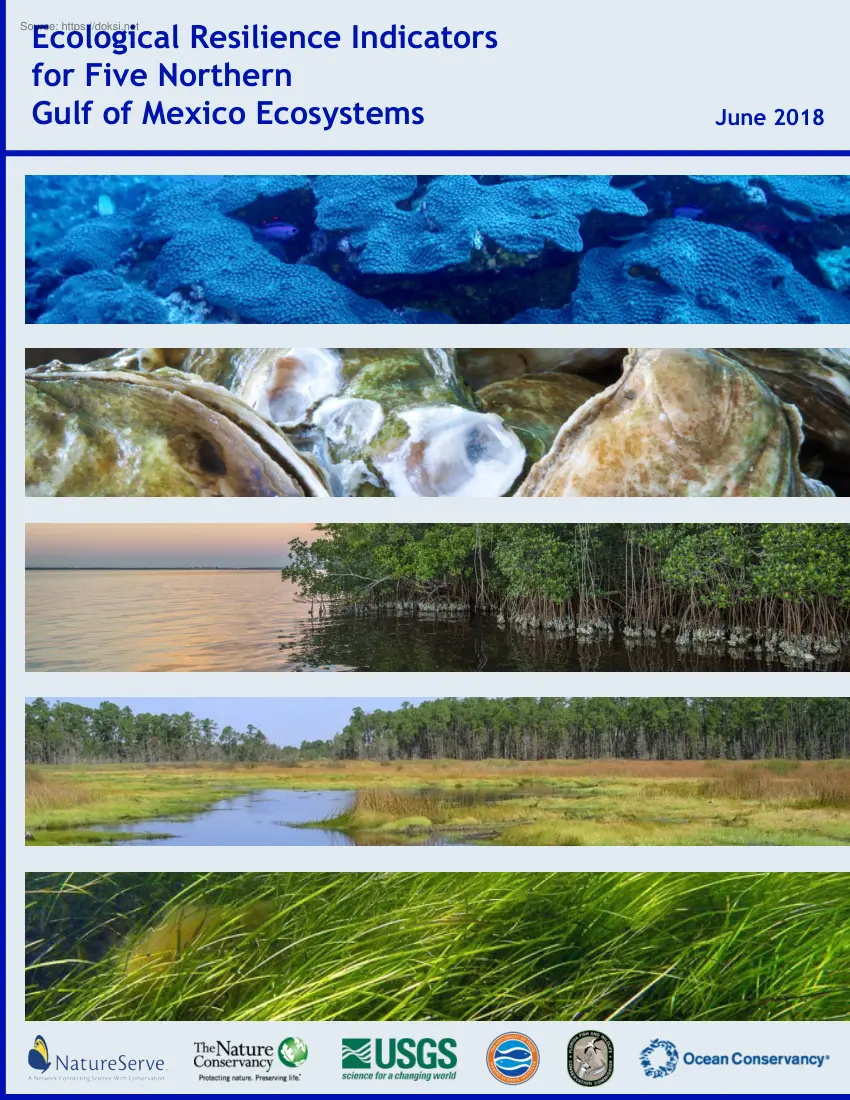
Ecological Resilience Indicators for Five Northern Gulf of Mexico Ecosystems June 2018 Cover Photo Credits (from top to bottom): Coral: NURC/UNCW and NOAA/FGBNMS Oyster: Aki Kamozawa and H. Alexander Talbot Mangrove: The Nature Conservancy Salt Marsh: NOAA Photo Library Seagrass: Christoffer Bostrom Ecological Resilience Indicators for Five Northern Gulf of Mexico Ecosystems Kathleen L. Goodin1, Don Faber-Langendoen1, Jorge Brenner2, Scott T Allen3,8, Richard H Day3, Victoria M. Congdon4, Christine Shepard5, Katherine E Cummings6, Camille L Stagg3, Christopher A Gabler3,9, Kenneth H. Dunton4, R Rob Ruzicka 6, Kate Semon-Lunz6, Dave Reed6, Katherine Wirt Ames6, Matthew Love7 June 2018 1 NatureServe, Arlington, VA, U.SA The Nature Conservancy, Texas Chapter, Houston, TX, U.SA 3 U.S Geological Survey, Wetland and Aquatic Research Center, Lafayette, LA, USA 4 University of Texas, Austin, TX, U.SA 5 The Nature Conservancy, Gulf of Mexico Program, Punta Gorda, FL, U.SA 6
Florida Fish and Wildlife Conservation Commission, Fish and Wildlife Research Institute, Florida City, FL, U.SA 7 Ocean Conservancy, Austin, TX, U.SA 8 ETH Zurich, Department of Environmental Systems Science, Zurich, Switzerland (current affiliation) 9 University of Texas Rio Grande Valley, Department of Biology, Brownsville, TX, U.SA (current affiliation) 2 Acknowledgements This study was funded by the NOAA RESTORE Science Program via Award NA15NOS4510227 (to NatureServe), Award NA15NOS4510234 (to University of Texas at Austin), and Award RASP15-18 (to U.S Geological Survey Wetland and Aquatic Research Center), and supported in part by the U.S Geological Survey Ecosystems Program. This work would not be possible without the generous input and guidance provided by our expert ecosystem panelists and workshop participants listed in Appendix II. We are grateful for the technical assistance and advice from Becky Allee and administrative grant support from Frank Parker. William Kiene
and G.P Schmahl (with Flower Garden Banks National Marine Sanctuary) provided valuable information about ecosystem services of coral reefs. Dave Harlan and Jill Andrew supported the publication of the maps. Thanks to Brighid Milan, who provided support for workshop planning and final report production, and to Nicholas Moy, James Moore, and Lizette Rocha-Aguilar, who provided graphic design and report production support. We are also grateful for the onsite workshop support provided by Courtney Hall, Lauren Leonpacher, Tiffany Ottoson, and Droucelle Ramage. Preferred Citation Main Report: Goodin, K.L, D Faber-Langendoen, J Brenner, ST Allen, RH Day, VM Congdon, C Shepard, KE Cummings, C.L Stagg, CA Gabler, M Osland, KH Dunton, RR Ruzicka, K Semon-Lunz, D Reed, and M Love. 2018 Ecological Resilience Indicators for Five Northern Gulf of Mexico Ecosystems NatureServe, Arlington, VA. 381 pages Chapters: Allen, S.T, CL Stagg, J Brenner, KL Goodin, D Faber-Langendoen, CA Gabler, and KW Ames
2018 Ecological Resilience Indicators for Salt Marsh Ecosystems. In: Goodin, KL et al, Ecological Resilience Indicators for Five Northern Gulf of Mexico Ecosystems. NatureServe, Arlington, VA 53 pages Day, R.H, ST Allen, J Brenner, KL Goodin, D Faber-Langendoen, and KW Ames 2018 Ecological Resilience Indicators for Mangrove Ecosystems. In: Goodin, KL et al, Ecological Resilience Indicators for Five Northern Gulf of Mexico Ecosystems. NatureServe, Arlington, VA 60 pages Congdon, V.M, KH Dunton, J Brenner, KL Goodin, and KW Ames 2018 Ecological Resilience Indicators for Seagrass Ecosystems. In: Goodin, KL et al, Ecological Resilience Indicators for Five Northern Gulf of Mexico Ecosystems. NatureServe, Arlington, VA 57 pages Shepard, C., J Brenner, KL Goodin, and KW Ames 2018 Ecological Resilience Indicators for Oyster Ecosystems. In: Goodin, KL et al, Ecological Resilience Indicators for Five Northern Gulf of Mexico Ecosystems. NatureServe, Arlington, VA 40 pages Cummings, K.E, RR
Ruzicka, K Semon-Lunz, J Brenner, KL Goodin, and KW Ames 2018 Ecological Resilience Indicators for Coral Ecosystems. In: Goodin, KL et al, Ecological Resilience Indicators for Five Northern Gulf of Mexico Ecosystems. NatureServe, Arlington, VA 71 pages Table of Contents EXECUTIVE SUMMARY 1 CHAPTER 1. PROJECT OVERVIEW 9 Introduction 9 Methods 14 Results 27 Discussion 33 References 35 CHAPTER 2. ECOLOGICAL RESILIENCE INDICATORS FOR SALT MARSH ECOSYSTEMS 37 Ecosystem Description 37 Factors Involved in Ecological Integrity 40 Factors Involved in Ecosystem Service Provision 45 Indicators, Metrics, and Assessment Points 46 References 82 CHAPTER 3. ECOLOGICAL RESILIENCE INDICATORS FOR MANGROVE ECOSYSTEMS 91 Ecosystem Description 91 Factors Involved in Ecological Integrity 93 Factors Involved in Ecosystem Service Provision 99 Indicators, Metrics, and Assessment Points 101 References 141 CHAPTER 4. ECOLOGICAL RESILIENCE INDICATORS FOR SEAGRASS
ECOSYSTEMS 151 Ecosystem Description 151 Factors Involved in Ecological Integrity 153 Factors Involved in Ecosystem Service Provision 158 Indicators, Metrics, and Assessment Points 160 References 198 CHAPTER 5. ECOLOGICAL RESILIENCE INDICATORS FOR OYSTER REEFS 209 Ecosystem Description 209 Factors Involved in Ecological Integrity 211 Factors Involved in Ecosystem Service Provision 214 Indicators, Metrics, and Assessment Points 216 References 242 CHAPTER 6. ECOLOGICAL RESILIENCE INDICATORS FOR CORAL ECOSYSTEMS 249 Ecosystem Description 249 Factors Involved in Ecological Integrity 255 Factors Involved in Ecosystem Service Provision 260 Indicators, Metrics, and Assessment Points 261 References 303 APPENDICES 321 Appendix I: Project Team 321 Appendix II: Workshop Participants 323 Appendix III: Sources of Ecosystem Distribution Data 325 Appendix IV: Monitoring Programs for Each Indicator 335 Ecological Resilience Indicators for Five
Northern Gulf of Mexico Ecosystems Executive Summary Billions of dollars will be spent on the management and restoration of Northern Gulf of Mexico (NGoM) ecosystems over the next twenty years. Resource managers and restoration practitioners must monitor ecologically appropriate indicators to effectively evaluate the performance and impacts of their activities and guide adaptive management of living marine resources (LMRs). They need access to baseline data and trends in the condition of sites to help them set ecologically valid restoration goals and monitor the performance of their projects. Decision makers need synthesized data to make decisions within timelines set by politics and law. Grant makers need data to evaluate whether proposed restoration and management activities are appropriate for the proposed sites and to measure the impacts of their investments across multiple sites. This report recommends a comprehensive set of ecologically-informed ecological resilience indicators
for salt marsh, mangrove, seagrass, oyster, and coral ecosystems in the NGoM that can be used to inform sustainable ecosystem and LMR management (Tables 1–5). These indicators address both the ecological integrity and ecosystem services of these ecosystems. Application of these indicators will provide critical information relevant to damage assessment and recovery planning, restoration planning and evaluation, and ecosystem health assessment. To develop the indicators, we applied an innovative Ecological Resilience Framework (ERF [Figure 1]) that integrates information on ecosystem drivers, ecological integrity and ecosystem service provision. We linked this framework with a comprehensive programmatic and spatial analysis to assess the degree to which the recommended indicators are currently being monitored by existing programs in the NGoM, and thereby identify gaps in monitoring opportunities for additional data collection. Figure 1. Ecological Resilience Framework used to identify
ecosystem integrity and ecosystem service indicators 1 Ecological Resilience Indicators for Five Northern Gulf of Mexico Ecosystems Using the ERF to develop the recommended set of ecosystem indicators, we: • • • created Conceptual Ecological Models (CEMs) that identify the critical ecosystem drivers and functions and specify the linkages between them that ultimately effect ecosystem services. used the CEM to identify indicators with specific metrics that can be monitored to assess the ecological integrity of the ecosystem and its capacity to provide ecosystem services. developed metric ratings with quantifiable assessment points that allow evaluation of ecological condition and capacity for provision of ecosystem services across sites and over time. To assess the degree to which the recommended indicators for each ecosystem are currently being collected by monitoring programs across the NGoM, we: • • • • • compiled ecosystem range maps, and created a distribution
map of each ecosystem across the NGoM. inventoried existing monitoring programs and identified the data that they collect analyzed the metadata of indicators from the monitoring programs to identify the programs that collect data on our recommended indicators completed a spatial analysis of the monitoring programs that collect data for each indicator to assess the degree of implementation of the indicators geographically across the NGoM published the spatial analyses and supporting data for each indicator of each ecosystem via the Coastal Resilience Decision Support Tool (CRDST) (http://maps.coastalresilienceorg/gulfmex/) The challenge to collect, aggregate, and share data on these ecologically appropriate indicators has been a major impediment to ensuring maximum impact and return on investments in the NGoM. Agreement on the indicators and data that are needed to monitor the health of NGoM ecosystems is the first step towards addressing the challenge. The ecological resilience
indicators recommended here represent a major step towards achieving the goal of coordinating the monitoring efforts in the NGoM to support effective management of sustainable ecosystems and LMRs. Deployment of these indicator as a standard by multiple monitoring sites across the region and aggregation of the data would allow for Gulf-wide condition and trend assessment to help ensure that investments in resource management and restoration significantly improve and sustain the ecological condition of the NGoM, its LMRs and the ecosystem services it provides. The summary list of indicators and their metrics is presented here in the context of the key factors from the conceptual models. 2 Ecological Resilience Indicators for Five Northern Gulf of Mexico Ecosystems Table 1. Summary of Salt Marsh Metrics Based on the Conceptual Ecological Model SALT MARSH ECOSYSTEMS Function & Major Services Ecological Factor or Service Sustaining/ Abiotic Ecological Factors Integrity Ecosystem
Structure Ecosystem Function Key Ecological Attribute or Service Indicator/Metric Hydrologic Regime: Flood Depth/Duration/Frequency -- Water Quality Eutrophication/Basin-wide Nutrient Load (Total Nitrogen, Total Phosphorus) -Land Aggregation/Aggregation Index (AI) Lateral Migration/Shoreline Migration --- Soil Physicochemistry Marsh Morphology Plant Community Structure Microbial Community Structure Elevation Change Primary Production Secondary Production Ecosystem Services Decomposition Biogeochemical Cycling Supporting Habitat Regulating Coastal Protection Water Quality Cultural Carbon Sequestration Aesthetics-Recreational Opportunities Submergence Vulnerability/Wetland Relative Sea Level Rise (RSLRwet) and Submergence Vulnerability Index (SVI) Above Ground Primary Production/ Aboveground Live Biomass Stock Below Ground Primary Production/Soil Shear Stress Specialist Birds/Clapper Rail and Seaside Sparrow Density --Specialist Birds/Clapper Rail and Seaside Sparrow
Density Wave Attenuation/Percent Wave Height Reduction per Unit Distance Nutrient Reduction/Basin-wide Nutrient Load (Total Nitrogen, Total Phosphorus) Soil Carbon Density/Soil Carbon Density Recreational Fishery/Spotted Seatrout Density and Recreational Landings of Spotted Seatrout 3 Ecological Resilience Indicators for Five Northern Gulf of Mexico Ecosystems Table 2. Summary of Mangrove Metrics Based on the Conceptual Ecological Model MANGROVE ECOSYSTEMS Function & Major Services Ecological Factor or Service Sustaining/ Abiotic Ecological Factors Integrity Key Ecological Attribute or Service Indicator/Metric Minimum Temperatures Soil Physicochemistry Hydrologic Setting Ecosystem Structure Plant Community Structure --Eutrophication/Basin-wide Nutrient Load (Total Nitrogen, Total Phosphorus) Connectivity/Multi-metric Stand Health/Foliage Transparency Regeneration Potential/Propagule, Seedling, Sapling Presence Land Aggregation/Aggregation Index (AI) Land Cover
Change/Land Cover Change Rate -- Landscape Structure Ecosystem Function Microbial Community Structure Elevation Change Primary Production Decomposition Secondary Production Ecosystem Services Supporting Biogeochemical Cycling Habitat Provisioning Food Regulating Cultural 4 Coastal Protection Water Quality Carbon Sequestration Aesthetics-Recreational Opportunities Submergence Vulnerability/Wetland Relative Sea Level Rise (RSLRwet) and Submergence Vulnerability Index (SVI) --Fish Habitat/Killifish Species Diversity Invasive Species/Presence (Multiple Species) -Status of Macrofauna Populations/Density of Juvenile Common Snook Status of Snapper-Grouper Complex Commercial Fishery/Density of Gray Snapper and Annual Commercially Landed Weight of Gray Snapper (Lutjanus griseus) in the Gulf of Mexico States and/or Federal Waters Erosion Reduction/Shoreline Change Nutrient Reduction/Basin-wide Nutrient Load (Total Nitrogen, Total Phosphorus) Soil Carbon Storage/Mangrove Height
Recreational Fishery/Density of Juvenile Common Snook Ecological Resilience Indicators for Five Northern Gulf of Mexico Ecosystems Table 3. Summary of Seagrass Metrics Based on the Conceptual Ecological Model SEAGRASS ECOSYSTEMS Function & Major Services Ecological Factor or Service Sustaining/ Abiotic Ecological Factors Integrity Ecosystem Structure Key Ecological Attribute or Service Indicator/Metric Water Quality Transparency/Percent Surface Irradiance Phytoplankton Biomass/Chlorophyll a concentration Sediment Load/Total Suspended Solids -Change in Areal Extent/Areal Extent Change in Cover/Percent Cover Seagrass Species Composition/Species Dominance Index Shoot Allometry/Leaf Length Shoot Allometry/Leaf Width Nutrient Content/Nutrient Limitation Index Stable Isotope Ratios/δ13C and δ15N Scallop Abundance/Scallop Density -- Soil Physicochemistry Abundance Plant Community Structure Morphology Chemical Constituents Ecosystem Function Ecosystem Services Secondary
Production Carbon and Nutrient Sequestration Biogeochemical Cycling Primary Production Supporting Habitat Provisioning Food Regulating Coastal Protection Water Quality Carbon Sequestration Cultural Aesthetics-Recreational Opportunities --Scallop Abundance/Scallop Density Scallop Abundance/Scallop Density Erosion Reduction/Shoreline Change --Recreational Fishery/Spotted Seatrout Density and Recreational Landings of Spotted Seatrout 5 Ecological Resilience Indicators for Five Northern Gulf of Mexico Ecosystems Table 4. Summary of Oyster Metrics Based on the Conceptual Ecological Model OYSTER ECOSYSTEMS Function & Major Services Ecological Factor or Service Sustaining/ Abiotic Ecological Factors Integrity Ecosystem Structure Key Ecological Attribute or Service Indicator/Metric Water Quality Salinity/Salinity Dissolved Oxygen/Dissolved Oxygen Change in Percent Cover of Reef Substrate/Percent Cover of Reef Substrate -Disease Prevalence (Dermo)/Weighted Prevalence -Change in
Reef Area/Area Change in Reef Height/Height Density of Live Oysters/Density of Live Oysters Relative to the Regional Mean --Species Richness/Number of Species per Unit Area Resident Species/Biomass of Resident Species ---Status of Macrofaunal Populations/Density of Naked Goby Oyster Fishery/Site Harvest Status and Commercial Oyster Landings Erosion Reduction/Shoreline Change -Recreational Fishery/Perception of Recreational Anglers Fishing in the Area of Influence of Oyster Reefs Substrate Availability Acidification Disease Food Availability Reef Structure Ecosystem Function Ecosystem Services Supporting Oyster Larvae Predation Habitat Provisioning Filtration Condition of Adjacent Habitat Nitrogen Removal Habitat Provisioning Food Regulating Cultural 6 Coastal Protection Water Quality Aesthetics-Recreational Opportunities Ecological Resilience Indicators for Five Northern Gulf of Mexico Ecosystems Table 5. Summary of Coral Reef Metrics Based on the Conceptual Ecological
Model CORAL ECOSYSTEMS Function & Services Sustaining/ Ecological Integrity Ecosystem Services Major Ecological Factor or Service Abiotic Factors Key Ecological Attribute or Service Indicator/Metric Water Quality Nutrient Enrichment/Chlorophyll a Concentration Light Attenuation/Water Transparency Temperature Regime/Temperature Range Carbonate Chemistry/Aragonite Saturation State -Epibenthic Sessile Community Structure/Living Biota Percent Cover Grazing/Echinoid Abundance -- Ecosystem Structure Substrate Attributes Benthic Community Structure Ecosystem Function Infaunal Community Structure Benthic Community Condition Supporting Connectivity Primary Production Secondary Production Tertiary Production Nutrient Cycling Environmental Condition Habitat Provisioning Food Cultural Aesthetics-Recreational Opportunities Educational Opportunities Macroalgae/Macroalgal Percent Cover Coral Disease/Disease Prevalence Coral Bleaching/Bleaching Prevalence Coral Mortality/Recent
Mortality Prevalence and Old Mortality Prevalence ------Status of Macrofauna Populations/Live Stony Coral Cover Status of Snapper-Grouper Complex Commercial Fishery/Density of Red Snapper Recreational Fishery/Density of Juvenile Common Snook Educational Program Participation/Number of Visitors of a Coral Reef Participating in an Education Program 7 Ecological Resilience Indicators for Five Northern Gulf of Mexico Ecosystems Chapter 1. Project Overview Introduction To achieve the goal of sustaining healthy, diverse, and resilient coastal and marine habitats and living marine resources (LMRs) in the Northern Gulf of Mexico (NGoM), resource managers need a way to take the pulse of this vast ecosystem to evaluate its health and its ability to provide needed ecosystem services. Managers need good indicators that track the condition of ecosystems and are sufficiently sensitive to stressors and their effects on LMRs, such that changes in these indicators inform management strategies.
Finding the right metrics that indicate ecosystem condition and that support the delivery and management of sustainable ecosystem services and LMRs requires an understanding of how Gulf ecosystems function and how drivers and stressors impact their condition and services. A comprehensive set of consistently and broadly monitored indicators that inform these needs is not available for the NGoM. Although current inventory and monitoring programs use indicators that provide status and trend information for a variety of biological and socio-economic resources, most are focused on specific geographies defined by institutional or agency mandates that address the needs of their jurisdiction. As a result, the output of these monitoring programs is at best uneven across the range of ecosystems, hindering our ability to support sustainable ecosystem and LMR management. Thus, despite large investments in time and money, the effectiveness of these programs in addressing critical management
questions across necessary spatial and ecological scales is unclear. A coordinated effort and structured framework is needed to review and improve the scope and outputs of existing monitoring programs, so they can be maximally effective in providing the information needed to efficiently support sustainable ecosystems and LMRs. Often, the identification of indicators has been limited to either indicators of the ecological condition or integrity of an ecosystem (such as indicators for species diversity or water quality), or indicators of the services that an ecosystem provides (such as fishing, tourism, or energy production). But this limits our understanding of the interaction between natural processes and human uses. There is now strong recognition that an inventory and review of indicators should use a framework that includes both the condition of key ecosystem types in the NGoM and the variety of ecosystem services that they provide (National Research Council, 2014). Such an approach
can be achieved using a framework grounded in the concept of ecological resilience. Classically, resilience has been defined as a “measure of the persistence of systems and of their ability to absorb change and disturbance and still maintain the same relationships between populations or state variables” (Holling, 1973). As defined, this concept largely corresponds to ecological integrity; that is, an assessment of the degree to which, under current conditions, the structure, composition, function, and connectivity of an ecosystem corresponds to reference conditions and is within the bounds of natural or historic disturbance regimes (Parrish et al., 2003; Faber-Langendoen et al., 2016) But the concept of resilience can be expanded to include both human and natural processes and disturbances within what are termed “social-ecological systems;” namely, linked systems of people and nature (Berkes and Folke, 1998; Lloyd et al., 2013) Ecological resilience is thus a measure of the
persistence of systems and their ability to maintain ecological integrity and provide ecosystem services while absorbing changes and disturbances. Here, we apply an innovative Ecological Resilience Framework (ERF) that integrates information on ecosystem drivers, 9 Ecological Resilience Indicators for Five Northern Gulf of Mexico Ecosystems structure and function and ecosystem service provision to make recommendations for a set of ecosystem indicators that should be monitored to assess ecosystem resilience. The Ecological Resilience Framework (Figure 1.1) emphasizes the two major dynamic components of ecological resilienceecological integrity and ecosystem services (Berkes and Folke, 1998; Lloyd et al., 2013). The Framework consists of: • • • Conceptual Ecological Models (CEMs) that identify the critical ecosystem drivers and functions and specify the linkages between them that ultimately effect ecosystem services. Indicators with specific metrics determined within the
context of the CEMs that can be monitored at the site level to assess the ecological integrity of the ecosystem and its capacity to provide ecosystem services. Metric ratings with quantifiable assessment points that allow evaluation of ecological condition and capacity for provision of ecosystem services across sites and over time. Figure 1.2 Ecological Resilience Framework The framework incorporates both ecological and ecosystem services indicators that guide managers in their assessment of the ecological resilience of Living Marine Resources. The primary objective of this project was to develop and apply the ERF in order to recommend a set of scientifically rigorous indicators that are practical to monitor for the five major ecosystem types in the NGoM. A second objective was to complete programmatic and spatial analyses to assess the degree to which the recommended indicators are currently being monitored by existing programs in the NGoM to identify gaps in monitoring and
opportunities for additional data collection. 10 Ecological Resilience Indicators for Five Northern Gulf of Mexico Ecosystems Ideally monitoring of these indicators will deliver essential information to managers that will result in healthier, more diverse, more resilient and sustainable ecosystems and LMRs in the NGoM. We expect that this work will support the following management needs: Management of sustainable ecosystems and LMRs: Having indicators that track the linkage between drivers/stressors, ecosystem condition, and the ecosystem services they provide will help managers decide which management activities will likely have the most impact towards meeting their management goals. Damage Assessment and Recovery Planning: Once programs are in place to monitor the key indicators, this information will support the establishment of baseline ecosystem condition and ecosystem service status information and will provide the information needed to detect impacts of major disturbance
events. The CEMs and metric ratings can help managers develop ecologically appropriate recovery plans. Restoration Planning and Evaluation: Ecosystem integrity indicators can be used to assess the overall success of restoration efforts and they provide a means for tracking the progress made in restoring an ecosystem back to desired levels of ecological integrity and ecosystem services. Having NGoM-wide indicator information on each ecosystem will also support the effective allocation of funds for restoration where the conditions warrant the greatest need. Ecosystem Health Assessments: The ERF is a necessary precursor to the development of reporting briefs and scorecards for both local and Gulf-wide ecosystem health. After programs are in place that monitor the key indicators of each ecosystem throughout the NGoM, we will have a means of assessing the overall health of the NGoM. Project Area The area for this study covers the Northern Gulf of Mexico (NGoM) including the coastal and
nearshore areas of Texas, Louisiana, Mississippi, Alabama and Florida (Figure 1.2) The project area extent boundary was derived from the NOAA Coastal Assessment Framework (CAF) GIS dataset. The CAF provides a consistently derived, watershed-based digital spatial framework for managers and analysts to organize and present information on the nation's coastal, near-ocean, and Great Lakes' resources. The landward extent follows the watersheds that drain directly into an estuarine or marine water body. The drainage areas are based on the USGS Watershed Boundary Dataset, Hydrologic Unit 8 (HUC8) level boundaries. The seaward extent was derived from the NOAA 200 m contour in the NGoM This polygon encompasses the full project area of analysis of ecosystem distribution and for monitoring programs in the NGoM. 11 Ecological Resilience Indicators for Five Northern Gulf of Mexico Ecosystems Figure 1.3 Project area extent along the Northern Gulf of Mexico Ecosystem Types We used
the ERF to develop indicators for five NGoM ecosystems: salt marsh, mangrove, seagrass, oyster beds/reefs, and coral reefs/coral colonized substrates. We followed the Coastal and Marine Ecological Classification Standard (CMECS; FGDC, 2012) for each ecosystem definition as noted below. We also note the related units in the US National Vegetation Classification (USNVC, 2016) where applicable. Salt Marsh Ecosystems Salt marshes are coastal wetland ecosystems within the intertidal zone, characterized by hypoxic, saline soil conditions and low biodiversity. The NGoM region contains roughly 60% (2,211,674 acres in 2009) of salt marsh in the contiguous United States, partly due to the presence of the large river deltas (Dahl, 2013). While there are several types of salt marshes in the NGoM, ranging from low to high salt marshes, salt flats and brackish marsh (Tiner, 2013), the smooth cordgrass (Spartina alterniflora) low salt marsh is the most extensive and is the focus of this description.
This type is classified under the “Low and Intermediate Salt Marsh Biotic Group” in CMECS (FGDC, 2012), and as “Atlantic & Gulf Coastal Low Salt Marsh (G122), especially Gulf Coast Cordgrass Salt Marsh (CEGL004190),” in the USNVC (2016). Mangrove Ecosystems Mangrove ecosystems are coastal wetland ecosystems dominated by mangrove species that are typically found in the intertidal zone, characterized by frequently flooded saline soil conditions. The majority of the approximately 500,000 acres of mangrove ecosystem in the United States occurs in the NGoM, and almost all of that is in Florida, with over 90 percent in the four southern counties of Lee, Collier, Miami-Dade, and Monroe. Scattered stands and individuals occur north and westward into 12 Ecological Resilience Indicators for Five Northern Gulf of Mexico Ecosystems Louisiana and Texas (Osland et al., 2016) The three common mangrove species are: black mangrove (Avicennia germinans), white mangrove (Laguncularia
racemosa), and red mangrove (Rhizophora mangle). The mangrove system described in this project includes Tidal Mangrove Shrubland and Tidal Mangrove Forest as classified in CMECS (FGDC, 2012). It is classified as Caribbean Fringe Mangrove (G004) in the USNVC (2016), with a variety of distinct associations, based on species dominance and ecological setting. Seagrass Bed Ecosystems Seagrasses are marine angiosperms, typically with long strap-like leaves, found in many shallow coastal and oceanic waters around the world. These plants are found in intertidal or subtidal zones, down to depths of about 50 m. They are widely dispersed, extending from the tropics to the Arctic Circle Despite their large geographic extent, seagrass beds have low species biodiversity. Globally, there are approximately 60 seagrass species, six of which occur in the NGoM. The three most prevalent species, Thalassia testudinum, Syringodium filiforme, and Halodule wrightii can form monospecific stands or mixed
assemblages. The areal extent of seagrass beds in the NGoM comprises nearly half of total seagrass coverage in the United States of America. This ecosystem is classified as “Seagrass Bed Biotic Group” in CMECS (FGDC, 2012). Oyster Ecosystems Oyster reefs are intertidal or subtidal biogenic structures formed by living oysters that provide habitat with significant structural complexity (Galtstoff, 1964; Chestnut, 1974). Eastern oysters, Crassostrea virginica, are natural components of estuaries along the NGoM and mostly tend towards forming reefs. For this project we include “Oyster Reef Biotic Group,” “Oyster Beds,” and “Attached Oysters Biotic Group” as defined by CMECS (2012). An oyster reef system is an area of ecologically connected reefs or beds and oyster shell dominated bottom, and may include small areas of bare mud, sand or shelly substrates that offer benefits to neighboring submerged aquatic vegetation, marsh grass and mangrove habitats. While reefs are
normally an integral part of such diverse landscapes (Puckett and Eggleston, 2012), oysters also occur as bedsareas of oyster shell bottom with low densities of live oysters (1–10 m-2). Oyster ecosystems occur in all states in the NGoM Coral Ecosystems Coral reefs are composed of large, limestone-building, colonial organisms in the phylum Cnidaria. In the NGoM, corals are mostly found in shallow waters within the photic zone, though some deepwater varieties exist. For this project we include the Shallow/Mesophotic Reef Biota Subclass and the Attached Corals Biotic Group as defined by CMECS (FGDC, 2012). Temperature limitations constrain corals to 30 degrees north and south of the equator. Typical tropical reef systems, with high topographic complexity, accretion, and diversity are rare in the NGoM. The NGoM is more temperate and corals are at the northern limit of their range. Because abiotic aspects limit growth of coral communities in the NGoM, the coral ecosystems on hardbottom
are often composed of a mixture of scleractinian corals, sponges, octocorals, and hydrozoan corals and may or may not exhibit reef structure. 13 Ecological Resilience Indicators for Five Northern Gulf of Mexico Ecosystems Methods Development of an Ecological Resilience Framework Process Overview We developed indicators of ecological resilience for the five major ecosystems, using the Ecological Resilience Framework outlined above. Our project team was organized into eight working groups (see Appendix I for working group members): Methodology Development and Application Working Group – This working group was responsible for development, refinement and consistent application of the methodology. They provided oversight and were engaged with all other working groups to ensure consistency and quality across the final products. The methodologies used by the various working groups are described in the next section. Ecosystem Specialist Working Groups – These five working groups (one
group for each ecosystem) were responsible for Conceptual Ecological Models (CEM), Indicator, and Metric Rating development, and ecosystem narrative writing. Ecosystem Service Working Group – This working group was responsible for providing ecosystem service indicator and metric rating development for all five ecosystems, and integrating them into the CEM. Monitoring Program Inventory and Analysis Working Group – This working group conducted the monitoring program inventory, programmatic and spatial analyses, and published inventory results. As a first step, each ecosystem specialist working group created a draft CEM and list of potential ecological integrity indicators, then worked with the ecosystem services working group to expand the CEM to include ecosystem services indicators. They invited ecosystem experts to form a panel of 4–7 individuals to support and evaluate their work (see Appendix II for the list of expert panel participants). The expert panels were convened in two
workshops to refine the CEMs and the list of indicators for the ERF and to help identify specific metrics and metric ratings for each indicator. The first workshop focused on one ecosystemsalt marshwhich allowed us to test and refine the methodology and products. During the second workshop we applied the refined methodology to the remaining four ecosystems. During each workshop, participants reviewed and refined the CEM and reorganized the draft indicator list as needed. Using a consistent set of evaluation criteria, they then assessed each existing indicator according to its utility for demonstrating the ecological integrity of the ecosystem and informing the ecosystem services and management of associated LMRs. They also considered practicality and cost effectiveness of monitoring each indicator. After the final set of indicators and metrics were identified, the ecosystem working groups revised the CEMs and list of indicators and metrics. They also completed metric rating tables with
assessment points for each metric, based on supporting literature and their expert judgment. For each ecosystem, the ecosystem working group produced 1) a CEM, with 2) a recommended set of ecological integrity and ecosystem service indicators and metrics, and 3) metric ratings. For each ecosystem we provided a narrative that describes the major ecosystem components and the linkage between them. Details on the development of each of these components of the ERF are provided in the following sections. 14 Ecological Resilience Indicators for Five Northern Gulf of Mexico Ecosystems Conceptual Ecological Models Conceptual Ecological Models (CEMS) are widely used to describe ecosystem structure, function and dynamics and to help identify indicators that track the system’s response to disturbances (Mitchell et al., 2014). CEMs are an effective tool for developing consensus regarding a set of working hypotheses that explain ecosystem processes. They can also be used to specify linkages
between ecosystem condition and LMR management needs to support communication between science and management (Tierney et al., 2009; Mitchell et al, 2014) We developed CEMs for the five major ecosystems based on existing literature, previously developed models, and expert opinion to identify the most critical drivers and key ecosystem functions and services. Our CEMs are narrative-based, non-quantitative models, including both descriptive text and a diagram that highlight the major anthropogenic and natural drivers, key ecological factors and ecosystem service attributes. Figure 13 provides the general framework we used for each CEM. The terminology for the CEMs is provided in Box A In each CEM narrative, we described the most direct or strongest linkages between the ecosystem components, including those between ecosystem processes and structure and the largely external environmental drivers, such as climate, hydrogeomorphology, and anthropogenic influences (both positive and negative).
Figure 1.4 The CEM includes the primary drivers (yellow boxes), major ecological factors and key ecological attributes (green boxes), and major ecosystem services and key ecosystem services (blue boxes). 15 Ecological Resilience Indicators for Five Northern Gulf of Mexico Ecosystems BOX A. Terminology for Conceptual Ecological Models Environmental Drivers are major external driving forces such as climate, hydrology, and anthropogenic activities that have large-scale influences on natural ecosystems. Major Ecological Factors (MEF) and Major Ecosystem Services (MES) broadly describe the ecological characteristics of the ecosystem. Major Ecological Factors: Abiotic Factors: includes physical and chemical attributes that are characteristic of the system. Ecosystem Structure: includes biological structure, and landscape structure attributes. Ecosystem Function: includes ecosystem processes of the system, such as productivity and decomposition. Major Ecosystem Services: We used the
categories developed by the Millennium Ecosystem Assessment (MEA 2005) to describe major ecosystem services. Supporting: includes benefits to the ecosystem itself; i.e, plants, animals and their habitats, that are needed for the system to persist and that are the foundation for other ecosystem services. Supporting services indicators partly overlap with ecological integrity indicators. Provisioning: includes goods and services provided directly by the system which benefit people and include food, water and other resources, such as genetic materials and medicinal sources. Regulating: includes benefits received from natural regulation of ecological factors, such as water quality and flood and disease control. Cultural: are the benefits that provide cultural experiences, and contribute to human mental, physical, and spiritual well-being, such as recreation. Key Ecological Attributes (KEAs) and Key Ecological Services (KESs) of an ecosystem are subsets of major ecological factors or
services that are critical to a particular aspect of the ecosystem’s response to both natural ecological processes and anthropogenic disturbances and the services it provides. Alterations to KEAs can lead to the degradation or loss of that ecosystem and its services. KEAs and KESs are helpful for detailed models of specific ecosystem types For example, salt marsh KEAs within the Ecosystem Function MEF include biogeochemical cycling, secondary production, primary production, decomposition, and elevation change. Typical KESs include nursery/habitat, nutrient reduction, disturbance regulation (e.g, protection of coastline and built infrastructure), water quality, and recreational fisheries. 16 Ecological Resilience Indicators for Five Northern Gulf of Mexico Ecosystems Indicators and Metrics Indicators are a select subset of measurable ecosystem features or processes whose values are indicative of the integrity or services of the larger ecological system to which they belong. We
used the CEMs for each of the five ecosystems to identify the key indicators that describe the condition of an ecosystem and its ability to deliver ecosystem services. We use the terms “ecological integrity indicators” and “ecological condition indicators” interchangeably to specify indicators that track Key Ecological Attributes. We use the term “ecosystem service indicators” to specify indicators that track Key Ecological Services. We adopted the Ecological Integrity Assessment methods developed by NatureServe and partners (Unnasch et al., 2009; Mitchell et al, 2014; Faber-Langendoen et al, 2016a,b) as the basis for selecting ecosystem integrity indicators. Through the workshop process described above, we evaluated each indicator according to the criteria identified in Table 1.1 Those that met the most criteria were included in our final list. Because any given indicator may vary in its ability to serve as a warning sign, we identified multiple indicators for each
ecosystem. By using multiple lines of evidence from multiple indicators, managers can be more confident in the kind of management actions needed. The result was a set of ecologically relevant, practical indicators of ecological resilience. An example of the CEM and selected indicators is provided in Figure 1.4 Table 1.6 Indicator Evaluation Criteria Evaluation Criteria Definition Informative of ecological condition Documented (scientifically) relationship to ecological integrity – i.e the structure, composition, function and connectivity of an ecosystem. Detects long term trends High signal: noise ratio (sensitive to detecting long-term trends and insensitive to short-term variability, such as differences associated with short-term weather patterns and time since disturbance). Repeatable Can be measured with a methodology that provides consistent results by different observers. Low susceptibility to bias Relatively easy to standardize measurement or observation of indicator
across observers. Precision suitable for analyses that support management applications Can be easily understood and applied by managers Can be quantified with selected sampling design with sufficient level of precision at scale(s) relevant to management needs. Applicable at multiple scales Applicable to multiple management objectives Can be applied by trained mangers with undergraduate or master's level knowledge of relevant resource management. Does not require specialized expertise to apply. Applicable to management at multiple scales (plot to Gulf-wide). Characterization of indicator at one scale can be extrapolated to other scales (assuming an appropriate sampling design) in order to facilitate interpretation of current condition or provision of services. Can be consistently applied to address multiple management objectives including Living Marine Resources. 17 Ecological Resilience Indicators for Five Northern Gulf of Mexico Ecosystems Evaluation Criteria
Definition Low cost for data collection Cost, including field and analysis expense and time, necessary to obtain the required number of measurements with a sufficient level of precision, accuracy and repeatability (across years) is relatively low. Currently collected in the NGoM by existing monitoring programs. Currently collected in the NGoM Can be collected more cheaply by remote sensing Remote sensing detection currently or soon possible with high resolution imagery or satellite imagery, at less than field cost at observation or plot level. A major contribution of this work was to identify the linkages between ecological integrity and ecosystem services. The descriptions of these linkages were particularly important because they illustrated how indicators that track one factor within the ecosystem can directly and indirectly serve as indicators of the service of a given site. In some cases, the linkages were so strong that we selected the same metric to indicate both ecological
integrity and ecosystem service provision. For example, scallop production is an excellent indicator of both secondary production and of food production in seagrass ecosystems. For ecosystem services indicators, we identified the ecological factors that can be measured to assess the capacity of a given site to provide those services. In many cases it’s very difficult to measure the direct contribution of a given ecosystem to a particular human benefit. For example, several of the ecosystems we studied are known to provide nursery habitat for commercially important fish species, but it is extremely difficult to track the juvenile fish from a given site within an ecosystem all the way to human consumption. In this case, we recommended collecting data on the density of commercially or recreationally important juvenile fish species at a site. 18 Ecological Resilience Indicators for Five Northern Gulf of Mexico Ecosystems Figure 1.5 Example CEM with indicators The terms in the white
boxes are the indicators identified for a key attribute. Ecological integrity indicators are those associated with Major Ecological Factors (green boxes). Ecosystem services indicators are those associated with Major Ecosystem Services (blue boxes) For each indicator, we identified the metrics and measures that are used to assess and monitor them. Metrics are quantified forms of indicators that inform the relative condition or services of the ecosystem. Measures are the data actually measured in the field and used to calculate the metric For example, in salt marsh ecosystems, measures of stem height are needed to calculate the metric of aboveground live biomass stock for the Aboveground Primary Production indicator. Note: In some instances, the name of the indicator and metric are the same, which simply reflects that the indicator is best known by the name of the metric used to assess it. Metrics may vary considerably in the ease and cost of data collection. We assessed each metric by
assigning it to a “Tier,” which describes level of intensity of effort required to document a metric. Tier 1 metrics use data that are relatively easy to collect and apply, such as may be available from remote sensing imagery or data loggers. Tier 2 typically requires rapid field collection that can be collected in less than half a day. Tier 3 typically requires intensive field collection that takes a day or more to collect Although low cost data collection is ideal, we did not exclude indicators if they fell into Tier 3. The working groups and expert panelists agreed that some Tier 3 metrics are worth the effort required for data collection because of the valuable information on ecosystem condition that they can provide. 19 Ecological Resilience Indicators for Five Northern Gulf of Mexico Ecosystems Metric Ratings and Assessment Points A major reason for implementing an environmental monitoring program is to provide early warning of abnormal conditions, impending concerns, or
potential shifts in resource values relative to management goals (Bennetts et al., 2007) An indicator-based approach is a well-tested means to provide these early warnings, particularly when metric ratings with specific assessment points are provided for the indicators. Metric Ratings indicate how the measured values are informative of the integrity of the ecosystem (e.g Excellent, Good, Fair, Poor) They are determined by quantifiable Assessment Points, which are specified ranges in a measure that distinguish expected or acceptable conditions from unacceptable conditions that warrant further evaluation or management action. They represent preselected points along a continuum of indicator values that provide an assessment of the status or trend of a resource (Bennetts et al., 2007) Assessment points are critical for providing guidance to managers on how the ecosystem is changing and whether management actions should be taken (Figure 1.5) Assessment points may also represent ecological
thresholds; that is, where relatively small changes in an indicator value lead to substantial changes in a system, below or above which it may be hard to recover (Bennetts et al., 2007; Carter and Bennetts, 2007) We chose to use the more generic term “assessment point” over the term “ecological threshold” for this study because the specific ecological thresholds are often unknown or uncertain for many indicators. To be meaningful, assessment points must represent a quantitative or semi-quantitative value and avoid ambiguity about whether a given point has been reached. They may represent the measure or value of a given indicator at a given point in time, the value of a derived or aggregated measure or index; or the rate of change for the value of a given indicator (see Carter and Bennetts, 2007). Each ecosystem team developed quantitative metrics and assessment points from the literature, known values from existing sites, and from the expert panelists, and documented the
rationale for their selection. For example, the salt marsh team identified “Primary Production” as a KEA for Salt Marsh, and “Above Ground Primary Production” as its best indicator. Although there were multiple ways to measure this indicator, the salt marsh team concluded that the best (i.e most cost-effective, reliable, and widely used) metric was Aboveground Live Biomass Stock. They consulted the literature and experts to develop the metric ratings and assessment points to track declining levels of aboveground primary production (Table 1.2) The Fair assessment point may or may not trigger any action, because recovery may occur through natural processes, but the Poor should trigger action, because these levels indicate that the system may be failing and may not be able to recover its production levels (Figure 1.5) 20 Ecological Resilience Indicators for Five Northern Gulf of Mexico Ecosystems Figure 1.6 Assessment Point Concept (from Carter and Bennetts, 2007) Table 1.7
For Salt Marsh Aboveground Live Biomass Stock, the assessment points establish the range of biomass values that pertain to a particular level of integrity. Salt Marsh Metric Rating Rating Good/Excellent Fair Poor Aboveground Live Biomass Stock Assessment Points Standing Biomass > 600 g m-2 Standing Biomass 300–600 g m-2 Standing Biomass < 300 g m-2 Analysis of Existing Monitoring Efforts Current availability of data for the indicator was one of the criteria we used to evaluate each indicator. To assess the degree to which the recommended indicators for each ecosystem are currently being collected by monitoring programs across the NGoM, we completed the following steps for each ecosystem: • • • Compiled ecosystem range maps, and created a distribution map of each ecosystem across the NGoM. Inventoried existing monitoring programs and identified the data that they collect Analyzed the metadata of indicators from the monitoring programs to identify the programs that
collect data on our recommended indicators 21 Ecological Resilience Indicators for Five Northern Gulf of Mexico Ecosystems • • Completed a spatial analysis of the monitoring programs that collect data for each indicator to assess the degree of implementation of the indicators geographically across the NGoM Published the spatial analyses and supporting data for each indicator of each ecosystem on a publicly available website Each of these steps is described further below. Note that evaluating whether an indicator is “currently collected in the NGoM” (see Table 1.1 above) is one of several criteria used to evaluate candidate indicators. Not all recommended indicators scored highly on this criterion The indicators that scored low on this criterion, but were still recommended by our evaluation, are included because they met other important evaluation criteria in Table 1.1 Despite their not being collected by existing programs, we recommend that their use by expanded in the
NGoM. Thus, our analysis emphasizes gaps in indicator data coverage and highlights the need for additional monitoring efforts. Ecosystem Range Maps To create the ecosystem range maps, we compiled and adjusted readily available spatial ecosystem data from sources throughout the NGoM. Mapped ecosystem data were available from multiple sources both at the state level and NGoM regional level but varied in extent and scale. The primary sources we used included NOAA Environmental Sensitivity Index, NOAA Office for Coastal Management (formerly Coastal Services Center), NOAA National Marine Fisheries Service, FWS National Wetlands Inventory, Texas Parks and Wildlife Office, Texas General Land Office, Florida Wildlife Commission/Florida Wildlife Research Institute, Louisiana’s Statewide GIS Atlas, among others. See Appendix III for a complete listing of the data used to compile distribution maps for each ecosystem. For each ecosystem we linked the source units to match CMECS unit definitions.
This was particularly important for National Wetland Inventory (NWI) maps, where multiple source classification codes intersect with CMECS units. For mangrove ecosystem types, some of the NWI mapping units are broader than the corresponding CMECS units. For example, the NWI map unit E2SS3 – Estuarine Intertidal BroadLeaved Evergreen Scrub Shrub includes mangroves as well as other evergreen shrubs that are not mangroves. There is not enough information on the NWI maps to make a clear separation We had to decide whether to potentially over-identify or under-identify mangrove sites. We opted to include these more broadly defined units in our map, so it is probable that the mangrove map over-estimates mangrove distribution. A small subset of the highlighted hexagons, especially in the northern regions of the NGoM may not include mangroves. The NWI codes that we included in each map are provided in Appendix III. Inventory of Existing Monitoring Programs We completed an inventory of
existing indicators (both ecological and ecosystem services) for the five ecosystem types, starting with the Ocean Conservancy’s geodatabase that contained a long-term monitoring program inventory and associated information on these NGoM ecosystems (Love et al., 2015). The Ocean Conservancy inventory captures information on individual monitoring efforts obtained through meetings with resource experts and a review of primary literature and monitoring plans. Ocean Conservancy met or corresponded with nearly 300 individuals from federal and state agencies, academia and nonprofits. These communications were essential to compiling information on the geographic and temporal scope, sampling methods, and focal species of long-term monitoring programs 22 Ecological Resilience Indicators for Five Northern Gulf of Mexico Ecosystems in the NGoM. The inventory of monitoring includes information, or metadata, about environmental programs that conduct systematic monitoring of natural resources
in the NGoM. Only programs that produce publicly accessible information were included. This inventory was built upon a previous effort to document all monitoring programs with a minimum five-year data record. To augment the Ocean Conservancy inventory, we reviewed additional sources including the Gulf GAME catalog (http://research.myfwccom/game/searchaspx), the Gulf of Mexico Data Atlas (www.gulfatlasnoaagov), Data Basin (wwwdatabasinorg), the Gulf of Mexico Research Initiative’s master research database, and GRIIDC (Gulf of Mexico Initiative Information and Data Cooperative – https://data.gulfresearchinitiativeorg/) For this project, we removed the minimum data record requirement and identified additional, shorter-term programs that collect data for the five target ecosystem types. There are likely additional environmental monitoring efforts in the coastal or offshore areas of the NGoM that were not documented in this inventory because they were either not relevant to the
project's goals or were not identified during the process. Metadata in the monitoring program inventory includes information on the program that manages the sampling effort, contact information, the parameters that are monitored, sampling frequency and the length of the data record. For a large subset of programs in the inventory, the spatial sampling footprint for the program was assembled in a GIS layer and maintained as a separate geodatabase. The spatial data set included programs assessed in the original Ocean Conservancy monitoring assessment (Love et al., 2015) and any additional programs that were identified during this project The sampling footprint was either provided directly by the monitoring program in the form of coordinates or sampling boundaries or it was estimated from published descriptions. The final monitoring inventory and spatial sampling extents (or spatial footprints) were compiled via a Microsoft Access database and an Environmental Systems Research
Institute geodatabase and are linked by the ID field common to each file. Assessment of Monitoring Program Inventory The Ocean Conservancy monitoring database contains data on a broad number of ecosystems and many different types of monitoring programs (e.g sediments, water quality, habitats, etc) To hone in on the relevant programs for our study, we first searched the Ocean Conservancy monitoring database for all programs that collected any type of data for each ecosystem (e.g Coral = True), and used that information to create a list of monitoring programs that collect data for each ecosystem. We then searched for potential metrics that corresponded with our recommended indicators by using sets of keywords. We excluded some monitoring programs from the list if: 1. they were research studies, restoration programs, or harvest activities that manipulated ecosystem variables; 2. they were not focused on ecological integrity indicators, or the data collected were not relevant to this work
(e.g, soil profile data); 3. there wasn’t enough information about the variables collected to discern whether they were a good match (e.g, we excluded bird counts that did not specify monitoring for specific species); or 4. there was no evidence that a data set was collected for the purpose of monitoring a specific ecosystem (e.g, we excluded general water quality monitoring programs where it was unclear whether the monitoring sites were in the same location as a given ecosystem). 23 Ecological Resilience Indicators for Five Northern Gulf of Mexico Ecosystems For example, our initial search of the inventory database returned 40 monitoring programs that collected data for seagrasses. We excluded two of these programs because one was a research study that manipulated variables, and the second did not provide enough information on the variables collected. Therefore, the total number of relevant seagrass monitoring programs that we included in the NGoM was 38. Using these screening
criteria, we developed a list of monitoring programs where the keyword search resulted in a match for our metric. We then calculated the percentage of relevant monitoring programs that collect data for each metric (n%=number of programs collecting data for the metric/total number of relevant monitoring programs). In the following ecosystem indicator narratives, we note this as the “Programmatic” implementation. Note that for several of the metrics, there were no instances of monitoring activity in the NGoM. This was particularly true for many of the ecosystem services metrics At this time, we don’t know whether this is an artifact of the program inventory methodology, a result of the way ecosystem services monitoring programs report their activities, or whether they are truly not monitored. See Appendix IV for a list of the monitoring programs that collect information for each metric. Spatial Analysis of Existing Efforts To determine the geographic extent and distribution of
collection of data for each metric, we used the monitoring inventory geodatabase to map the spatial footprint of monitoring programs that collect data for each metric, and we overlaid that information on its corresponding ecosystem range map (Figure 1.6) Spatial footprint data were not available for some monitoring programs and the spatial footprints were very large for a few national or regional monitoring programs and did not identify specific sampling sites (e.g the spatial footprint for the National Lidar Survey includes the entire GOM) We did not map the spatial extent of the programs in either of these cases, but did include these programs in our analysis of programmatic implementation described above. 24 Ecological Resilience Indicators for Five Northern Gulf of Mexico Ecosystems Figure 1.7 This map shows salt marsh distribution (green) with the spatial footprints of the collection sites for the Aboveground Live Biomass Stock metric (red). To provide a consistent spatial
unit of analysis, we created a 100 km2 hexagon grid for the study area using DGGRID software (http://www.discreteglobalgridsorg/software/) To create the generalized ecosystem distribution map, we shaded the hexagons in the study area if they contained any mapped occurrence of the ecosystem. Shaded hexagons demonstrate presence of the ecosystem in the 100 km 2 hexagon area. We then highlighted hexagon cells where there was at least one instance of the metric being collected in that area (Figure 1.7) and calculated the percentage of ecosystem hexagons where each indicator is monitored (n%=number of hexagon cells where the indicator is collected/total number of hexagon cells with the ecosystem). We then rated each of the indicators according to the scale in Table 1.3 We also described the geographic distribution of the data collection for each metric (eg, throughout the range, only in certain states, clustered in certain areas, etc.) We refer to these calculations as “Geographic”
implementation in the following ecosystem narratives. Table 1.8 Rating scale for geographic extent of each metric Well collected Monitored in more than half of the hexagons Moderately well collected Less well collected Not well collected Monitored in 25-49% of the hexagons Monitored in 10-24% of the hexagons Monitored in <10% of the hexagons 25 Ecological Resilience Indicators for Five Northern Gulf of Mexico Ecosystems Figure 1.8 Spatial distribution of salt marsh habitat and Aboveground Live Biomass Stock Metric by 100 km2 hexagon. Note that neither the shaded hexagons nor the highlighted hexagons demonstrate the density of the ecosystem or metric respectively (i.e, there could be one or more sites within the cell where the ecosystem occurs or where a program is collecting data for the metric). To get a sense of the overall monitoring effort for the recommended metrics for each ecosystem, we also mapped the density of monitoring efforts and calculated the percentage of
hexagons where at least one metric is monitored (Figure 1.8) 26 Ecological Resilience Indicators for Five Northern Gulf of Mexico Ecosystems At least one of the recommended metrics is monitored in 76% (530/696) of the hexagons containing seagrass ecosystems Figure 1.9 Density of the recommended indicators being collected in seagrass ecosystems in the NGoM Publication of Spatial Analyses and Downloadable Data We published the spatial analyses and resulting maps and made them publicly available via the Coastal Resilience Decision Support Tool (CRDST) (http://maps.coastalresilienceorg/gulfmex/) The project geodatabase containing all spatial data is also available for download from that site. Results The lists of the indicators and metrics for each ecosystem in the context of the key factors from the CEMs are provided in Tables 1.4–18 below Complete ecosystem narratives are provided in the following chapters. Chapter 2: Ecological Resilience Indicators for Salt Marsh Ecosystems
Chapter 3: Ecological Resilience Indicators for Mangrove Ecosystems Chapter 4: Ecological Resilience Indicators for Seagrass Ecosystems Chapter 5: Ecological Resilience Indicators for Oyster Ecosystems Chapter 6: Ecological Resilience Indicators for Coral Ecosystems 27 Ecological Resilience Indicators for Five Northern Gulf of Mexico Ecosystems Table 1.9 Summary of Salt Marsh Metrics Based on the Conceptual Ecological Model SALT MARSH ECOSYSTEMS Function & Major Services Ecological Factor or Service Sustaining/ Abiotic Ecological Factors Integrity Ecosystem Structure Ecosystem Function Key Ecological Attribute or Service Indicator/Metric Hydrologic Regime: Flood Depth/Duration/Frequency -- Water Quality Eutrophication/Basin-wide Nutrient Load (Total Nitrogen, Total Phosphorus) -Land Aggregation/Aggregation Index (AI) Lateral Migration/Shoreline Migration --- Soil Physicochemistry Marsh Morphology Plant Community Structure Microbial Community Structure Elevation
Change Primary Production Secondary Production Ecosystem Services Decomposition Biogeochemical Cycling Supporting Habitat Regulating Coastal Protection Water Quality Cultural 28 Carbon Sequestration Aesthetics-Recreational Opportunities Submergence Vulnerability/Wetland Relative Sea Level Rise (RSLRwet) and Submergence Vulnerability Index (SVI) Aboveground Primary Production/ Aboveground Live Biomass Stock Belowground Primary Production/Soil Shear Stress Specialist Birds/Clapper Rail and Seaside Sparrow Density --Specialist Birds/Clapper Rail and Seaside Sparrow Density Wave Attenuation/Percent Wave Height Reduction per Unit Distance Nutrient Reduction/Basin-wide Nutrient Load (Total Nitrogen, Total Phosphorus) Soil Carbon Density/Soil Carbon Density Recreational Fishery/Spotted Seatrout Density and Recreational Landings of Spotted Seatrout Ecological Resilience Indicators for Five Northern Gulf of Mexico Ecosystems Table 1.10 Summary of Mangrove Metrics Based on the
Conceptual Ecological Model MANGROVE ECOSYSTEMS Function & Major Services Ecological Factor or Service Sustaining/ Abiotic Ecological Factors Integrity Key Ecological Attribute or Service Indicator/Metric Minimum Temperatures Soil Physicochemistry Hydrologic Setting Ecosystem Structure Plant Community Structure --Eutrophication/Basin-wide Nutrient Load (Total Nitrogen, Total Phosphorus) Connectivity/Multi-metric Stand Health/Foliage Transparency Regeneration Potential/Propagule, Seedling, Sapling Presence Land Aggregation/Aggregation Index (AI) Land Cover Change/Land Cover Change Rate -- Landscape Structure Ecosystem Function Microbial Community Structure Elevation Change Primary Production Decomposition Secondary Production Ecosystem Services Supporting Biogeochemical Cycling Habitat Provisioning Food Regulating Cultural Coastal Protection Water Quality Carbon Sequestration Aesthetics-Recreational Opportunities Submergence Vulnerability/Wetland Relative Sea
Level Rise (RSLRwet) and Submergence Vulnerability Index (SVI) --Fish Habitat/Killifish Species Diversity Invasive Species/Presence (Multiple Species) -Status of Macrofauna Populations/Density of Juvenile Common Snook Status of Snapper-Grouper Complex Commercial Fishery/Density of Gray Snapper and Annual Commercially Landed Weight of Gray Snapper (Lutjanus griseus) in the Gulf of Mexico States and/or Federal Waters Erosion Reduction/Shoreline Change Nutrient Reduction/Basin-wide Nutrient Load (Total Nitrogen, Total Phosphorus) Soil Carbon Storage/Mangrove Height Recreational Fishery/Density of Juvenile Common Snook 29 Ecological Resilience Indicators for Five Northern Gulf of Mexico Ecosystems Table 1.11 Summary of Seagrass Metrics Based on the Conceptual Ecological Model SEAGRASS ECOSYSTEMS Function & Major Services Ecological Factor or Service Sustaining/ Abiotic Ecological Factors Integrity Ecosystem Structure Key Ecological Attribute or Service Indicator/Metric Water
Quality Transparency/Percent Surface Irradiance Phytoplankton Biomass/Chlorophyll a Concentration Sediment Load/Total Suspended Solids -Change in Areal Extent/Areal Extent Change in Cover/Percent Cover Seagrass Species Composition/Species Dominance Index Shoot Allometry/Leaf Length Shoot Allometry/Leaf Width Nutrient Content/Nutrient Limitation Index Stable Isotope Ratios/δ13C and δ15N Scallop Abundance/Scallop Density -- Soil Physicochemistry Abundance Plant Community Structure Morphology Chemical Constituents Ecosystem Function Ecosystem Services 30 Secondary Production Carbon and Nutrient Sequestration Biogeochemical Cycling Primary Production Supporting Habitat Provisioning Food Regulating Coastal Protection Water Quality Carbon Sequestration Cultural Aesthetics-Recreational Opportunities --Scallop Abundance/Scallop Density Scallop Abundance/Scallop Density Erosion Reduction/Shoreline Change --Recreational Fishery/Spotted Seatrout Density and Recreational Landings of
Spotted Seatrout Ecological Resilience Indicators for Five Northern Gulf of Mexico Ecosystems Table 1.12 Summary of Oyster Metrics Based on the Conceptual Ecological Model OYSTER ECOSYSTEMS Function & Major Services Ecological Factor or Service Sustaining/ Abiotic Ecological Factors Integrity Ecosystem Structure Key Ecological Attribute or Service Indicator/Metric Water Quality Salinity/Salinity Dissolved Oxygen/Dissolved Oxygen Change in Percent Cover of Reef Substrate/Percent Cover of Reef Substrate -Disease Prevalence (Dermo)/Weighted Prevalence -Change in Reef Area/Area Change in Reef Height/Height Density of Live Oysters/Density of Live Oysters Relative to the Regional Mean --Species Richness/Number of Species per Unit Area Resident Species/Biomass of Resident Species ---Status of Macrofaunal Populations/Density of Naked Goby Oyster Fishery/Site Harvest Status and Commercial Oyster Landings Erosion Reduction/Shoreline Change -Recreational Fishery/Perception of
Recreational Anglers Fishing in the Area of Influence of Oyster Reefs Substrate Availability Acidification Disease Food Availability Reef Structure Ecosystem Function Ecosystem Services Supporting Oyster Larvae Predation Habitat Provisioning Filtration Condition of Adjacent Habitat Nitrogen Removal Habitat Provisioning Food Regulating Cultural Coastal Protection Water Quality Aesthetics-Recreational Opportunities 31 Ecological Resilience Indicators for Five Northern Gulf of Mexico Ecosystems Table 1.13 Summary of Coral Reef Metrics Based on the Conceptual Ecological Model CORAL ECOSYSTEMS Function & Services Sustaining/ Ecological Integrity Ecosystem Services Major Ecological Factor or Service Abiotic Factors Key Ecological Attribute or Service Indicator/Metric Water Quality Nutrient Enrichment/Chlorophyll a Concentration Light Attenuation/Water Transparency Temperature Regime/Temperature Range Carbonate Chemistry/Aragonite Saturation State -Epibenthic Sessile
Community Structure/Living Biota Percent Cover Grazing/Echinoid Abundance -- Ecosystem Structure Substrate Attributes Benthic Community Structure Ecosystem Function Infaunal Community Structure Benthic Community Condition Supporting Connectivity Primary Production Secondary Production Tertiary Production Nutrient Cycling Environmental Condition Habitat Provisioning Food Cultural 32 Aesthetics-Recreational Opportunities Educational Opportunities Macroalgae/Macroalgal Percent Cover Coral Disease/Disease Prevalence Coral Bleaching/Bleaching Prevalence Coral Mortality/Recent Mortality Prevalence and Old Mortality Prevalence ------Status of Macrofauna Populations/Live Stony Coral Cover Status of Snapper-Grouper Complex Commercial Fishery/Density of Red Snapper Recreational Fishery/Density of Juvenile Common Snook Educational Program Participation/Number of Visitors of a Coral Reef Participating in an Education Program Ecological Resilience Indicators for Five Northern Gulf of
Mexico Ecosystems Discussion The indicators that have been developed by NGoM ecosystem experts using the Ecological Resilience Framework (ERF) represent a major step towards achieving the goal of coordinating the monitoring efforts in the NGoM to support effective management of sustainable ecosystems and living marine resources (LMRs). The ERF is very timely, as billions of dollars will be spent on the management and restoration of NGoM ecosystems over the next twenty years. Implementing the indicators developed as part of the ERF will help ensure that this unprecedented level of funding significantly improves and sustains the ecological condition of the NGoM and its living marine resources. Ecosystem managers and restoration practitioners must monitor ecologically appropriate indicators to effectively evaluate the performance and impacts of their activities and guide adaptive management. They need access to baseline data and trends in the condition of sites to help them set
ecologically valid restoration goals and monitor the performance of their projects. Decision makers need synthesized data to make decisions within timelines set by politics and law. Grant makers need data to evaluate whether proposed restoration and management activities are appropriate for the proposed sites and to measure the impacts of their investments across multiple sites. Indicator monitoring data from multiple restoration projects across spatial and temporal scales must be aggregated to assess the collective impacts of management and restoration activities and to provide an ecological accounting for the money spent. The RESTORE Council, NRDA Trustees, National Fish and Wildlife Foundation and several other granting and scientific institutions in the NGoM all have stated the need to report on monitoring results to measure the impacts of their management and restoration investments and communicate progress at scales beyond the single project level (NAS 2017). They call for making
data publicly available to maximize utility of the data for multiple purposes. The challenge to collect, aggregate, and share ecologically appropriate indicator monitoring data has been a major impediment to ensuring maximum impact and return on investments. Developing standards on what data to collect is the first step towards addressing the challenge. This report recommends a comprehensive set of ecologically-informed ecological resilience indicators that can be used to inform sustainable ecosystem and LMR management, damage assessment and recovery planning, restoration planning and evaluation, and ecosystem health assessment. Because they specify the linkage between ecological integrity indicators and ecosystem service provision indicators, they can also be used to help understand how management activities and disturbances may impact the benefits that the ecosystems provide to humans. The indicators were developed for monitoring at the site level and can immediately be adopted by
monitoring programs that have the need to understand condition and tends at this scale. Deployment of these indicators as a standard by multiple monitoring sites across the region would allow for Gulf-wide condition and trend assessment. The spatial analyses of monitoring efforts for each indicator in this report can be used to identify opportunities to begin reporting on regional baseline condition and trends for some indicators in the near term. The spatial analyses can also be used to identify the needs for additional coordination and data collection for some of the indicators. Uptake of these standard indicators more broadly than the site level should be based on shared goals of the stakeholders in the region. Several efforts in the NGoM are being initiated to coordinate monitoring program efforts and support the synthesis of monitoring activities across the region. The Natural Resource Damage Assessment (NRDA) Trustee Implementation Group Cross-Trustee Implementation 33
Ecological Resilience Indicators for Five Northern Gulf of Mexico Ecosystems Group (TIG) Monitoring and Adaptive Management work group, the RESTORE Council Monitoring and Assessment Program (CMAP), Gulf of Mexico Alliance (GOMA) Data and Monitoring Priority Issue Team, the Seagrass Monitoring Community of Practice (funded by GOMA), the Florida Department of Environmental Protection Coastal Program, and the Florida Panhandle Landscape Conservation Cooperative are all seeking to coordinate ecosystem monitoring efforts in the region and to synthesize monitoring information from multiple scales. The indicators and evaluation of current monitoring programs can be used by these efforts to guide the development and implementation of a set of indicators that can be collected and reported comprehensively across the region. The aggregation of data on the recommended indicators from multiple monitoring programs will be required to provide data access to a wider community of practice and provide a
means for understanding the collective impact of restoration and management activities and detect trends in ecological resilience at multiple scales over time. Additional work will be needed to aggregate data from monitoring programs to make this possible. Some data transformation and standardization methods may need to be developed to allow for aggregation of existing indicator data that have been collected with varying collection methods and sampling design. A data portal to aggregate the data to facilitate reporting will also be required. The technology now exists to create an open data portal that provides continuously updated, standardized and aggregated monitoring data that is easy to discover, understand and use. This technology supports data providers to standardize and publish their indicator monitoring and ecosystem distribution data to a common platform, while maintaining ownership and control of their own data. Standardized data flowing from multiple providers across
multiple sites could be aggregated dynamically and used repeatedly. Development of such a solution would collectively save thousands of hours of time spent by those manually compiling data from scattered sources. Data reporting and visualization tools will also be required to support the uptake of data for use by decision makers. When fully operational, the indicators recommended in this report could be made available via visualization tools such as the NatureServe Biodiversity Indicators Dashboard (http://dashboard.natureserveorg/) and via the Gulf of Mexico Report Card being developed by the Harte Research Institute (https://www.harteresearchinstituteorg/news/gulf-mexico-report-card-trackand-share-health-gets-underway) By so doing, managers and scientists will have access to the information needed to support effective management of sustainable ecosystems and LMRs in the Gulf of Mexico. 34 Ecological Resilience Indicators for Five Northern Gulf of Mexico Ecosystems References
Bennetts, R.E, JE Gross, K Cahill, C McIntyre, BB Bingham, A Hubbard, L Cameron, and SL Carter 2007. Linking monitoring to management and planning: Assessment points as a generalized approach The George Wright Forum 24: 59–77. Berkes, F. and C Folke (editors) 1998 Linking Sociological and Ecological Systems: Management Practices and Social Mechanisms for Building Resilience. Cambridge University Press, New York, New York, USA. Carter, S.L and RE Bennetts 2007 The road to integrating science and management: Planning your next trip using hierarchical objectives and assessment points. The George Wright Forum 24: 78–93 Dahl, T.E 2013 Status and trends of wetlands in the coastal watersheds of the conterminous United States 2004 to 2009. National Oceanic and Atmospheric Administration, National Marine Fisheries Service and U.S Department of the Interior, Fish and Wildlife Service, 46 pages Faber-Langendoen, D., W Nichols, K Strakosch Walz, J Rocchio, J Lemly, L Gilligan, and G Kittel
2016a. NatureServe Ecological Integrity Assessment: Protocols for Rapid Field Assessment of Wetlands NatureServe, Arlington, VA. Faber-Langendoen, D., W Nichols, J Rocchio, K Walz, J Lemly, R Smyth and K Snow 2016b Rating the condition of reference wetlands across states: NatureServe’s Ecological Integrity Assessment method. National Wetlands Newsletter 38(3): 12–16. Federal Geographic Data Committee. 2012 FGDC-STD-18-2012 - Coastal and Marine Ecological Classification Standard. Federal Geographic Data Committee, Reston, VA, 345 pages Love, M., A Baldera, C Robbins, RB Spies, and JR Allen 2015 Charting the Gulf: Analyzing the gaps in long-term monitoring of the Gulf of Mexico. Ocean Conservancy, New Orleans, LA Lloyd, M.G, D Peel, and RW Duck 2013 Towards a social–ecological resilience framework for coastal planning. Land Use Policy 30: 925–933 Millennium Ecosystem Assessment. 2005 Ecosystems and human well-being: Biodiversity synthesis World Resource Institute, Washington, DC,
86 pages. Mitchell, B.R, GL Tierney, EW Schweiger, KM Miller, D Faber-Langendoen, and JB Grace 2014 Getting the message across: Using ecological integrity to communicate with resource managers. In: Guntenspergen, G.R, editor Application of Threshold Concepts in Natural Resource Decision Making Springer, 327 pages. National Academies of Sciences, Engineering and Medicine. 2017 Effective Monitoring to Evaluation Ecological Restoration in the Gulf of Mexico. The National Academies Press, Washington, DC National Research Council. 2014 An Ecosystem Services Approach to Assessing the Impacts of the Deepwater Horizon Oil Spill in the Gulf of Mexico. Final Report of the Committee on the Effects of the 35 Ecological Resilience Indicators for Five Northern Gulf of Mexico Ecosystems Deepwater Horizon Mississippi Canyon-252 Oil Spill on Ecosystem Services in the Gulf of Mexico. Ocean Studies Board of the National Research Council, National Academies Press, Washington, DC, 235 pages. Osland,
M.J, NM Enwright, RH Day, CA Gabler, CL Stagg, and JB Grace 2016 Beyond just sea-level rise: Considering macroclimatic drivers within coastal wetland vulnerability assessments to climate change. Global Change Biology 22: 1–11 Tierney, G.L, D Faber-Langendoen, BR Mitchell, WG Shriver, and JP Gibbs 2009 Monitoring and evaluating the ecological integrity of forest ecosystems. Frontiers in Ecology and the Environment 7: 308–316. Tiner, R.W 2013 Tidal Wetlands Primer: An Introduction to their Ecology, Natural History, Status, and Conservation. University of Massachusetts Press, Amherst, MA Unnasch, R.S, DP Braun, PJ Comer, and GE Eckert 2009 The Ecological Integrity Assessment Framework: A Framework for Assessing the Ecological Integrity of Biological and Ecological Resources of the National Park System. Report to the National Park Service USNVC [United States National Vegetation Classification]. 2016 United States National Vegetation Classification Database, V2.0 Federal Geographic
Data Committee, Vegetation Subcommittee, Washington, DC. http://usnvcorg Accessed February 20, 2017 Yoskowitz, D., C Santos, B Allee, C Carollo, J Henderson, S Jordan, and J Ritchie 2010 Proceedings of the Gulf of Mexico Ecosystem Services Workshop: Bay St. Louis, Mississippi, June 16–18, 2010 Harte Research Institute for Gulf of Mexico Studies, Texas A&M University-Corpus Christi, 16 pages. 36 Ecological Resilience Indicators for Five Northern Gulf of Mexico Ecosystems Chapter 2. Ecological Resilience Indicators for Salt Marsh Ecosystems Scott T. Allen1,2, Camille L Stagg1, Jorge Brenner3, Kathleen L Goodin4, Don Faber-Langendoen4, Christopher A. Gabler5, Katherine Wirt Ames6 1 U.S Geological Survey, Wetland and Aquatic Research Center, Lafayette, LA, USA ETH Zurich, Department of Environmental Systems Science, Zurich, Switzerland 3 The Nature Conservancy, Texas Chapter, Houston, TX, U.SA 4 NatureServe, Arlington, VA, U.SA 5 University of Texas Rio Grande Valley,
Department of Biology, Brownsville, TX, U.SA 6 Florida Fish and Wildlife Conservation Commission, Florida Wildlife Research Institute, Florida City, FL, U.SA 2 Ecosystem Description Salt marshes are coastal ecosystems within the intertidal zone, characterized by hypoxic, saline, soil conditions and low biodiversity. Low diversity arises from frequent disturbance and stressful conditions (i.e, high salinity and hypoxia), where vegetative reproduction and low competition result in mostly monotypic stands, with some differences in plant community influenced by flooding regime (described below). While there are several types of salt marshes in the Northern Gulf of Mexico (NGoM), ranging from low to high salt marshes and salt flats (Tiner, 2013), Spartina alterniflora–dominated salt marshes in the Coastal and Marine Ecological Classification Standard (CMECS) Low and Intermediate Salt Marsh Biotic Group (FGDC, 2012) are the most extensive and are the focus of this project. These salt
marshes are classified as “Gulf Coast Cordgrass Salt Marsh” (CEGL004190; USNVC, 2016). Within the NGoM region, some salt marsh areas are dominated by other species such as Spartina patens and Juncus roemerianus, which both occupy higher elevations in high-precipitation zones (e.g, Louisiana, Alabama, Mississippi, and Florida). In lower precipitation regions (southern Texas), hypersaline conditions often develop yielding communities of succulent salt marsh plants (Batis and Salicornia spp.) In climatic zones with warmer winter temperatures, temperate salt marshes naturally transition to mangrove (generally in the southern Gulf of Mexico range) or, in areas with lower precipitation, to salt flats (generally in western part of the study area). 37 Ecological Resilience Indicators for Five Northern Gulf of Mexico Ecosystems Figure 2.10 Distribution of salt marsh ecosystem within the Northern Gulf of Mexico Low elevation salt marshes are widely distributed throughout the NGoM
(Figure 2.1) This area contains roughly 60% of marshes in the contiguous United States, partially due to the presence of the large river deltas (Mitsch and Gosselink, 2007), which are also areas that are heavily developed by humans. Consequently, NGoM salt marshes are exposed to natural and anthropogenic disturbances (direct and indirect), including sea-level rise, terrestrial nutrient runoff and pollutants, and human land use change. These forces have resulted in historic widespread loss of wetlands. For example, since European settlement, Louisiana may have lost 25 to 50% of its salt, brackish, and freshwater coastal marshes (Tiner, 2013). Unfortunately, loss of coastal wetland habitats impedes ecosystem function and subsequent ecosystem services that sustain NGoM coastal communities, notably coastal protection, commercial and recreational fisheries, carbon sequestration, and water quality regulation. Despite multiple threats to salt marsh biota, salt marshes are resilient systems.
While salt marshes can rapidly subside, potentially resulting in wetland loss (transition to open water), subsidence can be compensated for by wetland elevation gains (Cahoon, 2015). Accretion-facilitated elevation gains may fully compensate for elevation losses from sea-level rise and subsidence, or just delay submergence. However, even with relatively high rates of accretion, marshes can still be lost when overcome by higher additive rates of sea-level rise and subsidence (i.e, relative sea-level rise) Accretion rates are maintained by high rates of primary production, low rates of organic matter decomposition, and tidal transport of suspended sediment onto the marsh surface (Cahoon et al., 2006) The high-frequency disturbance regime of an intertidal zone is also regulating and provides regular flushing and renewal of the surface and subsurface conditions. This resilience is a necessary characteristic of salt marsh 38 Ecological Resilience Indicators for Five Northern Gulf of
Mexico Ecosystems ecosystems, because of the dynamic landscape they occupy. While anthropogenic activity has introduced new stressors/disturbances and augmented natural ones, the capacity for system adaptation must be considered when assessing how these stressors impact system integrity. However, the transition to open water is a state from which there is lower probability of recovery to marsh (Stagg and Mendelssohn, 2011); thus, low-marsh ecosystems (dominated by S. alterniflora) are more vulnerable and deserve closer monitoring effort. To understand the ecological and human processes that affect the NGoM salt marshes, we developed a conceptual ecological model. We present the model as a diagram (Figure 22) that accompanies the following description of salt marsh ecosystem attributes or factors and their interactions. This diagrammatic representation of the ecosystem was designed to guide the selection of indicators of the ecosystem condition and associated services. In the following
narrative, we describe the most direct or strongest linkages between the ecosystem components, including those between ecosystem processes and the largely external environmental drivers, such as climatic, hydrogeomorphic, and anthropogenic drivers. From a monitoring perspective, these linkages are particularly important because they illustrate how indicators that track one factor within the ecosystem can directly and indirectly serve as indicators of the overall ecosystem condition. Condition of the overall system can be assessed by monitoring factors and functions that contribute to ecosystem services. Accordingly, this framework focuses on S alterniflora systems, but the metrics are applicable to monitoring and assessing all salt marsh ecosystem types. Figure 2.11 Salt Marsh Conceptual Ecological Model 39 Ecological Resilience Indicators for Five Northern Gulf of Mexico Ecosystems Factors Involved in Ecological Integrity Abiotic Factors Hydrologic Regime – Flood
depth/duration/frequency Hydrologic regime is often quantified as flood depth, duration, and frequency, and the variability surrounding those parameters. Hydrologic regime is heavily influenced by external forcing― precipitation, river flows, and tidal fluctuations (and less frequently by storm surges)imposed on the landscape topography, resulting in spatially and temporally varying water levels. Hydrologic regime determines habitat zonation, ecosystem productivity, physicochemical conditions, ecosystem structure, and marsh morphology (Mitsch and Gosselink, 2000). The hydrologic regime is largely determined by site position within the intertidal range. Lower elevation results in more frequent and deeper flooding. However, relationships between elevation and sea level are dynamic, because both elevation and sea level are constantly changing. Thus, for a marsh to be stable, relative sea-level rise must be matched by elevation gain (Reed, 1995). The processes controlling elevation gains
(and losses) are discussed below. River flows, tidal fluctuations, and precipitation are a function of climate and geomorphological setting, differing geographically and likely to change over time. Climate primarily affects precipitation amount, thereby influencing local salinity. Hydrologic regime can be directly modified by anthropogenic activity, including coastal engineering (e.g, channelization reducing water transit times) or upstream modification of rivers (Kennish, 2001). Both sea-level change and tectonic subsidence contribute to a regional trend of deeper flooding and higher rates of relative sea-level rise; given the timescales of these processes, this trend will continue (Kennish, 2001). Water Quality Water quality is affected by all the external factors that influence hydrologic regime, in addition to internal ecological functioning of the salt marsh. The geomorphic setting of the wetland is important in determining wetland type and the dominant sources of water a wetland
receives (Brinson, 1993). Important components of water quality in salt marshes are salinity, total suspended solids (TSS), and nutrient loadparticularly those contributing to eutrophication. These same three factors are necessary elements of salt marsh ecological function but can become stressors to the system at higher concentrations. Eutrophication is the excessive enrichment of nutrient concentrations in a body of water, often resulting from agricultural runoff and/or urban effluents high in nitrogen and phosphorus. Eutrophication directly affects soil chemistry, geomorphology, and plant growth; in coupled aquatic ecosystems, eutrophication often leads to algal blooms that inhibit secondary growth and production (Smith, 2003). Anthropogenic activity, especially agricultural development, increases nutrient loading, which can stimulate primary production, but also increases system vulnerability by altering biogeochemical cycles, community structure, and carbon allocation within
wetland plants (Deegan et al., 2012). 40 Ecological Resilience Indicators for Five Northern Gulf of Mexico Ecosystems Although water quality can be dominated by relatively short-term variations (e.g, most sediment transport occurs with infrequent extreme events), impacts of stochastic events are less understood and inherently less predictable (or assessable) than the long-term trends in water quality from human activity. For example, river flow dynamics determine TSS transport, but levees can affect the velocity with which sediment exits a river system, dams upstream can reduce the natural levels of sediment transport (Tockner et al., 1999), and channels and canals through the landscape can also reduce the deposition of sediment on marshes. Soil Physicochemistry The physical and chemical properties of soil are strongly related to the hydrogeomorphic setting. Topography and hydrologic regime (including water quality) determine the depositional setting, ultimately determining where
and how much accretion occurs. Surficial accretion of sediments occurs through the deposition of allochthonous and autochthonous carbon and the deposition of mineral sediments. High mineral content soils, which generally result from proximity to a mineral sediment source (e.g, rivers), have higher bulk density and lower organic matter (Morris et al, 2016) In general, lower mineral content soils (i.e, higher organic) are more vulnerable to collapse due to decomposition (Swarzenski et al., 2008) High mineral content soils also tend to have higher nutrient concentrations, which may stimulate production (Mitsch and Gosselink, 2007). However, elevated nutrient concentrations may not be optimal for system sustainability, because although nutrient enrichment in coastal wetlands increases aboveground production (leaves, stems) of foundation plant species, belowground foraging, and thus root production, decreases. Reduction in belowground biomass leads to bank erosion or collapse of marsh
platforms (Deegan et al., 2012) Belowground production and accretion of organic matter are important processes that contribute to the maintenance of marsh elevation (Stagg et al., 2016) Prolonged inundation from tidal flooding of salt marsh soils promotes hypoxic conditions (Mendelssohn and Seneca, 1980). Although hypoxia can inhibit primary production, salt marsh vegetation have adapted to hypoxic conditions by oxidizing the rhizosphere (Armstrong, 1979). Furthermore, hypoxic conditions limit decomposition of organic matter and thus enable organic matter accumulation (Day and Megonigal, 1993), providing elevation capital that stimulates production and maintenance of salt marsh elevation through hydrogeomorphic feedback loops (Kirwan et al., 2016) Nonetheless, despite flooded, anoxic, conditions, decomposition of organic matter does occur through anaerobic respiration pathways and facilitates energy flow through the detrital community (Stagg et al., 2017) Salinity is a dominant feature
of soil physicochemistry, acting as a natural stressor that salt marsh biota necessarily tolerate. Nonetheless, if salinity is high enough, it can reduce the height and production of vegetation through both direct ionic stress and competitive inhibition of ammonium uptake (Haines and Dunn, 1976; Bradley and Morris, 1991). Salinity can vary temporally and spatially as a function of precipitation and proximity to freshwater sources, and in sensitive areas, small changes in precipitation can cause large changes in cover of foundation plant species (Osland et al., 2014) The dramatic precipitation gradient across the NGoM, from Texas to Louisiana, is an example of such an ecological transition zone, where changes in precipitation and salinity can lead to a change in dominance from S. alterniflora (12–35 PSU) to halophytic succulent shrubs (> 35 PSU) and salt flats (up to 100 PSU), although the majority of low tidal saline wetlands along the NGoM are herbaceous, S. alterniflora marshes.
41 Ecological Resilience Indicators for Five Northern Gulf of Mexico Ecosystems Ecosystem Structure Marsh Morphology Despite low species diversity, marsh morphology can be very complex due to geographic setting, with secondary effects from the competing factors of deposition and erosion, both of which are affected by both natural and anthropogenic factors. Perhaps the largest source of geomorphic variation in coastal environments is the proximity to a river delta. River deltas commonly support large marsh complexes because of high sediment effluxes Within salt marshes, sediment and other materials are transported through sinuous natural channels, across areas of open water, and over mudflats to the adjacent vegetation. Interior areas, which are generally lower in elevation, are more susceptible to submergence and transition to open water, resulting in a disaggregated landscape (i.e, highly heterogeneous with impeded connectivity across the marsh) Landscape change can also occur
through lateral erosion and migration (Fagherazzi et al., 2013), which may occur in rapid pulses from storm influences (Guntenspergen et al., 1995) Human effects on landscape structure are prominent. Indirect anthropogenic activities that affect hydrology and water quality trickle down to affect marsh morphology (e.g, transport of sediment and nutrients from upstream affect marsh geomorphic processes [Kennish, 2001]). However, human activity also directly modifies marsh morphology. Infrastructure (including roads, pipelines, dams, oil and water wells, power and telecommunication cables, and many other human structures or modifications to the environment that do not represent a complete conversion of salt marsh habitat to another land use type) can have significant effects on salt marsh habitat connectivity. Depending on the type and nature of infrastructure present, it may directly affect water and material flow, produce a barrier to plant and/or animal migration, and contribute to
habitat fragmentation. The development of channels can alter water and sediment flows into and out of the marsh, as well as alter species corridors (Turner, 2010). Oil removal can directly drive subsidence (Kennish, 2001) Furthermore, the presence of the oil industry presents a risk of unintentional release of petrochemicals with potential effects on geomorphic stability (DeLaune et al., 1979b) Since belowground biomass affects sediment cohesion (Turner, 2010), the loss of vegetation, whether through petrochemical pollution (Culbertson et al., 2008) or other processes, results in less protection of surface sediments from erosive forces (Kadlec, 1990). Plant Community Structure The community structure of S. alterniflora–dominated salt marsh vegetation is simple compared to many other ecosystems. Most low salt marshes across the region are monotypic stands of S alterniflora While the focus of this work is the NGoM, the range of S. alterniflora extends across most of the Atlantic and
NGoM coasts, from Canada to Argentina. Height variations within these stands are common, with interior marsh areas having lower vegetation and edges having taller vegetation. The tall (~15m) herbaceous vegetation creates a dense habitat, both aerially and below ground, that provides habitat for fish, shellfish, and birds. Vegetative reproduction (rather than sexual reproduction) helps maintain a dense monotypic stand structure (Anderson, 1974). Higher elevation areas can have different species composition. Compared to low marsh, higher elevation zones can be more saline in drier climates, due to evaporative concentration of salts, or less saline in higher rainfall areas, due to frequent flushing of salts by fresh rainwater. Spartina patens and Juncus species are common to less saline areas or areas that are less frequently inundated (high marsh). Other 42 Ecological Resilience Indicators for Five Northern Gulf of Mexico Ecosystems halophytic succulents including Salicornia spp
(Anderson, 1974) are common in drier climates or impounded areas that can yield hypersaline soils, also often associated with high productivity algal mats (Zedler, 1980). Microbial Community Structure Salt marsh microorganisms are composed of fungi, bacteria, and other microorganisms that occupy the rhizosphere and litter layers. Microbial processes, mediated through soil reduction-oxidation status, control the major nutrient cycles (C, N, S) and provide an energy source that impacts decomposition of organic matter, nutrient mineralization, phytotoxin availability, and ultimately landscape-level productivity. Thus, microbial communities are essential to the ecological functioning of salt marshes Studies have shown that microbial communities, or at least the fluxes they control, can be fairly resilient against pollution effects (DeLaune et al., 1979b; Li et al, 1990) However, natural disturbances, such as sea-level rise, have the potential to alter soil respiration through changes in
microbial community composition and function (Chambers et al., 2013) Ecosystem Function Elevation Change Elevation change is an essential function for the sustainability of salt marsh ecosystems, but interpretation of that change should be placed in the context of sea level, sea-level change, and tidal variability (Cahoon, 2015). Elevation deficits occur with sea-level rise and surface erosion and subsidence, which is influenced by decomposition of organic matter and compaction of sediments (Cahoon and Turner, 1989), subsurface withdrawals (e.g, water, oil, gas), and geologic activity (Kennish, 2001). Elevation gains occur by accretionary processes of sediment deposition and in situ biomass production contributing to organic accretion (Cahoon et al., 2006) Thus, in a sustainable salt marsh, elevation relative to sea level must be in balance (Cahoon, 2015). However, organic accumulation and sedimentation rates are dependent on tidal flooding and the relative elevation within the tidal
range; accordingly, areas with a smaller tidal range, such as those in the NGoM, are more vulnerable to sealevel rise (Kirwan and Megonigal, 2013). For example, spring tidal ranges in the NGoM vary from approximately 0.3 m in south Texas to 1 m in south Florida, whereas elsewhere on the Atlantic and Pacific coasts, tidal ranges vary from 1 to > 3 m (Tiner, 2013). Despite high productivity in the NGoM region (Kirwan et al., 2009), total accretion rates are generally low (Neubauer, 2008) because of aforementioned alterations to allochthonous sediment supply. Primary Production Salt marshes can be highly productive ecosystems (Mitsch and Gosselink, 2007), and the NGoM S. alterniflora salt marshes are among the most productive salt marshes in the U.S (Kirwan et al, 2009) Other salt marsh systems (e.g, succulents) tend to have less productive vegetation, but these wetlands often contain algal mats that can have high productivity (Zedler, 1980). Total primary production in plants is
allocated across many different components: leaf, stem, root, and seed/fruit production; root exudates (which contribute to soil respiration); and photorespiration and maintenance respiration (Chapin et al., 2002) Aboveground biomass is the most visible component; however, it is not necessarily proportional to other components. For example, increased nutrients can increase aboveground biomass but dramatically decrease belowground production (Deegan et al., 2012) Primary production is a function of the availability of resources, capture of resources, and efficiency in use. Given that light and 43 Ecological Resilience Indicators for Five Northern Gulf of Mexico Ecosystems carbon dioxide are primary resources contributing to production, changes in climate may have major effects on production. However, shorter-term variations in productivity are mostly an effect of seasonal variation, direct anthropogenic effects, and hydrogeomorphic influences. Intermediate elevation (relative to the
tidal range) is generally optimal for vegetation growth, with decreased production at both high and low elevations (Morris et al., 2002) Severe drought is associated with sudden marsh dieback (McKee et al., 2004) While freshwater inputs can augment production (Mitsch and Gosselink, 2007), extended flood events associated with sea-level rise can lead to salt marsh deterioration and submergence (Boesch et al., 1984) The effects of pollution are not well understood, but oil spills may result in dieback that constitutes a short-term dramatic decrease in production. Secondary Production Secondary production of salt marshesdominated by birds, fish, invertebrates, and other soil microbiotais affected by energy sources, habitat quality, and system connectivity. Salt marshes are particularly important as nurseries, providing many fish and birds with shelter not available in other aquatic and wetland systems. These factors, however, are dependent on marsh elevations and vegetation structure and
production. The same perturbations that affect vegetation and soils (pollution, submergence, and landscape modification) also affect habitat quality. Fragmentation of the landscape (by channels, or simply by marsh loss) can have major detrimental impacts on marsh bird species, such as clapper rail and seaside sparrow. The aquatic species (shellfish and fish) are highly dependent on the provisioning of decomposed organic matter and associated biogeochemical processes (Mitsch and Gosselink, 2007). Decomposition Secondary production in salt marshes largely relies on decomposition (herbivores use only a small fraction of live biomass) and the organic exports that support the ecosystem (Teal et al., 1986) The soil fungal and bacterial communities account for the majority of detrital decomposition (Teal et al., 1986), and the detritus is efficiently converted to bacterial biomass that contributes to cycling of other nutrients (Mitsch and Gosselink, 2007). In salt marshes, only ~5% of carbon
produced in situ is exported from the system, indicating that the carbon either decomposes or is stored (Howes et al., 1985), illustrating the importance of decomposition for the overall functioning of the ecosystem. Biogeochemical Cycling Biogeochemical cycles are inexorably involved in all factors discussed above because of the chemical transformations and exchanges that occur. These transformations mostly occur in soil, largely facilitated by microbiota (Boon, 2006). Nitrogen cycles are especially distinct in wetlands because of the presence of both oxic and anoxic conditions, enabling nitrification and subsequent denitrification (Mitsch and Gosselink, 2007). In areas where nitrogen is unnaturally elevated, nitrogen cycling in wetlands can play an important role in reducing eutrophication. The accretion of nutrient-rich sediments in marshes can allow for storage of nutrients, removing a portion from circulation. Accordingly, the conditions that allow long-term capture, storage, or
transformation are essential to marsh maintenance, because they are part of the stabilization of sediments required for vertical accretion; that is, pedogenesis results in more stability than disaggregated sediments would otherwise have. 44 Ecological Resilience Indicators for Five Northern Gulf of Mexico Ecosystems Biogeochemical cycling in marshes also affects production in the connected aquatic systems by controlling the chemistry of exports (N, P, and C concentrations and forms) into those systems. Less direct but important effects of biogeochemical cycling are the atmospheric fluxes of CO2, CH4, and NO2 (Chmura et al., 2011), which alter atmospheric chemistry and radiative forcing Factors Involved in Ecosystem Service Provision Salt marshes provide a wealth of supporting, regulating, provisioning, and cultural services that include soil and sediment (shoreline stabilization) maintenance, nutrient regulation and water quality, food provision, recreational opportunities, and
hazard moderation (NAS, 2013). Their ability to provide these services can be compromised by stressors that degrade key ecological attributes. For example, salt marshes with good integrity accumulate sediments at rates that can keep the marsh in equilibrium with sea level. The suspended solids carried by tides over the marsh surface increase in part with the density and production of standing vegetation. In addition to surface deposition, production of organic matter, primarily of roots and rhizomes, contributes to the total accumulation rate (Stagg et al., 2016) Thus, declines in the indicator values of key ecological attributes related to marsh elevation, primary production, or root biomass translate into changes that will lower the ecosystem services of these marshes. A complete list of the services provided by salt marshes in the NGoM is provided by Yoskowitz et al. (2010) Below we provide an overview of the five most important Key Ecosystem Services that we included in the
conceptual ecological model. Supporting Habitat Saltmarsh habitat is essential for healthy estuaries, fisheries, coastlines, and communities. These ecosystems provide nursery habitat, refuge, and other services for more than 75% of fisheries species, including commercially important shrimp, blue crab, and many finfish (NOAA, 2016). The ability of the salt marsh to provide habitat for commercially important species depends on the factors described for the “Secondary Production” Key Ecological Attribute above. Regulating Coastal Protection Another important service of salt marshes is shoreline protection. Marshes protect the coast from erosion by attenuating wave action and trapping sediments. This is especially important as sea level rises due to climate change, and our coasts become more vulnerable in places where marshes are not present or are threatened (TNC and NOAA, 2011). Water Quality Salt marshes protect water quality by filtering runoff. Salt marsh vegetation enhances
sediment deposition, thereby removing suspended solids from the water column (Leonard and Luther, 1995). Additionally, salt marsh vegetation reduces the nutrient load in the water column through uptake and metabolism of excess nutrients in estuarine systems (Mitsch and Gosselink, 2008). 45 Ecological Resilience Indicators for Five Northern Gulf of Mexico Ecosystems Carbon Sequestration As one of the most productive ecosystems in the world, salt marshes sequester millions of tons of carbon annually in their anoxic soils. They are considered one of the most powerful carbon sinks on the planet (Macreadie et al., 2013) Carbon is sequestered in their leaves, stems, and roots, which are buried by accumulated sediment. Carbon is eventually released through respiration, or by disturbances to the sediments, including through excavation, dredging, or severe storms, such as hurricanes. Carbon storage and sequestration in coastal wetlands are increasingly being valued as part of “blue
carbon” initiatives (McCleod et al., 2011) Cultural Aesthetics/Recreational Opportunities Marshes provide a unique and aesthetic landscape that benefits millions of people living on the coast (Barbier et al., 2011) Recreational fishing is one such benefit, as is bird watching Indicators, Metrics, and Assessment Points Using the conceptual model described above, we identified a set of indicators and metrics that we recommend for monitoring salt marsh ecosystems across the NGoM. Table 21 provides a summary of the indicators and metrics proposed for assessing ecological integrity and ecosystem services of salt marsh ecosystems organized by the Major Ecological Factor or Service (MEF or MES) and Key Ecological Attribute or Service (KEA or KES) from the conceptual ecological model. Note that indicators were not recommended for several KEAs or KESs. In these cases, we were not able to identify a practical indicator based on our selection criteria. In some instances, the name of the
indicator and the name of the metric are the same, which simply reflects that the indicator is best known by the name of the metric used to assess it. Below we provide a detailed description of each recommended indicator and metric(s), including a rationale for its selection, guidelines on measurement, and a metric rating scale with quantifiable assessment points for each rating. We also completed a spatial analysis of existing monitoring efforts for the recommended indicators for salt marsh ecosystems. Figure 23 provides an overview of the overall density of indicators monitored Each indicator description also includes a more detailed spatial analysis of the geographic distribution and extent to which the metrics are currently (or recently) monitored in the NGoM, as well as an analysis of the percentage of active (or recently active) monitoring programs that are collecting information on the metric. The spatial analyses are also available in interactive form via the Coastal Resilience
Tool (http://maps.coastalresilienceorg/gulfmex/) where the source data are also available for download. 46 Ecological Resilience Indicators for Five Northern Gulf of Mexico Ecosystems Table 2.14 Summary of Salt Marsh Metrics Based on the Conceptual Ecological Model SALT MARSH ECOSYSTEMS Function & Major Services Ecological Factor or Service Sustaining/ Abiotic Ecological Factors Integrity Ecosystem Structure Ecosystem Function Key Ecological Attribute or Service Indicator/Metric Hydrologic Regime: Flood Depth/Duration/Frequency -- Water Quality Eutrophication/Basin-wide Nutrient Load (Total Nitrogen, Total Phosphorus) -Land Aggregation/Aggregation Index (AI) Lateral Migration/Shoreline Migration --- Soil Physicochemistry Marsh Morphology Plant Community Structure Microbial Community Structure Elevation Change Primary Production Secondary Production Ecosystem Services Decomposition Biogeochemical Cycling Supporting Habitat Regulating Coastal Protection Water
Quality Cultural Carbon Sequestration Aesthetics-Recreational Opportunities Submergence Vulnerability/Wetland Relative Sea Level Rise (RSLRwet) and Submergence Vulnerability Index (SVI) Above Ground Primary Production/ Aboveground Live Biomass Stock Below Ground Primary Production/Soil Shear Stress Specialist Birds/Clapper Rail and Seaside Sparrow Density --Specialist Birds/Clapper Rail and Seaside Sparrow Density Wave Attenuation/Percent Wave Height Reduction per Unit Distance Nutrient Reduction/Basin-wide Nutrient Load (Total Nitrogen, Total Phosphorus) Soil Carbon Density/Soil Carbon Density Recreational Fishery/Spotted Seatrout Density and Recreational Landings of Spotted Seatrout 47 Ecological Resilience Indicators for Five Northern Gulf of Mexico Ecosystems At least one of the recommended metrics is monitored in 65% (735/1220) of the hexagons containing salt marsh ecosystems Figure 2.12 Density of the recommended indicators being collected in salt marsh ecosystems in
the NGoM. Shaded hexagons indicate the number of the recommended indicators that are collected by monitoring programs in each hexagon. Ecological Integrity Indicators Indicator: Eutrophication MEF: Abiotic Factors KEA: Water Quality Metric: Basin-wide Nutrient Load (Total Nitrogen [TN] and Total Phosphorus [TP]) Definition: An excess of mobilized nitrogen and phosphorus, measured in spatially explicit hydrologic units (following Hydrologic Unit Codes [HUCs] http://water.usgsgov/nawqa/sparrow/) that encompass and contribute (downstream) to salt marshes. Background: Eutrophication affects salt marsh vegetation structure and fisheries and aquatic communities. Perhaps the most notable effect of excess nutrient availability on vegetation is the decline of root-to-shoot ratios, which reflects decreasing belowground productivity and can lead to increased soil erosion and marsh collapse (Deegan et al., 2012) Additionally, eutrophication reduces dissolved oxygen concentrations and light
transmission in surface water, with negative effects on competing aquatic biota. Rationale for Selection of Variable: This metric was chosen because of the importance of nutrient availability to salt marsh ecosystem functioning and the prevalence of excess nutrients in the study region (Smith, 2003). TN and TP were selected because both nutrients are primary drivers of eutrophication and both have widely available data with existing assessment criteria. 48 Ecological Resilience Indicators for Five Northern Gulf of Mexico Ecosystems Annual mean TN and TP concentrations are appropriate for assessment metrics, because nutrient fluxes vary at multiple spatial and temporal scales. Therefore, point measurements in space and time do not accurately represent the overall ecosystem condition with respect to nutrient cycling. Thus, a spatially and temporally aggregated metric is preferable for monitoring eutrophication. The HUC 8 scale is the most readily available aggregated measure
available at spatial and temporal scales relevant to ecosystem condition trends. Measures: Total phosphorus in mg L-1 and total nitrogen in mg L-1 (basin-wide) Tier: 1 (remotely sensed and modeled) Measurement: SPARROW (Spatially-Referenced Regression on Watershed Attributes) is a model that estimates basin-level long-term average fluxes of nutrients (Preston et al., 2011) The model integrates monitoring site data at high temporal resolution to develop site rating curves (integrating streamflow and water quality data) which are then extrapolated to individual basins with values scaled by land classifications within basins. The user-friendly online interface allows determination of both TN and TP loads for specific basins to identify relative water quality fluxes. Metric Rating and Assessment Points: Metric Rating Excellent Good Fair Poor Basin-wide Nutrient Load (mg L-1) TP < 0.1 and TN < 10 TP 0.1–02 and TN 10–20 TP 0.2–09 and TN 20–70 TP > 0.9 and TN > 7 Scaling
Rationale: SPARROW outputs for TN concentration range from near 0.05 to > 7 mg L-1 in coastal basins of the NGoM. TP concentrations range from near 000 to > 09 mg L-1 in coastal basins of the NGoM. While low nutrient concentrations do not necessarily indicate superior ecological function for all aspects of the ecosystem, the potential for eutrophication declines with lower nutrient concentration values. Assessment points were established in accordance with the SPARROW output breakpoints for mapping convenience; groupings were established to flag higher values as fair or poor. These higher values are in ranges generally associated with impaired water quality; of the NGoM states, only Florida has state-specific criteria (e.g, ~04 to 1 mg L-1 TN, depending on specific estuary; US EPA, 2016) Analysis of Existing Monitoring Efforts: Geographic: Basin-wide nutrient load is moderately well collected geographically in the NGoM, with 24% of habitat hexagons containing at least one
monitoring site. Monitoring locations for this metric are relatively well distributed across the NGoM, with multiple monitoring sites in each state. Programmatic: Data for this metric are collected by 5/49 (10%) of programs collecting relevant salt marsh data in the NGoM. A list of the salt marsh monitoring programs included on the map and table below is provided in Appendix IV. 49 Ecological Resilience Indicators for Five Northern Gulf of Mexico Ecosystems Metric Basin-wide Nutrient Load 50 Number of Salt Marsh Monitoring Programs Number of Programs Monitoring the Indicator 49 5 Percentage of Programs Monitoring the Indicator 10% Percent of Ecosystem Hexagons that Contain Monitoring Sites for the Indicator 24% Ecological Resilience Indicators for Five Northern Gulf of Mexico Ecosystems Indicator: Land Aggregation MEF: Ecosystem Structure KEA: Marsh Morphology Metric: Aggregation Index (AI) Definition: The physical structure of the marsh, accounting for topography,
spatial distribution and shape of land and water elements. This structure can partially be described quantitatively by the number of identical adjacent pixels of either water or land per pixel. Background: The lateral erosion and vertical subsidence of salt marshes are both related to the shape of the landscape. Subsidence generally occurs in interior marshes (Friedrichs and Perry, 2001), and thus the land form can suggest the relative degradation (Couvillion et al., 2016) The organization of the landscape structure is highly indicative of past changes and future trajectory (Kennish, 2001). Disaggregation also alters the flow of water into and out of the marsh and thus modifies where and whether deposition occurs (Bass and Turner, 1997). Rationale for Selection of Variable: The organization of the landscape differs between healthy and degraded marsh, with a degraded or degrading marsh showing evidence of increased erosion, increased open water, and increased fragmentation of the
landscape. In addition to indicating marsh loss, AI is important to quality of habitat. Measure: Landsat 30 m pixels classified as either water or marsh Tier: 1 (remotely sensed) Measurement: Remote sensing (tier 1) techniques with Landsat data (30 m resolution) can provide the data needed to calculate the aggregation index, a metric quantifying the fraction of pixels with adjacent pixels of the same classification; precise methodological details are in Couvillion et al. (2016) This requires classifying the pixel as either water or marsh, and then applying the analysis directly to the raster of classified pixels. AI was calculated for a given area of interest (AOI): AI = ∑ Adjacencies per pixel × Percent AOI Class Pixel Count × 8 This yields values from zero to 100, with Adjacencies Per Pixel = the number of adjacencies of like class value per pixel, Class Pixel Count = the number of pixels of the class within the AOI, and Percent AOI = the percent area occupied by the class
within the AOI. The aggregation index should be calculated as a moving average across 250 m square AOIs for a landscape-level assessment (integrating marsh and open water; Couvillion et al., 2016) 51 Ecological Resilience Indicators for Five Northern Gulf of Mexico Ecosystems Metric Rating and Assessment Points: Metric Rating Good Fair Poor Severe Aggregation Index (AI) Aggregation index is > 80% Aggregation index is 50–80% Aggregation index is < 50% Aggregation index is < 20% Scaling Rationale: Land aggregation scaling thresholds are defined with respect to Figure 2.4 in Couvillion et al. (2016) Nearly all sites with an aggregation index > 80% had 0–1% loss per year; few areas show 0% wetland loss. From 50% to 80% aggregated, losses increase Below 50%, there are substantially higher loss rates, and below 20%, wetland loss rates are substantially higher and represent severe conditions. Figure 2.13 Aggregation index versus change rate From Couvillion et al, 2016
Analysis of Existing Monitoring Efforts: Geographic: The data needed to calculate aggregation index are very well collected geographically in the NGoM, with 53% of habitat hexagons containing at least one monitoring site. Monitoring locations for this metric are relatively well distributed across the NGoM, with multiple monitoring sites in each state. Somewhat lower collection is evident along the Big Bend (and somewhat south) of Florida. Programmatic: Data that allow for the calculation of this metric are collected by 23/49 (47%) of the programs collecting relevant salt marsh data in the NGoM. 52 Ecological Resilience Indicators for Five Northern Gulf of Mexico Ecosystems A list of the salt marsh monitoring programs included on the map and table below is provided in Appendix IV. Metric Number of Salt Marsh Monitoring Programs Number of Programs Monitoring the Indicator Percentage of Programs Monitoring the Indicator Percent of Ecosystem Hexagons that Contain Monitoring Sites
for the Indicator Aggregation 49 23 47% 53% Index • Not all monitoring programs calculate aggregation index, but collect the data necessary to enable calculation. These programs were included in the map • Very large spatial footprints for two monitoring programs made assessment of sampling sites uncertain, and they were omitted from the map. Percent of hexagons containing monitoring sites may be an underestimate. 53 Ecological Resilience Indicators for Five Northern Gulf of Mexico Ecosystems Indicator: Lateral Migration MEF: Ecosystem Structure KEA: Marsh Morphology Metric: Shoreline Migration Definition: The change in the location of the shore. Background: Marsh loss can be monitored by measuring the location of the shoreline over time. At the local scale, the lateral retreat of the marsh can be seen by both a transition to open water and increased erosion at the water-marsh interface (Fagherazzi et al., 2013) This metric can be monitored by land use change via remote
sensing or with field based measurements. Both measurement techniques are described below. The metric ratings and associated thresholds are the same for each measurement Rationale for Selection of Variable: Measuring the migration of the shoreline is a direct measurement of erosion and lateral marsh loss or gain. Measure: Change in shoreline position Tier: 1 (remotely sensed) Measurement 1: Analysis of change in the shoreline position using remotely sensed land change data for the marsh edge. Remote-sensed data is valuable for analyzing trends in land change However, in wetlands, it is critical to account for differences in fluvial and inundation differences when the images were captured. Multi-temporal data from the Landsat database (1983–current) can be used along with inundation data to estimate changes in the shoreline of a particular marsh. Multi-temporal analysis should be conducted according to Allen et al. (2011) to account for differences in inundation When the required data
is not available for a specific time period or location, use the Tier 3 field intensive approach. Tier: 3 (intensive field measurement) Measurement 2: Quantitative field survey of change in the shoreline position by GPS survey of marsh edge. Establish repeat measurement sites for which yearly GPS surveys of the marsh edge will be recorded. These may be co-located with vegetation assessment plots Measurements after extreme events (e.g, hurricanes) are also warranted Data should not be assessed until a several-year record is collected. Metric Rating and Assessment Points: Metric Rating Good Fair Poor Shoreline Migration Net gains (significantly > 0 m over 5 years) No change (0 m over 5 years) Net losses (significantly > 0 m over 5 years) Scaling Rationale: While channel and marsh morphology are temporally dynamic and a natural element of variation, a net lateral loss (e.g, channel widening or submergence) is a negative effect Thus, thresholds are simply statistically significant
gain, no change, or significant loss. For context, Louisiana 54 Ecological Resilience Indicators for Five Northern Gulf of Mexico Ecosystems marsh erosion rates average -8.2 m y-1, which we know to be a “poor” condition system (Morton et al, 2005). Statistical significance can be evaluated by t-test test of H0 = no change Analysis of Existing Monitoring Efforts: Geographic: Lateral Shoreline Migration is less well collected geographically in the NGoM, with 16% of habitat hexagons containing at least one monitoring site. Monitoring locations for this metric are skewed towards Mississippi, Alabama, and Florida (except the Big Bend and somewhat south), with very few collections in Louisiana and Texas. Programmatic: Data for this metric are collected by 8/49 (16%) of the programs collecting relevant salt marsh data in the NGoM. A list of the salt marsh monitoring programs included on the map and table below is provided in Appendix IV. Shoreline Migration (cm/year) Metric
Shoreline Migration Number of Salt Marsh Monitoring Programs Number of Programs Monitoring the Indicator 49 8 Percentage of Programs Monitoring the Indicator 16% Percent of Ecosystem Hexagons that Contain Monitoring Sites for the Indicator 16% 55 Ecological Resilience Indicators for Five Northern Gulf of Mexico Ecosystems Indicator: Submergence Vulnerability MEF: Ecosystem Function KEA: Elevation Change Metric: Wetland Relative Sea Level Rise (RSLRwet) and Submergence Vulnerability Index (SVI) Definition: The rate of change in marsh surface elevation with respect to a hydrologic datum. Background: Marsh elevation increases with organic and mineral accretion. Accretionary processes feedback with elevation, such that sediment deposition rate (i.e, mineral accretion) is higher at lower elevation (with greater flood depth); conversely, accretion rates decline as elevation increases (lower flood depth). Productivity (and thus organic accretion) is maximized in intermediate
conditions, but decreases at both extreme high and low elevation (Morris et al., 2002) The ability of the marsh to maintain its intertidal position during periods of sea-level rise, in spite of other negative forces, is an example of an emergent ecosystem property of resilience (sensu Holling, 1973), and thus elevation change can be used as a measure of resilience to sea-level rise. However, with this feedback, sites with a smaller tidal range, such as those in the NGoM, are more vulnerable to sea-level rise (Kirwan and Megonigal, 2013). Rationale for Selection of Variable: Elevation change is a key indicator of marsh vulnerability, because elevation change (1) integrates ecologically relevant biogeochemical, hydrogeomorphic, and biologic processes (Kirwan and Megonigal, 2013), and (2) it indicates vulnerability to submergence when compared with sea-level rise (Cahoon, 2015). Wetland elevation should be measured alongside water level to quantify wetland relative sea-level rise
(RSLRwet), which is the difference between tide gauge RSLR and wetland surface elevation (Cahoon et al., 2015) An elevation rate deficit (sea level rising compared to wetland elevation) indicates vulnerability, whereas an elevation rate surplus (sea level falling compared to wetland elevation) indicates stability. However, because this assessment only considers differences between the water and wetland trajectories, a wetland that is situated high in the tidal frame with an elevation rate deficit may be considered vulnerable, when in fact it is not excessively flooded and has high rates of production (Morris et al., 2002) Therefore, when possible, an index of relative elevation within the tidal frame must also be used (submergence vulnerability index, SVI; Stagg et al., 2013) in complement to RSLRwet Measure: The rate of change in marsh surface elevation, based on rod surface elevation tables (RSET) with respect to a hydrologic datum Tier: 3 (intensive field measurement) Measurement:
Elevation change is measured using rod surface elevation tables (RSET; Cahoon et al., 2002a, 2002b). The elevation of the marsh surface relative to a fixed datum, established by a rod driven into the substrate until refusal, is measured periodically. Surface elevation change is quantified by estimating the change in marsh surface elevation over time using linear regression. Surface elevation change represents surface and subsurface processes occurring between the marsh surface and the bottom of the rod benchmark (Cahoon et al., 2002a) RSET stations are currently installed in many locations across NGoM states. SETs are generally measured at six-month intervals, with data quality improving over length of measurement. Further details are available at http://wwwpwrcusgsgov/set/ 56 Ecological Resilience Indicators for Five Northern Gulf of Mexico Ecosystems RSET measurements should be paired with water level measurements and sea-level rise rates (NGoM sea-level rise rates range from
1.38 mm yr-1 to 965 mm yr-1, with highest values from east Texas through Mississippi and with lower values on the Alabama and Florida coasts [Pendleton et al., 2010]) The calculation of SVI is a comparison of projected elevation to projected tidal range to assess not only the differences in trajectories, but also the relative position of the wetland within that tidal range. The SVI is a projection of wetland flooding frequency five years into future, accounting for tidal amplitude, periodicity, and projected site-relative elevation. In addition to long-term RSET and hydrologic data, wetland and water elevation must be referenced to a common datum (NAVD 88) to calculate the SVI (Stagg et al., 2013) Metric Rating and Assessment Points: Metric Rating Good Poor RSLRwet and SVI RSLRwet is negative or stationary (sea level falling relative to wetland), or RSLRwet is positive and SVI > 50 RSLRwet is positive (sea level rising relative to wetland) and SVI < 50 Scaling Rationale: Good
conditions are met when the wetland elevation is either matching or exceeding sea-level rise. Poor conditions occur when the wetland elevation is declining relative to sea level, which indicates that marsh is submerging. When RSLRwet is positive but the salt marsh elevation is high (SVI > 50), the wetland cannot be considered unstable. Although wetlands situated higher in the tidal frame may have a negative elevation trajectory due to low rates of accretion associated with shallow flood depth (Morris et al., 2002), the wetland is not excessively flooded or at risk of submergence Analysis of Existing Monitoring Efforts: Geographic: Wetland relative sea-level rise (RSLRwet) and submergence vulnerability index (SVI) are moderately well collected geographically in the NGoM, with 47% of habitat hexagons containing at least one monitoring site. Monitoring locations for this metric are relatively well distributed across the NGoM, with multiple monitoring sites in each state. Programmatic:
Data for this metric are collected by 17/49 (35%) of the programs collecting relevant salt marsh data in the NGoM. A list of the salt marsh monitoring programs included on the map and table below is provided in Appendix IV. 57 Ecological Resilience Indicators for Five Northern Gulf of Mexico Ecosystems Metric Number of Salt Marsh Monitoring Programs Number of Programs Monitoring the Indicator Percentage of Programs Monitoring the Indicator Percent of Ecosystem Hexagons that Contain Monitoring Sites for the Indicator Wetland Relative Sea Level Rise (RSLRwet) and 49 17 35% 47% Submergence Vulnerability Index (SVI) • Spatial footprint for one monitoring program was not available and not included on the map. Percent of hexagons containing monitoring sites may be an underestimate. 58 Ecological Resilience Indicators for Five Northern Gulf of Mexico Ecosystems Indicator: Aboveground Primary Production MEF: Ecosystem Function KEA: Primary Production Metric: Aboveground Live
Biomass Stock Definition: Aboveground primary production of vegetation is the annual biomass growth per area. For S alterniflora, aboveground standing live biomass calculated from stem height can be used as a proxy for aboveground production. Other species, when significantly present, should be sampled to assess aboveground production. Background: Salt marshes are one of the most productive ecosystems globally (Mitsch and Gosselink, 2007), and salt marshes in the NGoM are among the most productive (Kirwan et al., 2009) At a system level, this high biomass is important because it not only reflects the overall productivity of the system, but also drives accretion that is necessary for the sustainability of the marshes (Morris et al., 2002; Neubauer, 2008). There are natural variations in production related to hydrogeomorphic position on the landscape, where intermediate elevations have the greatest production. Accordingly, unstable waterlevel fluctuations (especially with relative
sea-level rise) can also affect production (Gedan et al, 2010) Rationale for Selection of Variable: Aboveground net primary production is a challenge to measure because of complexities of carbon allocation (Chapin et al., 2002) and high turnover within growing seasons (e.g, Kirby and Gosselink, 1976) For measurement efficiency, we instead recommend aboveground standing live biomass as a proxy. Biomass has important limitations (Linthurst and Reimold, 1978), but is a better metric than aboveground net primary production for rapid assessment. Measure: Height of the five tallest plants (mm) Tier: 2 (rapid field measurement) Measurement: Randomly establish a 0.1 m2 quadrat in at least 10 sampling points within the site For S. alterniflora marshes, within the quadrat, measure and average the height of the five tallest plants Aboveground standing (live) biomass of a S. alterniflora–dominated marsh is estimated nondestructively using the culm height of S alterniflora, in the following
equation: b = 0.074 × h × c + 15973 where b is standing live biomass (dried) in g m-2, h is the height in mm, and c is a scaling coefficient with value of 10 (Valiela et al., 1976) Measurements should be taken at the end of the growing season for comparison to assessment points. For other species, scaling relationships have not been established, so individuals should be destructively harvested (cut the soil surface within quadrats), brought back to lab, and dried to a constant mass. Dry mass per m2 is the sum of all ten 0.1 m2 quadrats 59 Ecological Resilience Indicators for Five Northern Gulf of Mexico Ecosystems Metric Rating and Assessment Points: Metric Rating Good/Excellent Fair Poor Aboveground Live Biomass Stock Standing biomass > 600 g m-2 Standing biomass 300–600 g m-2 Standing biomass < 300 g m-2 Scaling Rationale: The linkage between biomass and aboveground productivity was derived by comparing the biomass values compiled in Kirwan et al. (2009) versus
productivity values described in other S. alterniflora studies in the southeastern US (Bellis and Gaither, 1985; Kirby and Gosselink, 1976; Morris and Haskin, 1990; Visser et al., 2006; White et al, 1978) Generally, aboveground primary productivity is one to two times higher than end of season biomass. While substantially higher values are reported (e.g, Darby and Turner, 2008, and others cited in Mitsch and Gosselink, 2007), they often are a function of assumed high turnover rates. Typical values of standing biomass for Distichlis spicata (Bellis and Gaither, 1985), Juncus roemerianus (Bellis and Gaither, 1985), and Spartina patens marshes (Ruber et al., 1981; White et al, 1978; Linthurst and Reimold, 1978) are similar; biomass for succulents (e.g, Salicornia spp) are lower, but still within the ranges presented here (Zedler et al, 1980; Rey et al, 1990), particularly if the algal mat is also sampled (Zedler, 1980). For the combined good/excellent rating, assessment point values were
not set extremely high so that they encompass the majority of records typical across a marsh gradient. This range represents the values seen for most NGoM and southeastern Atlantic coast studies (Kirwan et al., 2009) Very high values are not needed for marsh resilience (Kirwan et al., 2016) The values for the fair rating are derived from the same meta-analysis, but with values accounting for aboveground net primary production up to 600 g m-2, which encompasses the lower third of studies. The poor rating was based on values from known degraded sites (Stagg and Mendelssohn, 2010; Stroud, 1976). Although the measurements from these studies were of productivity (ie, accounting for intraseason turnover), observations of these studies were still substantially lower than biomass values cited above. Analysis of Existing Monitoring Efforts: Geographic: Aboveground Live Biomass Stock is little-collected geographically in the NGoM, with 2% of habitat hexagons containing at least one monitoring
site. Monitoring locations for this metric are sparsely but evenly distributed across the NGoM, with samples collected in every state. Programmatic: Data for this metric are collected by 6/49 (12%) of the programs collecting relevant salt marsh data in the NGoM. A list of the salt marsh monitoring programs included on the map and table below is provided in Appendix IV. 60 Ecological Resilience Indicators for Five Northern Gulf of Mexico Ecosystems Metric Aboveground Live Biomass Stock Number of Salt Marsh Monitoring Programs Number of Programs Monitoring the Indicator 49 6 Percentage of Programs Monitoring the Indicator 12% Percent of Ecosystem Hexagons that Contain Monitoring Sites for the Indicator 2% 61 Ecological Resilience Indicators for Five Northern Gulf of Mexico Ecosystems Indicator: Belowground Primary Production MEF: Ecosystem Function KEA: Primary Production Metric: Soil Shear Stress Definition: Belowground primary production of vegetation is the annual
belowground biomass growth per area. Soil shear stress, a proxy for belowground biomass production, is a common geotechnical measurement that is strongly related to root occupation of the soil (Tobias, 1995). Background: Although not as commonly measured as aboveground biomass production, belowground biomass is possibly more important to the function and resilience of marshes (Turner et al., 2004; Turner, 2010), and is not necessarily correlated to aboveground biomass (Darby and Turner, 2008; Deegan et al., 2012; Stroud, 1976; Valiela et al, 1976) Roots provide strength to the soil (enabling shear stress to be a useful proxy), mitigating lateral erosive forces. Roots also contribute to vertical accretion of organic matter. Belowground biomass is responsive to environmental conditions, and the ratio of belowground to aboveground vegetation is also strongly affected by nutrient availability and soil redox condition (Stagg and Mendelssohn, 2010). Rationale for Selection of Variable:
Belowground net primary production is a challenge to measure because of turnover within growing seasons (e.g, Kirby and Gosselink, 1976), the small spatial scale of cores, and the time-intensive labor of processing roots from cores. For measurement efficiency, we instead use shear stress as a metric to indicate belowground production, which correlates with the strength of the existing root biomass (Tobias, 1995). Shear stress can be rapidly calculated using a shear vane (Swarzenski et al., 2008; Turner et al, 2009) Measure: Shear stress recorded by a shear vane at 5 cm depth increments Tier: 3 (intensive field measurement) Measurement: Within the site, randomly selected locations (> 10, paired with aboveground biomass measurement locations) are used for soil shear stress measurement. Measurements are made using a shear vane (e.g, 16-T0174, Controls Group Inc, Milan, Italy) following standard methods (ASTM D2573/ D2573M - 15e1), which yields a quantitative measurement of soil shear
stress. Measurements should be taken annually during peak growing season at 5 cm depth increments from the surface down to 50 cm deep (adapted from Turner [2010]). Measurements are averaged across the 10 increments and across the > 10 locations. Strength is a function of wetness, so repeat measurements should be taken during similar flooding conditions (e.g, low tide of a neap period) Metric Rating and Assessment Points: Metric Rating Good Poor Soil Shear Stress Shear strength values remain constant or increasing over time Shear strength declines over time Scaling Rationale: While the shear vane test is a commonly used method for many applications (e.g, geotechnical surveys) and has been used in marshes to assess belowground biomass (Swarzenski et al., 2008; Turner et al., 2009), critical values to define assessment points cannot be extracted, because 62 Ecological Resilience Indicators for Five Northern Gulf of Mexico Ecosystems values are dependent on moisture content and
species and soil properties, among other factors (Tobias, 1995). Thus, metric ratings are written in comparison to values taken at the same locations over time; this requires that several years of data are collected. Good is defined as conditions that are selfsustaining (ie, stable or increasing strength) Poor conditions are those of declining strength Analysis of Existing Monitoring Efforts: No programs in the monitoring program inventory specifically noted collection of soil shear stress. This method of data collection is relatively new and has not been widely implemented yet, though it has great promise for assessing belowground biomass. 63 Ecological Resilience Indicators for Five Northern Gulf of Mexico Ecosystems Indicator: Specialist Birds MEF: Ecosystem Function KEA: Secondary Production Metric: Clapper Rail and Seaside Sparrow Density Definition: Density, the abundance per unit area, of two salt marsh specialist species: clapper rail (Rallus crepitans) and seaside sparrow
(Ammodramus maritimus). Background: These two species are highly dependent on the salt marsh habitat and are responsive to its perturbation (Stouffer et al., 2013); these characteristics make for useful indicators of the habitat quality. Both are permanent residents of the coastal marshes, relying on the marsh for both foraging and nesting habitat. Clapper rails forage for seeds and invertebrates, including crabs, along the marsh edges and along tidal channels. Seaside sparrows prefer to perch on tidal and salt marsh, favoring taller grass patches. Therefore, they require the physical structure of healthy marsh vegetation and productive soil and aquatic biota (small fish and invertebrates) that are a food source (Leggett, 2014; Mitchell et al., 2006) Rationale for Selection of Variable: Given clapper rail and seaside sparrow specificity to and dependence on the salt marsh environment (including landscape, vegetation, and trophic structure), their presence and density are instructive as
an integrative ecological indicator. Measure: Density (birds ha-1) of individuals of clapper rail (R. crepitans) and of male seaside sparrow (A maritimus) Tier: 3 (intensive field measurement) Measurement: The survey route method described in Conway (2011) for secretive marsh birds, with call back surveys using recordings to correlate to density, should be used. These specific routines should be used due to the spatiotemporal variability in a tidal marsh landscape and the inconspicuous nature of these species, which must be accounted for in detection probability. Values should be reported in density with units of individual per hectare; for clapper rails, assessment points are defined for individuals of either sex while seaside sparrows are just males. Metric Rating and Assessment Points: Metric Rating Good Fair Poor Clapper Rail and Seaside Sparrow Density Seaside sparrow population of > 1 male ha-1 and clapper rail population > 1 individual ha-1 Seaside sparrow population of
> 1 male ha-1 or clapper rail population > 1 individual ha-1 Seaside sparrow population of < 1 male ha-1 and clapper rail population < 1 individual ha-1 Scaling Rationale: The scaling rationale was derived from analysis of densities across several studies for both clapper rails and seaside sparrows. In good condition sites, clapper rail densities tend to be greater than one individual ha-1 although rarely greater than 2–4 individuals ha-1 (Rush et al., 2012) Likewise, seaside sparrows can have considerably higher population densities (up to 20 males ha-1), but degraded 64 Ecological Resilience Indicators for Five Northern Gulf of Mexico Ecosystems marshes have been observed to have < 1 males ha-1 (Post and Greenlaw, 2009). While narrow, these rating points are conservative (likely densities are higher) to account for variability. Analysis of Existing Monitoring Efforts: Geographic: Monitoring data collected specifically on clapper rails and seaside sparrows are
not widely collected geographically in the NGoM, with 3% of habitat hexagons containing at least one monitoring site. Monitoring locations for this metric are clustered in Texas and Mississippi Programmatic: Data for this metric are collected by 4/49 (8%) of the programs collecting relevant salt marsh data in the NGoM. A list of the salt marsh monitoring programs included on the map and table below is provided in Appendix IV. 65 Ecological Resilience Indicators for Five Northern Gulf of Mexico Ecosystems Metric Number of Salt Marsh Monitoring Programs Number of Programs Monitoring the Indicator Percentage of Programs Monitoring the Indicator Percent of Ecosystem Hexagons that Contain Monitoring Sites for the Indicator Clapper Rail and Seaside Sparrow 49 4 8% 3% Density • Spatial footprint for one monitoring program was not available and not included on the map. Percent of hexagons containing monitoring sites may be an underestimate. • We included only studies that were
specifically monitoring either of these species. We did not include wider multi-species bird counts in our assessment since methods may not be appropriate for documenting species that occur at such low densities. 66 Ecological Resilience Indicators for Five Northern Gulf of Mexico Ecosystems Ecosystem Service Indicators Indicator: Specialist Birds MES: Supporting KES: Habitat Metric: Clapper Rail and Seaside Sparrow Density Secondary Production is used here as a proxy for the Habitat Provision ecosystem service and the indicator is the same as the Specialist Birds indicator above. Definition: Density, the abundance per unit area, of two salt marsh specialist species: clapper rail (Rallus crepitans) and seaside sparrow (Ammodramus maritimus). Background: These two species are highly dependent on the salt marsh habitat and are responsive to its perturbation (Stouffer et al., 2013); these characteristics make for useful indicators of the habitat quality. Both are permanent residents
of the coastal marshes, relying on the marsh for both foraging and nesting habitat. Clapper rails forage for seeds and invertebrates, including crabs, along the marsh edges and along tidal channels. Seaside sparrows prefer to perch on tidal and salt marsh, favoring taller grass patches. Therefore, they require the physical structure of healthy marsh vegetation and productive soil and aquatic biota (small fish and invertebrates) that are a food source (Leggett, 2014; Mitchell et al., 2006) Rationale for Selection of Variable: Given clapper rail and seaside sparrow specificity to and dependence on the salt marsh environment (including landscape, vegetation, and trophic structure), their presence and density is instructive as an indicator of habitat provision. Measure: Density (birds ha-1) of individuals of clapper rail (R. crepitans) and of male seaside sparrow (A maritimus) Tier: 3 (intensive field measurement) Measurement: The survey route method described in Conway (2011) for
secretive marsh birds, with call back surveys using recordings to correlate to density, should be used. These specific routines should be used due to the spatiotemporal variability in a tidal marsh landscape and the inconspicuous nature of these species, which must be accounted for in detection probability. Values should be reported in density with units of individual per hectare; for clapper rails, assessment points are defined for individuals of either sex while seaside sparrows are just males. Metric Rating and Assessment Points: Metric Rating Good Fair Poor Clapper Rail and Seaside Sparrow Density Seaside sparrow population of > 1 male ha-1 and clapper rail population > 1 individual ha-1 Seaside sparrow population of > 1 male ha-1 or clapper rail population > 1 individual ha-1 Seaside sparrow population of < 1 male ha-1 and clapper rail population < 1 individual ha-1 67 Ecological Resilience Indicators for Five Northern Gulf of Mexico Ecosystems Scaling
Rationale: The scaling rationale was derived from analysis of densities across several studies for both clapper rails and seaside sparrows. In good condition sites, clapper rail densities tend to be greater than one individual ha-1 although rarely greater than 2–4 individuals ha-1 (Rush et al., 2012) Likewise, seaside sparrows can have considerably higher population densities (up to 20 males ha-1), but degraded marshes have been observed to have < 1 males ha-1 (Post and Greenlaw, 2009). While narrow, these rating points are conservative (likely densities are higher) to account for variability. Analysis of Existing Monitoring Efforts: Geographic: Monitoring data collected specifically on clapper rails and seaside sparrows are not widely collected geographically in the NGoM, with 3% of habitat hexagons containing at least one monitoring site. Monitoring locations for this metric are clustered in Texas and Mississippi Programmatic: Data for this metric are collected by 4/49 (8%) of
the programs collecting relevant salt marsh data in the NGoM. A list of the salt marsh monitoring programs included on the map and table below is provided in Appendix IV. 68 Ecological Resilience Indicators for Five Northern Gulf of Mexico Ecosystems Metric Number of Salt Marsh Monitoring Programs Number of Programs Monitoring the Indicator Percentage of Programs Monitoring the Indicator Percent of Ecosystem Hexagons that Contain Monitoring Sites for the Indicator Clapper Rail and Seaside Sparrow 49 4 8% 3% Density • Spatial footprint for one monitoring program was not available and not included on the map. Percent of hexagons containing monitoring sites may be an underestimate. • We included only studies that were specifically monitoring either of these species. We did not include wider multi-species bird counts in our assessment since methods may not be appropriate for documenting species that occur at such low densities. 69 Ecological Resilience Indicators for
Five Northern Gulf of Mexico Ecosystems Indicator: Wave Attenuation MES: Regulating KES: Coastal Protection Metric: Percent Wave Height Reduction per Unit Distance Across Marsh Vegetation Definition: Wave attenuation is the reduction in wave height that occurs when a water wave passes through vegetated salt marsh. Shoreline width can be used as a proxy for wave attenuation Background: Salt marshes are frequently exposed to tide and wave influence. By absorbing wave energy, salt marshes provide a natural buffer to regular wave action and can help protect adjacent lands from storm surge impacts (Pinksy et al., 2013) While marshes cannot prevent significant damage from major hurricanes, these wetland habitats are known to significantly reduce wave energy and storm surges associated with frequently occurring storm disturbances (Shepard et al., 2011) In their meta-analysis of wave attenuation studies, Shepard et al. (2011) found that attenuation rates increased with marsh transect length,
or shoreline width. Wave attenuation and shoreline stabilization were also positively correlated to vegetation density, biomass production, and marsh size. Shoreline width can be modeled using remote sensing data or field measurements. We provide both measurements below. Rationale for Selection of Variable: Salt marsh vegetation has the potential to reduce the energy of frequent waves and stabilize shorelines by promoting sediment deposition and reducing shoreline erosion (Shepard et al., 2011) Wave energy reduction can be assessed by using a metric based on the relationship between wave attenuation and area of vegetated marsh. NAS (2013) suggest that the value of ecosystem services for NGoM storm protection is directly related to the total area of wetlands and to plant community composition. Measure: Salt marsh shoreline width in meters Tier: 1 (model using remotely sensed data) Measurement 1: From Shepard et al. (2011): For wave attenuation, percent wave height reduction per unit
distance is designated as the response variable. To measure shoreline width, remote sensed data from the Landsat dataset can be used if there is sufficient imagery within the appropriate time period (<1 year from assessment date, or after most recent major storm event, whichever is more recent). For each site, the average width of the shoreline (up to 1000 m) is measured. The shoreline width will be used to predict the percent wave attenuation using the relationship established in Shepard et al. (2011) 70 Ecological Resilience Indicators for Five Northern Gulf of Mexico Ecosystems Figure 2.14 Wave attenuation rates versus salt marsh transect length From Shepard et al, 2011 Tier: 2 (model using rapid field measurement) Measurement 2: From Shepard et al. (2011): For wave attenuation, percent wave height reduction per unit distance is designated as the response variable. To measure shoreline width, at least 10 transects will be established perpendicular to the shoreline. The
distance of vegetated marsh from the shoreline up to 1000 m inland will be measured along the transect. For each site, the average width of the shoreline (up to 1000 m) is calculated from the 10 transect distances. The shoreline width will be used to predict the percent wave attenuation using the relationship established in Shepard et al. (2011, Fig 25) Metric Rating and Assessment Points: Metric Rating Excellent Good Fair Poor Percent Wave Height Reduction > 1000 m, shoreline width associated with > 75% wave attenuation 100–1000 m, shoreline width associated with > 50% wave attenuation 10–100 m, shoreline width associated with 40–50% wave attenuation < 10 m, shoreline width associated with < 40% wave attenuation Scaling Rationale: Ratings for indicator values constitute the average percent wave attenuation derived from a meta-analysis conducted by Shepard et al. (2011) using seven studies with sufficient detail to assess a significant positive effect of
vegetation on wave attenuation by a 0.5 m high wave Thresholds used a 0.5 m high incoming wave across different transect lengths over salt marsh (perpendicular to shoreline). Analysis of Existing Monitoring Efforts: Geographic: Shoreline width is less well collected geographically in the NGoM, with 16% of habitat hexagons containing at least one monitoring site. Monitoring locations for this metric are skewed 71 Ecological Resilience Indicators for Five Northern Gulf of Mexico Ecosystems towards Mississippi, Alabama, and Florida (except the Big Bend and somewhat south), with very few collections in Louisiana and Texas. Programmatic: Data for this metric are collected by 8/49 (16%) of the programs collecting relevant salt marsh data in the NGoM. A list of the salt marsh monitoring programs included on the map and table below is provided in Appendix IV. Wave Attenuation Percent Wave Height Reduction Metric Percent Wave Height Reduction 72 Number of Salt Marsh Monitoring Programs
Number of Programs Monitoring the Indicator 49 8 Percentage of Programs Monitoring the Indicator 16% Percent of Ecosystem Hexagons that Contain Monitoring Sites for the Indicator 16% Ecological Resilience Indicators for Five Northern Gulf of Mexico Ecosystems Indicator: Nutrient Reduction MES: Regulating KES: Water Quality Metric: Basin-wide Nutrient Load (Total Nitrogen [TN] and Total Phosphorus [TP]) The indicator, metrics, and measurement techniques for assessing the Water Quality KES are the same as for the Water Quality KEA described above. Definition: A reduction of mobilized nitrogen and phosphorus, measured in spatially explicit hydrologic units (following Hydrologic Unit Codes [HUCs] http://water.usgsgov/nawqa/sparrow/) that encompass and contribute (downstream) to salt marshes. Background: Salt marshes protect water quality by filtering runoff. Salt marsh vegetation enhances sediment deposition, thereby removing suspended solids from the water column (Leonard and
Luther, 1995). Additionally, salt marsh vegetation reduces the nutrient load in the water column through uptake and metabolism of excess nutrients in estuarine systems (Mitsch and Gosselink, 2008). Rationale for Selection of Variable: This metric was chosen because of the prevalence of excess nutrients in the study region (Smith, 2003) that impact water quality. TN and TP were selected because both nutrients are primary drivers of eutrophication and both have widely available data with existing assessment criteria. Annual mean TN and TP concentrations are appropriate for assessment metrics, because nutrient fluxes vary at multiple spatial and temporal scales. Therefore, point measurements in space and time do not accurately represent the overall ecosystem condition with respect to nutrient cycling. Thus, a spatially and temporally aggregated metric is preferable for monitoring eutrophication. The HUC 8 scale is the most readily available aggregated measure available at spatial and
temporal scales relevant to ecosystem condition trends. Measures: Total phosphorus in mg L-1 and total nitrogen in mg L-1 (basin-wide) Tier: 1 (remotely sensed and modeled) Measurement: SPARROW (Spatially-Referenced Regression on Watershed Attributes) is a model that estimates basin-level long-term average fluxes of nutrients (Preston et al., 2011) The model integrates monitoring site data at high temporal resolution to develop site rating curves (integrating streamflow and water quality data), which are then extrapolated to individual basins with values scaled by land classifications within basins. The user-friendly online interface allows determination of both TN and TP loads for specific basins to identify relative water quality fluxes. Metric Rating and Assessment Points: Metric Rating Excellent Good Fair Poor Basin-wide Nutrient Load (mg L-1) TP < 0.1 and TN < 10 TP 0.1–02 and TN 10–20 TP 0.2–09 and TN 20–70 TP > 0.9 and TN > 7 73 Ecological Resilience
Indicators for Five Northern Gulf of Mexico Ecosystems Scaling Rationale: SPARROW outputs for TN concentration range from near 0.05 to > 7 mg L-1 in coastal basins of the NGoM. TP concentrations range from near 000 to > 09 mg L-1 in coastal basins of the NGoM. While low nutrient concentrations do not necessarily indicate superior ecological function for all aspects of the ecosystem, the potential for eutrophication declines with lower nutrient concentration values. Assessment points were established in accordance with the SPARROW output breakpoints; groupings were established to flag higher values as fair or poor. These higher values are in ranges generally associated with impaired water quality. Of the NGoM states, only Florida has state-specific criteria (e.g, ~04 to 1 mg L-1 TN, depending on specific estuary; US EPA, 2016) Analysis of Existing Monitoring Efforts: Geographic: Basin-wide Nutrient Load is moderately well collected geographically in the NGoM, with 24% of habitat
hexagons containing at least one monitoring site. Monitoring locations for this metric are relatively well distributed across the NGoM, with multiple monitoring sites in each state. Programmatic: Data for this metric are collected by 5/49 (10%) of programs collecting relevant salt marsh data in the NGoM. A list of the salt marsh monitoring programs included on the map and table below is provided in Appendix IV. Nutrient Reduction 74 Ecological Resilience Indicators for Five Northern Gulf of Mexico Ecosystems Metric Basin-wide Nutrient Load Number of Salt Marsh Monitoring Programs Number of Programs Monitoring the Indicator 49 5 Percentage of Programs Monitoring the Indicator 10% Percent of Ecosystem Hexagons that Contain Monitoring Sites for the Indicator 24% 75 Ecological Resilience Indicators for Five Northern Gulf of Mexico Ecosystems Indicator: Soil Carbon Density MES: Regulating KES: Carbon Sequestration Metric: Soil Carbon Density Definition: Soil carbon
density is the quantity of carbon in the soil, which is a product of percent soil carbon and soil bulk density (Chmura, 2013). Background: Salt marshes can store large quantities of carbon in the soil because of high rates of belowground primary production (carbon input) and relatively low rates of decomposition (carbon export). Salt marsh plants fix (or sequester) large amounts of carbon dioxide (CO2) in belowground biomass, which is ultimately incorporated into the soil. Soil carbon in flooded anaerobic wetland soils decomposes more slowly, because anaerobic respiration is less efficient than aerobic respiration. Therefore, the potential for long-term storage of carbon in wetland soils is significant, and salt marsh soils store more carbon than any other ecosystem globally (Mcleod et al., 2011) Salt marshes constitute approximately 25% of the global soil carbon storage (Chmura et al., 2003), and rates of atmospheric carbon sequestration in salt marshes are likely an order of
magnitude higher than that of temperate and tropical forests (Nellemann et al., 2009) Rationale for Selection of Variable: In salt marshes, soil carbon stocks are more stable than above- or belowground biomass or litter stock pools. Therefore, to assess carbon sequestration, or long-term carbon storage, it is most appropriate to measure soil carbon stocks. Soil carbon density is a measure of carbon quantity in the soil. Soil carbon density incorporates both percent carbon measurements and bulk density measurements to provide soil carbon concentration. When bulk density data are not considered in soil carbon measurements, relative carbon content measures alone will underestimate carbon quantity in soils with high bulk densities (Chmura, 2013). Measure: Density of carbon (g cm-3) Tier: 3 (intensive field measurement) Measurement: Soil carbon density is calculated as the product of soil carbon content (gC gsoil-1) and soil bulk density (g cm-3). Soil carbon content can either be measured
directly using total carbon analysis of the soil, or indirectly using a habitat-specific conversion factor to derive soil carbon from soil organic matter (Wang et al., 2016) Soil organic matter is measured using loss on ignition (LOI) methodology (Wang et al., 2011) At least six soil cores (three near shoreline and three inland) will be collected to a depth of 1 m, and the core will be divided into 10 cm intervals. Each interval will be analyzed for bulk density, soil carbon content will be determined (directly measured or converted from soil organic matter), and the carbon density will be calculated. Interval estimates will be averaged at the core and site level, and site-level carbon density values will be used in the assessment based on Chmura et al. (2003). 76 Ecological Resilience Indicators for Five Northern Gulf of Mexico Ecosystems Metric Rating and Assessment Points: Metric Rating Good Fair Poor Soil Carbon Density > 0.101 g/cm3 0.027–0101 g/cm3 < 0.027 g/cm3
Scaling Rationale: Soil carbon density estimates were obtained from 27 salt marsh sites in the NGoM in a field study by Chmura et al. (2003) The medium range (second and third quartile) of belowground carbon empirical values assessed in the NGoM sites represent the fair condition. Carbon values above and below the range and assessed in the region represent the good and poor conditions, respectively. Analysis of Existing Monitoring Efforts: Geographic: Soil carbon density is moderately well collected geographically in the NGoM, with 33% of habitat hexagons containing at least one monitoring site. Monitoring locations for this metric are relatively well distributed across the NGoM, with samples collected in every state. Programmatic: Data for this metric are collected by 4/49 (8%) of the programs collecting relevant salt marsh data in the NGoM. A list of the salt marsh monitoring programs included on the map and table below is provided in Appendix IV. 77 Ecological Resilience
Indicators for Five Northern Gulf of Mexico Ecosystems Metric Soil Carbon Density 78 Number of Salt Marsh Monitoring Programs Number of Programs Monitoring the Indicator 49 4 Percentage of Programs Monitoring the Indicator 8% Percent of Ecosystem Hexagons that Contain Monitoring Sites for the Indicator 33% Ecological Resilience Indicators for Five Northern Gulf of Mexico Ecosystems Indicator: Recreational Fishery MES: Cultural KES: Aesthetics-Recreational Opportunities Metric 1: Spotted Seatrout Density Metric 2: Recreational Landings of Spotted Seatrout Metric 1: Density of spotted seatrout (all size/age classes) Definition: Number of individuals of spotted seatrout (Cynoscion nebulosus) per unit area. Background: Spotted seatrout (C. nebulosus), also known as speckled trout, is a common estuarine fish found along the entire NGoM coast. The spotted seatrout is a euryhaline fish with a large range of salinity tolerance (0.2–75 ppt) Although adult spotted seatrout are
typically associated with salt marsh and seagrass habitats in the warmer months and deeper open water areas within the estuaries during colder periods, habitat utilization varies by geographic location within the NGoM based on the habitat types available and life history stage. Spotted seatrout constitutes one of the most important recreational and commercial components of the total NGoM fin-fishery (VanderKooy, 2001). The spotted seatrout is caught almost exclusively within state waters jurisdiction, due to its close association with salt marsh and seagrass habitats. Spotted seatrout have been declared gamefish in Texas and Alabama, and only limited commercial fisheries exist in Louisiana, Mississippi, and Florida (VanderKooy, 2001). Spotted seatrout constitutes the largest recreational fishery in the NGoM region, with 36 million fish caught in 2006 (66% in Louisiana; NMFS 2007). Rationale for Selection of Variable: Spotted seatrout density measurements allow for the assessment of
population resource utilization at a specific site and provide an indication of the potential for a site to contribute to recreational fishing. This metric is best used to assess ecosystem service of a specific site Measure: Number of individuals m-1 Tier: 3 (intensive field measurement) Measurement: Field-collected organisms should be identified and enumerated by age/size class. Conduct annual field measures during warmer months, post-spawning, when populations are expected to be the highest. Data should be presented on individuals/m2 Metric Rating and Assessment Points: Metric Rating Good Poor Density of Spotted Seatrout (or Significant Change in Age/Size Class Distribution) Increasing/stable Decreasing Scaling Rationale: Specific expected densities at given sites are not available to establish assessment points. Decreases in spotted seatrout density would indicate a decrease in a site’s capacity to provide fish for recreational fisheries. Changes in age/size class distribution
(eg, a decline in juveniles over time) may also indicate potential for declining contribution to recreational fisheries. 79 Ecological Resilience Indicators for Five Northern Gulf of Mexico Ecosystems Metric 2: Recreational landings of spotted seatrout Definition: Annual recreationally landed weight of spotted seatrout (C. nebulosus) Fishing can be conducted using different gear types as defined and allowed by state regulations. Background: Spotted seatrout (C. nebulosus), also known as speckled trout, is a common estuarine fish found along the entire NGoM coast. The spotted seatrout is a euryhaline fish with a large range of salinity tolerance (0.2–75 ppt) Although adult spotted seatrout are typically associated with salt marsh and seagrass habitats in the warmer months and deeper open water areas within the estuaries during colder periods, habitat utilization varies by geographic location within the NGoM based on the habitat types available and life history stage. Spotted
seatrout constitutes one of the most important recreational and commercial components of the total NGoM fin-fishery (VanderKooy, 2001). The spotted seatrout is caught almost exclusively within state waters jurisdiction, due to its close association with salt marsh and seagrass habitats. Spotted seatrout have been declared gamefish in Texas and Alabama, and only limited commercial fisheries exist in Louisiana, Mississippi, and Florida (VanderKooy, 2001). Spotted seatrout constitutes the largest recreational fishery in the NGoM region, with 36 million fish caught in 2006 (66% in Louisiana; NMFS 2007). Rationale for Selection of Variable: Recreational fishery landing statistics for spotted seatrout provide a direct measure of ecosystem service. Current statistics are available annually at the state level The recreational fishery landing statistic metric is best used to assess the potential contrition of salt marshes to recreational fisheries at the state level on an annual basis. Because
this metric has application at a broad spatial scale (state-level), it can be used to assess other spotted seatrout habitats, such as seagrasses. Measure: Total spotted seatrout weight caught per year in metric tons Tier: 3 (intensive field measurement) Measurement: Assess the total weight of spotted seatrout annually using recreational fishery statistics reported by the National Marine Fishery Service. Data for this database is gathered by the Marine Recreational Information Program (MRIP) and can be accessed at https://www.stnmfsnoaagov/recreational-fisheries/data-and-documentation/queries/index Metric Rating and Assessment Points: Metric Rating Good Fair Poor Total Spotted Seatrout Weight (Tons) NGoM Louisiana Mississippi > 6,568 t > 4,970 t > 401 t 5,508–6,568 t 3,812–4,970 t 251–401 t < 5,508 t < 3,812 t < 251 t Alabama > 309 t 228–309 t < 228 t Florida (west coast) > 1,130 t 1,075–1,130 t < 1,075 t Scaling Rationale: The assessment
scale is based on the average weight (metric tons) of total spotted seatrout caught between 1995 and 2015 in state waters in the NGoM (MRIP). The range between the second and third quartile of commercial landing statistics, reported by the NMFS (https://www.stnmfsnoaagov/recreational-fisheries/data-and-documentation/queries/index), was used to define the medium rating level. Data for Texas is not available in the MRIP database 80 Ecological Resilience Indicators for Five Northern Gulf of Mexico Ecosystems Analysis of Existing Monitoring Efforts: No programs in the monitoring program inventory specifically noted collection of spotted seatrout data, so no geographic or programmatic statistics were calculated for this indicator. 81 Ecological Resilience Indicators for Five Northern Gulf of Mexico Ecosystems References Anderson, C.E, 1974 A Review of Structure in Several North Carolina Salt Marsh Plants In: Reimold, RJ and W.H Queen (editors) Ecology of Halophytes Elsevier Inc,
USA, 307–344 Armstrong, W., 1979 Aeration in higher plants Advances in Botanical Research 7: 225–332 ASTM: D2573/D2573M, 2015. Standard Test Method for Field Vane Shear Test in Saturated Fine-Grained Soil. 2015 ASTM International Barbier, E.B, SD Hacker, C Kennedy, EW Koch, AC Stier, and BR Silliman, 2011 The value of estuarine and coastal ecosystem services. Ecological Monographs 81(2): 169–193 Bass, A.S and RE Turner, 1997 Relationships between salt marsh loss and dredged canals in three Louisiana estuaries. Journal of Coastal Research 13: 895–903 Bellis, V.J and AC Gaither, 1984 Salt Marsh Productivity Studies: A Project Status Report Report to North Carolina Phosphate Corp., Aurora, NC, 73 pages Boesch, D., A Mehta, J Morris, W Nuttle, C Simenstad, and D Swift, 1994 Scientific assessment of coastal wetland loss, restoration and management in Louisiana. Journal of Coastal Research Special Issue 20: 1–103. Brinson, M.M, 1993 Changes in the functioning of wetlands along
environmental gradients Wetlands 13: 65–74. doi:101007/BF03160866 Boon, P.I, 2006 Biogeochemistry and Bacterial Ecology of Hydrological Dynamic Wetlands In: Batzer, D.P and RR Sharitz (editors) Ecology of Freshwater and Estuarine Wetlands University of California Press, Berkeley, USA, 115–176. Bradley, P.M and JT Morris, 1991 The influence of salinity on the kinetics of NH inf4 sup+ uptake in Spartina alterniflora. Oecologia 85(3): 375–380 Cahoon, D.R, 2015 Estimating relative sea-level rise and submergence potential at a coastal wetland Estuaries Coasts 38: 1077–1084. doi:101007/s12237-014-9872-8 Cahoon, D.R, PF Hensel, T Spencer, DJ Reed, KL McKee, and N Saintilan, 2006 Coastal Wetland Vulnerability to Relative Sea-level Rise: Wetland Elevation Trends and Process Controls. In: Verhoeven, J.TA, B Beltman, R Bobbink, and DF Whigham (editors) Ecological Studies, Vol 190: Wetlands and Natural Resource Management. Springer-Verlag, Berlin, Germany, 271–292 Cahoon, D.R, JC Lynch,
P Hensel, R Boumans, BC Perez, B Segura, and JW Day, 2002a Highprecision measurements of wetland sediment elevation: I Recent improvements to the sedimentationerosion table Journal of Sedimentary Research 72: 730–733 doi:101306/020702720730 82 Ecological Resilience Indicators for Five Northern Gulf of Mexico Ecosystems Cahoon, D.R, JC Lynch, BC Perez, B Segura, RD Holland, C Stelly, G Stephenson, and P Hensel, 2002b. High-precision measurements of wetland sediment elevation: II The rod surface elevation table Journal of Sedimentary Research 72: 734–739. doi:101306/020702720734 Cahoon, D.R and RE Turner, 1989 Accretion and canal impacts in a rapidly subsiding wetland II Feldspar marker horizon technique. Estuaries 12: 260–268 doi:102307/1351905 Chambers, L.G, TZ Osborne, and KR Reddy, 2013 Effect of salinity-altering pulsing events on soil organic carbon loss along an intertidal wetland gradient: A laboratory experiment. Biogeochemistry 115(1–3): 363–383. Chapin, F.S, PA
Matson, and HA Mooney, 2002 Principles of Terrestrial Ecosystem Ecology Springer, New York, NY, USA. Childers, D.L and JW Day, 1990 Marsh-water column interactions in two Louisiana estuaries I Sediment dynamics. Estuaries 13: 393–403 doi:102307/1351784 Chmura, G.L, 2013 What do we need to assess the sustainability of the tidal salt marsh carbon sink? Ocean & Coastal Management 83: 25–31. Chmura, G.L, L Kellman, and GR Guntenspergen, 2011 The greenhouse gas flux and potential global warming feedbacks of a northern macrotidal and microtidal salt marsh. Environmental Research Letters 6: 44016. doi:101088/1748-9326/6/4/044016 Chmura, G.L, SC Anisfeld, DR Cahoon, and JC Lynch, 2003 Global carbon sequestration in tidal, saline wetland soils. Global Biogeochemical Cycles 17: 1111 Conway, C.J, 2011 Standardized North American marsh bird monitoring protocol Waterbirds 34: 319– 346. doi:101675/0630340307 Couvillion, B.R, MR Fischer, HJ Beck, and WJ Sleavin, 2016 Spatial configuration
trends in coastal Louisiana from 1985 to 2010. Wetlands 36: 1–13 doi:101007/s13157-016-0744-9 Craft, C., J Reader, JN Sacco, and SW Broome, 1999 Twenty-five years of ecosystem development of constructed Spartina alterniflora (loisel) marshes. Ecological Applications 9: 1405–1419 doi:10.1890/1051-0761(1999)009[1405:TFYOED]20CO;2 Culbertson, J.B, I Valiela, M Pickart, EE Peacock, and CM Reddy, 2008 Long-term consequences of residual petroleum on salt marsh grass. Journal of Applied Ecology 45(4): 1284–1292 Darby, F.A and RE Turner, 2008 Below-and aboveground Spartina alterniflora production in a Louisiana salt marsh. Estuaries and Coasts 31: 223–231 Day, F.P and JP Megonigal, 1993 The relationship between variable hydroperiod, production allocation, and belowground organic turnover in forested wetlands. Wetlands 13: 115–121 83 Ecological Resilience Indicators for Five Northern Gulf of Mexico Ecosystems Deegan, L.A, DS Johnson, RS Warren, BJ Peterson, JW Fleeger, S
Fagherazzi, and WM Wollheim, 2012. Coastal eutrophication as a driver of salt marsh loss Nature 490: 388–392 doi:10.1038/nature11533 DeLaune, R.D, RJ Buresh, and WH Patrick, 1979a Relationship of soil properties to standing crop biomass of Spartina alterniflora in a Louisiana marsh. Estuarine and Coastal Marine Science 8: 477–487 doi:10.1016/0302-3524(79)90063-X DeLaune, R.D, WH Patrick, and RJ Buresh, 1979b Effect of crude oil on a Louisiana Spartina alterniflora salt marsh. Environmental Pollution 20: 21–31 doi:101016/0013-9327(79)90050-8 Fagherazzi, S., G Mariotti, P Wiberg, and K McGlathery, 2013 Marsh collapse does not require sea level rise. Oceanography 26: 70–77 doi:105670/oceanog201347 Friedrichs, C.T and JE Perry, 2001 Tidal salt marsh morphodynamics: A synthesis Journal of Coastal Research Special Issue 27: 7–37. Gedan, K.B, ML Kirwan, E Wolanski, EB Barbier, and BR Silliman, 2010 The present and future role of coastal wetland vegetation in protecting shorelines:
Answering recent challenges to the paradigm. Climate Change 106: 7–29. doi:101007/s10584-010-0003-7 Guntenspergen, G.R, DR Cahoon, J Grace, GD Steyer, S Fournet, MA Townson, and AL Foote, 1995. Disturbance and recovery of the Louisiana coastal marsh landscape from the impacts of Hurricane Andrew. Journal of Coastal Research Special Issue 21: 324–339 Haines, B.L and EL Dunn, 1976 Growth and resource allocation responses of Spartina alterniflora Loisel. to three levels of NH4-N, Fe, and NaCl in solution culture Botanical Gazette 137(3): 224–230 Hatton, R.S, RD DeLaune, and WHJ Patrick, 1983 Sedimentation, accretion, and subsidence in marshes of Barataria Basin, Louisiana. Limnology and Oceanography 28(3): 494–502 Holling, C.S, 1973 Resilience and stability of ecological systems Annual Review of Ecology and Systematics 4: 1–23. Howes, B.L, JW Dacey, and JM Teal, 1985 Annual carbon mineralization and belowground production of Spartina alterniflora in a New England salt marsh.
Ecology 66(2): 595–605 Kadlec, R.H, 1990 Overland flow in wetlands: Vegetation resistance Journal of Hydraulic Engineering 116: 691–706. doi:101061/(ASCE)0733-9429(1990)116:5(691) Kennish, M.J, 2001 Coastal salt marsh systems in the US: A review of anthropogenic impacts Journal of Coastal Research 17: 731–748. Kirby, C.J and JG Gosselink, 1976 Primary production in a Louisiana Gulf coast Spartina alterniflora marsh. Ecology 57: 1052–1059 doi:102307/1941070 84 Ecological Resilience Indicators for Five Northern Gulf of Mexico Ecosystems Kirwan, M.L, GR Guntenspergen, and JT Morris, 2009 Latitudinal trends in Spartina alterniflora productivity and the response of coastal marshes to global change. Global Change Biology 15: 1982– 1989. doi:101111/j1365-2486200801834x Kirwan, M.L, and JP Megonigal, 2013 Tidal wetland stability in the face of human impacts and sealevel rise Nature 504: 53–60 doi:101038/nature12856 Kirwan, M.L, S Temmerman, EE Skeehan, GR Guntenspergen, and S
Fagherazzi, 2016 Overestimation of marsh vulnerability to sea level rise. Nature Climate Change 6: 253–260 doi:10.1038/nclimate2909 Knutson, P.L, RA Brochu, WN Seelig, and M Inskeep, 1982 Wave damping in Spartina alterniflora salt marshes. Wetlands 2(1): 97–104 Leggett, A.H, 2014 Distribution, abundance, and habitat associations of breeding marsh birds in Mississippi tidal marsh (Master’s Thesis). University of Georgia, Athens, GA Leonard, L.A and ME Luther, 1995 Flow hydrodynamics in tidal marsh canopies Limnology and Oceanography 40: 1474–1484. Li, Y., JT Morris, and DC Yoch, 1990 Chronic low-level hydrocarbon amendments stimulate plant growth and microbial activity in salt-marsh microcosms. Journal of Applied Ecology 27: 159–171 doi:10.2307/2403575 Linthurst, R.A and RJ Reimold, 1978 An evaluation of methods for estimating the net aerial primary productivity of estuarine angiosperms. Journal of Applied Ecology 15: 919–931 doi:102307/2402787 Macreadie P.I, AR Hughes, and
DL Kimbro, 2013 Loss of ‘blue carbon’ from coastal salt marshes following habitat disturbance. PLoS ONE 8(7): e69244 https://doiorg/101371/journalpone0069244 McCleod, E., GL Chmura, S Bouillon, R Salm, M Bjork, CM Duarte, CE Lovelock, WH Schlesinger, and B.R Silliman, 2011 A blueprint for blue carbon: Toward and improved understanding of the role of vegetated coastal habitats in sequestering CO2. Frontiers in Ecology 9: 552–560 McKee, K.L, IA Mendelssohn, IA, and MD Materne, 2004 Acute salt marsh dieback in the Mississippi River deltaic plain: A drought-induced phenomenon? Global Ecology and Biogeography 13: 65–73. doi:10.1111/j1466-882X200400075x Mendelssohn, I.A and ED Seneca, 1980 The influence of soil drainage on the growth of salt marsh cordgrass Spartina alterniflora in North Carolina. Estuarine and Coastal Marine Science 11: 27-40 Milliman, J.D and RH Meade, 1983 World-wide delivery of river sediment to the oceans The Journal of Geology 91: 1–21. Mitchell, L.R, S
Gabrey, PP Marra, and RM Erwin, 2006 Impacts of marsh management on coastalmarsh bird habitats Studies in Avian Biology 32: 155–175 85 Ecological Resilience Indicators for Five Northern Gulf of Mexico Ecosystems Mitsch, W.J and JG Gosselink, 2008 Wetlands Van Nostrand Reinhold, New York, New York, USA Mitsch, W.J and JG Gosselink, 2007 Wetlands, 4th ed John Wiley & Sons, Inc, New York, NY, USA Mitsch, W.J and JG Gosselink, 2000 The value of wetlands: Importance of scale and landscape setting Ecological Economics 35: 25–33. Morris, J.T, DC Barber, JC Callaway, R Chambers, SC Hagen, CS Hopkinson, BJ Johnson, P Megonigal, S.C Neubauer, T Troxler, and C Wigand, 2016 Contributions of organic and inorganic matter to sediment volume and accretion in tidal wetlands at steady state. Earths Future 4: 110–121 doi:10.1002/2015EF000334 Morris, J.T and B Haskin, 1990 A 5-year record of aerial primary production and stand characteristics of Spartina alterniflora. Ecology 71: 2209–2217
doi:102307/1938633 Morris, J.T, PV Sundareshwar, CT Nietch, B Kjerfve, and DR Cahoon, 2002 Responses of coastal wetlands to rising sea level. Ecology 83: 2869–2877 doi:101890/00129658(2002)083[2869:ROCWTR]20CO;2 Morton, R.A, T Miller, and L Moore, 2005 Historical shoreline changes along the US Gulf of Mexico: A summary of recent shoreline comparisons and analyses. Journal of Coastal Research 21: 704–709 NMFS. 2007 Gulf of Mexico Summary National Marine Fisheries Service - NOAA https://www.stnmfsnoaagov/st5/publication/econ/Gulf Summary Econpdf Neubauer, S.C, 2008 Contributions of mineral and organic components to tidal freshwater marsh accretion. Estuarine, Coastal, and Shelf Science 78: 78–88 doi:101016/jecss200711011 Nellemann, C., E Corcoran, CM Duarte, L Valdes, C De Young, L Fonseca, and G Grimsditch, 2009 Blue Carbon. A UNEP Rapid Response Assessment United Nations Environment Programme, GRIDArendal, 127 pages NOAA. 2016 What is a salt marsh? National Ocean Service – NOAA
Nyman, J.A, RJ Walters, RD Delaune, and WH Patrick, Jr, 2006 Marsh vertical accretion via vegetative growth. Estuarine, Coastal and Shelf Science: 69(3): 370-380 Pendleton, E.A, JA Barras, SJ Williams, and DC Twichell, 2010 Coastal Vulnerability Assessment of the Northern Gulf of Mexico to Sea-Level Rise and Coastal Change (USGS Open-File Report No. 2010– 1146). Pinksy, M.L, G Guannel, and KK Arkema, 2013 Quantifying wave attenuation to inform coastal habitat conservation. Ecosphere 4: 1–16 Post, W. and JS Greenlaw, 2009 Seaside sparrow (Ammodramus maritimus) The Birds of North America Online (A. Poole, editor) The Cornell Lab of Ornithology http://bna.birdscornelledu/bna/species/127 86 Ecological Resilience Indicators for Five Northern Gulf of Mexico Ecosystems Preston, S.D, RB Alexander, GE Schwarz, and CG Crawford, 2011 Factors affecting stream nutrient loads: A synthesis of regional SPARROW model results for the continental United States. JAWRA Journal of the American Water
Resources Association 47: 891–915. doi:101111/j1752-1688201100577x Reed, D.J, 1995 The response of coastal marshes to sea-level rise: Survival or submergence? Earth Surface Processes and Landforms 20: 39–48. Rey, J.R, J Shaffer, R Crossman, and D Tremain, 1990 Above-ground primary production in impounded, ditched, and natural Batis-salicornia marshes along the Indian River Lagoon, Florida, USA. Wetlands 10: 151–171 Ruber, E., G Gillis, and PA Montagna, 1981 Production of dominant emergent vegetation and of pool algae on a northern Massachusetts salt marsh. Bulletin of the Torrey Botanical Club: 180–188 Rush, S.A, KF Gaines, WR Eddleman, and CJ Conway, 2012 Clapper rail (Rallus longirostris) The Birds of North America Online (A. Poole, editor) The Cornell Lab of Ornithology http://bna.birdscornelledu/bna/species/340 Shepard, C.C, CM Crain, and MW Beck, 2011 The protective role of coastal marshes: A systematic review and meta-analysis. PLoS ONE 6(11): e27374 Smith, V.H, 2003
Eutrophication of freshwater and coastal marine ecosystems a global problem. Environmental Science and Pollution Research 10(2): 126–139 Stagg, C.L, DR Schoolmaster, KW Krauss, N Cormier, and WH Conner, 2017 Causal mechanisms of soil organic matter decomposition: Deconstructing salinity and flooding impacts in coastal wetlands. Ecology 98: 2003–2018. Stagg, C.L, KW Krauss, DR Cahoon, N Cormier, WH Conner, and CM Swarzenski, 2016 Processes contributing to resilience of coastal wetlands to sea-level rise. Ecosystems 19(8): 1445–1459 Stagg, C.L and IA Mendelssohn, 2011 Controls on resilience and stability in a sediment-subsidized salt marsh. Ecological Applications 21: 1731–1744 Stagg, C.L, L Sharp, TE McGinnis, and GA Snedden, 2013 Submergence Vulnerability Index Development and Application to Coastwide Reference Monitoring System Sites and Coastal Wetlands Planning, Protection and Restoration Act Projects (USGS Open-File Report No. 2013–1163) Stagg, C.L and IA Mendelssohn,
2010 Restoring ecological function to a submerged salt marsh Restoration Ecology 18: 10–17. doi:101111/j1526-100X201000718x Stouffer, P.C, S Taylor, S Woltmann, and CM Bergeron Burns, 2013 Staying Alive on the Edge of the Earth: Response of Seaside Sparrows (Ammodramus maritumus) to Salt Marsh Inundation, with Implications for Storms, Spills, and Climate Change. In: Shupe, TF and MS Bowen (editors) Proceedings of the 4th Louisiana Natural Resources Symposium, 82–93. 87 Ecological Resilience Indicators for Five Northern Gulf of Mexico Ecosystems Stroud, L.M, 1976 Net primary production of belowground material and carbohydrate patterns of two height forms of Spartina alterniflora in two North Carolina marshes (Ph.D Dissertation) North Carolina State University, Raleigh, North Carolina. Swarzenski, C.M, TW Doyle, B Fry, and TG Hargis, 2008 Biogeochemical response of organic-rich freshwater marshes in the Louisiana delta plain to chronic river water influx. Biogeochemistry 90:
49–63 doi:10.1007/s10533-008-9230-7 Teal, J.M, et al, 1986 The ecology of regularly flooded salt marshes of New England: A community profile. Fish and Wildlife Service, US Department of the Interior, Washington, DC The Nature Conservancy and NOAA, 2011. Marshes on the Move: A Manager’s Guide to Understanding and Using Model Results Depicting Potential Impacts of Sea Level Rise on Coastal Wetlands. The Nature Conservancy and National Oceanic and Atmospheric Administration, Washington, DC, 21 pages. Tiner, R.W, 2013 Tidal Wetlands Primer: An Introduction to Their Ecology, Natural History, Status, and Conservation. University of Massachusetts Press, Amherst and Boston, 508 pages Tobias, S., 1995 Shear Strength of the Soil-Root Bond System In: Barker, DH (editor) Vegetation and Slopes: Stabilisation, Protection and Ecology: Proceedings of the International Conference Held at the University Museum, Oxford, 29–30 September 1994. Thomas Telford Publishing Tockner, K., D Pennetzdorfer, N
Reiner, F Schiemer, and JV Ward, 1999 Hydrological connectivity, and the exchange of organic matter and nutrients in a dynamic river–floodplain system (Danube, Austria). Freshwater Biology 41: 521–535 doi:101046/j1365-2427199900399x Turner, R.E, 2010 Beneath the salt marsh canopy: Loss of soil strength with increasing nutrient loads Estuaries Coasts 34: 1084–1093. doi:101007/s12237-010-9341-y Turner, R.E, BL Howes, JM Teal, CS Milan, EM Swenson, and DDG Tonerb, 2009 Salt marshes and eutrophication: An unsustainable outcome. Limnology and Oceanography 54: 1634–1642 doi:10.4319/lo20095451634 Turner, R.E, EM Swenson, CS Milan, JM Lee, and TA Oswald, 2004 Below‐ground biomass in healthy and impaired salt marshes. Ecological Research 19(1): 29–35 US Environmental Protection Agency, 2016. State-Specific Water Quality Standards Effective Under the Clean Water Act (CWA). https://wwwepagov/wqs-tech/state-specific-water-quality-standardseffective-under-clean-water-act-cwa US
Environmental Protection Agency, 2003. Developing Water Quality Criteria for Suspended and Bedded Sediments (SABS): Potential Approaches. Office of Water Environmental Protection Agency, Washington, DC, 58 pages. 88 Ecological Resilience Indicators for Five Northern Gulf of Mexico Ecosystems USNVC [United States National Vegetation Classification], 2016. United States National Vegetation Classification Database, V2.0 Federal Geographic Data Committee, Vegetation Subcommittee, Washington DC. [usnvcorg] (accessed 23 Sept 2016) Valiela, I., JM Teal, and NY Persson, 1976 Production and dynamics of experimentally enriched salt marsh vegetation: Belowground biomass. Limnology and Oceanography 21: 245–252 doi:10.4319/lo19762120245 VanderKooy, S. (editor) 2001 The spotted seatrout fishery of the Gulf of Mexico, United States: A regional management plan. Gulf States Marine Fisheries Commission, Publication Number 87, Ocean Springs, Mississippi. Visser, J.M, CE Sasser, and BS Cade, 2006
The effect of multiple stressors on salt marsh end-ofseason biomass Estuaries Coasts 29: 328–339 doi:101007/BF02782001 Wamsley, T.V, MA Cialone, JM Smith, JH Atkinson, and JD Rosati, 2010 The potential of wetlands in reducing storm surge. Ocean Engineering 37: 59–68 Wamsley, T.V, MA Cialone, JM Smith, BA Ebersole, and AS Grzegorzewski, 2009 Influence of landscape restoration and degradation on storm surge and waves in southern Louisiana. Natural Hazards 51: 207–224. Wang, H., SC Piazza, LA Sharp, CL Stagg, BR Couvillion, GD Steyer, and TE McGinnis, 2016 Determining the spatial variability of wetland soil bulk density, organic matter, and the conversion factor between organic matter and organic carbon across coastal Louisiana, U.SA Journal of Coastal Research 33: 507–517. Wang, Q., Y Li, Y Wang, 2011 Optimizing the weight loss-on-ignition methodology to quantify organic and carbonate carbon of sediments from diverse sources. Environmental Monitoring and Assessment 174:
241–257. White, D.A, TE Weiss, JM Trapani, LB Thien, 1978 Productivity and decomposition of the dominant salt marsh plants in Louisiana. Ecology 59: 751–759 doi:102307/1938779 Wright, L.D, 1977 Sediment transport and deposition at river mouths: A synthesis Geological Society of America Bulletin 88: 857–868. doi:101130/0016-7606(1977)88<857:STADAR>20CO;2 Yoskowitz, D., C Santos, B Allee, C Carollo, J Henderson, S Jordan, and J Ritchie, 2010 Proceedings of the Gulf of Mexico Ecosystem Services Workshop: Bay St. Louis, Mississippi, June 16–18, 2010 Harte Research Institute for Gulf of Mexico Studies, Texas A&M University-Corpus Christi, 16 pages. Zedler, J.B, T Winfield, and P Williams, 1980 Salt marsh productivity with natural and altered tidal circulation. Oecologia 44: 236–240 Zedler, J.B, 1980 Algal mat productivity: comparisons in a salt marsh Estuaries 3: 122–131 89 Ecological Resilience Indicators for Five Northern Gulf of Mexico Ecosystems Chapter 3.
Ecological Resilience Indicators for Mangrove Ecosystems Richard H. Day1, Scott T Allen2, Jorge Brenner3, Kathleen Goodin4, Don Faber-Langendoen4, Katherine Wirt Ames5 1 U.S Geological Survey, Wetland and Aquatic Research Center, Lafayette, LA, USA ETH Zurich, Department of Environmental Systems Science, Zurich, Switzerland 3 The Nature Conservancy, Texas Chapter, Houston, TX, U.SA 4 NatureServe, Arlington, VA, U.SA 5 The Nature Conservancy, Gulf of Mexico Program, Punta Gorda, FL, U.SA 2 Ecosystem Description Mangrove ecosystems are characterized by often flooded saline soil conditions. Three tree species are commonly found in the Northern Gulf of Mexico (NGoM) mangrove ecosystems: black mangrove (Avicennia germinans), white mangrove (Laguncularia racemosa), and red mangrove (Rhizophora mangle). While these species differ in growth form, there can also be substantial plasticity in individuals within a species, leading to a variety of different forest structures in different
hydrogeomorphic environments. Mangrove ecosystems in the NGoM represent the majority of this ecosystem along the United States coastline. This is largely due to temperature sensitivity, which results in dramatic dieback of mangroves where freezing occurs, even periodically. Much of the NGoM is at the latitudinal limit for mangroves, and mangrove ecosystems in this region can be highly dynamic due to this driving disturbance regime. Figure 31 provides a general distribution of mangrove ecosystems in the NGoM Numerous independent or interacting factors control the condition, sustainability, and distribution of mangrove ecosystems. Like other coastal ecosystems, naturally dynamic conditions resulting from weather patterns drive riverine, estuarine, and coastal hydrogeomorphology and ultimately the spatial pattern of mangroves (Lugo and Snedaker, 1974). Precipitation gradients restrict the full development of mangrove ecosystems to relatively humid climates (Osland et al., 2016) Due to
their sensitivity to freezing and regular damage/recovery cycles after freeze events (Osland et al., 2015), climate provides a major disturbance cycle at the northern limits. Heavily populated coastlines in the region also make mangroves vulnerable to anthropogenic disturbances such as those to the landscape (channelization, impoundment), those on soil or water properties (eutrophication, pollution), or those on species (vegetation planting/removal, burning, introduction of invasive species). People may actively manage to reduce mangroves where marsh ecosystems are preferred. Sea-level rise further limits their distribution 91 Ecological Resilience Indicators for Five Northern Gulf of Mexico Ecosystems Figure 3.15 Distribution of mangrove ecosytems in the Northern Gulf of Mexico One of the sources of this mangrove distribution is the U.S Fish and Wildlife Service National Wetlands Inventory (USFWS, 2016) using Estuarine Forested and Estuarine Scrub/Shrub classifications, which
can include more than just mangrove species, causing an over-estimation of the distribution of mangroves in the northern Gulf of Mexico (NGoM), particularly near northern range limits in north Florida, Louisiana, and Texas. The hexagons depicted as mangrove habitat encompass the distribution of mangroves as of 2016, but some of the brown hexagons in north Florida, Louisiana, and Texas are known to not contain mangroves. We consider this map to be an appropriate representation of the distribution of mangroves in the NGoM using publicly available sources of data. To exist in a dynamic environment requires mechanisms for maintenance and responses to perturbations. These mechanisms aid in system resiliency against anthropogenic stressors With rising sea levels, mangrove roots play an important role of gaining elevation by strengthening soil, contributing organic matter to the subsurface, and facilitating sediment deposition (Krauss et al., 2014; Woodroffe et al., 2016) Given their
salinity tolerance, mangroves can continue to function when in a low position within the tidal prism. Mangroves readily grow from propagules so that they can become established in bare systems and newly aggraded land, prompting an elevation-maintaining feedback cycle. To understand the ecological and human processes that affect the NGoM mangrove ecosystems, we developed a conceptual ecological model. We present the model as a diagram (Figure 32) that accompanies the following description of mangrove ecosystem attributes or factors and their interactions. This diagrammatic representation of the ecosystem was designed to guide the selection of indicators of the ecosystem condition and associated services. In the following narrative, we describe the most direct or strongest linkages between the ecosystem components, including those between ecosystem processes and the largely external environmental drivers, such as climatic, hydrogeomorphic, 92 Ecological Resilience Indicators for Five
Northern Gulf of Mexico Ecosystems and anthropogenic drivers. From a monitoring perspective, these linkages are particularly important because they illustrate how indicators that track one factor within the ecosystem can directly and indirectly serve as indicators of the overall ecosystem condition. Generally, the primary control over condition is the existence and development of the ecosystem, and secondarily the quality of ecosystem function; all indicators relate to one or more of these elements. Figure 3.16 Mangrove Conceptual Ecological Model Factors Involved in Ecological Integrity Abiotic Factors Minimum Temperatures Mangrove forests are sensitive to low temperatures, with extended freeze events leading to partial or complete dieback. This freeze induced dieback, occurring with hydraulic failure and xylem cavitation, determines the physiological limits to mangrove range (Stuart et al., 2006) Given climate change effects on regionally increasing temperatures, freeze events are
less common, enabling expansion of mangrove systems across the NGoM (Comeaux et al., 2012), including in Mississippi and Louisiana However, across these regions freeze events still occur, resulting in dynamic ranges and general ecosystem transience. While air temperatures are important, other considerations such as tree size also affect 93 Ecological Resilience Indicators for Five Northern Gulf of Mexico Ecosystems resilience (Osland et al., 2015) Climate regime determines the permanence of the system, so more dynamic systems are expected at the latitudinal limits of mangroves (i.e, the northern edge of the NGoMNorth Texas, Louisiana, Mississippi, Alabama, North Florida). Thus, a mangrove system near the latitudinal limit can still be behaving naturally with frequent mortality, albeit with reduced function (Cavanaugh et al., 2014; Osland et al, 2013; Saintilan et al, 2014) A similar effect occurs along the precipitation gradient on the Texas coast with less than optimum mangrove
growing conditions along the arid coast nearing Mexico (Osland et al., 2014; Gabler et al, 2017; Feher et al, 2017) Soil Physicochemistry The physical and chemical properties of mangrove soils relate to the hydrologic and geomorphic setting. Topography and hydrologic regime (including water quality) determine deposition patterns, ultimately determining where and how much accretion occurs. Proximity to development also provides a major control on soil composition and how soils develop and change. Mangroves, like other wetlands, are characterized by soils with low oxygen levels due to frequent inundation. Although hypoxia can generally inhibit primary production and soil microbial processes, mangroves are adapted to hypoxic conditions by being able to oxidize the rhizosphere. More importantly, frequent tidal flushing maintains higher dissolved oxygen concentrations than seen in impounded wetlands, which may have critically low oxygen concentrations (Mitsch and Gosselink, 2015).
Decomposition of organic matter can and does also occur through anaerobic respiration pathways, facilitating energy flow through the detrital community. However, restrictions to tidal flushing result in dramatically reduced function due to limitations on dissolved oxygen (Lewis et al., 2016) Salinity is a dominant feature of soil physicochemistry, excluding other species and thereby enabling the dominance of mangrove species. While mangroves tolerate high salinities, excess salinity can produce stressful conditions, particularly in basin mangrove systems where salinities can become hypersaline. Hypersalinity occurs in areas not connected to coastal fluxes, such that isolated areas become increasingly saline with evaporation. In contrast, isolated areas can also become increasingly fresh where and when precipitation is more frequent. Mangrove ecosystems that are connected to estuaries and rivers generally have soils that have a higher nutrient and mineral content. Nutrient limitations
can occur where there are only oceanic influences and terrigenous sediment inputs are minimal (e.g, biogenic wetlands on top of carbonate platforms as in South Florida) (Feller, 1995). The presence of mineral content shows an external deposition source that can aid in maintaining elevations and results in higher bulk density (Morris et al., 2016) Lower organic matter can indicate greater resistance to change because components are less likely to leave as dissolved lateral fluxes. Elevated nutrients, while potentially increasing plant production, are not necessarily optimal for system sustainability (Lovelock et al., 2009) Nutrient enrichment can increase aboveground production (leaves, stems) with simultaneous decreases to belowground production. A resulting lower root-to-shoot ratio can lead to mortality (Lovelock et al., 2009) and likely more erosion and elevation loss from reduced root strength. Hydrologic Setting Hydrologic setting incorporates precipitation patterns, connectivity
to the ocean, connectivity to rivers, elevation, water table variability, sea level rise, water chemical composition, and many other factors. While all certainly have some effects on mangrove ecosystems, connectivity and hydrologic exchanges 94 Ecological Resilience Indicators for Five Northern Gulf of Mexico Ecosystems are prominently important. Mangroves exist in different geographic positions, which are associated with different hydrologic environments (Lugo and Snedaker, 1974; Mitsch and Gosselink, 2015). Fringe mangroves occupy coastal boundaries with frequent inundation, and water levels are almost exclusively driven by tide (most connected to ocean). Riverine mangroves occupy riparian zones along coastal channels and tidal creeks (less connected). Basin mangroves occupy inland depressions or impounded areas resulting in partially or fully stagnant water (least connected). Two other physiognomic settings of mangroves occur in overwash zones (high wave energy and/or tidal
velocities) and dwarf or scrub forests (nutrient limited and/or hypersaline) (Lugo and Snedaker, 1974). Often wetland water level variability is characterized by ‘hydroperiod’ incorporating flood depth, duration, and frequency, and the variability surrounding those parameters. However, the most important factor for mangroves is the degree of water exchange versus stagnancy. Lower elevation may be more vulnerable to submergence, and low elevation with exchange yields conditions that are more habitable than hypersaline disconnected areas. For low elevation to be sustainable and the hydrologic regime to be stationary (relative to elevation), sea-level rise must be matched by elevation gain. Connectivity has many definitions, but here we use it to describe the ease of flow of matter. Low connectivity results in little water level variability, hypoxia, often hypersaline or fresh conditions (depending on climate), and accumulation of other chemicals. High connectivity areas have a
chemical composition and water level pattern that mimics surrounding bodies of water, typically resulting in salinities and nutrient levels similar to adjacent aquatic environments. Altered connectivity (eg, by construction of berms or diverted flows) can result in rapid decline and potentially complete mortality, because mangroves are stressed by anoxic and/or hypersaline conditions (Lewis et al., 2016) This can also result in degradation of associated communities (e.g, microbes and fish) Water quality is affected by many of the factors that also influence hydrologic variability. The geomorphic setting determines water sources (Brinson, 1993) and ultimately the constituents within that water. Important components of water quality in mangroves are salinity, total suspended solids (TSS), and nutrient loadparticularly those nutrients contributing to eutrophication. These same three factors are necessary elements of mangrove ecological function, but can become stressors to the system at
higher concentrations. Human activity can directly and indirectly influence quality through system modifications. For example, dams and levees alter flow velocity and therefore how much sediment exits a river system (Tockner et al., 1999) Agricultural activity generally increases nutrients loads, increasing the likelihood of eutrophication. Ecosystem Structure Plant Community Structure Mangrove ecosystems exist with a diversity of structures that arise from land history, abiotic conditions, and the species present. Prominent physical characteristics defining mangrove systems are a dense canopy with highly intertwined crowns, frequently an understory dominated by prop roots, and a ground surface that is regularly flooded, with microbial mats, pneumatophores (extending from mangrove roots), or salt marsh grasses and forbs. Otherwise the understory can be remarkably bare (Mitsch and Gosselink, 2015). 95 Ecological Resilience Indicators for Five Northern Gulf of Mexico Ecosystems
Tree growth forms vary both within and across species, generally ranging from low shrubs to tall trees. Fringe and overwash systems tend to have mostly red mangroves; basin mangrove forests are dominated by black mangroves and white mangroves; and riverine and dwarf/scrub forests have mixtures of all three species. Riverine forests have generally taller and larger trees compared to basin and scrub mangroves, which are dominated by smaller and less dense individuals (Lugo and Snedaker, 1974; Day et al., 1989; Mitsch and Gosselink, 2015) All of these physiognomic patterns are mediated by the climate of the geographic location within the NGoM; freezing winter temperatures will have species specific effects of dieback, which can result in a scrub form (McMillan and Sherrod, 1986; Day et al., 2013). Black mangroves are the most freeze-tolerant and thus dominate the extreme northern latitudes of the NGoM, regardless of hydrologic setting (Day et al., 2013) Given that these trees are
long-lived, these size relationships are also a function of site permanence as opposed to just growth and production rates; for large trees to occur, the ecosystem must be stable enough to maintain adequate growing conditions over a long duration. Viability of propagules and saplings vary by site biotic and abiotic conditions. Optimal conditions for sapling growth are generally below ocean salinities (3–27 PSU), temperatures well below physiological limits, with gaps and thus available light; however, results are variable among studies (Krauss et al., 2008). It is likely that, like most plant ecosystems, establishment relies upon the availability of propagules, availability of growing space, and appropriate conditions that do not appear particularly distinct from those where overstory mangroves exist. The ability to successfully establish from propagule (Delgado et al., 2001) does enable development of new mangrove systems Landscape Structure Despite low species diversity, morphology
of the mangrove landscape can be very complex due to geographic setting, with secondary effects from the competing factors of deposition and erosion, both of which are affected by both ecological and anthropogenic factors. Mangroves expand through dispersal of floating propagules, and hydrology plays a key role in the rate of expansion as well as the relation of hydrologic barriers to landscape structure. Mangroves can expand into systems other than mudflats if conditions change to favor mangroves or if mangroves simply outcompete marsh vegetation. Like marshes, landscape change in mangrove ecosystems can also occur through lateral erosion and migration (Fagherazzi et al., 2013), which may occur in rapid pulses from storm influences (Guntenspergen et al., 1995; Smith et al, 2009) While mangroves can exist in large expansive areas, internal basins receive increasingly less exchange, which ultimately leads to dieback of internal areas (Lewis et al., 2016) Internal die back leads to a
more disaggregated landscape (ie, greater edge-to-area ratio). Human effects on landscape structure are prominent. Indirect anthropogenic effects on landscape patterns include upstream control over the transport of sediment and nutrients (Kennish, 2001). Even if infrastructure development does not directly remove mangroves, modifications to the environment can have significant effects on habitat connectivity. Depending on the type and nature of infrastructure present, it may directly affect water and material flow, produce a barrier to plant and/or animal migration, and contribute to habitat fragmentation. The development of channels can alter water and sediment flows into and out of mangrove forests, as well as alter species corridors (Turner, 2010). Oil removal can directly drive subsidence (Kennish, 2001), and unintentional releases of petrochemicals can alter geomorphic stability (DeLaune et al., 1979) Reduced or absent vegetation, whether impaired by 96 Ecological Resilience
Indicators for Five Northern Gulf of Mexico Ecosystems petrochemicals (Culbertson et al., 2008) or other processes, results in less protection of surface sediments from erosive forces (Kadlec, 1990). Microbial Community Structure Mangrove microorganisms include fungi, bacteria, and other species that occupy the rhizosphere and litter layers. Microbial mats on the soil surface can be particularly high in productivity (Zedler, 1981) and play an important role in total ecosystem function. Subsurface processes maintain elevation and provide the organic effluxes that provide an energy source for landscape-level productivity. Studies have shown that coastal soil microbial communities, or at least the fluxes they control, can be fairly resilient against pollution effects (DeLaune et al., 1979; Li et al, 1990), although changes may alter respiration and other processes (Chambers et al., 2013) Ecosystem Function Elevation Change Elevation change is an essential function for the sustainability
of mangrove ecosystems because sea levels change and land subsides. Interpretation of elevation change should be placed in the context of initial elevation relative to sea level, sea-level change, and tidal range. Decreases in elevation relative to sea level occur with sea-level rise and surface erosion and subsidence, which is influenced by erosion, decomposition, and compaction of sediments (Cahoon and Turner, 1989), subsurface withdrawals (e.g, water, oil, gas) and geologic activity (Kennish, 2001). Elevation gains occur by sediment deposition and in situ biomass production contributing to organic accretion (from leaves, roots, exudates, and soil biota). Slow decomposition rates associated with mangrove biomass can be important to maintaining peat accumulation that contributes to elevation capital (McKee et al., 2007) Elevation and sea level change have feedback because organic accumulation and sedimentation rates are dependent on tidal flooding and the relative elevation within the
tidal range. Accordingly, areas with a smaller tidal range, such as those in the NGoM, are more vulnerable to sea-level rise. While this concept has mostly been explored in salt marshes (e.g, Kirwan and Megonigal, 2013), the same processes occur in mangroves. Spring tidal ranges in the Gulf vary from approximately 03 m in south Texas to 1 m in south Florida, whereas elsewhere on the Atlantic and Pacific coasts, tidal ranges vary from 1 to > 3 m (Tiner, 2013). Despite high productivity in the NGoM region (Kirwan et al, 2009), total accretion rates are generally low (Neubauer, 2008) because of the small tidal range and small allochthonous sediment supply. Primary Production Primary production varies by system type, with higher productivity in fringe and riverine systems (Mitsch and Gosselink, 2015). Overall, mangroves are high productivity systems (10–30 Mg ha-1 yr-1 (Bouillon et al., 2008), comparable to other forest systems in tropical regions (eg, biome mean of tropical rain
forest aboveground net primary productivity = 1.4 Mg ha-1 yr-1; Chapin et al, 2002) While these values are not well constrained and are considerably uncertain, the potentially high production is noteworthy because of its contribution towards elevation gains. Controls over productivity are not well understood, but salinity, phosphorus, nitrogen, and hydroperiod appear to have important effects (Feller et al., 2003; Feller et al, 2007; Krauss et al, 2006; Scharler et al., 2015), but with optimal conditions being more intermediate In general, phosphorus is limiting on 97 Ecological Resilience Indicators for Five Northern Gulf of Mexico Ecosystems carbonate substrates, and nitrogen is limiting in areas that receive high sediment inputs (Feller et al., 2007; McKee et al., 2002) Climate is an important control, with lower latitudes having higher productivity. Understanding of productivity is limited by very few measurements of wood production and even fewer estimates of root production
(Bouillon et al., 2008) However, impeded connectivity is a stressor (Lewis et al., 2016) and associated conditions (low dissolved oxygen, low matter exchange, and high salinity) reduce productivity (Gilman et al., 2008) These effects are exacerbated by lower precipitation amounts that can further increase salinity and force early senescence (e.g, Day et al, 1996). Decomposition Besides the importance of decomposition to elevation changes, secondary production largely relies on decomposition (herbivores use a small fraction of live biomass) and the organic exports, which can be particularly high in mangroves (Maher et al., 2013) However, the high tannin content of partially decomposed mangrove materials may be less ideal for macrofaunal consumption (Lee, 1985). This is a primary difference from marsh ecosystems, where decomposition largely takes place in the marsh and is thus exported as more readily consumable products (Lee, 1985). Decomposition rates vary tremendously by species,
plant component, and ecosystem, with more impounded areas generally having slower decay rates (and, therefore lower DOC and DIC exchange rates). Secondary Production Secondary production in mangroves is mostly composed of soil microbial processes, with their biological activity most easily monitored through soil respiration measurements, which are largely driven by soil temperatures (e.g, Lovelock, 2008) Besides the microbial community, crabs are abundant; however, they do not necessarily play an important role in leaf decomposition as observed elsewhere (McIvor and Smith, 1995). Bird and fish communities are apparent. The dense ecosystem structure provides important nursery habitat for many species. Due to the southern extent of mangroves into tropical Florida, several species that are rare or absent from the rest of the United States are found in mangrove ecosystems (mangrove cuckoo, white crowned pigeon) (Bird Watcher’s Digest, 2017). Likewise, southern mangrove systems are
vulnerable to species invasion by tropical speciesan abundance of invasive species are currently in mangroves in southern Florida (Fourqurean et al., 2010; Ward et al, 2016) Management considerations that negatively affect the trees and their production have cascading effects on the heterotrophic communities. Conditions that lower tree productivity also alter the availability of energy sources to other trophic levels. Furthermore, the physical impediments to connectivity that stress trees also limit the exchange of matter and biota between mangrove forests and the surrounding aquatic environment (Lewis and Gilmore, 2007). Biogeochemical Cycling Biogeochemical cycles are inexorably involved in all factors discussed above because of the chemical transformations and exchanges that occur. Nitrogen cycles are especially distinct in wetlands because of the presence of both oxic and anoxic conditions, enabling nitrification and subsequent denitrification. In areas where nitrogen is
unnaturally elevated, nitrogen cycling in wetlands can play an important role in reducing eutrophication (Mitsch and Gosselink, 2015). 98 Ecological Resilience Indicators for Five Northern Gulf of Mexico Ecosystems The accretion of nutrient-rich sediments in wetlands can allow for storage of nutrients, removing a portion from circulation. Accordingly, the conditions that allow these long-term capture, storage, or transformation are essential to elevation maintenance because they are part of the stabilization of sediments required for vertical accretion; that is, pedogenesis results in more stability than disaggregated sediments would otherwise have. Mangroves play an atypical role in the greenhouse gas budget where salinity and water level variations can occur such that they can act as a carbon sink (through production and storage) or as a carbon source, due to effluxes of CO2, CH4, and nitrous oxide (e.g, Chen et al, 2016), which alter atmospheric chemistry and radiative forcing.
In general, healthy mangrove ecosystems in a stable tidal regime can sequester carbon, but factors which degrade or cause mortality of mangroves can lead to carbon release. Factors Involved in Ecosystem Service Provision Mangrove forests constitute one of the most productive ecosystems in the world, providing a diverse suite of ecosystems services upon which human well-being depends. These unique forests exist both above and below the waterline, providing habitat for an exceptional suite of biodiversity, including many threatened species. They provide fish habitat and nursery areas which support subsistence and commercial production while also providing timber, wood and medicinal plants. The physical structure of mangrove ecosystems acts to stabilize shorelines and protect vulnerable coasts from wind and wave erosion. Several studies have analyzed the value of mangroves and other habitats for protection of coastal communities from storm surge (e.g, Barbier et al, 2008; Costanza et al,
2008; Das and Vincent, 2009). It is often difficult to be precise about how much protection ecosystems are likely to provide given the variability of storms, including wind speed and direction, duration, and arrival of the storm relative to high tides (Koch et al., 2009), but there can be little doubt that their contributions can be significant. These protection benefits reduce the risk of human and material losses, thus enhancing economic benefits by upholding the diverse functions and uses of mangrove ecosystems, including potential biodiversity-related tourism (UNEP, 2014; Danielsen et al., 2005) Globally, mangrove forests and estuaries provide environmental services that mitigate and facilitate adaption to climate change, as they not only reduce the risks of extreme weather events, but also have great potential to sequester and store carbon (Twilley et al., 1992; Donato et al, 2011; Coastal Blue Carbon, 2015; Barbier et al., 2011) A complete list of the services provided by
mangroves in the NGoM is provided by Yoskowitz et al. (2010); below we provide an overview of the most important Key Ecosystem Services that we included in the conceptual ecological model. Supporting Habitat Mangrove vegetation provides habitat to support the diversity of terrestrial and marine invertebrates and vertebrates. The mangrove forest provides habitat characteristics that many species depend on, including good water quality, moderate slope in banks, slow currents, overhanging vegetation that provides shade, and the structure and protection that is provided by the mangrove shoot and root systems (Seaman and Collins, 1983). The ability of the mangrove to provide habitat for commercially 99 Ecological Resilience Indicators for Five Northern Gulf of Mexico Ecosystems important species depends on the factors described for the “Secondary Production” Key Ecological Attribute above. Provisioning Food Mangroves are the breeding and nursery grounds for many fish species.
Ninety percent of the commercial species in South Florida are dependent on mangrove ecosystems (Law and Pywell, 1988). Regulating Coastal Protection Mangroves provide ecosystem benefits that reduce coastal risks, such as coastal erosion, wave energy reduction, and storm surge reduction (McIvor et al., 2012) Mangroves help stabilize the shoreline by reducing the erosion and therefore making the shoreline less vulnerable to other natural hazards (The Nature Conservancy, 2017). This is especially important as sea level rises due to climate change, and our coasts become more vulnerable in places where marshes are not present or are threatened (TNC and NOAA, 2011). The protection benefit of any mangrove vegetation will depend on many factors, such as exposure, intensity, and local conditions. Reduction of wave energy depends on the structure of the plant canopy, its height and density, and the cross-shore and along-shore extent of the wetland (Koch et al., 2009; Krauss et al, 2009; Massel
et al, 1999; Narayan and Kumar, 2006; Shepard et al., 2011; Vosse, 2008) The velocity of water traveling within a plant canopy is relatively lower than above the canopy. Canopy height in relation to water depth is relevant because water flowing through the vegetation encounters a higher friction than does the water above the vegetation. Therefore, the total friction in the water column will change with the depth of vegetated and non-vegetated areas. Because a mangrove canopy is taller and exerts more drag than a salt marsh community, mangroves are more effective at reducing water inflow and waves than are salt marshes. Quartel et al (2007) suggested that the drag force exerted by a mangrove forest can be approximated by the function CD = 0.6e015A, where CD is the coefficient of drag and A is the projected cross-sectional area of the submerged canopy. For the same muddy surface without mangroves, the drag is a constant 0.6 Mazda et al (1997) observed that a 100-m-wide strip of mangrove
forest was capable of reducing wave energy by 20 percent. Reduction in water levels across a mangrove area in Florida was 9.4 cm/km (Krauss et al, 2009) Water Quality Mangroves improve water quality by retaining sediment particles and pollutants. Mineral accretion is important to long-term mangrove sustainability and is dependent on flood regime and the availability of mineral sediments in the water column (Childers and Day, 1990). While soil organic matter content reflects some aspects of total suspended solids, it is not directly related due to variations in hydrogeomorphic position (Hatton et al., 1983) Sediment sources are highly correlated to river delta morphology and river discharge, but these sources are altered by anthropogenic activity (e.g, levees and dams; Kennish, 2001). 100 Ecological Resilience Indicators for Five Northern Gulf of Mexico Ecosystems Carbon Sequestration Due to high above- and belowground productivity and minimal decomposition, mangroves are capable
of storing large amounts of organic carbon. As such, they play an important role in mitigating climate change despite their relatively small footprint. Cultural Aesthetics-Recreational Opportunities As nursery grounds for important game fish, mangroves provide opportunities for recreational fishing. Indicators, Metrics, and Assessment Points Using the conceptual model described above, we identified a set of indicators and metrics that we recommend be used for monitoring mangrove ecosystems across the NGoM. Table 31 provides a summary of the indicators and metrics proposed for assessing ecological integrity and ecosystem services of mangrove ecosystems organized by the Major Ecological Factor or Service (MEF or MES) and Key Ecological Attribute or Service (KEA or KES) from the conceptual ecological model. Note that indicators were not recommended for several KEAs or KESs. In these cases, we were not able to identify an indicator that was practical to apply based on our selection
criteria. Below we provide a detailed description of each recommended indicator and metric(s), including rationale for its selection, guidelines on measurement, and a metric rating scale with quantifiable assessment points for each rating. We also completed a spatial analysis of existing monitoring efforts for the recommended indicators for mangrove ecosystems. Figure 33 provides an overview of the overall density of indicators monitored Each indicator description also includes a more detailed spatial analysis of the geographic distribution and extent to which the metrics are currently (or recently) monitored in the NGoM, as well as an analysis of the percentage of active (or recently active) monitoring programs that are collecting information on the metric. The spatial analyses are also available in interactive form via the Coastal Resilience Tool (http://maps.coastalresilienceorg/gulfmex/) where the source data are also available for download. 101 Ecological Resilience
Indicators for Five Northern Gulf of Mexico Ecosystems Table 3.15 Summary of Mangrove Metrics Based on the Conceptual Ecological Model MANGROVE ECOSYSTEMS Function & Major Services Ecological Factor or Service Sustaining/ Abiotic Ecological Factors Integrity Key Ecological Attribute or Service Indicator/Metric Minimum Temperatures Soil Physicochemistry Hydrologic Setting Ecosystem Structure Plant Community Structure --Eutrophication/Basin-wide Nutrient Load (Total Nitrogen, Total Phosphorus) Connectivity/Multi-metric Stand Health/Foliage Transparency Regeneration Potential/Propagule, Seedling, Sapling Presence Land Aggregation/Aggregation Index (AI) Land Cover Change/Land Cover Change Rate -- Landscape Structure Ecosystem Function Microbial Community Structure Elevation Change Primary Production Decomposition Secondary Production Ecosystem Services Supporting Biogeochemical Cycling Habitat Provisioning Food Regulating Cultural 102 Coastal Protection Water Quality
Carbon Sequestration Aesthetics-Recreational Opportunities Submergence Vulnerability/Wetland Relative Sea Level Rise (RSLRwet) and Submergence Vulnerability Index (SVI) --Fish Habitat/Killifish Species Diversity Invasive Species/Presence (Multiple Species) -Status of Macrofauna Populations/Density of Juvenile Common Snook Status of Snapper-Grouper Complex Commercial Fishery/Density of Gray Snapper and Annual Commercially Landed Weight of Gray Snapper (Lutjanus griseus) in the Gulf of Mexico States and/or Federal Waters Erosion Reduction/Shoreline Change Nutrient Reduction/Basin-wide Nutrient Load (Total Nitrogen, Total Phosphorus) Soil Carbon Storage/Mangrove Height Recreational Fishery/Density of Juvenile Common Snook Ecological Resilience Indicators for Five Northern Gulf of Mexico Ecosystems Figure 3.17 Density of the recommended indicators being collected in mangrove ecosystems in the NGoM. Shaded hexagons indicate the number of the recommended indicators that are collected
by monitoring programs in each hexagon. Ecological Integrity Indicators Indicator: Eutrophication MEF: Abiotic Factors KEA: Hydrologic Setting Metric: Basin-wide Nutrient Load (Total Nitrogen [TN] and Total Phosphorus [TP]) Definition: An excess of mobilized nitrogen and phosphorus, measured in spatially explicit hydrologic units (following Hydrologic Unit Codes [HUCs] http://water.usgsgov/nawqa/sparrow/) that encompass and contribute (downstream) to mangrove waters. Background: Eutrophication affects root and production patterns (Krauss et al., 2008; Feller et al, 2007) and fisheries and aquatic communities. Perhaps the most notable effect of excess nutrient availability on vegetation is the decline of root-to-shoot ratios, which reflects decreasing belowground productivity, which, in turn, can lead to increased soil erosion and soil collapse (Deegan et al., 2012; Lovelock et al, 2009). Additionally, eutrophication reduces dissolved oxygen concentrations and light transmission in
surface water, with negative effects on competing aquatic biota. Rationale for Selection of Variable: This metric was chosen because of the importance of nutrient availability to ecosystem functioning, and prevalence of excess nutrients in the NGoM region (Smith, 2003). TN and TP were selected because both nutrients are primary drivers of eutrophication and both have widely available data with existing assessment criteria. 103 Ecological Resilience Indicators for Five Northern Gulf of Mexico Ecosystems Annual mean TN and TP concentrations are appropriate for assessment metrics because nutrient fluxes vary at multiple spatial and temporal scales. Therefore, point measurements in space and time do not accurately represent the overall ecosystem condition with regard to nutrient cycling. Thus, a spatially and temporally aggregated metric is preferable for monitoring eutrophication. The HUC scale is the most readily available aggregated measure available at spatial and temporal scales
relevant to ecosystem condition trends. Measures: Total phosphorus in mg L-1 and total nitrogen in mg L-1 (basin-wide) Tier: 1 (remote sensing and modeling) Measurement: SPARROW (Spatially-Referenced Regression on Watershed Attributes) is a model that estimates basin-level long-term average fluxes of nutrients (Preston et al., 2011) The model integrates monitoring site data at high temporal resolution to develop site rating curves (integrating streamflow and water quality data), which are then extrapolated to individual basins with values scaled by land classifications within basins. The user-friendly online interface allows determination of both TN and TP loads for specific basins to identify relative water quality fluxes. Metric Rating and Assessment Points: Metric Rating Excellent Good Fair Poor Basin-wide Nutrient Load (mg L-1) TP < 0.1 and TN < 10 mg TP 0.1–02 and TN 10–20 TP 0.2–09 and TN 20–70 TP > 0.9 and TN > 7 Scaling Rationale: SPARROW outputs for TN
concentration range from near 0.05 to > 7 mg L-1 in coastal basins of the NGoM. TP concentrations range from near 000 to > 09 mg L-1 in coastal basins of the NGoM. Applying these criteria to mangrove ecosystems necessarily takes into account that mangroves grow in varying steady-state morphological forms (gallery forests in riverine areas to dwarf forests on carbonate substrates in the Florida Keys). While low nutrient concentrations do not necessarily indicate superior ecological function for all aspects of the ecosystem, the potential for eutrophication in soils and within the water column declines with lower nutrient concentration values. Assessment points were established in accordance with the SPARROW output breakpoints for mapping convenience; groupings were established to flag higher values as fair or poor. These higher values are in ranges generally associated with impaired water quality. Of the NGoM states, only Florida has state-specific criteria (eg, 0.4 to 1 mg L-1
TN, depending on specific estuary; US EPA, 2016) Analysis of Existing Monitoring Efforts: Geographic: Basin-wide nutrient load is moderately well collected geographically in the NGoM, with 27% of habitat hexagons containing at least one monitoring site. Monitoring locations for this metric are relatively well distributed across the NGoM where mangroves occur. Programmatic: Data for this metric are collected by 2/42 (5%) of the programs collecting relevant mangrove data in the NGoM. 104 Ecological Resilience Indicators for Five Northern Gulf of Mexico Ecosystems A list of the mangrove monitoring programs included on the map and table below is provided in Appendix IV. Metric Basin-wide Nutrient Load Total Relevant Mangrove Monitoring Programs 42 Number of Programs Monitoring the Indicator 2 Percentage of Programs Monitoring the Indicator 5% Percent of Ecosystem Hexagons that Contain Monitoring Sites for the Indicator 27% 105 Ecological Resilience Indicators for Five
Northern Gulf of Mexico Ecosystems Indicator: Connectivity MEF: Abiotic Factors KEA: Hydrologic Setting Metric: Multi-metric Definition: The ease of water flow into and out of a site. Background: Where connectivity is impaired, issues such as hypoxia and hyper-salinity affect forest health. These impacts are arguably more prevalent to aquatic communities affected by changing water quality. Connectivity impairment manifests in quantitative and qualitative changes to hydrologic variability and water chemistry that can be detected. As mangrove stands lose hydrologic connectivity and become more stagnant, dissolved oxygen levels decrease, salinity increases, standing water in the stand builds up tannins, and sulfate-reducing bacteria become visibly apparent (anaerobic bacteria indicative of anoxic conditions [Day et al., 1989]) Because connectivity impairment is not likely in a fringe mangrove system, this assessment only applies to basin mangroves. Rational for Selection of Variable: In
the absence of hydrologic connectivity, there are rapid consequences that alter the biogeochemical and physiological processes that can lead to mortality and change of the ecosystem entirely. Measure: (a) relative tidal signature | (b) water color | (c) dissolved oxygen (DO) level | (d) sulfatereducing bacteria | (e) salinity | (f) observable presence of flow barriers Tier: 2 (rapid field measurement) and 3 (intensive field measurement) Measurement: Multiple assessment approaches are offered because sites differ in logistical ease of access. With proper equipment, salinity, dissolved oxygen, and water level variability are all easily measured. With experience, connectivity may be assessed by simple observations of water color, presence of bacterial films, or presence of obvious flow barriers. Although six metrics are described (a– f), one metric should be chosen due to ease of measurement, or observer expertise, and followed through all three ratings, rather than using a different
metric for each rating. Metric Rating and Assessment Points: Metric Rating Excellent–Good Fair Poor 106 Connectivity Multi-metric (a) sinusoidal tidal signature mirroring connected body of water, (b) water has color expected based on nearby water bodies, (c) DO varies with tide, (d) bacterial films are not apparent, (e) salinity >10 PSU and < 45 PSU, depending on location of mangroves with relation to freshwater input (f) no apparent obstructions to flow (a) some tidal variability apparent, but not following reference pattern, (b) reddish brown colored water (c) DO < 2 mg/L (hypoxic) under restricted flow condition, (d) sulfate reducing bacterial films may be present in small nondraining pools, (e) PSU > 45 or PSU < 90 (f) flow barriers restricting flow (e.g, road with undersized culvert) (a) no tidal signature, (b) dark brown to black colored water, (c) DO near 0 mg/L (anoxic) under chronic stagnant condition, (d) bacterial films are widespread (e) PSU > 90 (f)
berm around site or tidal channel filled, cutting off all flow Ecological Resilience Indicators for Five Northern Gulf of Mexico Ecosystems Scaling Rationale: Measurement of a tidal signature within a mangrove stand that is similar to the connecting body of water outside the stand is direct evidence of water flow in and out of the stand. Attenuation to absence of the tidal signature (caused by berms or tidal channel filling) indicates restricted to no flow, respectively. With restricted or absence of flow, water color becomes more tannic as stagnation ensues. Flow from a connecting body of water imparts oxygenated water to a mangrove stand. NOAA has defined hypoxia in the NGoM as water where the DO concentration is less than 2 mg/L (https://www.ncddcnoaagov/hypoxia/) While mangroves are adapted to survive in hypoxic and hypersaline conditions (Mitsch and Gosselink, 2015), it is not the optimum for highest mangrove growth and productivity. While mangroves may survive in conditions
of PSU > 90, optimum growth of some species is about half of seawater (Tomlinson, 1986). Seawater averages about PSU 35 (http://oceanservice.noaagov/facts/whysaltyhtml) Sulfate-reducing bacterial films indicating anoxic conditions are easily visible to a trained eye. Analysis of Existing Monitoring Efforts: Geographic: The metrics that are used to assess connectivity are collectively well collected geographically in the NGoM, with 51% of habitat hexagons containing at least one monitoring site for at least one of the metrics. Monitoring locations for these metrics are well distributed across the NGoM where mangroves occur. Programmatic: Data for this metric are collected by 9/42 (21%) of the programs collecting relevant mangrove data in the NGoM. A list of the mangrove monitoring programs included on the map and table below is provided in Appendix IV. 107 Ecological Resilience Indicators for Five Northern Gulf of Mexico Ecosystems Metric Connectivity Multi-metric 108 Total
Relevant Mangrove Monitoring Programs 42 Number of Programs Monitoring the Indicator 9 Percentage of Programs Monitoring the Indicator 21% Percent of Ecosystem Hexagons that Contain Monitoring Sites for the Indicator 51% Ecological Resilience Indicators for Five Northern Gulf of Mexico Ecosystems Indicator: Stand Health MEF: Ecosystem Structure KEA: Plant Community Structure Metric: Foliage Transparency Definition: Relative assessment of the amount of light penetrating the tree canopy. Background: A mangrove forest stand losing foliage cover is a sign of unhealthy conditions because mangroves are evergreen, and healthy mangroves have a cover of green leaves all year round, initiating new leaves as older leaves senesce to maintain constant leaf coverage (Tomlinson, 1986). Light penetration through the canopy is an indirect measure of the cover of leaves in the canopy. A distinction must be made between the loss of leaf cover from chronic health issues vs. the sudden
defoliation caused by storms, especially hurricanes (wind and/or wave action) or acute freeze damage. Prior knowledge of these sudden events is essential before making an assessment of site health using leaf cover as an indicator. Rational for Selection of Variable: Light penetration measurement gives a very quick estimation of leaf cover and can be measured quantitatively with light detecting instruments or qualitatively by visual observation. Measure: Measures were adapted from the US Forest Service Forest Inventory and Analysis (USFS FIA) protocol, with adjustments necessary for mangrove forest structure; specifically, we assess the “foliage transparency.” Only canopy trees (ie, dominant/codominant) should be selected for analysis Tier: 2 (rapid field measurement) Measurement: Foliage transparency is assessed by examining the crown of a tree, identifying where branches support foliage, and then assessing the amount of light transmission through that foliage. Figure 3.4 provides
guidance on assessment of potential foliated outline, and Figure 35 on the relative transmission through. Note that epicormic branchesshoots directly from dormant buds in a main branch or stemdo not count as crown and thus receive a rating of 100% transparency. Likewise, branches without foliage may still intercept light but should not be included in the rating (i.e, a fully defoliated tree has a 100% transparency). Branches that are shaded and have apparently died because of light competition and subsequent self-pruning (i.e, in deep shade) should not be treated as capable of maintaining foliage. Foliage transparency should be assessed at 10 randomly selected points within each monitoring plot. Due to differences between mangroves and other forests, we assess transparency vertically and for a single field of view at 45 degrees from vertical. 109 Ecological Resilience Indicators for Five Northern Gulf of Mexico Ecosystems Figure 3.19 Diagram showing how to assess the foliar
outline over which areas foliage density should be assessed (from USFS FIA) 5 15 25 35 45 55 65 75 85 95 Figure 3.18 Diagram to aid in determining the relative transparency of foliage Metric Rating and Assessment Points: Metric Rating Good Fair Poor Foliage Transparency Transparency < 25% 25 % < Transparency < 50% Transparency > 50% Scaling Rationale: Lewis et al. (2016) provide an in-depth discussion of detecting mangrove degradation and observations of stressed mangrove stands, including photographs. Given the absence of sudden defoliation caused by severe storms or freezes, percentages of 25% and 50% transparency are considered appropriate measures of mangrove stands in good and poor health condition, respectively. 110 Ecological Resilience Indicators for Five Northern Gulf of Mexico Ecosystems Analysis of Existing Monitoring Efforts: Geographic: Foliage transparency is less collected geographically in the NGoM, with 20% of habitat hexagons containing at
least one monitoring site. Monitoring locations for this metric are distributed across the NGoM where mangroves occur. Programmatic: Data for this metric are collected by 15/42 (36%) of the programs collecting relevant mangrove data in the NGoM. A list of the mangrove monitoring programs included on the map and table below is provided in Appendix IV. Metric Total Relevant Mangrove Monitoring Programs Number of Programs Monitoring the Indicator Percentage of Programs Monitoring the Indicator Percent of Ecosystem Hexagons that Contain Monitoring Sites for the Indicator Foliage 42 15 36% 20% Transparency • Very large spatial footprints for two monitoring programs made assessment of sampling sites uncertain, and they were omitted from the map. Percent of hexagons containing monitoring sites may be an underestimate. 111 Ecological Resilience Indicators for Five Northern Gulf of Mexico Ecosystems Indicator: Regeneration Potential MEF: Ecosystem Structure KEA: Plant Community
Structure Metric: Propagule, Seedling, Sapling Presence Definition: The density of mangrove species (R. mangle, A germinans, L racemosa) seedlings (< 1 m tall) and saplings (< 2.5 cm diameter) (Baldwin et al, 2001) and seed propagules over a given area Background: The condition of a stand goes well beyond simply examining canopy structure because the regeneration potential indicates the system’s long-term viability. In the absence of regeneration potential, a disturbance event can trigger a direction state change away from the target system. Mature trees generally better tolerate stress, which means that conditions that alter stand condition may be seen more readily in saplings and seedlings. Rational for Selection of Variable: All metrics are indicators of the ability for gaps to be filled, recover from disturbance, and general suitability of mangroves for the present abiotic conditions. Measure: Mean density of seedlings, saplings, and viable propagules across 10 plots Tier:
3 (intensive field measurement) Measurement: For a given assessment site, establish 10 randomly placed 5 × 5 m plots. Within each plot, count number of seedlings, saplings, and viable propagules. Calculate mean of the 10 plots Metric Rating and Assessment Points: Metric Rating Good Fair Poor Propagule, Seedling, Sapling Presence > 1 seedling or sapling per plot < 1 seedling or sapling per plot and propagules are present < 1 seedling per plot and propagules are absent Scaling Rationale: While more seedlings and saplings would be ideal, it is reasonable for them to be absent under dense canopies because of light competition. However, if suitable establishment conditions exist, there will always be some seedlings and/or saplings because of natural heterogeneities in the light environment. Thus, the average over 10 plots is used Presence of propagules is considered sufficient to indicate the potential for a sustainable stand, so a fair rating is assigned. Analysis of Existing
Monitoring Efforts: Geographic: Propagule, seedling, or sapling presence is less collected geographically in the NGoM, with 22% of habitat hexagons containing at least one monitoring site. Monitoring locations for this metric are relatively well distributed across the NGoM where mangroves occur. Programmatic: Data for this metric are collected by 13/42 (31%) of the programs collecting relevant mangrove data in the NGoM. A list of the mangrove monitoring programs included on the map and table below is provided in Appendix IV. 112 Ecological Resilience Indicators for Five Northern Gulf of Mexico Ecosystems Metric Total Relevant Mangrove Monitoring Programs Number of Programs Monitoring the Indicator Percentage of Programs Monitoring the Indicator Percent of Ecosystem Hexagons that Contain Monitoring Sites for the Indicator Propagule, Seedling, Sapling 42 13 31% 22% Presence • Very large spatial footprints for one monitoring programs made assessment of sampling sites
uncertain, and they were omitted from the map. • Spatial footprint for one monitoring program not available. • Percent of hexagons containing monitoring sites may be an underestimate. 113 Ecological Resilience Indicators for Five Northern Gulf of Mexico Ecosystems Indicator: Land Aggregation MEF: Ecosystem Structure KEA: Landscape Structure Metric: Aggregation Index (AI) Definition: The physical structure of the landscape, accounting for topography, spatial distribution, and shape of land and water elements. This structure can partially be described quantitatively by the number of identical adjacent pixels of either water or land per pixel. Background: The lateral erosion and vertical subsidence of coastal ecosystems are both related to the shape of the landscape. Subsidence generally occurs in interior areas (Lewis et al, 2016), and thus the land form can suggest the relative degradation (Couvillion et al., 2016) The organization of the landscape structure is highly
indicative of past changes and future trajectory (Kennish, 2001). Rational for Selection of Variable: The organization of the landscape differs between healthy and degraded mangrove forest, with a degraded or degrading system showing evidence of increased erosion, increased open water, and increased fragmentation of the landscape. In addition to indicating loss, AI is important to quality of habitat. Measure: Landsat 30 m pixels classified as water, unvegetated mudflats, marsh, or mangrove Tier: 1 (remotely sensed) Measurement: Remote sensing (tier 1) techniques with Landsat data (30 m resolution) will provide the data needed to calculate AI, a metric quantifying the fraction of pixels with adjacent pixels of the same classification. Winter images should be used because of the distinction between senescent marsh and evergreen mangroves during the winter. Precise methodological details are in Couvillion et al (2016) This requires classifying the pixel as either water, marsh, or
mangrove, and then applying the analysis directly to the raster of classified pixels. AI was calculated for a given area of interest (AOI): �� = ∑ ����������� ��� ����� × ������� ��� ����� ����� ����� × 8 yielding values from zero to 100, with Adjacencies Per Pixel = the number of adjacencies of like class value per pixel, Class Pixel Count = the number of pixels of the class within the AOI, and Percent AOI = the percent area occupied by the class within the AOI. The aggregation index should be calculated as a moving average across 250 m square AOIs for a landscape level assessment (integrating mangrove, marsh, and open water; Couvillion et al. 2016) Metric Ratings and Assessment Points: Metric Rating Good Fair Poor 114 Aggregation Index (AI) Aggregation Index is > 80% Aggregation Index is 50–80% Aggregation Index is < 50% Ecological Resilience Indicators for Five Northern
Gulf of Mexico Ecosystems Scaling Rationale: Land aggregation scaling assessment points are defined with respect to Figure 9 in Couvillion et al. (2016) While these metrics were developed for assessing salt marshes, we assume these same values apply to mangroves. Nearly all sites with an aggregation index > 80% had 0-1% loss per year; few areas show 0% wetland loss. From 50% to 80% aggregated, losses increase Below 50%, there are substantially higher loss rates. Note that below 20%, wetland loss rates are substantially higher and represent severe conditions. Figure 4.20 Aggregation index versus change rate From Couvillion et al, 2016 Analysis of Existing Monitoring Efforts: Geographic: The measurements needed to calculate the Aggregation Index are well collected geographically in the NGoM, with 55% of habitat hexagons containing at least one monitoring site. Monitoring locations for this metric are relatively well distributed across the NGoM where mangroves occur, with perhaps the
exception of the Big Bend of Florida where the measurements appear undercollected. Programmatic: Data for this metric are collected by 23/42 (55%) of the programs collecting relevant mangrove data in the NGoM. A list of the mangrove monitoring programs included on the map and table below is provided in Appendix IV. 115 Ecological Resilience Indicators for Five Northern Gulf of Mexico Ecosystems Metric Total Relevant Mangrove Monitoring Programs Number of Programs Monitoring the Indicator Percentage of Programs Monitoring the Indicator Percent of Ecosystem Hexagons that Contain Monitoring Sites for the Indicator Aggregation 42 23 55% 55% Index • Not all monitoring programs calculate Aggregation Index, but collect the data necessary to enable calculation. These programs were included in the map • Very large spatial footprints for two monitoring programs made assessment of sampling sites uncertain, and they were omitted from the map. • Percent of hexagons containing
monitoring sites may be an underestimate. 116 Ecological Resilience Indicators for Five Northern Gulf of Mexico Ecosystems Indicator: Land Cover Change MEF: Ecosystem Structure KEA: Landscape Structure Metric: Land Cover Change Rate Definition: Rate of expansion or contraction of vegetative cover over a five-year period. Background: Mangrove areal coverage within a landscape may contract or expand due to a variety of factors. Contraction is cause by lateral erosion, dieback within stagnated basin stands, or freeze dieback at the northern fringe of each mangrove species’ distribution in the NGoM. Expansion may occur onto newly formed mudflats after deposition events, ingrowth into basin mangrove stands after hydrology is restored, or poleward expansion during warm years lacking freeze mortality events (Diop et al., 1997; Eslami-Andargoli et al., 2009) Rational for Selection of Variable: Physical loss of mangroves due to dieback or erosion is unhealthy for ecosystem
sustainability. Likewise, expansion of mangrove habitat indicates conditions favorable for growth. Measure: Landsat 30 m pixels classified as mangrove in a series of images spanning a five-year period Tier: 1 (remotely sensed) Measurement: Remote sensing (tier 1) techniques with Landsat data (30 m resolution) will provide the data needed to calculate the areal extent of mangroves in the landscape. Winter images should be used because of the distinction between senescent marsh and evergreen mangroves during the winter. Pixels covering a chosen area are classified as mangrove or non-mangrove in least one image per year for five years. The rate of change is calculated from the difference in mangrove pixel count between years divided by the number of years. Metric Rating and Assessment Points: Metric Rating Excellent Good Fair Poor Land Cover Change Rate Mangrove areal cover expands at a rate detectable by remote sensing Mangrove areal cover stable Mangrove areal cover contracts at a slow
rate (< 10%) detectable by remote sensing Mangrove areal cover contracts at a rapid rate (> 10%) detectable by remote sensing Scaling Rationale: Mangrove expansion indicates conditions favorable to growth, while mangrove contraction indicates a condition (acute or chronic) causing loss of vegetative cover. Analysis of Existing Monitoring Efforts: Geographic: Land cover change rate is well collected geographically in the NGoM, with 54% of habitat hexagons containing at least one monitoring site. Monitoring locations for this metric are relatively well distributed across the NGoM where mangroves occur, with perhaps the exception of the Big Bend area of Florida, where the metric seems under-collected. 117 Ecological Resilience Indicators for Five Northern Gulf of Mexico Ecosystems Programmatic: Data for this metric are collected by 30/38 (79%) of programs collecting relevant seagrass bed data in the NGoM. A list of the mangrove monitoring programs included on the map and table
below is provided in Appendix IV. Metric Total Relevant Mangrove Monitoring Programs Number of Programs Monitoring the Indicator Percentage of Programs Monitoring the Indicator Percent of Ecosystem Hexagons that Contain Monitoring Sites for the Indicator Land Cover 42 23 55% 54% Change Rate • Very large spatial footprints for three monitoring programs made assessment of sampling sites uncertain, and they were omitted from the map. Percent of hexagons containing monitoring sites may be an underestimate. 118 Ecological Resilience Indicators for Five Northern Gulf of Mexico Ecosystems Indicator: Submergence Vulnerability MEF: Ecosystem Function KEA: Elevation Change Metric: Wetland Relative Sea Level Rise (RSLRwet) and Submergence Vulnerability Index (SVI) Definition: The rate of change in marsh surface elevation with respect to a hydrologic datum. Background: Mangrove elevation increases with organic and mineral accretion, largely related to root growth (McKee, 2011; McKee
et al., 2007) Elevation change can be used as a measure of resilience to sea-level rise. Low tidal ranges result in greater vulnerability because of lower accretion rates (Cahoon et al., 2006) Due to the importance of root growth, any alteration to root-to-shoot ratios or overall reduction in production could limit ability to maintain elevation. Rational for Selection of Variable: Elevation change indicates vulnerability to submergence when compared with sea-level rise (Cahoon, 2015). Wetland elevation should be measured alongside water level to quantify wetland relative sea-level rise (RSLRwet), which is the difference between tide gauge RSLR and wetland surface elevation (Cahoon et al., 2015) An elevation rate deficit (sea level rising compared to wetland elevation) indicates vulnerability, whereas an elevation rate surplus (sea level falling compared to wetland elevation) indicates stability. However, because RSLRwet only considers differences between the water and wetland
trajectories, this would mischaracterize the vulnerability of a wetland that is situated high in the tidal frame that will likely change types (depending on climate) as sea level rises (e.g, Osland et al, 2014) Therefore, when possible, an index of relative elevation within the tidal frame must also be used (submergence vulnerability index, SVI; Stagg et al., 2013) in complement to RSLRwet. Measure: The rate of change in wetland surface elevation, based on rod surface elevation tables (RSET) with respect to a hydrologic datum Tier: 3 (intensive field measurement) Measurement: Elevation change is measured using rod surface elevation tables (RSET; Cahoon et al., 2002a, 2002b). The elevation of the wetland surface relative to a fixed datum, established by a rod driven into the substrate until refusal, is measured periodically. Surface elevation change is quantified by estimating the change in wetland surface elevation over time using linear regression. Surface elevation change represents
surface and subsurface processes occurring between the wetland surface and the bottom of the rod benchmark (Cahoon et al., 2002a) RSET locations are currently installed in many locations across NGoM states. SETs are generally measured at six-month intervals, with data quality improving over length of measurement. Further details are available at http://www.pwrcusgsgov/set/ SET measurements should be paired with water level measurements and sea level rise rates. NGoM sea level rise rates ranges from 138 mm yr-1 to 965 mm yr-1, with highest values from Mississippi through east Texas, and with lower values on the Florida and Alabama coasts (Pendleton et al., 2010) The calculation of SVI is a comparison of projected elevation to projected tidal range to assess not only the differences in trajectories, but also the relative position of the wetland within that tidal range. The SVI is a projection of wetland flooding frequency five years into future, accounting for tidal amplitude,
periodicity, and projected site relative elevation. In addition to long-term RSET and hydrologic data, 119 Ecological Resilience Indicators for Five Northern Gulf of Mexico Ecosystems wetland and water elevation must be referenced to a common datum (NAVD 88) to calculate the SVI (Stagg et al., 2013) Metric Rating and Assessment Points: Metric Rating Good Poor RSLRwet and SVI RSLRwet is negative or stationary (sea level falling relative to wetland), or RSLRwet is positive and SVI > 50 RSLRwet is positive (sea level rising relative to wetland) and SVI < 50 Scaling Rationale: Good conditions are met when the wetland elevation is either matching or exceeding sea level rise. Poor conditions occur when the wetland elevation is declining relative to sea level, which indicates that wetland is submerging. When RSLRwet is positive but the salt wetland elevation is high (SVI > 50), the wetland cannot be considered unstable. Although wetlands situated higher in the tidal frame may
have a negative elevation trajectory, due to low rates of production associated with little flooding, the wetland is not excessively flooded or at risk of submergence. Analysis of Existing Monitoring Efforts: Geographic: Wetland relative sea level rise (RSLRwet) and submergence vulnerability index (SVI) are well collected geographically in the NGoM, with 52% of habitat hexagons containing at least one monitoring site. Monitoring locations for this metric are relatively well distributed across the NGoM where mangroves occur. Programmatic: Data for this metric are collected by 19/42 (45%) of the programs collecting relevant mangrove data in the NGoM. A list of the mangrove monitoring programs included on the map and table below is provided in Appendix IV. 120 Ecological Resilience Indicators for Five Northern Gulf of Mexico Ecosystems Metric Wetland Relative Sea Level Rise (RSLRwet) and Submergence Vulnerability Index (SVI) Total Relevant Mangrove Monitoring Programs 42 Number
of Programs Monitoring the Indicator 19 Percentage of Programs Monitoring the Indicator 45% Percent of Ecosystem Hexagons that Contain Monitoring Sites for the Indicator 52% • Very large spatial footprints for two monitoring programs made assessment of sampling sites uncertain, and they were omitted from the map. Percent of hexagons containing monitoring sites may be an underestimate. 121 Ecological Resilience Indicators for Five Northern Gulf of Mexico Ecosystems Indicator: Fish Habitat MEF: Ecosystem Function KEA: Secondary Production Metric: Killifish Species Diversity Definition: Fish habitat is assessed by diversity of killifish, which includes any egg-laying cyprinodontiform fish, spanning across several families. Background: Killifish are generally small (1–2 inches) and feed on insects, crustaceans, algae, or worms. As abundant small fish, they constitute an important energy source to high trophic level organisms. Rational for Selection of Variable: Given their
importance to higher trophic levels and their advantage associated with mangrove forest structure (Laegdsgaard and Johnson, 2001), presence of killifish indicates system health. Diversity specifically is assessed because while some species are common generalists and widespread (e.g, mosquitofish), others (eg, mangrove rivulus) are mangrove specialists (Davis et al., 1995) Measure: Number of killifish species Tier: 3 (intensive field measurement) Measurement: Standard fish collection methods may be used which are suitable for mangrove habitats such as throw traps, pull traps, drop nets, or minnow traps (Trexler et al., 2000), and adapted to maximize the catch of small fish. Metric Rating and Assessment Points: Metric Rating Good Fair Poor Killifish Species Diversity More than one killifish species present One killifish species present No killifish present Scaling Rationale: Presence of more than one killifish species indicates mangrove ecosystem conditions are diverse enough to
include killifish species with differing requirements. Presence of only one killifish species may indicate a condition very specific for the survival of that species although deleterious to other species. No killifish present in a mangrove stand is indicative of a system that has a poor food web structure, since killifish are near the base of the secondary producer food chain and are fed upon by fish as well as wading birds (Day et al., 1989) Analysis of Existing Monitoring Efforts: Geographic: Killifish diversity is moderately well collected geographically in the NGoM, with 26% of habitat hexagons containing at least one monitoring site. Monitoring locations for this metric are relatively well distributed across the NGoM where mangroves occur. Programmatic: Data for this metric are collected by 6/42 (14%) of the programs collecting relevant mangrove data in the NGoM. 122 Ecological Resilience Indicators for Five Northern Gulf of Mexico Ecosystems A list of the mangrove monitoring
programs included on the map and table below is provided in Appendix IV. Metric Killifish Diversity Total Relevant Mangrove Monitoring Programs 42 Number of Programs Monitoring the Indicator 6 Percentage of Programs Monitoring the Indicator 14% Percent of Ecosystem Hexagons that Contain Monitoring Sites for the Indicator 26% • Very large spatial footprints for one monitoring programs made assessment of sampling sites uncertain, and they were omitted from the map. Percent of hexagons containing monitoring sites may be an underestimate. 123 Ecological Resilience Indicators for Five Northern Gulf of Mexico Ecosystems Indicator: Invasive Species MEF: Ecosystem Function KEA: Secondary Production Metric: Presence (Multiple Species) Definition: Presence of invasive species that have a detrimental effect on the ecosystem function, including: Nilgai (Boselaphus tragocamelus), lionfish (Pterois miles and Pterois volitans), feral pig (Sus scrofa), and python (Python bivittatus).
Background: Various invasive species have become common within the mangrove ecosystems, but with varying detrimental effects. Nilgai (an antelope introduced from India to Texas hunting ranches) and feral pigs are large mammals which directly disturb vegetation through trampling and/or feeding on vegetation (Leslie, 2016). The Rhizophora borer (Coccotrypes rhizophorae) can destroy propagules and also directly invade trees. The lionfish and pythons are both invasive predators that can substantially alter the trophic dynamics (Barbour et al., 2010) Other species may be present (eg, iguana, monitor lizard, cichlids), although they are less likely to have large systemic impacts. Others have substantial impacts but are not easily detectable and thus are not useful as an indicator (e.g, Rhizophora borer) Two species of non-native mangroves were introduced into south Florida (Bruguiera gymnorrhiza and Lumnitzera racemosa), which were competing directly for space with native mangroves
(Fourqurean et al., 2010) Efforts to eradicate mature individuals of these invasive mangroves have been successful thus far, but saplings continue to reappear, possibly posing a threat in the future if control is relaxed. Rational for Selection of Variable: The presence of these species necessarily involves an alteration to the ecosystem function at the specific site observed, constituting an important variable to measure. Measures/Measurement: Nilgai evidence: Nilgai leave widespread evidence of browsing and tracks (detectable by aerial image). Currently, this is only relevant to Texas ecosystems. Feral pig evidence: Similarly, feral pig presence can be identified by the presence of tracks, root foraging, or wallows. Lionfish evidence: Use of citizen science observations presents an effective solution for monitoring lionfish presence (Scyphers et al., 2014) In sites that have tourism, recreation, and fishery uses, establishing a system for reporting observations can identify where
lionfish are. Python evidence: Currently pythons are only known to exist in south Florida ecosystems where extensive detection, monitoring, and eradication programs are already in progress, using multiple methods (e.g, eDNA and dogs; Avery, 2014; Hunter, 2015) While they are elusive, monitoring agencies should contact local wildlife management agencies for further information. Tier: 2 (rapid field measurement) 124 Ecological Resilience Indicators for Five Northern Gulf of Mexico Ecosystems Metric Rating and Assessment Points: Metric Rating Good Fair Poor Presence (Multiple Species) No evidence of invasive species Evidence of invasive species, but not affecting vegetation structure Evidence of invasive species altering vegetation structure Scaling Rationale: If invasive species alter the vegetation structure, this receives a poor rating because structural alterations affect related functions (e.g, elevation maintenance, habitat, production, regeneration potential) and many
ecological services (e.g, aesthetics, habitat values) In contrast, invasives that do not directly affect structure (e.g, lionfish) will likely only directly affect the secondary producers and not affect other important functions. Analysis of Existing Monitoring Efforts: Geographic: Invasive species presence is well collected geographically in the NGoM, with 52% of habitat hexagons containing at least one monitoring site. Monitoring locations for this metric are relatively well distributed across the NGoM where mangroves occur, with lower collection rates in the Big Bend area of Florida. Programmatic: Data for this metric are collected by 15/42 (36%) of the programs collecting relevant mangrove data in the NGoM. A list of the mangrove monitoring programs included on the map and table below is provided in Appendix IV. 125 Ecological Resilience Indicators for Five Northern Gulf of Mexico Ecosystems Metric Total Relevant Mangrove Monitoring Programs Number of Programs Monitoring
the Indicator Percentage of Programs Monitoring the Indicator Percent of Ecosystem Hexagons that Contain Monitoring Sites for the Indicator Presence 42 15 36% 52% (Multiple Species) • Very large spatial footprints for one monitoring programs made assessment of sampling sites uncertain, and they were omitted from the map. Percent of hexagons containing monitoring sites may be an underestimate. 126 Ecological Resilience Indicators for Five Northern Gulf of Mexico Ecosystems Ecosystem Service Indicators Indicator: Status of Macrofauna Population MES: Supporting and Provisioning KES: Habitat Metric: Density of Juvenile Common Snook Definition: Number of individuals of juvenile (standard length [SL] <= 25.4 cm [10 in]) common snook (Centropomus undecimalis), per unit area. Background: Snook are subtropical euryhaline fishes with a strong preference for mangrove estuarine habitats. Of the five species that occur in Florida, common snook (Centropomus undecimalis) is the most
common and popular inshore game fish in Florida (other snook species: http://myfwc.com/research/saltwater/fish/snook/sketch-common-snook/) Juvenile snook are found between freshwater rivers to mangrove-fringed estuarine coast until they reach about 10 to 14 inches long. After this they reach sexual maturity and move to higher-salinity areas of the estuaries Their habitat preference lies in the common characteristics of mangrove forest habitat of good water quality, moderate slope in banks, slow currents, overhanging vegetation that provides shade, and the structure that is provided by the mangrove root system (Seaman and Collins, 1983). Rationale for Selection of Variable: The fish densities used were estimated by Brame (2012) in the study of juvenile common snook along mangrove shoreline in Frog Creek, a tidal tributary of Tampa Bay, Florida. Density constitutes an important statistic to describe and understand wild populations It allows for the assessment of population resource
utilization at a specific habitat. The measurement of density is relevant when dealing with resident small fish and invertebrates when the goal is to assess complex areas (Beck et al., 2001) and where visual census is not suitable Measure: Individuals per square meter. Field-collected organisms should be identified and enumerated Tier: 3 (intensive field measurement) Measurement: Standard fish collection methods may be used which are suitable for mangrove habitats such as throw traps, pull traps, drop nets, or minnow traps (Trexler et al., 2000) Record all organisms, and data should be presented on individuals/m2. Conduct field measures at different areas of the estuaries such as upstream and downstream where the salinity gradient is different. Metric Rating and Assessment Points: Metric Rating Density of Juvenile* Common Snook (Centropomus undecimalis) Upstream (ponds and creeks mean) Downstream (ponds and creeks mean) 2 Good–Excellent >= 7.0 fish/100m or stable/increasing >=
26 fish/100m2 or stable/increasing Poor < 7.0 fish/100m2 or decreasing < 2.6 fish/100m2 or decreasing *Ratings here are provided for young of the year fish < 150 mm SL. Scaling Rationale: The fish densities used were estimated by Brame (2012) in the study of juvenile common snook along mangrove shoreline in Frog Creek, a tidal tributary of Tampa Bay, Florida. Density values above the published mean from Brame (2012) are considered good to excellent population health. Fish densities below are considered poor Densities at different salinity gradientsie, upstream 127 Ecological Resilience Indicators for Five Northern Gulf of Mexico Ecosystems and downstream estuarine areasare presented. Since the available assessment points are available from only one study, if densities vary significantly from the suggested values, employ the stable/increasing/decreasing metric ratings instead. Analysis of Existing Monitoring Efforts: No programs in the monitoring program inventory
specifically noted collection of data on snook densities. 128 Ecological Resilience Indicators for Five Northern Gulf of Mexico Ecosystems Indicator: Status of Snapper-Grouper Complex Commercial Fishery MES: Provisioning KES: Food Metric 1: Gray Snapper Density Metric 2: Commercial Landings of Gray Snapper Metric 1: Gray Snapper Density Definition: Number of individuals of gray snapper per unit area. Background: Gray snapper (also known as gray mangrove snapper or mangrove snapper) is a shallow species common to mangroves. Adults seek shelter in warm temperate reefs, mangroves, and seagrass habitats throughout the entire Gulf of Mexico. Juveniles typically settle in suitable estuarine habitat such as mangroves. Spatial and temporal dynamic analysis of their diel migratory movements using acoustic tagging and video show that shallow seagrass beds are frequented nocturnally and mangroves are occupied diurnally (Luo et al., 2009) Gray snapper constitutes an important commercial
fishery species that has been monitored nearly continuously since 1958 in Florida and along the southeast U.S coast (Rutherford et al, 1989) The species is sought largely as a seasonal supplement to other fisheries. Gray snapper fisheries are managed by federal and state agencies using common regulations, and commercial and recreational annual catch limits are set every year in the NGoM. Although its abundance on the Atlantic and Gulf coasts is unknown, it appears to have remained mostly stable over the last few decades. However, in the south Florida region, it is likely that gray snapper is overfished (Burton, 2001; http://safinacenter.org/documents/2014/08/mangrove-snapper-u-s-full-species-reportpdf) In the NGoM, a combined commercial and recreational annual catch limit (ACL) has been set at 1,097 metric tons (GMFMC, 2011). Rationale for Selection of Variable: Density allows for the assessment of population resource utilization at a specific site and provides an indication of the
potential for a site to contribute to commercial fishing. It is not a direct measure of the ecosystem service because little is known about population dynamics and fisheries impacts. This metric is best used when it is important to tie the ecosystem service to a specific site. Measure: Number individuals m-2 Tier: 3 (intensive field measurement) Measurement: Standard fish collection methods may be used which are suitable for mangrove habitats such as throw traps, pull traps, drop nets, and/or minnow traps (Trexler et al., 2000) Record all organisms, and data should be presented on individuals/m2. Field-collected organisms should be identified and enumerated by age/size class. Conduct annual field measurements Metric Rating and Assessment Points: Metric Rating Good Poor Density of Gray Snapper (or significant change in age/size class distribution) Increasing/stable Decreasing 129 Ecological Resilience Indicators for Five Northern Gulf of Mexico Ecosystems Scaling Rationale:
Specific expected densities at given sites are not available to establish assessment points. Decreases in gray snapper density would indicate a decrease in a site’s capacity to provide fish for commercial fisheries. Changes in age/size class distribution (eg, a decline in juveniles over time) may also indicate potential for declining contribution to recreational fisheries. Analysis of Existing Monitoring Efforts: No programs in the monitoring program inventory specifically noted collection of gray snapper data. Data for this resource is gathered by the Marine Recreational Information Program (MRIP) and can be accessed at: https://www.stnmfsnoaagov/recreational-fisheries/data-anddocumentation/queries/index No map or hexagon distribution statistics were calculated Metric 2: Commercial Landings of Gray Snapper Definition: Annual commercially landed weight of gray snapper (Lutjanus griseus). Background: Gray snapper (also known as gray mangrove snapper or mangrove snapper) is a shallow
species common to mangroves. Adults seek shelter in warm temperate reefs, mangroves, and seagrass habitats throughout the entire Gulf of Mexico. Juveniles typically settle in suitable estuarine habitat such as mangroves. Spatial and temporal dynamic analysis of their diel migratory movements using acoustic tagging and video show that shallow seagrass beds are frequented nocturnally and mangroves are occupied diurnally (Luo et al., 2009) Gray snapper constitutes an important commercial fishery species that has been monitored nearly continuously since 1958 in Florida and along the southeast U.S coast (Rutherford et al, 1989) The species is sought largely as a seasonal supplement to other fisheries. Gray snapper fisheries are managed by federal and state agencies using common regulations, and commercial and recreational annual catch limits are set every year in the NGoM. Although its abundance on the Atlantic and Gulf coasts is unknown, it appears to have remained mostly stable over the
last few decades. However, in the south Florida region, it is likely that gray snapper is overfished (Burton, 2001; http://safinacenter.org/documents/2014/08/mangrove-snapper-u-s-full-species-reportpdf) In the NGoM, a combined commercial and recreational annual catch limit (ACL) has been set at 1,097 metric tons (GMFMC, 2011). Rationale for Selection of Variable: Commercial fishery landing statistics provide direct measure of the degree of service enjoyed by humans. At best, current statistics are available annually at the state level (but only for some states) and cannot assess the contribution of a given site to the ecosystem service. This metric is best used to assess the potential contribution of mangroves to commercial fisheries at the state or regional level on an annual basis. Note that this is somewhat confounded by the fact that gray snapper use other estuarine habitats as well (such as seagrass and coral reefs). Measure: Metric tons (t) of gray snapper landed per year Tier: 3
(intensive field measurement) Measurement: Assess the total weight of gray snapper annually using recreational fishery statistics reported by the National Marine Fishery Service (NMFS). Federal and state data are available at the Annual Commercial Landings Statistics site of the NMFS at http://www.stnmfsnoaagov/st1/commercial/landings/annual landingshtml Statistics for each state 130 Ecological Resilience Indicators for Five Northern Gulf of Mexico Ecosystems or area (e.g, NGoM), represent a census of the volume and value of finfish and shellfish landed and sold at the dock, rather than an expanded estimate of landings based on sampling data. Principal landing statistics that are collected consist of the pounds of landings identified by species, year, month, state, county, port, water, and fishing gear. Metric Rating and Assessment Points: Metric Rating Commercial Landings of Gray Snapper (Metric Tons Landed/Year) Florida West Coast Texas* Gulf (northern) Good–Excellent >
135.4 t > 0.6 t > 151.8 t Fair 119.6–1354 t 0.4–06 t 135.6–1518 t Poor < 119.6 t < 0.4 t < 135.6 t *Data for Texas is only available for the period 2006–2009. Scaling Rationale: Metric ratings and assessment points are based on the average weight (metric tons) of total gray snapper caught in the Gulf (for Texas and Florida) over the last two decades (1995–2015). The range between the second and third quartile of commercial landing statistics reported by the NMFS (http://www.stnmfsnoaagov/st1/commercial/landings/annual landingshtml) was used to define the fair rating level for each geography: Florida west coast, Texas, and the entire northern Gulf. Landings above and below that range were rated as good to excellent, and poor, respectively. Analysis of Existing Monitoring Efforts: No programs in the monitoring program inventory specifically noted collection of gray snapper data. Data for this resource is gathered by the Marine Recreational Information Program
(MRIP) and can be accessed at: https://www.stnmfsnoaagov/recreational-fisheries/data-anddocumentation/queries/index No map or hexagon distribution statistics were calculated 131 Ecological Resilience Indicators for Five Northern Gulf of Mexico Ecosystems Indicator: Erosion Reduction MES: Regulating KES: Coastal Protection Metric: Shoreline Change Definition: The statistically significant gain or loss in shoreline positions over a length of time. Background: Shoreline protection capacity is provided by the relative inflexible plants that dissipate the incoming wave energy due to their height and width, and dense structure along the shoreline (Betts, 2006; Marois and Mitsch, 2015). Suzuki et al (2012) also provide various examples of wave attenuation by mangroves. Rationale for Selection of Variable: Shoreline stabilization constitutes an important measure of the risk reduction benefits provided by mangroves. Mangrove vegetation absorbs wave energy that otherwise would put at risk
people, property, or landscapes (The Nature Conservancy, 2017). Measure: Mangrove shoreline change in meters per year across permanent transects, and length of affected shoreline Tier: 1 (remotely sensed and modeled) Measurement: To measure mangrove shoreline width, remote sensed data from the Landsat dataset can be used if there is sufficient imagery within the appropriate time period (< 1 year from assessment date, or after most recent major storm event, whichever is more recent). Repeat over a time period of interest, such as a number of years in the past up to the present, or before and after storm. Tier: 3 (intensive field measurement) Measurement: Field measurements should be performed on the shoreline of the area adjacent to the mangrove, and at a control site with similar current and wave conditions in the region. Repeat over a time period of interest, such as a number of years in the past up to the present, or before and after a storm. For a complete description of the
methods, see The Nature Conservancy (2017) Metric Rating and Assessment Points: Metric Rating Good–Excellent Poor Shoreline Change (meters per/year and length of affected shoreline) No change, gain (accretion) Loss (erosion) Scaling Rationale: Assessment points for indicator values constitute no change or positive (accretion) and negative (erosion) changes in shoreline areas adjacent to the mangrove. Analysis of Existing Monitoring Efforts: Geographic: Shoreline change is moderately well collected geographically in the NGoM, with 27% of habitat hexagons containing at least one monitoring site. Monitoring locations for this metric are mostly collected in Florida, with a few monitoring sites in Texas. Programmatic: Data for this metric are collected by 2/42 (5%) of the programs collecting relevant mangrove data in the NGoM. 132 Ecological Resilience Indicators for Five Northern Gulf of Mexico Ecosystems A list of the mangrove monitoring programs included on the map and table
below is provided in Appendix IV. Metric Shoreline Change Total Relevant Mangrove Monitoring Programs Number of Programs Monitoring the Indicator 42 2 Percentage of Programs Monitoring the Indicator 5% Percent of Ecosystem Hexagons that Contain Monitoring Sites for the Indicator 27% 133 Ecological Resilience Indicators for Five Northern Gulf of Mexico Ecosystems Indicator: Nutrient Reduction MES: Regulating KES: Water Quality Metric: Basin-wide Nutrient Load (Total Nitrogen [TN] and Total Phosphorus [TP]) The indicator, metrics, and measurement techniques for assessing the Water Quality KES are the same as for the Water Quality KEA described above. Definition: An excess of mobilized nitrogen and phosphorus, measured in spatially explicit hydrologic units (following Hydrologic Unit Codes [HUCs] http://water.usgsgov/nawqa/sparrow/) that encompass and contribute (downstream) to mangrove waters. Background: Mangroves improve water quality by retaining sediment particles,
nutrients, and pollutants. Mineral accretion is important to long-term mangrove sustainability and is dependent on flood regime and the availability of mineral sediments in the water column (Childers and Day, 1990). Rationale for Selection of Variable: This metric was chosen because of the importance of the prevalence of excess nutrients in the NGoM region (Smith, 2003). TN and TP were selected because both nutrients are primary drivers of eutrophication, and both have widely available data with existing assessment criteria. Annual mean TN and TP concentrations are appropriate for assessment metrics because nutrient fluxes vary at multiple spatial and temporal scales. Therefore, point measurements in space and time do not accurately represent the overall water quality with regard to nutrient cycling. Thus, a spatially and temporally aggregated metric is preferable for monitoring eutrophication. The HUC scale is the most readily available aggregated measure available at spatial and
temporal scales relevant to water quality trends. Measures: Total phosphorus in mg L-1 and total nitrogen in mg L-1 (basin-wide) Tier: 1 (remotely sensed and modeled) Measurement: SPARROW (Spatially Referenced Regression on Watershed Attributes) is a model that estimates basin-level long-term average fluxes of nutrients (Preston et al., 2011) The model integrates monitoring site data at high temporal resolution to develop site rating curves (integrating streamflow and water quality data), which are then extrapolated to individual basins with values scaled by land classifications within basins. The user-friendly online interface allows determination of both TN and TP loads for specific basins to identify relative water quality fluxes. Metric Rating and Assessment Points: Metric Rating Excellent Good Fair Poor 134 Basin-wide Nutrient Load (mg L-1) TP < 0.1 and TN < 10 mg TP 0.1–02 and TN 10–20 TP 0.2–09 -and TN 20–70 TP > 0.9 and TN > 7 Ecological Resilience
Indicators for Five Northern Gulf of Mexico Ecosystems Scaling Rationale: SPARROW outputs for TN concentration range from near 0.05 to > 7 mg L-1 in coastal basins of the NGoM. TP concentrations range from near 000 to > 09 mg L-1 in coastal basins of the NGoM. Applying these criteria to mangrove ecosystems necessarily takes into account that mangroves grow in varying steady-state morphological forms (gallery forests in riverine areas to dwarf forests on carbonate substrates in the Florida Keys). While low nutrient concentrations do not necessarily indicate superior ecological function for all aspects of the ecosystem, the potential for eutrophication in soils and within the water column declines with lower nutrient concentration values. Assessment points were established in accordance with the SPARROW output breakpoints for mapping convenience; groupings were established to flag higher values as fair or poor. These higher values are in ranges generally associated with impaired
water quality. Of the NGoM states, only Florida has state-specific criteria (eg, 0.4 to 1 mg L-1 TN, depending on specific estuary; US EPA, 2016) Analysis of Existing Monitoring Efforts: Geographic: Basin-wide nutrient oad is moderately well collected geographically in the NGoM, with 27% of habitat hexagons containing at least one monitoring site. Monitoring locations for this metric are relatively well distributed across the NGoM where mangroves occur. Programmatic: Data for this metric are collected by 2/42 (5%) of the programs collecting relevant mangrove data in the NGoM. A list of the mangrove monitoring programs included on the map and table below is provided in Appendix IV. Nutrient Reduction 135 Ecological Resilience Indicators for Five Northern Gulf of Mexico Ecosystems Metric Basin-wide Nutrient Load 136 Total Relevant Mangrove Monitoring Programs Number of Programs Monitoring the Indicator 42 2 Percentage of Programs Monitoring the Indicator 5% Percent of
Ecosystem Hexagons that Contain Monitoring Sites for the Indicator 27% Ecological Resilience Indicators for Five Northern Gulf of Mexico Ecosystems Indicator: Soil Carbon Storage MES: Regulating KES: Carbon Sequestration Metric: Mangrove Height Definition: Soil carbon storage is the quantity of carbon stored in the soil. Mangrove height is a good indicator of ecosystem productivity and soil carbon storage. Background: Coastal wetland ecosystems (i.e, salt marshes, mangroves, and seagrass beds) can store large quantities of carbon in the soil because of high rates of above- and belowground primary production (carbon input), relatively low rates of decomposition (carbon export), and accretionary (i.e, soil burial) processes due to rising sea levels (Chmura et al., 2003; Donato et al, 2011; Mcleod et al, 2011). Mangrove ecosystems fix (or sequester) large amounts of carbon dioxide (CO2) in the soil Soil carbon in flooded and anaerobic wetland soils decompose more slowly, because
anaerobic respiration is less efficient than aerobic respiration. Therefore, the potential for long-term storage of carbon in wetland soils is significant and much greater than most terrestrial ecosystems. Rationale for Selection of Variable: In mangrove ecosystems, there is often a positive relationship between plant height and plant productivity (Komiyama et al., 2008; Castañeda-Moya et al, 2011; Castañeda-Moya et al., 2013) At the scale of the Gulf of Mexico, which spans many environmental gradients that affect carbon storage, plant height can serve as a proxy for productivity and soil carbon accumulation. Since data for these latter two rates (ie, carbon accumulation and productivity) are often not readily available, plant height is a valuable indicator that can be used to coarsely characterize and quickly assess the potential for carbon storage in mangrove ecosystems. Measure: Mangrove plant height (m) Tier: 3 (intensive field measurement) Measurement: There are many approaches
for measuring height. Height measurements could be conducted in the field and/or via remotely-sensed approaches. Metric Rating and Assessment Points: Metric Rating Excellent Good Fair Mangrove Height >2m 1–2 m <1m Scaling Rationale: Carbon storage potential is high in almost all mangroves. Hence, the excellent rating in the greater than 2 m height category and the good rating in the 1 to 2 m height category. Carbon storage is only likely to be low in ecosystems where an abiotic factor (e.g, hypersalinity, oligotrophic conditions, excessive inundation) limits mangrove development and productivity. In these systems, mangroves are likely to be short (i.e, less than 1 m in height) 137 Ecological Resilience Indicators for Five Northern Gulf of Mexico Ecosystems Analysis of Existing Monitoring Efforts: Geographic: Soil carbon storage is less well collected geographically in the NGoM, with 11% of habitat hexagons containing at least one monitoring site. Monitoring locations for
this metric are collected in Florida, Louisiana, and Texas. Programmatic: Data for this metric are collected by 6/42 (14%) of the programs collecting relevant mangrove data in the NGoM. A list of the mangrove monitoring programs included on the map and table below is provided in Appendix IV. Metric Mangrove Height 138 Total Relevant Mangrove Monitoring Programs Number of Programs Monitoring the Indicator 42 6 Percentage of Programs Monitoring the Indicator 14% Percent of Ecosystem Hexagons that Contain Monitoring Sites for the Indicator 11% Ecological Resilience Indicators for Five Northern Gulf of Mexico Ecosystems Indicator: Recreational Fishery MES: Cultural KES: Aesthetics-Recreational Opportunities Metric: Density of Juvenile Common Snook This metric is the same as used for the Status of Macrofauna Population indicator above. Definition: Number of individuals of juvenile (standard length [SL] <= 10 in) common snook (Centropomus undecimalis), per unit area.
Background: Snook are subtropical euryhaline fishes with a strong preference for mangrove estuarine habitats. Of the five species that occur in Florida, common snook (Centropomus undecimalis) is the most common and popular inshore game fish in Florida (see other species: http://myfwc.com/research/saltwater/fish/snook/sketch-common-snook/) In the NGoM, they occur just north of Tampa Bay, covering the densely mangrove-populated coast line. Juvenile snook are found between freshwater rivers to mangrove-fringed estuarine coast until they reach about 10 to 14 inches long. After this, they reach sexual maturity and move to higher-salinity areas of the estuaries Their habitat preference lies in the common characteristics of mangrove forest habitat of good water quality, moderate slope in banks, slow currents, overhanging vegetation that provides shade, and the structure that is provided by the mangrove root system (Seaman and Collins, 1983). Snook are fished year-round in Florida, and its
recreational fishery is regulated in state and federal waters. No commercial harvest or sale of snook is permitted at this point. Rationale for Selection of Variable: Density constitutes an important statistic to describe and understand wild populations. It allows for the assessment of population resource utilization at a specific habitat The measurement of density is relevant when dealing with resident small fish and invertebrates when the goal is to assess complex areas (Beck et al., 2001) and where visual census is not suitable Measure: Individuals per square meter. Field-collected organisms should be identified and enumerated Tier: 3 (intensive field measurement) Measurement: Use standard methods for fish census. Record all organisms and data should be presented on individuals/m2. Conduct field measures at different areas of the estuaries such as upstream and downstream where the salinity gradient is different. Metric Rating and Assessment Points: Metric Rating Density of
Juvenile* Common Snook (Centropomus undecimalis) Upstream (ponds and creeks mean) Downstream (ponds and creeks mean) 2 Good–Excellent >= 7.0 fish/100m or stable/increasing >= 26 fish/100m2 or stable/increasing Poor < 7.0 fish/100m2 or decreasing < 2.6 fish/100m2 or decreasing *Ratings here are provided for young of the year fish < 150 mm SL. Scaling Rationale: The fish densities used were estimated by Brame (2012) in the study of juvenile common snook along mangrove shoreline in Frog Creek, a tidal tributary of Tampa Bay, Florida. Density values above the published mean from Brame (2012) are considered good to excellent population health. Fish densities below are considered poor Densities at different salinity gradientsie, upstream 139 Ecological Resilience Indicators for Five Northern Gulf of Mexico Ecosystems and downstream estuarine areasare presented. Since the available assessment points are available from only one study, if densities vary significantly from
the suggested values, employ the stable/increasing/decreasing metric ratings instead. Analysis of Existing Monitoring Efforts: No programs in the monitoring program inventory specifically noted collection of common snook. Spatial data from Frog Creek study were not available. 140 Ecological Resilience Indicators for Five Northern Gulf of Mexico Ecosystems References Avery, M.L, JS Humphrey, KL Keacher, and WE Bruce, 2014 Detection and Removal of Invasive Burmese Pythons: Methods Development Update. Edited by RM Timm and JM O’Brien Proceedings of the 26th Veterbrate Pest Conference. University of California, Davis, CA, USA 145–148 Barbier, E.B, EW Koch, BR Silliman, SD Hacker, E Wolanski, J Primavera, EF Granek, S Polasky, S Aswani, L.A Cramer, D Stoms, CJ Kennedy, D Bael, CV Kappel, GME Perillo, and DJ Reed, 2008 Coastal ecosystem-based management with non-linear ecological functions and values. Science 319: 321–323. Barbier, E.B and M Cox, 2003 Does economic development
lead to mangrove loss? A cross-country analysis. Contemporary Economic Policy 21: 418–432 Barbier, E.B, SD Hacker, C Kennedy, EW Koch, A Stier, and BR Silliman, 2011 The value of estuarine and coastal ecosystem services. Ecological Monographs 81(2): 169–193 Barbour, A.B, ML Montgomery, AA Adamson, E Díaz-Ferguson, and BR Silliman, 2010 Mangrove use by the invasive lionfish Pterois volitans. Marine Ecology Progress Series 401: 291–294 Bellis, V. and A Gaither, 1985 Salt Marsh Productivity Studies: A Project Status Report to North Carolina Phosphate Corp., Aurora, NC, Sea-level rise as a cause of shore erosion" Journal Waterways and Harbors Division, ASCE 88. Beck, M.W, KL Heck, Jr, KW Able, DL Childers, DB Eggleston, BM Gillanders, B Halpern, CG Hays, K. Hoshino, TJ Minello, RJ Orth, PF Sheridan, and MP Weinstein, 2001 The identification, conservation, and management of estuarine and marine nurseries for fish and invertebrates: A better understanding of the habitats that
serve as nurseries for marine species and the factors that create sitespecific variability in nursery quality will improve conservation and management of these areas. BioScience 51(8): 633–641 Betts, T., 2006 An assessment of mangrove cover and forest structure in Las Perlas, Panama Master’s Thesis. Heriot Watt University, Edinburgh, Scotland Bird Watcher’s Digest, 2017. 10 Highlight Birds in Florida (https://www.birdwatchersdigestcom/bwdsite/explore/regions/southeast/florida/10-birds-floridaphp) Accessed online July 28, 2017. Brame, A.B, 2012 An Ecological Assessment of a Juvenile Estuarine Sportfish, Common Snook (Centropomus undecimalis), in a Tidal Tributary of Tampa Bay, Florida. Graduate Thesis and Dissertations. University of South Florida St Petersburg, 197 pages Bouillon, S., AV Borges, E Castañeda‐Moya, K Diele, T Dittmar, NC Duke, E Kristensen, SY Lee, C Marchand, J.J Middelburg, and VH Rivera‐Monroy, 2008 Mangrove production and carbon sinks: A revision of global
budget estimates. Global Biogeochemical Cycles 22(2) 141 Ecological Resilience Indicators for Five Northern Gulf of Mexico Ecosystems Brinson, M.M, 1993 Changes in the functioning of wetlands along environmental gradients Wetlands 13: 65–74. doi:101007/BF03160866 Burton, M.L, 2001 Age, growth, and mortality of gray snapper, Lutjanus griseus, from the east coast of Florida. Fishery Bulletin 99: 254–265 Cahoon, D.R, 2015 Estimating relative sea-level rise and submergence potential at a coastal wetland Estuaries Coasts 38: 1077–1084. doi:101007/s12237-014-9872-8 Cahoon, D.R, JC Lynch, P Hensel, R Boumans, BC Perez, B Segura, and JW Day, 2002a Highprecision measurements of wetland sediment elevation: I Recent improvements to the sedimentationerosion table Journal of Sediment Research 72: 730–733 doi:101306/020702720730 Cahoon, D.R, JC Lynch, BC Perez, B Segura, RD Holland, C Stelly, G Stephenson, and P Hensel, 2002b. High-precision measurements of wetland sediment elevation:
II The rod surface elevation table Journal of Sediment Research 72: 734–739. doi:101306/020702720734 Cahoon, D.R and RE Turner, 1989 Accretion and canal impacts in a rapidly subsiding wetland II Feldspar marker horizon technique. Estuaries 12: 260–268 doi:102307/1351905 Castañeda-Moya, E., RR Twilley, and VH Rivera-Monroy, 2013 Allocation of biomass and net primary productivity of mangrove forests along environmental gradients in the Florida Coastal Everglades, USA. Forest Ecology and Management 307: 226–241. Castañeda-Moya, E., RR Twilley, VH Rivera-Monroy, BD Marx, C Coronado-Molina, and SM Ewe, 2011. Patterns of root dynamics in mangrove forests along environmental gradients in the Florida Coastal Everglades, USA. Ecosystems 14: 1178–1195 Cavanaugh, K.C, JR Kellner, AJ Forde, DS Gruner, JD Parker, W Rodriguez, and IC Feller, 2014 Poleward expansion of mangroves is a threshold response to decreased frequency of extreme cold events. Proceedings of the National Academy of
Sciences 111: 723–727 Chambers, L.G, TZ Osborne, and KR Reddy, 2013 Effect of salinity-altering pulsing events on soil organic carbon loss along an intertidal wetland gradient: A laboratory experiment. Biogeochemistry 115(1–3): 363-383 Chapin, F.S, PA Matson, and HA Mooney, 2002 Principles of Terrestrial Ecosystem Ecology Springer, New York, NY, USA. Chen, G., B Chen, D Yu, NF Tam, Y Ye, and S Chen, 2016 Soil greenhouse gas emissions reduce the contribution of mangrove plants to the atmospheric cooling effect. Environmental Research Letters 11(12): 124019. Childers, D.L and JW Day, 1990 Marsh-water column interactions in two Louisiana estuaries I Sediment dynamics. Estuaries 13: 393–403 doi:102307/1351784 142 Ecological Resilience Indicators for Five Northern Gulf of Mexico Ecosystems Chmura, G.L, 2013 What do we need to assess the sustainability of the tidal salt marsh carbon sink? Ocean & Coastal Management 83: 25e31. Chmura, G.L, SC Anisfeld, DR Cahoon, and JC Lynch,
2003 Global carbon sequestration in tidal, saline wetland soils. Global Biogeochemical Cycles 17: 1111 Coastal Blue Carbon, 2015. Available from: https://wwwestuariesorg/bluecarbon Comeaux, R.S, MA Allison, and TS Bianchi, 2012 Mangrove expansion in the Gulf of Mexico with climate change: Implications for wetland health and resistance to rising sea levels. Estuarine, Coastal and Shelf Science 96: 81–95. Costanza, R., O Perez-Maqueo, ML Martinez, P Sutton, SJ Anderson, and K Mulder, 2008 The value of coastal wetlands for hurricane protection. Ambio 37(4): 241–248 Couvillion, B.R, MR Fischer, HJ Beck, and WJ Sleavin, 2016 Spatial configuration trends in coastal Louisiana from 1985 to 2010. Wetlands 1–13 doi:101007/s13157-016-0744-9 Culbertson, J.B, I Valiela, M Pickart, EE Peacock, and CM Reddy, 2008 Long-term consequences of residual petroleum on salt marsh grass. Journal of Applied Ecology 45(4): 1284–1292 Danielsen, F., MK Sorensen, MF Olwig, V Selvam, F Parish, ND Burgess, T
Hiraishi, VM Karunagaran, M.S Rasmussen, LB Hansen, A Quarto, and N Suryadiputra, 2005 The Asian tsunami: A protective role for coastal vegetation. Science 310(5748): 643 Das, S. and JR Vincent, 2009 Mangroves protected villages and reduced death toll during Indian super cyclone. Proceedings of the National Academy of Sciences of the United States of America 106(40): 7357–7360. Davis, W.P, SD Taylor, and BJ Turner, 1995 Does the autecology of the mangrove rivulus fish (Rivulus marmoratus) reflect a paradigm for mangrove ecosystem sensitivity? Bulletin of Marine Science 57(1): 208–214. Day, J.W, CAS Hall, WM Kemp, and A Yáñez-Arancibia, 1989 Estuarine Ecology John Wiley & Sons, Inc., New York Day, J.W, C Coronado-Molina, FR Vera-Herrera, R Twilley, VH Rivera-Monroy, H Alvarez-Guillen, R Day, and W. Conner, 1996 A 7-year record of above-ground net primary production in a southeastern Mexican mangrove forest. Aquatic Botany 55(1): 39–60 Day, J.W, A Yáñez-Arancibia, JH Cowan,
RH Day, RR Twilley, JR Rybczyk, 2013 Global Climate Change Impacts on Coastal Ecosystems in the Gulf of Mexico: Considerations for Integrated Coastal Management. In: Day, JW and A Yáñez-Arancibia (editors) Gulf of Mexico Origin, Waters, and Biota Volume 4: Ecosystem-based Management. Harte Research Institute for Gulf of Mexico Studies, Texas A & M University-Corpus Christi, Texas A&M University Press. 143 Ecological Resilience Indicators for Five Northern Gulf of Mexico Ecosystems Deegan, L.A, DS Johnson, RS Warren, BJ Peterson, JW Fleeger, S Fagherazzi, and WM Wollheim, 2012. Coastal eutrophication as a driver of salt marsh loss Nature 490: 388–392 doi:10.1038/nature11533 DeLaune, R.D, WH Patrick, RJ Buresh, 1979 Effect of crude oil on a Louisiana Spartina alterniflora salt marsh. Environmental Pollution 20: 21–31 doi:101016/0013-9327(79)90050-8 Delgado, P., PF Hensel, JA Jiménez, and JW Day, 2001 The importance of propagule establishment and physical factors in
mangrove distributional patterns in a Costa Rican estuary. Aquatic Botany 71(3): 157–178. Diop, E.S, A Soumare, N Diallo, and A Guisse, 1997 Recent changes of the mangroves of the Saloum River Estuary, Senegal. Mangroves and Salt Marshes 1: 163–172 Donato, D.C, JB Kauffman, D Murdiyarso, S Kurnianto, M Stidham, and M Kanninen, 2011 Mangroves among the most carbon-rich forests in the tropics. Nature Geoscience 4: 293–297 Eslami-Andargoli, L., P Dale, N Sipe, and J Chaseling, 2009 Mangrove expansion and rainfall patterns in Moreton Bay, southeast Queensland, Australia. Estuarine, Coastal and Shelf Science 85: 292–298 Ewel, K.C, RR Twilley, and JE Ong, 1998 Different kinds of mangrove forests provide different goods and services. Global Ecology and Biogeography Letters 7: 83–94 Fagherazzi, S., G Mariotti, P Wiberg, and K McGlathery, 2013 Marsh collapse does not require sea level rise. Oceanography 26: 70–77 doi:105670/oceanog201347 Feher, L.C, MJ Osland, and KT Griffith, et
al, 2017 Linear and nonlinear effects of temperature and precipitation on ecosystem properties in tidal saline wetlands. Ecosphere 8: Article e01956 Feller, I.C, 1995 Effects of nutrient enrichment on growth and herbivory of dwarf red mangrove (Rhizophora mangle). Ecological Monographs 65: 477–505 Feller, I.C, KL McKee, DF Whigham, and JP O'Neill, 2003 Nitrogen vs phosphorus limitation across an ecotonal gradient in a mangrove forest. Biogeochemistry 62: 145–175 Feller, I.C, C Lovelock, and KL Mckee, 2007 Nutrient addition differentially affects ecological processes of Avicennia germinans in nitrogen versus phosphorus limited mangrove ecosystems. Ecosystems 10: 347–359. Fourqurean, J.W, TJ Smith III, J Possley, TM Collins, D Lee, and S Namoff, 2010 Are mangroves in the tropical Atlantic ripe for invasion? Exotic mangrove trees in the forests of South Florida. Biological Invasions 12: 2509–2522. Gabler, C.A, MJ Osland, and JB Grace, et al, 2017 Macroclimatic change expected
to transform coastal wetland ecosystems this century. Nature Climate Change 7: 142–147 144 Ecological Resilience Indicators for Five Northern Gulf of Mexico Ecosystems Gilman, E.L, J Ellison, NC Duke, and C Field, 2008 Threats to mangroves from climate change and adaptation options: A review. Aquatic Botany 89(2): 237–250 Gilmore, R.G, CJ Donohoe, and DW Cooke, 1983 Observations on the distribution and biology of east-central Florida populations of the common snook, Centropomus undecimalis (Bloch). Florida Scientist 46: 313–336. GMFMC, 2011. Final Generic Annual Catch Limits/Accountability Measures Amendment for the Gulf of Mexico Fishery Management Council’s Red Drum, Reef Fish, Shrimp, Coral and Coral Reefs, Fishery Management Plans. GMFMC, Tampa, FL September 2011 Gulf of Mexico Fishery Management Council, 1981. Environmental impact statement and fishery management plan for the reef fish resources of the Gulf of Mexico. National Marine Fishery Service Tampa, 328 pages.
Guntenspergen, G.R, DR Cahoon, J Grace, GD Steyer, S Fournet, MA Townson, and AL Foote, 1995. Disturbance and recovery of the Louisiana coastal marsh landscape from the impacts of Hurricane Andrew. Journal of Coastal Research SI 21: 324–339 Hare, J.A, MJ Wuenschel, and ME Kimball, 2012 Projecting range limits with coupled thermal tolerance - Climate change models: An example based on gray snapper (Lutjanus griseus) along the U.S East coast. PLoS ONE 7(12): e52294 Hatton, R.S, RD DeLaune, and WHJ Patrick, 1983 Sedimentation, accretion, and subsidence in marshes of Barataria Basin, Louisiana. Limnology and Oceanography 28(3): 494–502 Holling, C.S, 1973 Resilience and stability of ecological systems Annual Review of Ecological Systems 4: 1–23. Hunter, M.E, SJ Oyler-McCance, RM Dorazio, JA Fike, BJ Smith, CT Hunter, RN Reed, and KM Hart, 2015. Environmental DNA (eDNA) sampling improves occurrence and detection estimates of invasive Burmese pythons. PloS ONE 10(4): e0121655 Kadlec,
R.H, 1990 Overland flow in wetlands: Vegetation resistance Journal of Hydraulic Engineering 116: 691–706. doi:101061/(ASCE)0733-9429(1990)116:5(691) Kennish, M.J, 2001 Coastal salt marsh systems in the US: A review of anthropogenic impacts Journal of Coastal Research 17: 731–748. Kirwan, M.L and JP Megonigal, 2013 Tidal wetland stability in the face of human impacts and sea-level rise. Nature 504: 53–60 doi:101038/nature12856 Knight, J.M, L Griffin, PE Dale, and M Sheaves, 2013 Short-term dissolved oxygen patterns in subtropical mangroves Estuarine, Coastal and Shelf Science 131: 290–296 Koch, E.W, EB Barbier, BR Silliman, DJ Reed, GM Perillo, SD Hacker, EF Granek, JH Primavera, N Muthiga, S. Polasky, BS Halpern, CJ Kennedy, CV Kappel, and E Wolanski, 2009 Non-linearity in 145 Ecological Resilience Indicators for Five Northern Gulf of Mexico Ecosystems ecosystem services: Temporal and spatial variability in coastal protection. Frontiers in Ecology and the Environment 7(1):
29–37. Komiyama, A., JE Ong, and S Poungparn, 2008 Allometry, biomass, and productivity of mangrove forests: A review. Aquatic Botany 89: 128–137 Krauss, K.W, TW Doyle, RR Twilley, VH Rivera-Monroy, and JK Sullivan, 2006 Evaluating the relative contributions of hydroperiod and soil fertility on growth of south Florida mangroves. Hydrobiologia 569(1): 311–324 Krauss, K.W, CE Lovelock, KL McKee, L López-Hoffman, SM Ewe, and WP Sousa, 2008 Environmental drivers in mangrove establishment and early development: A review. Aquatic Botany 89(2): 105–127. Krauss, K.W, KL McKee, CE Lovelock, DR Cahoon, N Saintilan, R Reef, and L Chen, 2014 How mangrove forests adjust to rising sea level. New Phytologist 202:19–34 Laegdsgaard, P. and C Johnson, 2001 Why do juvenile fish utilize mangrove habitats? Journal of Experimental Marine Biology and Ecology 257(2): 229–253. Law, B.E and NA Pywell, 1988 Mangroves-Florida’s coastal trees forest resources and conservation Fact Sheet FRC-43.
University of Florida, Cooperative Extension Service/Institute of Food and Agricultural Sciences, 4 pages. Lee, S.Y, 1995 Mangrove outwelling: A review Hydrobiologia 295(1–3): 203–212 Leslie, D.M, Jr, 2016 An International Borderland of ConcernConservation of Biodiversity in the Lower Rio Grande Valley: U.S Geological Survey Scientific Investigations Report 2016–5078, 120 pages http://dx.doiorg/103133/sir20165078 Lewis, R.R, EC Milbrandt, B Brown, KW Krauss, AS Rovai, JW Beever, and LL Flynn, 2016 Stress in mangrove forests: Early detection and preemptive rehabilitation are essential for future successful worldwide mangrove forest management. Marine pollution Bulletin 109: 764–771 Lovelock, C.E, 2008 Soil respiration and belowground carbon allocation in mangrove forests. Ecosystems 11(2): 342–354 Lovelock, C.E, MC Ball, KC Martin, and IC Feller, 2009 Nutrient enrichment increases mortality of mangroves. PLoS ONE 4(5): e5600 Lugo, A.E and SC Snedaker, 1974 The ecology of
mangroves Annual Review of Ecology and Systematics 5: 39–64. Luo, J., JE Serafy, S Sponaugle, PB Teare, and D Kieckbusch, 2009 Movement of gray snapper Lutjanus griseus among subtropical seagrass, mangrove, and coral reef habitats. Marine Ecology Progress Series 380: 255–269. 146 Ecological Resilience Indicators for Five Northern Gulf of Mexico Ecosystems Maher, D.T, IR Santos, L Golsby-Smith, J Gleeson, and BD Eyre, 2013 Groundwater‐derived dissolved inorganic and organic carbon exports from a mangrove tidal creek: The missing mangrove carbon sink? Limnology and Oceanography 58(2): 475–488. Marois, D.E and WJ Mitsch, 2015 Coastal protection from tsunamis and cyclones provided by mangrove wetlands–a review. International Journal of Biodiversity Science, Ecosystem Services & Management 11: 71–83. Marshall, A.R, 1958 A survey of the snook fishery of Florida, with studies of the biology of the principal species, Centropomus undecimalis (Bloch). Florida Board of
Conservation Marine Research Laboratory, Technical Series Report 22. McIvor, A.L, T Spencer, I Möller, and M Spalding, 2012 Storm surge reduction by mangroves Natural Coastal Protection Series: Report 2. Cambridge Coastal Research Unit Working Paper 41 Published by The Nature Conservancy and Wetlands International. McIvor, C.C and TJ Smith, 1995 Differences in the crab fauna of mangrove areas at a southwest Florida and a northeast Australia location: Implications for leaf litter processing. Estuaries 18(4): 591–597 McKee, K.L, IC Feller, M Popp, and W Wanek, 2002 Mangrove isotopic fractionation (15N and 13C) across a nitrogen versus phosphorus limitation gradient. Ecology 83: 1065–1075 McKee, K.L, DR Cahoon, and IC Feller, 2007 Caribbean mangroves adjust to rising sea level through biotic controls on change in soil elevation. Global Ecology and Biogeography 16(5): 545–556 Mcleod, E., GL Chmura, and S Bouillon, et al, 2011 A blueprint for blue carbon: Toward an improved
understanding of the role of vegetated coastal habitats in sequestering CO2. Frontiers in Ecology and the Environment 9: 552–560. McMillan, C. and CL Sherrod, 1986 The chilling tolerance of black mangrove, Avicennia germinans, from the Gulf of Mexico coast of Texas, Louisiana, and Florida. Contributions in Marine Science 29: 9–16 Milliman, J.D and RH Meade, 1983 World-wide delivery of river sediment to the oceans The Journal of Geology 91: 1–21. Millennium Ecosystem Assessment, 2005. Ecosystems and human well-being: Biodiversity synthesis World Resource Institute, Washington, DC, 86 pages. Mitsch, W.J and JG Gosselink, 2015 Wetlands, 5th ed John Wiley & Sons, Inc, Hoboken, NJ, USA Morris, J.T, DC Barber, JC Callaway, R Chambers, SC Hagen, CS Hopkinson, BJ Johnson, P Megonigal, S.C Neubauer, T Troxler, and C Wigand, 2016 Contributions of organic and inorganic matter to sediment volume and accretion in tidal wetlands at steady state. Earths Future 4: 110–121
doi:10.1002/2015EF000334 Neubauer, S.C, 2008 Contributions of mineral and organic components to tidal freshwater marsh accretion. Estuarine, Coastal and Shelf Science 78: 78–88 doi:101016/jecss200711011 147 Ecological Resilience Indicators for Five Northern Gulf of Mexico Ecosystems Osland, M.J, N Enwright, RH Day, and TW Doyle, 2013 Winter climate change and coastal wetland foundation species: salt marshes vs. mangrove forests in the southeastern United States Global Change Biology 19: 1482–1494. Osland, M.J, N Enwright, and CL Stagg, 2014 Freshwater availability and coastal wetland foundation species: Ecological transitions along a rainfall gradient. Ecology 95: 2789–2802 Osland, M.J, RH Day, AS From, ML McCoy, JL McLeod, and JJ Kelleway, 2015 Life stage influences the resistance and resilience of black mangrove forests to winter climate extremes. Ecosphere 6(9): 1– 15. Osland, M.J, NM Enwright, RH Day, CA Gabler, CL Stagg, and JB Grace, 2016 Beyond just sea-level rise:
Considering macroclimatic drivers within coastal wetland vulnerability assessments to climate change. Global Change Biology 22: 1–11 Pendleton, E.A, JA Barras, SJ Williams, and DC Twichell, 2010 Coastal Vulnerability Assessment of the Northern Gulf of Mexico to Sea-Level Rise and Coastal Change (USGS Open-File Report No. 2010– 1146). Preston, S.D, RB Alexander, GE Schwarz, and CG Crawford, 2011 Factors affecting stream nutrient loads: A synthesis of regional SPARROW model results for the continental United States. JAWRA Journal of the American Water Resources Association 47: 891–915. doi:101111/j1752-1688201100577x Rutherford, E.S, JT Tilmant, EB Thue, and TW Schmidt, 1989 Fishery harvest and population dynamics of gray snapper, Lutjanus griseus, in Florida Bay and adjacent waters. Bulletin of Marine Science 44(1): 139–154. Saintilan, N., NC Wilson, K Rogers, A Rajkaran, and KW Krauss, 2014 Mangrove expansion and salt marsh decline at mangrove poleward limits. Global Change
Biology 20: 147–157 Scharler, U.M, RE Ulanowicz, ML Fogel, MJ Wooller, M Jacobson-Meyers, CE Lovelock, IC Feller, M. Frischer, R Lee, K McKee, IC Romero, JP Schmit, and C Shearer, 2015 Variable nutrient stoichiometry (carbon:nitrogen:phosphorus) across trophic levels determines community and ecosystem properties in an oligotrophic mangrove system. Oecologia 179: 863–876 Scyphers, S.B, SP Powers, JL Akins, JM Drymon, CW Martin, ZH Schobernd, PJ Schofield, RL Shipp, and T.S Switzer, 2015 The role of citizens in detecting and responding to a rapid marine invasion. Conservation Letters 8(4): 242–250 Seaman, Jr., W and M Collins, 1983 Species profiles: Life histories and environmental requirements of coastal fishes and invertebrates (South Florida): Snook. No 82/1116 US Fish and Wildlife Service Smith, V.H, 2003 Eutrophication of freshwater and coastal marine ecosystems a global problem. Environmental Science and Pollution Research 10(2): 126–139 148 Ecological Resilience
Indicators for Five Northern Gulf of Mexico Ecosystems Smith III, T.J, GH Anderson, K Balentine, G Tiling, GA Ward, and KR Whelan, 2009 Cumulative impacts of hurricanes on Florida mangrove ecosystems: Sediment deposition, storm surges and vegetation. Wetlands 29: 24–34 Spalding, M., M Kainuma, and L Collins, 2010 World Atlas of Mangroves Earthscan London, 319 pages. Stagg, C.L, KW Krauss, DR Cahoon, N Cormier, WH Conner, and CM Swarzenski, 2016 Processes contributing to resilience of coastal wetlands to sea-level rise. Ecosystems 1–15 Stagg, C.L, L Sharp, TE McGinnis, and GA Snedden, 2013 Submergence Vulnerability Index Development and Application to Coastwide Reference Monitoring System Sites and Coastal Wetlands Planning, Protection and Restoration Act Projects (USGS Open-File Report No. 2013–1163) Stuart, S.A, B Choat, KC Martin, NM Holbrook, and MC Ball, 2007 The role of freezing in setting the latitudinal limits of mangrove forests. New Phytologist 173(3): 576–583 Suzuki,
T., M Zijlema, B Burger, MC Meijer, and S Narayan, 2012 Wave dissipation by vegetation with layer schematization in SWAN. Coastal Engineering 59(1): 64–71 The Nature Conservancy, 2017. Measures guidebook for flood and storm risk reduction projects The Nature Conservancy, Arlington, VA, 78 pages. Tiner, R.W, 2013 Tidal Wetlands Primer: An Introduction to their Ecology, Natural History, Status, and Conservation. University of Massachusetts Press, Amherst and Boston, 508 pages Tobias, S., 1995 Shear strength of the soil-root bond system In: Telford, T (editor) Vegetation and Slopes: Stabilisation, Protection and Ecology: Proceedings of the International Conference Held at the University Museum, Oxford, 29–30 September 1994. Tockner, K., D Pennetzdorfer, N Reiner, F Schiemer, and JV Ward, 1999 Hydrological connectivity, and the exchange of organic matter and nutrients in a dynamic river–floodplain system (Danube, Austria). Freshwater Biology 41: 521–535
doi:101046/j1365-2427199900399x Tomlinson, P.B, 1986 The Botany of Mangroves Cambridge University Press Trexler, J.C, WF Loftus, F Jordan, JL Lorenz, JH Chick, and RM Kobza, 2000 Empirical assessment of fish introductions in a subtropical wetland: an evaluation of contrasting views. Biological Invasions 2: 265–277. Turner, R.E, 2010 Beneath the salt marsh canopy: Loss of soil strength with increasing nutrient loads Estuaries Coasts 34: 1084–1093. doi:101007/s12237-010-9341-y Twilley, R.R, RH Chen, and T Hargis, 1992 Carbon sinks in mangroves and their implications to carbon budget of tropical coastal ecosystems. Water, Air, and Soil Pollution 64: 265–288 149 Ecological Resilience Indicators for Five Northern Gulf of Mexico Ecosystems UNEP, 2014. The Importance of Mangroves to People: A Call to Action van Bochove, J, E Sullivan, and T Nakamura (editors). UNEP World Conservation Monitoring Centre, Cambridge, 128 pages US EPA, 2016. State-Specific Water Quality Standards
Effective Under the Clean Water Act (CWA) https://www.epagov/wqs-tech/state-specific-water-quality-standards-effective-under-clean-water-actcwa USFS Forest Inventory and Analysis, 2011. Section 23: Crowns: Measurements and Sampling Phase 3 National Core Field Guide, version 5.1 US Department of Agriculture, US Forest Service https://www.fiafsfedus/library/field-guides-methods-proc/docs/2012/field guide p3 51 sec23 10 2011pdf USFWS [U.S Fish and Wildlife Service], 2016 National Wetlands Inventory website US Department of the Interior, Fish and Wildlife Service, Washington, DC. http://wwwfwsgov/wetlands/ USNVC [United States National Vegetation Classification], 2016. United States National Vegetation Classification Database, V2.0 Federal Geographic Data Committee, Vegetation Subcommittee, Washington DC. wwwusnvcorg Accessed 23 Sept 2016 Ward, R.D, DA Friess, RH Day, RA MacKenzie, 2016 Impacts of climate change on mangrove ecosystems: A region by region overview. Ecosystem Health and
Sustainability 2(4): e01211 doi:10.1002/ehs21211 Woodroffe, C.D, K Rogers, KL McKee, CE Lovelock, IA Mendelssohn, N Saintilan, 2016 Mangrove sedimentation and response to relative sea-level rise. Annual Review of Marine Science 8: 243–266 Wright, L.D, 1977 Sediment transport and deposition at river mouths: A synthesis Geological Society of America Bulletin 88: 857–868. doi:101130/0016-7606(1977)88<857:STADAR>20CO;2 Yoskowitz, D., C Santos, B Allee, C Carollo, J Henderson, S Jordan, and J Ritchie, 2010 Proceedings of the Gulf of Mexico Ecosystem Services Workshop: Bay St. Louis, Mississippi, June 16–18, 2010 Harte Research Institute for Gulf of Mexico Studies, Texas A&M University-Corpus Christi, 16 pages. 150 Ecological Resilience Indicators for Five Northern Gulf of Mexico Ecosystems Chapter 4. Ecological Resilience Indicators for Seagrass Ecosystems Victoria M. Congdon1, Kenneth H Dunton1, Jorge Brenner2, Kathleen L Goodin3, Katherine Wirt Ames4 1 University of
Texas, Austin, TX, U.SA The Nature Conservancy, Texas Chapter, Houston, TX, U.SA 3 NatureServe, Arlington, VA, U.SA 4 Florida Fish and Wildlife Conservation Commission, Fish and Wildlife Research Institute, Florida City, FL, U.SA 2 Ecosystem Description Seagrasses are marine angiosperms found in many shallow coastal and oceanic waters around the world. They are widely dispersed, extending from the tropics to the Arctic Circle (Green and Short, 2003). Despite their large geographic extent, seagrasses have low species biodiversity Globally, there are approximately 60 seagrass species with approximately 10% of the total number of species present in the Northern Gulf of Mexico (NGoM): Thalassia testudinum, Syringodium filiforme, Halodule wrightii, Halophila engelmannii, Halophila decipiens and Ruppia maritima. The three most prevalent species (T testudinum, S. filiforme and H wrightii) can form monospecific stands or mixed assemblages The areal extent of seagrass beds in the NGoM (Figure
4.1) comprises nearly half of total seagrass coverage in the United States of America (Green and Short, 2003). Figure 4.21 Distribution of seagrass beds in the Northern Gulf of Mexico 151 Ecological Resilience Indicators for Five Northern Gulf of Mexico Ecosystems Seagrass growth and productivity are largely controlled by the quantity and quality of light reaching the seagrass bed; therefore, changes in water transparency can alter seagrass abundance and distribution. Light stress is attributed to natural and anthropogenic stressors, often driven by coastal development (Dennison et al., 1993) Additionally, temperature and salinity are important abiotic factors that influence seagrass productivity. Physiological tolerances regulate the abundance and distribution of a given species, resulting in fluctuations in species composition and density. Seagrass response to nutrient addition is rapid, often involving sudden declines in abundance and shifts in species dominance stemming from a
cascade of direct and indirect effects including decreased light availability, sediment hypoxia and anoxia, and increased turbidity. Despite unprecedented global declines in seagrass (Orth et al., 2006; Waycott et al, 2009), these ecosystems are resilient and have exhibited recovery when stressors are controlled and disturbances are minimized (Macreadie et al., 2014) Nutrient loadings that are properly managed can reduce their input into coastal zones and allow stressed seagrass populations to rebound (Greening and Janicki, 2006). Therefore, monitoring the parameters that exert control on seagrass productivity, mainly light availability, and seagrass ecosystem structure and function, will allow early detection of habitat degradation. Coastal bays and watershed land use are tightly connected, and due to this strong coupling, the effects of increased nutrient sources from human activities ultimately impact the structure and function of seagrass habitats. Seagrasses are important
indicators of ecosystem health, where changes in abundance and distribution signify environmental perturbation. Seagrasses can respond to natural or human-induced disturbances rapidly over periods of a few weeks to months (Roca et al., 2016) However, response varies by species, where larger, climax species such as T. testudinum have a longer response time due to larger belowground carbohydrate reserves. Despite species differences, seagrasses are reliable indicators of deteriorating ecosystem condition because response times are quicker for degradation processes than for recovery. We developed a conceptual ecological model (CEM) to identify the most important ecological and human processes influencing seagrass ecosystems in the NGoM. We provided a visual diagram (Figure 4.2) in conjunction with this narrative to describe and identify indicators for the Drivers, Major Ecological Factors (MEFs) and Key Ecological Attributes (KEAs) and Key Ecosystem Services (KESs) that control seagrass
abundance, distribution, and persistence. There are numerous factors that exert control on seagrass ecosystems; however, we identified the most robust and direct relationships between drivers and ecosystem response and function. The CEM serves as a tool to assist resource managers by connecting physical and biotic parameters and ecosystem structure to major climatic and anthropogenic drivers. The linkages illustrate the overlap between drivers and indicators, which is important when considering driver-stressor-response relationships, as one driver can control several different aspects of seagrass ecosystem response. Since temporal comparisons are important in assessing the direction of condition, several indictors and metrics focus on the degree of change across time. Seagrass ecosystem condition can be assessed using the ecological factors and services derived from our model. 152 Ecological Resilience Indicators for Five Northern Gulf of Mexico Ecosystems Figure 4.22 Seagrass
Conceptual Ecological Model Factors Involved in Ecological Integrity Abiotic Factors Water Quality Seagrasses have specific habitat requirements that control their abundance, distribution, and persistence. As human population densities continue to increase along coastlines worldwide, the transition of wetlands for agricultural, suburban, and urban land use will ensue, leading to enhanced delivery rates of nutrients from non- and point sources (Valiela et al., 1992) Residence time, water depth, and the level of eutrophication can facilitate optimal conditions for micro- and macroalgal dominance. Therefore, shallow embayments and water bodies with long residence times are particularly susceptible to rapid changes in population and land use. Excessive nutrient conditions are ideal for stimulating and supporting rapid growth of algae, including phytoplankton and more commonly epiphytes and macroalgae. Algae blooms and epiphytes have minimal light requirements (~ 1%) and block sunlight
from penetrating to the seagrass canopy (Dennison et al., 1993) Conversely, seagrasses in Texas have been shown to require > 18% surface irradiance (Dunton, 1994), and when surface irradiance falls below 18%, photosynthesis is reduced. Oxygen 153 Ecological Resilience Indicators for Five Northern Gulf of Mexico Ecosystems transport to the rhizosphere (roots and rhizomes) is impaired and belowground tissue respiration will exceed production, resulting in the accumulation of sulfides and ammonium in adjacent sediments, which are toxic to seagrasses at high concentrations (Carlson et al., 1994; Koch and Erskine, 2001; Mateo et al., 2006) Ultimately, lower light penetration to the seagrass canopy results in a decrease in net photosynthesis, reduced seagrass biomass, and an overall decline in seagrass condition. Developmental pressures including urbanization, maintenance dredging, nutrient and sediment loading from runoff and sewage effluent, and cultural activities such as boating
and commercial fishing practices can increase turbidity (Short and Wyllie-Echeverria, 1996). There is generally a concomitant increase in sediment loading and sediment re-suspension with nutrient loading, which reduces light availability. If coupled with algal overgrowth from nutrient enrichment, seagrass decline is exacerbated as carbon reserves are depleted during low-light conditions. Moreover, wind, waves and currents increase erosion and accelerate seagrass loss, which compromises the integrity of the seagrass bed. As seagrass continues to decline, sediments are easily re-suspended and amplify poor water quality conditions. Although nutrients have been linked to algal overgrowth, mesograzers can directly control epiphyte abundance and ameliorate stress caused by eutrophication (Hughes et al., 2004; Heck and Valentine, 2007). Neckles et al (1993) found that epiphyte growth stimulated by nitrogen and phosphate enrichment failed to overcome grazing pressure by mesograzers. Greatest
negative impacts on seagrass populations were observed when amphipod mesograzers were removed from nutrient enriched H. wrightii beds, which increased epiphyte loads and decreased seagrass leaf biomass (Myers and Heck, 2013). Therefore, seagrass beds facing chronic exposure to elevated concentrations of nutrients may lead to declines in seagrass health in the absence of grazers over sustained periods of time. Soil Physicochemistry Seagrasses are robust indicators of nutrient availability since they often grow in nutrient-limited environments with clear water. Because seagrasses integrate water column conditions, their tissues reflect the relative availability of the macro-elements nitrogen and phosphorus (Atkinson and Smith, 1982; Duarte, 1990). Although the amount of nutrients in the soil can limit the growth of seagrasses, they can still colonize areas with nutrient limitations. Sediment type varies across the NGoM and can be clastic (terrigenous) or carbonate in origin. Terrigenous
sediments from human-induced perturbations (dredging or runoff) can cause water quality issues due to the fine particle size. In terrigenous sediments, nitrogen is typically the limiting nutrient for seagrass growth, whereas phosphorus is usually the limiting element in marine carbonate sediments (Short, 1987). However, some regions can exhibit patterns of both N- and P-limitation despite sediment type. For example, seagrasses collected from the carbonate sediments in Florida Bay reveal both N- and P-limited spatial patterns (Fourqurean et al., 2002) that are a function of increasing P availability with proximity to the NGoM. Additionally, light availability indirectly influences sulfide toxicity via photosynthesis. More specifically, in anoxic sediments, sulfate-reducing bacteria generate sulfides during the remineralization of nutrients. Remineralization can increase plant growth due to the production of nutrients (ammonium) but can also lead to plant decline through the accumulation
of sulfides. Increased productivity, however, allows for the translocation of oxygen to the belowground tissue, thereby oxidizing the sulfides (sulfates) and reducing its toxic effects (Koch et al., 1990; Lee and Dunton, 2000; Koch et al, 2007) Sulfide toxicity can be exacerbated when light availability is reduced due to eutrophication and can result in seagrass decline. 154 Ecological Resilience Indicators for Five Northern Gulf of Mexico Ecosystems Ecosystem Structure Abundance Seagrass abundance responds to natural and human disturbances and is reflected in changes of extent, cover, biomass, and/or density. Abundance measurements are sensitive enough to reflect changes in water quality, thus are widely collected by a variety of monitoring programs. However, seagrass bed response can vary, and there can be a change in biomass or density without a change in areal extent. Additionally, some seagrass parameters are less widely collected because they are destructive and labor
intensive (e.g, biomass and density) Therefore, measurements of extent and cover provide a rapid and non-destructive alternative and are frequently collected by monitoring programs (Neckles et al., 2012), specifically in the NGoM. Seagrass presence and distribution may be reduced by human impacts such as eutrophication, land use changes, coastal development, and dredging (see Short and Wyllie-Echeverria, 1996; Erftemeijer and Lewis, 2006). Mapping seagrass beds to determine areal extent allows for a coarse assessment of seagrass distribution across a large geographical area. Seagrass bed delineations from areal extent can be used to assess large-scale gains or losses of seagrass habitat over a long period of time depending on the frequency of sampling (at least five years if not more frequently but ideally no more than 10 years; Krause-Jensen et al., 2004) Because seagrass beds can be highly dynamic and exhibit local or regionspecific changes, cover estimates are required to assess the
degree of seagrass expansion or retraction Ultimately, the use of percent cover observations and areal extent in seagrass mapping can detect areas that change in habitat coverage. Plant Community Structure Plant species diversity and composition influence ecosystem productivity, nutrient cycling, and resiliency. Seagrass ecosystems in the NGoM are composed of six seagrass species (Thalassia testudinum, Syringodium filiforme, Halodule wrightii, Ruppia maritima, Halophila engelmannii and Halophila decipiens [Florida]), numerous species of macroalgae, and host a suite of microalgal epibionts. Inter- and intraspecific competition arising from physiological differences in nutrient, light, temperature and salinity requirements control species distributional and abundance patterns (Fourqurean et al., 2002). It is well documented that bottom-up processes such as nutrient loading are responsible for an increase in micro- (epiphytes and blooms) and macroalgal (drift algae) growth. This
overgrowth of algae can cause shading stress on seagrass beds, thereby reducing their abundance (Herzka and Dunton, 1998). However, top-down processes are also responsible for manipulating epiphyte and seagrass abundance. Mesograzers can alleviate stress induced by eutrophication on seagrasses by controlling epiphyte abundance (Hughes et al., 2004; Heck and Valentine, 2007) Myers and Heck (2013) found an increase in epiphyte loads and decrease in seagrass leaf biomass when mesograzers were removed from nutrient enriched H. wrightii beds Additionally, nutrient loading can enrich plant tissues and stimulate herbivory by increasing the palatability of the seagrass, which can result in biomass decline from preferential overgrazing (Heck et al., 2006) Shifts in species composition can occur when plants undergo extreme stress events brought on by biological and environmental variability. Typically fast-growing pioneer species, H wrightii and/or S filiforme, are precursors to T. testudinum
dominance; however, environmental perturbations can alter species composition based on their physiological differences. For example, nutrient enrichment can influence competitive interactions between these predominant seagrass species, where fertilization 155 Ecological Resilience Indicators for Five Northern Gulf of Mexico Ecosystems experiments in Florida Bay resulted in a dominance shift from T. testudinum to H wrightii communities (Howard et al., 2016) Additionally, S filiforme beds were replaced by H wrightii in Upper Laguna Madre, Texas during extended periods of drought (salinities > 50; Dunton, unpublished data). Ultimately, sudden shifts in dominance and community structure signal an imbalance in the ecosystem. Morphology Seagrass growth is an important measure of productivity and can vary spatially and by season, and in response to anthropogenic impacts. Seagrass species in the NGoM can exhibit strong seasonality where seagrass leaf lengths and numbers of leaves per
short shoot are at a minimum in winter and maximum in summer. Nutrient and light climates can also influence seagrass morphology; however, seagrass response to changes in nutrients are not uniform and can vary by species (Roca et al., 2016) With a reduction in light availability, seagrasses can exhibit a photoacclimatory response where they initially increase in height or width (Czerny and Dunton, 1995; Longstaff and Dennnison, 1999); however, carbohydrate reserves cannot sustain plant demands and plant size eventually decreases (Gordon et al., 1994). Unlike responses to light, morphological responses to nutrient loading are not as predictable, and some studies have shown that enrichment can result in either increased or decreased plant size (Roca et al., 2016) The duration of nutrient enrichment can also influence seagrass response, where biomass and density increased in short-term enrichment studies and decreased simultaneously when exposed to the long-term effects of nutrient
addition (Cabaço et al., 2013) Regardless, seagrass morphologies respond to changes in water quality and can be used to assess condition. Chemical Constituents Seagrasses require light and nutrients for plant growth and are reliable indicators of changes in water quality because they respond over time scales of weeks to months (Burke et al., 1996; Vermaat, 2009; van Katwijk et al., 2010; Roca et al, 2016) Although growth and structural responses are useful measures of condition, biochemical responses are faster and better capable of detecting habitat degradation prior to collapse because they are not buffered by the structure of the ecosystem. The chemical constituents of living tissue reflect nutrient composition and availability, as nutrient acquisition by seagrasses consists of an equal contribution from the sediment pore water and water column (Lee and Dunton, 1999). Nutrient contentthe proportion of carbon, nitrogen, and phosphorus and stable isotopic composition of the
leavesindicates the availability and source of nutrients, respectively. Under nutrient replete conditions, the availability of nitrogen (N) to phosphorus (P) is reflected in a balanced ratio of 30:1 for seagrasses. Nutrient limitation can be identified when N:P ratios deviate from the seagrass Redfield ratio of 30:1 (Atkinson and Smith, 1983; Duarte 1990; Fourqurean and Zieman, 1992; Fourqurean et al., 2001; Fourqurean and Zieman, 2002; Fourqurean et al, 2005; Fourqurean et al, 2015). Stable carbon isotopic signatures reflect changes in irradiance due to increased light attenuation. δ13C values indicate that as light becomes limiting, carbon becomes less limiting, and δ13C values become more negative (Durako and Hall, 1992). Additionally, benthic macrophytes residing in eutrophic marine ecosystems are documented to exhibit enriched stable nitrogen isotopic (δ15N) signatures (McClelland et al., 1997) Although δ15N response is not unidirectional and varies based on fractionation,
δ15N signals are commonly used to identify the source of nitrogen. For example, seagrass tissues that have a δ15N near 0‰ are typically influenced by agricultural runoff. Therefore, we can use stable isotope values to 156 Ecological Resilience Indicators for Five Northern Gulf of Mexico Ecosystems determine if seagrasses are growing under low-light conditions or receiving sewage or agricultural inputs. Generally, δ13C and δ15N are related to shading and nutrient processes, respectively. Coupled with C:N:P ratios, seagrasses can be used to identify nutrient over-enrichment. Chemical constituents can be linked to changes in one, or sometimes a few, stressing agents which makes them efficient and useful in the identification of stressor-response relationships (Roca et al., 2016) Ecosystem Function Secondary Production One important function of seagrass beds is that they support a rich assemblage of vertebrate and invertebrate species. Numerous commercially and recreationally
fished species – red drum, sea trout, blue crabs, shrimp, etc. – take refuge in the structurally complex habitat that seagrass canopies provide Seagrass abundance and species morphology determine habitat preference, which is particularly true for the bay scallop (Argopecten irradians). Bay scallops are exclusively found in, or adjacent to, seagrass beds (Eckman, 1987; Ambrose and Irlandi, 1992). Unfortunately, the decline in bay scallops, and their slow recovery, results from human impacts, specifically overharvesting and habitat degradation (Arnold et al., 2008) The removal of suspension-feeding bivalves disrupts the reciprocal positive interactions between seagrasses and bivalves, and can lead to increased water column primary production (Wall et al., 2008) In the presence of bivalves, seagrass productivity significantly increases and there is a reduction in epiphytic load on seagrass leaves as phytoplankton densities are regulated (Peterson and Heck, 2001; Wall et al., 2008)
Additionally, seagrasses offer refuge and facilitate bivalve growth and recruitment, thereby enhancing bivalve survivorship (Peterson and Heck, 2001; Wall et al., 2008) Ultimately, declines in bivalve densities can have adverse effects on water quality and alter the development, structure, and organization of seagrass ecosystems. Natural (hurricanes, droughts, and precipitation) and human (coastal development, sediment loading, eutrophication, and propeller scarring) disturbances can lead to seagrass ecosystem degradation, fragmentation, patchiness, and loss. These processes can reduce biodiversity and lead to bed collapse (Fonseca and Bell, 1998). Moreover, the risk extends to species that rely on these habitats, particularly ones with habitat-specific preferences such as the bay scallop. Carbon and Nutrient Sequestration Ammonium and nitrate are the primary nitrogenous forms supplied to seagrass leaves; however, seagrasses prefer to uptake the reduced form of nitrogen, ammonium. This
facilitates nitrogen removal via uptake by seagrass tissue. Additionally, seagrasses act as ecosystem engineers by dissipating wave energy and modifying the underwater environment. Seagrass canopies alter the flow of water, which facilitates sediment deposition, thereby enhancing water quality and augmenting carbon sequestration within seagrass soils (McGlathery et al., 2012; Duarte et al, 2013), creating important carbon stocks (Duarte et al., 2005; Duarte et al, 2010; Fourqurean et al, 2012) Locations with increased canopy complexity facilitate particle trapping and enhance sediment accretion (Gacia et al. 1999) Studies suggest that increasing seagrass abundance yields greater long-term carbon storage capacity in the sediments (Armitage and Fourqurean. 2015) Furthermore, sediment organic carbon stores are strongly correlated with grain size and proximity to the bed edge, where current 157 Ecological Resilience Indicators for Five Northern Gulf of Mexico Ecosystems attenuation
increases fine-sediment deposition and carbon burial within the interior of the bed (Oreska et al., 2017) Therefore, large, contiguous beds may have the capacity to store more sediment organic carbon than small, fragmented patches. However, land use conversion and habitat degradation disrupt the carbon and nutrient cycling within these invaluable ecosystems. Specifically, ecosystem loss may result in re-emission of previously sequestered carbon into the atmosphere and can alter the global carbon pool (Fourqurean et al., 2012; Pendleton et al, 2012; Macreadie et al, 2015) Biogeochemical Cycling Coastal sediments consist of a thin oxic layer followed by a deep anoxic layer. Typically, terrigenous soils are rich in organic material and microbial content, which control the relationship between reductionoxidation zones. Because of the anoxic sediment, the nitrogen pool surrounding the seagrass rhizosphere is primarily composed of reduced nitrogen (Short et al., 1983) Ammonium can originate
from the decomposition of organic matter via microbial activity, nitrogen fixation, and/or animal excretions. Nitrogen fixation can occur at the root surface when oxygen leaks and oxidizes ammonium, thereby decreasing the amount of ammonium in the sediment. However, in carbonate systems, phosphorus is readily adsorbed by carbonate sediments and leaves minor concentrations in the interstitial water resulting in plants that are P-limited (Short et al., 1985) Buried nutrient stores, specifically carbon, are a function of seagrass canopies, as they can trap resuspended sediments and other organic material. As seagrasses senesce, blades decay and are remineralized by microbes in the sediments. On average, around 24% of seagrass net primary production is exported from seagrass beds, where some of these seagrass-derived nutrients are immediately used by organisms or are remineralized in nearby ecosystems. Seagrass matter may be exported hundreds to thousands of kilometers away and
remineralized in the deep ocean (Duarte and Krause-Jensen, 2017). Primary Production Seagrasses are one of the most productive ecosystems in the world. As primary producers, seagrasses fix inorganic carbon into organic carbon as biomass via photosynthesis. Since photosynthesis requires carbon dioxide and light, these are the two main drivers of plant growth and biomass. Primary production relies on resource availability and photosynthetic efficiency. Net primary production considers the balance of energy between aboveground biomass, belowground biomass, reproductive organs and respiring tissues. Since seagrasses have high light requirements (10-25% SI; Duarte, 1991; Dunton, 1994), underwater light availability regulates seagrass productivity. As previously described, cultural impacts increase light stress to seagrasses due to decreased water transparency from coastal development, dredging, river runoff, and sediment loading. Human activities can expose seagrasses to chronic, low-light
conditions, which remains the largest threat to seagrass worldwide (Dennison et al., 1993; Orth et al., 2006; Waycott et al, 2009) Factors Involved in Ecosystem Service Provision Seagrass beds provide a variety of goods and services for marine biodiversity and people. These ecosystems play multiple functional roles in human well-being, such as filtering of nutrients and sediments, species nursery grounds, fisheries, control of erosion, and protection against floods (Barbier et al., 2011, Unsworth and Cullen-Unsworth, 2014) Although seagrasses are structurally similar, they 158 Ecological Resilience Indicators for Five Northern Gulf of Mexico Ecosystems vary widely in size, productivity, and distribution across the NGoM. Consequently, the ecosystem services that they provide vary across the different seagrass species and ecoregions (Mtwana et al., 2016). The ecosystem services that seagrasses provide are the consequences of their basic ecological attributes, including physiological
functions, such as primary production and nutrient recycling (by which they provide food to consumers and trap carbon and nutrients), and the habitat provided by their physical structures. A complete list of the services provided by seagrasses in the NGoM is provided by Yoskowitz et al. (2010) Below we provide an overview of the most important Key Ecosystem Services that we included in the conceptual ecological model. Supporting Habitat The provision of shelter, feeding, and nursery grounds are vital ecosystem services provided by seagrass beds (Unsworth and Cullen-Unsworth, 2014). A rich assemblage of commercially important vertebrate and invertebrate species is dependent on seagrass beds. Many invertebrate species live on their leaves and many other species live in the refuge offered by the seagrass bed canopies. Therefore, seagrass beds harbor complex food webs and maintain high marine biodiversity through the combined trophic and structural roles they serve. Thus, the abundance of
other species varies in relation to the abundance of seagrass beds. Provisioning Food Seagrass ecosystems generate value as habitat for ecologically and economically important species such as scallops, shrimp, crabs, and juvenile fish. Seagrass beds provide physical shelter and nursery habitat to protect these species from predators (Duarte, 2000). Regulating Coastal Protection Coastal protection and erosion control are often listed as important ecosystem services provided by seagrasses, as they can attenuate waves (Koch et al., 2009) Seagrasses act as ecosystem engineers by dissipating wave energy and modifying the underwater environment. Seagrass beds help stabilize the shoreline by reducing the erosion and therefore making the shoreline less vulnerable to other natural hazards (The Nature Conservancy, 2017). The protection benefit of any reef will depend on many factors, such as exposure, intensity and local condition. Water Quality Seagrasses improve water quality via nutrient
uptake and suspended particle deposition. Their canopies alter the flow of water, which facilitates sediment deposition, thereby enhancing water quality. Seagrass beds not only remove nutrients from the sediments and water column, but also their leaves are colonized by algae (epiphytes), which further remove nutrients from the water column (Cornelisen and Thomas. 2006) 159 Ecological Resilience Indicators for Five Northern Gulf of Mexico Ecosystems Carbon Sequestration Coastal wetland ecosystems (i.e, salt marshes, mangroves, and seagrass beds) can store large quantities of carbon in the soil because of high rates of belowground primary production (carbon input) and relatively low rates of decomposition (carbon export). Seagrass beds cover less than 02% of the area of the world's oceans but are estimated to sequester roughly 10% of the yearly estimated organic carbon burial in the oceans (Duarte et al., 2005) Seagrass canopies alter the flow of water which facilitates sediment
deposition, thereby augmenting carbon sequestration within seagrass soils (McGlathery et al., 2012; Duarte et al., 2013), creating important carbon stocks (Duarte et al, 2005; Duarte et al, 2010; Fourqurean et al., 2012) Increasing seagrass abundance yields greater long-term carbon storage capacity in the sediments (Armitage and Fourqurean, 2015). Cultural Aesthetics-Recreational Opportunities As stated above, seagrasses provide habitat for commercially and recreationally fish species such as spotted sea trout, red drum, and many others. Indicators, Metrics, and Assessment Points Using the conceptual model described above, we identified a set of indicators and metrics that we recommend be used for monitoring seagrass ecosystems across the NGoM. Table 41 provides a summary of the indicators and metrics proposed for assessing ecological integrity and ecosystem services of seagrass beds organized by the Major Ecological Factor or Service (MEF or MES) and Key Ecological Attribute or
Service (KEA or KES) from the conceptual ecological model. Note that indicators were not recommended for several KEAs or KESs. In these cases, we were not able to identify an indicator that was practical to apply based on our evaluation criteria. Below we provide a detailed description of each recommended indicator and metric(s), including rationale for its selection, guidelines on measurement, and a metric rating scale with quantifiable assessment points for each rating. We also completed a spatial analysis of existing monitoring efforts for the recommended indicators for seagrass ecosystems. Figure 43 provides an overview of the overall density of indicators monitored Each indicator description also includes a more detailed spatial analysis of the geographic distribution and extent to which the metrics are currently (or recently) monitored in the NGoM, as well as an analysis of the percentage of active (or recently active) monitoring programs that are collecting information on the
metric. The spatial analyses are also available in interactive form via the Coastal Resilience Tool (http://maps.coastalresilienceorg/gulfmex/) where the source data are also available for download The proposed list of indicators and metrics are applicable to the entire NGoM. To account for regional variation among ecosystems, we constructed two sets of metric ratings and assessment points for some indicators. This list of indicators and metrics is compatible with indicators proposed in recent synthetic reviews of seagrass ecological indicators (e.g Marbà et al, 2013 and Roca et al, 2016) and can serve as robust measures of ecosystem integrity. 160 Ecological Resilience Indicators for Five Northern Gulf of Mexico Ecosystems Table 4.16 Summary of Seagrass Metrics Based on the Conceptual Ecological Model SEAGRASS ECOSYSTEMS Function & Major Services Ecological Factor or Service Sustaining/ Abiotic Ecological Factors Integrity Ecosystem Structure Key Ecological Attribute or
Service Indicator/Metric Water Quality Transparency/Percent Surface Irradiance Phytoplankton Biomass/Chlorophyll a concentration Sediment Load/Total Suspended Solids -Change in Areal Extent/Areal Extent Change in Cover/Percent Cover Seagrass Species Composition/Species Dominance Index Shoot Allometry/Leaf Length Shoot Allometry/Leaf Width Nutrient Content/Nutrient Limitation Index Stable Isotope Ratios/δ13C and δ15N Scallop Abundance/Scallop Density -- Soil Physicochemistry Abundance Plant Community Structure Morphology Chemical Constituents Ecosystem Function Ecosystem Services Secondary Production Carbon and Nutrient Sequestration Biogeochemical Cycling Primary Production Supporting Habitat Provisioning Food Regulating Coastal Protection Water Quality Carbon Sequestration Aesthetics-Recreational Cultural Opportunities --Scallop Abundance/Scallop Density Scallop Abundance/Scallop Density Erosion Reduction/Shoreline Change --Recreational Fishery/Spotted Seatrout Density and
Recreational Landings of Spotted Seatrout 161 Ecological Resilience Indicators for Five Northern Gulf of Mexico Ecosystems Figure 4.23 Density of the recommended indicators being collected in seagrass ecosystems in the NGoM Shaded hexagons indicate the number of the recommended indicators that are collected by monitoring programs in each hexagon. Ecological Integrity Indicators Indicator: Transparency MEF: Abiotic Factors KEA: Water Quality Metric: Percent Surface Irradiance (% SI) Definition: Percent surface irradiance (% SI) is the percentage of incident light that reaches the canopy and is the minimum amount of light required for seagrass growth. Percent surface irradiance determines the maximum depth limit for seagrass survival and can vary by region and species. Background: Reductions in underwater light are one of the main factors responsible for global seagrass declines (Dennison et al., 1993; Orth et al, 2006; Waycott et al, 2009) Poor land management practices, altered
river flows, increased nutrient loads, and dredging are a few of the stressors that affect underwater light regimes (Ralph et al., 2007) Photosynthesis is required for plant growth, where seagrass productivity, survival, and depth distribution are controlled by underwater irradiance (Dennison et al., 1993) Light requirements are higher for seagrasses compared to other marine flora, 162 Ecological Resilience Indicators for Five Northern Gulf of Mexico Ecosystems where light availability controls the maximum depth at which seagrasses can grow, therefore, excluding them from areas with poor light conditions (Dennison et al., 1993; Abal and Dennison, 1996) Rationale for Selection of Variable: Seagrass growth and survival are directly related to the quantity and quality of light available for photosynthesis (Dennison et al., 1993) Seagrasses have a high minimal light requirement (10–25% SI; Duarte, 1991) compared to marine phytoplankton (~0.5–1%; Parsons et al, 1984); therefore,
light attenuation processes play an important role in controlling seagrass distribution. Additionally, seagrasses found in turbid waters have higher light requirements than those found in clearer waters (Duarte, 2007). Various water column and sediment stressors can decrease the amount of irradiance reaching the benthos and reduce plant photosynthetic efficiency. Decreased photosynthetic activity curtails the translocation of oxygen to belowground tissues and the rhizosphere (Mateo et al., 2006) As a result, belowground tissues undergo anaerobic conditions and deplete carbohydrate reserves, which can lead to declines in seagrass abundance. Measure: Percentage of incident light reaching the benthos Tier: 2 (rapid field measurement) Measurement: Surface or underwater irradiance measurements of photosynthetically active radiation (PAR; ca. 400–700 nm) are collected using LI-COR quantum or spherical sensors Percent surface irradiance (% SI) available at the seagrass canopy is derived
using LI-COR or secchi depth measurements, and is calculated as follows: I I0 % SI = ( z ) × 100 (LI-COR) % SI = e(−kd z) × 100 (Secchi) where Iz and I0 are irradiance (μmol photons m-2sec-1) at depth (z; meters) and just below the water surface, respectively. Percent surface irradiance is determined using the light attenuation coefficient and maximum depth penetration, z. Light attenuation is calculated using the transformed Beer-Lambert equation: I − [ln ( z )] I0 kd = z where kd is the light attenuation coefficient (m-1) and can be determined using PAR measurements or secchi depths. The secchi depth (meters) is the point in the water column at which the black and white disk can no longer be seen from the surface. Where secchi depths are measured and recorded, the light attenuation coefficient is calculated following Giesen et al. (1990): kd = 1.65 Secchi depth 163 Ecological Resilience Indicators for Five Northern Gulf of Mexico Ecosystems Metric Rating and
Assessment Points: Metric Rating Good/Excellent Fair Poor Percent Surface Irradiance (% SI) > 30% 20–30% < 20% Scaling Rationale: Assessment points were established using natural data ranges observed in the literature. Halodule wrightii, Syringodium filiforme, and Thalassia testudinum in Indian River Lagoon, Florida, require 33% of SI (Steward et al., 2005), whereas T testudinum in Tampa Bay, Florida, needs 23% SI (Tomasko and Hall, 1999). Dunton (1994) determined that H wrightii requires a minimum of 18% SI in Texas; however, in Florida, surface irradiance for H. wrightii was 25–27% SI (Choice et al, 2014) Additionally, irradiance is not as limiting in Florida Bay, where waters are clearer (ranged from 44–70% of SI; Fourqurean et al., 2015) unlike other coastal environments that have greater turbidity Analysis of Existing Monitoring Efforts: Geographic: Percent surface irradiance as measured either by Secchi Depth or LI-COR is moderately well collected geographically in
the NGoM, with 35% of habitat hexagons containing at least one monitoring site using either method. Monitoring locations for this metric are somewhat well distributed across the NGoM. Collections are missing in Louisiana and parts of Texas Programmatic: Data for this metric are collected by 17/38 (49%) of programs collecting relevant seagrass bed data in the NGoM. A list of the seagrass monitoring programs included on the map and table below is provided in Appendix IV. 164 Ecological Resilience Indicators for Five Northern Gulf of Mexico Ecosystems Metric Percent Surface Irradiance (measured by either LI-COR or Secchi Depth) Total Relevant Seagrass Monitoring Programs 38 Number of Programs Monitoring the Indicator 17 Percentage of Programs Monitoring the Indicator 45% Percent of Ecosystem Hexagons that Contain Monitoring Sites for the Indicator 35% 165 Ecological Resilience Indicators for Five Northern Gulf of Mexico Ecosystems Indicator: Phytoplankton Biomass MEF:
Abiotic Factors KEA: Water Quality Metric: Chlorophyll a Concentration (μg L-1) Definition: Chlorophyll a concentration is used as a proxy for the biomass of primary producers and is a measure of trophic condition. Background: Chlorophyll a is frequently used as a measure of phytoplankton biomass, as planktonic primary production closely reflects algal biomass. Algal biomass is often associated with eutrophication, where an excess input of nutrients into near-shore waters can fuel algal production (Nixon, 1995; Smith et al., 1999) Light requirements for phytoplankton are minimal (1% SI; Strickland, 1958), allowing them to proliferate under low light conditions. Seagrasses, however, have high light requirements and the decreased light availability due to algal blooms can result in seagrass decline (Cloern, 2001). Rational for Selection of Variable: Phytoplankton blooms are sensitive to nutrient loading and availability, providing a measure of overall water quality. There is a strong
positive correlation between chlorophyll a and light attenuation (Dennison et al., 1993; Abal and Dennison, 1996), and this relationship controls seagrass survival and maximum depth distribution. Measure: Chlorophyll a (μg L-1) Tier: 2 (rapid field measurement) Measurement: Water samples are collected, and a known volume of water sample is filtered onto a glass filter. The filters, with particulates, are stored in a dark vial and are immediately frozen until further processing. Acetone is used to extract chlorophyll a from phytoplankton cells and the extract is analyzed on a fluorometer (Strickland and Parsons, 1972). Metric Rating and Assessment Points: Metric Rating Good/Excellent Fair Poor Chlorophyll a Concentration (μg L-1) for Clastic Sediments 0–10.0 μg L-1 10.0–250 μg L-1 > 25.0 μg L-1 Scaling Rationale: Metric ratings and assessment points are partitioned by sediment type (clastic or carbonate) because the range of chlorophyll a concentration is generally higher
in siliceous environments that support seagrasses. Assessment points for carbonate sediments follow those prescribed by Boyer et al. (2009), and for clastic sediments, historical datasets (chlorophyll a ranges) were used, because Texas waters are generally more turbid (Onuf, 1994; 1996). Additionally, Dennison et al. (1993) found that sites with persistent or fluctuating seagrass beds at depths of 1m or greater occurred when median chlorophyll concentrations were < 15 μg L-1. Analysis of Existing Monitoring Efforts: Geographic: Chlorophyll a concentration is moderately well collected geographically in the NGoM, with 29% of habitat hexagons containing at least one monitoring site. Monitoring locations for this metric are 166 Ecological Resilience Indicators for Five Northern Gulf of Mexico Ecosystems somewhat well distributed across the NGoM, but measures are missing in Louisiana, parts of Texas, and the Florida Keys. Programmatic: Data for this metric are collected by 12/38
(32%) of programs collecting relevant seagrass bed data in the NGoM. A list of the seagrass monitoring programs included on the map and table below is provided in Appendix IV. Metric Chlorophyll a Concentration Total Relevant Seagrass Monitoring Programs 38 Number of Programs Monitoring the Indicator 12 Percentage of Programs Monitoring the Indicator 32% Percent of Ecosystem Hexagons that Contain Monitoring Sites for the Indicator 29% • Spatial footprint unavailable for one monitoring program. Percent of hexagons containing monitoring sites may be an underestimate. 167 Ecological Resilience Indicators for Five Northern Gulf of Mexico Ecosystems Indicator: Sediment Load MEF: Abiotic Factors KEA: Water Quality Metric: Total Suspended Solids (TSS; mg L-1) Definition: The concentration of organic and inorganic particles suspended in the water column. Elevated levels of total suspended solids (TSS) can impair water quality by increasing light attenuation. Background: TSS
and light attenuation are tightly coupled, where high concentrations of TSS reduce water transparency (Dennison et al., 1993) Concomitant increases in TSS and light attenuation decrease the light available for photosynthesis, which can deplete carbohydrate reserves when respiration exceeds photosynthesis. In adjacent watersheds, human activities including coastal engineering, boating, and dredging (Onuf, 1994) decrease light availability by increasing sedimentation. Shallow bays may also naturally exhibit greater TSS concentrations driven by wind events (Onuf, 1996). Rational for Selection of Variable: Seagrasses grow in shallow, near-shore coastal waters, receiving sediment inputs from nearby watersheds. Due to their proximity to these inputs, combined with their hydrologic setting, seagrasses are extremely sensitive to increased sedimentation and decreased water quality resulting in seagrass loss (Orth et al., 2006) Denuded locations often have high turbidity associated with
increased sediment loading and re-suspension. These locations are subject to further seagrass loss and bed degradation when coupled with wind-driven wave and current erosion. Measure: Total suspended solids (TSS; mg L-1) Tier: 2 (rapid field measurement) Measurement: Measure gravimetrically following the EPA Method 106.2 A well-mixed water sample is filtered through a glass fiber filter to capture the particulate matter. The analyte is dried overnight, cooled in a desiccator, and weighed. Total suspended solids are calculated as: TSS (mg L−1 ) = 1000 × (A − B) × ( 1000 ) C where A = weight of filter + analyte (mg), B = weight of filter (mg), and C = volume of sample water filtered (mL). Metric Rating and Assessment Points: Metric Rating Good/Excellent Fair Poor Total Suspended Solids (TSS) (mg L-1) < 15 mg L-1 15–25 mg L-1 > 25 mg L-1 Scaling Rationale: Assessment points and ratings were developed using the median reported value of 15 mg L-1 by Dennison et al. (1993)
for Chesapeake Bay They found that sites consisting of persistent or variable seagrass beds occurred in locations that exhibited TSS near this value. These findings are in agreement with historical datasets for the Texas coast and Florida Bay, where values < 15 mg L-1 are considered good/excellent conditions. 168 Ecological Resilience Indicators for Five Northern Gulf of Mexico Ecosystems Analysis of Existing Monitoring Efforts: Geographic: Total suspended solids are moderately well collected geographically in the NGoM, with 27% of habitat hexagons containing at least one monitoring site. Monitoring locations for this metric occur in all states but Louisiana, with gaps in parts of Texas and Florida south of Tampa Bay, including the Keys. Programmatic: Data for this metric are collected by only 3/38 (6%) of programs collecting relevant seagrass bed data in the NGoM. A list of the seagrass monitoring programs included on the map and table below is provided in Appendix IV. Metric
Total Relevant Seagrass Monitoring Programs Number of Programs Monitoring the Indicator Percentage of Programs Monitoring the Indicator Percent of Ecosystem Hexagons that Contain Monitoring Sites for the Indicator Total Suspended 38 12 32% 27% Solids • Very large spatial footprints for two monitoring programs made assessment of sampling sites uncertain, and they were omitted from the map. • For two monitoring programs there is some uncertainty whether the metrics measured were the same, so they were omitted from the map. • Percent of hexagons containing monitoring sites may be an underestimate. 169 Ecological Resilience Indicators for Five Northern Gulf of Mexico Ecosystems Indicator: Change in Areal Extent MEF: Ecosystem Structure KEA: Abundance Metric: Areal Extent (% change yr-1) Definition: The change in seagrass extent (square kilometers or hectares) over time. This is a coarse resolution of seagrass distribution and provides information over very large spatial and
long temporal scales. Background: Areal extent measurements are typically acquired using airborne or satellite remote sensing methods, where imagery is obtained every five years or so. Areal extent is useful for monitoring programs, as it quantifies seagrass distribution over large geographic areas. Despite coarse resolution, seagrass areal extent is sensitive to anthropogenic stressors and can be used to detect change (Latimer and Rego, 2010). Rational for Selection of Variable: The areal extent of seagrass beds in the NGoM rivals the known distribution of all countries, with the exception of Australia and Indonesia (Green and Short, 2003). To identify major status and trends such as bed expansion, retraction, and patchiness, two main levels of resolution are acquired. Low-resolution, remotely sensed imagery captures broad-scale changes in seagrass distribution, and high-resolution photo imagery can identify changes in edge dynamics (Dunton et al., 2011) Changes observed in the
maximum depth distribution, as revealed from areal extent, are integrative and can reveal light and water quality issues. As imagery is collected every five to 10 years, changes and/or patterns in seagrass distribution can be identified at a spatiotemporal scale. Measure: Areal extent m2 or hectares Tier: 1 (remotely sensed) Measurement: Large-scale assessments characterizing seagrass distribution are acquired by remote sensing using 1:24,000 scale true color imagery. For finer resolution under Tiers 2 and 3, high-resolution imagery (1:96,000) should be attained (Dunton et al., 2011) Ideally, benthic ecosystem and mapping should include both resolution scales and occur at a minimum every two to five years to detect the percent of change over time. Metric Rating and Assessment Points: Metric Rating Good/Excellent Fair Poor Areal Extent (% change yr-1) 0–25% increase < 25% decrease > 25% decrease Scaling Rationale: Because areal extent covers a large geographical region, it is
not species-specific and assesses change on a bed level. Assessment points were developed using the concept of the BraunBlanquet cover-abundance scale (BBCA; Braun-Blanquet, 1972), which is commonly used to survey seagrass abundance. The difference between two consecutive scores is equivalent to 25% and is the minimal detectable change in the BBCA scale. 170 Ecological Resilience Indicators for Five Northern Gulf of Mexico Ecosystems Analysis of Existing Monitoring Efforts: Geographic: Areal extent is very well collected geographically in the NGoM, with 76% of habitat hexagons containing at least one monitoring site. Monitoring locations for this metric are very evenly distributed across the NGoM. Programmatic: Data for this metric are collected by 33/38 (87%) programs collecting relevant seagrass bed data in the NGoM. A list of the seagrass monitoring programs included on the map and table below is provided in Appendix IV. Metric Areal Extent Total Relevant Seagrass Monitoring
Programs 38 Number of Programs Monitoring the Indicator 33 Percentage of Programs Monitoring the Indicator 87% Percent of Ecosystem Hexagons that Contain Monitoring Sites for the Indicator 76% 171 Ecological Resilience Indicators for Five Northern Gulf of Mexico Ecosystems Indicator: Change in Cover MEF: Ecosystem Structure KEA: Abundance Metric: Percent Cover (% change year-1) Definition: Percent cover describes the fraction of the sea floor that is obscured by vegetation within a predetermined area. The change in percent cover of each seagrass species (Thalassia testudinum, Halodule wrightii, Syringodium filiforme, Halophila engelmannii, Halophila decipiens and Ruppia maritima) in the NGoM is determined on an annual basis typically during peak leaf-on conditions. Background: Global declines in seagrass cover stemming from human alteration of the coastal environment are well documented (Orth et al., 2006; Waycott et al, 2009) Seagrasses in the NGoM comprise nearly 50% of
total US seagrass extent (Green and Short, 2003). Measures of plant abundance, such as percent cover, are useful in assessing ecosystem condition, as changes in cover signify natural and anthropogenic perturbations (Lewis et al., 1985; Quammen and Onuf, 1993; Fourqurean et al, 2001; Short et al., 2006a) Rational for Selection of Variable: Percent cover is an efficient and cost-effective measure of seagrass condition and is sensitive enough to detect spatial and temporal changes in seagrass abundance (Neckles et al., 2012) Numerous monitoring programs and agencies routinely collect percent cover (eg, Texas Seagrass Monitoring Program, South Florida Fisheries Habitat Assessment Program, Florida Keys National Marine Sanctuary Seagrass Monitoring Project, National Park Service, and Dauphin Island Sea Lab Seagrass Monitoring) because it is relatively inexpensive, robust, and highly replicable (Fourqurean et al., 2001; Neckles et al, 2012) Measure: Percent cover (estimated) Tier: 2 (rapid
field measurement) Measurement: Seagrass sampling is conducted at permanent stations annually, usually in midsummer during the time of peak biomass (Krause-Jensen et al., 2004; Neckles et al, 2012) Seagrass percent cover by species is visually estimated (0 to 100%) by vertical observation using a framed quadrat. Cover should be standardized according to the photographic reference manual published in Short et al. (2006b). It is recommended that observers are trained and familiarized with these percent cover standards to minimize bias (Krause-Jensen et al., 2004) Cover measurements may also be determined using a visual assessment technique developed by Braun-Blanquet (1972), where seagrass cover is categorized into abundance classes and scored as: 5 = > 75 %; 4 = 51–75 %; 3 = 26–50 %; 2 = 6–25%; 1 = ≤ 5%; 0 = 0% (modified from Fourqurean et al., 2001; Neckles et al, 2012) Although data from these methods are reported differently, cover estimates following the methods of Short
et al. (2006b) are comparable and can be converted into modified cover classes of the BBCA scale. Alternatively, BraunBlanquet (BB) scores can be converted to percent cover values (van der Maarel, 2007) First, the raw BB scores are converted to ordinal transfer values (OTV) of 1–9 using a “combined transformation,” which is a combination of a cover scale in angular transformation with a weighting based on abundance (van der Maarel, 1979). Then, the OTV is converted to percent cover values using the following equation: ln � = (��� − 2)⁄� 172 Ecological Resilience Indicators for Five Northern Gulf of Mexico Ecosystems In this equation, C = cover %, OTV = 1–9 Ordinal Transfer Value, and a = factor weighting the cover values (1.380 or 1415) Additionally, if percent cover or BBCA measurements are not collected, the frequency of seagrass occurrence can also be applied by determining the proportion of binary presence/absence responses. Figure 4.24 Seagrass Cover
Reference Manual published in Short et al, 2006b Metric Ratings and Assessment Points: Metric Rating Good/Excellent Fair Poor Percent Cover Greater than 50% (% change yr-1) 0–25% increase < 25% decrease > 25% decrease Metric Rating Good Poor Percent Cover Less than 50% (% change yr-1) < 10% decrease > 10% decrease Scaling Rationale: Changes in percent cover are assessed at the basin/bay scale (or the scale of inference) across time and identified at the species level. Assessment points for percent cover are separated into two categories, as some regions are naturally composed of sparser seagrass beds. For 173 Ecological Resilience Indicators for Five Northern Gulf of Mexico Ecosystems example, Fourqurean et al. (2003) found that the probability of a station composed of sparse beds of T testudinum (< 25% cover) in Florida Bay was greater than 50%. This is not unusual for east Florida Bay, as this region is consistently documented with sparse seagrass cover
(Zieman et al., 1989; Durako, 1994; Hall et al., 1999) The assessment points for greater than 50% cover were determined using the minimal detectable change of a BBCA; however, assessment points for less than 50% cover were set lower due to sparseness. Analysis of Existing Monitoring Efforts: Geographic: Percent cover is very well collected geographically in the NGoM, with 76% of habitat hexagons containing at least one monitoring site. Monitoring locations for this metric are very evenly distributed across the NGoM, with multiple locations in all states. Programmatic: Data for this metric are collected by 32/38 (84%) of programs collecting relevant seagrass bed data in the NGoM. A list of the seagrass monitoring programs included on the map and table below is provided in Appendix IV. 174 Ecological Resilience Indicators for Five Northern Gulf of Mexico Ecosystems Metric Percent Cover Total Relevant Seagrass Monitoring Programs 38 Number of Programs Monitoring the Indicator
32 Percentage of Programs Monitoring the Indicator 84% Percent of Ecosystem Hexagons that Contain Monitoring Sites for the Indicator 76% • Very large spatial footprints for two monitoring programs made assessment of sampling sites uncertain, and they were omitted from the map. 175 Ecological Resilience Indicators for Five Northern Gulf of Mexico Ecosystems Indicator: Seagrass Species Composition MEF: Ecosystem Structure KEA: Plant Community Structure Metric: Species Dominance Index (Ratio Change yr-1) Definition: The Species Dominance Index (SDI) provides a measure of diversity by evaluating the degree to which a seagrass species dominates a certain area. Background: Species diversity is important because community structure and composition influence ecosystem productivity (Lavery et al., 2013) Shifts in species composition can occur when plants undergo extreme stress events brought on by environmental variability. For example, long-term fertilization experiments conducted
in Florida Bay illustrate the influence of nutrient additions on seagrass communities. Excremental waste produced by roosting birds was responsible for shifts in species dominance between T. testudinum and H wrightii (Howard et al, 2016) Several regions in both Texas and Florida Bay are composed of either T. testudinum or H wrightii monocultures; therefore, the index incorporates the concept of a target species, which is the highest species in succession that a bay/basin can support. Target species are identified in order of succession and can vary by region: H wrightii, S. filiforme or T testudinum Rational for Selection of Variable: Diversity is important for ecosystem resilience, and dense monocultures are susceptible to mass mortality if the conditions present themselves. A suite of environmental conditions control seagrass abundance, distribution, and composition, where interspecific differences in physiology dictate spatial distribution. The SDI (adapted from Madden et al, 2009)
provides flexibility for regions that experience extreme environmental conditions, which are inherently low in diversity. Measure: Species percent cover-abundance Tier: 2 (rapid field measurement) Measurement: Species abundances are determined using the Braun-Blanquet cover-abundance scale or percent cover observations following the methods supplied for the metric (percent cover). The Relative Species Composition of the dominant species (RSCDOM) at the site is determined by dividing the mean abundance (D) of the dominant species (DDOM) by the summed mean abundances as follows: RSCDOM = DDOM DHD + DHE + DRM + DTarget + DDOM RSCDOM = D DDOM HE + DRM + DTarget + DDOM (Florida) (Texas) where Halophila decipiens (DHD), Halophila engelmannii (DHE), Ruppia maritima (DRM) and DTarget. The targeted species (DTarget) is the highest species in succession that the area can support, which is one of the following: Halodule wrightii, Syringodium filiforme or Thalassia testudinum. The relative
species composition of the dominant species is then applied to the following equation to determine SDI: 176 Ecological Resilience Indicators for Five Northern Gulf of Mexico Ecosystems Species Dominance Index (SDI) = 1.25 × (1 – RSCDOM ) (Florida) Species Dominance Index (SDI) = 1.3 × (1 – RSCDOM ) (Texas) where index values are on a 0–1 scale. Values closer to 0 indicate dominance by a single species and mixed compositions exhibit values near 1. Metric Rating and Assessment Points: Metric Rating Good/Excellent Fair Poor Species Dominance Index (ratio change yr-1) No change or increase < 0.25 decrease > 0.25 decrease Scaling Rationale: Seagrass communities that remain relatively stable or approach greater diversity are rated as good/excellent. Changes greater than 025 in the Species Dominance Index are equivalent to the loss of one species, assuming all four/five species are equally represented, ultimately reducing diversity. These ranges are consistent with
the upper and lower metric bounds established by Madden et al. (2009) Analysis of Existing Monitoring Efforts: Geographic: Species dominance is very well collected geographically in the NGoM, with 71% of habitat hexagons containing at least one monitoring site. Monitoring locations for this metric are very evenly distributed across the NGoM, with multiple monitoring sites in each state. Programmatic: Data for this metric are collected by 30/38 (79%) of programs collecting relevant seagrass bed data in the NGoM. A list of the seagrass monitoring programs included on the map and table below is provided in Appendix IV. 177 Ecological Resilience Indicators for Five Northern Gulf of Mexico Ecosystems Metric Total Relevant Seagrass Monitoring Programs Number of Programs Monitoring the Indicator Percentage of Programs Monitoring the Indicator Percent of Ecosystem Hexagons that Contain Monitoring Sites for the Indicator Species 38 30 79% 71% Dominance Index • Very large spatial
footprints for one monitoring program made assessment of sampling sites uncertain, and it was omitted from the map. • For one monitoring program, there is some uncertainty whether the metrics measured were the same, so it was omitted from the map. • Percent of hexagons containing monitoring sites may be an underestimate. 178 Ecological Resilience Indicators for Five Northern Gulf of Mexico Ecosystems Indicator: Shoot Allometry MEF: Ecosystem Structure KEA: Morphology Metric: Leaf Length (% change yr-1) Definition: Leaf length is determined by measuring the distal blade, extending from the meristem to the blade tip. Shoot length characterizes the canopy structure (canopy height) and responds to environmental changes by increasing or decreasing over time. Background: Blade length, which determines canopy height, is sensitive enough to illustrate changes in water quality; however, seagrasses may exhibit different structural responses to the same stressor. The degree of these
effects can vary by species in their response time to alterations in temperature, light, and nutrient climates (Gordon et al., 1994; Longstaff and Dennison, 1999; Lee and Dunton, 2000) Generally, low light availability results in decreased leaf length (Dunton, 1994; Gordon et al., 1994), where environmental shading caused declines in T. testudinum leaf measurements in Tampa Bay, Florida (Hall et al., 1999) Photoacclimatory responses such as leaf elongation can initially occur as a way to capture more light (Czerny and Dunton, 1995; Longstaff and Dennison, 1999); however, plant growth is not sustained during prolonged periods of exposure and growth decreases. Additionally, Lee and Dunton (2000) performed nutrient enrichment treatments in T. testudinum beds in Laguna Madre, Texas and showed that shoot length increased in fertilized plots, which is consistent with findings from Powell et al. (1989) in Florida Bay, Florida Rational for Selection of Variable: Changes in leaf length over
time suggest that changes in water quality or chemistry are occurring. Blade length generally decreases under light limitation and increases with nutrient enrichment. Measure: Shoot leaf length (% change yr-1) Tier: 2 (rapid field measurement) Measurement: Shoot leaf length is determined by measuring the photosynthetic tissue of aboveground biomass only. If quantifying in situ, shoots and blades are stretched to their maximum height, excluding the tallest 20% of leaves, providing an estimate for 80% of the canopy (Short et al., 2003) Shoots collected in biomass samples or quadrats can be processed for leaf length by measuring the longest leaves of randomly selected shoots. The quantity selected to subsample should provide a close representation of the mean, which can then be multiplied by 80% to obtain a comparable representation (Short et al., 2003) Shoot length must be compared during the same season across years due to temperature related growth differences (Dunton, 1994). Metric
Rating and Assessment Points: Metric Rating Good/Excellent Fair Poor Leaf Length (% change yr-1) < 10% 10–25% > 25% 179 Ecological Resilience Indicators for Five Northern Gulf of Mexico Ecosystems Scaling Rationale: Because morphological plasticity in response to changes in environmental conditions is variable by species (Ralph et al., 2007), the assessment points were derived from the net growth or reduction in shoot length. These ratings were developed using historical datasets for the Texas coast and Florida Bay. Shoot leaf length provides an estimate of canopy height at the bed level and can be scaled up to the basin/bay level for all NGoM seagrass species. Analysis of Existing Monitoring Efforts: Geographic: Leaf length is less well collected geographically in the NGoM, with 24% of habitat hexagons containing at least one monitoring site. Monitoring locations for this metric are patchily distributed across the NGoM, with no collection sites in Alabama, Louisiana,
parts of Texas, or the Big Bend of Florida. Programmatic: Data for this metric are collected by 13/38 (34%) of programs collecting relevant seagrass bed data in the NGoM. A list of the seagrass monitoring programs included on the map and table below is provided in Appendix IV. 180 Ecological Resilience Indicators for Five Northern Gulf of Mexico Ecosystems Metric Leaf Length Total Relevant Seagrass Monitoring Programs 38 Number of Programs Monitoring the Indicator 13 Percentage of Programs Monitoring the Indicator 34% Percent of Ecosystem Hexagons that Contain Monitoring Sites for the Indicator 24% 181 Ecological Resilience Indicators for Five Northern Gulf of Mexico Ecosystems Indicator: Shoot Allometry MEF: Ecosystem Structure KEA: Morphology Metric: Leaf Width (% change yr-1) Definition: Seagrass leaves that exhibit a change in width (narrowing or widening) over time imply changes in light or nutrient regimes. Background: As integrators of water quality, changes in
seagrass shoot characteristics indicate important alterations in nutrient or light availability in the environment. Reductions in irradiance result in decreased plant size (Gordon et al., 1994; Lee and Dunton, 1997), where blades of T testudinum narrowed in response to low light conditions (Hall et al., 1991; Dunton, 1994) Conversely, leaf width increased in T. testudinum when exposed to nutrient enrichment (Powell et al, 1989) Rational for Selection of Variable: Seagrass blade width responds to various environmental stressors on the scale of weeks to months depending on species size (Roca et al., 2016) When light is limiting, T testudinum blade width decreases (Dunton, 1994); therefore, reductions in leaf width signify changes in water quality and indicate possible impairment. Additionally, an increase in blade width may indicate a shift in nutrient availability. Powell et al (1989) and Lee and Dunton (2000) found that N enrichment resulted in increased blade width. Measure: Shoot
leaf width (mm) Tier: 3 (intensive field measurement) Measurement: Shoots collected in biomass samples or extracted from a quadrat are processed for leaf width by measuring a number of randomly selected shoots, where the width of the leaf is measured to the nearest millimeter. Samples must be obtained during maximum production (summer; Dunton, 1994) to eliminate the effect of growth associated with the normal growing season. Synchronous sampling will allow a temporal comparison of width measurements. The change in blade width is only applicable to T testudinum, as the other seagrass species in the NGoM are generally too narrow to measure (Powell et al., 1989) Metric Rating and Assessment Points: Metric Rating Good/Excellent Fair Poor Leaf Width (% change yr-1) < 10% 10–25% > 25% Scaling Rationale: Assessment points were derived using measurements from historical datasets for Florida Bay and the Texas coast. Lee and Dunton (2000) found that T testudinum leaf widths from
fertilized plots significantly increased (> 25%) relative to control plots during the summer. Additionally, there was no difference between experimental and control plots when the change in leaf width was < 10%. Findings from this study, in conjunction with historical datasets, helped formulate the metric ratings and assessment points for leaf width. 182 Ecological Resilience Indicators for Five Northern Gulf of Mexico Ecosystems Analysis of Existing Monitoring Efforts: Geographic: Leaf width is less well collected geographically in the NGoM, with 12% of habitat hexagons containing at least one monitoring site. Monitoring locations for this metric are found only in Southern Texas and the Tampa Bay area of Florida. Programmatic: Data for this metric are collected by only 3/38 (8%) of programs representing collecting relevant seagrass bed data in the NGoM. A list of the seagrass monitoring programs included on the map and table below is provided in Appendix IV. Metric Leaf
Width Total Relevant Seagrass Monitoring Programs 38 Number of Programs Monitoring the Indicator 3 Percentage of Programs Monitoring the Indicator 8% Percent of Ecosystem Hexagons that Contain Monitoring Sites for the Indicator 12% 183 Ecological Resilience Indicators for Five Northern Gulf of Mexico Ecosystems Indicator: Nutrient Content MEF: Ecosystem Structure KEA: Chemical Constituents Metric: Nutrient Limitation Index Definition: The Nutrient Limitation Index (NLI) is used to determine whether a plant, representative of a location, is nutrient limited. Positive or negative index values indicate N or P limitation, respectively (Campbell and Fourqurean, 2009). Additionally, an index value further from the “Seagrass Redfield Ratio (SRR),” referred to as a high index, indicates greater nutrient limitation. Background: The elemental composition (carbon, nitrogen and phosphorus) of plant tissue is used to assess the condition and availability of nutrients for seagrass
communities (Duarte, 1990). Redfield (1958) showed that the relative composition of C, N, and P of marine suspended particulate organic matter (phytoplankton) was 106:16:1 (“Redfield ratio”). The SRR, identified by Atkinson and Smith (1983) and Duarte (1990) was calculated ca. 30:1 Although marine environments are generally Nlimited, certain areas may also exhibit P limitation Seagrass beds can be exposed to spatial gradients in N or P availability, which is characteristic of Florida Bay (Fourqurean et al., 2005) Therefore, the index is particularly useful in determining if a sub-basin or region is N- or P-limited. Rational for Selection of Variable: Seagrasses effectively integrate water column conditions into their tissues, and the proportion of nitrogen to phosphorus is used as a measure of environmental condition (Duarte, 1990). The nutrient composition of seagrass tissue relates to nutrient availability in the environment. It is well known that nutrient-sufficient seagrasses
have a N:P ratio of 30:1 (Atkinson and Smith, 1983; Duarte, 1990); therefore, the degree of deviation from the Nutrient Limitation Index points to the extent and type of nutrient limitation. Measure: Carbon, Nitrogen, Phosphorus content Tier: 3 (intensive field measurement) Measurement: Intact seagrass shoots are harvested, placed on ice, and returned to the laboratory for further processing. Leaves are gently scraped and rinsed in DI/milli-Q water to remove algal and faunal epiphytes. Cleaned seagrass tissues are dried to a constant weight at 60°C and homogenized by grinding to a fine powder using a mortar and pestle. Carbon and nitrogen content are determined using a CHN elemental analyzer (Fourqurean et al., 2005; Dunton et al, 2011) Phosphorus content is determined using a general method that involves oxidation and acid hydrolysis extraction and is analyzed by colorimetric analysis following the methods of Solórzano and Sharp (1980). Elemental ratios (C:N:P) are calculated on a
mole:mole basis, where N:P is inserted into the following equation to derive NLI: Nutrient Limitation Index (NLI) = 30 − N: P High values indicate a greater degree of nutrient limitation, and negative or positive values imply phosphorus or nitrogen limitation, respectively. 184 Ecological Resilience Indicators for Five Northern Gulf of Mexico Ecosystems Metric Rating and Assessment Points: Metric Rating Good/Excellent Fair Poor Nutrient Limitation Index 0 to ±1 ± 1 to 2.5 > ± 2.5 Scaling Rationale: Tissue N:P ratios approaching an SRR of 30:1 indicate nutrient balance (Atkinson and Smith, 1983; Duarte, 1990). Armitage et al (2005) found that an N:P ratio of 31:1 for T testudinum was not affected by N or P enrichment, suggesting a balance with N and P supply (Atkinson and Smith, 1983). This finding provided a baseline for the metric rating good/excellent. The remaining assessment points were developed using seasonal ranges that occur naturally in seagrass elemental
stoichiometry in Florida Bay (Fourqurean et al., 2005) The source of nutrient limitation can be determined in combination with isotope ratios. Analysis of Existing Monitoring Efforts: Geographic: Data required to calculate the Nutrient Limitation Index are less well collected geographically in the NGoM, with 14% of habitat hexagons containing at least one monitoring site. Monitoring locations for this metric are found in Southern Texas, Mississippi, Northern Florida, and the Florida Keys. Programmatic: Data for this metric are collected by only 4/38 (11%) of programs collecting relevant seagrass bed data in the NGoM. A list of the seagrass monitoring programs included on the map and table below is provided in Appendix IV. 185 Ecological Resilience Indicators for Five Northern Gulf of Mexico Ecosystems Metric Total Relevant Seagrass Monitoring Programs Number of Programs Monitoring the Indicator Percentage of Programs Monitoring the Indicator Percent of Ecosystem Hexagons that
Contain Monitoring Sites for the Indicator Nutrient 38 4 11% 14% Limitation Index • Spatial footprint unavailable for one monitoring program. Percent of hexagons containing monitoring sites may be an underestimate. 186 Ecological Resilience Indicators for Five Northern Gulf of Mexico Ecosystems Indicator: Stable Isotope Ratios MEF: Ecosystem Structure KEA: Chemical Constituents Metric: δ13C, δ15N (‰ change yr -1) Definition: Carbon and nitrogen isotopic ratios (δ13C, δ15N) are measured using the ratio of 13C to 12C and 15 N to 14N, respectively. Background: Stable isotope content is used to identify nutrient sources and processing in ecosystems (Dawson et al., 2002) The carbon isotopic signature (δ13C) is controlled by carbon source, irradiance, and temperature (Durako and Hall, 1992; Grice et al., 1996) and reflects the discrimination against 13C during photosynthesis relative to 12C (Durako and Hall, 1992). Optical water quality conditions are important in determining
seagrass distribution and growth, where changes to light regimes result in large-scale seagrass loss (Dennison et al., 1993) Grice et al (1996) demonstrated that seagrass species exposed to full sunlight exhibited less negative values. Thus, δ13C signatures can be used to assess changes in environmental light and water quality conditions. The nitrogen isotopic signature (δ15N) provides information regarding the source of dissolved inorganic nitrogen. Enriched δ15N signatures in benthic macrophytes have been linked to eutrophic marine ecosystems (McClelland et al., 1997) Sewage inputs and groundwater are isotopically heavy and are distinguished from other DIN influences by assessing the degree of fractionation from microbial processing in N cycling processes (i.e, denitrification, nitrification, and nitrogen fixation; Dawson et al., 2002) Additionally, artificial fertilizers have a δ15N of near 0‰. Rationale for Selection of Variable: Although seagrass δ13C values exhibit a wide
range of values and variation (McMillan et al., 1980; Hemminga and Mateo, 1996), their natural signatures can be used to reconstruct the environmental conditions that impact seagrass dynamics. Thus, δ13C and δ15N analyses of seagrass leaf tissue can provide important information about nutrient sources and processing in seagrass ecosystems. Measure: Isotope ratios δ (‰) Tier: 3 (intensive field measurement) Measurement: Intact seagrass shoots are collected, placed on ice, and returned to the laboratory for further processing. Leaves are gently scraped and rinsed in DI/milli-Q water to remove algal and faunal epiphytes. Cleaned seagrass tissues are dried to a constant weight at 60°C and homogenized by grinding to a fine powder. Tissue samples are analyzed for carbon and nitrogen isotopic values (δ13C and δ15N, respectively) using an Isotope-ratio Mass Spectrometer. Isotopic ratios (R) are reported in the standard delta notation: δ (‰) = [(R sample /R standard )] × 1000 187
Ecological Resilience Indicators for Five Northern Gulf of Mexico Ecosystems Metric Rating and Assessment Points: Metric Rating Good/Excellent Fair Poor δ13C and δ15N (‰ change yr -1) < 0.5‰ 0.5 to 10‰ > 1.0‰ Scaling Rationale: The sinusoidal relationship, with amplitude of 0.5‰, between δ13C and δ15N, and season were used to develop assessment points (Fourqurean et al., 2005) The amplitude was doubled to provide the seasonal range, values normally observed, and was set as the maximum boundary between a fair and poor rating. Therefore, values that fall outside the seasonal range indicate the influence of a nutrient source. It is strongly recommended that sampling occur during the same season for temporal continuity. Direct comparisons of δ13C and δ15N patterns can also reflect seasonal variation, where values peak in summer (Fourqurean et al., 2005) and can be easily misinterpreted The type of limitation can be determined in combination with elemental ratios.
Analysis of Existing Monitoring Efforts: Geographic: δ13C, δ15N change is less well collected geographically in the NGoM, with 18% of habitat hexagons containing at least one monitoring site. Monitoring locations for this metric are patchily distributed across the NGoM. There are no monitoring sites in Alabama or Louisiana, and monitoring sites are patchily distributed in the other states. Programmatic: Data for this metric are collected by 5/38 (13%) of programs collecting relevant seagrass bed data in the NGoM. A list of the seagrass monitoring programs included on the map and table below is provided in Appendix IV. 188 Ecological Resilience Indicators for Five Northern Gulf of Mexico Ecosystems Metric δ13C, δ15N Total Relevant Seagrass Monitoring Programs 38 Number of Programs Monitoring the Indicator 5 Percentage of Programs Monitoring the Indicator 13% Percent of Ecosystem Hexagons that Contain Monitoring Sites for the Indicator 18% • Spatial footprint
unavailable for one monitoring program. Percent of hexagons containing monitoring sites may be an underestimate. 189 Ecological Resilience Indicators for Five Northern Gulf of Mexico Ecosystems Indicator: Scallop Abundance MEF: Ecosystem Function KEA: Secondary Production Metric: Scallop Density (individuals m-2) Definition: The abundance of bay scallops (Argopecten irradians) per unit area. Background: Scallop abundances have decreased significantly, most likely due to overharvesting, recruitment failure, and habitat degradation (Arnold et al., 2008) Bay scallops almost always co-occur with seagrasses (Eckman, 1987; Ambrose and Irlandi, 1992) and scallops appear to actively select seagrass habitat over non-vegetated habitat (Bologna and Heck, 1999). Greenawalt et al (2004) point out the importance of seagrass habitats, where higher abundances of scallops were found in T. testudinum and S. filiforme beds, and mixed seagrass assemblages Additionally, their findings suggest that S.
filiforme provides a more suitable habitat for scallop recruitment, growth, and preferential settlement of larger scallops. Rationale for Selection of Variable: The immobility of bay scallops makes this species a useful indicator of habitat quality, as they depend on the presence and refuge of seagrass structure. Measure: Scallop density (individuals m-2) Tier: 3 (intensive field measurement) Measurement: In Florida, adult populations are surveyed following the methods of Arnold et al. (2008) Weighted transects, typically 300 m in length, are deployed in seagrass beds at randomly selected stations beginning early summer (June). Two SCUBA divers, with one diver on each side, quantify the number of scallops within 1 m of the transect line. The areas of these surveys are 600 m2, but scallop density should be reported as the number of individuals m-2. In Texas, scallops are collected using bag seines and trawls in grids stratified by depth depending on the type of fishing gear. Scallops
hauled in by seines or trawls are quantified as described in Martinez-Andrade et al. (2005) Metric Rating and Assessment Points: Metric Rating Good/Excellent Fair Poor Scallop Density (individuals m-2) > 0.4 individuals m-2 0.01–004 individuals m-2 < 0.01 individuals m-2 Scaling Rationale: Assessment points were set low and in accordance with the Florida Fish and Wildlife Conservation Commission due to declines in scallop populations. The metric ratings and assessment points translate to collapsed populations when < 5 individuals/600m2 and healthy scallop populations when > 25 individuals/600m2 (Leverone et al., 2010) Analysis of Existing Monitoring Efforts: Geographic: Scallop density is less well collected geographically in the NGoM, with 16% of habitat hexagons containing at least one monitoring site. Monitoring locations for this metric only occur in Mississippi and Florida. 190 Ecological Resilience Indicators for Five Northern Gulf of Mexico Ecosystems
Programmatic: Data for this metric are collected by 6/38 (16%) of programs collecting relevant seagrass bed data in the NGoM. A list of the seagrass monitoring programs included on the map and table below is provided in Appendix IV. Metric Scallop Density Total Relevant Seagrass Monitoring Programs 38 Number of Programs Monitoring the Indicator 6 Percentage of Programs Monitoring the Indicator 16% Percent of Ecosystem Hexagons that Contain Monitoring Sites for the Indicator 16% • Spatial footprint unavailable for one monitoring program. Percent of hexagons containing monitoring sites may be an underestimate. 191 Ecological Resilience Indicators for Five Northern Gulf of Mexico Ecosystems Ecosystem Service Indicators Indicator: Scallop Abundance MES: Supporting and Provisioning KES: Habitat and Food Metric: Scallop Density (individuals m-2) Definition: The abundance of bay scallops (Argopecten irradians) per unit area. Background: Scallop abundances have decreased
significantly most likely due to overharvesting, recruitment failure, and habitat degradation (Arnold et al., 2008) Bay scallops almost always co-occur with seagrasses (Eckman, 1987; Ambrose and Irlandi, 1992) and scallops appear to actively select seagrass habitat over non-vegetated habitat (Bologna and Heck, 1999). Greenawalt et al (2004) point out the importance of seagrass habitats, where higher abundances of scallops were found in T. testudinum and S. filiforme beds, and mixed seagrass assemblages Additionally, their findings suggest that S. filiforme provides a more suitable habitat for scallop recruitment, growth, and preferential settlement of larger scallops. From 2014–2016, nearly 4300 pounds of scallops were harvested from Florida’s west coast (https://www.stnmfsnoaagov/pls/webpls/MF ANNUAL LANDINGSRESULTS) No data are available for other NGoM States. Given bay scallops specificity to and dependence on the seagrass environment, their presence and density is instructive
as an integrative ecological indicator of habitat and potential for food provision. Rationale for Selection of Variable: The immobility of bay scallops makes this species a useful indicator of habitat quality as they depend on the presence and refuge of seagrass structure. Measure: Scallop density (individuals m-2) Tier: 3 (intensive field measurement) Measurement: In Florida, adult populations are surveyed following the methods of Arnold et al. (2008) Weighted transects, typically 300 m in length, are deployed in seagrass beds at randomly selected stations beginning early summer (June). Two SCUBA divers, with one diver on each side, quantify the number of scallops within 1 m of the transect line. The areas of these surveys are 600 m2, but scallop density should be reported as the number of individuals m-2. In Texas, scallops are collected using bag seines and trawls in grids stratified by depth depending on the type of fishing gear. Scallops hauled in by seines or trawls are
quantified as described in Martinez-Andrade et al. (2005) Metric Rating and Assessment Points: Metric Rating Good/Excellent Fair Poor Scallop Density (individuals m-2) > 0.4 individuals m-2 0.01–004 individuals m-2 < 0.01 individuals m-2 Scaling Rationale: Assessment points were set low and in accordance with the Florida Fish and Wildlife Conservation Commission due to declines in scallop populations. The metric ratings and assessment 192 Ecological Resilience Indicators for Five Northern Gulf of Mexico Ecosystems points translate to collapsed populations when < 5 individuals/600m2 and healthy scallop populations when > 25 individuals/600m2 (Leverone et al., 2010) Analysis of Existing Monitoring Efforts: Geographic: Scallop density is less well collected geographically in the NGoM, with 16% of habitat hexagons containing at least one monitoring site. Monitoring locations for this metric only occur in Mississippi and Florida. Programmatic: Data for this metric are
collected by 6/38 (16%) of programs collecting relevant seagrass bed data in the NGoM. A list of the seagrass monitoring programs included on the map and table below is provided in Appendix IV. Metric Scallop Density Total Relevant Seagrass Monitoring Programs 38 Number of Programs Monitoring the Indicator Percentage of Programs Monitoring the Indicator Percent of Ecosystem Hexagons that Contain Monitoring Sites for the Indicator 6 16% 16% • Spatial footprint unavailable for one monitoring program. Percent of hexagons containing monitoring sites may be an underestimate. 193 Ecological Resilience Indicators for Five Northern Gulf of Mexico Ecosystems Indicator: Erosion Reduction MES: Regulating KES: Coastal Protection Metric: Shoreline Change Definition: The statistically significant gain or loss in shoreline positions. Background: Seagrasses provide ecosystem benefits that reduce coastal risks and build resilience, such as coastal erosion and wave energy reduction
(Larkum et al., 2006) Their protection capacity is provided by the vertical structure that helps slow currents down, attenuate waves, and increase deposition of and reduce resuspension of sediments. The most favorable protection scenarios might be provided by large, long-living and slow-growing seagrass species, with biomass being largely independent of seasonal fluctuations, and with the maximum standing biomass reached under the highest hydrodynamic forcings. Ondiviela et al. (2014) found incident energy flux, density, standing biomass, and plant stiffness to be the main physical and biological factors influencing the efficiency of the protection provided by seagrasses. Site level production statistics are not readily available for most sites. Rationale for Selection of Variable: Shoreline stabilization constitutes an important measure of the risk reduction benefits provided by seagrass. Seagrass vegetation absorbs wave energy that otherwise would put at risk people, property, or
landscapes (The Nature Conservancy, 2017). Measure: Shoreline change in meters per year across permanent transects, and length of affected shoreline Tier: 3 (intensive field measurement) Measurement: Measurements should be performed on the shoreline of the area adjacent to the seagrass, and at a control site with similar current and wave conditions in the region. For a complete description of the methods see The Nature Conservancy (2017). Metric Rating and Assessment Points: Metric Rating Good–Excellent Poor Shoreline Change No change, gain (accretion) Loss (erosion) Scaling Rationale: Thresholds for indicator values constitute no-change or positive (accretion) and negative (erosion) changes in shoreline areas adjacent to the seagrass. Analysis of Existing Monitoring Efforts: No programs in the monitoring program inventory specifically noted collection of shoreline change associated with seagrass. 194 Ecological Resilience Indicators for Five Northern Gulf of Mexico Ecosystems
Indicator: Recreational Fishery MES: Cultural KES: Aesthetics-Recreational Opportunities Metric 1: Spotted Seatrout Density Metric 2: Recreational Landings of Spotted Seatrout Metric 1: Spotted Seatrout Density Definition: Number of individuals of spotted seatrout (Cynoscion nebulosus) per unit area. Background: Spotted seatrout (Cynoscion nebulosus), also known as speckled trout, constitutes the largest recreational fishery in the NGoM region, with 36 million fish caught in 2006 (66% in Louisiana; NMFS, 2007). They are euryhaline fish with a large range of salinity tolerance (02–75 parts per thousand). Although adult spotted seatrout are typically associated with seagrass habitats in the warmer months and deeper areas within the estuaries during colder periods, habitat utilization varies by geographic location within the NGoM based on the habitat types available and life history stage. Spotted seatrout constitute one of the most important recreational and commercial components to
the total NGoM fin-fishery (VanderKooy, 2001). These fish are caught almost exclusively within state waters jurisdiction due to their close association with coastal seagrass habitats. Spotted seatrout have been declared gamefish in Texas and Alabama, and only limited commercial fishery exists in Louisiana, Mississippi, and Florida (VanderKooy, 2001). Rationale for Selection of Variable: Spotted seatrout density measurements allow for the assessment of population resource utilization at a specific site and provide an indication of the potential for a site to contribute to recreational fishing. This metric is best used to assess ecosystem service of a specific site Measure: Number individuals m-1 Tier: 3 (intensive field measurement) Measurement: Field collected organisms should be identified and enumerated by age/size class. Conduct annual field measures during warmer months, post-spawning, when populations are expected to be the highest. Data should be presented on individuals/m2
Metric Rating and Assessment Points: Metric Rating Spotted Seatrout Density (or significant change in age/size class distribution) Good Poor Increasing/stable Decreasing Scaling Rationale: Specific expected densities at given sites are not available to establish assessment points. Decreases in spotted seatrout density would indicate a decrease in a site’s capacity to provide fish for recreational fisheries. Changes in age/size class distribution (eg, a decline in juveniles over time) may also indicate potential for declining contribution to recreational fisheries. 195 Ecological Resilience Indicators for Five Northern Gulf of Mexico Ecosystems Analysis of Existing Monitoring Efforts: No programs in the monitoring program inventory specifically noted collection of spotted seatrout data, so no geographic or programmatic statistics were calculated for this indicator. Metric 2: Recreational Landings of Spotted Seatrout Definition: Annual recreationally landed weight of spotted
seatrout (C. nebulosus) Fishing can be conducted using different gear types as defined and allowed by state regulations. Background: Spotted seatrout (C. nebulosus), also known as speckled trout, is a common estuarine fish found along the entire NGoM coast. The spotted seatrout is a euryhaline fish with a large range of salinity tolerance (0.2–75 ppt) Although adult spotted seatrout are typically associated with seagrass habitats in the warmer months and deeper areas open water areas within the estuaries during colder periods, habitat utilization varies by geographic location within the NGoM based on the habitat types available and life history stage. Spotted seatrout constitute one of the most important recreational and commercial components of the total NGoM fin-fishery (VanderKooy, 2001). The spotted seatrout is caught almost exclusively within state waters jurisdiction, due to its close association with seagrass habitats. Spotted seatrout have been declared gamefish in Texas and
Alabama, and only limited commercial fisheries exist in Louisiana, Mississippi, and Florida (VanderKooy, 2001). Spotted seatrout constitutes the largest recreational fishery in the NGoM region, with 36 million fish caught in 2006 (66% in Louisiana; NMFS. 2007) Rationale for Selection of Variable: Recreational fishery landing statistics for spotted seatrout provide a direct measure of ecosystem service. Current statistics are available annually at the state level The recreational fishery landing statistic metric is best used to assess the potential contribution of seagrass to recreational fisheries at the state level on an annual basis. Because this metric has application at a broad spatial scale (state-level), it can be used to assess other spotted seatrout habitats, such as seagrasses. Measure: Total spotted seatrout weight caught per year in metric tons Tier: 3 (intensive field measurement) Measurement: Assess the total weight of spotted seatrout annually using recreational fishery
statistics reported by the National Marine Fishery Service. Data for this database is gathered by the Marine Recreational Information Program (MRIP) and can be accessed at https://www.stnmfsnoaagov/recreational-fisheries/data-and-documentation/queries/index Metric Rating and Assessment Points: Metric Rating Good Fair Poor Total Spotted Seatrout Weight (tons) NGoM Louisiana Mississippi > 6,568 t > 4,970 t > 401 t 5,508–6,568 t 3,812–4,970 t 251–401 t < 5,508 t < 3,812 t < 251 t Alabama > 309 t 228–309 t < 228 t Florida (west coast) > 1,130 t 1,075–1,130 t < 1,075 t Scaling Rationale: The assessment scale is based on the average weight (metric tons) of total spotted seatrout caught during 1995–2015 in state waters in the NGoM (MRIP). The range between the second 196 Ecological Resilience Indicators for Five Northern Gulf of Mexico Ecosystems and third quartile of commercial landing statistics, reported by the NMFS
(https://www.stnmfsnoaagov/recreational-fisheries/data-and-documentation/queries/index), was used to define the medium rating level. Data for Texas is not available in the MRIP database Analysis of Existing Monitoring Efforts: No programs in the monitoring program inventory specifically noted collection of spotted seatrout data, so no geographic or programmatic statistics were calculated for this indicator. 197 Ecological Resilience Indicators for Five Northern Gulf of Mexico Ecosystems References Abal, E.G and WC Dennison, 1996 Seagrass depth range and water quality in Southern Moreton Bay, Queensland, Australia. Marine and Freshwater Research 47: 763–771 Ambrose, W.G and EA Irlandi, 1992 Height of attachment on seagrass leads to trade-off between growth and survival in the bay scallop Argopecten irradians. Marine Ecology Progress Series 90: 45–51 Armitage, A.R, TA Frankovich, KL Heck, and JW Fourqurean, 2005 Experimental nutrient enrichment causes complex changes in
seagrass, microalgae, and macroalgae community structure in Florida Bay. Estuaries 28: 422–434. Armitage, A.R and JW Fourqurean, 2015 Carbon storage in seagrass soils: long-term nutrient history exceeds the effects of near-term nutrient enrichment. Biogeosciences 13: 313–321 Arnold, W.S, DC Marelli, CP Bray, and MM Harrison, 1998 Recruitment of bay scallops Argopecten irradians in Floridian Gulf of Mexico waters: scales of coherence. Marine Ecology Progress Series 17: 143–157. Atkinson, M.J and SV Smith, 1983 C-N-P ratios of benthic marine plants Limnology and Oceanography 28: 568–574. Barbier, E.B, SD Hacker, C Kennedy, EW Koch, A Stier, and BR Silliman, 2011 The value of estuarine and coastal ecosystem services. Ecological Monographs 81(2): 169–193 Bologna, P.AX and KL Heck, 1999 Differential predation and growth rates of bay scallops within a seagrass habitat. Journal of Experimental Marine Biology and Ecology 239: 299–314 Boyer, J.N, CR Kelble, PB Ortner, and DT
Rudnick, 2009 Phytoplankton bloom status: Chlorophyll a biomass as an indicator of water quality condition in the southern estuaries of Florida, USA. Ecological Indicators 9S: S56–S67. Braun-Blanquet, J., 1972 Plant Sociology: The Study of Plant Communities Hafner, New York Burke, M.K, WC Dennison, and KA Moore, 1996 Non-structural carbohydrate reserves of eelgrass Zostera marina. Marine Ecology Progress Series 137: 195–201 Cabaço, S., ET Apostolaki, P García-Marín, R Gruber, I Hernández, B Martínez-Crego, O Mascaró, M Pérez, A. Prathep, C Robinson, J Romero, AL Schmidt, FT Short, BI van Tussenbroek, and R Santos, 2013. Effects of nutrient enrichment on seagrass population dynamics: Evidence and synthesis from the biomass-density relationships. Journal of Ecology 101: 1552–1562 Campbell, J.E and JW Fourqurean, 2009 Interspecific variation in the elemental and stable isotope content of seagrasses in South Florida. Marine Ecology Progress Series 387: 109–123 Carlson, P.R
Jr, LA Yarbro, and TR Barber, 1994 Relationship of sediment sulfide to mortality of Thalassia testudinum in Florida Bay. Bulletin of Marine Science 54: 733–746 198 Ecological Resilience Indicators for Five Northern Gulf of Mexico Ecosystems Childers, D.L and JW Day, 1990 Marsh-water column interactions in two Louisiana estuaries I Sediment dynamics. Estuaries 13: 393–403 Chmura, G.L, 2013 What do we need to assess the sustainability of the tidal salt marsh carbon sink? Ocean & Coastal Management 83: 25e31. Choice, Z.D, TK Frazer, and CA Jacoby, 2014 Light requirements of seagrasses determined from historical records of light attenuation along the Gulf coast of peninsular Florida. Marine Pollution Bulletin 81: 94–102. Cloern, J.E, 2001 Our evolving conceptual model of the coastal eutrophication problem Marine Ecology Progress Series 210: 223–253. Cornelisen, C.D and FI Thomas, 2006 Water flow enhances ammonium and nitrate uptake in a seagrass community. Marine Ecology
Progress Series 312: 1–13 Czerny, A.B and KH Dunton, 1995 The effects of in situ light reduction on the growth of two subtropical seagrasses, Thalassia testudinum and Halodule wrightii. Estuaries 18: 418–427 Dawson, T.E, S Mambelli, AH Plamboeck, PH Templer, and KP Tu, 2002 Stable isotopes in plant ecology. Annual Review of Ecology, Evolution, and Systematics 33: 507–559 Dennison, W.C, RJ Orth, KA Moore, JC Stevenson, V Carter, S Kollar, PW Bergstrom, and RA Batiuk, 1983. Assessing water quality with submersed aquatic vegetation BioScience 43: 86–94 Duarte, C.M, 1990 Seagrass nutrient content Marine Ecological Progress Series 67: 201–207 Duarte C.M, 1991 Seagrass depth limits Aquatic Botany 40: 363–377 Duarte, C.M and J Cebrián, 1996 The fate of marine autotrophic production Limnology and Oceanography 41: 1758–1766. Duarte, C.M, JJ Middelburg, and N Caraco, 2005 Major role of marine vegetation on the oceanic carbon cycle. Biogeosciences 2: 1–8 Duarte, C.M, N Marbà, D
Krause-Jensen, and M Sánchez-Camacho, 2007 Testing the predictive power of seagrass depth limit models. Estuaries and Coasts 30: 652–656 Duarte, C.M, N Marbà, E Gacia, JW Fourqurean, J Beggins, C Barrón, and ET Apostolaki, 2010 Seagrass community metabolism: Assessing the carbon sink capacity of seagrass meadows. Global Biogeochemical Cycles 24: 1–8. Duarte, C.M, IJ Losada, IE Hendriks, I Mazarrasa, and N Marbà, 2013 The role of coastal plant communities for climate change mitigation and adaptation. Nature Climate Change 3: 961–968 Duarte, C.M and K Krause-Jensen, 2017 Export from seagrass meadows contributes to marine carbon sequestration. Frontiers in Marine Science 4: 13 199 Ecological Resilience Indicators for Five Northern Gulf of Mexico Ecosystems Dunton, K.H, 1994 Seasonal growth and biomass of the subtropical seagrass Halodule wrightii in relation to continuous measurements of underwater irradiance. Marine Biology 120: 479–489 Dunton, K.H, W Pulich, and T
Mutchler, 2011 A Seagrass Monitoring Program for Texas Coastal Waters: Multiscale Integration of Landscape Features with Plant and Water Quality Indicators. (Report No. 0627) Corpus Christi, TX Retrieved from http://www.texasseagrassorg/doc/A%20Seagrass%20Monitoring%20Program%20for%20Texas%20110-11pdf Accessed 08 September 2016 Durako, M.J and MO Hall, 1992 Effects of light on the stable carbon isotope composition of the seagrass Thalassia testudinum. Marine Ecology Progress Series 86: 99–101 Durako, M.J, 1994 Seagrass die-off in Florida Bay (USA): Changes in shoot demographic characteristics and population dynamics in Thalassia testudinum. Marine Ecology Progress Series 110: 59–66 Eckman, J.E, 1987 The role of hydrodynamics in recruitment, growth, and survival in Argopecten irradians (Lamark) and Anomia simplex (D’Orbigny) within eelgrass meadows. Journal of Experimental Marine Biology and Ecology 106: 165–191. EPA, 2003. Developing water quality criteria for suspended and
bedded sediments (SABS): Potential approaches. Office of Water Environmental Protection Agency, Washington, DC, 58 pages Erftemeijer, P.LA and RRR Lewis, 2006 Environmental impacts of dredging on seagrasses: A review Marine Pollution Bulletin 52: 1553–1572. Fonseca, M.S and SS Bell, 1998 Influence of physical setting on seagrass landscapes near Beaufort, North Carolina, USA. Marine Ecology Progress Series 171: 109–121 Fourqurean, J.W and JC Zieman, 1992 Phosphorus limitation of primary production in Florida Bay: Evidence from C:N:P ratios of the dominant seagrass Thalassia testudinum. Limnology and Oceanography 37: 162–171. Fourqurean, J.W, A Willsie, CD Rose, and LM Rutten, 2001 Spatial and temporal pattern in seagrass community composition and productivity in south Florida. Marine Biology 138: 341–354 Fourqurean, J.W and JC Zieman, 2002 Nutrient content of the seagrass Thalassia testudinum reveals regional patterns of relative availability of nitrogen and phosphorus in the
Florida Keys USA. Biogeochemistry 61: 229–245. Fourqurean, J.W, MJ Durako, MO Hall, and LN Hefty, 2002 Seagrass distribution in South Florida: A multi-agency coordinated monitoring program. In: JW Porter and KG Porter (editors) The Everglades, Florida Bay, and the Coral Reefs of the Florida Keys. CRC Press, Boca Raton, FL, 497–522 Fourqurean, J.W, JN Boyer, MJ Durako, LN Hefty, and BJ Peterson, 2003 Forecasting responses of seagrass distributions to changing water quality using monitoring data. Ecological Applications 13: 474– 489. 200 Ecological Resilience Indicators for Five Northern Gulf of Mexico Ecosystems Fourqurean, J.W, SP Escorcia, WT Anderson, and JC Zieman, 2005 Spatial and seasonal variability in elemental content, δ13C, and δ15N of Thalassia testudinum from South Florida and its implications for ecosystem studies. Estuaries 28: 447–461 Fourqurean, J.W, CM Duarte, H Kennedy, N Marbà, M Holmer, MA Mateo, ET Apostolaki, GA Kendrick, D. Krause-Jensen, KJ
McGlathery, and O Serrano, 2012 Seagrass ecosystems as a globally significant carbon stock. Nature Geoscience 5: 505–509 Fourqurean, J.W, SA Manuel, KA Coates, WJ Kenworthy, and JN Boyer, 2015 Water quality, isoscapes and stoichioscapes of seagrasses indicate general P limitation and unique N cycling in shallow water benthos of Bermuda. Biogeosciences 12: 6235–6249 Gacia, E., TC Granata, and CM Duarte, 1999 An approach to measurement of particle flux and sediment setention within seagrass (Posidonia oceanica) meadows. Aquatic Botany 65: 255–268 Giesen, W.BJT, MM van Katwijk, and C den Hartog, 1990 Eelgrass condition and turbidity in the Dutch Wadden Sea. Aquatic Botany 37: 71–85 Gordon, D.M, KA Grey, SC Chase, and CJ Simpson, 1994 Changes to the structure and productivity of a Posidonia sinuosa meadow during and after imposed shading. Aquatic Botany 47: 265–275 Green, E.P and FT Short, 2003 World Atlas of Seagrasses Prepared by the UNEP World Conservation Monitoring Centre.
University of California Press, Berkeley, USA Greenawalt, J.M, TK Frazer, SR Keller, and CA Jacoby, 2004 Abundance and sizes of bay scallops in heterogeneous habitats along the Gulf Coast of Florida. Gulf of Mexico Science 1: 74–84 Grice, A.M, NR Loneragan, and WC Dennison, 1996 Light intensity and the interactions between physiology, morphology and stable isotope ratios in five species of seagrass. Journal of Experimental Marine Biology and Ecology 195: 91–110. Hall, M.O, DA Tomasko, and FX Courtney, 1991 Responses of Thalassia testudinum to in situ light reduction. In: Kenworthy, WJ and DE Haunert (editors) The Light Requirements of Seagrasses: Proceedings of a Workshop to Examine the Capability of Water Quality Programs to Protect Seagrasses. NOAA Mem, NMFSSEFC-287. Beaufort, North Carolina, 85–94 Hall, M.O, MJ Durako, JW Fourqurean, and JC Zieman, 1999 Decadal changes in seagrass distribution and abundance in Florida Bay. Estuaries 22: 445–459 Hatton, R.S, RD DeLaune, and
WHJ Patrick, 1983 Sedimentation, accretion, and subsidence in marshes of Barataria Basin, Louisiana. Limnology and Oceanography 28(3): 494–502 Heck, K.L Jr, JF Valentine, JR Pennock, G Chaplin, and PM Spitzer, 2006 Effects of nutrient enrichment and grazing on shoalgrass Halodule wrightii and its epiphytes: Results of a field experiment. Marine Ecology Progress Series 326: 145–156. 201 Ecological Resilience Indicators for Five Northern Gulf of Mexico Ecosystems Heck, K.L Jr and JF Valentine, 2007 The primacy of top-down effects in shallow benthic ecosystems Estuaries 30: 371–381. Hemminga, M.A and MA Mateo, 1996 Stable carbon isotopes in seagrasses: Variability in ratios and use in ecological studies. Marine Ecology Progress Series 140: 285–298 Herzka, S.Z and KH Dunton, 1998 Light and carbon balance in the seagrass Thalassia testudinum: Evaluation of current production models. Marine Biology 132: 711–721 Howard, J.L, A Perez, CC Lopes, and JW Fourqurean, 2016
Fertilization changes seagrass community structure but not blue carbon storage: Results from a 30-year field experiment. Estuaries and Coasts 39: 1422–1434. Hughes, A.R, KJ Bando, LF Rodriguez, and SL Williams, 2004 Relative effects of grazers and nutrients on seagrasses: A meta-analysis approach. Marine Ecology Progress Series 282: 87–99 Kennish, M.J, 2001 Coastal salt marsh systems in the US: A review of anthropogenic Impacts Journal of Coastal Research 17: 731–748. Koch, M.S, IA Mendelssohn, and KL McKee, 1990 Mechanism for the hydrogen sulfide-induced growth limitation in wetland macrophytes. Limnology and Oceanography 35: 399–408 Koch, M.S and JM Erskine, 2001 Sulfide as a phytotoxin to the tropical seagrass Thalassia testudinum: Interactions with light, salinity and temperature. Journal of Experimental Marine Biology and Ecology 266: 81–95. Koch, M.S, SA Schopmeyer, M Holmer, CJ Madden, and C Kyhn-Hansen, 2007 Thalassia testudinum response to the interactive stressors
hypersalinity, sulfide and hypoxia. Aquatic Botany 87: 104–110 Koch, E.W, E Barbier, BR Silliman, DJ Reed, GME Perillo, SD Hacker, EF Granek, JH Primavera, N Muuthiga, S. Polasky, BS Halpern, CJ Kennedy, CV Kappel, and E Wolanski, 2009 Non-linearity in ecosystem services: Temporal and spatial variability in coastal protection. Frontiers in Ecology and the Environment 7: 29–37. Krause-Jensen, D., AL Quaresma, AH Cunha, and TM Greve, 2004 How are seagrass distribution and abundance monitored? In: Borum, J., CM Duarte, D Krause-Jensen, and TM Greve (editors) European Seagrasses: An Introduction to Monitoring and Management. 45–53 EU Project Monitoring and Managing of European Seagrasses (M&MS) EVK3-CT-2000-00044. http://www.seagrassesorg/handbook/european seagrasses highpdf Accessed 1 August 2016 Larkum, A., RJ Orth, and C Duarte, 2006 Seagrasses: Biology, Ecology and Conservation Springer Latimer, J.S and SA Rego, 2010 Empirical relationship between eelgrass extent and
predicted watershed-derived nitrogen loading for shallow New England estuaries. Estuarine, Coastal and Shelf Science 90: 231–240. 202 Ecological Resilience Indicators for Five Northern Gulf of Mexico Ecosystems Lavery, P.S, MA Mateo, O Serrano, and M Rozaimi, 2013 Variability in the carbon storage of seagrass habitats and its implications for global estimates of blue carbon ecosystem service. PLoS ONE 8: e73748 Lee, K.S and KH Dunton, 1997 Effects of in situ light reduction on the maintenance, growth and partitioning of carbon resources in Thalassia testudinum banks ex Konig. Journal of Experimental Marine Biology and Ecology 210: 53–73. Lee, K.S and KH Dunton, 1999 Inorganic nitrogen acquisition in the seagrass Thalassia testudinum: Development of a whole-plant nitrogen budget. Limnology and Oceanography 44: 1204–1215 Lee, K.S and KH Dunton, 2000 Effects of nitrogen enrichment on biomass allocation, growth, and leaf morphology of the seagrass Thalassia testudinum. Marine
Ecology Progress Series 196: 39–48 Leverone, J.R, SP Geiger, SP Stephenson, and WS Arnold, 2010 Increase in bay scallop (Argopecten irradians) populations following releases of competent larvae in two west Florida estuaries. Journal of Shellfish Research 20: 395–406. Lewis, R.R, MJ Durako, MD Moffler, and RC Phillips, 1985 Seagrass meadows of Tampa Bay: A review. In: Tampa Bay Area Scientific Information Symposium Burgess Publishing Company, Florida, 210–246. Longstaff, B.J and WC Dennison, 1999 Seagrass survival during pulsed turbidity events: The effects of light deprivation on the seagrasses Halodule pinifolia and Halophila ovalis. Aquatic Botany 65: 105–121 Macreadie, P.I, SM Trevathan-Tackett, CG Skilbeck, J Sanderman, N Curlevski, G Jacobsen, and JR Seymour, 2015. Losses and recovery of organic carbon from a seagrass ecosystem following disturbance Proceedings of the Royal Society B 282: 20151537. Madden, C.J, DT Rudnick, AA McDonald, KM Cunniff, and JW Fourqurean, 2009
Ecological indicators for assessing and communicating seagrass status and trends in Florida Bay. Ecological Indicators 9S: S68–S82. Marbà, N., D Krause-Jensen, T Alcoverro, S Birk, A Pedersen, JM Neto, S Orfanidis, JM Garmendia, I Muxika, A. Borja, K Dencheva, and CM Duarte, 2013 Diversity of European seagrass indicators: Patterns within and across regions. Hydrobiologia 704: 1–14 Martinez-Andrade, F., P Campbell, and B Fuls, 2005 Trends in relative abundance and size of selected finfishes and shellfishes along the Texas coast: November 1975–December 2003. Texas Parks and Wildlife Coastal Fisheries Division. Management Data Series No 232, Austin, Texas, 128 pages Mateo, M.A, J Cebrian, KH Dunton, and T Mutchler, 2006 Carbon flux in seagrass ecosystems In: Larkum, A.WD, RJ Orth, and C Duarte (editors) Seagrasses: Biology, Ecology and Conservation Springer Netherlands, Dordrecht, 159–192. 203 Ecological Resilience Indicators for Five Northern Gulf of Mexico Ecosystems
McClelland, J.W, I Valiela, and RH Michener, 1997 Nitrogen-stable isotope signatures in estuarine food webs: A record of increasing urbanization in coastal watersheds. Limnology and Oceanography 42: 930–937. McGlathery, K.J, LK Reynolds, LW Cole, RJ Orth, SR Marion, and A Schwarzschild, 2012 Recovery trajectories during state change from bare sediment to eelgrass dominance. Marine Ecology Progress Series 448: 209–221. McMillan, C., PL Parker, and B Fry, 1980 13C/12C ratios in seagrasses Aquatic Botany 9: 237–249 Milliman, J.D and RH Meade, 1983 World-wide delivery of river sediment to the oceans Journal of Geology 91: 1–21. Mtwana, N., L Koch, EW Barbier, and JC Creed, 2016 Seagrass ecosystem services and their variability across genera and geographical regions. PLoS ONE 11(10): e0163091 Myers, J.A and KL Heck Jr, 2013 Amphipod control of epiphyte load and its concomitant effects on shoalgrass Halodule wrightii biomass. Marine Ecology Progress Series 483: 133–142 National
Marine Fisheries Service, 2007. Gulf of Mexico Summary National Marine Fisheries Service NOAA https://wwwstnmfsnoaagov/st5/publication/econ/Gulf Summary Econpdf Neckles, H.A, RL Wetzel, and RJ Orth, 1993 Relative effects of nutrient enrichment and grazing on epiphyte-macrophyte (Zostera marina L.) dynamics Oecologia 93: 285–295 Neckles, H.A, BS Kopp, BJ Peterson, and PS Pooler, 2012 Integrating scales of seagrass monitoring to meet conservation needs. Estuaries and Coasts 35: 23–46 Nixon, S.W, 1995 Coastal marine eutrophication: A definition, social causes, and future concerns Ophelia 41: 199–219. Ondiviela, B., IJ Losada, JL Lara, M Maza, C Galván, TJ Bouma, and J van Belzen, 2014 The role of seagrasses in coastal protection in a changing climate. Coastal Engineering 87: 158–168 Onuf, C.P, 1994 Seagrasses, dredging and light in Laguna Madre, Texas, USA Estuarine, Coastal and Shelf Science 39: 75–91. Onuf, C.P, 1996 Biomass patterns in seagrass meadows of the Laguna Madre,
Texas Bulletin of Marine Science 58: 404–420. Oreska, M.P, KJ McGlathery, and JH Porter, 2017 Seagrass blue carbon spatial patterns at the meadow-scale. PLoS ONE 12: e0176630 Orth, R.J, TJB Carruthers, WC Dennison, CM Duarte, JW Fourqurean, KL Heck, AR Hughes, GA Kendrick, W.J Kenworthy, S Olyarnik, FT Short, M Waycott, and SL Williams, 2006 A global crisis for seagrass ecosystems. Bioscience 56: 987–996 204 Ecological Resilience Indicators for Five Northern Gulf of Mexico Ecosystems Parsons, T.R, M Takahashi, and B Hargrave, 1984 Biological Oceanographic Processes Pergamon Press, Oxford, UK. Pendleton, L., DC Donato, BC Murray, S Crooks, WA Jenkins, S Sifleet, C Craft, JW Fourqurean, JB Kauffman, N. Marbà, P Megonigal, E Pidgeon, D Herr, D Gordon, and A Baldera, 2012 Estimating global "blue carbon" emissions from conversion and degradation of vegetated coastal ecosystems. PLoS ONE 7: e43542. Peterson, B.J and KL Heck, Jr, 2001 Positive interactions between
suspension feeding bivalves and seagrass – a facultative mutualism. Marine Ecology Progress Series 213: 143–155 Powell, G.VN, WJ Kenworthy, and JW Fourqurean, 1989 Experimental evidence for nutrient limitation of seagrass growth in a tropical estuary with restricted circulation. Bulletin of Marine Science 44: 324–340. Preston, S.D, RB Alexander, GE Schwarz, and CG Crawford, 2011 Factors affecting stream nutrient loads: A synthesis of regional SPARROW model results for the continental United States. JAWRA Journal of the American Water Resources Association 47: 891–915. Quammen, M.L and WA Onuf, 1993 Laguna Madre: Seagrass changes continue decades after salinity reduction. Estuaries 16: 302–309 Ralph, P.J, MJ Durako, S Enríquez, CA Collier, MA Doblin, 2007 Impact of light limitation on seagrasses. Journal of Experimental Marine Biology and Ecology 350: 176–193 Redfield, A.C, 1958 The biological control of chemical factors in the environment American Scientist 46: 561–600.
Roca, G., T Alcoverro, D Krause-Jensen, TJS Balsby, MM van Katwijk, N Marbà, R Santos, R Arthur, O. Mascaró, Y Fernández-Torqemada, M Pérez, CM Duarte, and J Romero, 2016 Response of seagrass indicators to shifts in environmental stressors: A global review and management synthesis. Ecological Indicators 63: 310–323. Short, F.T, MW Davis, RA Gibson, and CF Zimmermann, 1985 Evidence for phosphorus limitation in carbonate sediments of the seagrass Syringodium filiforme. Estuarine, Coastal and Shelf Science 20: 419– 430. Short, F.T, 1987 Effects of sediment nutrients on seagrasses: Literature review and mesocosm experiment. Aquatic Botany 27: 41–57 Short, F.T and S Wyliie-Echeverria, 1996 Natural and human-induced disturbance of seagrasses Environmental Conservation 23: 17–27. Short, F.T, EW Koch, JC Creed, KM Magalhaes, E Fernandez, and JL Gaeckle, 2006a SeagrassNet monitoring across the Americas: Case studies of seagrass decline. Marine Ecology 27: 277–289 205
Ecological Resilience Indicators for Five Northern Gulf of Mexico Ecosystems Short, F.T, LJ McKenzie, RG Coles, KP Vidler, and JL Gaeckle, 2006b SeagrassNet Manual for Scientific Monitoring of Seagrass Habitat, Worldwide Edition. University of New Hampshire Publication, 75 pages. Solórzano, L. and JH Sharp, 1980 Determination of total dissolved phosphorus and particulate phosphorus in natural waters. Limnology and Oceanography 25: 754–758 Steward, J.S, RW Virnstein, LJ Morris, and EF Lowe, 2005 Setting seagrass depth, coverage, and light targets for the Indian River Lagoon System, Florida. Estuaries 28: 923–935 Strickland, J.DH, 1958 Solar radiation penetrating the ocean: A review of requirements, data and methods of measurement, with particular reference to photosynthetic productivity. Journal of the Fisheries Research Board of Canada 15: 453–493. Strickland, J.DH and TR Parsons, 1972 A practical handbook of seawater analysis Bulletin of the Fisheries Research Board of Canada
167: 1–310. The Nature Conservancy, 2017. Measures Guidebook for Flood and Storm Risk Reduction Projects The Nature Conservancy, Arlington, VA, 78 pages. Tomasko, D.A and MO Hall, 1999 Productivity and biomass of the seagrass Thalassia testudinum along a gradient of freshwater influence in Charlotte Harbor, Florida. Estuaries 22: 592–602 Unsworth, R.KF and LC Cullen-Unsworth, 2014 Biodiversity, ecosystem services, and the conservation of seagrass meadows. In: Maslo, B and JL Lockwood (editors) Coastal Conservation Conservation Biology Series 19. Cambridge University Press, New York, 95–130 Valiela, I., K Foreman, M LaMontagne, D Hersh, J Costa, P Peckol, B DeMeo-Anderson, C D'Avanzo, M. Babione, C Sham, J Brawley, and K Lathja, 1992 Couplings of watersheds and coastal waters: Sources and consequences of nutrient enrichment in Waquoit Bay, Massachusetts. Estuaries 15: 443– 457. VanderKooy, S. (editor), 2001 The Spotted Seatrout Fishery of the Gulf of Mexico, United States:
A Regional Management Plan. Gulf States Marine Fisheries Commission, Publication Number 87 Ocean Springs, Mississippi. van der Maarel, E., 1979 Transformation of cover-abundance values in phytosociology and its effect on community similarity. Vegetation 39: 97–114 van der Maarel, E., 2007 Transformation of cover-abundance values for appropriate numerical treatment – alternatives to the proposals by Podani. Journal of Vegetation Science 18: 767–770 van Katwijk, M.M, AR Bos, P Kennis, and R de Vries, 2010 Vulnerability to eutrophication of a semiannual life history: A lesson learnt from an extinct eelgrass (Zostera marina) population Biological Conservation 143: 248–254. 206 Ecological Resilience Indicators for Five Northern Gulf of Mexico Ecosystems Vermaat, J.E, 2009 Linking clonal growth patterns and ecophysiology allows the prediction of meadowscale dynamics of seagrass beds Perspectives in Plant Ecology, Evolution and Systematics 11: 137–155 Wall, C.C, BJ Peterson,
and CJ Gobler, 2008 Facilitation of seagrass Zostera marina productivity by suspension-feeding bivalves. Marine Ecology Progress Series 357: 165–174 Waycott, M., CM Duarte, TJB Carruthers, RJ Orth, WC Dennison, S Olyarnik, A Calladine, JW Fourqurean, K.L Heck, AR Hughes, GA Kendrick, WJ Kenworthy, FT Short, and SL Williams, 2009 Accelerating loss of seagrasses across the globe threatens coastal ecosystems. Proceedings of the National Academy of Sciences 106: 12377–12381. Wright, L.D, 1977 Sediment transport and deposition at river mouths: A synthesis Geological Society of America Bulletin 88: 857–868. Zieman, J.C, JW Fourqurean, and RL Iverson, 1989 Distribution, abundance and productivity of seagrasses and macroalgae in Florida Bay. Bulletin of Marine Science 44: 292–311 207 Ecological Resilience Indicators for Five Northern Gulf of Mexico Ecosystems Chapter 5. Ecological Resilience Indicators for Oyster Reefs Christine Shepard1, Jorge Brenner2, Kathleen L. Goodin3,
Katherine Wirt Ames4 1 The Nature Conservancy, Gulf of Mexico Program, Punta Gorda, FL, U.SA The Nature Conservancy, Texas Chapter, Houston, TX, U.SA 3 NatureServe, Arlington, VA, U.SA 4 Florida Fish and Wildlife Conservation Commission, Fish and Wildlife Research Institute, Florida City, FL, U.SA 2 Ecosystem Description Oyster reefs and beds are intertidal or subtidal biogenic structures formed by living oysters that provide habitat with significant structural complexity (Galtstoff, 1964; Chestnut, 1974). For this project we include “oyster reefs,” “oyster beds,” and “attached oysters” as defined by CMECS (2012). Eastern oysters, Crassostrea virginica, are natural components of estuaries along the Gulf of Mexico and mostly tend toward forming reefs. These reef structures accrete shell material via recruitment and growth, which is in turn degraded at varying rates (Powell et al., 2006; Powell and Klinck, 2007) The balance between degradation and accretion from recruitment
and growth of oysters (shell budgets) is critical to developing carbonate-dominated habitats and determines the long-term stability of the reef (see Powell and Klinck, 2007; Powell et al., 2006; Waldbusser et al, 2013) In some intertidal locations, reefs are exposed to the point where accretion is limited and the reef height does not increase over time. An oyster reef system is an area of ecologically connected reefs or beds and oyster shell–dominated bottom, and may include small areas of bare mud, sand, or shelly substrates that may offer benefits to neighboring submerged aquatic vegetation, marsh grass, and mangrove habitats. While reefs are normally an integral part of such diverse landscapes (Puckett and Eggleston, 2012), areas of oyster shell bottom with low densities of live oysters (1–10 m-2) are classified in CMECS as attached oyster faunal beds. Oyster reef and oyster bed systems occur in all states in the Northern Gulf of Mexico (NGoM) (Figure 5.1) Oysters provide
considerable ecosystem services to humans. Benefits include essential habitat and enhanced production of fish and invertebrates of commercial, recreational, and ecological significance; water quality improvement; removal of excess nutrients from coastal ecosystems; and shoreline stabilization and/or facilitation of adjacent habitats such as seagrass beds and salt marshes. Increasingly, these ecosystem services are cited as the principal or secondary goal(s) of oyster habitat restoration projects. 209 Ecological Resilience Indicators for Five Northern Gulf of Mexico Ecosystems Figure 5.25 Distribution of oyster ecosystem within the Northern Gulf of Mexico Although commercial landings of wild oysters in the Gulf of Mexico are the highest in the world (Beck et al., 2011), the region has suffered serious declines in overall oyster biomass (zu Ermgassen et al, 2012) and abundance (Beck et al., 2011) Degradation has been primarily driven by anthropogenic factors such as destructive and
excessive harvest, changes to hydrology and salinity regimens, pollution, and introduced disease. While oyster restoration efforts have historically focused on improving harvests, in recent decades there has been an increasing recognition and better quantitative description of a broader array of ecological functions and services provided by oysters. As the pace of oyster restoration increases across the Gulf of Mexico, restoration managers need to systematically monitor indicators of condition across the Gulf’s oyster reef systems to understand how oyster health and condition are changing over time and allow for adaptive management and evaluation of restoration investments. To understand the ecological and human processes that affect the NGoM oyster ecosystem, we developed a conceptual ecological model. We present the model as a diagram (Figure 5.2) that accompanies the following description of oyster ecosystem attributes or factors and their interactions. This diagrammatic
representation of the ecosystem was designed to guide the selection of indicators of the ecosystem condition and associated ecosystem services. In the following narrative, we describe the most direct or strongest linkages between the ecosystem components, including those between ecosystem processes and the largely external environmental drivers, such as climatic, hydrogeomorphic, and anthropogenic drivers. From a monitoring perspective, these linkages are particularly important, because they illustrate how indicators that track one factor within the ecosystem can directly and indirectly serve as indicators of the overall ecosystem condition. Oyster reef 210 Ecological Resilience Indicators for Five Northern Gulf of Mexico Ecosystems restoration monitoring has been thoroughly addressed in the Oyster Habitat Restoration Monitoring and Assessment Handbook (Baggett et al., 2014) developed by a group of oyster experts (some of whom were also a part of this project team). Many of the
selected indicators have been previously addressed in the restoration handbook. In such cases, we adopted the indicators, metrics, and measurement approaches verbatim, where possible. Figure 5.26 Oyster Conceptual Ecological Model Factors Involved in Ecological Integrity Abiotic Factors Water Quality Adult oysters normally occur at salinities between 10 and 30‰, but they tolerate salinities of ~2 to 40‰ (Gunter and Geyer, 1955). Occasional, short pulses of freshwater inflow can greatly benefit oyster populations by reducing predation and disease; however, extended durations of high or low salinities can affect the growth and survival of oysters and the persistence of the reef structure itself. Sustained periods of low salinity (increased freshwater inflow) can reduce spat survival and cause sedimentation, while extended periods of high salinity (drought) can result in increased predation and prevalence and 211 Ecological Resilience Indicators for Five Northern Gulf of Mexico
Ecosystems intensity of diseases such as P. marinus infections (Chu and Volety, 1997; Soniat, 1996; La Peyre et al, 2003; Volety et al., 2009; La Peyre et al, 2009; La Peyre et al, 2013) Dissolved oxygen (DO) can be an indication of disruption of the equilibrium in the estuary and how well the estuary can support benthic aquatic plant and animal life. Higher levels of DO generally are considered better water quality. Low DO can have lethal and sublethal effects on oysters, including reduced growth, reduced feeding, and increased susceptibility to disease. Low DO can be driven by anthropogenic factors such as nutrient input. Large nutrient inputs, such as those containing sewage and/or fertilizer, can stimulate algal blooms. When the algae comprising the bloom die, they decompose and diminish oxygen levels. Substrate Availability Young oysters, known as spat, need a hard surface or a living oyster reef on which to settle and grow. Oyster shells themselves (both living and dead) provide
a suitable hard substrate for the attachment and growth of oyster larvae over time. Historically, spat settled on the shells of oysters in precisely this way, but sedimentation and removal of oyster shells across the Gulf has resulted in a shortage of hard substrate for spat to settle. Acidification The oceans have absorbed approximately 30% of anthropogenic CO2, altering oceanic carbonate chemistry and lowering pH. This lower pH, or ocean acidification, can negatively impact oysters and other shell building organisms. Ocean acidification can cause reduced growth rates in adult oysters and developmental abnormalities and mortality in larval oysters. In addition, some bays and estuaries along the Gulf Coast will experience acidification earlier than global projections indicate because of local drivers such as coastal eutrophication, upwelling, and discharge of low-ΩAr river water (Ekstrom et al., 2015). Ecosystem Structure Disease Oyster diseases are widespread throughout the Gulf of
Mexico. It is important to measure disease prevalence and intensity to better understand mortality patterns and inform adaptive management decisions. Dermo disease, which is caused by the endoparasitic protozoan Perkinsus marinus, is prevalent in the region and can cause massive mortality in oyster populations (Mackin, 1961; Mackin, 1962). Dermo outbreaks are often associated with higher temperatures and salinities (Soniat, 1996) Food Availability Chlorophyll a concentration is an indicator of phytoplankton abundance and biomass in coastal and estuarine waters. Chlorophyll a has been used as a proxy for food availability in models of bivalve growth (Hofmann et al., 2006) and carrying capacity (Smaal et al, 2001) and has been shown to limit growth when concentrations are too high or too low. Although chlorophyll a is measured for many oyster restoration projects in the Gulf, our expert group has not found chlorophyll a measurements to be very informative for predicting reef performance.
Most of the time that chlorophyll a is measured on restored reefs and reference sites, it is being used as a filtration indicator rather than an indicator of food availability. 212 Ecological Resilience Indicators for Five Northern Gulf of Mexico Ecosystems Reef Structure Reef structure can be characterized using established metrics that measure reef area, relative height (relief), and density. Each of the structural characteristics can influence oyster attachment, establishment, and growth. Measurements of reef area, height, and density are critical to assessing reef persistence through time, oyster population abundance, and ultimately the quantity of the ecosystem services provided by the restored oyster reef (Coen and Luckenbach, 2000; Grabowski and Peterson, 2007; Grabowski et al., 2012) However, harvest and non-harvest oyster reefs may have different characteristics, and the timing of sampling should be considered relative to harvest seasons. Oyster Larvae Some bays and
estuaries have seen such dramatic declines in naturally occurring oysters reef (from overharvest, water quality issues, and/or dredging) that the existing population of oysters does not produce enough larvae to sustain further reef production. In some cases, the existing reefs are too small and/or too far apart to allow the larvae to reach adjacent reefs or other suitable substrate. These systems are described as “larval limited.” Oyster restoration in these systems requires significant investment in hatcheries and remote setting techniques. Predation Predation can have dramatic effects on the structure of oyster reefs. Predators influence the size structures of oyster populations and affect overall abundance and distribution patterns (Gosling, 2003). Oysters are vulnerable to different predators at different phases of their life cycle. Predation is strongest during the larval stage, in which an estimated 99% of oyster larvae are consumed before settlement (Kennedy, 1991). Oyster
spat (larvae that have settled successfully on substrate) are targeted by carnivorous worms and small crabs, while larger invertebrates such as blue crabs, whelks, oyster drills, rays, and several sciaenid fish prey on some spat and adult oysters. Predation causes significant natural mortality; however, the type and intensity of predation can vary with environmental impacts such as salinity. Ecosystem Function Habitat Provisioning Habitat-forming species are widely recognized to support high levels of biodiversity, which is also an indicator of ecosystem function in both nature and commodity producing landscapes (Fischer et al., 2006). Numerous coastal species, such as blue crab (Callinectes sapidus) and red drum (Sciaenops ocellatus), among others, utilize intertidal and subtidal oyster habitats for shelter and feeding or reproduction grounds (Coen et al., 1999; Breitburg, 1999; Peterson et al, 2003; Humphries et al, 2011; McCoy et al., 2017) Species that are not commercially or
recreationally important are still ecologically important in that they may feed on zooplankton or serve as prey for larger fish (Breitburg, 1999; Harding and Mann, 2000; Harding, 2001), thus functioning as important links in the food chain. Oyster reefs also directly and indirectly provide food resources for numerous waterbirds (e.g, herons, oystercatchers, gulls, and terns), and aggregations of dead oysters can provide nesting and roosting sites. Both species richness (the total number of species) and biomass (the mass of the species residing in the reef) indicate the capacity of the oyster reef to provide habitat for species. 213 Ecological Resilience Indicators for Five Northern Gulf of Mexico Ecosystems Filtration Oysters can play an important role in regulating local water clarity through their filtration activities. They can decrease turbidity, and thus improve water clarity, by removing sestonminute living (e.g, plankton) and non-living (e.g, sediment) particlesfrom the
water column (see discussion in Grabowski and Peterson, 2007; Kellogg et al., 2013; zu Ermgassen et al, 2012b, 2013) The decreased turbidity, along with the transfer of particulate material including nutrients from the water column to the sediment (benthic-pelagic coupling) provided by bivalve filtration, can have beneficial effects on nearby benthic habitats such as seagrass beds (Peterson and Heck, 2001; Newell and Koch, 2004; Wall et al., 2008; Booth and Heck, 2009). Bivalves also aid in removing heavy metals, toxins, and fecal coliform from the water column through their filtration activities, and, as such, have been utilized in the bioremediation of effects of industrial or other anthropogenic pollution (e.g, Gifford et al, 2005), (Oyster Habitat Restoration Monitoring and Assessment Handbook, 2014). Nitrogen Removal Oysters play an important role in coastal biogeochemical cycles by regulating carbon, nitrogen, and phosphorous fluxes through the sequestration of C, N, and P in
their shells and tissues, and by contributing to denitrification processes. While some of the nitrogen that oysters filter from organic matter in the water column is retained in their tissues, other nitrogen is delivered to the sediments in the form of bio-deposits (feces and pseudo-feces). The nitrogen present in these bio-deposits may then be converted into nitrogen gas through nitrification and denitrification. This nitrogen gas diffuses from the sediment into the water column and then into the atmosphere (see Sisson et al., 2011 and references therein for more detailed information). The methodologies for measuring the denitrification and nutrient fluxes associated with oyster reefs are developing, with likely advances in the near future. As a result, no standard technique for the measurement of denitrification is provided. This does not detract from the importance of denitrification by oyster habitats and the utility of measuring this ecosystem service (Oyster Habitat Restoration
Monitoring and Assessment Handbook, 2014). Condition of Adjacent Habitat Intertidal and subtidal oyster reefs can help protect adjacent vegetated habitats from natural and anthropogenic-derived waves, currents, and tides (e.g, Piazza et al, 2005; Scyphers et al, 2011) This lessening of wave action may also allow sediments to accumulate inshore (landward) of the reef, stabilizing the shoreline. This shoreline stabilization and sediment accumulation can benefit nearby marsh habitat by both protecting the marsh from erosion and even possibly allowing the marsh to expand due to the accretion of sediments. Oyster habitats may also aid in the creation or protection of submerged aquatic vegetation (SAV) habitat through sediment stabilization and improvements in water quality that often occur as a result of water filtration by the oysters (Oyster Habitat Restoration Monitoring and Assessment Handbook, 2014). Factors Involved in Ecosystem Service Provision Supporting Habitat Oyster reef
habitat is utilized by many vertebrate and invertebrate species of commercially and recreationally importance for shelter (i.e, refugia), feeding, and reproduction (Coen and Luckenbach, 214 Ecological Resilience Indicators for Five Northern Gulf of Mexico Ecosystems 2000). In 1961, Wells collected more than 300 species that use oyster reefs This work included a list of species that use oyster reefs primarily as habitat, versus those that depend on the reef for food (transient species). In the Gulf of Mexico, important ecological and commercial species use intertidal and subtidal oyster reefs as resident or transient habitatse.g, naked goby (Gobiosoma bosc), blue crab (Callinectes sapidus), red drum (Sciaenops ocellatus), striped bass (Morone saxatilis), and multiple bird species (Coen et al., 1999) Small fish and invertebrates that are residents of oyster reefs are ecologically important because they serve as food for large fish (Breitburg, 1999; Coen and Luckenbach, 2000).
Although oyster reefs are considered a renewable resource, the destruction of oyster reef habitat impacts the habitat of numerous other marine species (VanderKooy, 2012). Provisioning Food Although oyster reefs provide a multitude of services to people and nature, the production of oysters for food constitutes the primary benefit perceived by people (Grabowski and Peterson, 2007; Yoskowitz et al., 2010) From 2012 through 2016, more than 91 million pounds of oysters worth more than $435,000,000 in revenue were harvested in Gulf states (NOAA National Marine Fisheries Commercial Landing Statistics, https://www.stnmfsnoaagov/pls/webpls/MF ANNUAL LANDINGSRESULTS) They are also part of the rich cultural heritage of coastal communities along the Gulf of Mexico, whose economies and populations grew in part because of the bountiful oyster reefs in this region (Coen et al., 2007). Overharvesting has reduced the number of oysters in the population and, in turn, reduced the amount of substrate
available on which new larvae can settle, thus perpetuating the decline of the population. Oysters also provide habitat for commercial fisheries species (Grabowski et al., 2007) The loss of oyster reefs means more than just the loss of an important commodity. It can also cause decline in habitat for sustaining other commercially important species and species important to ecosystem stability (Beck et al., 2011) Regulating Coastal Protection Oyster reefs benefit humans by stabilizing shorelines and preventing erosion, and by acting as a buffer against hurricanes and tropical storms. Intertidal and shallow subtidal oyster reefs serve as breakwaters that protect coastlines against the impacts of waves. They also promote shoreline accretion during nonstorm periods, which, in turn, protects the coast by absorbing the impact of storms Water Quality As described above, oysters improve water quality by filtering plankton and particles from the water for food. At the same time, they also remove
nutrients, chemicals, and other pollutants from the water (Grabowski et al., 2012) Mineral accretion is important to long-term oyster sustainability and is dependent on flood regime and the availability of mineral sediments in the water column (Childers and Day, 1990). 215 Ecological Resilience Indicators for Five Northern Gulf of Mexico Ecosystems Cultural Aesthetics-Recreational Opportunities Recreational fishing is a favorite pastime in the U.S (NAS, 2016) Oyster reefs are fish-attracting structures that create habitat for large fish. The cavities created by their complex reef structure provide the environment needed for fish and invertebrates to seek shelter, reproduce, and feed. Indicators, Metrics, and Assessment Points Using the conceptual model described above, we identified a set of indicators and metrics that we recommend for monitoring oyster ecosystems across the NGoM. Table 51 provides a summary of the indicators and metrics proposed for assessing ecological
integrity and ecosystem services of oyster ecosystems organized by the Major Ecological Factor or Service (MEF or MES) and Key Ecological Attribute or Service (KEA or KES) from the conceptual ecological model. Note that indicators were not recommended for several KEAs or KESs. In these cases, we were not able to identify an indicator that was practical to apply based on our indicator evaluation criteria. In some instances, the name of the indicator and the name of the metric are the same, which simply reflects that the indicator is best known by the name of the metric used to assess it. Below we provide a detailed description of each recommended indicator and metric(s), including rationale for its selection, guidelines on measurement, and a metric rating scale with quantifiable assessment points for each rating. We also completed a spatial analysis of existing monitoring efforts for the recommended indicators for oyster ecosystems. Figure 53 provides an overview of the overall density
of indicators monitored Each indicator description also includes a more detailed spatial analysis of the geographic distribution and extent to which the metrics are currently (or recently) monitored in the NGoM, as well as an analysis of the percentage of active (or recently active) monitoring programs that are collecting information on the metric. The spatial analyses are also available in interactive form via the Coastal Resilience Tool (http://maps.coastalresilienceorg/gulfmex/), where the source data are also available for download 216 Ecological Resilience Indicators for Five Northern Gulf of Mexico Ecosystems Table 5.17 Summary of Oyster Metrics Based on the Conceptual Ecological Model OYSTER ECOSYSTEMS Function & Major Services Ecological Factor or Service Sustaining/ Abiotic Ecological Factors Integrity Ecosystem Structure Key Ecological Attribute or Service Indicator/Metric Water Quality Salinity/Salinity Dissolved Oxygen/Dissolved Oxygen Change in Percent Cover
of Reef Substrate/Percent Cover of Reef Substrate -Disease Prevalence (Dermo)/Weighted Prevalence -Change in Reef Area/Area Change in Reef Height/Height Density of Live Oysters/Density of Live Oysters Relative to the Regional Mean --Species Richness/Number of Species per Unit Area Resident Species/Biomass of Resident Species ---Status of Macrofaunal Populations/Density of Naked Goby Oyster Fishery/Site Harvest Status and Commercial Oyster Landings Erosion Reduction/Shoreline Change -Recreational Fishery/Perception of Recreational Anglers Fishing in the Area of Influence of Oyster Reefs Substrate Availability Acidification Disease Food Availability Reef Structure Ecosystem Function Ecosystem Services Supporting Oyster Larvae Predation Habitat Provisioning Filtration Condition of Adjacent Habitat Nitrogen Removal Habitat Provisioning Food Regulating Cultural Coastal Protection Water Quality Aesthetics-Recreational Opportunities 217 Ecological Resilience Indicators for Five
Northern Gulf of Mexico Ecosystems Figure 5.27 Density of the recommended indicators being collected in oyster ecosystems in the NGoM Shaded hexagons indicate the number of the recommended indicators that are collected by monitoring programs in each hexagon. Ecological Integrity Indicators Indicator: Salinity MEF: Abiotic Factors KEA: Water Quality Metric: Salinity (Summer Mean) Definition: Salinity is the concentration of dissolved salts of a body of water. Background: Although C. virginica occurs in a range of salinity from 0 to 40 practical salinity units (psu), little to no growth occurs when salinities drop below 5 ppt (Watson et al., 2015) Rationale for Selection of Variable: This metric was chosen because salinity influences C. virginica’s growth and mortality, and, to a lesser degree, reproduction (Shumway, 1996). In the Gulf of Mexico, several studies have documented limited or no recruitment when salinity is below 10 (Cake, 1983; Chatry et al., 1983; Pollack et al, 2011),
which can affect oyster size and availability of hard substrate Also, more so than temperature, higher salinities can be associated with greater instances of disease and predation in C. virginica (Ewart and Ford, 1993; Shumway, 1996) 218 Ecological Resilience Indicators for Five Northern Gulf of Mexico Ecosystems Measure: Salinity in ppt (parts per thousand) or psu (note: salinity measurements from an instrument that utilizes a conductivity ratio, such as a CTD, are unitless) Tier: 1 (monitoring stations) or 2 (rapid field measurement) Measurement: If no suitable monitoring station is nearby, salinity measurements should be taken near the substrate as close to the reef as possible and should be reported in ppt or psu, with a 1 ppt or 1 psu resolution. Measurements may be taken using a permanently deployed in situ instrument with a datalogger, a refractometer, or with other instrumentation. Samples should be taken between May and August to calculate summer means. Metric Rating and
Assessment Points: Metric Rating Excellent Good Fair Poor Salinity (ppt or psu) Between 12 and 20 Between 5 and 25 Periods between 3–7 days outside 5–25 range Periods exceeding 8 days outside 5–25 range Scaling Rationale: Brief exceedances of the optimal salinity range can be tolerated by oysters (reviewed in Shumway, 1996). However, the longer these periods last, the more likely they are to negatively affect oyster health and condition (LaPeyre et al., 2013) Analysis of Existing Monitoring Efforts: Geographic: Salinity is very well collected geographically in the NGoM, with 72% of habitat hexagons containing at least one monitoring site. Monitoring locations for this metric are very well distributed across the NGoM, with multiple monitoring sites in each state. Programmatic: Data for this metric are collected by 16/27 (58%) of the programs collecting relevant oyster data in the NGoM. A list of the oyster monitoring programs included on the map and table below is provided in
Appendix IV. 219 Ecological Resilience Indicators for Five Northern Gulf of Mexico Ecosystems Metric Total Relevant Oyster Monitoring Programs Number of Programs Monitoring the Indicator Salinity 27 16 220 Percentage of Programs Monitoring the Indicator 59% Percent of Ecosystem Hexagons that Contain Monitoring Sites for the Indicator 72% Ecological Resilience Indicators for Five Northern Gulf of Mexico Ecosystems Indicator: Dissolved Oxygen MEF: Abiotic Factors KEA: Water Quality Metric: Dissolved Oxygen (DO) Definition: DO is the amount of oxygen dissolved in a body of water. Background: DO can be an indication of how polluted the water is and how well the water can support aquatic plant and animal life. Higher levels of DO generally indicate better water quality Low DO can have lethal and sublethal effects on oysters, including reduced growth, reduced feeding, and increased susceptibility to disease. Rational for Selection of Variable: This metric was chosen
because hypoxia has been shown to have detrimental effects on the settlement, growth, and survival of oysters (e.g, Baker and Mann, 1992; Johnson et al., 2009) For bivalves, a low oxygen event can be classified according to severity: moderate hypoxia (4 mg L-1 to 2 mg L-1), severe hypoxia (< 2 mg L-1 to 0.5 mg L-1) and anoxia (< 05 mg L-1) (Renaud, 1986; Diaz and Rosenberg, 1995; Turner et al., 2005) It is assumed that low DO is less likely to be a problem for intertidal oyster reefs. Measure: Dissolved oxygen in mg L-1 Tier: 1 (monitoring station) or 2 (rapid field measurement) Measurement: If no suitable monitoring station is nearby, dissolved oxygen measurements should be taken near the substrate as close to the reef as possible and should be reported in mg L-1. Time of day and tidal stage during which the measurements were taken should be noted. Measurements may be taken using a permanently deployed in situ instrument with a datalogger, or with instrumentation such as a DO
meter. Metric Rating and Assessment Points: Metric Rating Good Fair Poor Dissolved Oxygen (Subtidal Reefs Only) > 4 mg L-1 1–7 consecutive days < 4 mg L-1 > 7 consecutive days < 4 mg L-1 Scaling Rationale: Extended periods of hypoxia have been shown to reduce both survival and growth, although further research is needed to examine the cumulative effects of repeated exposure to moderate hypoxia (Johnson et al., 2009) Therefore, we took a conservative approach in determining these assessment points. Analysis of Existing Monitoring Efforts: Geographic: Dissolved oxygen is well collected geographically in the NGoM, with 36% of habitat hexagons containing at least one monitoring site. Monitoring locations for this metric are mostly in Florida and Texas. Programmatic: Data for this metric are collected by 6/27 (22%) of the programs collecting relevant oyster data in the NGoM. 221 Ecological Resilience Indicators for Five Northern Gulf of Mexico Ecosystems A list of the
oyster monitoring programs included on the map and table below is provided in Appendix IV. Metric Dissolved Oxygen 222 Total Relevant Oyster Monitoring Programs Number of Programs Monitoring the Indicator 27 6 Percentage of Programs Monitoring the Indicator 22 Percent of Ecosystem Hexagons that Contain Monitoring Sites for the Indicator 36% Ecological Resilience Indicators for Five Northern Gulf of Mexico Ecosystems Indicator: Change in Percent Cover of Reef Substrate MEF: Abiotic Factors KEA: Substrate Availability Metric: Percent Cover of Reef Substrate Definition: The percentage of the reef footprint covered in hard substrate suitable for oyster settlement. Background: Measurement of the percent cover of reef substrate (both living and non-living) provides a quick estimate of the habitat available for oyster settlement. This measurement also provides information concerning smaller-scale patchiness of reef substrate within the larger project footprint/reef area.
Rational for Selection of Variable: Reef substrate is a key indicator of reef vulnerability, as hard substrate availability is critical for oyster settlement. Measure: Percent cover Tier: 2 (rapid field measurement) Measurement: Record a visual estimation of the percent coverage of reef substrate (including living oysters and non-living hard substrate) within the same quadrats used for measures of oyster density. Percent coverage estimate must be made before oysters are excavated for the oyster density samples. To aid in determination of percent coverage, a quadrat with a delineated (usually with string) grid pattern can be used in areas of sufficient water clarity. Count the number of squares in the grid in which shell is present, and from that determine the percentage of the substrate within the grid covered by shell. Metric Rating and Assessment Points: Metric Rating Good Poor Percent Cover of Reef Substrate Increasing/stable Decreasing Scaling Rationale: Assessment points were
established based on the trend in hard substrate availability. Decreases in hard substrate can lead to reduced settlement and deteriorating reef condition (Baggett et al., 2014) Analysis of Existing Monitoring Efforts: No programs in the monitoring program inventory specifically noted collection of change in percent cover of reef substrate. 223 Ecological Resilience Indicators for Five Northern Gulf of Mexico Ecosystems Indicator: Disease Prevalence (Dermo) MEF: Ecosystem Structure KEA: Disease Metric: Weighted Prevalence Definition: Disease prevalence, or percent infection (PI), is the number of diseased oysters per sample divided by the total number of oysters in the sample. The weighted prevalence is the mean infection intensity of the oysters in the sample. Background: Monitoring for the presence of oyster disease may not be necessary if disease prevalence and/or intensity are not thought to be high in or near the reef area. If the reef site is in a state that has a disease
monitoring program and has monitoring sites near the reef, consultation with the staff of their state’s disease monitoring program can inform on the need for reef site disease monitoring. If disease is suspected or known to be present at or near the reef site(s), and state disease monitoring data are not available, then monitoring the presence and intensity of disease should be considered. Rational for Selection of Variable: Oyster disease is cited as one of the major causes of oyster population decline, particularly along the Gulf coast of the United States. Dermo, caused by the protozoan Perkinsus marinus, can cause high levels of mortality among infected oyster populations. Perkinsus marinus is prevalent throughout the Gulf of Mexico. Measure: Disease prevalence (%), weighted prevalence (unitless) Tier: 3 (rapid field sampling that requires further laboratory analysis) Measurement: Randomly collect a minimum of 25 adult oysters from across the reef for analysis of Dermo prevalence
and intensity (see Marques and Cabral [2007] for information regarding sample size determination for disease sampling). Oysters should be transported to a local testing lab (check with local universities or extension offices) as per the lab’s instructions. Alternatively, if practitioners have the ability, they may determine disease prevalence using Ray’s fluid thioglycolate method (Ray, 1952; Bushek et al., 1994; Bobo et al, 1997) Where a small piece of tissue is removed and assayed for disease after incubation in fluid thioglycollate and antibiotics for one week, P. marinus intensity is scored using a 0 to 5 scale developed by Mackin (1962), where 0 is no infection and 5 is an infection in which the oyster tissue is almost entirely obscured by the parasite. Calculations are made of percent infection (PI) and weighted prevalence (WP), which is the sum of the disease intensity numbers divided by the total number of oysters in the sample. Metric Rating and Assessment Points: Metric
Rating Excellent Good Poor Weighted Prevalence <1 1–2 >2 Scaling Rationale: Dermo infection intensity should be ranked according to Mackin’s scale (Ray et al., 1953): 5 = Heavy Infection, 4 = Moderate to Heavy Infection, 3 = Moderate Infection, 2 = Light to Moderate Infection, 1 = Light Infection, 0.5 = Very Light Infection The weighted prevalence is the mean 224 Ecological Resilience Indicators for Five Northern Gulf of Mexico Ecosystems infection intensity of the oysters in the sample. A WP of 15 could be considered a level at which disease-related mortalities are occurring. For example, Mackin (1962) claims a population of live oyster with a weighted prevalence of 2.0 “contains an intense epidemic, and more than half of the population may be in advanced stages of the disease, with all of the individuals infected.” Analysis of Existing Monitoring Efforts: Geographic: Disease prevalence of Dermo is moderately well collected geographically in the NGoM, with 28% of
habitat hexagons containing at least one monitoring site. Monitoring locations for this metric are somewhat well distributed across the NGoM, but are less collected in Louisiana and Mississippi. Programmatic: Data for this metric are collected by 7/27 (26%) of the programs collecting relevant oyster data in the NGoM. A list of the oyster monitoring programs included on the map and table below is provided in Appendix IV. Metric Weighted Prevalence Total Relevant Oyster Monitoring Programs Number of Programs Monitoring the Indicator Percentage of Programs Monitoring the Indicator Percent of Ecosystem Hexagons that Contain Monitoring Sites for the Indicator 27 7 26% 28% 225 Ecological Resilience Indicators for Five Northern Gulf of Mexico Ecosystems Indicator: Change in Reef Area MEF: Ecosystem Structure KEA: Reef Structure Metric: Area Definition: Reef area is the summed area of patches of living and non-living oyster shell within the reef footprint. Background: In some
cases, the project footprint and the reef area may be the same. However, when the reef is comprised of reef patches, the reef footprint area and actual reef area may be quite different. Reef footprint is the maximum areal extent of the reef. Reef area is the actual area (summed) of patches of living and non-living oyster shell within reef footprint. Rational for Selection of Variable: This metric was chosen because stable or increasing reef area indicates that conditions are sustaining or increasing the oyster population. Measure: Reef area in meters2 Tier: 2 (rapid field measurement) Measurement: Measure area of each patch reef using GPS, surveyor’s measuring wheel or transect tape, or aerial imagery; for subtidal areas, use sonar or depth finder with ground truthing, or SCUBA. Sum all patches to get total reef area. Metric Rating and Assessment Points: Metric Rating Good Poor Area Increasing/stable Decreasing Scaling Rationale: The assessment points were chosen because a stable
or increasing reef area indicates that conditions are sustaining or increasing the oyster population. Decreasing reef area indicates poor conditions and/or oyster condition (Baggett et al., 2014) Analysis of Existing Monitoring Efforts: Geographic: Reef area is less well collected geographically in the NGoM, with 17% of habitat hexagons containing at least one monitoring site. Monitoring locations for this metric are primarily clustered in Florida and Texas. Programmatic: Data for this metric are collected by 4/27 (15%) of the programs collecting relevant oyster data in the NGoM. A list of the oyster monitoring programs included on the map and table below is provided in Appendix IV. 226 Ecological Resilience Indicators for Five Northern Gulf of Mexico Ecosystems Metric Total Relevant Oyster Monitoring Programs Number of Programs Monitoring the Indicator Area 27 4 Percentage of Programs Monitoring the Indicator 15% Percent of Ecosystem Hexagons that Contain Monitoring
Sites for the Indicator 17% 227 Ecological Resilience Indicators for Five Northern Gulf of Mexico Ecosystems Indicator: Change in Reef Height MEF: Ecosystem Structure KEA: Reef Structure Metric: Height (Relative to Bottom) Definition: Reef height is a measure of the mean height of the reef above the surrounding substrate (in relation to the substrate immediately adjacent to the reef, not the shoreline). Background: Along with reef footprint and reef area, measurement of reef height provides valuable information regarding changes in the reef over time, such as the persistence of a reef after storms, as well as the habitat provided for resident and transient finfish and invertebrate species. In addition to reporting the mean reef height, reporting the minimum and maximum reef heights is recommended. Rational for Selection of Variable: This metric was chosen because stable or increasing reef height indicates that conditions are sustaining or increasing the oyster population. Measure:
Reef height in centimeters Tier: 2 (rapid field measurement) Measurement: Measure using ruler, graduated rod and transit, or survey equipment; for subtidal areas, use sonar or depth finder. Metric Rating and Assessment Points: Metric Rating Good Poor Height (cm) Stable or increasing height Decreasing height Scaling Rationale: The assessment points were chosen because a stable or increasing reef height indicates that conditions are sustaining or increasing the oyster population. Decreasing reef area indicates poor conditions and/or oyster condition. Practitioners need to consider the degree of oyster seeding and harvest (if any) when assessing this metric (Baggett et al., 2014) Analysis of Existing Monitoring Efforts: No programs in the monitoring program inventory specifically noted collection of reef height. 228 Ecological Resilience Indicators for Five Northern Gulf of Mexico Ecosystems Indicator: Density of Live Oysters MEF: Ecosystem Structure KEA: Reef Structure Metric:
Density of Live Oysters Relative to the Regional Mean (Including Recruits) Definition: Live oyster density is the number of live oysters, including recruits, in m-2. Relative oyster density is the density at the assessment site divided by the regional mean. Background: The mean density of live oysters provides information concerning oyster population size, survivorship, and recruitment of oysters on reefs. Comparison to a regional mean controls for regional variation in expected oyster densities. Rational for Selection of Variable: This metric was chosen because mean density of live oysters provides information on the health, condition, and trajectory of the reef. Measure: (individuals m-2/regional mean density) X 100% Tier: 2 (rapid field measurement) Measurement: Utilize quadrats. Collect substrate to depth necessary to obtain all live oysters within quadrat, and enumerate number of live oysters, including recruits. Ensure time of year consistent and accounted for as midsummer
densities may be strongly influenced by a single settlement event. Metric Rating and Assessment Points: Metric Rating Good Fair Poor Density of Live Oysters Relative to the Regional Mean > 80% 20–80% < 20% Scaling Rationale: Relative density assessment points were developed by the expert team during the workshop. If possible, refer to available density data for natural and/or restored reefs in nearby locations with similar environmental conditions as well as historical data (Baggett et al., 2014) Historical densities may be different than those we could expect to see today, and target densities will vary by project type and location. It is therefore necessary to consider the full range of data available There are numerous data sources available regionally through state fisheries management agencies, and nationally from zu Ermgassen et al. (2012) Practitioners need to consider the degree of oyster seeding and harvest (if any) when assessing this metric. Analysis of Existing
Monitoring Efforts: Geographic: Density of live oysters is not well collected geographically in the NGoM, with only 3% of habitat hexagons containing at least one monitoring site. The few monitoring locations for this metric occur in Mississippi and Florida. Programmatic: Data for this metric are collected by 6/27 (22%) of the programs collecting relevant oyster data in the NGoM. 229 Ecological Resilience Indicators for Five Northern Gulf of Mexico Ecosystems A list of the oyster monitoring programs included on the map and table below is provided in Appendix IV. Metric Density of Live Oysters 230 Total Relevant Oyster Monitoring Programs Number of Programs Monitoring the Indicator 27 6 Percentage of Programs Monitoring the Indicator 22% Percent of Ecosystem Hexagons that Contain Monitoring Sites for the Indicator 3% Ecological Resilience Indicators for Five Northern Gulf of Mexico Ecosystems Indicator: Species Richness MEF: Ecosystem Functions KEA: Habitat
Provisioning Metric: Number of Species per Unit Area Definition: Species richness is the count of different species represented in an ecological community, landscape, or region. Species richness is the number of species and does not take into account the abundances of the species or their relative abundance distributions. Background: Numerous coastal species, many of which are commercially or recreationally important, such as blue crab (Callinectes sapidus) and red drum (Sciaenops ocellatus), among others, utilize intertidal and subtidal oyster habitats for shelter and feeding or reproduction grounds (Coen et al., 1999b; Breitburg, 1999; Breitburg et al., 2000; Peterson et al, 2003; Humphries et al, 2011; McCoy et al., 2017) Species that are not commercially or recreationally important are still ecologically important in that they may feed on zooplankton or serve as prey for larger fish (Breitburg, 1999; Coen and Luckenbach, 2000; Harding and Mann, 2000; Harding, 2001), thus
functioning as important links in the food chain. Oyster reefs also directly and indirectly provide food resources for numerous waterbirds (e.g, herons, oystercatchers, gulls, and terns), and aggregations of dead oysters can provide nesting and roosting sites. Rational for Selection of Variable: Oyster reefs provide habitat and food for a range of species including fish, invertebrates, and birds. Species richness is a straightforward metric for the diversity of species utilizing the oyster reef as habitat and/or food source. Measure: Number of species m-2 Tier: 2 (rapid field measurement) Measurement: Count number of target species/faunal groups using quadrat samples (epifaunal sessile invertebrates); core samples (infaunal invertebrates); substrate baskets (small resident mobile fish and invertebrates); seines, lift nets, etc. (transient crustaceans and juvenile fish); gillnets (transient adult fish); or visual surveys (waterbirds). Metric Rating and Assessment Points: Metric Rating
Good Poor Number of Species per Unit Area Increasing or stable Decreasing Scaling Rationale: Species richness should be stable or increasing over time on a healthy reef. There is not strong guidance available on the expected time period needed to assess trends. Control or reference site data may also be considered if previous survey data is not available (Baggett et al., 2014) Analysis of Existing Monitoring Efforts: Geographic: Number of species is not well collected geographically in the NGoM, with only 3% of habitat hexagons containing at least one monitoring site. The few monitoring locations for this metric occur in Alabama and Florida. 231 Ecological Resilience Indicators for Five Northern Gulf of Mexico Ecosystems Programmatic: Data for this metric are collected by 2/27 (7%) of the programs collecting relevant oyster data in the NGoM. A list of the oyster monitoring programs included on the map and table below is provided in Appendix IV. Metric Number of Species 232
Total Relevant Oyster Monitoring Programs Number of Programs Monitoring the Indicator 27 2 Percentage of Programs Monitoring the Indicator 7% Percent of Ecosystem Hexagons that Contain Monitoring Sites for the Indicator 3% Ecological Resilience Indicators for Five Northern Gulf of Mexico Ecosystems Indicator: Resident Species MEF: Ecosystem Function KEA: Habitat Provisioning Metric: Biomass of Resident Species Definition: Biomass of resident species is the total mass of resident organisms in a given reef area. Background: Numerous invertebrate and vertebrate species use structure provided by oyster reefs as habitat, with similar assemblages being supported by both historic and restored reefs (Brown et al., 2013). The complexity of the reef structures is thought to increase resident species by reducing predation (Grabowski et al., 2008), creating more foraging sites (MacArthur, 1958) and increasing larval retention (Tegner and Dayton, 1981). A list of fish species that have
been identified as oyster reef residents is provided by Volety (2013). Rational for Selection of Variable: Oyster reefs provide habitat for a range of resident species of invertebrates and fish. Wet weight gives an indication of the abundance and biomass of residence species. Measure: Wet weight by species (g m-2) Tier: 2 (rapid field measurement) Measurement: Measure wet weight of target species/faunal groups using quadrat samples (epifaunal sessile invertebrates), core samples (infaunal invertebrates), and substrate baskets (small resident mobile fish and invertebrates). Metric Rating and Assessment Points: Metric Rating Good Poor Biomass of Resident Species Stable or increasing Decreasing Scaling Rationale: Resident biomass should be stable or increasing over time on a healthy reef. There is not strong guidance available on the expected time period needed to assess trends. Control or reference site data may also be considered if previous survey data is not available (Baggett et
al., 2014) Analysis of Existing Monitoring Efforts: Geographic: Biomass of resident species is not well collected geographically in the NGoM, with 3% of habitat hexagons containing at least one monitoring site. The monitoring locations for this metric occur in Florida and Alabama. Programmatic: Data for this metric are collected by 2/27 (7%) of the programs collecting relevant oyster data in the NGoM. A list of the oyster monitoring programs included on the map and table below is provided in Appendix IV. 233 Ecological Resilience Indicators for Five Northern Gulf of Mexico Ecosystems Metric Biomass of Resident Species 234 Total Relevant Oyster Monitoring Programs Number of Programs Monitoring the Indicator 27 2 Percentage of Programs Monitoring the Indicator 7% Percent of Ecosystem Hexagons that Contain Monitoring Sites for the Indicator 3% Ecological Resilience Indicators for Five Northern Gulf of Mexico Ecosystems Ecosystem Service Indicators Indicator: Status of
Macrofaunal Populations MES: Supporting KES: Habitat Metric: Density of Naked Goby Definition: Density (individuals per area unit) of naked goby (Gobiosoma bosc), a small oyster reef resident mobile fish. Background: Naked goby is a species that has been associated with oyster reef habitat because it spawns inside remnant oyster shells, and its development depends on the habitat provided by the reef (Harding and Mann, 2000; http://txstate.fishesoftexasorg/gobiosoma%20boschtm) In estuarine waters, oyster reefs provide a habitat service to naked goby, a small resident fish that is commonly found along the reefs in the Gulf of Mexico coast and spawns primarily from late April to October inside shells. Rationale for Selection of Variable: A variety of small resident fish and invertebrate species use oyster reefs for shelter (i.e, refugia), feeding, and reproduction (Coen and Luckenbach, 2000; VanderKooy, 2012). Density constitutes an important statistic to describe and understand wild
populations It allows for the assessment of population resource utilization at a specific habitat. Therefore, it is important to describing the current status of the population and for making predictions about how the population could change in the future. The measurement of density is relevant when dealing with resident small fish and invertebrates when the goal is to assess complex areas (Beck et al., 2001; Breitburg, 1999), and where visual census is not suitable. Measures of organism density allow for comparisons across multiple structurally complex habitats that characterize reef environments. Measure: Number of individuals/m2 Tier: 3 (intensive field measurement) Measurement: Field-collected organisms should be identified and enumerated. Data should be presented on individuals/m2. Metric Rating and Assessment Points: Metric Rating Good–Excellent Poor Density of Naked Goby >= 21.22 individuals/m2 < 21.22 individuals/m2 Scaling Rationale: The summer mean (21.22 fish/m2;
annual mean = 215 fish/m2) of adult (> 40 mm) naked goby density in Palace Bar Oyster Reef, Piankatank River, Virginia in 1996 (Harding and Mann, 2000) was used to assign the assessment points. Densities above or equal to the mean are considered good population health. Values below the mean are considered poor If local densities are significantly higher or lower than those provided, use a “stable or increasing vs. decreasing” metric rating instead Analysis of Existing Monitoring Efforts: No programs in the monitoring program inventory specifically noted collection of density of naked goby. 235 Ecological Resilience Indicators for Five Northern Gulf of Mexico Ecosystems Indicator: Oyster Fishery MES: Provisioning KES: Food Metric 1: Site Harvest Status Metric 2: Commercial Oyster Landings Metric 1: Site Harvest Status Definition: Determination of whether a specific oyster reef is currently commercially productive and contributes to oyster meat availability in public markets.
Background: Oyster meat for human consumption constitutes the main service received by humans from this fishery resource (Grabowski and Peterson, 2007). The Gulf has dominated US oyster production since the early 1980s, when the northeast U.S oyster fisheries began their decline Total Gulf production has increased from this time period to present. The increase trend remains true after the hurricanes of 2004 and 2005, which destroyed a number of reefs in the northern Gulf, and production has remained fairly stable (VanderKooy, 2012). Site level production statistics are not readily available for most sites. Rationale for Selection of Variable: Harvest status provides an indication of whether a given site is contributing to commercial oyster production for human benefit. This metric is best used when it is important to tie the ecosystem service to a specific site, even when the total oyster production for the site is unknown. Measure: Is site harvested for commercial production (Y/N)?
Tier: 2 (rapid assessment) Measurement: Assess whether the site is actively harvested for commercial use. Metric Rating and Assessment Points: Metric Rating Good–Excellent Poor Area commercially productive and contributes to oyster meat availability in public markets Yes No Scaling Rationale: Harvestable reefs that contribute to oyster meat availability in markets provide food benefits to people. Metric 2: Commercial Oyster Landings Definition: Annual commercially landed pounds of meat of eastern oyster (Crassostrea virginica) in private and public leases in state waters. All gears are considered in these indicatorsie, dredge, tong, and other. Background: Oyster meat for human consumption constitutes the main service received by humans from this fishery resource (Grabowski and Peterson, 2007). The Gulf has dominated US oyster production since the early 1980s, when the northeast U.S oyster fisheries began their decline Total Gulf 236 Ecological Resilience Indicators for Five
Northern Gulf of Mexico Ecosystems production has increased from this time period to present. The increase trend remains true after the hurricanes of 2004 and 2005, which destroyed a number of reefs in the northern Gulf, and production has remained fairly stable (VanderKooy, 2012). Site level production statistics are not readily available for most sites. Rationale for Selection of Variable: Commercial landing statistics provide direct measure of the degree of service enjoyed by humans. At best, current statistics are available annually at the state level This metric is best used to assess the potential contrition of oyster reefs to commercial landings at the state level on an annual basis. Measure: Metric tons of meat landed per year Tier: 3 (intensive field measurement) Measurement: The Gulf States Marine Fisheries Commission repots landings in millions of pounds at the state level, and the NMFS aggregates it into metric tons. Federal and state data is available at the Annual
Commercial Landings Statistics site of the National Marine Fishery Service (http://www.stnmfsnoaagov/st1/commercial/landings/annual landingshtml) Principal landing statistics that are collected consist of the pounds of landings identified by species, year, month, state, county, port, water, and fishing gear. Metric Rating and Assessment Points: Metric Rating Good–Excellent Fair (Q2-Q3) Poor Commercial Oyster Landings (Metric Tons) Gulf Texas Louisiana (Northern) Mississippi > 10,893 > 2,588 9,963–10,893 2,233–2,588 < 9,963 < 2,233 > 1,248 1,038–1,248 < 1,038 > 6,259 5,831–6,259 < 5,831 Alabama Florida (West Coast) > 348 > 1,145 260–348 881–1,145 < 260 < 881 Scaling Rationale: Landings used for ratings are based in eastern oyster commercial catch levels in Gulf states over the last two decades (1995–2015). Quartiles 2 and 3 of the catch were assigned a fair rating, whereas above and below those values were assigned good to
excellent and poor ratings, respectively. Analysis of Existing Monitoring Efforts: No programs in the monitoring program inventory specifically noted collection of oyster fishery metrics. 237 Ecological Resilience Indicators for Five Northern Gulf of Mexico Ecosystems Indicator: Erosion Reduction MES: Regulating KES: Coastal Protection Metric: Shoreline Change Definition: The statistically significant gain or loss in shoreline positions. Background: Shallow reefs help stabilize the shoreline by reducing erosion and making the shoreline less vulnerable to other natural hazards (The Nature Conservancy, 2017). The protection benefit of any reef will depend on many factors, such as exposure, intensity, and local condition. Rationale for Selection of Variable: Shoreline stabilization constitutes an important measure of the risk reduction benefits provided by the oyster reef. Nearshore shallow reefs absorb wave energy that otherwise would put at risk people, property, or landscapes (The
Nature Conservancy, 2017). Measure: Shoreline change in meters per year across permanent transects, and length of affected shoreline Tier: 3 (intensive field measurement) Measurement: Measurements should be performed on the shoreline of the area adjacent to the reef and at a control site with similar current and wave conditions in the region. For a complete description of the methods, see The Nature Conservancy (2017). Metric Rating and Assessment Points: Metric Rating Shoreline Change Good–Excellent Poor No change, gain (accretion) Loss (erosion) Scaling Rationale: Assessment points for indicator values constitute no change or gain (accretion) and loss (erosion) in shoreline areas adjacent to nearshore shallow oyster reefs. Analysis of Existing Monitoring Efforts: Geographic: Shoreline change is not well collected geographically in the NGoM, with only 1% of habitat hexagons containing at least one monitoring site. Monitoring locations for this metric are only in one small area
in Florida. Programmatic: Data for this metric are collected by 1/27 (4%) of the programs collecting relevant oyster data in the NGoM. A list of the oyster monitoring programs included on the map and table below is provided in Appendix IV. 238 Ecological Resilience Indicators for Five Northern Gulf of Mexico Ecosystems Reduction Metric Shoreline Change Total Relevant Oyster Monitoring Programs Number of Programs Monitoring the Indicator 27 1 Percentage of Programs Monitoring the Indicator 4% Percent of Ecosystem Hexagons that Contain Monitoring Sites for the Indicator 1% 239 Ecological Resilience Indicators for Five Northern Gulf of Mexico Ecosystems Indicator: Recreational Fishery MES: Cultural KES: Aesthetics-Recreational Opportunities Metric: Perception of Recreational Anglers Fishing in the Area of Influence of Oyster Reefs Definition: Percentage of people that fish in the area of influence of oyster reefs (including natural and restored reefs) that have a
positive experience. Fishing can be conducted using different gear types as defined and allowed by state regulations. Background: Estuarine predators such as red and black drum, spotted seatrout, sheepshead, flounder, snapper, striped bass, and snook are seasonal visitors of oyster reefs. However, in the northern Gulf of Mexico, pelagic fish such as Spanish mackerel and cobia are also known to follow menhaden, mullet, and anchovies onto oyster reefs. The National Marine Fisheries Service (NMFS) of the National Oceanic and Atmospheric Administration (NOAA) is responsible for collecting information on marine recreational angling. The Marine Recreational Information Program (MRIP) is a survey program that consists of an inperson survey at fishing access sites and a mail survey, in addition to other complementary or alternative surveys conducted in some states (NMFS, 2016). Data collected from anglers through the MRIP supply fisheries managers with essential information for assessing fish
stocks, fishing trips, fishing locations, and fishing gears/modes (NMFS, 2016). Although the MRIP provides a systematic national baseline of catch, effort, and participation angling data, it is limited in its current capacity to report data on the fishing habitats targeted (i.e, oyster reefs; NAS, 2016) At present, the opportunity for obtaining biological catch effort and economic data in a cost-effective manner comes from ad hoc access point intercept surveys targeting angles in estuaries where the reefs of interest occur. An example of such a survey is the recent assessment conducted by The Nature Conservancy (TNC) and Texas Sea Grant Program in Matagorda Bay, Texas. In this study, 400 anglers were surveyed about their perception of the benefits received while fishing in the TNC-restored oyster reef habitat (TNC, 2016). Rationale for Selection of Variable: At present, the MRIP access point intercept survey of recreational anglers constitutes the most comprehensive sampling method for
obtaining biological catch effort and economic data in a cost-effective manner. Measure: Percent of anglers per site and year with positive perception of fishing in oyster reefs Tier: 2 (rapid field measurement) Measurement: On Gulf of Mexico coasts, the survey is conducted at public marine fishing access points (boat ramps, piers, beaches, jetties, bridges, marinas, etc.) to collect individual catch data From these angler interviews, a catch per trip (catch rate) estimate is made for each type of fish encountered, either observed or reported (http://www.stnmfsnoaagov/recreational-fisheries/data-anddocumentation/queries/index) Although catch effort is reported in angler trips in MRIP, the number of anglers constitutes the basis of these statistics (NMFS, 2016). 240 Ecological Resilience Indicators for Five Northern Gulf of Mexico Ecosystems Metric Rating and Assessment Points: Metric Rating Good–Excellent Fair Poor Perception of Recreational Anglers Fishing in the Area of
Influence of Oyster Reefs > 90% positive 50–90% positive < 50% positive Scaling Rationale: If above 90% of anglers respond positively with a satisfying experience, the metric is considered good to excellent. If the majority of anglers (50–90%) respond positively, the indicator is considered fair. Below that, the experience is considered poor These numbers are based on the proportion of recreational anglers in the intercept survey reporting that the oyster restored–habitat at Half Moon Reef offers a more satisfying experience than other fishing locations in Matagorda Bay, Texas (TNC, 2016). Analysis of Existing Monitoring Efforts: No programs in the monitoring program inventory specifically noted collection of recreational fishery metrics. 241 Ecological Resilience Indicators for Five Northern Gulf of Mexico Ecosystems References Baggett, L.P, SP Powers, R Brumbaugh, LD Coen, B DeAngelis, J Greene, B Hancock, and S Morlock, 2014. Oyster Habitat Restoration Monitoring
and Assessment Handbook The Nature Conservancy, Arlington, VA, 96 pages. Baker, S.M and R Mann, 1992 Effects of hypoxia and anoxia on larval settlement, juvenile growth, and juvenile survival of the oyster Crassostrea virginica. Biological Bulletin 182: 265–269 Beck, M.W, RD Brumbaugh, L Airoldi, A Carranza, LD Coen, C Crawford, O Defeo, GJ Edgar, B Hancock, M.C Kay, HS Lenihan, MW Luckenback, CL Toropova, and G Zhang, 2009 Shellfish Reefs at Risk: A Global Analysis of Problems and Solutions. The Nature Conservancy, Arlington, VA Beck, M.W, RD Brumbaugh, L Airoldi, A Carranza, LD Coen, C Crawford, O Defeo, GJ Edgar, B Hancock, M.C Kay, HS Lenihan, MW Luckenback, CL Toropova, G Zhang, and X Guo, 2011 Oyster reefs at risk and recommendations for conservation, restoration, and management. BioScience 61: 107– 116. Beck, M.W, KL Heck, Jr, KW Able, DL Childers, DB Eggleston, BM Gillanders, B Halpern, CG Hays, K. Hoshino, TJ Minello, RJ Orth, PF Sheridan, and MP Weinstein, 2001 The
identification, conservation, and management of estuarine and marine nurseries for fish and invertebrates: A better understanding of the habitats that serve as nurseries for marine species and the factors that create sitespecific variability in nursery quality will improve conservation and management of these areas. BioScience 51(8): 633–641 Borsje, B.W, BK van Wesenbeeck, F Dekker, et al, 2011 How ecological engineering can serve in coastal protection. Ecological Engineering 37: 113–122 Bobo, M.Y, DL Richardson, LD Coen, and VG Burrell, 1997 A report on the protozoan pathogens Perkinsus marinus (Dermo) and Haplosporidium nelsoni (MSX) in South Carolina shellfish populations. South Carolina Department of Natural Resources Technical Report 86. Charleston, SC, 60 pages Breitburg, D.C, 1999 Are Three Dimensional Structure and Healthy Oyster Populations the Keys to an Ecologically Interesting and Important Fish Community? In: Luckenbach, M.W, R Mann, and JA Wesson (editors). Oyster
Reef Habitat Restoration: A Synopsis and Synthesis of Approaches Virginia Institute of Marine Science Press, Gloucester Point, VA, 239–250. Brown, L., J Furlong, K Brown, and M LaPeyre, 2013 Oyster reef restoration in the northern Gulf of Mexico: Effect of artificial substrate and age on nekton and commensal community use. Restoration Ecology: 1–9. Bushek, D., SE Ford, and SK Allen, Jr, 1994 Evaluation of methods using Ray’s fluid thioglycollate medium for diagnosis of Perkinsus marinus infection in the eastern oyster, Crassostrea virginica. Annual Review of Fish Diseases 4: 201–217. 242 Ecological Resilience Indicators for Five Northern Gulf of Mexico Ecosystems Cake, E.W, Jr, 1983 Habitat suitability index models: Gulf of Mexico American oyster FWS/OBS82/1057 US Fish and Wildlife Service, Washington, DC, 37 pages Chatry, M., RJ Dugas, and KA Easley, 1983 Optimum salinity regime for oyster production on Louisiana’s state seed grounds. Contributions in Marine Science 26:
81–94 Chestnut, A.F, 1974 Oyster Reefs In: HT Odum, BJ Copeland, and EA McMahan Coastal Ecological Systems of the United States II. The Conservation Foundation, Washington, DC, 171–203 Childers, D.L and JW Day, 1990 Marsh-water column interactions in two Louisiana estuaries I Sediment dynamics. Estuaries 13: 393–403 Chu, F.LE and AK Volety, 1997 Disease processes of the parasite, Perkinsus marinus in eastern oyster Crassostrea virginica: Minimum dose for infection initiation, and interaction of temperature, salinity and infective cell dose. Diseases of Aquatic Organisms 28(1): 61–68 Coen, L.D, MW Luckenbach, and DL Breitburg, 1999 The Role of Oyster Reefs as Essential Fish Habitat: A Review of Current Knowledge and Some New Perspectives. In: Benaka, LR (editor) Fish Habitat: Essential Fish Habitat and Rehabilitation. American Fisheries Society, Symposium 22, Bethesda, MD, 438–454. Coen, L.D, DM Knott, EL Wenner, NH Hadley, and AH Ringwood, 1999 Intertidal Oyster Reef Studies
in South Carolina: Design, Sampling and Experimental Focus for Evaluating Habitat Value and Function. In: Luckenbach, MW, R Mann, and JA Wesson (editors) Oyster Reef Habitat Restoration: A Synopsis and Synthesis of Approaches. Virginia Institute of Marine Science Press, Gloucester Point, VA, 131–156. Coen, L.D and MW Luckenbach, 2000 Developing success criteria and goals for evaluating oyster reef restoration: Ecological function or resource exploitation? Ecological Engineering 15: 323–343. Coen, L.D, RD Brumbaugh, D Bushek, R Grizzle, MW Luckenbach, MH Posey, SP Powers, and SG Tolley, 2007. Ecosystem services related to oyster restoration Marine Ecology Progress Series 341: 301– 307. Diaz, R.J and R Rosenberg, 1995 Marine benthic hypoxia: A review of its ecological effects and the behavioral responses of benthic macrofauna. Oceanography and Marine Biology: An Annual Review 33: 245–303. Ewart, J.W and SE Ford, 1993 History and impact of MSX and dermo diseases on oyster stocks
in the Northeast region. Northeastern Regional Aquaculture Center Fact Sheet No 200, www.nracumdedu/files/Factsheets/fact200pdf Ekstrom, J.A, L Suatoni, SR Cooley, GG Waldbusser, JE Cinner, J Ritter, R van Hooidonk, C Langdon, M.W Beck, LM Brander, D Rittschof, PET Edwards, and K Wellman, 2015 Vulnerability and adaptation of US shellfisheries to ocean acidification. Nature Climate Change 5: 207–214 10.1038/nclimate2508 243 Ecological Resilience Indicators for Five Northern Gulf of Mexico Ecosystems Fischer, J., DB Lindenmayer, and AD Manning, 2006 Biodiversity, ecosystem function, and resilience: Ten guiding principles for commodity production landscapes. Frontiers in Ecology and the Environment 4(2): 80–86. Galtsoff, P.S, 1964 The American oyster Crassostrea virginica Gmelin US Fish Wildlife Service Fishery Bulletin 64: 1–480. Gosling, E., 2003 Bivalve Molluscs: Biology, Ecology, and Culture Fishing News Books, MA Gunter, G. and RA Geyer, 1955 Studies on fouling organisms of
the Northwest Gulf of Mexico on platform and pile. Publications of the Institute of Marine Science 4(1): 37–67 Grabowski, J.H and CH Peterson, 2007 Restoring Oyster Reefs to Recover Ecosystem Services In: Cuddington, K., JE Byers, WG Wilson, and A Hastings (editors) Ecosystem Engineers: Concepts, Theory and Applications. ElsevierAcademic Press, Amsterdam, 281–298 Grabowski, J.H, AR Hughes, and DL Kimbro, 2008 Habitat complexity influences cascading effects of multiple predators. Ecology 89: 3413–3422 Grabowski, J.H, R Brumbaugh, R Conrad, A Keeler, J Opaluch, C Peterson, M Piehler, S Powers, and A. Smyth, 2012 Economic valuation of ecosystem services provided by oyster reefs BioScience 62: 900– 909. Hatton, R.S, RD DeLaune, and WHJ Patrick, 1983 Sedimentation, accretion, and subsidence in marshes of Barataria Basin, Louisiana. Limnology and Oceanography 28(3): 494–502 Harding, J.M, 2001 Seasonal, diurnal, and tidal patterns of zooplankton abundance in distribution in relation
to a restored Chesapeake Bay oyster reef. Estuaries 24: 453–466 Harding, J.M and R Mann, 2000 Estimates of naked goby (Gobiosoma bosc), striped blenny (Chasmodes bosquianus) and eastern oyster (Crassostrea virginica) larval production around a restored Chesapeake Bay oyster reef. Bulletin of Marine Science 66: 29–45 Humphries A.T, MK La Peyre, and GA Decossas, 2011 The effect of structural complexity, prey density, and ‘‘predator-free space’’ on prey survivorship at created oyster reef mesocosms. PLoS ONE 6(12): e28339. doi:101371/journalpone0028339 Johnson, M.W, SP Powers, J Senne, and K Park, 2009 Assessing in situ tolerances of Eastern oysters (Crassostrea virginica) under moderate hypoxic regimes: Implications for restoration. Journal of Shellfish Research 28: 185–192. Kennedy, V.S, 1991 Eastern Oyster In: Funderburk, SL, SJ Jordan, JA Mihursky, and D Riley (editors). Habitat Requirements for Chesapeake Bay Living Resources Chesapeake Research Consortium, Inc.,
Solomons, Maryland Kennish, M.J, 2001 Coastal salt marsh systems in the US: A review of anthropogenic impacts Journal of Coastal Research 17: 731–748. 244 Ecological Resilience Indicators for Five Northern Gulf of Mexico Ecosystems La Peyre, M.K, AD Nickens, G Tolley, A Volety, and JF La Peyre, 2003 Environmental significance of freshets in reducing Perkinsus marinus infection in eastern oysters (Crassostrea virginica): Potential management applications. Marine Ecology Progress Series 248: 165–176 La Peyre, M.K, B Gossman, and JF La Peyre, 2009 Defining optimal freshwater flow for oyster production: Effects of freshet rate and magnitude of change and duration on eastern oysters and Perkinsus marinus infection. Estuaries and Coasts 32(3): 522–534 La Peyre, M.K, BS Eberline, TS Soniat, and JF La Peyre, 2013 Differences in extreme low salinity timing and duration differentially affect eastern oyster (Crassostrea virginica) recruitment, size class growth and mortality in Breton
Sound, LA. Estuarine Coastal and Shelf Science 135: 146–157 La Peyre, M.K, AT Humphries, SM Casas, and JF La Peyre, 2014 Temporal variation in development of ecosystem services from oyster reef restoration. Ecological Engineering 63: 34–44 doi:10.1016/jecoleng201312001 La Peyre, M.K, K Serra, TA Joyner, and A Humphries, 2015 Assessing shoreline exposure and oyster habitat suitability maximizes potential success for sustainable shoreline protection using restored oyster reefs. PeerJ 3: e1317 MacArthur, R.H, 1958 Population ecology of some warblers of northeastern coniferous forests Ecology 39: 599–619. Mackin, J.G, 1961 Mortality of oysters Proceedings of the National Shellfish Association 50: 21–40 Mackin, J.G, 1962 Oyster disease caused by Dermocystidium marinum and other microorganisms in Louisiana. Publications of the Institute of Marine Science 7: 132–299 McCoy, E., SR Borrett, MK La Peyre, and BJ Peterson, 2017 Estimating the impact of oyster restoration scenarios on
transient fish production. Restoration Ecology 25: 789–809 doi: 10.1111/rec12498 Meyer, D.L, EC Townsend, and GW Thayer, 1997 Stabilization and erosion control value of oyster cultch for intertidal marsh. Restoration Ecology 5: 93–99 Millennium Ecosystem Assessment, 2005. Ecosystems and Human Well-being: Biodiversity Synthesis World Resource Institute, Washington, DC, 86 pages. Milliman, J.D and RH Meade, 1983 World-wide delivery of river sediment to the oceans The Journal of Geology 91: 1–21. NAS, 2016. Review of the Marine Recreational Information Program (MRIP) The National Academies (NAS). The National Academies Press, Washington, DC NMFS, 2016. Marine Recreational Information Program: Data User Handbook National Marine Fishery Service – NOAA. Washington, DC, 68 pages 245 Ecological Resilience Indicators for Five Northern Gulf of Mexico Ecosystems Peterson, C.H, JH Grabowski, and SP Powers, 2003 Estimated enhancement of fish production resulting from restoring oyster
reef habitat: Quantitative valuation. Marine Ecology Progress Series 264: 249–264. Pollack, J.B, HC Kim, EK Morgan, and PA Montagna, 2011 Role of flood disturbance in natural oyster (Crassostrea virginica) population maintenance in an estuary in South Texas, USA. Estuaries and Coasts 34: 187–197. Powell, E.N, JN Kraeuter, and KA Ashton-Alcox, 2006 How long does oyster shell last on an oyster reef? Estuarine, Coastal and Shelf Science 69: 531–542. Powell, E.N and JM Klinck, 2007 Is oyster shell a sustainable estuarine resource? Journal of Shellfish Research 26: 181–194. Preston, S.D, RB Alexander, GE Schwarz, and CG Crawford, 2011 Factors affecting stream nutrient loads: A synthesis of regional SPARROW model results for the continental United States. JAWRA Journal of the American Water Resources Association 47: 891–915. Puckett, B.J and DB Eggleston, 2012 Oyster demographics in a network of no-take reserves: Recruitment, growth, survival, and density dependence. Marine and
Coastal Fisheries: Dynamics, Management, and Ecosystem Science 4(1): 605–627. Ray, S.M, 1952 A culture technique for the diagnosis of infections with Dermocystidium marium Mackin, Owen, and Collier in oysters. Science 116: 360 Ray, S., JG Mackin, and JL Boswell, 1953 Quantitative measurement of the effects on oysters of disease caused by Dermocystidium marium. Bulletin of Marine Science of the Gulf and Caribbean 13: 6– 33. Renaud, M.L, 1986 Hypoxia in Louisiana coastal waters during 1983: Implications for fisheries Fisheries Bulletin (Washington, DC) 84: 19–26. Shumway, S.E, 1996 Natural Environmental Factors In: Kennedy, VS, RIE Newell, and AF Eble (editors). The Eastern Oyster Crassostrea virginica Maryland Sea Grant College, College Park, MD, 467– 513. Soniat, T.M, 1996 Epizootiology of Perkinsus marinus disease of eastern oysters in the Gulf of Mexico Journal of Shellfish Research 15: 35–43. Tegner, M.J and PK Dayton, 1981 Population structure, recruitment and mortality
of two sea urchins (Strongylocentrotus franciscanus and S. purpuratus) in a kelp forest Marine Ecology Progress Series 5: 255–268. Theuerkauf, S.J, DB Eggleston, BJ Puckett, and KW Theuerkauf, 2016 Wave exposure structures oyster distribution on natural intertidal reefs, but not on hardened shorelines. Estuaries and Coasts: 1– 11. 246 Ecological Resilience Indicators for Five Northern Gulf of Mexico Ecosystems The Nature Conservancy, 2016. Half Moon Reef: Measuring the Recreational Fishing Benefits of a Restored Oyster Habitat. The Nature Conservancy and Texas Sea Grant, Arlington, VA, 5 pages The Nature Conservancy, 2017. Measures Guidebook for Flood and Storm Risk Reduction Projects The Nature Conservancy, Arlington, VA, 78 pages. Turner, R.E, NN Rabalais, EM Swenson, M Kasprzak, and T Romaire, 2005 Summer hypoxia in the northern Gulf of Mexico and its prediction from 1978 to 1995. Marine Environmental Research 59: 65– 77. VanderKooy, S. (editor), 2012 The Oyster Fishery
of the Gulf of Mexico, United States: A Regional Management Plan – 2012 Revision. Publication No 202, Gulf States Marine Fisheries Commission, Ocean Springs, Mississippi, 375 pages. Volety, A.K, M Savarese, SG Tolley, WS Arnold, P Sime, P Goodman, RH Chamberlain, and PH Doering, 2009. Eastern oysters (Crassostrea virginica) as an indicator for restoration of Everglades ecosystems. Ecological Indicators 9(6)S: S120–S136 Volety, A.K, 2013 Habitat: Oyster Reefs In: Southwest Florida Shelf Coastal Marine Ecosystem MARES – MARine and Estuarine Goal Setting for South Florida (http://www.aomlnoaagov/ocd/ocdweb/docs/MARES/MARES SWFS ICEM 20130913 Appendix Oyst erReefs.pdf) Watson, A., J Reece, BE Tirpak, CK Edwards, L Geselbracht, M Woodrey, M LaPeyre, and PS Dalyander, 2015. The Gulf Coast Vulnerability Assessment: Mangrove, Tidal Emergent Marsh, Barrier Islands, and Oyster Reef. Waldbusser, G.G, EN Powell, and R Mann, 2013 Ecosystem effects of shell aggregations and cycling in coastal
waters: An example of Chesapeake Bay oyster reefs. Ecology 94(4): 895–903 Wells, H.W, 1961 The fauna of oyster beds with special reference to the salinity factor Ecological Monographs 31: 239–266. Wright, L.D, 1977 Sediment transport and deposition at river mouths: A synthesis Geological Society of America Bulletin 88: 857–868. Yoskowitz, D., C Santos, B Allee, C Carollo, J Henderson, S Jordan, and J Ritchie, 2010 Proceedings of the Gulf of Mexico Ecosystem Services Workshop: Bay St. Louis, Mississippi, June 16–18, 2010 Harte Research Institute for Gulf of Mexico Studies, Texas A&M University-Corpus Christi, 16 pages. zu Ermgassen, P.SE, B Hancock, B DeAngelis, J Greene, E Schuster, M Spalding, and R Brumbaugh, 2016. Setting Objectives for Oyster Habitat Restoration Using Ecosystem Services: A Manager’s Guide The Nature Conservancy, Arlington, VA, 76 pages. zu Ermgassen, P.SE, MD Spalding, B Blake, LD Coen, B Dumbauld, S Geiger, JH Grabowski, R Grizzle, M. Luckenbach, K
McGraw, B Rodney, JL Ruesink, SP Powers, and R Brumbaugh, 2012 247 Ecological Resilience Indicators for Five Northern Gulf of Mexico Ecosystems Historical ecology with real numbers: Past and present extent and biomass of an imperiled estuarine habitat. Proceedings of the Royal Society B rspbroyalsocietypublishingorg on June 13, 2012 248 Ecological Resilience Indicators for Five Northern Gulf of Mexico Ecosystems Chapter 6. Ecological Resilience Indicators for Coral Ecosystems Katherine E. Cummings1, R Robert Ruzicka1, Kate Semon-Lunz1, Jorge Brenner2, Kathleen L Goodin3, and Katherine Wirt Ames1 1 Florida Fish and Wildlife Conservation Commission, Fish and Wildlife Research Institute, Florida City, FL, U.SA 2 The Nature Conservancy, Texas Chapter, Houston, TX, U.SA 3 NatureServe, Arlington, VA, U.SA Ecosystem Description Coral reefs are marine ecosystems found in oligotrophic waters composed largely of coralslarge, limestone-building, colonial organisms in the phylum
Cnidaria. The calcium carbonate skeletons secreted by the corals provide invaluable habitat for many other marine organisms, and coral reefs are often described as the “rainforests of the sea.” Although coral reefs cover less than 1% of the ocean floor, they support about a quarter of all known marine species for all or part of their life cycles (National Ocean Service, 2011). Corals have a symbiotic relationship with a type of dinoflagellate algae called zooxanthellae, wherein corals provide the zooxanthellae shelter, and the zooxanthellae provide the corals energy from photosynthesis (e.g Muscatine, 1958; Muscatine and Porter, 1977) Because of this important relationship with a photosynthetic organism, hermatypic corals (those associated with zooxanthellae) are mostly found in shallow waters within the photic zone. Temperature limitations also constrict corals to 30 degrees north and south of the equator; thus, they are generally warm, shallow-water ecosystems (Wells, 1957).
Typical tropical reef systems, with high topographic complexity, accretion, and diversity, are found elsewhere in the Caribbean and Western Atlantic but are rare in the Gulf of Mexico. The Gulf of Mexico is more temperate and eutrophic, and corals are at the northern limit of their range. Because abiotic aspects limit coral growth here, reefs in the Gulf of Mexico are composed of a mixture of scleractinian corals, sponges, octocorals, and hydrozoan corals. The distribution of corals in the Northern Gulf of Mexico (NGoM) is provided in Figure 6.1 Coral communities in this project include the Shallow and Mesophtic Reef Biota Subclass and the Attached Coral Biotic Group as described in CMECS (2012). In this study, we addressed the coral communities of the four major reef systems in the Gulf of Mexico based on geographic location and depth: shallow water West Florida Shelf reefs, Flower Garden Banks reefs, mesophotic reefs, and northwest Gulf of Mexico reefs. Many stressors or drivers of
change are widespread throughout the Gulf of Mexico. These include overfishing of grouper, snapper, shrimp, and sponges; red tides and harmful algal blooms; pollutant and nutrient loading from major US rivers; cold-water upwelling events; coastal development; climate change (including warming waters and increased frequency and intensity of storms and extreme weather events); invasion of lionfish, green mussels, and orange cup coral; and pollution from ocean dumping and oil and gas development (Puglise and Kelty, 2007). 249 Ecological Resilience Indicators for Five Northern Gulf of Mexico Ecosystems Table 6.18 Gulf of Mexico reef systems at a glance References used: Cairns, 1977; Cross et al, 2004; Cancelmo, 2008; Coleman et al., 2004; Coleman et al, 2005; Coleman et al, 2011 Continental Shelf Associates, 1992; Cross et al., 2005; David and Gledhil, 2010; Dennis and Bright, 1988 Department of the Interior, 2008; Dodge and Lang, 1983; Halley et al., 2003; Halley et al, 2005;
Hickerson and Schmahl, 2007; Hickerson et al, 2008; Hine et al., 2004; Hine et al, 2008; Jaap et al, 1989; Jaap, 2015; Jaap et al, 2015; Jarrett et al, 2005; Nash, 2013; National Ocean Service, 2015; Parker et al., 1983; Reich et al, 2013; Rezak et al, 1990; Schmahl and Hickerson, 2006; Schmahl et al., 2008; Smith et al, 1975; Smith, 1976; Simmons et al, 2015; Turgeon et al, 2002; Weaver et al, 2002; Weaver et al., 2006 Area (km2) Depth range (m) Vertical relief (m) Coral species richness (per site) Fish species richness (per site) West Florida Shelf Flower Garden Banks West Florida Shelf Mesophotic Reefs Florida Middle Grounds Other Shelf Habitat Coral Cap Mesophotic Pulley Zone Zone Ridge (0-40m) West Florida Slope 900-1,193 29-250 57.1/717 (East/West) 250 40-50,000 193 - 213 25-45 0-50 15-86 60-90 - 60-120 80 60-120 10-15 1-8 85 10-30 - 60 - 60 6-21 14-21 23 5 7-10 7-43 - - - 95-170 101 85 85 60 101 193 316 64 Steamboat The
MadisonLumps Edges Swainson Northwest Gulf of Mexico Reefs Mid-shelf Banks Shelf-edge Banks Sonnier Stetson Alderdice McGrail Relic Carbonate Bank Other Bright Geyer South Texas Banks The Pinnacles Area (km2) 0.4 1.1 7.6 2.5 13.8 17 16.22 - Depth range (m) Vertical relief (m) Coral species richness (per site) Fish species richness (per site) 18-50 17-62 55-84 32-11 37-110 37-190 55-90 73-101 30 45 29 78 73 153 10-35 9-15 9 14 9 9 11 5 - - 77 76 95 78 95 95 66 159 250 Ecological Resilience Indicators for Five Northern Gulf of Mexico Ecosystems Figure 6.28 Distribution of coral habitats in the study area Data were assembled from various sources that are provided in Appendix III. Shallow-Water West Florida Shelf Reefs Shallow-water Florida Shelf reefs are here defined as reef systems on the West Florida Shelf shallower than 40 m depth. They are generally relic shorelines of limestone hardbottom with low to moderate relief, with
sediments composed predominately of carbonate materials (Phillips et al., 1990) The West Florida Shelf is a distally steepened carbonate ramp that terminates on the West Florida Escarpment, an underwater cliff dropping to 3,200 m (Hine et al., 2008) It is one of the largest continental shelf/slope systems in the world, extending 900 km along the 75-m bathymetric line and is 250 km wide (Hine et al., 2008). The Florida Middle Grounds are the only major reef area on the West Florida Shelf, but live bottom communities are present throughout the area. Most of the shelf is a mosaic of sandy bottom and hard bottom covered with a thin sand veneer, with occasional rock outcrops and generally less than 1 m relief (Phillips et al., 1990) Live bottom above 50 m is most common in 10–20m of water (Phillips et al., 1990), where the sand veneer over the limestone bedrock is thin enough to allow for benthic faunal settlement. Coral abundance and diversity on the hard bottom habitat throughout the
region is higher on structures like ledges and rocky outcrops and lower near outflows of rivers (Jaap et al., 2015) 251 Ecological Resilience Indicators for Five Northern Gulf of Mexico Ecosystems Florida Middle Grounds The Florida Middle Grounds are a 1,200 sq km area in the northeastern Gulf of Mexico (see Figure 6.2) composed of two parallel ridges running north to northwest, separated by a valley with depth ranges of 25–45 m. They were likely formed by shore-paralleling sediment bars preserved by vermetid gastropods 10,000 years ago (Reich et al., 2013). They are mainly composed of a limestone platform, with carbonate mud, sand, and mangrove peat also present (Reich et al., 2013). The Loop Current supplies nutrients and warmer waters, and, when combined with topography of overhangs and caverns, allows for a diverse assemblage of fish, invertebrates, and algae (Phillips et al., 1990) However, diversity is reduced by winter water temperatures that exclude most tropical marine
species. It is the northernmost hermatypic coral reef in the Gulf of Mexico (GMFMC and SAFMC, 1982; Simmons et al., 2015) Figure 6.29 Location of the Florida Middle Grounds on the West Florida Shelf. Credit: Reich et al, 2013 Flower Garden Banks Reefs The East and West Flower Garden Banks are located in the Flower Garden Banks National Marine Sanctuary (FGBNMS). They are the only true massive-growth coral reef communities in the northern Gulf of Mexico (Dodge and Lang, 1983). The banks are salt domes, formed by salt layers sandwiched between ancient riverine sediments expanding and pushing upward (Simmons et al., 2015) Coral reefs started to form on these domes between 10–15,000 years ago (Bright et al., 1985; Rezak et al, 1990; Cancelmo ,2008), when coral larvae were likely transported here on now defunct currents moving northward from Mexico (National Ocean Service, 2015). These reefs are unique from other Gulf of Mexico reefs and are more similar to oligotrophic Caribbean reefs
because of their distance from shore (largely outside of the zone of influence from major freshwater rivers entering the Gulf), allowing for the clearer, nutrient poor water in which hermatypic corals thrive (Simmons et al., 2015; Rezak et al, 1990) In fact, reef assemblages are more similar to Bermudan reefs than other Gulf of Mexico reefs due to their northerly location and distance from source populations, leading to lower diversity than other south Atlantic reefs (Simmons et al., 2015) The designation of the Flower Garden Banks as a National Marine Sanctuary alleviated some stressors common to the Gulf, including fishery-associated stressors, point sources of pollution, and physical degradation. Most significantly, no oil and gas exploration activity is allowed within a four-mile buffer zone around the FGBNMS, reducing potential for sedimentation onto the reefs and pollution (Schmahl et al., 2008) No vessels of any length are allowed to anchor within the preserve, eliminating
physical damage to the reef from anchoring. Harvesting of any marine life (coral, crustacean, or fish) is 252 Ecological Resilience Indicators for Five Northern Gulf of Mexico Ecosystems prohibited. These protections, along with their distance from shore and many human impacts, may explain why coral reefs of the Flower Garden Banks have not shown as severe declines as the Caribbean and western Atlantic reefs in the last 30 years (Deslarzes and Lugo-Fernandez, 2007; Gardner et al., 2003). Mesophotic Reefs Mesophotic reefs are reefs located in the “twilight zone” between 40–150 m (Kahng et al., 2010) Beyond 150 m, no photosynthesis can occur and hermatypic, Symbiodinium–bearing corals cannot survive. The reduced light availability leads to changes in both species assemblage and growth forms (i.e, platy growth forms), but there are some overlaps between mesophotic reefs and typical shallow water reefs, which extend to the 50 m depth batholine. Numerous areas of live bottom
habitat on the West Florida Shelf exist throughout the mesophotic depth range, especially between 70–90 m and 120– 160 m (Phillips et al., 1990) The higher abundance of benthic organisms at 70 m on the southern part of the shelf is due to Pulley Ridge, which acts like a giant berm and blocks large amounts of sand from accumulating and forming thick sand veneer over the limestone bedrock here (Phillips et al., 1990) Major mesophotic reefs in the eastern Gulf of Mexico include (from south to north) Pulley Ridge, Steamboat Lumps, the Edges, Madison-Swainson, and the Pinnacles. Pulley Ridge Pulley Ridge is the deepest known hermatypic coral reef in the United States (Hine et al., 2008; Halley et al, 2004). It is a North-South trending drowned paleo-barrier island that is 5 km across with up to 10 m of relief, shallowing up to 60 m (see Figure 6.3) Benthic productivity is moderate to high on parts of Pulley Ridge, unusual at this depth in the Gulf of Mexico and the Caribbean. This is
due to the topography of the bottom, the Loop Current bringing in clear and warm water over the area, and upwelling nutrients within a thermocline (Jarrett et al., 2005) The system is thriving at Figure 6.30 Location of the Pulley Ridge on the West 1–2% of PAR (available surface light) and Florida Shelf. Credit: USGS about 5% of the light typically available to shallow water reefs (Jarrett et al., 2005), indicating it is adapted to low light conditions Reef accretion likely started in the last 6,000 years, is very slow growing, and is forming as a biostrome (laterally extensive instead of vertical framework constructed) reef (Hine et al., 2008; Jarrett et al, 2005) Coral growth here often takes on platy forms as a response to low light conditions. 253 Ecological Resilience Indicators for Five Northern Gulf of Mexico Ecosystems West Florida Slope Rocky outcrops are less common below 50 m than they are on the shallower parts of the West Florida Shelf, and therefore corals are less
common. The coral communities here are dominated by small, solitary, non-reef building azooxanthellate corals. Benthic communities are composed of algae, sponges, octocorals, and scleractinian corals (Jaap et al., 2015) Steamboat Lumps, The Edges, and Madison Swanson These reef habitats off the Big Bend region of Florida are composed of drowned fossil reefs on the edge of the West Florida Shelf, providing hard substrate for benthic fauna to grow on. Rugosity is higher at Madison-Swainson, with sandy plains surrounded by rocky ridges, pinnacles, boulders, and caves (Jaap et al., 2015) Steamboat Lumps is made up of a series of low-relief terraces composed of carbonate rocks. Dense invertebrate communities are found here, with sponges, octocorals, coralline algae, and occasional Oculina colonies. They are documented spawning site for gag, scamp, red grouper, and red snapper (Simmons et al., 2015) Northwest Gulf of Mexico Reefs Unlike the carbonate system of the West Florida shelf, the
substrate of the northwestern Gulf of Mexico is largely made up of riverine sediments (Schmahl et al., 2008) The continental shelf slopes gradually from shore to depths of 100–200m, with scattered banks rising out of the soft sediments paralleling the edge of the shelf. Many of these are salt diapirs, like the East and West Flower Garden Banks Major and studied reef systems in this region include The Pinnacles and McGrail, Alderdice, Sonnier, Bright, and Stetson Banks. They can largely be divided into three main types: mid-shelf banks with carbonate reef caps, shelf-edge or outer-shelf banks with carbonate reef caps, and reefs growing on relic carbonate shelf. Mid-shelf bank reefs include Claypile, Sonnier, Stetson, Fishnet, Coffee Lump, and 32 Fathom Banks. The two most studied of these are Stetson and Sonnier Banks. Mid-shelf banks have a diverse fish assemblage with many important commercial and recreational fish (Dennis and Bright, 1988; Weaver et al., 2006) Many of the reef
areas in the northern Gulf were protected under the designation as a Habitat Area of Particular Concern (HAPC) in 2006, including Alderdice, Geyer, McGrail, Stetson, and Sonnier Banks (Simmons et al., 2015) Of these, Stetson was included within the Flower Garden Banks Marine Sanctuary in 1996, and Stetson and McGrail have fishing regulations and restrictions that alleviate stresses due to overfishing or poor fishing practices. Sonnier Bank Sonnier Bank is composed of eight separate banks associated with the same salt dome. It is within the Millepora-Sponge zone described by Rezak et al. (1990) with three primary genera of coral Stephanocoenia sp., Millepora spp, and Agarcia sppabundant sponges, and uncommon isolated stony coral heads and coralline algae. The benthic community here is described as a “coral community” (Geister, 1983) with other organisms besides corals dominating the benthos (Schmahl et al., 2008) 254 Ecological Resilience Indicators for Five Northern Gulf of
Mexico Ecosystems Stetson Bank Stetson Bank is 48 km northwest of the West Flower Garden Banks. The benthic community here is similar to Sonnier and is a “coral community” (Geister, 1983) further characterized as Millepora-Sponge zone (Rezak et al., 1990) Millepora alcicornis can make up 30% of the benthic cover in some areas of Stetson, with sponges composing another 30% and limited abundance of isolated stony coral heads and coralline algae (Schmahl et al., 2008; Rezak et al, 1990) Figure 6.31 Coral Conceptual Ecological Model Factors Involved in Ecological Integrity Abiotic Factors Water Quality Abiotic factors associated with the water column strongly control the distribution of coral reefs around the world. The “first-order determinants of reef distribution at the global scale” are light attenuation, temperature, salinity, nutrients, and aragonite saturation state (Kleypas et al., 1999) Changes in water quality can affect many of these determinantsan increase in
nutrients can be detrimental to coral both for the reduction in available light and from increases in macroalgae and other eutrophication impacts, for example. Corals can be extremely sensitive to change in any of these five factors, especially 255 Ecological Resilience Indicators for Five Northern Gulf of Mexico Ecosystems extreme fluctuations in short time periods. Therefore, the duration of stressful events can be just as important as the intensity of the event. There is some evidence of corals adapting to subpar conditions in the face of gradual change or more minor fluctuations over the long-term by morphological variation or altering zooxanthellae density (e.g Kleypas et al, 1999; Chalker, 1981; Mass et al, 2007; Lesser et al, 2009). Light, temperature, and aragonite saturation state are the factors accounting for most of the variance in coral distribution data around the world (Kleypas et al., 1999) Excess nutrient input can indirectly affect reefs by increasing macroalgal
populations. Substrate Attributes Substrate is often regarded as the single most important factor in benthic invertebrate distribution (Collard and D’Asaro, 1973). Corals require hard, stable substrate to attach to, such as limestone or artificial reef habitats. Suitable substrate must occur in areas which do not receive large amounts of allochthonous terrigenous inputs, which can preclude corals from living there due to eutrophication, sedimentation, and light limitations. The hard substrate needs to be stablecorals cannot attach or will soon die if they settle on substrate that has too thick a veneer of sand on top of it, or is comprised of loose rubble. Additionally, suitable substrate must be located at or above the depth at which hermatypic corals can thrive. Relief or substrate angle may also be importantsome coral species prefer vertical or horizontal substratum (Bak and Engel, 1979). Coral planulae larvae are planktonic and swim in the water column until they find suitable
substrate to attach to using chemical signals. The presence of crustose corraline algae is highly attractive for many coral species (Vermiej, 2005). However, certain species of macroalgae emit chemical signals that can negatively impact coral larval settlement via modifying the pH of the water (McConnaughey et al., 2000), altering dissolved nutrient concentrations (Carpenter et al., 1991; Larkum et al, 2003), or by emitting secondary metabolites that effect the larvae itself (Steinberg and de Nys, 2002; Gross, 2003; Walter et al., 2003; Harrison and Wallace, 1990; Pawlik, 1992; Birrell et al, 2008) Many rivers that run through major agricultural areas in the United States flow into the Gulf of Mexico, making it a more eutrophic system than the rest of the Caribbean. This shrinks the amount of substrate available to corals and precludes them from settling in nearshore areas that are within the riverine plumes entering the Gulf. The advent of oil and gas exploration in the Gulf and the
subsequent construction of oil platforms have served as new substrate for corals in the northern Gulf since the 1940s (Atchison et al., 2008) Ecosystem Structure Benthic Community Structure Monitoring the structure and composition of the principal components of the ecosystem (scleractinian corals, hydrozoan corals, octocorals, and/or sponges) is important to determine if changes are happening in the reef system. Changes in the environment will be reflected by changes in species composition and the evenness or abundance of certain species. In particular, percent cover is a commonly used metric for assessing the status of reefs (i.e, Jokiel et al, 2005) A healthy ecosystem is stable and can maintain its organization and structure over time, as well as being resilient (able to bounce back to its previous state) to stressors (Rapport et al., 1998) When a system’s resilience is exceeded, its structure and organization will change to an alternate state. 256 Ecological Resilience
Indicators for Five Northern Gulf of Mexico Ecosystems Infaunal Community Structure Infaunal organism are benthic animals that live in and burrow into the bottom. Benthic invertebrate communities of reef systems are controlled by temperature, salinity, turbidity, and substrate (Collard and D’Asaro, 1973). Infaunal invertebrate community assemblages will differ based on characteristics of those four controls and on the quality of the habitat. Changes in community assemblages will reflect changes in habitat quality. In coral reefs, infaunal communities are comprised of polychaete worms, mollusks (bivalves and gastropods), echinoderms (crinoids, asteroids, ophiruoids, echinoids, holothurians, and concentricycloids), and crustaceans (decopods, amphipods, isopods, cumaceans, and tanaids). Boring organisms in these groups excavate the limestone structure left from dead coral colonies and fossil reefs, creating a network of cavities within the reef framework and increasing habitat
complexity. Besides composition changes to the infaunal assemblage, certain species or groups can act as indicators for the overall system. Good biological indicators must be vital to the ecology and trophic structure of the community, be numerically important, show high niche specificity, be sensitive to disturbances, and have limited mobility and dispersion patterns. As such, benthic invertebrates are often good biological indicators because they are more likely to meet these requirements, unlike more motile fish (Levy et al., 1996). Amphipods are particularly suitable for reef indicators They are a large, diverse, and abundant group with a variety of niche partitions. A change in the assemblage of amphipods could indicate a change in habitat structure, availability, and/or quality. Ecosystem Function Benthic Community Condition The condition, or health, of the principal components of the ecosystem (scleractinian corals, hydrozoan corals, octocorals, and/or sponges) is critical in
determining the integrity of the reef system. Widespread disease and illness is indicative of stress and may eventually lead to mortality of key species and degraded ecosystem state and function. Under this MEF, we assess macroalgal cover, disease, bleaching, and mortality as reflecting changes in ecosystem function. Reefs in decline often have high fleshy macroalgae biomass that inversely correlates with coral cover, providing a good indicator of ecosystem degradation (Hughes, 1994; Adey, 1998; McCook et al., 2001; Bruno et al, 2009; Barott and Rohwer, 2012; Jackson et al., 2014) Estimates of the partial morality of coral colonies can be used to determine if there are changes in the ecosystem leading to large amounts of recent coral mortality, or if most of the mortality is “old” and cumulative over many years (Kramer, 2003). Connectivity Connectivity between reefs is important when considering genetic diversity and the ability of reefs to recover after disturbance events
(Roberts, 1997). Gulf of Mexico reef systems are susceptible to issues caused by low genetic diversity because of the distance between reef systems. The Flower Garden Banks, for example, are 650 km of the next major “upstream” reefthe Lobos-Tuxpan Reef System off of Cabo Rojo, Mexico (Atchison et al., 2008) West Florida shelf reefs are even further from potential source reefsbetween the diverse Flower Garden Banks and generally depauperate West Florida Shelf is a hydrologic barrier created by the riverine plume from the Atchalafaya and Mississippi Rivers. 257 Ecological Resilience Indicators for Five Northern Gulf of Mexico Ecosystems Corals can reproduce via broadcast spawning, brooding, or clonal fragmentation. Most coral larvae can survive for 1–2 months (Roberts, 1997). Brooding corals are sexually mature at 1–2 years and can release larvae up to 10 times a year. Their planulae are fully developed and ready to settle onto substrate in under four hours (Harrison and
Wallace, 1990). Broadcast spawners reproduce only once a year, become sexually mature at four years or more, and their embryos can take up to a week to fully develop (Atchison et al., 2008) Before the fertilized embryos fully develop into competent planular larvae, they have no motile capabilities and are at the whim of currents. Because of these differences, brooding corals are more effective at short-distance dispersal, while broadcast spawners can disperse longer distances. Brooding corals have an advantage over broadcasters because their larvae are subjected to multiple water circulation patterns each time they spawn in the year, providing their larvae with an opportunity to settle in different areas. The nearest reef systems that are “upstream” of Gulf of Mexico reefs are the Lobos-Tuxpan Reef System (13 km east of Cabo Rojo, Mexico), Campeche Bank Reefs (181 km northwest of the Yucatan Peninsula), and Alacran (north of the Yucatan Peninsula). Other reefs are present in the
northwest Gulf, but are not well-developed reef systems and do not contribute much to coral recruitment outside these areas. Oil platforms and other artificial reefs may provide stepping stones for corals to disperse throughout the Gulf of Mexico. It has been postulated that mesophotic reefs may seed their shallower counterparts for depth-generalist species, but data is lacking (Bongaerts et al., 2010) Primary Production Coral reefs have some of the highest rates of primary production of all the marine ecosystemsabout 1,000 gC/m2/yr (Lewis, 1981). Primary productivity depends strongly on light availability, so shallow, clear, tropical waters generally found with coral reefs contribute to the high productivity of this system. Gross primary productivity is largely controlled by light availability and nutrient cycling rates (Hallock and Schlager, 1986; Chiappone and Sullivan, 1996). Phytoplankton production rates are very low on reefs due to the low nutrient levelsmost of the primary
production comes from the benthos. The coral-zooxanthallae symbiosis contributes to much of the productivity in coral reefsbetween 50 and 70% of the total primary production (Douglas, 2009). Most of the primary production is transferred directly to the coral as part of the symbiosis, where it is either released into the surrounding water column as organic material, stored, or respired (Douglas, 2009). The other main groups of primary producers on reef systems are calcareous algae, crustose coralline algae, macroalgae, turf algae, and blue-green filamentous algae, but mixotrophic sponges, foraminifera, and mollusks also contribute to primary production (Chiappone and Sullivan, 1996). Secondary Production Coral reefs are well-known for their diverse assemblage of reef inhabitants and support many species of fish, crustaceans, mollusks, and other invertebrates. Trophic flow in reef systems is primarily through grazing, not detritus pathways like in many other benthic marine systems
(Hatcher, 1983). Secondary production organisms include herbivores/detritivores, herbivores, and omnivores who eat phytoplankton, detritus, micro and macrophytes, and other algae (Hatcher, 1983). Herbivores in reef systems include macro-herbivores like fishes, intermediate-size herbivores like urchins, and microherbivores like amphipods and polychaetes. Most of the suspended organic material in reefs are detrital and from that same reef system, namely turf algae and macroalgae, coral mucous, or fecal pellets from herbivores. Although the zooxanthellae inside corals are primary producers, the corals themselves can 258 Ecological Resilience Indicators for Five Northern Gulf of Mexico Ecosystems also function as secondary producers by feeding on this organic matter using mucous nets and strands. Benthic deposit feeders also ingest detritus among the sediments. Other secondary production pathways include the translocation of organic matter within corals between the coral animal and
their zooxanthellae, decomposition of detritus, and utilization of suspended particulate matter (Lewis, 1981). Herbivorous fishes and sea urchins are particularly important for coral reef systems. As a rule, macroalgae are competitors against coral for space on the reef, both for adult coral growth and coral settlement and recruitment. Herbivorous fishes and the long-spined sea urchin Diadema antilarrum are prolific grazers and help keep macroalgal populations in check, strongly affecting community structure. However, in the mesophotic reefs found in the Gulf, herbivorous fish communities are depauperate, although the reason is unknown, as macroalgae can be abundant and diverse (Kahng et al., 2010) Tertiary Production Tertiary producer biomass on coral reefs is comprised mainly by fish, but also includes invertebrates and reef transients. In mesophotic reef systems, plankton supplies most of the energetic demands of fish (Kahng et al., 2010), and thus planktivorous fish often dominate
the fish assemblages on mesophotic reefs in the Gulf, composing up to 94% of the fish communities on some reefs (Weaver et al., 2006) Invertivores can compose up to half of fish assemblages on some reefs, eating urchins, corals, mollusks, and worms. Corals themselves contribute to tertiary production at night, when some species extend their polyps and feed on plankton and polychaetes in the water column. Carnivore biomass, especially that of sharks, is often cited as an indication of overall reef health. Overexploited and overfished systems can have decreased predator populations, leading to an increase in prey abundance and cascading effects down the food web (Dulvy et al., 2004) Furthermore, Gulf of Mexico coral reef systems are documented grouper and red snapper spawning habitats (Simmons et al., 2013; Coleman et al., 2011) Nutrient Cycling Coral reefs generally occur in oligotrophic seas where nutrient concentrations are low, so the recycling of nutrients that occurs on reefs in
these areas is critical to the reef ecosystem. Seawater concentrations of sulphate, magnesium, and potassium are generally high, but other essential nutrients like nitrogen, phosphorus, and iron can be limiting. Although coral reefs are surrounded by nutrient-poor waters, they have some of the highest biomass and productivity of any marine system, deemed the ‘paradox of the coral reef’ (Szmant Frelich, 1983). The high productivity of these systems is explained by the nutrient cycling ratenutrients are tightly and efficiently recycled in coral reefs. Nutrient retention is facilitated by the mutualism between corals and their symbiotic zooxanthellaethe zooxanthellae uptake nitrate and other nutrients from the water and ammonium from the coral, using them for photosynthesis and keeping it within the system by allowing for coral growth (Chiappone and Sullivan, 1996, Jaap chapter). This relationship results in a recycling rate that is often 100%, reflected in the fact that corals do not
excrete waste (Szmant Frelich, 1983). Some sponges, mollusks, and ascidians also have algal symbionts In addition, new nutrients are supplied by nitrogen-fixing blue-green algae and bacteria who can fix nitrogen into its bioavailable form, nitrate (Mague and Holm-Hansen, 1975; Burris, 1976; Capone et al., 1977; Wiebe et al., 1975; Szman Frelich, 1983) Coral reef systems have exploited these low-nutrient areas with their efficient nutrient cycling rates. Besides recycling and regenerating nutrients, new sources of nutrients to the system include upwelling events and water flow from outside areas. Waste 259 Ecological Resilience Indicators for Five Northern Gulf of Mexico Ecosystems materials from fish and other larger organisms can fall into the reef structure, becoming entrapped in the cavities of the carbonate framework. Because plankton growth stimulated by high nutrient levels will make the water more turbid and decrease light availability for corals, as well as favor coral
predators, competitors, macroalgae, and bioeroders (Hallock and Schlager, 1986; Jaap and Hallock, 1990), reefs are not as well developed in the more eutrophied waters in the Gulf compared to the greater Caribbean region. The reefs in the Gulf of Mexico receive higher nutrient input from terrestrial sources, namely riverine input and runoff. Factors Involved in Ecosystem Service Provision Healthy coral reefs are among the most biologically diverse and economically valuable ecosystems on the planet, providing important services to human communities. At least 500 million people around the world rely on coral reefs for food, coastal protection, and their livelihoods (Millennium Ecosystem Assessment, 2005), and 30 million people are almost entirely dependent on coral reefs (Status of Coral Reefs of the World, 2008). Corals provide a myriad of ecosystem services, including benefits from tourism and recreation, coastal protection, fisheries, medicines, and biodiversity that combined are
estimated to be valued around $29.8 billion per year on a global scale (Cesar Environmental Economics Consulting, NOAA). These services vary by region A complete list of the services provided by corals in the Gulf of Mexico is provided by Yoskowitz et al. (2010), and below we provide an overview of the most important Key Ecosystem Services. Supporting Habitat Scleractinians, or reef-building corals, are the main contributors to a reef's three-dimensional framework. This framework constitutes the structure that provides critical habitat for many reef organisms, including commercially important fish species. Stony corals contribute primarily to reef habitat heterogeneity, which has been referred to as the strongest factor structuring organism richness and abundance (Luckhurst and Luckhurst, 1978; Weiler, 2014). Coral cover varies across reef types and regional variance, but typically reef systems have high coral cover, moderate crustose coralline, calcareous, and short turf algae,
and low fleshy macroalgae cover. Many studies have indicated that both coral cover and topographic complexity are particularly important in explaining local reef fish diversity and abundance (see references within Munday, 2004). Provisioning Food Coral reefs provide the spawning and nursery grounds that economically important fish populations need to thrive. In the United States, commercial and recreational fisheries are estimated to be worth over $100 million a year each (National Marine Fisheries Service, 2001). Red snapper (Lutjanus campechanus) is one of the most iconic and valued reef fish in the Gulf of Mexico, contributing to a multibillion-dollar commercial fishery. This species uses primarily natural hard substrate and ridges of deep reefs in the Gulf. It is targeted by commercial fisherman as they are considered a prized offering at restaurants and seafood markets. These fish can weigh up to 50 pounds and live more than 50 years 260 Ecological Resilience Indicators for
Five Northern Gulf of Mexico Ecosystems Regulating Coastal Protection The physical barrier formed by coral reefs helps protect coastal communities from storm surges and erosion from waves, both of which are likely to increase in the face of sea-level rise (Moberg and Folke, 1999). Coral reefs form natural barriers that protect nearby shorelines from the eroding forces of the sea, thereby protecting coastal dwellings, agricultural land, and beaches. Cultural Aesthetics-Recreational Opportunities Coral reefs can be appreciated simply for the wonder and amazement they inspire, and exploring firsthand the underwater world of coral reefs has marveled people for centuries. Globally, coral reefs provide millions of jobs to local people through tourism, fishing, and recreational activities (Millennium Ecosystem Assessment, 2005). The reefs in the Florida Keys are estimated to be worth about $18 billion per year from tourism, recreational fisheries, and associated economic contribution from
visitors spending money to participate in reef-related recreation, providing 10,000 jobs to the local community (Johns et al., 2001) Snorkeling and SCUBA diving ecotourism encourages conservation, generates revenue, and supports local communities. The decrease in cost and widespread availability of SCUBA diving and snorkeling has made these habitats more accessible. Divers interested in learning more of the importance of reef ecosystems and their diverse habitats can take SCUBA diving courses that will teach them how they can contribute to coral reef conservation (e.g, PADI’s AWARE Coral Reef Conservation Specialty) Educational Opportunities Due to their biodiversity, coral reefs offer a large variety of educational opportunities at all levels, including K-12 programs, informal environmental education programs, and academic scientific programs. Coral reefs are complex habitats that maintain large trophic communities of invertebrates and vertebrates in a relatively small area,
creating a natural laboratory to study many different aspects of biology, species management, threats, and habitat conservation. Environmental education provides benefits to students, including increasing student engagement in science, improving student achievement in core subject areas, and providing critical tools for a 21st-century workforce (http://www.fundeeorg/campaigns/nclb/brief2bhtm) Additionally, the International Society for Reef Studies (ICRS) promotes the production and dissemination of scientific knowledge and understanding of coral reefs useful for their management and conservation (http://coralreefs.org/) Indicators, Metrics, and Assessment Points Using the conceptual model described above, we identified a set of indicators and metrics that we recommend be used for monitoring coral ecosystems across the NGoM. Table 62 provides a summary of the indicators and metrics proposed for assessing ecological integrity and ecosystem services of coral ecosystems organized by the
Major Ecological Factor or Service (MEF or MES) and Key Ecological Attribute or Service (KEA or KES) from the conceptual ecological model. Note that indicators were not recommended for several KEAs or KESs. In these cases, we were not able to identify an indicator that 261 Ecological Resilience Indicators for Five Northern Gulf of Mexico Ecosystems was practical to apply based on our selection criteria. Below we provide a detailed description of each recommended indicator and metric(s), including the rationale for its selection, guidelines on measurement, and a metric rating scale with quantifiable assessment points for each rating. We also completed a spatial analysis of existing monitoring efforts for the recommended indicators for coral ecosystems. Figure 65 provides an overview of the overall density of indicators monitored Each indicator description also includes a more detailed spatial analysis of the geographic distribution and extent to which the metrics are currently (or
recently) monitored in the NGoM, as well as an analysis of the percentage of active (or recently active) monitoring programs are collecting information on the metric. The spatial analyses are also available in interactive form via the Coastal Resilience Tool (http://maps.coastalresilienceorg/gulfmex/) where the source data are also available for download Note that coral ecosystems were not the focus of the initial Ocean Conservancy monitoring program inventory. Our search for coral programs may not have been exhaustive Note that we limited our spatial analysis only to programs that were actively collecting data on corals. We did not include water quality monitoring data that may be currently collected in the vicinity of coral monitoring programs if we could not verify that they were being collected in conjunction with the coral data. These factors may contribute to an under-representation of existing coral monitoring programs. Much of the coral reefs in the Gulf of Mexico waters remain
under-studied. With the exception of the Flower Garden Banks National Marine Sanctuary and Florida Keys, most of the reef systems in the Gulf of Mexico are deep and/or farther offshore, equating to more expensive and time-intensive research. 262 Ecological Resilience Indicators for Five Northern Gulf of Mexico Ecosystems Table 3.19 Summary of Coral Reef Metrics Based on the Conceptual Ecological Model CORAL ECOSYSTEMS Function & Services Sustaining/ Ecological Integrity Ecosystem Services Major Ecological Factor or Service Abiotic Factors Key Ecological Attribute or Service Indicator/Metric Water Quality Nutrient Enrichment/Chlorophyll a Concentration Light Attenuation/Water Transparency Temperature Regime/Temperature Range Carbonate Chemistry/Aragonite Saturation State -Epibenthic Sessile Community Structure/Living Biota Percent Cover Grazing/Echinoid Abundance -- Ecosystem Structure Substrate Attributes Benthic Community Structure Ecosystem Function Infaunal
Community Structure Benthic Community Condition Supporting Connectivity Primary Production Secondary Production Tertiary Production Nutrient Cycling Environmental Condition Habitat Provisioning Food Cultural Aesthetics-Recreational Opportunities Educational Opportunities Macroalgae/Macroalgal Percent Cover Coral Disease/Disease Prevalence Coral Bleaching/Bleaching Prevalence Coral Mortality/Recent Mortality Prevalence and Old Mortality Prevalence ------Status of Macrofauna Populations/Live Stony Coral Cover Status of Snapper-Grouper Complex Commercial Fishery/Density of Red Snapper Recreational Fishery/Density of Juvenile Common Snook Educational Program Participation/Number of Visitors of a Coral Reef Participating in an Education Program 263 Ecological Resilience Indicators for Five Northern Gulf of Mexico Ecosystems Figure 3.32 Density of the recommended indicators being collected in coral ecosystems in the NGoM Shaded hexagons indicate the number of the recommended
indicators that are collected by monitoring programs in each hexagon. Ecological Integrity Indicators Indicator: Nutrient Enrichment MEF: Abiotic Factors KEA: Water Quality Metric: Chlorophyll a Concentration Definition: Nutrient enrichment, or eutrophication, is defined as excessive nutrients in a body of water outside the norm which causes dense growth of plant and algal life. Chlorophyll a is the main photosynthetic pigment in plants and other photosynthetic organisms and can indicate phytoplankton biomass and nutrient rich conditions. Background: Nutrients are one of the five “first-order determinants of reef distribution at the global scale,” along with temperature, salinity, light, and aragonite saturation state (Kleypas et al., 1999) Nutrient enrichment (especially increases in the commonly limiting nutrients N and P) can cause dense growth of algae in marine and coastal systems. For coral reefs, this can lead to 1) reduced light availability (critical for the
photosynthesizing zooxanthellae that live inside hermatypic coral tissue) (Bell 1992; Hallock and Schlager, 1986); 2) coral smothering from increased organic sediment load (Endean, 1976); 3) increased competition for available substrate with macroalgae and other benthic organisms (Brown and Howard, 1985; Bell, 1992; Dubinsky and Stambler, 1996); 4) reduced coral growth rates (Tomascik and Sander, 1985; Stambler et al., 1991); 5) reduced coral recruitment (Hallock and Schlager, 1986; Tomascik, 1991); 6) bioerosion of the reef structure (Hallock and Schlager, 1986; Bell 1992); 7) 264 Ecological Resilience Indicators for Five Northern Gulf of Mexico Ecosystems changes in the zooxanthellae-coral symbiosis such as lower allocation of photosynthetic energy to the coral (Dubinsky and Stambler, 1996); and 8) enhanced disease outbreaks (black band disease; Antonius, 1985). Rationale for Selection of Variable: Reef growth in the Gulf of Mexico is limited by excess nutrients and consequent
increase in bioerosion (Hallock and Schlager, 1986; Hallock 1988). Parts of the Gulf of Mexico are strongly influenced by allochthonous input from major river systems that flow into the Gulf, which can bathe corals in low salinity water, bring in excess nutrients, and increase turbidity. In the northern Gulf, some of the banks are far enough offshore and have significant vertical relief to be outside the zone of coastal influence from the Atchafalaya and Mississippi River. However, freshwater plumes have occasionally been shown to reach offshore to depths of 15–20 m (McGrail and Horne, 1981), the depth of the shallowest cap on the Flower Garden Banks. Annual river discharge from the Atchafalaya River has been negatively correlated with annual coral growth on the Flower Garden Banks (Dodge and Lang, 1983) due to coral’s low tolerance to salinity fluctuations (Vaughn, 1916; Wells, 1932; Johannes, 1975), and decreased light availability from suspended sediment (Dodge and Lang, 1983).
Reef communities on Claypile, Sonnier, Coffee Lump, Southern Bank (a South Texas bank) and Alderdice are all partially inundated with river run-off at depths where reefs are present (Rezak et al., 1990) Nutrient input does not pose a risk to more offshore banks because nutrients have already been depleted by the time the water mass reaches the banks (Deslarzes and Lugo-Fernandez, 2007), but banks closer to shore on the mid-shelf may be affected. The mesophotic community structure of banks located in the northwest Gulf of Mexico are highly influenced by terrigenous inputs from major rivers (i.e, Mississippi-Atchyafalaya) Banks that are too near these outflows or have lower elevation experience more sedimentation and have depauperate coral communities (Rezak et al., 1990; Kahng et al., 2010) Reefs on the southern part of the West Florida Shelf are not as likely to be affected by low salinities or allochthonous sedimentation, as the major rivers discharging into the eastern Gulf are not
large enough to impact systems further offshore; however, the Florida Middle Grounds are often affected by Mississippi River in the spring (Jaap, 2015; Coleman et al., 2005) Nutrient input on the northwest Florida Shelf can also come from upwellings of high-nutrient water masses and seasonal chlorophyll plumes (Gilbes et al., 1996) Chlorophyll a is a commonly used indicator for phytoplankton biomass in aquatic and marine systems (Megard and Berman, 1989; Balali et al., 2012; Boyer et al, 2009; Steele, 1962) and as an indicator for eutrophication (Bell, 1992; Tomascik and Sanders, 1985; Laws and Redalje, 1979). Increases in algal biomass occur as a direct result of eutrophication and are easier to measure than the soluble inorganic nutrients themselves because they are so quickly taken up by algae (Bell et al., 2013) Futhermore, chlorophyll a and particulate matter concentrations are inversely correlated to coral growth rate (Tomascik and Sander, 1985). Measure: Chlorophyll a
concentration monitored ideally monthly, or at minimum quarterly, seasonally, or in conjunction with episodic events Tier: 2 (rapid field measurement) Measurement: Chlorophyll a can be measured using spectrophotometry. Water samples are collected from the same depth as the reef, then filtered to concentrate the chlorophyll-containing organisms and mechanically rupture the collected cells. Chlorophyll is then extracted from the disrupted cells with acetone. The extract is then analyzed by either a spectrophotometric method (absorbance or 265 Ecological Resilience Indicators for Five Northern Gulf of Mexico Ecosystems fluorescence), using the known optical properties of chlorophyll, or by high performance liquid chromatography (YSI Environmental). Metric Rating and Assessment Points: Metric Rating Good Fair Poor Chlorophyll a Concentration <=0.05 mg/m3 0.06 to < 02 mg/m3 >=0.2 mg/m3 Scaling Rationale: An annual mean of 0.2 mg/m3 is an agreed-upon value for the
Eutrophication Threshold Concentration for the wider Caribbean, including the Florida Keys (Lapointe et al., 2007; Lapointe and Mallin, 2011). Above this value, eutrophication starts to affect the reef through increases in macroalgal cover and concomitant decreases in coral cover (Lapointe and Mallin, 2011). Various studies have found significantly decreased coral growth rates with chlorophyll a levels > 0.4mg/m3 in Barbados (Tomascik and Sander, 1985), and > 0.68 mg/m3 of chlorophyll a in Kaneohe Bay, Hawaii (Laws and Redalje, 1979). Bell (1992) suggests a chlorophyll a threshold value at an annual mean of 05 mg/ m3, although caveats that reefs with better flushing and higher turbulence would have higher thresholds. Less than 0.05 µg/l of chlorophyll a is within the typical range of regional observations, while 006 to > 0.2µg/l is higher than normal, and some minor eutrophication impacts may be present A profile study of chlorophyll a concentrations off the Florida Keys
showed a strong chlorophyll a peak of 0.8 µg/L at approximately 60–70 m depth, with values falling to roughly 0.1 µg/L at the surface and 005 µg/L at 150 m (Leichter et al., 2007; Lesser et al, 2009) Analysis of Existing Monitoring Efforts: Geographic: Chlorophyll a concentration is not well collected geographically in the NGoM, with less than 1% of habitat hexagons containing at least one monitoring site. Monitoring locations for this metric are clustered in only one area within Flower Gardens National Marine Sanctuary. Programmatic: Data for this metric are collected by 1/18 (6%) of the programs collecting relevant coral data in the NGoM. A list of the coral monitoring programs included on the map and table below is provided in Appendix IV. 266 Ecological Resilience Indicators for Five Northern Gulf of Mexico Ecosystems Metric Chlorophyll a Concentration Total Relevant Coral Monitoring Programs Number of Programs Monitoring the Indicator 18 1 Percentage of Programs
Monitoring the Indicator 6% Percent of Ecosystem Hexagons that Contain Monitoring Sites for the Indicator < 1% 267 Ecological Resilience Indicators for Five Northern Gulf of Mexico Ecosystems Indicator: Light Attenuation MEF: Abiotic Factors KEA: Water Quality Metric: Water Transparency Definition: Water transparency describes the clarity and degree of particulate matter in the water. It is a measure of how far light can penetrate the water column. Background: Light is one of the five “first-order determinants of reef distribution at the global scale,” along with temperature, salinity, nutrients, and aragonite saturation state (Kleypas et al., 1999) Light availability depends on the amount of light reaching the ocean surface (itself a function of the angle of the sun and atmospheric attenuation), light attenuation (a function of the optical properties of the water itself and absorption due to dissolved and particulate matter), and the depth of the reef (Lesser et al.,
2009; Kleypas et al, 1999) Water transparency, or water clarity, is expressed as the attenuation of light through each meter of water. Rational for Selection of Variable: Hermatypic corals are restricted to the photic zone due to the light requirements of Symbiodinium, their symbiotic dinoflagellates. The zooxanthellae harbored within the coral tissue photosynthesize, sharing sugars and energetic byproducts of photosynthesis with their hosts. Corals respond to decreased light availability by decreased growth rates (Dustan, 1979; Hubbard and Scaturo, 1985), morphometric changes from mounded to flat, platy forms (Grauss and Macintyre, 1982), and increasing the density of zooxanthellae within coral tissue and altering chlorophyll concentrations inside their cells (Mass et al., 2007; Lesser et al, 2009) Measure: Water transparency, K Tier: 2 (rapid field measurement) Measurement: For reefs shallower than 30 m, water transparency (K) can be calculated inexpensively by Secchi depth (d) using
the following equation: K = 1.5/d Following Beer’s Law, the light intensity at the surface, available from existing monitoring efforts, can be used with the K values obtained with the Secchi disk to calculate light intensity at depth using the following equation: Light Intensity at depth = Light intensity at surface x exp-Kd x depth On mesophotic reefs deeper than 30 m, characteristics of the water column may change and preclude the use of surface measurements. We recommend light meters (for example LI-COR quantum counter Li-185 and sensor Li-192 or PAR sensor from Biospherical Instruments, Inc.) to measure light intensity at depth in µ mol/m2/second. This indicator should be monitored ideally monthly or at minimum quarterly, seasonally, or in conjunction with episodic events. Monthly monitoring has been found to be good for trend detection, but more frequent monitoring can lose efficiency due to autocorrelation (Reckhow and Stow, 1990). 268 Ecological Resilience Indicators for
Five Northern Gulf of Mexico Ecosystems Metric Rating and Assessment Points: Metric Rating Good–Excellent Water Transparency Shallow Water Reefs 400–600+ µ mol/m2/s Fair Poor 250–400 µ mol/m2/s 50–250 µ mol/m2/s Mesophotic Reefs Pass Above 1% surface irradiance Fail Below 1 % surface irradiance Scaling Rationale: According to a worldwide survey of reef habitats done by Kleypas et al. (1999), light limits range from 50–450 µ mol/m2/s. The minimum PAR necessary for reef growth is 250 µ mol /m2/s (Kleypas, 1997; Guan et al., 2015), although this value does not include the “reef community” systems found in the Gulf of Mexico nor deepwater corals. The 250 µ mol/m2/s limit restricts reef growth to 30 m or shallower, but corals can grow down to 50 µ mol/m2/s, roughly 10% surface irradiance at the Equator (Kleypas, 1997). 600 µ mol/m2/s produces the best match for models’ predicted reef area with actual observations (Guan, 2015). Light saturation curves for the
Pacific coral Acropora formosa show that net photosynthesis plateaus at peak efficiency from about 400–600 µ mol/m2/s and reaches zero at just under 100 µ mol/m2/s at shallow depths (Chalker et al., 1988), following the idealized photosynthesis-irradiance curve for corals shown below (Figure 6.6; Falkowski et al, 1990) Figure 6.33 Idealized photosynthesis-irradiance curve for corals (adapted from Falkowski et al, 1990) Corals found at mesophotic depths have adaptions that allow them to live in darker environments, including growing in platy forms which provide more surface area to the diffuse light and greater efficiency of zooxanthellae in whole-cell light absorption (Dustan, 1982). Although mesophotic reefs are specially adapted to low light environments, they still require clear water in order to receive enough 269 Ecological Resilience Indicators for Five Northern Gulf of Mexico Ecosystems light for zooxanthellate photosynthesis. In the ‘Au’au Channel off Hawaii,
average light intensity values were 245 µ mol/m2/s at 34 m, 25 µ mol/m2/s at 90 m, and 2.5 µ mol/m2/s at 147 m (Pyle et al, 2016) The average daily PAR at 60 m on Pulley Ridge is about 45 µE/m2/s (3.9 mol/m2/day; Gattuso et al, 2006). A study of Madracis spp on reef slopes of Curacao found that the minimum light intensity found where Madracis pharaensis occurred was 1.5 µE/m2/s (Vermeij and Bak, 2002), although the study only assessed corals up to 50 m depth. A more general, but possibly more meaningful, threshold would be to establish 1% of surface irradiance as the threshold for reef growth, as this is also the lower limit of the euphotic zone (Kirk, 1994). The bottom of the euphotic zone is where photosynthesis equals respiration, so strictly autotrophic organisms cannot survive below this depth. Corals can still be found below the euphotic zone, but must acquire mixotrophic methods, i.e, use heterotrophy in addition to photosynthesis to meet their energy requirements (Lesser
et al., 2009) Analysis of Existing Monitoring Efforts: No programs in the monitoring program inventory specifically noted collection of water transparency. 270 Ecological Resilience Indicators for Five Northern Gulf of Mexico Ecosystems Indicator: Temperature Regime MEF: Abiotic Factors KEA: Water Quality Metric: Temperature Range (of Suitable Temperatures for Coral Survival) Definition: Temperature is the degree of heat present in an object. Background: Temperature is one of the five “first-order determinants of reef distribution at the global scale,” along with light attenuation, salinity, nutrients, and aragonite saturation state (Kleypas et al., 1999). Corals and other benthic organisms have physiological limits to temperature that can negatively affect growth, reproduction, and survival if they experience temperatures outside of their ideal temperature range. Rational for Selection of Variable: Corals are very sensitive to changes in temperature and have a narrow
tolerance to conditions beyond their temperature limits. The corals of the Gulf of Mexico occur near the northern limit of their range. Consequently, in winter months, temperatures can drop to near or below the minimum temperature for vigorous coral reef growth (18°C; Stoddart, 1969). Temperature is a major control on coral growth in the northern Gulf of Mexico, with marked declines in growth occurring every winter on the Flower Garden Banks (Dodge and Lang, 1983). Cold-water upwellings can also lead to mortality eventsthere is evidence that a cold-water upwelling in 1977 locally extirpated benthic flora and fauna on the Florida Middle Grounds (Rezak et al., 1990) Measure: Water temperature at depth Tier: 1 (collected by temperature loggers) Measurement: Water temperature can be measured using in situ temperature loggers placed at the depth of the reef, such as the HOBO Temperature Loggers. Temperature can be measured hourly and loggers should be collected and redeployed on an annual
basis. Metric Rating and Assessment Points: Metric Rating Good–Excellent Fair Poor Temperature Range (assessed as daily means) 25–29°C 16.1–249°C and 291–304°C < 16 and > 30.5°C Scaling Rationale: Generally, the optimal temperature range of most zooxanthellate corals is between 25–29°C (Wells, 1957). Temperatures below 16–18°C exclude vigorous coral growth (Hubbard, 1997; Wells, 1957), with prolonged exposure to colder temperatures leading to coral death (Hubbard, 1997), although a few hermatypic coral species can survive at even lower temperatures than this (Wells, 1957). Temperature over 30°C can lead to decreases in coral growth rates (Huang et al., 1991), and temperatures over 30.5°C (Manzello et al, 2007) can lead to coral bleaching and reduced growth and reproductive potential, and in some cases the eventual death of the coral (Brown, 1997). It should be noted however, that bleaching can occur whenever the mean monthly maximum temperature exceeds the
norm for the specific reef in question, so temperature thresholds can change on a case-by-case basis (Hoegh-Guldberg, 1999). 271 Ecological Resilience Indicators for Five Northern Gulf of Mexico Ecosystems Although temperature limits may be slightly different for mesophotic reefs, which have organisms that are adapted to both low light and colder temperatures, more research is needed to determine if temperature ranges on mesophotic reefs parallel those in shallow water systems. The broad metric ratings listed here can be applied, but may need to be adjusted with further research and monitoring. Analysis of Existing Monitoring Efforts: Geographic: Temperature is less well collected geographically in the NGoM, with 12% of habitat hexagons containing at least one monitoring site. Monitoring locations for this metric are clumped in the Florida Bay and Florida Keys and around Flower Garden Banks National Marine Sanctuary. Programmatic: Data for this metric are collected by 7/18 (39%) of
the programs collecting relevant coral data in the NGoM. A list of the coral monitoring programs included on the map and table below is provided in Appendix IV. Metric Temperature Range 272 Total Relevant Coral Monitoring Programs Number of Programs Monitoring the Indicator Percentage of Programs Monitoring the Indicator Percent of Ecosystem Hexagons that Contain Monitoring Sites for the Indicator 18 7 39% 12% Ecological Resilience Indicators for Five Northern Gulf of Mexico Ecosystems Indicator: Carbonate Chemistry MEF: Abiotic Factors KEA: Water Quality Metric: Aragonite Saturation State, Ω Definition: The saturation state of seawater with respect to aragonite is defined as the product of the seawater concentrations of dissolved calcium and carbonate ions divided by the seawater concentration of their product at equilibrium, calcium carbonate. Background: When Ω is 1, seawater is in equilibrium (or saturation) with respect to aragoniteit will not dissolve or
precipitate out of solution. When Ω is greater than 1, seawater is supersaturated with respect to aragonite, and aragonite can precipitate out of solution. When Ω is less than 1, the seawater is undersaturated with respect to aragonite, and aragonite minerals will dissolve. Rational for Selection of Variable: Aragonite saturation state is one of the five “first-order determinants of reef distribution at the global scale,” along with light attenuation, salinity, nutrients, and temperature (Kleypas et al., 1999) Corals are animals that produce a calcium carbonate skeleton Carbonate chemistry is therefore extremely important in determining coral growth and the potential for dissolution of the reef structure. This is of particular concern with the increased burning of fossil fuels in the past century, resulting in higher inputs of CO2 into ocean waters. The more CO2 in water and the more acidic seawater becomes, the harder it is for calcifying organisms like corals to deposit
calcium carbonate, which can even lead to the dissolution of the existing calcium carbonate skeletons. Net erosion is already occurring on part of the Florida Keys during certain seasons (Muehllehner et al., 2016), but data is currently absent for the rest of the Gulf of Mexico. Measures: Temperature, salinity, and two of the following: total alkalinity, dissolved inorganic carbon, pCO2, or pH. Tier: 2 (rapid field measurement) Measurement: Aragonite saturation state can be found by first calculating the full seawater carbonic system. First, a water sample should be collected at the depth of the reef in question Water temperature should be collected from depth, and salinity measured. Using gran titration, measure alkalinity. A small amount of seawater should be put in a beaker and the pH measured Sulfuric acid should be added to the water until the pH is lowered to 4.5 The amount of sulfuric acid it took to turn the pH of the water to 4.5 can be converted to units of alkalinity Enter
the salinity, pH, temperature, and alkalinity into the software program CO2SYS to get the aragonite saturation state and other variables within the carbonic system (http://cdiac.ornlgov/oceans/co2rprthtml) [Ca2+] ×[CO32-] ) / [CaCO3] = Ω Sampling frequency should be on the same timescale as chlorophyll a concentration and water transparency sampling. We recommend this indicator to be monitored ideally monthly, or at minimum quarterly, seasonally, or in conjunction with episodic events. Monthly monitoring has been found to be good for trend detection, but more frequent monitoring can lose efficiency due to autocorrelation (Reckhow and Stow, 1990). 273 Ecological Resilience Indicators for Five Northern Gulf of Mexico Ecosystems Metric Rating and Assessment Points: Metric Rating Good–Excellent Fair Poor Threshold for Coral Presence Aragonite Saturation State (Ω) > 3.5 3.3 < Ω < 35 2.5 < Ω <33 < 2.5 Scaling Rationale: Shallow-water zooxanthellate corals
are not found in seawater with a Ω under 2.5– 2.82 (Hall-Spencer et al, 2008; Shamberger et al, 2011; Guan, 2015), although deep sea corals can be found in waters with Ω < 2.5 (Sandra Brooke, personal communication) Reef to coral community transition occurs near an aragonite saturation state of 3.4 (Kleypas et al, 1999), and few reefs are found lower than this value. They further define marginal reef environments as those with an aragonite saturate state less than 3.5 Some studies corroborate these values, finding net erosion occurring below values of 2.5 (mesocosm study by Yates and Halley, 2006), 2.8 (field study by Falter et al, 2012), 32–34 (field study by Albright et al., 2013) However, numerous mesocosm and field-based studies indicate these values could be even lower, finding a tipping point between net carbonate accretion and erosion at values between 1.2–25 (Shaw et al., 2012; Andersson et al, 2009, Langdon et al, 2000; Shamberger et al, 2011) Other studies have
found accretion/erosion tipping points at even higher values, ranging from 3.4–49 from field based studies (Ohde and van Woesik, 1999; Silverman et al., 2007; Guan, 2015; Muehllehner et al, 2016). Variation is likely site specific and due to the interacting effects on coral accretion rates by aragonite saturation state with temperature and light. Furthermore, not all of these studies include Caribbean, mesophotic, or Gulf corals. Analysis of Existing Monitoring Efforts: Geographic: Aragonite saturation state is not well collected geographically in the NGoM, with less than 1% of habitat hexagons containing at least one monitoring site. Monitoring locations for this metric are only found in Flower Gardens Bank National Marine Sanctuary. Programmatic: Data for this metric are collected by 1/18 (6%) of the programs collecting relevant coral data in the NGoM. A list of the coral monitoring programs included on the map and table below is provided in Appendix IV. 274 Ecological
Resilience Indicators for Five Northern Gulf of Mexico Ecosystems Metric Aragonite Saturation State Total Relevant Coral Monitoring Programs Number of Programs Monitoring the Indicator 18 1 Percentage of Programs Monitoring the Indicator 6% Percent of Ecosystem Hexagons that Contain Monitoring Sites for the Indicator < 1% 275 Ecological Resilience Indicators for Five Northern Gulf of Mexico Ecosystems Indicator: Epibenthic Sessile Community Structure MEF: Ecosystem Structure KEA: Benthic Community Structure Metric: Living Biota Percent Cover Definition: Community structure can be defined by its species richness and diversity. Percent cover is a measure of the relative abundance and contribution to overall ecosystem structure by a given species or species group. Background: Reef communities vary greatly throughout the Gulf of Mexico and strongly depend on depth and distance from shore. In West Florida Shelf communities, octocorals are dense and are the dominant taxa
group, followed by large sponges (Phillips et al., 1990) Below 20 m however, octocorals decrease markedly in abundance (Phillips et al. 1990) Stony corals are a minor component on these reefs and are mostly composed of the hydrozoan corals from the genus Millepora (fire corals) (Coleman et al., 2005) Although some reefs in the upper mesophotic zone may have similar composition to their shallow water counterparts, reefs in the lower mesophotic zone become more specialized to deal with the lower light conditions (Bongaerts et al., 2015) Evidence is also lacking for a genetic linkage between adjacent, mesophotic, and shallow reefs, as most brooding coral larvae have limited dispersal ability (Bongaerts et al., 2010) In the Gulf of Mexico, mesophotic reefs can range from having very high coral cover, like the average of 70% seen in parts of the Flower Garden Banks, down to an average of 10%, as seen on Southern Pulley Ridge. Some mesophotic reefs are dominated by stony corals, while others
are composed mainly of algae, sponges, octocorals, and coralline algae. The banks of the NGoM can vary dramatically based on their distance from shore and depth of the reef crest. Communities on these banks have been described by Rezak et al (1990) and are strongly controlled by depth. The Millepora-Sponge zone is characterized by higher abundances of hydrozoan corals and sponges, and limited abundance of stony corals and corraline algae and is found from 20–50 m. The low diversity Stephanocoenia-Montastrea-Agaricia zone is found from 20–35 m and is dominated by the stony corals Stephanocoenia intersepta, Montastrea sp., and Agaricia sp, abundant coralline algae, and limited abundances of Millepora alciornis and leafy algae. The Madracis and Leafy Algae zone (dominated by Madracis mirabilis, abundant leafy algae) is found at depths of 28–46 m, and the Stephanocoenia-Millepora zone (low diversity reef dominated by hermatypic corals; abundant coralline algae; limited leafy algae;
high abundance of thorny oysters) from 36–52 m. Into the mesophotic zone, the Algal-Sponge zone (dominated by crustose coralline algae; limited hermatypic corals and Millepora; abundant leafy algae) stretches from 46–82 m. Below this depth, only minor reef-building activity occurs. The Antipatharian Transitional zone, dominated by antipatharian corals with sponges, coralline algae, and azooxanthellate stony and soft corals, is present from 82–86 m, while the Nepheloid Layer (a layer of water with significant amounts of suspended sediment with no reef building activity and depauperate benthic communities with scattered octocorals and solitary stony corals) starts at 86 m, with soft bottom habitats emerging at 100 m. Rational for Selection of Variable: The structure of the benthic community itselfincluding the key species of scleractinians, hydrozoans, octocoralians, and poriferansis critical in understanding changes to the reef over time. Scleractinian corals, octocorals, and
sponges all provide structure, refugia, and 276 Ecological Resilience Indicators for Five Northern Gulf of Mexico Ecosystems food sources to other organisms living on the reef. By assessing the structure of the reef, we also indirectly assess the rugosity and structural complexity that is important for the function of the coral reef ecosystem as a whole (Kramer, 2003). Epibenthic sessile community structure falls under the “Organization” variable that defines ecosystem health as defined by Rapport (1998), which is widely accepted in ecosystem health science (Sweatman, 2007). Many other coral reef monitoring efforts use this as an indicator of reef health, including the Atlantic and Gulf Rapid Reef Assessment (AGGRA), Hawai’i Coral Reef Assessment and Monitoring Program (CRAMP), the Mesoamerican Coral Reef Watch Program (MAR), the Caribbean Coastal Marine Productivity Program (CARICOMP), Reef Check (Sweatman, 2007), and the Coral Reef Evaluation and Monitoring Project (CREMP).
Measure: Percent cover and abundances of the key species of the benthic community (including scleractinians, hydrozoans, octocoralians, and poriferans) Tier: 3 (intensive field measurement) Measurement: For shallow water reefs accessible by SCUBA gear, these measures can be gathered by divers following similar protocols to the CREMP survey methodology. CREMP utilizes metal stakes drilled into the reef substrate, between which a chain is laid and corals are surveyed in a 10x1m transect. All corals within 0.5 m are surveyed on either side of the chain up to the 10m mark This ensures that the same area of the reef is being surveyed over the years of the monitoring effort. A similar survey methodology could be developed for a subset of Gulf of Mexico reefs. For deeper mesophotic reefs, technical diving or surveys through the use of remotely operated and autonomous underwater vehicles or manned submersibles could be used Although all living biota will be used as our metric, during the
surveys data should be separated by species and genera (scleractinian corals, hydrozoan corals, octocorals, and sponges). These surveys should be conducted on an annual basis. Metric Ratings and Assessment Points: Metric Rating Excellent Good/Fair Poor Living Biota Percent Cover Increasing: Positive rate of change Stable: No rate of change; rate of change is not statistically significant Decreasing: Negative rate of change Scaling Rationale: Baseline information on community structure is lacking for much of the Gulf of Mexico, necessitating a “rate of change” approach. A metric rating can only be assigned after multiple years of data have been collected as part of the monitoring program. A long-term dataset will be necessary to understand population trends – too short a dataset may lead to the wrong conclusions due to seasonal or natural variability within a system. It will take a few years of data in order to determine directionality and whether or not the reef systems are
continually improving and moving (presumably) towards a state of health, or if they are in decline. The number of years required will depend on the data itself, as some organisms and systems necessitate only a few years of data, while others would require at least 20 years to make meaningful observations (White, 2017). After monitoring data has been collected, it will be necessary to develop metrics for each reef type in the Gulf of Mexico: West Florida 277 Ecological Resilience Indicators for Five Northern Gulf of Mexico Ecosystems Shelf reefs, mesophotic reefs, the Flower Garden Banks National Marine Sanctuary, and reefs found in the northern Gulf of Mexico. Analysis of Existing Monitoring Efforts: Geographic: Living biota percent cover data are less well collected geographically in the NGoM, with 13% of habitat hexagons containing at least one monitoring site. Monitoring locations for this metric are clustered in Florida Bay and Florida Keys and Flower Garden Banks National
Marine Sanctuary. Programmatic: Data for this metric are collected by 11/18 (61%) of the programs collecting relevant coral data in the NGoM. A list of the coral monitoring programs included on the map and table below is provided in Appendix IV. Metric Total Relevant Coral Monitoring Programs Number of Programs Monitoring the Indicator Percentage of Programs Monitoring the Indicator Percent of Ecosystem Hexagons that Contain Monitoring Sites for the Indicator Living Biota 18 11 61% 13% Percent Cover • Spatial footprint unavailable for one monitoring program. Percent of hexagons containing monitoring sites may be an underestimate. 278 Ecological Resilience Indicators for Five Northern Gulf of Mexico Ecosystems Indicator: Grazing MEF: Ecosystem Structure KEA: Benthic Community Structure Metric: Echinoid Abundance Definition: The consumption of macroalgae by herbivores on the reef, here defined specifically by echinoids such as sea urchins. Background: We chose to assess
populations of echinoids because they represent the primary grazers on Gulf of Mexico reefs. Grazing keeps algal populations in check, which are spatial competitors with coral. The data can easily be collected in conjunction with assessments of benthic cover and condition, and urchins have high reef fidelity, unlike transient fish. Although we don’t yet know which echinoid species can serve as “key indicator species,” monitoring can focus effort on key indicator species of reef health after baseline studies are conducted. Rational for Selection of Variable: Invertebrates are important coral reef community members and interact on a number of scales with corals, algae, and other reef inhabitants. Here we focus specifically on echinoids, or sea urchins. Sea urchins can be prodigious grazers on reef substrates (eg Lessios et al, 2015; Sangil and Guzman, 2016). A degraded reef will have different invertebrate community structure than a healthy reef, with consequent changes in their
functional abilities, such as increased algal cover and decreased coral abundance (as seen in the Caribbean in the 1980’s with the severe decline of Diadema antillarum contributing to the phase shift of many reefs from coral to algal-dominated communities; Lessios et al., 1984; Hughes, 1994) Echinoid abundance, a subset of benthic community structure falls under the “Organization” variable that defines ecosystem health as defined by Rapport (1998), which is a widely accepted resource on ecosystem health science (Sweatman, 2007). Although the species will be different from those that would be monitored in the Gulf of Mexico, many other coral reef monitoring efforts assess invertebrate communities as an indicator for reef health, including AGGRA, MAR, Reef Check (Sweatman, 2007), and CREMP. Measure: Abundance Tier: 3 (intensive field measurement) Measurement: Collecting abundance data will allow calculation of other metrics, such as diversity, richness, evenness, dominance, and
relative abundance. Abundance surveys can be conducted by divers or using videos and/or photography on the same transects of the reef utilized in the other benthic surveys on an annual basis. Again, for deeper reefs where it is unsafe or not possible to send divers down, data can be collected from ROVs or manned submersibles. A long-term dataset will be necessary to understand population trends. Too short a dataset may lead to the wrong conclusions due to seasonal or natural variability within a system. It will take a few years of data in order to determine directionality and whether or not the reef systems are continually improving and moving (presumably) towards a state of health, or if they are in decline. The number of years required will depend on the data itself, as some organisms and systems necessitate only a few years of data, while others would require at least 20 years to make meaningful observations (White, 2017). 279 Ecological Resilience Indicators for Five Northern
Gulf of Mexico Ecosystems Metric Rating and Assessment Points: Metric Rating Excellent Good/Fair Poor Echinoid Abundance Increasing: Positive rate of change Stable: No rate of change; rate of change is not statistically significant Decreasing: Negative rate of change Scaling Rationale: Echinoid abundances on reef communities in the Gulf of Mexico are largely unknown at this time and will likely differ between reef types and region of the Gulf. Using a rate of change approach would be more appropriate given the paucity of information. As a reference point, Diadema antillarum mean population densities in the Florida Keys were 1.7 urchins/m2 from 1970–1978 (Bauer, 1980), < 0.001 urchins/m2 from 1990–1991 (Forcucci, 1994), and 0.02 urchins/m2 in 2011 (Chiappone et al, 2013; Lessios 2015) Diadema antillarum is an important macroalgal grazer found throughout the tropical Western Atlantic. A severe die-off in the 1980’s led to an explosion of macroalgae on Caribbean reefs. Analysis
of Existing Monitoring Efforts: Geographic: Echinoid abundance is not yet very well collected geographically in the NGoM, with 7% of habitat hexagons containing at least one monitoring site. Monitoring locations for this metric are clustered in the Florida Bay and Florida Keys and the Flower Garden Banks National Marine Sanctuary. Programmatic: Data for this metric are collected by 4/18 (22%) of the programs collecting relevant coral data in the NGoM. A list of the coral monitoring programs included on the map and table below is provided in Appendix IV. 280 Ecological Resilience Indicators for Five Northern Gulf of Mexico Ecosystems Metric Echinoid Abundance Total Relevant Coral Monitoring Programs Number of Programs Monitoring the Indicator 18 4 Percentage of Programs Monitoring the Indicator 22% Percent of Ecosystem Hexagons that Contain Monitoring Sites for the Indicator 7% 281 Ecological Resilience Indicators for Five Northern Gulf of Mexico Ecosystems Indicator:
Macroalgal Cover MEF: Ecosystem Function KEA: Benthic Community Condition Metric: Macroalgal Percent Cover Definition: Macroalgae are large algae that can make up a large component of the benthos, including the commonly found Western Atlantic genera Dictyota, Halimeda, Caulerpa, and Lobophora. Background and Rationale for Selection of Variable: The structure of the benthic community is critical to understanding changes to the reef over time. The percent cover of scleractinian corals and macroalgae are often negatively correlated in reef systems, and macroalgae can directly compete with corals for space on the reef (e.g Hughes, 1994; Adey, 1998; McCook et al, 2001; Bruno et al, 2009, Barott and Rohwer, 2012; Jackson et al., 2014), alter the coral-associated microbial community (Thurber et al, 2012), and reduce larval coral recruitment success (Hughes 1989, 1994). Many other coral reef monitoring efforts use this as an indicator of reef health, including the Atlantic and Gulf Rapid Reef
Assessment (AGGRA), Hawai’i Coral Reef Assessment and Monitoring Program (CRAMP), the Mesoamerican Coral Reef Watch Program (MAR), the Caribbean Coastal Marine Productivity Program (CARICOMP), Reef Check (Sweatman 2007), and the Coral Reef Evaluation and Monitoring Project (CREMP). Measure: Percent cover and abundance of key guilds of macroalgae Tier: 3 (intensive field measurement) Measurement: These measures can be gathered by divers following similar protocols to the CREMP survey methodology and collected on an annual basis. CREMP utilizes metal stakes drilled into the reef substrate, between which a chain is laid and the benthos is photographed along a 22 m transect. This ensures that the same area of the reef is being surveyed over the years of the monitoring effort. A similar survey methodology could be developed for a subset of Gulf of Mexico reefs. For deeper mesophotic reefs, technical diving, or surveys through the use of remotely operated and autonomous underwater vehicles
or manned submersibles could be used. Metric Rating and Assessment Points: Metric Rating Excellent Good Fair Poot Macroalgal Percent Cover 0–10% cover 10–20% cover 20–50% cover Over 50% cover Scaling Rationale: The regional historic baseline for macroalgal cover in the Caribbean is calculated to range between 0–10% (Bruno et al., 2009), and macroalgal cover on the Flower Garden Banks never exceeded 6% up until 1998 (Johnston et al., 2015) Some studies have found coral recruitment to be impaired with 20-30% macroalgal cover. Algal dominance, and therefore a phase-shift from a coral dominated reef to algal-dominated reef, is established to be 50–60% in the Caribbean. 282 Ecological Resilience Indicators for Five Northern Gulf of Mexico Ecosystems Analysis of Existing Monitoring Efforts: Geographic: Macroalgal percent cover is not well collected geographically in the NGoM, with 3% of habitat hexagons containing at least one monitoring site. Monitoring locations for this
metric are clustered in the Florida Bay and Florida Keys and in one hexagon around the Flower Garden Banks National Marine Sanctuary. Programmatic: Data for this metric are collected by 4/18 (22%) of the programs collecting relevant coral data in the NGoM. A list of the coral monitoring programs included on the map and table below is provided in Appendix IV. Metric Macroalgal Percent Cover Total Relevant Coral Monitoring Programs Number of Programs Monitoring the Indicator 18 4 Percentage of Programs Monitoring the Indicator 22% Percent of Ecosystem Hexagons that Contain Monitoring Sites for the Indicator 3% 283 Ecological Resilience Indicators for Five Northern Gulf of Mexico Ecosystems Indicator: Coral Disease MEF: Ecosystem Function KEA: Benthic Community Condition Metric: Disease Prevalence Definition: Disease here is defined broadly as abnormal condition of a coral caused by infection of a pathogen, stress, pollution, congenital defects, or combinations of multiple
factors that impairs function of the organism. Note: Bleaching is assessed separately Background: Diseases can be assigned to five categories: 1) Non-infectious diseases: physiological and/or morphological changes due to pollution or toxins; 2) Trauma: predation, groundings, etc.; 3) Parasitic infections: infestation by protozoans, metazoans, or parazoans; 4) Growth anomlies; and 5) Infectious disease: disease and associated mortality caused by bacteria, fungi, or viruses (Woodley et al., 2008). Rational for Selection of Variable: Although background levels of disease incidence are present on all reef systems, even healthy ones, disease outbreaks are a major contributor to coral reef decline worldwide (ICRI, 2010). The condition of the key species of these reefs is very important for assessing the integrity of the system as a whole (Kramer, 2003; Dustan and Halas, 1987; Done, 1997). Scleractinian corals, hydrozoan corals, octocorals, and sponges all provide structure, refugia, and food
sources to other organisms living on the reef. The health of these benthic species is important to their ability to function in these roles. Coral disease may reduce growth, reproduction, and recruitment success, can decrease coral resilience and resistance to other sources of stress, and can sometimes result in the death of the colony (Wheaton et al., 2001; Hoegh-Guldberg, 1999; Knowlton, 2001; Nystrom et al, 2000; Patterson et al., 2002; Porter and Tougas, 2001; Porter et al, 2001; Richmond, 1993) Sponge disease outbreaks can often lead to drastic population reductions, such as that seen in 1938 on Caribbean reefs which cause a population decline of 70–95% (Galstoff, 1942 in Webster, 2007). Many other coral reef monitoring efforts use disease as an indicator of reef health, including AGGRA, Reef Check (mortality and disease) (Sweatman, 2007), CREMP, and the NOAA Coral Reef Conservation Program’s National Coral Reef Monitoring Program. Although data is lacking for the Gulf of
Mexico, the Western Atlantic and Caribbean regions overall have become a hot spot for coral disease, with over 70% of all coral disease reports worldwide coming from these reefs (Weil, 2004; Miller et al., 2009; ICRI, 2010) Increased sponge disease may also be becoming more common along with other marine organisms (Lafferty et al., 2004), although baseline data is lacking, and it is impossible to determine whether sponge disease incidence is truly increasing or if sponge diseases are simply being studied more now than it was in the past (Webster, 2007). It is likely disease events will continue to be more common with climate change, as warming waters enhance growth rates of infectious diseases while simultaneously impairing defense mechanisms of corals (Boyett et al., 2007; Webster, 2007) Other stressors that become more prevalent under climate change make corals and sponges more susceptible to disease, including warming waters, nutrient enrichment, ocean acidification, algal
competition, loss of biodiversity on the reef, and higher irradiance levels (Webster, 2007). Measure: Prevalence of diseases Tier: 3 (intensive field measurement) 284 Ecological Resilience Indicators for Five Northern Gulf of Mexico Ecosystems Measurement: Prevalence of diseases should be measured by recording the presence of any stony coral, octocorals, or sponge with evidence of disease. We define prevalence as the percentage of colonies or individuals affected by disease out of the total number of colonies surveyed. This will allow calculation of the proportion of affected individuals in the greater population, as well as the frequency and extent of the disease, and what species are being affected. These surveys should be conducted on an annual basis on the same transects as indicators for epibenthic sessile community structure, grazing, and macroalgae through the use of divers on shallow reefs. Although it may be harder to identify diseases through the use of ROVs or manned
submersibles, these tools may have to be used to assess mesophotic reefs that are not safely accessible by divers. Metric Rating and Assessment Points: Metric Rating Good–Excellent Fair Poor Disease Prevalence 0–5% 5–10% Over 10% Scaling Rationale: We based our “Good–Excellent” rating on CREMP survey data and that from other data available from throughout the Florida Keys and Caribbean, which reported that the majority of surveyed sites had less than 5–6% disease prevalence (Santavy et al., 2005; Cróquer and Weil, 2009; Florida Reef Resiliency Program, 2015). Additionally, no coral disease was reported at the Flower Garden Banks until recently, indicating that background levels of disease are low here (or probably a product of the limited research and monitoring conducted on Gulf of Mexico reef communities). White plague was noted as present on Montastraea annularis, M. cavernosa, Colpophylia natans, and Diploria strigosa in 2002–2003 (Precht et al., 2008), and
disease incidence was 007% in the Flower Garden Banks (Johnston et al., 2015) Although previous work suggests 13% disease prevalence to “signal critical conditions” and was the highest prevalence recorded in their surveys (Santavy et al., 2005), based on CREMP data we suggest a lower threshold of 10%. Analysis of Existing Monitoring Efforts: Geographic: Disease prevalence is less well collected geographically in the NGoM, with 12% of habitat hexagons containing at least one monitoring site. Monitoring locations for this metric are clustered in the Florida Bay and Florida Keys and Flower Garden Banks National Marine Sanctuary. Programmatic: Data for this metric are collected by 8/18 (44%) of programs collecting relevant coral data in the NGoM. A list of the coral monitoring programs included on the map and table below is provided in Appendix IV. 285 Ecological Resilience Indicators for Five Northern Gulf of Mexico Ecosystems Metric Disease Prevalence Total Relevant Coral
Monitoring Programs Number of Programs Monitoring the Indicator 18 8 Percentage of Programs Monitoring the Indicator 44% Percent of Ecosystem Hexagons that Contain Monitoring Sites for the Indicator 12% • Spatial footprint unavailable for one monitoring program. Percent of hexagons containing monitoring sites may be an underestimate. 286 Ecological Resilience Indicators for Five Northern Gulf of Mexico Ecosystems Indicator: Coral Bleaching MEF: Ecosystem Function KEA: Benthic Community Condition Metric: Bleaching Prevalence Definition: The loss of symbiotic algae (zooxanthellae) living within the coral tissue that provides much of the energy needs of the coral. Background: As described above, orals have a mutualistic relationship with a single celled green alga known as zooxanthellae (Ruppert et al., 2004) Zooxanthellae are intracellular and provide corals with energy derived from photosynthesis, and the coral provides the algae with a ready source of nutrients and
shelter. However, corals can tolerate only a relatively narrow temperature range and prefer water between 25–29°C, and water temperatures over 30°C or under 16°C can become stressful and eventually fatal for coral (Hubbard, 1997; Wells, 1957). As a result of stress, zooxanthellae produce reactive oxygen species to deal with excess heat energy, compounds that are harmful to the coral and necessitate their expulsion from the coral tissue (NOAA Coral Reef Watch, 2013). Coral can lose zooxanthellae in three ways: 1) as a response to higher than normal temperatures, 2) algal-stress bleaching under high light and/or temperature, and 3) coral-stress bleaching, where coral cells containing zooxanthellae are shed (Fitt et al., 2001) Although the coral is still alive, just colorless, it can die from starvation if the zooxanthellae does not return. However, coral bleaching is not strictly a temperature driven stress response and can also be caused by other sources of stress (Fitt et al.,
2001), such as increased solar radiation (Brown et al., 1994), decreased salinity (Coles and Jokeil, 1992), exposure at low tide (Vaughan, 1914; Yonge and Nicholls, 1931), or sedimentation (Bak, 1978; Dollar and Grigg, 1981). Rational for Selection of Variable: The condition of the key species of these reefs is very important for assessing the integrity of the system as a whole (Kramer, 2003; Dustan and Halas, 1987; Done, 1997). Scleractinian and hydrozoan corals provide structure, refugia, and food sources to other organisms living on the reef. The health of these benthic species is important to their ability to function in these roles Corals are sensitive to even small temperature changes and can react through bleaching, reduced growth rates, reduced reproduction, increased vulnerability to diseases, and die-offs (Hubbard, 1997; Wells, 1957; Huang et al., 1991; Manzello et al, 2007; Brown, 1997) Although bleaching prevalence is rare in the Gulf of Mexico, bleaching events have been
observed on the Florida Middle Ground and on hardbottom ledges between Naples and Bay Port, FL (Walt Jaap, personal communication). Additionally, massive, region-wide bleaching events have become more common on the Florida Reef Tract in recent years. Six extensive coral bleaching events have affected the entire Florida Reef Tract since 1987, with substantial mass coral mortality occurring during the global bleaching events of 1997/1998 and 2014/2015 (Manzello, 2015). Coral bleaching and die-off also began in 2016 in the East Flower Garden Bank (https://sanctuaries.noaagov/news/sep16/investigation-of-coral-die-off-continues-amidbleaching-eventhtml) Even beyond these major bleaching episodes, some level of bleaching is occurring nearly every year in the Florida Keys. Other coral reef monitoring efforts use bleaching as an indicator of reef health, including AGGRA (Sweatman, 2007) and CREMP. 287 Ecological Resilience Indicators for Five Northern Gulf of Mexico Ecosystems Measure:
Bleaching presence and prevalence Tier: 3 (intensive field measurement) Measurement: Bleaching should be surveyed at the same transects and time as the indicators of grazing, macroalgal cover, and coral disease, and monitored on an annual basis. Bleaching should be recorded as presence or absence and include completely and partially bleached coral colonies. Prevalence can be calculated using the percentage of colonies or individuals affected by bleaching out of the total number of colonies surveyed. This allows calculation of the proportion of affected individuals in the greater population, as well as the frequency and extent of the disease and/or bleaching event. We recommend diver surveys on permanently established belt transects on the shallower reefs. Although it may be harder to identify diseases through the use of ROVs or manned submersibles, these tools will have to be used to assess mesophotic reefs that divers cannot safely access. Metric Rating and Assessment Points: Metric
Rating Good Impaired Degraded Highly Degraded Bleaching Prevalence 0–5% 5–20% 20–50% Over 50% Scaling Rationale: We based our values on current knowledge of the Florida Reef Tract from programs that monitor bleaching. Santavy et al (2005) suggests 3% bleaching or partially bleaching prevalence as a threshold signaling deleterious impacts to corals, but based on CREMP data for the Florida Keys background levels of bleaching range from 0–5%. Bleaching prevalence is largely unknown for the Gulf of Mexico, although monitoring conducted on the Flower Garden Banks showed that < 5% of corals exhibited bleaching, paling, or fish predation, falling within the range of our category of “Excellent”, and that bleaching prevalence from 1989–2003 only exceeded 4% in 2001 (Hickerson et al., 2008) The Nature Conservancy’s Florida Reef Resiliency Program uses a similar metric rating threshold values: 0– 20% bleaching prevalence for their “Mild” rating, 20–50% for their
“Moderate” rating, and over 50% for their “Severe” rating (Florida Reef Resilience Program, 2015). Analysis of Existing Monitoring Efforts: Geographic: Bleaching prevalence is less well collected geographically in the NGoM, with 13% of habitat hexagons containing at least one monitoring site. Monitoring locations for this metric are clustered in the Florida Bay and Florida Keys and Flower Garden Banks National Marine Sanctuary. Programmatic: Data for this metric are collected by 8/18 (44%) of programs collecting relevant coral data in the NGoM. A list of the coral monitoring programs included on the map and table below is provided in Appendix IV. 288 Ecological Resilience Indicators for Five Northern Gulf of Mexico Ecosystems Metric Bleaching Prevalence Total Relevant Coral Monitoring Programs Number of Programs Monitoring the Indicator 18 8 Percentage of Programs Monitoring the Indicator 44% Percent of Ecosystem Hexagons that Contain Monitoring Sites for the
Indicator 13% • Spatial footprint unavailable for one monitoring program. Percent of hexagons containing monitoring sites may be an underestimate. 289 Ecological Resilience Indicators for Five Northern Gulf of Mexico Ecosystems Indicator: Coral Mortality MEF: Ecosystem Function KEA: Benthic Community Condition Metric 1: Mean recent mortality per colony (scleractinians, hydrozoans, and octocorallians) Metric 2: Mean old mortality per scleractinian coral colony Definition: For stony corals, old mortality is defined by the absence of any corallite structure and is often overgrown by algae or invertebrates. Recent mortality is defined by algae-free, intact or slightly eroded calyx structure in the absence of any living tissue. Background: The condition of the key species of these reefs is important for assessing the integrity of the system as a whole (Kramer, 2003; Dustan and Halas, 1987; Done, 1997). Stony corals, octocorals, and sponges all provide structure, refugia, and food
sources to other organisms living on the reef. The health of these benthic species is critically important to their functioning in these roles. Many other coral reef monitoring efforts use mortality as an indicator of reef health, including AGGRA, Hawai’i CRAMP, the MAR, Reef Check (Sweatman, 2007), and CREMP. Rational for Selection of Variable: Each mortality type provides different information on the state of the reef. Recent mortality demonstrates that some sort of stressful event is either actively occurring or happened very recently. Old mortality demonstrates overall condition of the reef and provides a historical perspective on the size and health of the community. Greater frequencies of coral colonies with mortality indicate a reef that is subjected to more stress. Measure: Average percent old and recent mortality per colony Tier: 3 (intensive field measurement) Measurement: Mortality should be recorded on the same transects used for grazing, macroalgal cover, coral disease,
and bleaching, and monitored on the same annual recurrence. For each scleractinian and hydrozoan coral colony the surveyor should estimate the amount of old and recent mortality to the nearest percentage (for colonies exhibiting partial mortality). The estimate is based upon the entire size of the colony inclusive of dead areas. For stony corals, old mortality is defined by the absence of any corallite structure and is often overgrown by algae or invertebrates. Whole colonies that are 100% olddead should not be recorded in the survey as timing or cause of mortality cannot be determined When recent mortality is recorded, the disease, syndrome, or adverse condition responsible for the recent mortality should be identified for each species if possible. Assessing mortality presence or absence can also be used to calculate the mortality prevalence. We define prevalence as the percentage of colonies or individuals affected by these mortality types out of the total number of colonies
surveyed. This will allow calculation of the proportion of affected individuals in the greater population, as well as the frequency and extent of the mortality event. With percent cover estimates of partial recent mortality, the loss of benthic organisms over time can be determined. We recommend diver surveys on permanently established belt transects on the shallower reefs. Although it may be harder to identify diseases through the use of ROVs or manned submersibles, these tools will have to be used to assess mesophotic reefs that divers cannot safely access. 290 Ecological Resilience Indicators for Five Northern Gulf of Mexico Ecosystems Estimates of percent old mortality should not be assessed for octocorals, as old dead branches eventually break off, resulting in unreliable estimates regarding the size of the absent portion of the colony. Recent mortality in octocorals is defined as newly exposed axis that has not been colonized yet by macroalgae or other sessile organisms. The
amount of recent mortality is determined by estimating the percentage of the total colony affected (exposed axis and damaged tissues). When the condition responsible for causing the mortality can be determined, the condition should be recorded along with the percentage of recent mortality. Metric Ratings and Assessment Points: Metric Rating Good-Excellent Fair Poor Recent Scleractinian and Octocorallian Mortality – Average percent mortality per colony 0–4% 4–10% > 10% Metric Rating Good-Excellent Fair Poor Old Stony Coral Mortality 0–10% 10–22% > 22% Scaling Rationale: Averages of old mortality on coral colonies will generally be higher than recent mortality because old mortality is additive throughout the years and includes recent mortality from years past. Our values are based on AGGRA surveys throughout the Western Atlantic, which identified a 3% recent mortality prevalence for Gulf of Mexico reefs compared to a Western Atlantic regional average of 4%, with
ranges up to 20% (Kramer, 2003). Old mortality in the Gulf of Mexico averaged 10%, with a regional average of 22% (Kramer, 2003). Analysis of Existing Monitoring Efforts: Geographic: Coral mortality (based on either metric) is not well collected geographically in the NGoM, with 5% of habitat hexagons containing at least one monitoring site. Monitoring locations for this metric are clustered in the Florida Bay and Florida Keys. Programmatic: Data for this metric are collected by 3/18 (17%) of programs collecting relevant coral data in the NGoM. Note: This analysis was completed prior to the recent mass coral die-off event in Flower Garden Banks National Marine Sanctuary. A list of the coral monitoring programs included on the map and table below is provided in Appendix IV. 291 Ecological Resilience Indicators for Five Northern Gulf of Mexico Ecosystems Metric Coral Mortality Total Relevant Coral Monitoring Programs Number of Programs Monitoring the Indicator 18 3 Percentage
of Programs Monitoring the Indicator Percent of Ecosystem Hexagons that Contain Monitoring Sites for the Indicator 17% • The two metrics, Recent Mortality and Old Mortality, have been combined on this map. 292 5% Ecological Resilience Indicators for Five Northern Gulf of Mexico Ecosystems Ecosystem Service Indicators Indicator: Status of Macrofauna Populations MES: Supporting KES: Habitat Metric: Live Stony Coral Cover Definition: Proportion of reef surface covered by live Scleractinian (i.e, stony) coral colonies as a measure of their relative abundance. Background: In the context of reef degradation, the effects of coral cover loss and resulting decline in topographic complexity on reef fish biodiversity have been widely emphasized (Wilson et al., 2009) The species richness and abundance of reef fish communities have often been related to structural or topographic complexity provided by live coral colonies, a measure of variation in the vertical relief of the habitat
(Gratwicke and Speight, 2005; Syms and Jones, 2000). Rationale for Selection of Variable: Coral cover is expected to be particularly important in explaining the abundance of obligate coral-dwelling species and corallivorous fishes, or species reliant on coral habitat for recruitment (Munday, 2002; Pratchett et al., 2006) Measure: Percent cover of scleractinian corals Tier: 3 (intensive field measurement) Measurement: For shallow water reefs accessible by SCUBA gear, live stony coral cover can be gathered by divers following similar protocols to the CREMP survey methodology. CREMP utilizes metal stakes drilled into the reef substrate, between which a chain is laid and corals are surveyed in a 10x1m transect. This ensures that the same area of the reef is being surveyed over the years of the monitoring effort. All corals within 05 m are surveyed on either side of the chain up to the 10-m mark Overlapping photographs are then taken down the entire length of the chain. These photographs
are run through the software program Point Count, which assigns 15 random dots on each picture. The benthic organism under each point is then identified, and percent cover estimates are gleaned from these points. A similar survey methodology could be developed for a subset of Gulf of Mexico reefs. For deeper mesophotic reefs, technical diving or surveys through the use of remotely operated and autonomous underwater vehicles or manned submersibles could be used. 293 Ecological Resilience Indicators for Five Northern Gulf of Mexico Ecosystems Metric Rating and Assessment Points: Metric Rating Live Stony Coral Cover (Percent) West Florida Mesophotic* Shelf* Flower Garden Northwestern Gulf Banks National (northern)* Marine sanctuary (FGBNMS)* Excellent 16–30% 10–70% > 50% 0–30% Good ? ? 30–50% ? Fair ? ? 10–30% ? Poor Less than 10% Less than 10% Less than 10% ? *Reef communities in the Gulf of Mexico are highly variable even among reefs of the same general type. Using a
rate of change approach would be more appropriate given the paucity of information on some of these reefs, when baseline data are not available. *During the period 1978–2014 (East & West FGBNMS, Johnston et al.) Scaling Rationale: Reef communities vary greatly throughout the Gulf of Mexico and strongly depend on depth and distance from shore. In West Florida Shelf communities, octocorals are dense and are the dominant taxa group, followed by large sponges. Below 20 m however, octocorals decrease markedly in abundance. Stony corals are a minor component on these reefs and are mostly composed of the hydrozoan corals from the genus Millepora (fire corals). Note that values for ranking live coral cover do not exist in most reefs and coral communities along the Gulf and thus we suggest using values of “Increasing” (positive rate of change over defined period of time), “Stable” (no rate of change over defined period of time), or “Decreasing” (negative rate of change over
defined period of time). Mesophotic reefs are in some ways extensions of their shallow water reef counterparts, but can have differences in structure and composition. It is likely that mesophotic reefs that are downhill from more diverse and abundant coral reefs will also have higher coral cover than mesophotic reefs that are downhill of naturally more depauperate communities. Mesophotic reefs can range from having very high coral cover, like the average of 70% seen in parts of the FGBNMS, down to an average of 10%, as seen on Southern Pulley Ridge. Some mesophotic reefs are dominated by stony corals, while others are composed mainly of algae, sponges, octocorals, and coralline algae. The banks of the northern Gulf of Mexico can vary dramatically based on their distance from shore and depth of the reef crest. Communities on these banks have been described by Rezak (1980) and are strongly controlled by depth. The Millepora-Sponge zone is characterized by higher abundances of hydrozoan
corals and sponges, and limited abundance of stony corals and corraline algae and is found from 20–50 m. The low diversity Stephanocoenia-Montastrea-Agaricia zone is found from 20–35 m and is dominated by the stony corals Stephanocoenia intersepta, Montastrea sp., and Agaricia sp, abundant coralline algae, and limited abundances of Millepora alciornis and leafy algae. The Madracis and Leafy Algae zone (dominated by Madracis mirabilis; abundant leafy algae) is found at depths of 28–46 m, and Stephanocoenia-Millepora zone (low diversity reef dominated by hermatypic corals; abundant coralline algae; limited leafy algae, high abundance of thorny oysters from 36–52 m. Into the mesophotic zone, the Algal-Sponge zone (dominated by crustose coralline algae; limited hermatypic corals and Millepora; abundant leafy algae) stretches from 46–82 m. Below this depth, only minor reef-building activity 294 Ecological Resilience Indicators for Five Northern Gulf of Mexico Ecosystems
occurs. The Antipatharian Transitional zone, dominated by antipatharian corals with sponges, coralline algae, and azooxanthellate stony and soft corals, is present from 82–86 m, while the Nepheloid Layer (a layer of water with significant amounts of suspended sediment with no reef building activity and depauperate benthic communities with scattered octocorals and solitary stony corals) starts at 86 m, with soft bottom habitats emerging at 100 m. Determining if a reef is “healthy” or not will probably best be obtained by using a stoplight and rate of change approach for some of the lesser studied reefs in the Gulf of Mexico. When available, the baseline values given in the Metrics Rating tables or found in the Resource Information Briefs can be used. Rate of change and “healthy/not healthy” designations would be based upon differences between time periods, or between the baseline and the present. It will take a few years of data in order to determine directionality and whether
or not the reef systems are continually improving and moving (presumably) towards a state of health, or if they are in decline. Analysis of Existing Monitoring Efforts: Geographic: Live stony coral cover is not well collected geographically in the NGoM, with 6% of habitat hexagons containing at least one monitoring site. Monitoring locations for this metric are clustered in the Florida Bay and Florida Keys and Flower Garden Banks National Marine Sanctuary. Programmatic: Data for this metric are collected by 11/18 (61%) of programs collecting relevant coral data in the NGoM. A list of the coral monitoring programs included on the map and table below is provided in Appendix IV. 295 Ecological Resilience Indicators for Five Northern Gulf of Mexico Ecosystems Metric Total Relevant Coral Monitoring Programs Number of Programs Monitoring the Indicator Percentage of Programs Monitoring the Indicator Percent of Ecosystem Hexagons that Contain Monitoring Sites for the Indicator Live
Stony Coral 18 11 61% 6% Cover • Spatial footprint unavailable for one monitoring program. Percent of hexagons containing monitoring sites may be an underestimate. 296 Ecological Resilience Indicators for Five Northern Gulf of Mexico Ecosystems Indicator: Status of Snapper-Grouper Complex Commercial Fishery MES: Supporting KES: Food Metric 1: Density of Red Snapper Definition: Number of individuals of red snapper (Lutjanus campechanus), per unit area, in the Gulf of Mexico states and/or federal waters. Background: Red snapper is a reef species that uses primarily natural hard substrate and ridges of deep reefs in the Gulf. As the discovery of these habitats in the Gulf expanded in the 1930’s, the red snapper stock has been severely overfished throughout the Gulf (Gulf of Mexico Fishery Management Council, 1981). The most recent assessment completed in September 2015 has determined that the stock was no longer undergoing overfishing (Cass-Calay et al., 2015) In 2017, its annual
catch limit has been set to 6,663,900 pounds (http://gulfcouncil.org/images/2017ACLBLOGGraphic CS Finalpdf) At the FGBNMS, mid to lower mesophotic reefs (>= 46 m depth), with relief ranging from 20 to over 100 cm, yield the highest fish density, biomass and species richness. Red snapper has the second highest density of all species present in mid to lower mesophotic reefs. Additionally, frequency of occurrence and density were significantly greater on hardbottom habitats than soft bottom at this depth range (Clark et al., 2014). Rationale for Selection of Variable: Red snapper is common in warm temperate reefs throughout the entire Gulf of Mexico (Reef Fish Plan, 1981). Red snapper is an important commercial fishery species along the southeast US coast. Red snapper fisheries are managed by federal and state agencies, using common regulations, and commercial and recreational annual catch limits are set every year in the Gulf of Mexico by the Gulf of Mexico Fishery Management Council
(2017; see for limits and closure information). Density constitutes an important statistic to describe and understand wild populations It allows for the assessment of population resource utilization at a specific habitat. The measurement of density is relevant when dealing with resident small fish and invertebrates when the goal is to assess complex areas (Beck et al., 2001) Density allows for the assessment of population resource utilization at a specific site and provides an indication of the potential for a site to contribute to recreational fishing. This metric is best used when it important to tie the ecosystem service to a specific site. It can be sensitive to fishery management policies and fishing pressures. Measure: Individuals per square meter Tier: 3 (intensive field measurement) Measurement: Record all organisms and data should be presented on individuals/m2. Field-collected organisms should be identified and enumerated by age/size class. Conduct annual field measures
during months when populations are expected to be the highest. 297 Ecological Resilience Indicators for Five Northern Gulf of Mexico Ecosystems Metric Rating and Assessment Points: Metric Rating Density of Red Snapper FGBNMS Coralline algal reef* Deep reef (> 46 m depth) Excellent/Good >= 0.32 >= 0.61 Fair/Poor < 0.32 < 0.61 All Other Sites Stable/Increasing Decreasing Scaling Rationale: Snapper densities vary by habitat within FGBNMS. The values correspond to mean fish density as reported by Clark et al. (2014) Specific expected densities at given sites are not available to establish assessment points. Decreases in red snapper density would indicate a decrease in a site’s capacity to provide fish for commercial fisheries. Changes in age/size class distribution (eg, a decline in juveniles over time) may also indicate potential for declining contribution to commercial fisheries. Analysis of Existing Monitoring Efforts: No programs in the monitoring program
inventory specifically noted collection of red snapper density. 298 Ecological Resilience Indicators for Five Northern Gulf of Mexico Ecosystems Indicator: Number of Reef Visitors MES: Cultural KES: Aesthetics-Recreational Opportunities Metric: Number of People Using the Reef System Recreationally Definition: Annual number of persons using the reef system by reef typei.e, shallow hermatypic reef, and mesophotic reef (> 30 m deep). Examples of reef use recreational activities considered are snorkeling, SCUBA diving, fishing, and glass bottom boats. Only natural coral reef habitat is considered Background: In the Gulf of Mexico, the FGBNMS off the Texas coast provides an excellent opportunity for divers to see a true coral reef ecosystem in the Gulf of Mexico (e.g, http://sanctuaries.noaagov/diving/) Although ecotourism or organized diving trips are not provided through the Sanctuary, visitors can book trips with selected diving and fishing charters that help protect the reefs
and provide the Sanctuary with a voluntary vessel trip report after the trip (http://flowergarden.noaagov/document library/forms/vesselreportformpdf) Moreover, sanctuary management encourages people to send voluntary reports of their visits and interesting observations conducted using online forms (specially to report incidents in the water, invasive lionfish and key species; e.g, http://flowergardennoaagov/visiting/reportobservationshtml) Recreational fishing at the FGBNMS is permitted but regulated by specific rules (see http://flowergarden.noaagov/document library/protdocs/fgbnmsfinalrule2012pdf) It is estimated that the FGBNMS is visited by 1500 to 2000 sport divers each year (Ditton and Thailing, 2003; http://sanctuaries.noaagov/science/socioeconomic/factsheets/flowergardenbankshtml) It is unclear the extent to which other sites are used recreationally in the NGoM. Rationale for Selection of Variable: Total number of visitors per site over time provides information on the extent
to which the reef provides the recreational services. Measure: Total number of visitors per site, per day, and per year. Data is assessed per reef site or system in one year. Tier: 2 (rapid assessment through surveys or collection of trip data) Measurement: At present, National Marine Sanctuaries in the Gulf do not collect systematic information on visitor activities and rely on voluntary reports to assess this activity. The assessment of the annual total number of visitors per day will require a variety of assessment techniques: 1) reef specific on-site field survey, 2) ecotourism agency and diving provider (or shop) trip surveys (e.g, diving shop), and 3) other surveys coordinated with diving and recreational fishing associations and local clubs. An example of the survey methods used to assess reef visitation and use in south Florida reef systems is provided by Johns et al. (2001) Metric Rating and Assessment Points: Metric Rating Good Poor Number of Reef Visitors FGBNMS >= 1500
persons per year < 1500 persons per year All other sites Stable/Increasing Decreasing 299 Ecological Resilience Indicators for Five Northern Gulf of Mexico Ecosystems Scaling Rationale: Due to the offshore location of most coral reefs in the northern Gulf of Mexico most sites (reef systems) lack specific data to assess the visitation effort, so “Increasing/Stable vs Decreasing” assessment points will be required until patterns are established through monitoring. Thresholds for the ratings for FGBNMS visitors are from a study conducted by Ditton and Thailing (2003; http://sanctuaries.noaagov/science/socioeconomic/factsheets/flowergardenbankshtml) The lower bound of the estimate from the only know study at the FGBNMS was used as a threshold of poor and good reef system visitation division. Analysis of Existing Monitoring Efforts: No programs in the monitoring program inventory specifically noted collection of the number of reef visitors. 300 Ecological Resilience
Indicators for Five Northern Gulf of Mexico Ecosystems Indicator: Educational Program Participation MES: Cultural KES: Educational Opportunities Metric: Number of Visitors to a Coral Reef Participating in an Educational Program Definition: Annual number of visitors of a coral reef (site or system level), demonstration site or management office participating in an educational program related to coral reef values (i.e, biological, economic, social, etc.) An educational program is defined as an environmental content-based program seeking to increase public awareness and knowledge about coral reef values, threats, and conservation that is offered by protected area educators or partner organizations. Educational programs range from interpretative paths or site-specific signage (e.g, plaques) to active educator-lead courses Note: Offsite educational programs are not included. Background: In the Gulf, the FGBNMS offers educational programs and materials that highlight the value of coral reefs
and the threats that they face regionally (e.g, http://flowergarden.noaagov/education/educationhtml) Multiple other organizations support this effort by contributing content, equipment, facilities and field opportunities to study coral reefs in the Gulf of Mexico (e.g, http://wwwreeforg/) Rationale for Selection of Variable: Environmental education about specific ecosystems can best help individuals understand the complex, conceptual connections between economic prosperity, benefits to society, environmental health, and human well-being. Assessing the number of participants of coral reef educational programs along the Gulf of Mexico is important for understanding the potential impact of the programs in the communities both ecological and behavioral. For example, the number of participants can inform of the number of environmental stewards and changes in perception, should there be a need for follow up on any specific actions (Baugh et al., 2015) Measure: Total number of visitors that
participate in an educational program in one year Tier: 2 (rapid field measurement) Measurement: Data is assessed at specific reef system or the entire protected area. Metric Rating and Assessment Points: Metric Rating Good/Excellent Fair/Poor FGBNMS: Number of Participants in Educational Programs >=2580 (mean) <2580 Metric Rating Excellent Good/Fair Poor All Other Sites: Type of Educational Programs and Infrastructure Available Active regularly-scheduled events (i.e, interactive and/or instructor-lead) Passive (e.g, signage) No education programs available Scaling Rationale: The mean of student and adult educational program participant data conducted by the FGBNMS between 2013 and 2016 was used to assess the Good/Excellent threshold. Below that amount it is considered Fair/Poor. 301 Ecological Resilience Indicators for Five Northern Gulf of Mexico Ecosystems Specific expected densities at given sites beyond FGBNMS are not available to establish assessment points. For
other sites, we use the type of educational programs available to assess the capacity of the ecosystem site to provide an educational benefit by the type of programming that is available for potential participants. It is assumed that passive educational infrastructure is the minimum capacity that educational programs need to provide the education service. Analysis of Existing Monitoring Efforts: No programs in the monitoring program inventory specifically noted collection of number of participants in educational programs. 302 Ecological Resilience Indicators for Five Northern Gulf of Mexico Ecosystems References Adey, W.H 1998 Coral reefs: Algal structured and mediated ecosystems in shallow, turbulent, alkaline waters. Journal of Phycology 34: 393–406 Albright, R., C Langdon, and KRN Anthony 2013 Dynamics of seawater carbonate chemistry, production, and calcification of a coral reef flat, Central Great Barrier Reef. Biogeoscience Discussions 10(5): 7641–7676. Andersson, A.J,
IB Kuffner, FT Mackenzie, PL Jokiel, KS Rogers, and A Tan 2009 Net loss of CaCO3 from a subtropical calcifying community due to seawater acidification: Mesocosm-scale experimental evidence. Biogeoscience Discussions 6: 1811–1823 Antonius, A. 1985 Coral disease in the Indo-Pacific: A first record Marine Ecology 6: 197–218 Aronson, R.B, WF Precht, TJ Murdoch, and ML Robbart 2005 Long-term persistence of coral assemblages on the Flower Garden Banks, northwestern Gulf of Mexico: Implications for science and management. Gulf of Mexico Science 23(1): 84–94 Atchison, A.D, PW Sammarco, and DA Brazeau 2008 Genetic connectivity in corals on the Flower Garden Banks and surrounding oil/gas platforms, Gulf of Mexico. Journal of Experimental Marine Biology and Ecology 365: 1–12. Bak, R.PM 1978 Lethal and sublethal effects of dredging on reef corals Marine Pollution Bulletin 9: 14– 16. Bak, R.PM and MS Engels 1979 Distribution, abundance and survival of juvenile hermatypic corals
(Scleractinia) and the importance of life history strategies in the parent coral community. Marine Biology 54: 341–352. Balali, S., SA Hoseini, R Ghorbani, and S Balali 2012 Correlation of Chlrophyll a with secchi disk depth and water turbidity in the International Alma Gol Wetland, Iran. World Journal of Fish and Marine Sciences 4(5): 504–508. Barott, K.L and FL Rohwer 2012 Unseen players shape benthic competition on coral reefs Trends in Microbiology 20: 621–628. Bauer, J.C 1980 Observations on geographical variations in population density of the echinoid Diadema antillarum within the Western North Atlantic. Bulletin of Marine Science 30: 509–515 Baugh, D., C Stek, and G Leet 2015 Environmental Education and Community Stewardship: Strengthening and Expanding the National Fish and Wildlife Foundation’s Conservation Stewardship Portfolio. National Fish and Wildlife Foundation, 70 pages Beck, M.W, KL Heck, Jr, KW Able, DL Childers, DB Eggleston, BM Gillanders, B Halpern, CG
Hays, K. Hoshino, TJ Minello, RJ Orth, PF Sheridan, and MP Weinstein 2001 The identification, conservation, and management of estuarine and marine nurseries for fish and invertebrates: A better 303 Ecological Resilience Indicators for Five Northern Gulf of Mexico Ecosystems understanding of the habitats that serve as nurseries for marine species and the factors that create sitespecific variability in nursery quality will improve conservation and management of these areas. BioScience 51(8): 633–641 Bell, P.RF 1992 Eutrophication and coral reefs – some examples in the Great Barrier Reef lagoon Water Resources 26(5): 553–568. Bell, P.RF, I Elmetri, and BE Lapointe 2013 Evidence of large-scale chronic eutrophication in the Great Barrier Reef: Quantification of Chlorophyll a thresholds for sustaining coral reef communities. AMBIO 43(3): 361–376. Birrell, C.L, LJ McCook, BL Willis, and L Harrington 2008 Chemical effects of macroalgae on larval settlement of the broadcast spawning
coral Acropora millepora. Marine Ecology Progress Series 362: 129–137. Bongaerts, P., T Ridgway, EM Sampayo, and O Hoegh-Guldberg 2010 Assessing the ‘deep reef refugia’ hypothesis: focus on Caribbean reefs. Coral Reefs 29: 309–327 Bongaerts, P., PR Frade, KB Hay, N Englebert, KRW Latijnhouwers, RPM Bak, MJA Vermij, and O Hoegh-Guldberg. 2015 Deep down on a Caribbean reef: Lower mesophotic depth harbor a specialized coral-endosymbiont community. Nature 5(7652): 1–9 Boyer, J.N, CR Kelble, PB Ortner, and DT Rudnick 2009 Phytoplankton bloom status: Chlorophyll a biomass as an indicator of water quality condition in the southern estuaries of Florida, USA. Ecological Indicators 9(6): S56–S67. Boyett, H.V, DG Bourne, and BL Willis 2007 Elevated temperature and light enhance progression and spread of black band disease on staghorn corals of the Great Barrier Reef. Marine Biology 151(5): 1711–1720. Bright, T.J, DW McGrail, R Rezak, GS Boland, and AR Trippett 1985 The Flower
Gardens: A compendium of information. OCS Studies/MMS 85-0024, Minerals Management Service, New Orleans, LA, 103 pages. Brown, B.E and LS Howard 1985 Assessing the effects of “stress” on reef corals In: Baster, JHS and M. Yonge (editors) Advances in Marine Biology Vol 22 Academic Press, London, 1–63 Brown, B.E, RP Dunne, TP Scoffin, and MDA Le Tissier 1994 Solar damage in intertidal crals Marine Ecological Progress Series 105: 219–230. Brown, B.E Disturbances to Reefs in Recent Times 1997 In: Birkeland, C (editor) Life and Death of Coral Reefs. Kluwer Academic Publishers, Boston, 354–378 Bruno, J.F, H Sweatman, WF Precht, ER Selig, and VG Schutte 2009 Assessing evidence of phase shifts from coral to macroalgal dominance on coral reefs. Ecology 90(6): 1478–84 Bruckner, A.W 2002 Life-saving products from coral reefs Issues in Science and Technology 18(3) 304 Ecological Resilience Indicators for Five Northern Gulf of Mexico Ecosystems Burke, L., K Reytar, M Spalding, and A
Perry 2011 Reefs and Risk Revisited World Resource Institute, Washington, DC, 115 pages. Burris, R.H 1976 Nitrogen fixation by blue-green algae of the Lizard Island area of the Great Barrier Reef. Australian Journal of Plant Physiology 3: 41–51 Burton, M.L 2001 Age, growth, and mortality of gray snapper, Lutjanus griseus, from the east coast of Florida. Fishery Bulletin 99: 254–265 Cairns, S.D 1977 Stony corals: I Caryophylliina and Dendrophylliina (Anthozoa: Scleractinia) Memoirs of the Hourglass Cruises 3(4). Florida Marine Research Institute, St Petersburg, FL Cancelmo, J. 2008 Texas Coral Reefs Texas A&M University Press, College Station, TX Cass-Calay, S.L, CE Porch, DR Goethel, MW Smith, V Matter, and KJ McCarthy 2015 Stock assessment of red snapper in the Gulf of Mexico 1872–2013 - with provisional 2014 landings. SEDAR Update Assessment. A SEDAR report to the Gulf of Mexico Fishery Management Council Tampa, FL, 242 pages. Capone, D.G, DL Taylor, and BF Taylor 1977
Nitrogen fixation (acetylene reduction) associated with macroalgae in a coral-reef community in the Bahamas. Marine Biology 40: 29–32 Carpenter, K.E, M Abrar, G Aeby, RB Aronson, and S Banks, et al 2008 One-third of reef building corals face elevated extinction risk from climate change and local impacts. Science 321: 560–563 Carpenter R.C, JM Hackney, and WH Adey 1991 Measurements of primary productivity and nitrogenase activity of coral reef algae in a chamber incorporating oscillatory flow. Limnology and Oceanography 36: 40–49. Cesar Environmental Economics Consulting. The economics of worldwide coral reef degradation Cesar Environmental Economics Consulting, Arnhem, and WWF-Netherlands, Zeist, The Netherlands, 23 pages. Chalker, B.E 1981 Simulating light-saturation curves for photosynthesis and calcification by reefbuilding corals Marine Biology 63: 135–141 Chalker, B.E, DJ Barnes, WC Dunlap, and PL Jokiel 1988 Light and reef-building corals Interdisciplinary Science Reviews
13(3): 222–237. Chiappone, M., L Rutten, S Miller, and D Swanson 2013 Recent trends (1999–2011) in population density and size of the echinoid Diadema antillarum in the Florida Keys. Florida Scientist 76: 23–35 Chiappone, M. and KM Sullivan 1996 Functional Ecology and Ecosystem Trophodynamics In: Site Characterization for the Florida Keys National Marine Sanctuary and Environs Volume 8. The Nature Conservancy, Miami, FL, 112 pages. 305 Ecological Resilience Indicators for Five Northern Gulf of Mexico Ecosystems Clark, R., JC Taylor, CA Buckel, and LM Kracker (editors) 2014 Fish and benthic communities of the Flower Garden Banks National Marine Sanctuary: Science to support sanctuary management. NOAA Technical Memorandum NOS NCCOS 179. Silver Spring, MD, 317 pages Coleman F.C, PB Baker, and CC Koenig 2004 A review of Gulf of Mexico marine protected areas Fisheries 29: 10–21. Coleman, F.C, G Dennis, W Jaap, GP Schmahl, C Koenig, S Reed, and C Beaver 2005 Status and trends of
the Florida Middle Grounds. Technical Report to the Gulf of Mexico Fisheries Management Council. Tampa, FL Coleman, F.C, KM Scanlon, and CC Koenig 2011 Groupers on the edge: Shelf edge spawning habitat in and around marine reserves of the northeastern Gulf of Mexico. Professional Geography 63(4): 456– 474. Coles, S.L and PL Jokeil 1992 Effects of salinity on coral reefs In: Connel, DW and DW Hawker (editors). Pollution in tropical aquatic systems CRC Press, Boca Raton, FL, 147–166 Collard, S.B and CN D’Asaro 1973 Benthic Invertebrates of the Eastern Gulf of Mexico In: Jones JI, R.E Ring, MO Rinkel, and RE Smith (editors) A Summary of Knowledge of the Eastern Gulf of Mexico The State University System of Florida Institute of Oceanography. Conservation International. 2008 Economic Values of Coral Reefs, Mangroves, and Seagrasses: A Global Compilation. Center for Applied Biodiversity Science, Conservation International, Arlington, VA, 35 pages. Continental Shelf Associates, Inc.
1992 Mississippi-Alabama Shelf Pinnacle trend habitat mapping study OCS Study/MMS 92-0026. US Department of the Interior, Minerals Management Service, Gulf of Mexico OCS Regional Offices, New Orleans, LA. Cróquer, A. and E Weil 2009 Changes in Caribbean coral disease prevalence after the 2005 bleaching event. Diseases of Aquatic Organisms 87: 33–43 Cross, V.A, DS Blackwood, RB Halley, and DC Twichell 2004 Bottom photographs from the Pulley Ridge deep coral reef. DVD-ROM US Geological Survey Open-file Report 2004-1228 Cross V.A, DC Twichell, RB Halley, KT Ciembronowicz, BD Jarrett, ES Hammar-Klose, AC Hine, SD Locker, and D.F Naar 2005 GIS Compilation of data collected from the Pulley Ridge deep coral reef region. DVD-ROM US Geological Survey Open-file Report 2005-1089 David, A. and C Gledhill 2010 Reef fish observations in two marine protected areas in the northeastern Gulf of Mexico during 2010. Report to the Gulf of Mexico Fishery Management Council Dennis, G.D and TJ Bright 1988
Reef fish assemblages on hard bank in the northwestern Gulf of Mexico. Bulletin of Marine Science 43(2): 280–307 306 Ecological Resilience Indicators for Five Northern Gulf of Mexico Ecosystems Department of the Interior (MMS). 2008 Leasing activities information: Western and central Gulf of Mexico topographic features stipulation map package for oil and gas leases in the Gulf of Mexico. Available from: http://www.boemgov/uploadedFiles/topo features packagepdf Deslarzes, K.JP and A Lugo-Fernandez 2007 Influence of terrigeneous runoff on offshore coral reefs: an example from the Flower Garden Banks, Gulf of Mexico. In: Aronson, RB (editor) Geological Approaches to Coral Reef Ecology. Springer, New York, 126–160 Ditton, R.B and CE Thailing 2003 The economic impacts of sport divers using the Flower Garden Banks National Marine Sanctuary. Proceedings of the Gulf and Caribbean Fisheries Institute 54: 349–360 Dodge, R.E and JC Lang 1983 Environmental correlates of hermatypic coral
(Montastrea annularis) growth on the East Flower Gardens Bank, Northwest Gulf of Mexico. Limnology and Oceanography 28: 228–240. Dollar, S.J and RW Grigg 1981 Impact of a kaolin clay spill on a coral reef in Hawaii Marine Biology 65: 269–276. Done, T. 1997 Four performance indicators for integrated reef resources management Workshop on Integrated Reef Resources Management in the Maldives: 237–251. Douglas, A.E 2009 The Productivity of Corals In: Nihoul, JCJ and CA Chen (editors) Oceanography, Vol II. Eolss Publishers Co Ltd, Oxford, United Kingdom Dubinsky, Z. and N Stambler 1996 Corals and marine pollution Global Change Biology 2: 511–526 Dulvy, N.K, RP Freckleton, and NVC Polunin 2004 Coral reef cascades and the indirect effects of predator removal by exploitation. Ecology Letters 7: 410–416 Dustan, P. 1979 Distribution of Zooxanthellae and photosynthetic chloroplast pigments of the reefbuilding coral Montastrea annularis Ellis and Solander in relation to depth on a West
Indian coral reef Bulletin of Marine Science 29(1): 79–95. Dustan, P. and JC Halas 1987 Changes in the coral-reef community of Carysfort Reef, Key Largo, Florida: 1974–1982. Coral Reefs 6: 91–106 Dustan, P. 1982 Depth-dependent photoadaptation by zooxanthellae of the reef coral Montastrea annularis. Marine Biology 68: 253–264 Endean, R. 1976 Destruction and recovery of coral reef communities In: Jones, OA and R Endean (editors). Biology and Geology of Coral Reefs, Vol 2, Biology Academic Press, New York, 215–254 Falkowski, P.G, PL Jokiel, and RA Kinzie III 1990 Irradiance and Corals In: Dubinsky, Z (editor) Coral Reefs: Ecosystems of the World 25. Elsevier Science Publishing Company, New York, New York, 89–107 307 Ecological Resilience Indicators for Five Northern Gulf of Mexico Ecosystems Falter, J.L, RJ Lowe, MJ Atkinson, and P Cuet 2012 Seasonal coupling and de-coupling of net calcification rates from coral reef metabolism and carbonate chemistry at Ningaloo Reef,
Western Australia. Journal of Geophysical Research 117: C05003 Fitt, W.K, BE Brown, ME Warner, and RP Dunne 2001 Coral bleaching: interpretation of thermal tolerance limits and thermal thresholds in tropical corals. Coral Reefs 20: 51–65 Florida Reef Resilience Program. 2015 Florida Reef Resilience Program Disturbance Response Monitoring Quick Look Report: Summer 2015. Florida Reef Resilience Program, 7 pages Forcucci, D. 1994 Population density, recruitment and 1991 mortality event of Diadema antillarum in the Florida Keys. Bulletin of Marine Science 54: 917–928 Galstoff, P.S 1942 Wasting disease causing mortality of sponges in the West Indies and Gulf of Mexico Proc VIII American Science Congress 3: 411–421. Gardner, T.A, IM Cote, JA Gill, A Grant, and AR Watkinson 2003 Long-term region-wide declines in Caribbean corals. Science 301: 958–960 Gattuso, J.P, B Gentili, CM Duarte, JA Kleypas, JJ Middelburg, and D Antoine 2006 Light availability in the coastal ocean: Impact on the
distribution of benthic photosynthetic organisms and contribution to primary production. Biogeosciences Discussions, European Geosciences Union 3(4): 895–959 Geister, J. 1983 Holocene West Indian coral reefs: geomorphology, ecology and facies Facies 9: 173– 284. Gilbes, F., C Tomas, J Walsh, and F Muller-Karger 1996 An episodic chlorophyll plume on the West Florida Shelf. Continental Shelf Research 16: 1201–1224 GMFMC. 2011 Final Generic Annual Catch Limits/Accountability Measures Amendment for the Gulf of Mexico Fishery Management Council’s Red Drum, Reef Fish, Shrimp, Coral and Coral Reefs, Fishery Management Plans. GMFMC, Tampa, FL Gulf of Mexico Fishery Management Council and South Atlantic Fishery Management Council. 1982 Fishery Management Plan for Coral and Coral Reefs in the Gulf of Mexico and South Atlantic Fisher Management Councils. Gulf of Mexico Fishery Management Council, Tampa, FL; South Atlantic Fishery Management Council, Charleston, SC. Grauss, R.R and IG
Macintyre 1982 Variations in growth forms of the reef coral Montastrea annularis: A quantitative evaluation of growth response to light distribution using computer simulation. In: Rutzler, K. and IG Macintyre (editors) The Atlantic Barrier Reef Ecosystem at Carrie Bow Cay, Belize I Structure and Communities. Smithsonian Contributions to Marine Science 12, Smithsonian Institution Press, Washington, DC, 441–464. Gross, E.M 2003 Allelopathy of aquatic autotrophs Critical Reviews in Plant Science 22: 313–339 308 Ecological Resilience Indicators for Five Northern Gulf of Mexico Ecosystems Guan, Y., S Hohn, and A Merico 2015 Suitable environmental ranges for potential coral reef habitats in the tropical ocean. PloS ONE 10(6): 1–17 Gulf of Mexico Fishery Management Council. 2017 Commercial Fishing Regulations for Gulf of Mexico Federal Waters: For Species Managed by the Gulf of Mexico Fishery Management Council. Tampa, FL, 41 pages. Gratwicke, B. and MR Speight 2005 The
relationship between fish species richness, abundance and habitat complexity in a range of shallow tropical marine habitats. Journal of Fish Biology 66: 650–667 Gross, E.M 2003 Allelopathy of aquatic autotrophs Critical Reviews in Plant Science 22: 313–339 Gulf of Mexico Fishery Management Council. 1981 Environmental Impact Statement and Fishery Management Plan for the Reef Fish Resources of the Gulf of Mexico. National Marine Fishery Service, Tampa, FL, 328 pages. Halley, R.B, VE Garrison, KT Ciembronowicz, R Edwards, WC Jaap, G Mead, S Earle, AC Hine, BD Jarrett, and S.D Locker 2003 Pulley Ridge: The US deepest coral reef? Joint conference on the science and restoration of the Greater Everglades and Florida Bay ecosystem from Kissimmee to the Keys, GEER program and abstracts, Palm Harbor, FL, 238–240. Halley, R.B, GP Dennis, D Weaver, and F Coleman 2005 Characterization of Pulley Ridge coral and fish fauna. Technical Report to the Gulf of Mexico Fisheries Management Council,
Tampa, FL Hallock, P. 1988 The role of nutrient availability in bioerosion: Consequences to carbonate buildups Paleogeography, Palaeoclimatology, Palaeoecology 63: 275–291. Hallock, P. and W Schlager 1986 Nutrient excess and the demise of coral reefs and carbonate platforms. Palaios 1: 389–398 Hall-Spencer, J.M, R Rodolfo-Metalpa, S Martin, E Ransome, M Fine, SM Turner, SJ Rowlye, D Tedesco, and M.C Buia 2008 Volcanic carbon dioxide vents show ecosystem effects of ocean acidification. Nature 454(7200): 96–99 Hare, J.A, MJ Wuenschel, and ME Kimball 2012 Projecting range limits with coupled thermal tolerance - Climate change models: An example based on gray snapper (Lutjanus griseus) along the U.S East Coast. PLoS ONE 7(12): e52294 Harrison, P.L and CC Wallace 1990 Reproduction, dispersal and recruitment of scleractinian corals In: Dubinsky, Z. (editor) Ecosystems of the World 25: Coral Reefs Elsevier, Amsterdam, 133–207 Hatcher, B.G Grazing in Coral Reef Ecosystems In: Barnes,
DJ (editor) Perspectives on Coral Reefs Brian Clouston Publisher, Hong Kong, 164–179. Hickerson, E.L and GP Schmahl 2007 Algae and Invertebrates of Deepwater Communities in the Northwestern Gulf of Mexico. Last updated 7 Nov 2014 Accessed 29 Sept 2016 http://flowergarden.noaagov/document library/scidocs/invertssmpdf 309 Ecological Resilience Indicators for Five Northern Gulf of Mexico Ecosystems Hickerson, E.L, GP Schmahl, M Robbart, WF Precht, and C Caldow 2008 The state of coral reef ecosystems of the Flower Garden Banks, Stetson Bank, and other banks in the northwestern Gulf of Mexico. In: The State of Coral Reef Ecosystems of the Flower Garden Banks, Stetson Bank, and Other Banks in the Northwestern Gulf of Mexico. 189–217 Hine, A.C, RB Halley, SD Locker, BD Jarrett, WC Jaap, DJ Mallinson, KT Ciembronowicz, NB Ogden, B.T Donahue, DF Naar 2008 Coral reefs, present and past, on the West Florida Shelf and platform margin. In: Riegl, BM, RE Dodge (editors) Coral Reefs of the
USA Springer, Dordrecht, 127– 174. Hoegh-Guldberg, O. 1999 Climate change, coral bleaching and the future of the world’s coral reefs Marine Freshwater Research 50: 839–866. Hoegh-Guldberg, O., PJ Mumby, AJ Hooten, RS Steneck, P Greenfield, E Gomez, CD Harvell, PF Sale, A.J Edwards, K Caldeira, and N Knowlton 2007 Coral reefs under rapid climate change and ocean acidification. Science 318(5857): 1737–1742 Huang, C.C, TC Hung, and KL Fan 1991 Nonbiological factors associating with coral bleaching events in the shallow water near the outlet of the third nuclear power plant in southern Taiwan. Acta Oceanographica Taiwanica 26: 20–35. Hubbard, D.K and D Scaturo 1985 Growth rates of seven species of scleractinean corals from Cane Bay and Salt River, St. Croix, US Virgin Islands Bulletin of Marine Science 36: 325–338 Hubbard, D.K Reefs as Dynamic Systems 1997 In: Birkeland, C (editor) Life and Death of Coral Reefs Kluwer Academic Publishers, Boston, 43–67. Hughes, T.P 1989
Community structure and diversity of coral reefs: The role of history Ecology 70(1): 275–279. Hughes, T.P 1994 Catastrophes, phase shifts, and large-scale degradation of a Caribbean coral reef Science, New Series 265(5178): 1547–1551. ICRI/UNEP-WCMC. 2010 Disease in Tropical Coral Reef Ecosystems: ICRI Key Messages on Coral Disease 11 pages. Jaap, W.C, WG Lyons, P Dustan, and JC Halas 1989 Stony coral (Scleractinia and Milleporina) community structure at Bird Key Reef, Ft. Jefferson National Monument, Dry Tortugas, Florida Florida Marine Research Publications 46: 1–31. Jaap, W.C 2015 Stony coral (Milleporidae and Scleractinia) communities in the eastern Gulf of Mexico: A synopsis with insights from the Hourglass collections. Bulletin of Marine Science 91(2): 207–253 Jaap, W.C, SW Ross, S Brooke, and WS Arnold 2015 Factors affecting coral reef fisheries in the eastern Gulf of Mexico. In: Bortone, SA (editor) Interrelationships Between Corals and Fisheries CRC Press, Boca Raton,
FL, 83–112. 310 Ecological Resilience Indicators for Five Northern Gulf of Mexico Ecosystems Jaap, W. and P Hallock Coral Reefs 1990 In: Myers and Ewel (editors) Florida Ecosystems University Central Florida Press, 765 pages. Jackson, J.BC, MK Donovan, KL Cramer, and VV Lam (editors) 2014 Status and Trends of Caribbean Coral Reefs: 1970–2012. Global Coral Reef Monitoring Network, IUCN, Gland, Switzerland Jarrett, B.D, AC Hine, RB Halley, DF Naar, SD Locker, AC Neumann, D Twichell, C Hu, BT Donahue, W.C Jaap, D Palandro, and K Ciembronowicz 2005 Strange bedfellows - a deep hermatypic coral reef superimposed on a drowned barrier island; southern Pulley Ridge, SW Florida platform margin. Marine Geology 214: 295–307 Johannes, R.E 1975 Pollution and degradation of coral reef communities In: Wood, EJ and RE Johannes (editors). Tropical Marine Pollution Elsevier, 13–51 Johns, et al. 2001 Socioeconomic study of reefs in southeast Florida Report by Hazen and Sawyer under contract to
Broward County, Florida, 225 pages. Johns, G.M, VR Leeworthy, FW Bell, and MA Bonn 2001 Socioeconomic study of reefs in south Florida. Final Report to NOAA Hazen and Sawyer Environmental Engineers and Scientists, 384 pages Johnston, M.A, MF Nuttall, RJ Eckert, and JA Embesi 2015 Long-Term Monitoring at East and West Flower Garden Banks National Marine Sanctuary: 2014 Annual Report. US Department of Commerce, National Oceanic and Atmospheric Administration, Flower Garden Banks National Marine Sanctuary, Galveston, TX, 63 pages. Johnston, M.A, RJ Eckert, and TK Sterne 2016 Long-Term Monitoring at East and West Flower Garden Banks: 2015 Annual Report. US Marine Sanctuaries Conservation Series ONMS-16-02 US Department of Commerce, National Oceanic and Atmospheric Administration, Flower Garden Banks National Marine Sanctuary, Galveston, TX, 86 pages. Jokiel, P.L, KS Rodgers, EK Brown, JC Kenyon, G Aeby, WR Smith, and F Farrell 2005 Comparison of coral cover measures: Comparison of methods
used to estimate coral cover in the Hawaiian Islands. Report to NOAA/NOS NWHI Coral Reef Ecosystem Reserve, Honolulu, HI. http://cramp.wcchawaiiedu/Downloads/Publications/TR Methods Comparisonpdf Jones, G.P, MI McCormick, M Srinivasan, and JV Eagle 2004 Coral decline threatens fish biodiversity in marine reserves. Proceedings of the National Academy of Sciences USA 101: 8251–8253 Kahng, S.E, JR Garcia-Sais, HL Spalding, E Brokovich, D Wagner, E Weil, L Hinderstein, and RJ Toonen. 2010 Community ecology of mesophotic coral reef ecosystems Coral Reefs 29(2): 255–275 Kirk, J.TO 1994 Light and Photosynthesis in Aquatic Ecosystems Cambridge University Press, New York Kleypas, J.A 1997 Modeled estimates of global reef habitat and carbonate production since the last glacial maximum. Paleooceanogrpahy 12(4): 533–545 311 Ecological Resilience Indicators for Five Northern Gulf of Mexico Ecosystems Kleypas, J.A, JW McManus, and LAB Menez 1999 Environmental limits to coral reef
development: Where do we draw the line? Journal of American Zoology 39: 146–159. Knowlton, N. 2001 The future of coral reefs Proceedings of the National Academy of Sciences USA 98: 5419–5425. Kramer, P.K 2003 Synthesis of coral reef health indicators for the Western Atlantic: Results of the AGRRA Program (1997–2000). In: Lang, JC (editor) Status of coral reefs in the western Atlantic: Results of initial surveys, Atlantic and Gulf Rapid Reef Assessment (AGRRA) Program. Atoll Research Bulletin 496: 1–55. Lafferty, K.D, JW Porter, and SE Ford 2004 Are diseases increasing in the ocean? Annual Review of Ecology, Evolution, and Systematics 35: 31–54. Langdon, C., T Takahashi, C Sweeney, D Chipman, J Goddard, F Marubini, H Aceves, H Barnett, and M.J Atkinson 2000 Effect of calcium carbonate saturation state on the calcification rate of an experimental coral reef. Global Biogeochemical Cycles 14: 639–654 Lapointe, B.E, BJ Bedford, MM Littler, and DS Littler 2007 Shifts in coral
overgrowth by sponges and algae. Coral Reefs 26(3): 515 Lapointe, B.E and MA Mallin 2011 Nutrient enrichment and eutrophication on fringing coral reefs of Bonaire and Curacao, Netherlands Antilles. Report to the United Nations Environment Programme, 42 pages. Larkum, A.WD, EMW Koch, and M Kuhl 2003 Diffusive boundary layers and photosynthesis of the epilithic algal community of coral reefs. Marine Biology 142: 1073–1082 Laws, E.A and DG Redalje 1979 Effect of sewage enrichment on the phytoplankton population of a subtropical estuary. Pacific Science 33(2): 129–144 Leichter, J.J, A Paytan, S Wankel, K Hanson, S Miller, and A Altabet 2007 Nitrogen and oxygen isotopic signatures of subsurface nitrate: Evidence of deep water nutrient sources to the Florida Keys reef tract. Limnology and Oceanography 52: 1258–1267 Lesser, M.P, M Slattery, and JJ Leichter 2009 Ecology of mesophotic coral reefs Journal of Experimental Marine Biology 375: 1–8. Lessios, H.A, JD Cubit, DR Robertson, MJ
Shulman, MR Parker, SD Carrity, and SC Levings 1984 Mass mortality of Diadema antillarum on the Caribbean coast of Panama. Coral Reefs 3(4): 173–182 Lessios, H.A 2015 The great Diadema antillarum die-off: 30 years later Annual Review of Marine Science 8: 1.1–117 Levy, J.M, M Chiappone, and KM Sullivan 1996 Invertebrate Infauna and Epifauna of the Florida Keys and Florida Bay. Site Characterization for the Florida Keys National Marine Sanctuary and Environs, Vol 5. The Nature Conservancy, Miami, FL, 166 pages 312 Ecological Resilience Indicators for Five Northern Gulf of Mexico Ecosystems Lewis, J.B 1981 Coral reef ecosystems In: Longhurst AR (editor) Analysis of Marine Ecosystems Academic Press, New York, 127–158. Luckhurst, B.E and K Luckhurst 1978 Analysis of the influence of substrate variables on coral reef fish communities. Marine Biology 49: 317–323 Manzello, D.P, R Berkelmans, and JC Hendee 2007 Coral bleaching indices and thresholds for the Florida Reef Tract,
Bahamas, and St. Croix, US Virgin Islands Marine Pollution Bulletin 54: 1923–1931 Mague, T.H and O Holm-Hansen 1975 Nitrogen fixation on a coral reef Phycologia 14: 87–92 Manzello, D.P 2015 Rapid recent warming of coral reefs in the Florida Keys Nature 5: 1–10 Mass, T., S Einbinder, E Brokovich, N Shashar, R Vargo, J Erwz, and Z Dubinksy 2007 Photoacclimation of Stylophora pistillata to light extremes: Metabolism and calcification. Marine Ecologyical Progress Series 334: 93–102. McConnaughey, T.A, WH Adey, and AM Small 2000 Community and environmental influences on reef coral calcification. Limnology and Oceanography 45: 1667–1671 McCook, L.J, J Jompa, and G Diaz-Pulido 2001 Competition between corals and algae on coral reefs: A review of evidence and mechanisms. Coral Reefs 19(4): 400–417 McGrail, D. and D Horne 1981 Water and sediment dynamics In: Northern Gulf of Mexico Topographic Features Study. Final Report, Vol 3 Technical Report 81-2-T Department of Oceanography,
Texas A&M University, College Station, TX, 9–45. Megard, R.O and T Berman, 1989 Effects of algae on the Secchi transparency of the southern Mediterranean Sea. Limnology and Oceanography 34: 1640–1655 Millennium Ecosystem Assessment. 2005 Ecosystems and Human Well-being: Biodiversity Synthesis World Resource Institute, Washington, DC, 86 pages. Miller, J., E Muller, C Rogers, R Waara, A Atkinson, KRT Whelan, M Patterson, and B Witcher 2009 Coral disease following massive bleaching in 2005 causes 60% decline in coral cover on reefs in the US Virgin Islands. Coral Reefs 28: 925–937 Moberg, F. and C Folke 1999 Ecological goods and services of coral reef ecosystems Ecological Economics 29(2): 215–233. Muehllehner, N., C Langdon, A Venti, and D Kadko 2016 Dynamics of carbonate chemistry, production, and calcification of the Florida Reef Tract (2009–2010): Evidence for seasonal dissolution. Global Biogeochemical Cycles 30. doi:101002/2015GB005327 Munday, P.L 2002 Does habitat
availability determine geographical-scale abundances of coral-dwelling fishes? Coral Reefs 21: 105–116. 313 Ecological Resilience Indicators for Five Northern Gulf of Mexico Ecosystems Munday, P.L 2004 Habitat loss, resource specialization, and extinction on coral reefs Global Change Biology 10: 1642–1647. Muscatine, L. 1958 Direct evidence for the transfer of materials from symbiotic algae to the tissues of a coelenterate. Proceedings of the National Academy of Sciences USA 44(12): 1259–263 Muscatine, L. and J Porter 1977 Reef corals: Mutualistic symbioses adapted to nutrient-poor environments. BioScience 27(7): 454–460 Nash, H.L 2013 Trinational governance to protect ecological connectivity: Support for establishing an international Gulf of Mexico marine protected area network. PhD Dissertation, Texas A&M University, Corpus Christi, TX. National Marine Fisheries Service. 2001 NMFS Office of Protected Resources www.nmfsnoaagov/prot res/PR/coralhomehtml National Ocean
Service. Natural Setting Flower Garden Banks National Marine Sanctuary Last updated 30 Dec 2015. Accessed 8 July 2016 http://flowergardennoaagov/about/naturalsettinghtml#reef National Ocean Service. The variety of species living on a coral reef is greater than in any other shallowwater marine ecosystem, making reefs one of the most diverse ecosystems on the planet Florida Keys National Marine Sanctuary. Last updated 08 Dec 2011 Accessed 28 June 2017 http://floridakeys.noaagov/corals/biodiversityhtml NOAA Coral Reef Watch. 2013 Coral Bleaching NOAA Satellite and Information Service Last updated 2013. Accessed 12 Feb 2017 https://coralreefwatch.noaagov/satellite/education/tutorial/crw04 morebleachingphp Nystrom, M., C Folke, and F Moberg 2000 Coral reef disturbance and resilience in a human-dominated environment. Trends in Ecology & Evolution 15: 413–417 Ohde, S., and R van Woesik 1999 Carbon dioxide flux and metabolic processes of a coral reef, Okinawa. Bulletin of Marine Science
65: 559–576 Parker, R.O, DR Colby, and TD Willis 1983 Estimated amount of reef habitat on a portion of the US South Atlantic and Gulf of Mexico continental shelf. Bulletin of Marine Science 33: 935–940 Patterson, K.L, JW Porter, KB Ritchie, SW Polson, E Mueller, EC Peters, DL Santavy, and GW Smith. 2002 The etiology of white pox, a lethal disease of the Caribbean elkhorn coral, Acropora palmata. Proceedings of the National Academy of Sciences USA 99: 8725–8730 Pawlik, J.R 1992 Chemical ecology of the settlement of benthic marine invertebrates Oceanography and Marine Biology Annual Review 30: 273–335. Phillips, N.W, DA Gettleson, and KD Spring 1990 Benthic biological studies of the Southwest Florida Shelf. Journal of American Zoology 30: 65–75 314 Ecological Resilience Indicators for Five Northern Gulf of Mexico Ecosystems Plaisance, L., MJ Caley, RE Brainard, and N Knowlton 2011 The diversity of coral reefs: What are we missing? PLoS ONE 6(10): e25026. Porter, J.W, P
Dustan, WC Jaap, KL Patterson, V Kosmynin, OW Meier, ME Patterson, and M Parsons. 2001 Patterns of spread of coral disease in the Florida Keys Hydrobiologia 460: 1–24 Porter, J.W and JI Tougas 2001 Reef Ecosystems: Threats to their biodiversity In: Levin, S (editor) Encyclopedia of Biodiversity. Academic Press, 73–95 Pratchett, M.S, SK Wilson, and AH Baird 2006 Declines in the abundance of Chaetodon butterflyfishes (Chaetodontidae) following extensive coral depletion. Journal of Fish Biology 69: 1269– 1280. Precht, W.F, RB Aronson, KJ Deslarzes, ML Robbart, DJ Evans, B Zimmer, and L Duncan 2008 Long-term monitoring at the East and West Flower Garden Banks, 2004-2005-Interim report. Volume II: Appendices. US Department of the Interior, Minerals Management Service, Gulf of Mexico OCS Region, New Orleans, LA, 1330. Puglise, K.A and R Kelty (editors) 2007 NOAA Coral Reef Ecosystem Research Plan for Fiscal Years 2007 to 2011. NOAA Technical Memorandum CRCP 1 NOAA Coral Reef
Conservation Program, Silver Spring, MD, 128 pages. Pyle, R.l, R Boland, H Bolick, BW Bowen, CJ Bradley, C Kane, RK Kosaki, R Langston, K Longenecker, A. Montgomery, FA Parrish, BN Popp, J Rooney, CM Smith, D Wagner, and HL Spalding. 2016 A comprehensive investigation of mesophotic coral ecosystems in the Hawaiian Archipelago. PeerJ 4L e2475 http://doiorg/107717/peerj2474 Rapport, D. 1998 Defining ecosystem health In: Rapport, D, R Costanza, PR Epstein, C Gaudet, and R Levins (editors). Ecosystem Health Blackwell Scientific, 18–33 Rapport, D.J, R Costanza, and AJ McMichael 1998 Assessing ecosystem health Trends in Ecology and Evolution 13(10): 397–402. Reckhow, K. and C Stow 1990 Monitoring design and data analysis for trend detection Lake and Reservoir Management 6(1): 49–60. Reich, C.D, RZ Poore, and TD Hickey, 2013 The role of vermetid gastropods in the development of the Florida Middle Ground, northeast Gulf of Mexico. Journal of Coastal Research SI 63: 46–57
doi:10.2112/SI63-0051 Rezak, R., SR Gittings, and TJ Bright 1990 Biotic assemblages and ecological controls on reefs and banks of the Northwest Gulf of Mexico. Journal of American Zoology 30: 23–35 Richmond, R.H 1993 Coral reefs: Present problems and future concerns resulting from anthropogenic disturbance. American Zoologist 33: 524–536 Roberts, C.M 1997 Connectivity and management of Caribbean coral reefs Science 278: 1454–1457 315 Ecological Resilience Indicators for Five Northern Gulf of Mexico Ecosystems Rouphael, A.B and GJ Inglis 2001 Take only photographs and leave only footprints? An experimental study of the impacts of underwater photographers on coral reef dive sites. Biological Conservation 100: 281–287. Ruppert, E.E, RS Fox, and RD Barnes Invertebrate Zoology: A Functional Evolutionary Approach, Seventh Edition. 2004 Sangil, C. and HM Guzman 2016 Assessing the herbivore role of the sea-urchin Echinometra viridis: Keys to determine the structure of communities
in disturbed coral reefs. Marine Environmental Research 120: 202–213. Santavy, D.L, JK Summers, VD Engle, and LC Harwell 2005 The condition of coral reefs in South Florida (2000) using coral disease and bleaching as indicators. Environmental Monitoring and Assessment 100: 129–152. Schmahl, G.P, EL Hickerson, and W Precht 2008 Biology and ecology of coral reefs and coral communities in the Flower Garden Banks region, northwestern Gulf of Mexico. In: Riegl, BM and RE Dodge (editors). Coral Reefs of the USA Springer, Dordrecht, 221–261 Shamberger, K.EF, RA Feely, CL Sabine, MJ Atkinson, EH DeCarlo, FT Mackenzie, PS Drupp, and D.A Butterfield 2011 Calcification and organic production on a Hawaiian coral reef Marine Chemistry 127: 64–75. Shaw, E.C, BI McNeil, and B Tilbrook 2012 Impacts of ocean acidification in naturally variable coral reef flat ecosystems. Journal of Geophysical Research 117: C03038 Sheppard, C.RC, SK Davy, and GM Pilling 2011 The Biology of Coral Reefs Biology of
Habitat Series Oxford University Press, Oxford, 339 pages. Silverman, J., B Lazar, and J Erez 2007 Effect of aragonite saturation, temperature, and nutrients on the community calcification rate of a coral reef. Journal of Geophysical Research 112: C05004 Simmons, C.M, AB Collins, and R Ruzicka 2015 Distribution and diversity of coral habitat, fishes, and associated fisheries in U.S waters of the Gulf of Mexico In: Bortone, SA (editor) Interrelationships Between Corals and Fisheries. CRC Press, Boca Raton, FL, 19–37 Smith, G.B, HM Austin, SA Bertone, RW Hasting, LH Ogren 1975 Fishes of the Florida Middle Ground with comments on ecological zoogeography. Florida Marine Resources Publication 9: 14 Smith, G.B 1976 Ecology and distribution of eastern Gulf of Mexico reef fishes Florida Marine Research Publication No. 19 Florida Marine Research Institute, St Petersburg, FL Stambler, N., N Popper, Z Dubinsky, and J Stimson 1991 Effects of nutrient enrichment and water motion on the coral
Pocillopora damicornis. Pacific Science 45: 299–307 Steele, J.H 1962 Environmental control of photosynthesis in the sea Limnology and Oceanography 7(2): 137–150. 316 Ecological Resilience Indicators for Five Northern Gulf of Mexico Ecosystems Steinberg, P.D, R de Nys, and S Kjelleberg 2002 Chemical cues for surface colonization Journal of Chemical Ecology 28: 1935–1951. Steinberg, P.D and R de Nys 2002 Chemical mediation of colonization of seaweed surfaces Journal of Phycology 38: 621–629. Stoddart, D.R 1969 Ecology and morphology of recent coral reefs Biological Review 44: 433–493 Sweatman, H. 2007 Coral reef health indicators and thresholds of concern Unpublished report to the Marine and Tropical Sciences Research Facility. Reef and Rainforest Research Centre Limited Cairns, 31 pages. Syms, C., and GP Jones 2000 Disturbance, habitat structure and the dynamics of a coral-reef fish community. Ecology 81: 2714–2729 Szmant-Froelich, A. 1983 Functional aspects of nutrient
cycles on coral reefs In: Reaka, ML (editor) The Ecology of Deep and Shallow Coral Reefs, Symposium Series Under-Sea Research. National Oceanic and Atmospheric Administration Undersea Research Program, Rockville, MD, 133–139. Thurber, R.V, DE Burkepile, AM Correa, AR Thurber, AA Shantz, R Welsh, C Pritchard, and S Rosales. 2012 Macroalgae decrease growth and alter microbial community structure of the reefbuilding coral, Porites astreoides PLoS ONE 7(9): e44246 Tomascik, T. and F Sander 1985 Effects of eutrophication on reef-building corals: I Growth rate of the reef-building coral Montastrea annularis. Marine Biology 87: 153–155 Tomascik, T. 1991 Settlement patterns of Caribbean scleractinian corals on artificial substrata along a eutrophication gradient, Barbados, West Indies. Marine Ecology Progress Series 77: 261–269 Turgeon, D.D, RG Asch, BD Causey, RE Dodge, W Jaap, K Banks, J Delaney, BD Keller, R Speiler, C.A Matos, JR Garcia, E Diaz, D Catanzaro, CS Rogers, Z
Hillis-Starr, R Nemeth, M Taylor, GP Schmahl, M.W Miller, DA Gulko, JE Maragos, AM Friedlander, CL Hunter, RS Brainard, P Craig, R.H Richond, G Davis, J Starmer, M Trianni, P Houk, CE Birkeland, A Edward, Y Golbuu, J Gutierrez, N. Idechong, G Paulay, A Tafileichig, and N Vander Velde 2002 The State of Coral Reef Ecosystems of the United States and Pacific Freely Associated States. NOAA Technical Report Silver Spring, MD Vaughan, T.W 1914 Reef corals of the Bahamas and South Florida Carnegie Institute of Washington Yearbook 13: 222–226. Vaughan, T.W 1916 The results of investigation of the ecology of the Floridian and Bahamian shoalwater corals Proceedings of the National Academy of Sciences USA 2: 95–100 Vermeij, M.JA and RPM Bak 2002 How are coral populations structured by light? Marine light regimes and the distribution of Madracis. Marine Ecology Progress Series 233: 105–116 Vermeij, J. 2005 Substrate composition and adult distribution determine recruitment patterns in a
Caribbean brooding coral. Marine Ecology Progress Series 295: 123–133 317 Ecological Resilience Indicators for Five Northern Gulf of Mexico Ecosystems Walters, L.J, CM Smith, and MG Hadfield 2003 Recruitment of sessile marine invertebrates on Hawaiian macrophytes: Do pre-settlement or post-settlement processes keep plants free from fouling? Bulletin of Marine Science 72: 813–839. Weaver D.C, GD Dennis, and KJ Sulak 2002 Northeastern Gulf of Mexico coastal and marine ecosystem program: Community structure and trophic ecology of demersal fishes on the Pinnacles reef tract. Final Synthesis Report US Department of the Interior, Geological Survey USGS BSR-2001-0008; Minerals Management Service, Gulf of Mexico OCS Region, OCCS Study MMS 2002-034. Weaver, D.C, EL Hickerson, and GP Schmahl 2006 Deep reef fish surveys by submersible on Alderdice, McGrail, and Sonnier Banks in the northwestern Gulf of Mexico. In: Tayler, JC (editor) Emerging Technologies for Reef Fisheries Research and
Management. NOAA Professional Paper NMFS, Seattle, WA, 69–87. Webster, N.S 2007 Sponge disease: a global threat? Environmental Microbiology 9(6): 1363–1375 Weil, E. 2004 Coral reef diseases in the wider Caribbean In: Rosenberg, E and Y Loya (editors) Coral Health and Disease. Springer-Verlag, Berlin, 25–68 Weiler, D. 2014 Influence of Live Coral Cover and Additional Habitat Factors on Invertebrate and Fish Communities in Moorea, French Polynesia. University of California, Berkeley, 22 pages Wells, J.W 1932 Study of the reef corals of the Tortugas Carnegies Institute of Washington Yearbook 31: 290–291. Wells, J.W Coral Reefs 1957 In: Hedgepeth, J (editor) Treatise on Marine Ecology and Paleoecology Volume 1: Ecology. Geological Society of America, Baltimore, MD 609–631 Wheaton, J., WC Jaap, JW Porter, V Kosminyn, K Hackett, M Lybolt, MK Callahan, J Kidney, S Kupfner, C. Tsokos, G Yanev 2001 EPA/FKNMS Coral Reef Monitoring Project, Executive Summary 2001. In: FKNMS Symposium:
An Ecosystem Report Card Washington, DC White, E.R 2017 Minimum time required to detect population trends: the need for long-term monitoring programs. PeerJ Preprints 5: e3168v3 https://doiorg/107287/peerjpreprints3168v3 Wiebe, W.J, RE Johannes, and KL Webb 1975 Nitrogen fixation in a coral reef community Science 188: 257–259. Wilson, S.K, AM Dolman, AJ Cheal, MJ Emslie, MS Pratchett, et al 2009 Maintenance of fish diversity on disturbed coral reefs. Coral Reefs 28: 3–14 Woodley, C.M, AW Bruckner, AL McLenon, JL Higgins, SB Galloway, and JH Nicholson 2008 Field Manual for Investigating Coral Disease Outbreaks. NOAA Technical Memorandum NOS NCCOS 80 and CRCP 6. National Oceanic and Atmospheric Administration, Silver Spring, MD, 85 pages Yates, K.K, and RB Halley 2006 Carbonate concentration and pCO2 thresholds for calcification and dissolution on the Molokai reef flat, Hawaii. Biogeosciences 3(3): 357–369 318 Ecological Resilience Indicators for Five Northern Gulf of Mexico
Ecosystems Yentsch, C.S, CM Yentsch, JJ Cullen, B Lapointe, DA Phinney, and SW Yentsch 2002 Sunlight and water transparency: Cornerstones in coral research. Journal of Experimental Marine Biology and Ecology 268: 171–183. Yonge, C.M and AG Nicholls 1931 Studies on the physiology of corals V The effect of starvation in light and darkness on the relationship between corals and zooxanthellae. Science Report Great Barrier Reef Expedition 1928–1929 1: 177–211. Yoskowitz, D., C Santos, B Allee, C Carollo, J Henderson, S Jordan, and J Ritchie 2010 Proceedings of the Gulf of Mexico Ecosystem Services Workshop: Bay St. Louis, Mississippi, June 16–18, 2010 Harte Research Institute for Gulf of Mexico Studies, Texas A&M University-Corpus Christi, 16 pages. YSI Environmental. The Basics of Chlorophyll Measurement YSI Tech Note 0113 T606-01 Accessed 13 Feb 2017. https://wwwysicom/File%20Library/Documents/Technical%20Notes/T606-The-Basics-ofChlorophyll-Measurementpdf 319
Ecological Resilience Indicators for Five Northern Gulf of Mexico Ecosystems Appendices Appendix I: Project Team Methodology Development and Application Working Group – This working group was responsible for development, refinement and consistent application of the methodology. They provided oversight and were engaged with all other working groups to ensure consistency and quality across the final products. Members: Kathleen L. Goodin, Don Faber-Langendoen, Jorge Brenner, Camille L Stagg, Matthew Love Ecosystem Specialist Working Groups – These five working groups (one group for each ecosystem) were responsible for Conceptual Ecological Models (CEM), Indicator, and Metric Rating development, and ecosystem narrative writing. Salt Marsh Working Group Members: Scott T. Allen, Camille L Stagg, Christopher A Gabler Mangrove Working Group Members: Richard R. Day, Scott T Allen, Michael Osland Seagrass Working Group Members: Victoria M. Congdon, Kenneth Dunton Oyster Working Group
Member: Christine Shepard Coral Working Group Members: Katherine E. Cummings, R Rob Ruzicka, Kate Semon-Lunz Ecosystem Service Working Group – This working group was responsible for providing ecosystem service indicator and metric rating development for all five ecosystems, and integrating them into the CEM. Members: Jorge Brenner, Kathleen L. Goodin Monitoring Program Inventory and Analysis Working Group – This working group conducted the monitoring program inventory, programmatic and spatial analyses, and published inventory results. Members: Kathleen L. Goodin, Matthew Love, Katherine Wirt Ames, Dave Reed, David Harlan 321 Ecological Resilience Indicators for Five Northern Gulf of Mexico Ecosystems Appendix II: Workshop Participants LAFAYETTE WORKSHOP PARTICIPANTS Name Affiliation Barry Wilson Becky Allee Camille Stagg Chris Shepard Christopher Gabler Dave Reed Don Cahoon Don Faber-Langendoen Greg Steyer Gregg Snedden Jorge Brenner Kate Lunz Kathy Goodin Ken Dunton
Matt Love Richard Day Scott Hemmerling Sean Graham Tracy Elsey-Quirk Victoria Condgon Wei Wu U.S Fish and Wildlife Service National Oceanic and Atmospheric Administration U.S Geological Survey The Nature Conservancy University of Texas, Rio Grande Valley Florida Fish and Wildlife Research Institute U.S Geological Survey NatureServe U.S Geological Survey U.S Geological Survey The Nature Conservancy Florida Fish and Wildlife Research Institute NatureServe University of Texas, Austin Ocean Conservancy U.S Geological Survey The Water Institute of the Gulf Nicholls State University Louisiana State University University of Texas, Austin University of Southern Mississippi ST. PETERSBURG WORKSHOP PARTICIPANTS Name Affiliation Becky Allee Bill Kiene Chris Shepard Danny Gleason Dave Reed Don Faber-Langendoen Eric Millbrandt Hilary Neckles Ilka (Candy) Feller John Tirpak Jorge Brenner Justin Campbell Kate Lunz Kathy Goodin Ken Dunton Laura Flynn National Oceanic and Atmospheric Administration
NOAA Office of National Marine Sanctuaries The Nature Conservancy Georgia Southern University Florida Fish and Wildlife Research Institute NatureServe Sanibel-Captiva Conservation Foundation U.S Geological Survey Smithsonian Environmental Research Center U.S Fish and Wildlife Service The Nature Conservancy Florida Fish and Wildlife Research Institute NatureServe University of Texas, Austin Coastal Resources Group, Inc Team Coral Team Project Team Coral Team Project Team Project Team Oyster Team Seagrass Team Mangrove Team Project Team Project Team Project Team Project Team Mangrove Team 323 Ecological Resilience Indicators for Five Northern Gulf of Mexico Ecosystems ST. PETERSBURG WORKSHOP PARTICIPANTS Mark Monaco Matt Love Megan La Peyre Michael Osland Mike Durako Paul Sammarco Penny Hall Richard Day Rob Ruzicka National Oceanic and Atmospheric Administration Ocean Conservancy U.S Geological Survey – Louisiana State University U.S Geological Survey University of North
Carolina, Wilmington LUMCON Florida Fish and Wildlife Research Institute U.S Geological Survey Florida Fish and Wildlife Research Institute Ruth Carmichael Sandra Brooke Scott Allen Steve Geiger Victoria Congdon Dauphin Island Sea Lab Florida State University U.S Geological Survey Florida Fish and Wildlife Research Institute University of Texas, Austin 324 Project Team Oyster Team Seagrass Team Coral Team Seagrass Team Project Team Project Team Ecosystem Services Seagrass/Oysters Coral Team Project Team Oyster Team Project Team Ecological Resilience Indicators for Five Northern Gulf of Mexico Ecosystems Appendix III: Sources of Ecosystem Distribution Data Salt Marsh Habitat Distribution Data Data Source NOAA Coverage Mississippi Format Documentation Link Polygon http://response.restorationnoaagov/maps -and-spatial-data/download-esi-maps-andgis-data.html#Mississippi FWS - National Wetlands Inventory Mississippi Polygon https://www.fwsgov/wetlands/Data/State
-Downloads.html FWS - National Wetlands Inventory Louisiana Polygon https://www.fwsgov/wetlands/Data/State -Downloads.html FWS - National Wetlands Inventory Alabama Polygon https://www.fwsgov/wetlands/Data/State -Downloads.html FWS - National Wetlands Inventory Texas Polygon https://www.fwsgov/wetlands/Data/State -Downloads.html Notes Codes included: E2EM1/SS1P, E2EM1/SS1Pd, E2EM1/SS3P, E2EM1N, E2EM1Nd, E2EM1P, E2EM1Pd, E2SS1/EM1P, E2SS3/EM1P Codes included: E2EM1/SS1P, E2EM1/SS3N, E2EM1/USN, E2EM1N, E2EM1N4, E2EM1N5, E2EM1N6, E2EM1Nd, E2EM1Nh, E2EM1Ns, E2EM1Ns4, E2EM1Nx, E2EM1P, E2EM1P4, E2EM1P5, E2EM1P6, E2EM1Pd, E2EM1Ph, E2EM1Ps, E2EM1Ps4, E2EM1Ps5, E2EM1Px Codes included: E2EM1/FO4P, E2EM1/SS1P, E2EM1/SS3P, E2EM1/SS4P, E2EM1N, E2EM1Nd, E2EM1P, E2EM1Pd, E2EM1Ph, E2EM1Px Codes included: E2EM1/SS3N, E2EM1/SS3P, E2EM1/USN, E2EM1/USP, E2EM1N, E2EM1N4, E2EM1N5, E2EM1N6, E2EM1Nh, E2EM1Ns, E2EM1Nx, E2EM1P, E2EM1P4, E2EM1P5, E2EM1P6, E2EM1Pd, E2EM1Ph, E2EM1Ps, E2EM1Px,
E2SS3/EM1P, E2US/EM1N, E2US/EM1P 325 Ecological Resilience Indicators for Five Northern Gulf of Mexico Ecosystems Salt Marsh Habitat Distribution Data Data Source Coverage Format Texas Parks and Wildlife Department Texas Polygon FWS - National Wetlands Inventory Florida Polygon FWC/WMD Florida Polygon 326 Documentation Link https://drive.googlecom/open?id=0B32g5s G2VKbgSG0zVjZJcnhhRTQ http://tpwd.texasgov/gis/data/downloads https://www.fwsgov/wetlands/Data/State -Downloads.html http://geodata.myfwccom/datasets/20ab7 447d9424929bf0e7a2a633d6407 3 Notes Common names included: Chenier Plain: Salt and Brackish High Tidal Marsh, Chenier Plain: Salt and Brackish Low Tidal Marsh, Coastal: Irregularly Flooded Salt/Brackish Marsh Shurbland, Coastal: Irregularly Flooded Salt/Brackish Tidal Marsh, Coastal: Salt and Brackish High Tidal Marsh, Coastal: Salt and Brackish Low Tidal Marsh, Marsh Codes included: E2EM1/AB4N, E2EM1/ABN, E2EM1/FO3N, E2EM1/FO3P, E2EM1/FO4P,
E2EM1/SS1P, E2EM1/SS3N, E2EM1/SS3Nd, E2EM1/SS3Nx, E2EM1/SS3P, E2EM1/SS3P6, E2EM1/SS3Pd, E2EM1/SS4P, E2EM1/SS4Pd, E2EM1/SS7P, E2EM1/SSPd, E2EM1/US2N, E2EM1/US2Nx, E2EM1/US2P, E2EM1/US2Pd, E2EM1/US3N, E2EM1/USN, E2EM1/USP, E2EM1N, E2EM1N6, E2EM1Nd, E2EM1Nh, E2EM1Nx, E2EM1Nx6, E2EM1P, E2EM1P6, E2EM1Pd, E2EM1Ph, E2EM1Ps, E2EM1Px Ecological Resilience Indicators for Five Northern Gulf of Mexico Ecosystems Salt Marsh Habitat Distribution Data Data Source Coverage NOAA Upper TX Coast Matagorda Bay to LA border Format Polygon USGS Texas to Alabama Raster NOAA LSU Atlas LSU Atlas Louisiana Louisiana Louisiana Polygon Polygon Polygon NOAA Alabama Polygon South Florida keys Polygon http://response.restorationnoaagov/maps -and-spatial-data/download-esi-maps-andgis-data.html#Texas https://pubs.erusgsgov/publication/sim33 36 http://response.restorationnoaagov/maps -and-spatial-data/download-esi-maps-andgis-data.html#Louisiana http://atlas.lsuedu/search/
http://atlas.lsuedu/search/ http://response.restorationnoaagov/maps -and-spatial-data/download-esi-maps-andgis-data.html#Alabama http://response.restorationnoaagov/maps -and-spatial-data/download-esi-maps-andgis-data.html#Florida http://geodata.myfwccom/datasets/e911e 2ec1d764eada7b7ddd9b0b55fbe 35 http://response.restorationnoaagov/maps -and-spatial-data/download-esi-maps-andgis-data.html#Florida Charlotte Harbor Polygon In house at FWRI NOAA FL panhandle Polygon FWC Florida Statewide Polygon NOAA Charlotte Harbor National Estuary Program Documentation Link Notes Brackish marsh - not salt Data also included in Florida ESI 10A layer includes both SouthFlorida ESI 10A and Florida panhandle ESI 10A layers Data also included in Florida ESI 10A layer No documentation, the Charlotte Harbor data are included in the statewide FL salt marsh layer 327 Ecological Resilience Indicators for Five Northern Gulf of Mexico Ecosystems Mangrove Habitat Distribution Data Data Source
FWS - National Wetlands Inventory FWS - National Wetlands Inventory Coverage Format Texas Polygon Louisiana Polygon FWS - National Wetlands Inventory Florida Polygon Texas Parks and Wildlife Department The Texas General Land Office Texas Brownsville to Matagorda Bay Polygon 328 Polygon Documentation Link Notes https://www.fwsgov/wetlands/Data/State -Downloads.html https://www.fwsgov/wetlands/Data/State -Downloads.html E2EM1/SS3N, E2EM1/SS3P, E2SS3/EM1P, E2SS3N, E2SS3Ns, E2SS3P, E2SS3Ps https://www.fwsgov/wetlands/Data/State -Downloads.html https://drive.googlecom/open?id=0B32g5s G2VKbgSG0zVjZJcnhhRTQ http://tpwd.texasgov/gis/data/downloads http://www.glotexasgov/land/landmanagement/gis/ E2SS3/EM1N, E2SS3N, E2SS3P, E2SS3Ps E2EM1/FO3N, E2EM1/FO3P, E2EM1/SS3N, E2EM1/SS3Nd, E2EM1/SS3Nx, E2EM1/SS3P, E2EM1/SS3Pd, E2EM1/SS7P, E2EM1/SSPd, E2FO3/1P, E2FO3/4P, E2FO3/EM1N, E2FO3/EM1P, E2FO3/SS3N, E2FO3/SS3P, E2FO3/US2P, E2FO3/USP, E2FO3N, E2FO3Nd, E2FO3P, E2FO3Pd, E2FO3Ps,
E2FO3Px, E2FO7/SS7P, E2FO7P, E2SS3/1P, E2SS3/4P, E2SS3/EM1N, E2SS3/EM1Nd, E2SS3/EM1P, E2SS3/EM1Pd, E2SS3/EM1Px, E2SS3/EM5P, E2SS3/EM5Pd, E2SS3/FO3P, E2SS3/FO3Pd, E2SS3/FO4P, E2SS3/US2N, E2SS3/US2Nx, E2SS3/US2P, E2SS3/US3N, E2SS3/USN, E2SS3/USP, E2SS3N, E2SS3Nd, E2SS3Nh, E2SS3Ns, E2SS3P, E2SS3Pd, E2SS3Ph, E2SS3Ps, E2SS3Px, E2SS7/EM5P, E2SS7P, E2US/FO3P, E2US/SS3N, E2US/SS3P, E2US2/SS3N, E2US2/SS3Nx, E2US2/SS3P Extracted the mangrove shrubland polygons Ecological Resilience Indicators for Five Northern Gulf of Mexico Ecosystems Mangrove Habitat Distribution Data Data Source Coverage Format Documentation Link FWC/FWRI South Florida Pasco through Monroe Counties Polygon USGS SE US Polygon http://geodata.myfwccom/datasets/a78a2 7e02f9d4a71a3c3357aefc35baf 4 https://www.sciencebasegov/catalog/item /523b572ae4b08cabd166d1a2 Polygon http://response.restorationnoaagov/maps -and-spatial-data/download-esi-maps-andgis-data.html#Florida Polygon
http://response.restorationnoaagov/maps -and-spatial-data/download-esi-maps-andgis-data.html#Florida Polygon http://response.restorationnoaagov/maps -and-spatial-data/download-esi-maps-andgis-data.html#Louisiana NOAA FL panhandle NOAA South Florida keys NOAA Louisiana Notes ESI does not distinguish between Scrubshrub wetlands and Mangroves in this category. Some of these polygons are likely not mangrove. Extracted the present mangrove polygons (mangrove = 1) ESI does not distinguish between Scrubshrub wetlands and Mangroves in this category. Some of these polygons may not be mangrove. ESI does not distinguish between Scrubshrub wetlands and Mangroves in this category. Some of these polygons may not be mangrove. ESI does not distinguish between Scrubshrub wetlands and Mangroves in this category. Some of these polygons may not be mangrove. 329 Ecological Resilience Indicators for Five Northern Gulf of Mexico Ecosystems Seagrass Habitat Distribution Data Data Source
Coverage Format Documentation Link NOAA CSC San Antonio Bay, Espiritu Santo Bay Upper Texas -E Matagorda Bay to Galveston Bay FWRI Florida Polygon NOAA Louisiana Polygon NOAA Mississippi Polygon NOAA Polygon FWC Alabama South Florida & Panhandle NOAA OCM Project Area Polygon In house at FWRI https://catalog.datagov/dataset/seagrasse s-in-the-continental-united-states-as-ofmarch-2015/resource/fae9772b-d0714399-8a9f-c444403d1b36 TPWD Texas Polygon https://tpwd.texasgov/gis/seagrass/ TPWD LSU Atlas TPWD Texas Louisiana Christmas Bay West Bay, Galveston Polygon Polygon Polygon https://tpwd.texasgov/gis/seagrass/ http://atlas.lsuedu/search/ Provided in email from Victoria Congdon Polygon Provided in email from Victoria Congdon NOAA CSC TPWD 330 Polygon Polygon Polygon Notes http://www.corisnoaagov/metadata/reco rds/html/tx coastal bend phaseIIb patchy srv p-meta 0070784.html http://response.restorationnoaagov/maps
-and-spatial-data/download-esi-maps-andgis-data.html#Texas http://geodata.myfwccom/datasets/4d1b4 e758e704def90773bd49806dd4c 6 http://response.restorationnoaagov/maps -and-spatial-data/download-esi-maps-andgis-data.html#Louisiana http://response.restorationnoaagov/maps -and-spatial-data/download-esi-maps-andgis-data.html#Mississippi http://response.restorationnoaagov/maps -and-spatial-data/download-esi-maps-andgis-data.html#Alabama All polygons within project area were selected. There may be some overlap with TPWD NOAA Seagrass. There may be some overlap with TPWD Seagrass. Ecological Resilience Indicators for Five Northern Gulf of Mexico Ecosystems Seagrass Habitat Distribution Data Data Source FWS - National Wetlands Inventory FWS - National Wetlands Inventory FWS - National Wetlands Inventory FWS - National Wetlands Inventory FWS - National Wetlands Inventory Coverage Format Documentation Link Alabama Polygon https://www.fwsgov/wetlands/Data/State -Downloads.html
Florida Polygon https://www.fwsgov/wetlands/Data/State -Downloads.html Louisiana Polygon Mississippi Polygon https://www.fwsgov/wetlands/Data/State -Downloads.html https://www.fwsgov/wetlands/Data/State -Downloads.html Polygon https://www.fwsgov/wetlands/Data/State -Downloads.html Texas Notes Codes Included: E1AB3L, E1ABL Codes Included: E1AB/UBL, E1AB3L, E1AB3Lx, E1ABL, E1ABLx, E2ABN, M1AB3L, M1ABL, M2ABN Codes Included: E1AB3L, E1AB3L4, E1AB3L5, E1AB3L6, E1AB3Lx, E1ABL, E1ABL4, E1ABL5, E1ABL6, E1ABLx, M2ABM Codes Included: E1AB3L, E1ABL, E2ABN Codes Included: E1AB3L, E1AB3L5, E1AB3Lx, E1ABL6, E1ABLx, E2ABN, E2ABNh, E2ABNs 331 Ecological Resilience Indicators for Five Northern Gulf of Mexico Ecosystems Oyster Habitat Distribution Data Data Source Coverage Format FWRI The Texas General Land Office Florida Corpus Christ Bay to Galveston Bay Polygon NOAA Louisiana Polygon FWRI Florida Polygon NOAA Alabama Polygon NOAA Mississippi Polygon NOAA Matagorda
Bay to LA coast Polygon Louisiana Polygon Florida Polygon Texas Polygon NOAA FWS - National Wetlands Inventory FWS - National Wetlands Inventory 332 Polygon Documentation Link http://geodata.myfwccom/datasets/a7816 0f5acaf4439b49f9fbef4c100ac 5 http://www.glotexasgov/land/landmanagement/gis/ http://response.restorationnoaagov/maps -and-spatial-data/download-esi-maps-andgis-data.html#Louisiana http://geodata.myfwccom/datasets/84b36 f0516e1454e920fa5b0b4d38a94 31 http://response.restorationnoaagov/maps -and-spatial-data/download-esi-maps-andgis-data.html#Alabama http://response.restorationnoaagov/maps -and-spatial-data/download-esi-maps-andgis-data.html#Mississippi http://response.restorationnoaagov/maps -and-spatial-data/download-esi-maps-andgis-data.html#Texas http://response.restorationnoaagov/maps -and-spatial-data/download-esi-maps-andgis-data.html#Louisiana https://www.fwsgov/wetlands/Data/State -Downloads.html https://www.fwsgov/wetlands/Data/State -Downloads.html
Notes Oyster reef Codes Included: E1RF2L, E2RF2/US2N, E2RF2/USM, E2RF2M, E2RF2N Codes Included: E1RF2L, E2RF2M, E2RF2N, E2RF2Nr, E2RFN Ecological Resilience Indicators for Five Northern Gulf of Mexico Ecosystems Coral Habitat Distribution Data Data Source Coverage Format NOAA NMFS GOM Polygon FWRI Florida Polygon FWRI Florida Polygon NOAA Louisiana Texas Matagorda Bay to Galveston Bay South Florida South Florida South Florida Polygon NOAA FWRI FWRI FWRI Polygon Polygon Polygon Polygon Documentation Link Notes http://sero.nmfsnoaagov/maps gis data/ habitat conservation/efh gom/geodata/co ral efh gom.htm http://geodata.myfwccom/datasets/1ab76 f29338b441ab0d0f9e28aecdcdc 7 http://geodata.myfwccom/datasets/4d1b4 e758e704def90773bd49806dd4c 6 http://response.restorationnoaagov/maps -and-spatial-data/download-esi-maps-andgis-data.html#Louisiana http://response.restorationnoaagov/maps -and-spatial-data/download-esi-maps-andgis-data.html#Texas In house at FWRI In
house at FWRI In house at FWRI 333 Ecological Resilience Indicators for Five Northern Gulf of Mexico Ecosystems Appendix IV: Monitoring Programs for Each Indicator Salt Marsh Ecosystems Salt Marsh Ecosystems: Eutrophication/Basin-wide Nutrient Load (Total Nitrogen, Total Phosphorus) Program ID Monitoring Program Name 118 123 925 932 National Aquatic Resource Surveys National Coastal Condition Assessment Salt Marsh Monitoring in the Northern Gulf of Mexico Periphyton Accumulation Rates from Shark River Slough, Taylor Slough and Florida Bay, Everglades National Park Soil Characteristic and Nutrient Data from the Taylor Slough, within Everglades National Park 957 McNeal, 2015 Program Website or Contact Email Note http://water.epagov/type/oceb/assessmonitor/nccacfm http://www.dislorg/ http://fcelter.fiuedu/data/core/metadata/?datasetid=LT PP Gaiser 003 http://fcelter.fiuedu/data/core/metadata/?datasetid=LT SS Rubio 001
https://data.gulfresearchinitiativeorg/data/R3x174000:0 004/ No better project name or citation available. Salt Marsh Ecosystems: Land Aggregation/Aggregation Index (AI) Program ID Monitoring Program Name Program Website or Contact Email 71 National Wetland Inventory http://www.fwsgov/wetlands/ National Lidar Surveys 3D 383 Elevation Program 384 National Coastal Mapping Program http://earthexplorer.usgsgov/ http://shoals.samusacearmymil/Mappingaspx Note Very large spatial footprint with undelineated sampling sites. Not on map. Very large spatial footprint with undelineated sampling sites. Not on map. 335 Ecological Resilience Indicators for Five Northern Gulf of Mexico Ecosystems Salt Marsh Ecosystems: Land Aggregation/Aggregation Index (AI) Program ID Monitoring Program Name 618 621 622 625 626 627 628 630 634 640 Coastwide Reference Monitoring System Land to Water Ratio Texas Shoreline Change Project Coastal Data Acquisition Program Regional Coastal Monitoring
Rookery Bay National Estuarine Research Reserve Shoreline Monitoring Rookery Bay National Estuarine Research Reserve Surface Elevation Monitoring Apalachicola Bay National Estuarine Research Reserve Surface Elevation Monitoring Mission-Aransas National Estuarine Research Reserve Surface Elevation Monitoring Tampa Bay Surface Elevation Monitoring Sea-Level and Storms Impacts on Estuarine Environments and Shorelines (SSIEES) Project Everglades Hydrologic Restoration 641 Effects on Plant Communities 642 University of Louisiana Coastal 643 Plant Ecology Program NPS Gulf Coast Inventory and Monitoring Program: Geomorphic 908 Change Monitoring Protocol 336 Program Website or Contact Email http://www.lacoastgov/crms2/Homeaspx http://www.begutexasedu/coastal/tscpphp http://www.depstateflus/beaches/programs/cdahtm https://rookerybay.org/learn/research/mappingmonitoringhtml http://www.nwrcusgsgov/ http://apalachicolareserve.com/rsrchphp http://missionaransas.org/science/research,
https://www.ngsnoaagov/web/science edu/ecosystems climate/NERRS.shtml http://www.nwrcusgsgov/research/cca/indexhtm http://coastal.erusgsgov/ssiees/indexhtml https://my.usgsgov/gcmp/program/show/941780 martha segura@nps.gov Note Ecological Resilience Indicators for Five Northern Gulf of Mexico Ecosystems Salt Marsh Ecosystems: Land Aggregation/Aggregation Index (AI) Program ID Monitoring Program Name 913 930 950 952 1000 1001 NPS South Florida/Caribbean Inventory and Monitoring Network: Mangrove-Marsh Ecotone Monitoring NPS Gulf Coast Inventory and Monitoring Program: Vegetation Community Mapping Mapping and Monitoring Louisiana's Mangroves in the Aftermath of the 2010 Gulf of Mexico Oil Spill Coastwide Reference Monitoring System Accretion Data USFWS SE Inventory and Monitoring: Grand Bay Habitat Mapping Change Project USFWS SE Inventory and Monitoring: Key Deer NWR Sea Level and Vegetation Response Program Website or Contact Email Note
http://science.naturenpsgov/im/units/sfcn/monitor/terre strial freshwater/mangrove ecotone.cfm martha segura@nps.gov No contact available http://cims.coastallouisianagov/ https://www.fwsgov/southeast/IMnetwork/indexhtml, https://www.fwsgov/refuge/grand bay/ https://www.fwsgov/southeast/IMnetwork/indexhtml, https://www.fwsgov/refuge/National Key Deer Refuge/ Salt Marsh Ecosystems: Lateral Migration/Shoreline Migration Program ID Monitoring Program Name 621 Texas Shoreline Change Project Coastal Data Acquisition Program 622 Regional Coastal Monitoring Mississippi Coastal Geology 624 Program Rookery Bay National Estuarine Research Reserve Shoreline 625 Monitoring Program Website or Contact Email Note http://www.begutexasedu/coastal/tscpphp http://www.depstateflus/beaches/programs/cdahtm http://geology.deqmsgov/Coastal/Defaulthtm https://rookerybay.org/learn/research/mappingmonitoringhtml 337 Ecological Resilience Indicators for Five Northern Gulf of Mexico Ecosystems Salt Marsh
Ecosystems: Lateral Migration/Shoreline Migration Program ID Monitoring Program Name Alabama Shoreline Change 637 Monitoring Mississippi Coastal Geology 901 Program Mississippi Division of Marine Resources Shoreline Erosion in 904 Port Areas Program Website or Contact Email Note http://www.southalabamaedu/colleges/engineering/ce/in dex.html http://geology.deqmsgov/Coastal/Defaulthtm keil@geosciconsultants.com No citation available 958 McClenahan, 2015 Salt Marsh Ecosystems: Submergence Vulnerability/Wetland Relative Sea Level Rise (RSLRwet) and Submergence Vulnerability Index (SVI) Program ID Monitoring Program Name 384 National Coastal Mapping Program Inventory and Monitoring Network 620 Status and Trends 621 Texas Shoreline Change Project Coastal Data Acquisition Program 622 Regional Coastal Monitoring Rookery Bay National Estuarine Research Reserve Surface 626 Elevation Monitoring Apalachicola Bay National Estuarine Research Reserve 627 Surface Elevation Monitoring
Mission-Aransas National Estuarine Research Reserve 628 Surface Elevation Monitoring Tampa Bay Surface Elevation 630 Monitoring 338 Program Website or Contact Email http://shoals.samusacearmymil/Mappingaspx http://www.fwsgov/Refuges/NaturalResourcePC/IandM/, https://swbioscience.com/ http://www.begutexasedu/coastal/tscpphp http://www.depstateflus/beaches/programs/cdahtm http://www.nwrcusgsgov/ http://apalachicolareserve.com/rsrchphp http://missionaransas.org/science/research, https://www.ngsnoaagov/web/science edu/ecosystems climate/NERRS.shtml http://www.nwrcusgsgov/research/cca/indexhtm Note Ecological Resilience Indicators for Five Northern Gulf of Mexico Ecosystems Salt Marsh Ecosystems: Submergence Vulnerability/Wetland Relative Sea Level Rise (RSLRwet) and Submergence Vulnerability Index (SVI) Program ID Monitoring Program Name 632 635 641 643 906 908 952 966 1001 Grand Bay National Estuarine Research Reserve Surface Elevation Monitoring Weeks Bay National Estuarine
Research Reserve Surface Elevation Monitoring Everglades Hydrologic Restoration Effects on Plant Communities University of Louisiana Coastal Plant Ecology Program Tampa Bay Critical Coastal Habitat Assessment NPS Gulf Coast Inventory and Monitoring Program: Geomorphic Change Monitoring Protocol Coastwide Reference Monitoring System Accretion Data Everglades Hydrologic Restoration Effects on Plant Communities USFWS SE Inventory and Monitoring: Key Deer NWR Sea Level and Vegetation Response Program Website or Contact Email Note http://grandbaynerr.org/sentinel-sites/ http://www.outdooralabamacom/weeks-bayreserve/weeks-bay-research https://my.usgsgov/gcmp/program/show/941780 esherwood@tbep.org martha segura@nps.gov http://cims.coastallouisianagov/ http://my.usgsgov/gcmp Spatial footprint not available. Not on map https://www.fwsgov/southeast/IMnetwork/indexhtml, https://www.fwsgov/refuge/National Key Deer Refuge/ Salt Marsh Ecosystems: Aboveground Primary Production/Aboveground
Live Biomass Stock Program ID Monitoring Program Name Salt Marsh Monitoring in the 123 Northern Gulf of Mexico Inventory and Monitoring Network 620 Status and Trends Program Website or Contact Email Note http://www.dislorg/ http://www.fwsgov/Refuges/NaturalResourcePC/IandM/, https://swbioscience.com/ 339 Ecological Resilience Indicators for Five Northern Gulf of Mexico Ecosystems Salt Marsh Ecosystems: Aboveground Primary Production/Aboveground Live Biomass Stock Program ID Monitoring Program Name 632 909 956 960 Grand Bay National Estuarine Research Reserve Surface Elevation Monitoring NPS Gulf Coast Inventory and Monitoring Program: Terrestrial Vegetation Monitoring Qianxin, 2015. Aboveground biomass, plant stem density, and total petroleum hydrocarbon data for salt marshes along Barataria Bay, January 2011 Mishra, 2011 Program Website or Contact Email Note http://grandbaynerr.org/sentinel-sites/ martha segura@nps.gov No contact available Citation not available Salt
Marsh Ecosystems: Specialist Birds/Clapper Rail and Seaside Sparrow Density Program ID Monitoring Program Name Mississippi Marsh Bird Research 785 and Monitoring Program Mississippi Marsh Bird Research 786 and Monitoring Program Aransas National Wildlife Refuge 708 Marshbird Survey Florida Nesting Secretive Marsh 824 Bird Surveys 340 Program Website or Contact Email Note msw103@ra.msstateedu msw103@ra.msstateedu carey strobel@fws.gov donatdonlo@aol.com Spatial footprint approximated with information from related study. Spatial footprint not available. Not on map Ecological Resilience Indicators for Five Northern Gulf of Mexico Ecosystems Salt Marsh Ecosystems: Soil Carbon Density/Soil Carbon Density Program ID Monitoring Program Name 118 123 917 954 National Aquatic Resource Surveys National Coastal Condition Assessment Salt Marsh Monitoring in the Northern Gulf of Mexico Percentage of Carbon and Nitrogen of Soil Sediments from the Shark River Slough, Taylor Slough and
Florida Bay within Everglades National Park (FCE) Coastwide Reference Monitoring System Soil Properties Data Program Website or Contact Email Note http://water.epagov/type/oceb/assessmonitor/nccacfm http://www.dislorg/ http://fcelter.fiuedu/data/core/metadata/?datasetid=LT CCD Chambers 001 http://cims.coastallouisianagov/ 341 Ecological Resilience Indicators for Five Northern Gulf of Mexico Ecosystems Mangrove Ecosystems Mangrove Ecosystems: Eutrophication/Basin-wide Nutrient Load (Total Nitrogen, Total Phosphorus) Program ID Monitoring Program Name National Aquatic Resource Surveys National Coastal Condition 118 Assessment National Aquatic Resource Surveys National Coastal Condition 923 Assessment Program Website or Contact Email Note http://water.epagov/type/oceb/assessmonitor/nccacfm http://water.epagov/type/oceb/assessmonitor/nccacfm Mangrove Ecosystems: Sediment Load/Basin-wide Total Suspended Solids Program ID Monitoring Program Name National Aquatic Resource
Surveys National Coastal Condition 118 Assessment Periphyton Accumulation Rates from Shark River Slough, Taylor Slough and Florida Bay, Everglades 925 National Park SPARROW (Spatially-Referenced Not in Regression on Watershed database Attributes) Program Website or Contact Email Note http://water.epagov/type/oceb/assessmonitor/nccacfm http://fcelter.fiuedu/data/core/metadata/?datasetid=LT PP Gaiser 003 Preston, S.D, Alexander, RB, Schwarz, GE, Crawford, C.G, 2011 Factors Affecting Stream Nutrient Loads: A Synthesis of Regional SPARROW Model Results for the Continental United States. JAWRA J Am Water Resour Assoc. 47, 891–915 doi:101111/j1752-1688201100577x Spatial footprint not available. Not on map Mangrove Ecosystems: Connectivity/Multi-metric Program ID Monitoring Program Name National Aquatic Resource Surveys National Coastal Condition 118 Assessment 342 Program Website or Contact Email http://water.epagov/type/oceb/assessmonitor/nccacfm Note Ecological Resilience
Indicators for Five Northern Gulf of Mexico Ecosystems Mangrove Ecosystems: Connectivity/Multi-metric Program ID Monitoring Program Name 384 National Coastal Mapping Program Inventory and Monitoring Network 620 Status and Trends Consumer Stocks: Physical Data from Everglades National Park 919 (FCE) Nutrient and sulfide concentrations in porewaters of mangrove forests from the Shark River Slough and Taylor Slough, 923 Everglades National Park (FCE) Coastwide Reference Monitoring 951 System Hydrographic Data Coastwide Reference Monitoring 953 System Vegetation Data USFWS SE Inventory and Monitoring: Grand Bay Habitat 1000 Mapping Change Project USFWS SE Inventory and Monitoring: Key Deer NWR Sea 1001 Level and Vegetation Response Program Website or Contact Email Note http://shoals.samusacearmymil/Mappingaspx http://www.fwsgov/Refuges/NaturalResourcePC/IandM/, https://swbioscience.com/ http://fcelter.fiuedu/data/core/metadata/?datasetid=LT CD Trexler 002
http://fcelter.fiuedu/data/core/metadata/?datasetid=LT ND deMutsert 001 http://cims.coastallouisianagov/ http://cims.coastallouisianagov/ https://www.fwsgov/southeast/IMnetwork/indexhtml , https://www.fwsgov/refuge/grand bay/ https://www.fwsgov/southeast/IMnetwork/indexhtml, https://www.fwsgov/refuge/National Key Deer Refuge/ Mangrove Ecosystems: Stand Health/Foliage Transparency Program ID Monitoring Program Name National Lidar Surveys 3D 383 Elevation Program 386 Coastal Change Analysis Program Program Website or Contact Email Note http://earthexplorer.usgsgov/ https://www.mrlcgov/, https://coast.noaagov/digitalcoast/data/homehtml Very large spatial footprint with undelineated sampling areas. Not on map. Very large spatial footprint with undelineated 343 Ecological Resilience Indicators for Five Northern Gulf of Mexico Ecosystems Mangrove Ecosystems: Stand Health/Foliage Transparency Program ID Monitoring Program Name Program Website or Contact Email Note sampling areas.
Not on map. 618 620 634 641 906 909 913 919 930 950 344 Coastwide Reference Monitoring System Land to Water Ratio Inventory and Monitoring Network Status and Trends Sea-Level and Storms Impacts on Estuarine Environments and Shorelines (SSIEES) Project Everglades Hydrologic Restoration Effects on Plant Communities Tampa Bay Critical Coastal Habitat Assessment NPS Gulf Coast Inventory and Monitoring Program: Terrestrial Vegetation Monitoring NPS South Florida/Caribbean Inventory and Monitoring Network: Mangrove-Marsh Ecotone Monitoring Consumer Stocks: Physical Data from Everglades National Park (FCE) NPS Gulf Coast Inventory and Monitoring Program: Vegetation Community Mapping Mapping and Monitoring Louisiana's Mangroves in the Aftermath of the 2010 Gulf of Mexico Oil Spill http://www.lacoastgov/crms2/Homeaspx http://www.fwsgov/Refuges/NaturalResourcePC/IandM/, https://swbioscience.com/ http://coastal.erusgsgov/ssiees/indexhtml https://my.usgsgov/gcmp/program/show/941780
esherwood@tbep.org martha segura@nps.gov http://science.naturenpsgov/im/units/sfcn/monitor/terre strial freshwater/mangrove ecotone.cfm http://fcelter.fiuedu/data/core/metadata/?datasetid=LT CD Trexler 002 martha segura@nps.gov No contact available. Ecological Resilience Indicators for Five Northern Gulf of Mexico Ecosystems Mangrove Ecosystems: Stand Health/Foliage Transparency Program ID Monitoring Program Name Coastwide Reference Monitoring 953 System Vegetation Data USFWS SE Inventory and Monitoring: Grand Bay Habitat 1000 Mapping Change Project USFWS SE Inventory and Monitoring: Key Deer NWR Sea 1001 Level and Vegetation Response Program Website or Contact Email Note http://cims.coastallouisianagov/ https://www.fwsgov/southeast/IMnetwork/indexhtml , https://www.fwsgov/refuge/grand bay/ https://www.fwsgov/southeast/IMnetwork/indexhtml, https://www.fwsgov/refuge/National Key Deer Refuge/ Mangrove Ecosystems: Regeneration Potential/Propagule, Seedling, Sapling Presence
Program ID Monitoring Program Name 386 Coastal Change Analysis Program Inventory and Monitoring Network 620 Status and Trends Everglades Hydrologic Restoration 641 Effects on Plant Communities Sediment Elevation and Accumulation in Response to Hydrology, Vegetation, and 642 Disturbance in Southwest Florida Tampa Bay Critical Coastal Habitat 906 Assessment 907 Mangrove Watch NPS Gulf Coast Inventory and Monitoring Program: Terrestrial 909 Vegetation Monitoring Program Website or Contact Email https://www.mrlcgov/, https://coast.noaagov/digitalcoast/data/homehtml http://www.fwsgov/Refuges/NaturalResourcePC/IandM/, https://swbioscience.com/ Note Very large spatial footprint with undelineated sampling areas. Not on map. https://my.usgsgov/gcmp/program/show/941780 http://sofia.usgsgov/projects/indexphp?project url=sedel ev acc esherwood@tbep.org william.ellis04@saintleoedu Not on map martha segura@nps.gov 345 Ecological Resilience Indicators for Five Northern Gulf of Mexico
Ecosystems Mangrove Ecosystems: Regeneration Potential/Propagule, Seedling, Sapling Presence Program ID Monitoring Program Name 913 919 926 950 953 1001 NPS South Florida/Caribbean Inventory and Monitoring Network: Mangrove-Marsh Ecotone Monitoring Consumer Stocks: Physical Data from Everglades National Park (FCE) Mangrove Forest Growth from the Shark River Slough, Everglades National Park Mapping and Monitoring Louisiana's Mangroves in the Aftermath of the 2010 Gulf of Mexico Oil Spill Coastwide Reference Monitoring System Vegetation Data USFWS SE Inventory and Monitoring: Key Deer NWR Sea Level and Vegetation Response Program Website or Contact Email Note http://science.naturenpsgov/im/units/sfcn/monitor/terre strial freshwater/mangrove ecotone.cfm http://fcelter.fiuedu/data/core/metadata/?datasetid=LT CD Trexler 002 http://fcelter.fiuedu/data/core/metadata/?datasetid=LT SS Chambers 001 No contact information available http://cims.coastallouisianagov/
https://www.fwsgov/southeast/IMnetwork/indexhtml, https://www.fwsgov/refuge/National Key Deer Refuge/ Mangrove Ecosystems: Land Aggregation/Aggregation Index (AI) Program ID Monitoring Program Name 71 National Wetland Inventory National Lidar Surveys 3D 383 Elevation Program 384 National Coastal Mapping Program Coastwide Reference Monitoring 618 System Land to Water Ratio 621 Texas Shoreline Change Project 346 Program Website or Contact Email http://www.fwsgov/wetlands/ http://earthexplorer.usgsgov/ http://shoals.samusacearmymil/Mappingaspx http://www.lacoastgov/crms2/Homeaspx http://www.begutexasedu/coastal/tscpphp Note Spatial footprint very large. Not on map. Spatial footprint very large. Not on map. Ecological Resilience Indicators for Five Northern Gulf of Mexico Ecosystems Mangrove Ecosystems: Land Aggregation/Aggregation Index (AI) Program ID Monitoring Program Name 622 625 626 627 628 630 634 640 641 642 643 Coastal Data Acquisition Program Regional Coastal
Monitoring Rookery Bay National Estuarine Research Reserve Shoreline Monitoring Rookery Bay National Estuarine Research Reserve Surface Elevation Monitoring Apalachicola Bay National Estuarine Research Reserve Surface Elevation Monitoring Mission-Aransas National Estuarine Research Reserve Surface Elevation Monitoring Tampa Bay Surface Elevation Monitoring Sea-Level and Storms Impacts on Estuarine Environments and Shorelines (SSIEES) Project Change and Soil Accretion in the Mangrove Salinity Transition Zone Everglades Hydrologic Restoration Effects on Plant Communities Sediment Elevation and Accumulation in Response to Hydrology, Vegetation, and Disturbance in Southwest Florida University of Louisiana Coastal Plant Ecology Program Program Website or Contact Email Note http://www.depstateflus/beaches/programs/cdahtm https://rookerybay.org/learn/research/mappingmonitoringhtml http://www.nwrcusgsgov/ http://apalachicolareserve.com/rsrchphp http://missionaransas.org/science/research,
https://www.ngsnoaagov/web/science edu/ecosystems climate/NERRS.shtml http://www.nwrcusgsgov/research/cca/indexhtm http://coastal.erusgsgov/ssiees/indexhtml http://my.sfwmdgov/portal/page/portal/xweb%20environ mental%20monitoring/environmental%20monitoring https://my.usgsgov/gcmp/program/show/941780 http://sofia.usgsgov/projects/indexphp?project url=sedel ev acc 347 Ecological Resilience Indicators for Five Northern Gulf of Mexico Ecosystems Mangrove Ecosystems: Land Aggregation/Aggregation Index (AI) Program ID Monitoring Program Name 908 913 930 950 952 1000 1001 NPS Gulf Coast Inventory and Monitoring Program: Geomorphic Change Monitoring Protocol NPS South Florida/Caribbean Inventory and Monitoring Network: Mangrove-Marsh Ecotone Monitoring NPS Gulf Coast Inventory and Monitoring Program: Vegetation Community Mapping Mapping and Monitoring Louisiana's Mangroves in the Aftermath of the 2010 Gulf of Mexico Oil Spill Coastwide Reference Monitoring System Accretion
Data USFWS SE Inventory and Monitoring: Grand Bay Habitat Mapping Change Project USFWS SE Inventory and Monitoring: Key Deer NWR Sea Level and Vegetation Response Program Website or Contact Email Note martha segura@nps.gov http://science.naturenpsgov/im/units/sfcn/monitor/terre strial freshwater/mangrove ecotone.cfm martha segura@nps.gov http://cims.coastallouisianagov/ https://www.fwsgov/southeast/IMnetwork/indexhtml , https://www.fwsgov/refuge/grand bay/ https://www.fwsgov/southeast/IMnetwork/indexhtml, https://www.fwsgov/refuge/National Key Deer Refuge/ Mangrove Ecosystems: Land Cover Change/Land Cover Change Rate Program ID Monitoring Program Name 71 National Wetland Inventory 348 Program Website or Contact Email Note http://www.fwsgov/wetlands/ Very large spatial footprint with undelineated sampling areas. Not on map. Ecological Resilience Indicators for Five Northern Gulf of Mexico Ecosystems Mangrove Ecosystems: Land Cover Change/Land Cover Change Rate Program
ID Monitoring Program Name National Lidar Surveys 3D 383 Elevation Program 384 National Coastal Mapping Program 386 Coastal Change Analysis Program Coastwide Reference Monitoring 618 System Land to Water Ratio Inventory and Monitoring Network 620 Status and Trends 621 Texas Shoreline Change Project Coastal Data Acquisition Program 622 Regional Coastal Monitoring Rookery Bay National Estuarine Research Reserve Shoreline 625 Monitoring Rookery Bay National Estuarine Research Reserve Surface 626 Elevation Monitoring Apalachicola Bay National Estuarine Research Reserve 627 Surface Elevation Monitoring Mission-Aransas National Estuarine Research Reserve 628 Surface Elevation Monitoring Program Website or Contact Email http://earthexplorer.usgsgov/ http://shoals.samusacearmymil/Mappingaspx https://www.mrlcgov/, https://coast.noaagov/digitalcoast/data/homehtml http://www.lacoastgov/crms2/Homeaspx http://www.fwsgov/Refuges/NaturalResourcePC/IandM/, https://swbioscience.com/
http://www.begutexasedu/coastal/tscpphp Note Very large spatial footprint with undelineated sampling areas. Not on map. Very large spatial footprint with undelineated sampling areas. Not on map. Very large spatial footprint with undelineated sampling areas. Not on map. http://www.depstateflus/beaches/programs/cdahtm https://rookerybay.org/learn/research/mappingmonitoringhtml http://www.nwrcusgsgov/ http://apalachicolareserve.com/rsrchphp http://missionaransas.org/science/research, https://www.ngsnoaagov/web/science edu/ecosystems climate/NERRS.shtml 349 Ecological Resilience Indicators for Five Northern Gulf of Mexico Ecosystems Mangrove Ecosystems: Land Cover Change/Land Cover Change Rate Program ID Monitoring Program Name 630 641 906 908 909 913 930 950 953 1000 1001 350 Tampa Bay Surface Elevation Monitoring Everglades Hydrologic Restoration Effects on Plant Communities Tampa Bay Critical Coastal Habitat Assessment NPS Gulf Coast Inventory and Monitoring Program:
Geomorphic Change Monitoring Protocol NPS Gulf Coast Inventory and Monitoring Program: Terrestrial Vegetation Monitoring NPS South Florida/Caribbean Inventory and Monitoring Network: Mangrove-Marsh Ecotone Monitoring NPS Gulf Coast Inventory and Monitoring Program: Vegetation Community Mapping Mapping and Monitoring Louisiana's Mangroves in the Aftermath of the 2010 Gulf of Mexico Oil Spill Coastwide Reference Monitoring System Vegetation Data USFWS SE Inventory and Monitoring: Grand Bay Habitat Mapping Change Project USFWS SE Inventory and Monitoring: Key Deer NWR Sea Level and Vegetation Response Program Website or Contact Email http://www.nwrcusgsgov/research/cca/indexhtm https://my.usgsgov/gcmp/program/show/941780 esherwood@tbep.org martha segura@nps.gov martha segura@nps.gov http://science.naturenpsgov/im/units/sfcn/monitor/terre strial freshwater/mangrove ecotone.cfm martha segura@nps.gov No contact information available http://cims.coastallouisianagov/
https://www.fwsgov/southeast/IMnetwork/indexhtml , https://www.fwsgov/refuge/grand bay/ https://www.fwsgov/southeast/IMnetwork/indexhtml, https://www.fwsgov/refuge/National Key Deer Refuge/ Note Ecological Resilience Indicators for Five Northern Gulf of Mexico Ecosystems Mangrove Ecosystems: Submergence Vulnerability/Wetland Relative Sea Level Rise (RSLRwet) and Submergence Vulnerability Index (SVI) Program ID Monitoring Program Name 71 National Wetland Inventory National Lidar Surveys 3D 383 Elevation Program 384 National Coastal Mapping Program Inventory and Monitoring Network 620 Status and Trends 621 Texas Shoreline Change Project Coastal Data Acquisition Program 622 Regional Coastal Monitoring Rookery Bay National Estuarine Research Reserve Surface 626 Elevation Monitoring Apalachicola Bay National Estuarine Research Reserve 627 Surface Elevation Monitoring Mission-Aransas National Estuarine Research Reserve 628 Surface Elevation Monitoring Tampa Bay Surface Elevation 630
Monitoring Sea-Level and Storms Impacts on Estuarine Environments and 634 Shorelines (SSIEES) Project Program Website or Contact Email http://www.fwsgov/wetlands/ http://earthexplorer.usgsgov/ http://shoals.samusacearmymil/Mappingaspx http://www.fwsgov/Refuges/NaturalResourcePC/IandM/, https://swbioscience.com/ http://www.begutexasedu/coastal/tscpphp Note Very large spatial footprint with undelineated sampling areas. Not on map. Very large spatial footprint with undelineated sampling areas. Not on map. http://www.depstateflus/beaches/programs/cdahtm http://www.nwrcusgsgov/ http://apalachicolareserve.com/rsrchphp http://missionaransas.org/science/research, https://www.ngsnoaagov/web/science edu/ecosystems climate/NERRS.shtml http://www.nwrcusgsgov/research/cca/indexhtm http://coastal.erusgsgov/ssiees/indexhtml 351 Ecological Resilience Indicators for Five Northern Gulf of Mexico Ecosystems Mangrove Ecosystems: Submergence Vulnerability/Wetland Relative Sea Level Rise
(RSLRwet) and Submergence Vulnerability Index (SVI) Program ID Monitoring Program Name Change and Soil Accretion in the 640 Mangrove Salinity Transition Zone Everglades Hydrologic Restoration 641 Effects on Plant Communities Sediment Elevation and Accumulation in Response to Hydrology, Vegetation, and 642 Disturbance in Southwest Florida University of Louisiana Coastal 643 Plant Ecology Program Tampa Bay Critical Coastal Habitat 906 Assessment NPS Gulf Coast Inventory and Monitoring Program: Geomorphic 908 Change Monitoring Protocol Coastwide Reference Monitoring 952 System Accretion Data USFWS SE Inventory and Monitoring: Key Deer NWR Sea 1001 Level and Vegetation Response Program Website or Contact Email Note http://my.sfwmdgov/portal/page/portal/xweb%20environ mental%20monitoring/environmental%20monitoring https://my.usgsgov/gcmp/program/show/941780 http://sofia.usgsgov/projects/indexphp?project url=sedel ev acc esherwood@tbep.org martha segura@nps.gov
http://cims.coastallouisianagov/ https://www.fwsgov/southeast/IMnetwork/indexhtml, https://www.fwsgov/refuge/National Key Deer Refuge/ Mangrove Ecosystems: Fish Habitat/Killifish Species Diversity Program ID Monitoring Program Name 71 National Wetland Inventory 352 Program Website or Contact Email Note http://www.fwsgov/wetlands/ Very large spatial footprint with undelineated sampling areas. Not on map. Ecological Resilience Indicators for Five Northern Gulf of Mexico Ecosystems Mangrove Ecosystems: Fish Habitat/Killifish Species Diversity Program ID Monitoring Program Name 118 918 920 921 922 National Aquatic Resource Surveys National Coastal Condition Assessment Consumer Stocks: Fish, Vegetation, and other Non-physical Data from Everglades National Park (FCE) Consumer Stocks: Fish Biomass from Everglades National Park (FCE), Consumer Stocks: Fish Biomass from Everglades National Park (FCE) Consumer Stocks: Wet weights from Everglades National Park (FCE) Program
Website or Contact Email Note http://water.epagov/type/oceb/assessmonitor/nccacfm http://fcelter.fiuedu/data/core/metadata/?datasetid=LT CD Trexler 001 http://fcelter.fiuedu/data/core/metadata/?datasetid=LT CD Trexler 003 http://fcelter.fiuedu/data/core/metadata/?datasetid=LT CD Trexler 004 http://fcelter.fiuedu/data/core/metadata/?datasetid=LT CD Trexler 005 Mangrove Ecosystems: Invasive Species/Presence (Multiple Species) Program ID Monitoring Program Name National Aquatic Resource Surveys National Coastal Condition 118 Assessment 383 384 641 642 National Lidar Surveys 3D Elevation Program National Coastal Mapping Program Everglades Hydrologic Restoration Effects on Plant Communities Sediment Elevation and Accumulation in Response to Program Website or Contact Email Note http://water.epagov/type/oceb/assessmonitor/nccacfm http://earthexplorer.usgsgov/ http://shoals.samusacearmymil/Mappingaspx Very large spatial footprint with undelineated sampling areas. Not on map.
https://my.usgsgov/gcmp/program/show/941780 http://sofia.usgsgov/projects/indexphp?project url=sedel ev acc 353 Ecological Resilience Indicators for Five Northern Gulf of Mexico Ecosystems Mangrove Ecosystems: Invasive Species/Presence (Multiple Species) Program ID Monitoring Program Name 906 909 918 920 921 922 930 953 1000 1001 354 Hydrology, Vegetation, and Disturbance in Southwest Florida Tampa Bay Critical Coastal Habitat Assessment NPS Gulf Coast Inventory and Monitoring Program: Terrestrial Vegetation Monitoring Consumer Stocks: Fish, Vegetation, and other Non-physical Data from Everglades National Park (FCE) Consumer Stocks: Fish Biomass from Everglades National Park (FCE), Consumer Stocks: Fish Biomass from Everglades National Park (FCE) Consumer Stocks: Wet weights from Everglades National Park (FCE) NPS Gulf Coast Inventory and Monitoring Program: Vegetation Community Mapping Coastwide Reference Monitoring System Vegetation Data USFWS SE Inventory and
Monitoring: Grand Bay Habitat Mapping Change Project USFWS SE Inventory and Monitoring: Key Deer NWR Sea Level and Vegetation Response Program Website or Contact Email esherwood@tbep.org martha segura@nps.gov http://fcelter.fiuedu/data/core/metadata/?datasetid=LT CD Trexler 001 http://fcelter.fiuedu/data/core/metadata/?datasetid=LT CD Trexler 003 http://fcelter.fiuedu/data/core/metadata/?datasetid=LT CD Trexler 004 http://fcelter.fiuedu/data/core/metadata/?datasetid=LT CD Trexler 005 martha segura@nps.gov http://cims.coastallouisianagov/ https://www.fwsgov/southeast/IMnetwork/indexhtml , https://www.fwsgov/refuge/grand bay/ https://www.fwsgov/southeast/IMnetwork/indexhtml, https://www.fwsgov/refuge/National Key Deer Refuge/ Note Ecological Resilience Indicators for Five Northern Gulf of Mexico Ecosystems Mangrove Ecosystems: Erosion Reduction/Shoreline Change Program ID Monitoring Program Name 621 Texas Shoreline Change Project Coastal Data Acquisition Program 622
Regional Coastal Monitoring Program Website or Contact Email Note http://www.begutexasedu/coastal/tscpphp http://www.depstateflus/beaches/programs/cdahtm Mangrove Ecosystems: Soil Carbon Density/Soil Carbon Density Program ID Monitoring Program Name National Aquatic Resource Surveys National Coastal Condition 118 Assessment Percentage of Carbon and Nitrogen of Soil Sediments from the Shark River Slough, Taylor Slough and Florida Bay within 917 Everglades National Park (FCE) Program Website or Contact Email Note http://water.epagov/type/oceb/assessmonitor/nccacfm http://fcelter.fiuedu/data/core/metadata/?datasetid=LT CCD Chambers 001 355 Ecological Resilience Indicators for Five Northern Gulf of Mexico Ecosystems Seagrass Ecosystems Seagrass Ecosystems: Transparency/Percent Surface Irradiance Program ID Monitoring Program Name 296 553 554 557 558 559 560 561 566 568 572 575 356 Florida Keys National Marine Sanctuary Seagrass Monitoring Project Pinellas County Ambient
and Seagrass Monitoring Programs Choctawhatchee Basin Alliance Seagrass Monitoring St. Joseph Bay Aquatic Preserve Seagrass Monitoring Franklin County Coastal Waters Seagrass Monitoring Northern Big Bend Seagrass Monitoring Northen Big Bend Seagrasses Aquatic Preserve Seagrass Monitoring Southern Big Bend Region Seagrass Monitoring Tampa Bay Seagrass Mapping Sarasota County Seagrass Monitoring of Sarasota Bay Rookery Bay National Estuarine Research Reserve Seagrass Monitoring NPS Gulf Coast Inventory and Monitoring Program: Gulf Islands National Seashore Seagrass Monitoring Program Website or Contact Email https://floridadep.gov/fco/fco/content/florida-seagrasses, http://serc.fiuedu/seagrass/!CDreport/DataHomehtm http://www.pinellascountyorg/environment/watershed/m onitoring.htm Note Licor and Secchi Licor http://www.basinallianceorg/pagecfm?articleID=13 Secchi http://myfwc.com/media/2718472/st-joseph-baypdf http://myfwc.com/media/2718427/franklin-countycoastalpdf Licor and
Secchi http://myfwc.com/media/2718436/northern-big-bendpdf Licor and Secchi http://myfwc.com/media/2718436/northern-big-bendpdf Licor and Secchi http://myfwc.com/media/2718460/southern-big-bendpdf http://myfwc.com/media/2718478/tampa-baypdf Licor and Secchi Licor http://myfwc.com/media/3010037/sarasota-baypdf Secchi http://myfwc.com/media/2718448/rookery-baypdf Licor and Secchi http://science.naturenpsgov/im/units/guln/monitor/seag rass.cfm Licor and Secchi Licor and Secchi Ecological Resilience Indicators for Five Northern Gulf of Mexico Ecosystems Seagrass Ecosystems: Transparency/Percent Surface Irradiance Program ID Monitoring Program Name NPS Gulf Coast Inventory and Monitoring Program: Padre Island National Seashore Seagrass 576 Monitoring Texas Seagrass Monitoring 577 Program Seagrass and Salt Marsh 579 Monitoring in Perdido Bay, Florida Texas Parks and Wildlife Department Seagrass Monitoring 970 in San Antonio Bay Program Website or Contact Email Note
http://science.naturenpsgov/im/units/guln/monitor/seag rass.cfm Secchi http://texasseagrass.org/ https://www.dislorg/about/faculty/faculty-projects/longterm-ecosystems-dynamics-in-coastal-lagoons-of-perdidobay-florida https://tpwd.texasgov/landwater/water/habitats/seagrass https://tpwd.texasgov/landwater/water/environconcerns/ water quality/wq research/WQ Reports.phtml Licor and Secchi Licor Licor and Secchi Seagrass Ecosystems: Phytoplankton Biomass/Chlorophyll a Concentration Program ID Monitoring Program Name 553 556 558 559 560 561 Pinellas County Ambient and Seagrass Monitoring Programs St. Andrews Bay Aquatic Preserve Seagrass Monitoring Franklin County Coastal Waters Seagrass Monitoring Northern Big Bend Seagrass Monitoring Northern Big Bend Seagrasses Aquatic Preserve Seagrass Monitoring Southern Big Bend Region Seagrass Monitoring Program Website or Contact Email Note http://www.pinellascountyorg/environment/watershed/m onitoring.htm
http://myfwc.com/media/2718469/st-andrew-baypdf http://myfwc.com/media/2718427/franklin-countycoastalpdf http://myfwc.com/media/2718436/northern-big-bendpdf http://myfwc.com/media/2718436/northern-big-bendpdf http://myfwc.com/media/2718460/southern-big-bendpdf 357 Ecological Resilience Indicators for Five Northern Gulf of Mexico Ecosystems Seagrass Ecosystems: Phytoplankton Biomass/Chlorophyll a Concentration Program ID Monitoring Program Name 572 575 576 577 Rookery Bay National Estuarine Research Reserve Seagrass Monitoring NPS Gulf Coast Inventory and Monitoring Program: Gulf Islands National Seashore Seagrass Monitoring NPS Gulf Coast Inventory and Monitoring Program: Padre Island National Seashore Seagrass Monitoring Texas Seagrass Monitoring Program Seagrass and Salt Marsh 579 Monitoring in Perdido Bay, Florida Lower Laguna Madre Water 976 Quality and Seagrass Monitoring Program Website or Contact Email Note http://myfwc.com/media/2718448/rookery-baypdf
http://science.naturenpsgov/im/units/guln/monitor/seag rass.cfm http://science.naturenpsgov/im/units/guln/monitor/seag rass.cfm http://texasseagrass.org/ https://www.dislorg/about/faculty/faculty-projects/longterm-ecosystems-dynamics-in-coastal-lagoons-of-perdidobay-florida hdeyoe@utpa.edu Spatial footprint not available. Not on map Seagrass Ecosystems: Sediment Load/Total Suspended Solids Program ID Monitoring Program Name Pinellas County Ambient and 553 Seagrass Monitoring Programs St. Andrews Bay Aquatic Preserve 556 Seagrass Monitoring Franklin County Coastal Waters 558 Seagrass Monitoring Northern Big Bend Seagrass 559 Monitoring 358 Program Website or Contact Email http://www.pinellascountyorg/environment/watershed/m onitoring.htm http://myfwc.com/media/2718469/st-andrew-baypdf http://myfwc.com/media/2718427/franklin-countycoastalpdf http://myfwc.com/media/2718436/northern-big-bendpdf Note Ecological Resilience Indicators for Five Northern Gulf of Mexico Ecosystems
Seagrass Ecosystems: Sediment Load/Total Suspended Solids Program ID Monitoring Program Name 560 561 575 576 577 970 Northern Big Bend Seagrasses Aquatic Preserve Seagrass Monitoring Southern Big Bend Region Seagrass Monitoring NPS Gulf Coast Inventory and Monitoring Program: Gulf Islands National Seashore Seagrass Monitoring NPS Gulf Coast Inventory and Monitoring Program: Padre Island National Seashore Seagrass Monitoring Texas Seagrass Monitoring Program Texas Parks and Wildlife Department Seagrass Monitoring in San Antonio Bay Seagrass Occurrence and Variation 992 Along the Northern Gulf of Mexico Apalachicola Bay Ephemeral SAV 997 Monitoring Program Website or Contact Email Note http://myfwc.com/media/2718436/northern-big-bendpdf http://myfwc.com/media/2718460/southern-big-bendpdf http://science.naturenpsgov/im/units/guln/monitor/seag rass.cfm http://science.naturenpsgov/im/units/guln/monitor/seag rass.cfm http://texasseagrass.org/
http://tpwd.texasgov/landwater/water/habitats/seagrass/ https://tpwd.texasgov/landwater/water/environconcerns/ water quality/wq research/WQ Reports.phtml https://nccwsc.usgsgov/displayproject/4f8c652fe4b0546c0c397b4a/5012df8ce4b0514003 9e03c7 https://floridadep.gov/fco/nerrapalachicola/content/submerged-aquatic-vegetationmonitoring-anerr Uncertain if indicator collected by the program is the same. Not on map Very large spatial footprint with undelineated sampling sites. Not on map. Uncertain if indicator collected by the program is the same. Not on map Seagrass Ecosystems: Change in Areal Extent/Areal Extent Program ID Monitoring Program Name Dauphin Island Sea Laboratory 122 Seagrass Monitoring Program Website or Contact Email Note https://www.dislorg/ 359 Ecological Resilience Indicators for Five Northern Gulf of Mexico Ecosystems Seagrass Ecosystems: Change in Areal Extent/Areal Extent Program ID Monitoring Program Name 296 553 554 555 556 557 558 559 560 561 563 564 565
566 567 568 360 Florida Keys National Marine Sanctuary Seagrass Monitoring Project Pinellas County Ambient and Seagrass Monitoring Programs Choctawhatchee Basin Alliance Seagrass Monitoring Florida Seagrass Integrated Monitoring and Mapping Project St. Andrews Bay Aquatic Preserve Seagrass Monitoring St. Joseph Bay Aquatic Preserve Seagrass Monitoring Franklin County Coastal Waters Seagrass Monitoring Northern Big Bend Seagrass Monitoring Northern Big Bend Seagrasses Aquatic Preserve Seagrass Monitoring Southern Big Bend Region Seagrass Monitoring Springs Coast Seagrass Monitoring Western Pinellas County Seagrass Monitoring Tampa Bay Seagrass Monitoring Tampa Bay Seagrass Mapping Sarasota Bay Seagrass Monitoring Sarasota County Seagrass Monitoring of Sarasota Bay Program Website or Contact Email https://floridadep.gov/fco/fco/content/florida-seagrasses, http://serc.fiuedu/seagrass/!CDreport/DataHomehtm http://www.pinellascountyorg/environment/watershed/m onitoring.htm
http://www.basinallianceorg/pagecfm?articleID=13 http://myfwc.com/research/habitat/seagrasses/projects/a ctive/simm/ http://myfwc.com/media/2718469/st-andrew-baypdf http://myfwc.com/media/2718472/st-joseph-baypdf http://myfwc.com/media/2718427/franklin-countycoastalpdf http://myfwc.com/media/2718436/northern-big-bendpdf http://myfwc.com/media/2718436/northern-big-bendpdf http://myfwc.com/media/2718460/southern-big-bendpdf http://myfwc.com/media/2718466/springs-coastpdf http://myfwc.com/media/2718484/western-pinellaspdf http://myfwc.com/media/2718478/tampa-baypdf http://myfwc.com/media/2718478/tampa-baypdf http://myfwc.com/media/3010037/sarasota-baypdf http://myfwc.com/media/3010037/sarasota-baypdf Note Ecological Resilience Indicators for Five Northern Gulf of Mexico Ecosystems Seagrass Ecosystems: Change in Areal Extent/Areal Extent Program ID Monitoring Program Name Seagrass Integrated Mapping and Monitoring Program - Sarasota Bay 569 Aerial Mapping Charlotte Harbor Seagrass
570 Monitoring 571 Estero Bay Seagrass Monitoring Rookery Bay National Estuarine Research Reserve Seagrass 572 Monitoring Ten Thousand Islands Seagrass 573 Monitoring NPS Gulf Coast Inventory and Monitoring Program: Gulf Islands National Seashore Seagrass 575 Monitoring NPS Gulf Coast Inventory and Monitoring Program: Padre Island National Seashore Seagrass 576 Monitoring Texas Seagrass Monitoring 577 Program Alabama Coastal Area Management Program's Submerged Aquatic Vegetation 578 Mapping NPS South Florida/Caribbean Inventory and Monitoring 911 Network: Landscape Dynamics Program Website or Contact Email Note http://myfwc.com/media/3010037/sarasota-baypdf https://floridadep.gov/fco/aquaticpreserve/content/seagrass-monitoring-charlotte-harboraquatic-preserves, http://myfwc.com/media/2718409/charlotte-harborpdf https://floridadep.gov/fco/fco/content/mapping-andmonitoring-seagrass-communities http://myfwc.com/media/2718448/rookery-baypdf
http://myfwc.com/media/2718481/ten-thousandislandspdf http://science.naturenpsgov/im/units/guln/monitor/seag rass.cfm http://science.naturenpsgov/im/units/guln/monitor/seag rass.cfm http://texasseagrass.org/ http://www.mobilebaynepcom/library http://science.naturenpsgov/im/units/sfcn/monitor/lands cape/benthic mapping.cfm Uncertain if indicator collected by the program is the same. Not on map 361 Ecological Resilience Indicators for Five Northern Gulf of Mexico Ecosystems Seagrass Ecosystems: Change in Areal Extent/Areal Extent Program ID Monitoring Program Name Benthic Community Extent & Distribution Texas Parks and Wildlife Department Seagrass Monitoring 970 in San Antonio Bay Southwest Florida Water Management District SWIM 975 Program Seagrass Mapping 977 Springs Coast Seagrass Mapping 979 Naples Bay Seagrass Monitoring Seagrass Occurrence and Variation 992 Along the Northern Gulf of Mexico Apalachicola Bay Ephemeral SAV 997 Monitoring Program Website or Contact
Email Note http://tpwd.texasgov/landwater/water/habitats/seagrass/ https://tpwd.texasgov/landwater/water/environconcerns/ water quality/wq research/WQ Reports.phtml https://www.swfwmdstateflus/projects/swim/ Kristen.kaufman@swfwmdstateflus https://www.naplesgovcom/naturalresources/page/seagr asses https://nccwsc.usgsgov/displayproject/4f8c652fe4b0546c0c397b4a/5012df8ce4b0514003 9e03c7 https://floridadep.gov/fco/nerrapalachicola/content/submerged-aquatic-vegetationmonitoring-anerr Very large spatial footprint with undelineated sampling sites. Not on map. Seagrass Ecosystems: Change in Cover/Percent Cover Program ID Monitoring Program Name Dauphin Island Sea Laboratory 122 Seagrass Monitoring Florida Keys National Marine Sanctuary Seagrass Monitoring 296 Project Pinellas County Ambient and 553 Seagrass Monitoring Programs Choctawhatchee Basin Alliance 554 Seagrass Monitoring 362 Program Website or Contact Email kheck@disl.org
https://floridadep.gov/fco/fco/content/florida-seagrasses, http://serc.fiuedu/seagrass/!CDreport/DataHomehtm http://www.pinellascountyorg/environment/watershed/m onitoring.htm http://www.basinallianceorg/pagecfm?articleID=13 Note Ecological Resilience Indicators for Five Northern Gulf of Mexico Ecosystems Seagrass Ecosystems: Change in Cover/Percent Cover Program ID Monitoring Program Name 555 556 557 558 559 560 561 563 564 565 567 568 569 570 571 572 Florida Seagrass Integrated Monitoring and Mapping Project St. Andrews Bay Aquatic Preserve Seagrass Monitoring St. Joseph Bay Aquatic Preserve Seagrass Monitoring Franklin County Coastal Waters Seagrass Monitoring Northern Big Bend Seagrass Monitoring Northern Big Bend Seagrasses Aquatic Preserve Seagrass Monitoring Southern Big Bend Region Seagrass Monitoring Springs Coast Seagrass Monitoring Western Pinellas County Seagrass Monitoring Tampa Bay Seagrass Monitoring Tampa Bay Seagrass Mapping Sarasota Bay Seagrass Monitoring
Sarasota County Seagrass Monitoring of Sarasota Bay Seagrass Integrated Mapping and Monitoring Program - Sarasota Bay Aerial Mapping Charlotte Harbor Seagrass Monitoring Rookery Bay National Estuarine Research Reserve Seagrass Monitoring Program Website or Contact Email Note http://myfwc.com/research/habitat/seagrasses/projects/a ctive/simm/ http://myfwc.com/media/2718469/st-andrew-baypdf http://myfwc.com/media/2718472/st-joseph-baypdf http://myfwc.com/media/2718427/franklin-countycoastalpdf http://myfwc.com/media/2718436/northern-big-bendpdf http://myfwc.com/media/2718436/northern-big-bendpdf http://myfwc.com/media/2718460/southern-big-bendpdf http://myfwc.com/media/2718466/springs-coastpdf http://myfwc.com/media/2718484/western-pinellaspdf http://myfwc.com/media/2718478/tampa-baypdf http://myfwc.com/media/2718478/tampa-baypdf http://myfwc.com/media/3010037/sarasota-baypdf http://myfwc.com/media/3010037/sarasota-baypdf http://myfwc.com/media/3010037/sarasota-baypdf
http://myfwc.com/media/2718409/charlotte-harborpdf http://myfwc.com/media/2718448/rookery-baypdf 363 Ecological Resilience Indicators for Five Northern Gulf of Mexico Ecosystems Seagrass Ecosystems: Change in Cover/Percent Cover Program ID Monitoring Program Name 573 575 576 577 578 970 975 977 978 Ten Thousand Islands Seagrass Monitoring NPS Gulf Coast Inventory and Monitoring Program: Gulf Islands National Seashore Seagrass Monitoring NPS Gulf Coast Inventory and Monitoring Program: Padre Island National Seashore Seagrass Monitoring Texas Seagrass Monitoring Program Alabama Coastal Area Management Program's Submerged Aquatic Vegetation Mapping Texas Parks and Wildlife Department Seagrass Monitoring in San Antonio Bay Southwest Florida Water Management District SWIM Program Seagrass Mapping Springs Coast Seagrass Mapping St. Andrews Bay Prop Scar Monitoring 979 Naples Bay Seagrass Monitoring Seagrass Occurrence and Variation 992 Along the Northern Gulf of Mexico 364
Program Website or Contact Email Note http://myfwc.com/media/2718481/ten-thousandislandspdf http://science.naturenpsgov/im/units/guln/monitor/seag rass.cfm http://science.naturenpsgov/im/units/guln/monitor/seag rass.cfm http://texasseagrass.org/ http://www.mobilebaynepcom/library http://tpwd.texasgov/landwater/water/habitats/seagrass/ https://tpwd.texasgov/landwater/water/environconcerns/ water quality/wq research/WQ Reports.phtml https://www.swfwmdstateflus/projects/swim/ Kristen.kaufman@swfwmdstateflus kent.smith@myfwccom https://www.naplesgovcom/naturalresources/page/seagr asses https://nccwsc.usgsgov/displayproject/4f8c652fe4b0546c0c397b4a/5012df8ce4b0514003 9e03c7 Very large spatial footprint with undelineated sampling sites. Not on map. Ecological Resilience Indicators for Five Northern Gulf of Mexico Ecosystems Seagrass Ecosystems: Change in Cover/Percent Cover Program ID Monitoring Program Name Apalachicola Bay Ephemeral SAV 997 Monitoring Program Website or
Contact Email Note https://floridadep.gov/fco/nerrapalachicola/content/submerged-aquatic-vegetationmonitoring-anerr Seagrass Ecosystems: Seagrass Species Composition/Species Dominance Index Program ID Monitoring Program Name Dauphin Island Sea Laboratory 122 Seagrass Monitoring Florida Keys National Marine Sanctuary Seagrass Monitoring 296 Project Pinellas County Ambient and 553 Seagrass Monitoring Programs Florida Seagrass Integrated 555 Monitoring and Mapping Project St. Andrews Bay Aquatic Preserve 556 Seagrass Monitoring St. Joseph Bay Aquatic Preserve 557 Seagrass Monitoring Franklin County Coastal Waters 558 Seagrass Monitoring Northern Big Bend Seagrass 559 Monitoring Northern Big Bend Seagrasses Aquatic Preserve Seagrass 560 Monitoring Southern Big Bend Region Seagrass 561 Monitoring 563 Springs Coast Seagrass Monitoring Program Website or Contact Email Note https://www.dislorg/ https://floridadep.gov/fco/fco/content/florida-seagrasses,
http://serc.fiuedu/seagrass/!CDreport/DataHomehtm http://www.pinellascountyorg/environment/watershed/m onitoring.htm http://myfwc.com/research/habitat/seagrasses/projects/a ctive/simm/ Uncertain if indicator collected by the program is the same. Not on map http://myfwc.com/media/2718469/st-andrew-baypdf http://myfwc.com/media/2718472/st-joseph-baypdf http://myfwc.com/media/2718427/franklin-countycoastalpdf http://myfwc.com/media/2718436/northern-big-bendpdf http://myfwc.com/media/2718436/northern-big-bendpdf http://myfwc.com/media/2718460/southern-big-bendpdf http://myfwc.com/media/2718466/springs-coastpdf 365 Ecological Resilience Indicators for Five Northern Gulf of Mexico Ecosystems Seagrass Ecosystems: Seagrass Species Composition/Species Dominance Index Program ID Monitoring Program Name 564 565 568 569 570 Western Pinellas County Seagrass Monitoring Tampa Bay Seagrass Monitoring Sarasota County Seagrass Monitoring of Sarasota Bay Seagrass Integrated Mapping and
Monitoring Program - Sarasota Bay Aerial Mapping Charlotte Harbor Seagrass Monitoring 571 Estero Bay Seagrass Monitoring Rookery Bay National Estuarine Research Reserve Seagrass 572 Monitoring Ten Thousand Islands Seagrass 573 Monitoring NPS Gulf Coast Inventory and Monitoring Program: Gulf Islands National Seashore Seagrass 575 Monitoring NPS Gulf Coast Inventory and Monitoring Program: Padre Island National Seashore Seagrass 576 Monitoring Texas Seagrass Monitoring 577 Program Alabama Coastal Area Management Program's Submerged Aquatic Vegetation 578 Mapping 366 Program Website or Contact Email http://myfwc.com/media/2718484/western-pinellaspdf http://myfwc.com/media/2718478/tampa-baypdf http://myfwc.com/media/3010037/sarasota-baypdf http://myfwc.com/media/3010037/sarasota-baypdf http://myfwc.com/media/2718409/charlotte-harborpdf https://floridadep.gov/fco/fco/content/mapping-andmonitoring-seagrass-communities http://myfwc.com/media/2718448/rookery-baypdf
http://myfwc.com/media/2718481/ten-thousandislandspdf http://science.naturenpsgov/im/units/guln/monitor/seag rass.cfm http://science.naturenpsgov/im/units/guln/monitor/seag rass.cfm http://texasseagrass.org/ http://www.mobilebaynepcom/library Note Ecological Resilience Indicators for Five Northern Gulf of Mexico Ecosystems Seagrass Ecosystems: Seagrass Species Composition/Species Dominance Index Program ID Monitoring Program Name 970 975 977 978 Texas Parks and Wildlife Department Seagrass Monitoring in San Antonio Bay Southwest Florida Water Management District SWIM Program Seagrass Mapping Springs Coast Seagrass Mapping St. Andrews Bay Prop Scar Monitoring 979 Naples Bay Seagrass Monitoring Seagrass Occurrence and Variation 992 Along the Northern Gulf of Mexico Apalachicola Bay Ephemeral SAV 997 Monitoring Program Website or Contact Email Note http://tpwd.texasgov/landwater/water/habitats/seagrass/ https://tpwd.texasgov/landwater/water/environconcerns/ water quality/wq
research/WQ Reports.phtml https://www.swfwmdstateflus/projects/swim/ Kristen.kaufman@swfwmdstateflus kent.smith@myfwccom https://www.naplesgovcom/naturalresources/page/seagr asses https://nccwsc.usgsgov/displayproject/4f8c652fe4b0546c0c397b4a/5012df8ce4b0514003 9e03c7 https://floridadep.gov/fco/nerrapalachicola/content/submerged-aquatic-vegetationmonitoring-anerr Very large spatial footprint with uncertain sampling sites. Not on map Seagrass Ecosystems: Shoot Allometry/Leaf Length Program ID Monitoring Program Name 553 557 566 567 568 570 Pinellas County Ambient and Seagrass Monitoring Programs St. Joseph Bay Aquatic Preserve Seagrass Monitoring Tampa Bay Seagrass Mapping Sarasota Bay Seagrass Monitoring Sarasota County Seagrass Monitoring of Sarasota Bay Charlotte Harbor Seagrass Monitoring Program Website or Contact Email Note http://www.pinellascountyorg/environment/watershed/m onitoring.htm http://myfwc.com/media/2718472/st-joseph-baypdf
http://myfwc.com/media/2718478/tampa-baypdf http://myfwc.com/media/3010037/sarasota-baypdf http://myfwc.com/media/3010037/sarasota-baypdf http://myfwc.com/media/2718409/charlotte-harborpdf 367 Ecological Resilience Indicators for Five Northern Gulf of Mexico Ecosystems Seagrass Ecosystems: Shoot Allometry/Leaf Length Program ID Monitoring Program Name 571 Estero Bay Seagrass Monitoring Rookery Bay National Estuarine Research Reserve Seagrass 572 Monitoring NPS Gulf Coast Inventory and Monitoring Program: Gulf Islands National Seashore Seagrass 575 Monitoring Texas Seagrass Monitoring 577 Program Texas Parks and Wildlife Department Seagrass Monitoring 970 in San Antonio Bay 979 Naples Bay Seagrass Monitoring Apalachicola Bay Ephemeral SAV 997 Monitoring Program Website or Contact Email Note https://floridadep.gov/fco/fco/content/mapping-andmonitoring-seagrass-communities http://myfwc.com/media/2718448/rookery-baypdf http://science.naturenpsgov/im/units/guln/monitor/seag
rass.cfm http://texasseagrass.org/ http://tpwd.texasgov/landwater/water/habitats/seagrass/ https://tpwd.texasgov/landwater/water/environconcerns/ water quality/wq research/WQ Reports.phtml https://www.naplesgovcom/naturalresources/page/seagr asses https://floridadep.gov/fco/nerrapalachicola/content/submerged-aquatic-vegetationmonitoring-anerr Seagrass Ecosystems: Shoot Allometry/Leaf Width Program ID Monitoring Program Name 566 Tampa Bay Seagrass Monitoring Texas Seagrass Monitoring 577 Program Texas Parks and Wildlife Department Seagrass Monitoring 970 in San Antonio Bay 368 Program Website or Contact Email http://myfwc.com/media/2718478/tampa-baypdf http://texasseagrass.org/ http://tpwd.texasgov/landwater/water/habitats/seagrass/ https://tpwd.texasgov/landwater/water/environconcerns/ water quality/wq research/WQ Reports.phtml Note Ecological Resilience Indicators for Five Northern Gulf of Mexico Ecosystems Seagrass Ecosystems: Nutrient Content/Nutrient Limitation Index
Program ID Monitoring Program Name 296 575 577 976 Florida Keys National Marine Sanctuary Seagrass Monitoring Project NPS Gulf Coast Inventory and Monitoring Program: Gulf Islands National Seashore Seagrass Monitoring Texas Seagrass Monitoring Program Lower Laguna Madre Water Quality and Seagrass Monitoring Program Website or Contact Email Note https://floridadep.gov/fco/fco/content/florida-seagrasses, http://serc.fiuedu/seagrass/!CDreport/DataHomehtm http://science.naturenpsgov/im/units/guln/monitor/seag rass.cfm http://texasseagrass.org/ hdeyoe@utpa.edu Spatial footprint not available. Not on map Seagrass Ecosystems: Stable Isotope Ratios/ δ13C and δ15N Program ID Monitoring Program Name 296 566 575 577 976 Florida Keys National Marine Sanctuary Seagrass Monitoring Project Tampa Bay Seagrass Mapping NPS Gulf Coast Inventory and Monitoring Program: Gulf Islands National Seashore Seagrass Monitoring Texas Seagrass Monitoring Program Lower Laguna Madre Water Quality and
Seagrass Monitoring Program Website or Contact Email Note https://floridadep.gov/fco/fco/content/florida-seagrasses, http://serc.fiuedu/seagrass/!CDreport/DataHomehtm http://myfwc.com/media/2718478/tampa-baypdf http://science.naturenpsgov/im/units/guln/monitor/seag rass.cfm http://texasseagrass.org/ Kristen.kaufman@swfwmdstateflus Spatial footprint not available. Not on map 369 Ecological Resilience Indicators for Five Northern Gulf of Mexico Ecosystems Seagrass Ecosystems: Scallop Abundance/Scallop Density Program ID Monitoring Program Name 122 553 559 560 607 994 370 Dauphin Island Sea Laboratory Seagrass Monitoring Pinellas County Ambient and Seagrass Monitoring Programs Northern Big Bend Seagrass Monitoring Northern Big Bend Seagrasses Aquatic Preserve Seagrass Monitoring Florida Bay Scallop Monitoring Program Effects of Deepwater Horizon Oil Spill on Nektonic Assemblages of Salt Marshes and SAV habitats in Florida and Alabama Program Website or Contact Email Note
https://www.dislorg/ http://www.pinellascountyorg/environment/watershed/m onitoring.htm http://myfwc.com/media/2718436/northern-big-bendpdf http://myfwc.com/media/2718436/northern-big-bendpdf http://myfwc.com/research/saltwater/mollusc/bayscallops/monitoring/ http://www.fitedu/research/portal/project/52/effects-ofa-major-oil-spill-on-nektonic-assemblages-of-salt-marshesand-adjacent-sav-habitats-in-florida-and-alabama Spatial footprint not available. Not on map Ecological Resilience Indicators for Five Northern Gulf of Mexico Ecosystems Oyster Ecosystems Oyster Ecosystems: Salinity/Salinity Program ID Monitoring Program Name Oyster Sentinel - Oyster Health 455 Program Oyster Sentinel - Water Quality 456 Program Choctawhatchee Basin Alliance Living Shorelines Oyster Reef 537 Monitoring Mississippi Interjurisdictional 538 Oyster Dredge Monitoring Survey Mississippi Interjurisdictional Oyster Visual Monitoring Survey 539 Square Meter Sampling 540 541 544 547 550 610 658 Shellfish
Harvesting Area Monitoring Alabama Shellfish Monitoring Program Dauphin Island Sea Laboratory Oyster Habitat Assessment Louisiana Department of Wildlife and Fisheries Nestier Tray Coastal Oyster Sampling Mississippi State Shellfish Harvest Area Monitoring Texas Oyster Resource Monitoring Program Louisiana Molluscan Shellfish Program Program Website or Contact Email Note http://www.oystersentinelorg/ http://www.oystersentinelorg/ http://www.basinallianceorg/pagecfm?articleID=14 mike.brainard@dmrmsgov mike.brainard@dmrmsgov https://www.freshfromfloridacom/BusinessServices/Aquaculture/Shellfish-Harvesting-AreaClassification/Harvesting-Management http://www.adphorg/foodsafety/Defaultasp?id=1141 http://dim.dislorg/datasetscfm#sthash3O7gaaNkdpuf pbanks@ldwf.lagov http://www.dmrmsgov/marine-fisheries/shellfish Mark.Fisher@tpwdtexasgov http://dhh.louisianagov/indexcfm/page/629/n/210 371 Ecological Resilience Indicators for Five Northern Gulf of Mexico Ecosystems Oyster Ecosystems:
Salinity/Salinity Program ID Monitoring Program Name 961 972 980 993 Mississippi Shellfish Bureau Phytoplankton Surveys Sarasota Bay Oyster Habitat Restoration Naples Bay Oyster Habitat Restoration and Monitoring Oyster Recruitment in Barataria Bay Program Website or Contact Email Note scott.gordon@dmrmsgov http://sarasotabay.org/habitat-restoration/hard-bottom/ https://www.naplesgovcom/naturalresources/page/oyste r-reefs http://www.brownlabbiologylsuedu/brownlabhomehtml Oyster Ecosystems: Dissolved Oxygen/Dissolved Oxygen Program ID Monitoring Program Name Choctawhatchee Basin Alliance Living Shorelines Oyster Reef 537 Monitoring 540 610 961 972 993 372 Shellfish Harvesting Area Monitoring Texas Oyster Resource Monitoring Program Mississippi Shellfish Bureau Phytoplankton Surveys Sarasota County Comprehensive Oyster Monitoring Program Oyster Recruitment in Barataria Bay Program Website or Contact Email http://www.basinallianceorg/pagecfm?articleID=14
https://www.freshfromfloridacom/BusinessServices/Aquaculture/Shellfish-Harvesting-AreaClassification/Harvesting-Management Mark.Fisher@tpwdtexasgov scott.gordon@dmrmsgov http://maps.wateratlasusfedu/SarasotaOysters/ http://www.brownlabbiologylsuedu/brownlabhomehtml Note Ecological Resilience Indicators for Five Northern Gulf of Mexico Ecosystems Oyster Ecosystems: Disease Prevalence (Dermo)/Weighted Prevalence Program ID Monitoring Program Name Oyster Sentinel - Oyster Health 455 Program Oyster Sentinel - Water Quality 456 Program Texas A&M University Vibrio 481 Monitoring in Oysters 540 541 968 980 Shellfish Harvesting Area Monitoring Alabama Shellfish Monitoring Program Apalachicola Bay State-Funded Oyster Monitoring Naples Bay Oyster Habitat Restoration and Monitoring Program Website or Contact Email Note http://www.oystersentinelorg/ http://www.oystersentinelorg/ http://www.tamugedu/seafoodsafetylab/indexhtml
https://www.freshfromfloridacom/BusinessServices/Aquaculture/Shellfish-Harvesting-AreaClassification/Harvesting-Management http://www.adphorg/foodsafety/Defaultasp?id=1141 melanie.parker@myfwccom https://www.naplesgovcom/naturalresources/page/oysterreefs Oyster Ecosystems: Change in Reef Area/Area Program ID Monitoring Program Name Sarasota County Bays and Creeks Field Oyster Habitat Mapping 973 Project Tampa Bay Oyster Mapping and 974 Assessment Texas Intertidal Oyster Reef 990 Mapping USFWS SE Inventory and Monitoring: Grand Bay Oyster 998 Resource Mapping Program Website or Contact Email Note http://www.sarasotawateratlasusfedu/oysters/ Kathleen.OKeife@MyFWCcom https://www.uhcledu/environmentalinstitute/research/completed-projects/mapping-shallowreefs https://www.fwsgov/southeast/IMnetwork/indexhtml, https://www.fwsgov/refuge/grand bay/ 373 Ecological Resilience Indicators for Five Northern Gulf of Mexico Ecosystems Oyster Ecosystems: Density/Density of Live Oysters
Relative to the Regional Mean Program ID Monitoring Program Name 536 Florida Wild Oyster Monitoring Mississippi Interjurisdictional Oyster Visual Monitoring Survey 539 Square Meter Sampling Apalachicola Bay Oyster 967 Restoration Monitoring Apalachicola Bay State-Funded 968 Oyster Monitoring Sarasota County Comprehensive 972 Oyster Monitoring Program Naples Bay Oyster Habitat 980 Restoration and Monitoring Program Website or Contact Email Note melanie.parker@myfwccom mike.brainard@dmrmsgov melanie.parker@myfwccom melanie.parker@myfwccom http://maps.wateratlasusfedu/SarasotaOysters/ https://www.naplesgovcom/naturalresources/page/oysterreefs Oyster Ecosystems: Species Richness/Number of Species per Unit Area Program ID Monitoring Program Name Choctawhatchee Basin Alliance Living Shorelines Oyster Reef 537 Monitoring Dauphin Island Sea Laboratory 544 Oyster Habitat Assessment Program Website or Contact Email Note http://www.basinallianceorg/pagecfm?articleID=14
http://dim.dislorg/datasetscfm#sthash3O7gaaNkdpuf Oyster Ecosystems: Resident Species/Biomass of Resident Species Program ID Monitoring Program Name Choctawhatchee Basin Alliance Living Shorelines Oyster Reef 537 Monitoring Dauphin Island Sea Laboratory 544 Oyster Habitat Assessment 374 Program Website or Contact Email http://www.basinallianceorg/pagecfm?articleID=14 http://dim.dislorg/datasetscfm#sthash3O7gaaNkdpuf Note Ecological Resilience Indicators for Five Northern Gulf of Mexico Ecosystems Oyster Ecosystems: Erosion Reduction/Shoreline Change Program ID Monitoring Program Name Choctawhatchee Basin Alliance Living Shorelines Oyster Reef 537 Monitoring Program Website or Contact Email Note http://www.basinallianceorg/pagecfm?articleID=14 375 Ecological Resilience Indicators for Five Northern Gulf of Mexico Ecosystems Coral Ecosystems Coral Ecosystems: Nutrient Enrichment/Chlorophyll a Concentration Program ID Monitoring Program Name Coral Reef Ocean Acidification
Sentinel Site in The Flower Garden 931 Banks National Marine Sanctuary Program Website or Contact Email Note http://marinecadastre.gov/espis/#/search/study/27205 Coral Ecosystems: Temperature Regime/Temperature Range Program ID Monitoring Program Name Florida Coral Reef Evaluation and 295 Monitoring Project 314 Stetson Bank Coral Monitoring NPS South Florida/Caribbean Inventory and Monitoring Network: Marine: Communities & 912 Wildlife Monitoring Coral Reef Ocean Acidification Sentinel Site In The Flower Garden 931 Banks National Marine Sanctuary 982 Florida Keys Bleach Watch Water Temperature on Coral Reefs 986 in the Florida Keys Continuous Bottom Temperature Measurements along the Florida 989 Reef Tract 376 Program Website or Contact Email http://myfwc.com/research/habitat/coral/cremp/ http://flowergarden.noaagov/document library/scidocum ents.html#mms http://science.naturenpsgov/im/units/sfcn/monitor/mari ne/index.cfm http://marinecadastre.gov/espis/#/search/study/27205
https://mote.org/research/program/coral-reef-sciencemonitoring/bleachwatch No contact available jeff.anderson@noaagov Note Ecological Resilience Indicators for Five Northern Gulf of Mexico Ecosystems Coral Ecosystems: Carbonate Chemistry/Aragonite Saturation State Program ID Monitoring Program Name Coral Reef Ocean Acidification Sentinel Site in The Flower Garden 931 Banks National Marine Sanctuary Program Website or Contact Email Note http://marinecadastre.gov/espis/#/search/study/27205 Coral Ecosystems: Epibenthic Sessile Community Structure/Living Biota Percent Cover Program ID Monitoring Program Name Long-term Monitoring of the East 131 and West Flower Garden Banks Florida Coral Reef Evaluation and 295 Monitoring Project 314 Stetson Bank Coral Monitoring 316 Pulley Ridge Fish Survey NPS South Florida/Caribbean Inventory and Monitoring Network: Marine: Communities & 912 Wildlife Monitoring 981 Florida Reef Resilience Program 983 Key West Coral Photo Archive Lower
Florida Keys Patch Reef 984 Study Dry Tortugas Benthic Cover and 985 Species Inventory Project Assessment of Coral Reef Organisms in Dry Tortugas National Park and the Western Florida Keys National Marine 987 Sanctuary (Not in geodatabase) Program Website or Contact Email Note http://www.databoemgov/PI/PDFImages/ESPIS/3/3880p df http://myfwc.com/research/habitat/coral/cremp/ http://flowergarden.noaagov/document library/scidocum ents.html#mms andy.david@noaagov http://science.naturenpsgov/im/units/sfcn/monitor/mari ne/index.cfm http://frrp.org/ http://reefrelieffounders.com/indexhtml No contact available http://myfwc.com/research/habitat/coral/cremp/siteselection-monitoring/ No contact available Spatial footprint not available. Not on map 377 Ecological Resilience Indicators for Five Northern Gulf of Mexico Ecosystems Coral Ecosystems: Epibenthic Sessile Community Structure/Living Biota Percent Cover Program ID Monitoring Program Name Etiology and Distribution of Coral
Diseases in the Florida Keys 988 National Marine Sanctuary Program Website or Contact Email Note https://cfpub.epagov/si/si public record reportcfm?dirE ntryId=60067 Coral Ecosystems: Grazing/Echinoid Abundance Program ID Monitoring Program Name Long-term Monitoring of the East 131 and West Flower Garden Banks Abundance, Distribution, and Condition of Acropora Corals, Other Benthic Coral Reef 169 Organisms, and Marine Debris Florida Coral Reef Evaluation and 295 Monitoring Project NPS South Florida/Caribbean Inventory and Monitoring Network: Threatened and Rare 915 Species Monitoring Program Website or Contact Email Note http://www.databoemgov/PI/PDFImages/ESPIS/3/3880p df http://people.uncwedu/millers/CoralReef Homehtm http://myfwc.com/research/habitat/coral/cremp/ http://science.naturenpsgov/im/units/sfcn/monitor/at ri sk/index.cfm Coral Ecosystems: Macroalgae/Macroalgal Percent Cover Program ID Monitoring Program Name Florida Coral Reef Evaluation and 295 Monitoring
Project 314 Stetson Bank Coral Monitoring NPS South Florida/Caribbean Inventory and Monitoring Network: Marine: Communities & 912 Wildlife Monitoring 378 Program Website or Contact Email http://myfwc.com/research/habitat/coral/cremp/ http://flowergarden.noaagov/document library/scidocum ents.html#mms http://science.naturenpsgov/im/units/sfcn/monitor/mari ne/index.cfm Note Ecological Resilience Indicators for Five Northern Gulf of Mexico Ecosystems Coral Ecosystems: Macroalgae/Macroalgal Percent Cover Program ID Monitoring Program Name Dry Tortugas Benthic Cover and 985 Species Inventory Project Program Website or Contact Email Note http://myfwc.com/research/habitat/coral/cremp/siteselection-monitoring/ Coral Ecosystems: Coral Disease/Disease Prevalence Program ID Monitoring Program Name 131 136 169 295 981 985 987 988 Long-term Monitoring of the East and West Flower Garden Banks Population Status of Elkhorn Coral Abundance, Distribution, and Condition of Acropora
Corals, Other Benthic Coral Reef Organisms, and Marine Debris Florida Coral Reef Evaluation and Monitoring Project Florida Reef Resilience Program Dry Tortugas Benthic Cover and Species Inventory Project Assessment of Coral Reef Organisms in Dry Tortugas National Park and the Western Florida Keys National Marine Sanctuary Etiology and Distribution of Coral Diseases in the Florida Keys National Marine Sanctuary Program Website or Contact Email Note http://www.databoemgov/PI/PDFImages/ESPIS/3/3880p df https://www.sefscnoaagov/species/corals/acroporahtm http://people.uncwedu/millers/CoralReef Homehtm http://myfwc.com/research/habitat/coral/cremp/ http://frrp.org/ http://myfwc.com/research/habitat/coral/cremp/siteselection-monitoring/ No contact available Spatial footprint not available. Not on map https://cfpub.epagov/si/si public record reportcfm?dirE ntryId=60067 379 Ecological Resilience Indicators for Five Northern Gulf of Mexico Ecosystems Coral Ecosystems: Coral
Bleaching/Bleaching Prevalence Program ID Monitoring Program Name 131 136 169 295 912 Long-term Monitoring of the East and West Flower Garden Banks Population Status of Elkhorn Coral Abundance, Distribution, and Condition of Acropora Corals, Other Benthic Coral Reef Organisms, and Marine Debris Florida Coral Reef Evaluation and Monitoring Project NPS South Florida/Caribbean Inventory and Monitoring Network: Marine: Communities & Wildlife Monitoring 982 Florida Keys Bleach Watch Assessment of Coral Reef Organisms in Dry Tortugas National Park and the Western Florida Keys National Marine 987 Sanctuary Etiology and Distribution of Coral Diseases in the Florida Keys 988 National Marine Sanctuary Program Website or Contact Email Note http://www.databoemgov/PI/PDFImages/ESPIS/3/3880p df https://www.sefscnoaagov/species/corals/acroporahtm http://people.uncwedu/millers/CoralReef Homehtm http://myfwc.com/research/habitat/coral/cremp/
http://science.naturenpsgov/im/units/sfcn/monitor/mari ne/index.cfm https://mote.org/research/program/coral-reef-sciencemonitoring/bleachwatch No contact available Spatial footprint not available. Not on map https://cfpub.epagov/si/si public record reportcfm?dirE ntryId=60067 Coral Ecosystems: Coral Mortality/Recent Mortality Prevalence and Old Mortality Prevalence Program ID Monitoring Program Name 136 Population Status of Elkhorn Coral Florida Coral Reef Evaluation and 295 Monitoring Project 981 Florida Reef Resilience Program 380 Program Website or Contact Email https://www.sefscnoaagov/species/corals/acroporahtm http://myfwc.com/research/habitat/coral/cremp/ http://frrp.org/ Note Ecological Resilience Indicators for Five Northern Gulf of Mexico Ecosystems Coral Ecosystems: Status of Macrofauna Populations/Live Stony Coral Cover Program ID Monitoring Program Name Long-term Monitoring of the East 131 and West Flower Garden Banks Florida Coral Reef Evaluation and 295
Monitoring Project 314 Stetson Bank Coral Monitoring Northern Gulf of Mexico Marine 315 Protected Areas Surveys 316 Pulley Ridge Fish Survey NPS South Florida/Caribbean Inventory and Monitoring Network: Marine: Communities & 912 Wildlife Monitoring NPS South Florida/Caribbean Inventory and Monitoring Network: Threatened and Rare 915 Species Monitoring 981 Florida Reef Resilience Program Lower Florida Keys Patch Reef 984 Study Dry Tortugas Benthic Cover and 985 Species Inventory Project Assessment of Coral Reef Organisms in Dry Tortugas National Park and the Western Florida Keys National Marine 987 Sanctuary Program Website or Contact Email Note http://www.databoemgov/PI/PDFImages/ESPIS/3/3880p df http://myfwc.com/research/habitat/coral/cremp/ http://flowergarden.noaagov/document library/scidocum ents.html#mms https://www.sefscnoaagov/labs/panama/abouthtm andy.david@noaagov http://science.naturenpsgov/im/units/sfcn/monitor/mari ne/index.cfm
https://science.naturenpsgov/im/units/sfcn/monitor/at r isk/index.cfm http://frrp.org/ None http://myfwc.com/research/habitat/coral/cremp/siteselection-monitoring/ No contact available Spatial footprint not available. Not on map 381
 Just like you draw up a plan when you’re going to war, building a house, or even going on vacation, you need to draw up a plan for your business. This tutorial will help you to clearly see where you are and make it possible to understand where you’re going.