A doksi online olvasásához kérlek jelentkezz be!
A doksi online olvasásához kérlek jelentkezz be!
Nincs még értékelés. Legyél Te az első!
Legnépszerűbb doksik ebben a kategóriában


Tartalmi kivonat
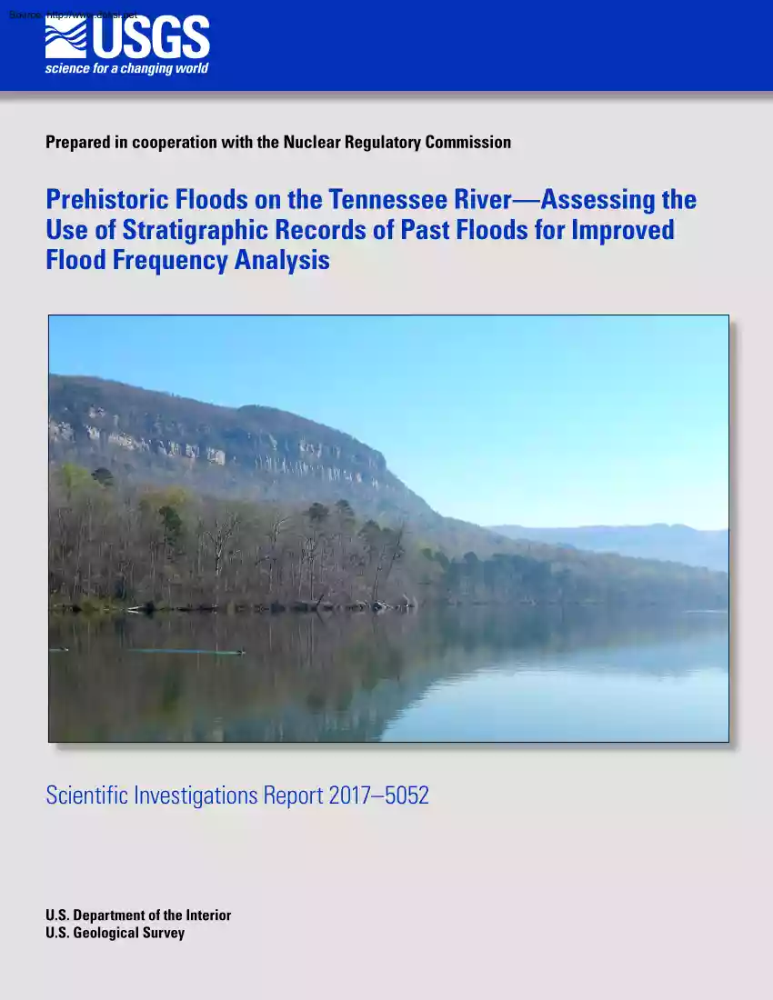
Source: http://www.doksinet Prepared in cooperation with the Nuclear Regulatory Commission Prehistoric Floods on the Tennessee RiverAssessing the Use of Stratigraphic Records of Past Floods for Improved Flood Frequency Analysis Scientific Investigations Report 2017–5052 U.S Department of the Interior U.S Geological Survey Source: http://www.doksinet Front cover: Photograph of the Tennessee River at river mile 445 in the Tennessee River Gorge, Tennessee. Photograph by Tessa Harden, US Geological Survey, March 22, 2016. Back cover: Photograph of large boulders where sediment is likely preserved along the Tennessee River in the Tennessee River Gorge, Tennessee. Photograph by Tessa Harden, U.S Geological Survey, March 21, 2016 Source: http://www.doksinet Prehistoric Floods on the Tennessee River Assessing the Use of Stratigraphic Records of Past Floods for Improved Flood Frequency Analysis By Tessa M. Harden and Jim E O’Connor Prepared in cooperation with the Nuclear
Regulatory Commission Scientific Investigations Report 2017–5052 U.S Department of the Interior U.S Geological Survey Source: http://www.doksinet U.S Department of the Interior RYAN K. ZINKE, Secretary U.S Geological Survey William H. Werkheiser, Acting Director U.S Geological Survey, Reston, Virginia: 2017 For more information on the USGSthe Federal source for science about the Earth, its natural and living resources, natural hazards, and the environmentvisit https://www.usgsgov or call 1–888–ASK–USGS For an overview of USGS information products, including maps, imagery, and publications, visit https://store.usgsgov Any use of trade, firm, or product names is for descriptive purposes only and does not imply endorsement by the U.S Government Although this information product, for the most part, is in the public domain, it also may contain copyrighted materials as noted in the text. Permission to reproduce copyrighted items must be secured from the copyright owner
Suggested citation: Harden, T.M, and O’Connor, JE, 2017, Prehistoric floods on the Tennessee RiverAssessing the use of stratigraphic records of past floods for improved flood-frequency analysis: U.S Geological Survey Scientific Investigations Report 2017–5052, 15 p., https://doiorg/103133/sir20175052 ISSN 2328-0328 (online) Source: http://www.doksinet iii Contents Abstract.1 Introduction.1 Description of Study Area.1 Purpose and Scope.2 Measured and Historical Streamflow.2 Stratigraphic Field Inspections and Results.4 Study Reach Selection.4 Field Reconnaissance.4 Stratigraphy of Selected Candidate Paleoflood Sites.4 Jeff-n-Steph Site.4 Red Flower Site.9 Williams Island Site.11 Eaves Ferry Study Area.12 A Tennessee River Comprehensive Flood StudyActivities and Requirements.13 Summary.14 Acknowledgments.14 References Cited.15 Figures 1. 2. 3. 4. 5. 6. 7. 8. 9. Map showing Tennessee River Basin, including locations of study reaches and three nuclear power plants.2 Map
showing main study reach of the Tennessee River Gorge downstream of Chattanooga, Tennessee, showing the types of locations where flood deposits are preserved .3 Flood profiles showing high-water marks and computed backwater curves, Tennessee River Gorge, Tennessee.5 Photographs showing rock shelters, created by boulders, where flood deposits are preserved in the Tennessee River Gorge, Tennessee.6 Photographs showing alcoves and caves between river miles 454 and 456, Tennessee River, near Chattanooga, Tennessee.7 Photographs showing exposed stratigraphy along the floodplain near Eaves Ferry, immediately downstream of Chattanooga, and at Williams Island, Tennessee River, near Chattanooga, Tennessee.7 Photograph showing finely laminated micaceous silty sand likely deposited by the 1867 or 1875 floods, Tennessee River, near Chattanooga, Tennessee.8 Schematic diagram and photographs showing stratigraphy of the Jeff-n-Steph site, location of site beneath a boulder, and location of pit in
boulder shelter, Tennessee River near Chattanooga, Tennessee.8 Schematic diagram and photographs showing stratigraphy of the Red Flower site and location of the site, Tennessee River Gorge near Chattanooga, Tennessee.10 Source: http://www.doksinet iv FiguresContinued 10. Graph showing rating curve of the largest floods in the gaged record and the elevations of the flood deposits at the Jeff-n-Steph and Red Flower sites, Tennessee River Gorge near Chattanooga, Tennessee.11 11. Photograph showing stratigraphy at Williams Island site indicating approximate locations of optically stimulated luminescence samples, Tennessee River, Tennessee.11 12. Map and photograph showing Eaves Ferry study reach and a rock shelter containing preserved flood deposits along the Tennessee River, Tennessee.12 Tables 1. Radiocarbon results from the Jeff-n-Steph and Red Flower sites in the Tennessee River Gorge near Chattanooga, Tennessee.9 2. Optically simulated luminescence results from Williams Island
and the Red Flower sites near Chattanooga, Tennessee.10 Conversion Factors U.S customary units to International System of Units Multiply By To obtain inch (in.) foot (ft) mile (mi) Length 2.54 0.3048 1.609 centimeter (cm) meter (m) kilometer (km) square mile (mi2) Area 2.590 square kilometer (km2) cubic foot per second (ft3/s) Flow rate 0.02832 cubic meter per second (m3/s) Datums Vertical coordinate information is referenced to the National Geodetic Vertical Datum of 1929 (NGVD 29). Horizontal coordinate information is referenced to the North American Datum of 1927 (NAD 27). Elevation, as used in this report, refers to distance above the vertical datum. Source: http://www.doksinet Prehistoric Floods on the Tennessee RiverAssessing the Use of Stratigraphic Records of Past Floods for Improved Flood Frequency Analysis By Tessa M. Harden and Jim E O’Connor Abstract Stratigraphic analysis, coupled with geochronologic techniques, indicates that a rich history of large
Tennessee River floods is preserved in the Tennessee River Gorge area. Deposits of flood sediment from the 1867 peak discharge of record (460,000 cubic feet per second at Chattanooga, Tennessee) are preserved at many locations throughout the study area at sites with flood-sediment accumulation. Small exposures at two boulder overhangs reveal evidence of three to four other floods similar in size, or larger, than the 1867 flood in the last 3,000 yearsone possibly as much or more than 50 percent larger. Records of floods also are preserved in stratigraphic sections at the mouth of the gorge at Williams Island and near Eaves Ferry, about 70 river miles upstream of the gorge. These stratigraphic records may extend as far back as about 9,000 years ago, giving a long history of Tennessee River floods. Although more evidence is needed to confirm these findings, a more in-depth comprehensive paleoflood study is feasible for the Tennessee River. Introduction Most nuclear power plants and
related structures in the United States are close to large rivers or coastlines for access to cooling water. Proximity to water poses risks of plant inundation, including riverine flooding for facilities adjacent to rivers. After the 2011 release of radioactive materials resulting from the tsunami inundation of the nuclear power plant in Fukushima Daiichi, Japan (Kurokawa and others, 2012), the National Research Council (2014) and other agencies have emphasized better risk-based assessment of flood hazards to critical structures (Nicholson and Reed, 2013). Studies of previously unrecorded floods, or paleofloods, can support assessment of flood hazards by improving estimates of the frequency and magnitude of rare and large riverine floods (Harden and others, 2011; Benito and O’Connor, 2013; O’Connor and others, 2014). Such studies give empirical information on exceptional floods that can be efficiently incorporated into quantitative flood frequency assessments (Stedinger and Cohn,
1986; Stedinger and Baker, 1987; O’Connell and others, 2002). Description of Study Area The Tennessee River starts at the confluence of the French Broad and Holston Rivers in Knoxville, Tennessee, and flows 652 river miles (RM) to its Ohio River confluence (fig. 1) The basin drains 41,000 square miles (mi2), originating in the Blue Ridge mountains of Virginia, Tennessee, and North Carolina before flowing southwestward into northern Alabama and then northwestward until joining the Ohio River in western Kentucky near its Mississippi River confluence. The main study reach of this investigation was the Tennessee River Gorge, near Chattanooga, Tennessee (figs. 1 and 2) The gorge extends from just downstream of Chattanooga, at RM 455, to about RM 430, about 5 miles (mi) downstream of the western extent of the map (fig. 2) The study area is in the pool (Nickajack Reservoir) of Nickajack Dam at RM 425, about 5 mi downstream of the gorge. The Tennessee River Gorge incises the Cumberland
Plateau, an uplifted sequence of gently folded Mississippian and Pennsylvanian carbonate and clastic sedimentary rocks. The valley bottom is mostly less than 0.3 mi wide and about 0.2 mi below the higher surfaces of the Cumberland Plateau Based on a longitudinal river profile during low water of 1881 (Tennessee Valley Authority, 1940), prior to impoundment, the river bottom was a series of bedrock shoals and drops, particularly between RM 440 and 470, although some large alluvial islands, such as Williams Island at RM 455–456, split the channel. The channel margins are generally steep slopes of vegetated colluvium including large boulders of Pennsylvanian sandstone that caps the underlying Mississippian carbonate and shale. Bedrock cliffs, mainly formed of carbonate rocks, locally constrain the channel near river level. Source: http://www.doksinet 2 Prehistoric Floods on the Tennessee RiverUse of Stratigraphic Records of Past Floods for Improved Flood Frequency Analysis 89°
88° 87° 86° 85° 84° INDIANA 82° Lexington-Fayette Louisville 38° 83° 81° WEST VIRGINIA ILLINOIS KENTUCKY U EA AT Watts Bar L P Nuclear Plant Johnson City D Sequoyah AN L Nuclear Knoxville ER Murfreesboro Plant B M U Asheville C BLUE RIDGE MOUNTAINS 37° Nashville 36° Jackson TENNESSEE Browns Ferry Nuclear Plant 35° Huntsville Te n n e ssee R MISSISSIPPI NORTH CAROLINA Charlotte Chattanooga SOUTH CAROLINA Decatur 34° VIRGINIA ALABAMA Atlanta GEORGIA Columbia Birmingham 33° Basemap modified from U.S Geological Survey and other digital data, various scales and dates. Coordinate reference system: GCS North American 1927, WKID: 4267 Authority: EPSG. Horizontal datum is North American Datum of 1927 0 0 50 50 100 100 200 MILES 200 KILOMETERS EXPLANATION Tennessee River Gorge, main study reach Eaves Ferry study reach Tennessee River Basin Nuclear power plant Figure 1. Tennessee River Basin, including locations of study reaches and three
nuclear power plants Purpose and Scope This report documents a reconnaissance-level field study that assessed the potential for paleoflood studies to improve estimates of the magnitude and frequency of past large floods on the Tennessee River near Chattanooga, Tennessee (fig. 1) This study builds on a desktop screening effort assessing the potential for paleoflood studies to improve flood-risk assessments for 104 nuclear power plants in the United States (O’Connor and others, 2014). That earlier screening identified the Southeastern United Statesa region with several nuclear power plantsas having high potential because of the combination of regional geology and river valley physiography. Three plantsWatts Bar, Sequoyah, and Browns Ferry (fig. 1)are along the Tennessee River and are operated by the Tennessee Valley Authority (TVA). The specific objectives of this study were to evaluate the presence and preservation of paleoflood deposits along the Tennessee River and to evaluate the
effort necessary to do a comprehensive paleoflood study leading to measurably better estimates of flood 01 riskparticularly for rare and large floods. tac17-1140 fig The Tennessee River study area also was selected because of the scarcity of past paleoflood studies in the region. Most paleoflood studies nationally and globally have been done in arid or semi-arid regions for which deposit preservation is more likely (Benito and O’Connor, 2013). Consequently, one objective of this analysis was to evaluate if deposit preservation and identification was possible in high humidity environments, particularly because of the preponderance of nuclear power plants in the Eastern United States. Measured and Historical Streamflow USGS streamgage 03568000, Tennessee River at Chattanooga, Tennessee, at RM 464.3 provides a continuousflow record dating back to 1874 and high-stage record back to 1826. This streamgage is at the upstream end of the study area and is directly relevant to the Tennessee
River Gorge because there are no large intervening tributaries. The contributing area at the streamgage is 21,400 mi2. The stage and discharge Source: http://www.doksinet Measured and Historical Streamflow 3 85°25' 85°24' 85°23' 85°22' reek Hog pen Br an Alex M cNabb Branch RM455 Mo + ch Pa n + Joh n BraMcNa nch bb H uff B r a n c h Chattanooga Raccoon Mountain Pumped Station Reserve RM 460 Br ch Br Bla ck Cre ek Base map from The National Map, digital edition, 2017. Loo ko 0 EXPLANATION 0 Cave/alcove Detailed sites Bank exposure U.S Geological Survey streamgaging station 03568000 Historical high-water mark Chattanoo Creek g a + Cre ek en gd Hu Ha rw oo d Oba rB ra n Bible Branch RM 440 u String ers Bra n c h an Br RM445 Ellis Gap Branch + 35° 01' a in o Bl WILLIAMS ISLAND E SSEE RIV ER r pB Ga 35° 02' g n wi r 35° 03' NN ch Nickajack Reservoir rin Sp yB Dry B ran ch n
al ut le Mu l TE gs k ree sC k ree Sho Pine 35° 04' Butcher C 35° 05' y dd Mu nch a Br 85°19' Cr ee +RM450 35° 06' 85°20' k Mid d 35° 07' C le 85°21' Cre ek 85°26' Creek 85°27' nt 85°28' Suc k 35° 08' 1 1 2 2 3 MILES 3 KILOMETERS RM 440 + River Mile Rock shelter Figure 2. Main study reach of the Tennessee River Gorge downstream of Chattanooga, Tennessee, showing the types of locations where flood deposits are preserved. “Detailed sites” include the Jeff‑n-Steph and Red Flower sites. records from this streamgage are augmented by TVA-provided Tennessee River Gorge flood-profile diagrams that show high-water evidence and computed profiles for six large floods between 1867 and 1936 (Tennessee Valley Authority, 1940; fig. 3), including three that pre-date the 1913 construction of Hales Bar Dam (decommissioned and dismantled in 1968) at RM 431. The largest documented flood on the
Tennessee River was March 11, 1867 (Tennessee Valley Authority, 1961). At the USGS streamgage 03568000 at Chattanooga, a discharge of 459,000 cubic feet per second (ft3/s) is estimated for the associated stage of 679.0 feet (ft) Large flows were also documented at this site on March 1, 1875 (410,000 ft3/s), April 3, 1886 (391,000 ft3/s), and March 7, 1917tac17-1140 fig02 (341,000 ft3/s). All other flood peaks were less than 300,000 ft3/s. High-water evidence and constructed profiles for the flows of 1867, 1875, 1886, 1917, 1926–27 (partial profile; 249,000 ft3/s), and 1936 (234,000 ft3/s) are shown in figure 3 for the Tennessee River between RM 390 and 470, encompassing the entire Tennessee River Gorge study area. Additional historical documentation for the USGS streamgage indicates that stages of 662.6 and 6635 ft occurred in March 1826 and March 1847, respectively. These stages are more than 15 ft lower than the maximum stage of 1867 and probably similar to the March 2, 1890,
flood of 283,000 ft3/s (no profile available), which had a maximum stage of 663.6 ft Although these early floods were smaller than the largest flows, these historical records indicate as early as 1826, the very largest flows from the Tennessee River were documented. Source: http://www.doksinet 4 Prehistoric Floods on the Tennessee RiverUse of Stratigraphic Records of Past Floods for Improved Flood Frequency Analysis Stratigraphic Field Inspections and Results Study Reach Selection The approach for this study was to identify promising terrain for formation and preservation of paleoflood deposits, and then do a field reconnaissance to confirm the presence of flood stratigraphy that could enable a robust paleoflood analysis. The screening study of O’Connor and others (2013) pointed to the Tennessee River. Topographic and geologic map inspection and available historical information, such as the historical gage record and flood profiles, indicated that the Tennessee River Gorge
could be a viable location for a comprehensive study and provided a solid observational basis from which to extend flood frequency analyses. The bedrock gorge is a geomorphic setting conducive to flood deposit formation and preservation, as well as paleohydraulic analysis due to the stability and narrow width of the valley. Field Reconnaissance Potential paleoflood sites along the Tennessee River were inspected in late March 2016. Most effort was focused in the Tennessee River Gorge between RM 440 and 460. Downstream of RM 440, inundation by Nickajack Reservoir (pool-elevation level typically 633–634 ft) covers elevations reached by large pre-dam floods (fig. 3) Potential sites upstream along the shore of Chickamauga Reservoir in the Eaves Ferry study reach were also briefly inspected, approximately RM 518–527 (fig. 1), in collaboration with Howard Cyr, Senior Archaeologist, University of Tennessee. We identified several sites of potential or confirmed stratigraphic records of
Tennessee River floods (fig. 2) Most sites are in the Tennessee River Gorge, but we also identified potential sites during our brief inspection of the Eaves Ferry study reach (fig. 1) Many sites consisted of sediment accumulations under large colluvial boulders (fig. 4) These boulders, mostly large sandstone blocks fallen from the upper edges of the Cumberland Plateau, sheltered flood deposits from erosion and precipitation, and in places limited vegetation growth and resulting bioturbation. We also identified potential sites in bedrock caves and alcoves where bedrock outcrops were close to river level or in range of large floods. A promising area of caves and alcoves extends from RM 454 to 456, on river left when looking downstream (figs. 2 and 5) These caves and alcoves formed in carbonate rocks and have accumulated flood sediment, and are deep and well sheltered, likely preserving a stratigraphic record of several floods with little bioturbation. The caves and alcoves are at various
elevations, providing opportunities for records spanning different time periods and flood magnitudes. Long and well-exposed stratigraphic records are also preserved in the alluvial stratigraphy of floodplains and floodplain islands (fig. 6) One example is at RM 4557, on the eastern edge of Williams Island. Similar exposures are common along the eroding floodplain shoreline of the former Hales Bar Reservoir in the main study reach (fig. 2) Such alluvial stratigraphic records are difficult to use as a sole basis for paleoflood reconstructions, primarily because of the difficulty to reliably estimate flood discharge associated with specific deposits in these settings. In these wider reaches, the channel can shift, resulting in uncertain stage-discharge relationships. However, stratigraphic records from these alluvial floodplain and island sites can confirm and extend findings from nearby caves and rock shelters (for example, Hosman and others, 2003). Stratigraphy of Selected Candidate
Paleoflood Sites Limited stratigraphic investigations were done during this reconnaissance study. The investigations were limited to inspections of small exposures at several boulder-shelter sites and evaluation of the alluvial stratigraphy at the Williams Island section, and a brief inspection of an upstream site near Eaves Ferry. Boulder-shelter sites were investigated only in the Tennessee River Gorge. Sites in the elevation range of the 1875 flood, as indicated by the Tennessee Valley Authority (1940) flood profiles, commonly contained a layer, as much as 2 inches (in.) thick, of micaceous silty sand, in places finely laminated (fig. 7) The mica indicates a Tennessee River source for the sediment, derived from the metamorphic rocks of the Blue Ridge Mountains, rather than being sediment derived from local hillslope erosion (where the rocks do not contain significant mica) and deposited by colluvial processes or by local runoff. The fine planar laminations indicate fluvial
deposition from suspended load. Because this sediment is close to the surface, we infer it was likely deposited by the 1867 or 1875 floods. Two boulder-shelter sites among several possible candidates were investigated in greater detail (fig. 2) Both are at RM 445 and are large sandstone boulders embedded in the colluvial slope descending down to river level. Jeff-n-Steph Site Jeff-n-Steph boulder, named for graffiti decoration, forms a 3-ft overhang sheltering a 4×10 ft area (fig. 8) The area under the overhang is flatter, drier, and less vegetated than the adjacent slope. The surface was covered with organic debris, mostly dry leaves, isolated stones apparently fallen from the overhang above, some broken glass, and an aluminum can. The surface elevation, as measured by hand level from Source: http://www.doksinet Stratigraphic Field Inspections and Results 5 Feet above riverbed 60 RM 443–457 680 680 EXPLANATION 55 Year and high water marks, in cubic feet per second
1867; 459,000 45 1875; 410,000 660 1886; 391,000 Market St. Bridge, EL 6936 1917; 341,000 1926–27; 249,000 1936; 234,000 Main study reach Low water of 1881 Hales Bar Reservoir (dismantled in 1968) Detailed flood site, this study 400 410 420 430 25 640 15 5 Lookout Creek Chattanooga Creek The Pot Suck Creek Massengale Point 620 Hales Bar (Bridge) streamgage (1932 to date) Zero = 588.63 Hales Bar Dam streamgages (1906 to date) Zero = 588.9 550 390 Crow Creek 560 Bridgeport streamgage (1892 to date) Zero = 585.20 580 South Pittsburg 600 Sequatchie River Nickajack Dam 620 35 Chattanooga streamgage (1874 to date) Zero = 621.10 640 Mud Creek Elevation, in feet above National Geodetic Vertical Datum of 1929 660 600 580 560 440 450 460 550 470 River miles upstream of the Tennessee River mouth Figure 3. Flood profiles showing high-water marks and computed backwater curves, Tennessee River Gorge, Tennessee (modified from Tennessee Valley Authority,
1940). the pool of Nickajack Reservoir, is 650 ft, just below the maximum 652 ft stage of the 1867 flood at the site, judging from the Tennessee Valley Authority (1940) flood profiles. Two shallow pits about 3 ft apart, one about 2 ft deep, and another approximately 1.2 ft deep, provided stratigraphic exposure. Both pits contained similar stratigraphy; measurements and observations are from the deeper pit (fig. 8), with corroboration from the shallower pit Within the 2-ft-deep exposure, roots and burrowing were common, particularly in the top several centimeters (fig. 8) The upper 8 in. was brown silty fine sand, locally mottled, and contained charcoal fragments, charred nuts, and glass (mostly in the upper 4 in.) No visible primary stratigraphy tac17-1140 fig 03 was preserved. The lower boundary of this 8-in thick unit is marked by a distinct but discontinuous stone line. The next unit, from 8 to 12 in. below the surface, was reddish brown silty fine-to-medium sand, with its base
also marked by another distinct but discontinuous stone line at 1 ft below the surface. The unit between 10 and 13 ft below the surface was compact reddish brown fine-to-medium sand. This unit was distinctly more micaceous and contained less silt than the overlying units. Its base also was marked by a discontinuous stone line. Between 13 ft and the bottom of the excavation, there was reddish brown sand, poorly exposed in the bottom of the narrow hole. Source: http://www.doksinet 6 Prehistoric Floods on the Tennessee RiverUse of Stratigraphic Records of Past Floods for Improved Flood Frequency Analysis Figure 4. Rock shelters, created by boulders, where flood deposits are preserved in the Tennessee River Gorge, Tennessee. Photographs by Tessa M Harden and Jim E O’Connor, US Geological Survey, March 22, 2016. tac17-1140 fig 04 Source: http://www.doksinet Stratigraphic Field Inspections and Results 7 A C B D Figure 5. Alcoves (A and C) and caves (B and D) between
river miles 454 and 456, Tennessee River, near Chattanooga, Tennessee. Photographs by Tessa M. Harden and Jim E O’Connor, US Geological Survey, March 22–23, 2016. A C B Figure 6. Exposed stratigraphy along the floodplain near Eaves Ferry (A), immediately downstream of Chattanooga (B), and at Williams Island (C), Tennessee River, near tac17-1140 fig 05 Chattanooga, Tennessee. Photographs by Tessa M Harden, US Geological Survey, March 22, 2016. Source: http://www.doksinet 8 Prehistoric Floods on the Tennessee RiverUse of Stratigraphic Records of Past Floods for Improved Flood Frequency Analysis Elevation, in feet above National Geodetic Vertical Datum of 1929 Figure 7. Finely laminated micaceous silty sand likely deposited by the 1867 or 1875 floods, Tennessee River, near Chattanooga, Tennessee. Photograph by Tessa M Harden, US Geological Survey, March 21, 2016. A The stratigraphy indicates at least four episodes of sand deposition, with the upper three separated by
discontinuous stone lines almost certainly resulting from rock debris flaking off the overhanging boulder between floods. The sand layers all contain mica, although the 1.0–13 ft layer is distinctly more micaceous. The presence of mica indicates that the sand was deposited by the Tennessee River rather than from local sources. Although fine stratigraphy is not well preserved because of bioturbation and possibly poor exposure in the small, narrow excavations, the four sand units likely represent at least four separate flood deposits. A bigger and deeper excavation with more time spent evaluating the stratigraphy may show more individual flood layers in and below the exposed stratigraphy. The upper layer, containing glass in the upper 4 in., may be from the 1867 flood It is not clear, however, if the glass was in the flood deposit, or as we judge more likely, was on the surface but buried later by burrowing animals. The elevation of the Jeff-n-Steph site deposit relative to the
Tennessee Valley Authority (1940) flood profiles (fig. 3) C B 1867 flood = approximately 652 feet Approximately 650 feet 0 1867? Depth below land surface, in feet I Locally mottled CD II 1 III Very micaceous EXPLANATION JNS(3) charcoal ww10884; 3055 ± 35 1411–1223 B.C VI? tac17-1140 fig 07 c s vf f m cs g Sand Grain-size scale (x-axis) Glass c = clay s = silt vf = very fine sand f = fine sand m = medium sand cs = coarse sand g = gravel Root Rock I 2 Modern organics Flood unit–? indicates possible flood Radiocarbon sampleField name; material laboratory No.; radiocarbon age; calendar age Figure 8. Stratigraphy of the Jeff-n-Steph site (A and B), location of site beneath a boulder (C), and location of pit in boulder shelter (D), Tennessee River near Chattanooga, Tennessee. Radiocarbon sample information and analytical results are shown in table 1 Photographs by Tessa M. Harden, US Geological Survey, March 24, 2016 Source: http://www.doksinet Stratigraphic
Field Inspections and Results 9 indicates that the floods that deposited sediment here all had discharges of at least 400,000 ft3/s. One deposit, likely in or comprising the upper 8 in., was probably deposited by the 1867 flood (fig. 8), estimated to be 459,000 ft3/s at USGS streamgage 03568000 at Chattanooga. The deposit between 1.0 and 13 ft depth may have been deposited by a larger flood with higher velocity, as indicated by the slightly coarser texture of the sediment. The age range for this deposit is not well known. A single radiocarbon age from a piece of charcoal in the 1.3-ft-deep stone line gave a corrected radiocarbon age of 3,055±35 years before present (yr BP; lab ID ww10884, table 1; fig. 8) Calibrated to calendar years, this is equivalent to 1411–1223 B.C Although more dates are necessary to confirm the timing of deposition of the stone line, this preliminary information indicates that the flood record here may be more than 3,000 years. Red Flower Site The Red
Flower site, named for fire pink (Silene virginica) blossoming at the site, is up the slope from Jeff‑n‑Steph, about 30 ft higher at about 680 ft. It is an area of approximately 1.5×65 ft protected by a large tilted and overhanging slab of sandstone (fig. 9) The sheltered surface is dry and covered with organic debris, mostly dry leaves, and isolated stones apparently fallen from the overhang above. A shallow, 1-ft deep pit provides a limited exposure of the stratigraphy (fig. 9) The top 1 in of this site is dry and loose, gray-silty gravelly sand with abundant organic debris. This caps 2.4 in of brown, loose, fine sand with abundant charcoal flecks. These loose units overlie 2-in thick (from 3 to 5 in deep) reddish brown and compact, silty very fine sand which is distinctly micaceous. It contains small charcoal pieces, particularly near its base. Its lower contact is irregular and marked by granules and pebbles to 0.4 in diameter The unit from 5 in. down to the bottom of the hole
at approximately 1 ft was brownish orange mottled, poorly sorted, loose silty fine sand with abundant pebbles and granules. Only the layer from 3 to 5 in. contained obvious mica The micaceous silty very fine sand from 3 to 5 in. below the surface is probably evidence of a very high Tennessee River flood deposit. This conclusion is tentative without confirmation by evidence from more systematic stratigraphic analysis and evidence from additional sites. The other loose and mica-free units appear to be local materials brought in by slopewash or colluvial processes, mixed with rock fragments flaking off the overhanging boulder. The elevation of the possible Red Flower site flood deposit, at approximately 680 ft (surveyed by hand level and laser rangefinder from the pool elevation of Nickajack Reservoir), is more than 25 ft higher than the maximum historical flood of 1867, which attained a stage of approximately 652 ft at RM 445 (figs. 3 and 10) This is much higher than any measured or
estimated discharge and estimating a minimum discharge for this flood requires more precise surveying and additional flow modeling. Based on an extended rating curve that includes the local elevations of historical floods (fig. 10), it may have been greater than 1,000,000 ft3/s, assuming no major changes in channel and valley geometry. To date this high flood deposit, we sampled charcoal from the base (fig. 9) and collected a sample for optically stimulated luminescence (OSL) dating (Huntley and others, 1985; table 2). The radiocarbon age is 180±30 yr BP, which, using INTCAL13 calibration data set (Reimer and others, 2013) calibrates to possible calendar-year ranges (in years A.D) 1652–96, 1726–1815, 1836–77, and 1917–50. These results indicate the flood post-dated A.D 1652 Because this deposit requires such a large discharge that would almost certainly been of historical notice, the older ranges of the radiocarbon result (A.D 1652–96 and AD 1726–1815) are more likely to
indicate the deposit age, although we emphasize that more stratigraphic analysis, hydraulic analysis, and dating and stratigraphic analysis are necessary to confirm the occurrence and magnitude of this possibly exceptional flood. Table 1. Radiocarbon results from the Jeff-n-Steph and Red Flower sites in the Tennessee River Gorge near Chattanooga, Tennessee. [Samples were processed at the U.S Geological Survey Radiocarbon Dating Laboratory in Reston, Virginia Conventional 14C age: Referenced to 1950 A.D, calculated on basis of Libby half-life of 5,568 years; ages were determined at the Center for Accelerator Mass Spectrometry (CAMS), Lawrence Livermore National Laboratory, Livermore, California. Calibrated 2σ age ranges in calendar years: Referenced to A.D 1950, using INTCAL13 calibration data set (Reimer and others, 2013) and a laboratory error multiplier of 1; where multiple intercepts calculated, solutions are listed in order of greatest likelihood summing to greater than 90
percent of the probability density function.] Laboratory identifier Sample idenifier Material δ13C (per mil) Conventional 14 C age (years) Uncertainty (±) Calibrated 2σ age ranges in calendar years ww10883 JEO RED(1) Charcoal -25 180 30 A.D 1652–1696; A.D 1726–1815; A.D 1836–1877; A.D 1917 –1950 ww10884 JEO JNS(3) Charcoal -25.2 3,055 35 1141–1223 B.C Source: http://www.doksinet 10 Prehistoric Floods on the Tennessee RiverUse of Stratigraphic Records of Past Floods for Improved Flood Frequency Analysis A Modern organics Rock I Depth below land surface, in feet Elevation, in feet above National Geodetic Vertical Datum of 1929 Approximately 680 feet EXPLANATION B 0 I Flood unit Radiocarbon sampleField name; material laboratory No.; radiocarbon age; calendar age Micaceous Optically stimulated lumiscence (OSL) sample laboratory No.Age in years BP; calendar age 0.5 Grain-size scale (x-axis) c = clay s = silt vf = very fine sand f =
fine sand m = medium sand cs = coarse sand g = gravel C 1 c Red(1); 3,000 ± 240 2760–3240 B.C s vf f m cs g Sand Red(1) charcoal ww10883; 180 ± 30 A.D 1652–1696, A.D 1726–1815 1867 flood = approximately 652 feet Figure 9. Stratigraphy of the Red Flower site (A and B) and location of the site (C), Tennessee River Gorge near Chattanooga, Tennessee Radiocarbon sample information and analytical results shown in table 1. Optically stimulated luminescence (OSL) sample information and analytical results shown in table 2. Photographs by Tessa M Harden and Jim E O’Connor, US Geological Survey, March 24, 2016 Table 2. Optically simulated luminescence results from Williams Island and the Red Flower sites near Chattanooga, Tennessee [Water content: Field moisture; figures in parentheses indicate the complete sample saturation percentage. Dose rates calculated using 50 percent of the saturated moisture (that is, 9 [40] = 40 × 0.5 = 20) Potassium, Uranium, and Thorium: Analyses
obtained using high-resolution gamma spectrometry (high purity Germanium detector). Total dose: Includes cosmic doses and attenuation with depth calculated using the methods of Prescott and Hutton (1994) Cosmic doses were between 0.29 and 010 grays per thousand years (Gy/ka) n: Number of replicated equivalent dose (DE) estimates used to calculate the equivalent dose. Figures in parentheses indicate total number of measurements included in calculating the represented DE and age using the minimum age model; analyzed through single aliquot regeneration on feldspar grains. Scatter: Defined as “over-dispersion” of the DE values Obtained by the “R” factor program Values greater than 25 percent are considered to be poorly bleached or mixed sediments. Age: Dose rate and age for fine-grained 25–180 microns quartz Exponential plus linear fit used on equivalent dose, errors to one sigma. Abbreviations: Gy, gray (absorbed radiation); ka, thousand of years; ppm, parts per million; ±,
plus or minus] Sample identifer JEO-OSL-20(1) JEO-OSL-20(2) JEO-OSL-RED(1) Wate r content (percent) Potassium (percent) 9 (40) 18 (85) 22 (59) 1.43 ± 004 201 ± 016 804 ± 029 215 ± 006 186 ± 20 0.77 ± 005 172 ± 022 492 ± 041 120 ± 007 119 ± 09 0.37 ± 004 149 ± 020 494 ± 028 108 ± 005 324 ± 020 Uranium (ppm) Thorium (ppm) The OSL sample was collected from just below the micaceous Tennessee River flood unit, at 5–7 in. below the surface (fig. 10) Results from the OSL sample indicate that tac17-1140 fig09 the flood must have occurred in the last 3,000±240 years Total dos e (Gy/ka) Equivale nt dose (Gy) n Scatte r (percent) Age (ka) 3 (24) 2 (24) 10 (20) 37 52 138 8,640 ± 960 9,900 ± 940 3,000 ± 240 (table 2; fig. 10) These results indicate that the flood unit was deposited in about the last 3,000 years and underscore the need for additional work to confirm the timing of occurrence of this flood. Source: http://www.doksinet Stratigraphic Field
Inspections and Results 11 690 Elevation, in feet above National Geodetic Vertical Datum of 1929 EXPLANATION Flood sites, this study Historical flood 680 Red Flower site 20(2); 9,900 ± 940 10840–8960 B.C 670 660 JEO-OSL-20(1); 8,640 ± 960 9600–7680 B.C 1867 1875 1886 Jeff-n-Steph site 1917 650 640 200 400 600 800 1,000 1,200 Discharge, in thousands of cubic feet per second Figure 10. Rating curve of the largest floods in the gaged record and the elevations of the flood deposits at the Jeff-n-Steph and Red Flower sites, Tennessee River Gorge near Chattanooga, Tennessee Williams Island Site Williams Island is a 2-mi long alluvial island near the eastern end of the Tennessee River Gorge (fig. 2; near Lookout Creek in fig. 3), extending between RM 4546 and 4566 It is a large sandy island with a surface locally exceeding 660 ft, more than 25 ft above the pool of Nickajack Reservoir (fig. 3) and about 50 ft above the historical low-flow river elevation of about
610 ft (Tennessee Valley Authority, 1940). Historical floods inundated the island, including the 1867 flood that attained a stage of about 675 ft (Tennessee Valley Authority, 1940). We examined a shoreline exposure at RM 455.7 (fig 11) The top of the exposure was at approximately 661 ft, 27 ft above the 633.5 ft pool level of Nickajack Reservoir at the time of our inspection. The exposure consisted of bedded sand, deposited in layers that became finer and thinner up the section. The bedding of the upper 6 ft was less distinct because of soil development and bioturbation. The lowermost units were as much as 20 in. thick and locally contained rounded pebble layers. These deposits record building up of the island by vertical accretion of fluvial deposits. The pebble layers and thick sand deposits low in the section may be sand and pebble bars, but we interpret finer intervening layers and the mostly thinner and finer layers of the upper several meters to be overbank deposits from the
suspended load of floods overtopping the growing island. As the island became taller, inundation probably became progressively less frequent and shorter duration during each flood, resulting in thinner and finer flood tac17-1140 fig 10 EXPLANATION Approximate locations of optically stimulated luminescence (OSL) samplesLaboratory No.; age in years BP; age in calendar years Figure 11. Stratigraphy at Williams Island site indicating approximate locations of optically stimulated luminescence samples, Tennessee River, Tennessee. Optically stimulated luminescence sample information and analytical results shown in table 2. Photograph by Tessa M Harden, US Geological Survey, March 23, 2016. layers, as well as allowing more pedogenic alteration and bioturbation of flood layers between increasingly rare episodes of renewed deposition. Two OSL samples were collected and analyzed at the Williams Island site (table 2). One site was near the bottom of the section at about 6 ft above the water
surface and one site was from about 20 ft above the water surface (fig. 11) Both ages were similar (8,640 ± 960 and 9,900 ± 940 years BP). This chronology indicates that (1) much of Williams Island was deposited rapidly about 8,000–10,000 years ago, and (2) Williams Island contains a long record of flood events spanning most of the Holocene. Because many of these sand layers in alluvial sections such as at Williams Island and other floodplain sites are likely much lower than the peak stage of the depositing floods (the 1867 flood was about 15 ft above the top of the Williams Island exposure), they are difficult to interpret directly in terms of paleoflood magnitude. Nevertheless, deposit grain size and thickness may indicate relative flood magnitude, which can in turn assist in interpretation of flood chronologies developed at higher sites. The Williams Island site may be particularly valuable in this regard because of the yet unanalyzed but promising cave and alcove sites at the
same river position along the western valley margin (fig. 2), which also likely preserve a long record of large floods. tac17-1140 fig 11 Source: http://www.doksinet 12 Prehistoric Floods on the Tennessee RiverUse of Stratigraphic Records of Past Floods for Improved Flood Frequency Analysis Eaves Ferry Study Area 40 ft on the outside staff plate (gage datum = 666.35 ft) The elevation of these deposits is 12 ft higher than the 27.7 ft stage (gage datum) attained by the largest flow of 205,000 ft3/s on March 29, 1936, in the short 1934–40 record (Parker, 1942). Although not in the Tennessee River Gorge focus area, this site indicates that deposits are likely present in other reaches, thereby providing opportunities for additional and independent evaluation of paleoflood records. The Eaves Ferry site also is close to several sites of alluvial stratigraphy being assessed by the University of Tennessee (Howard Cyr, University of Tennessee, written commun., 2016), providing an
opportunity for examining sections of floodplain overbank deposits in conjunction with flood slackwater deposits in high rock shelters and alcoves. We made a cursory investigation at a rocky alcove along Eaves Bluff near Eaves Ferry (RM 523.2) during the course of evaluating floodplain stratigraphy sites along the shores of Chickamauga Reservoir (fig. 12) This rocky bluff along river left contains several shallow alcoves, including one near the former ferry landing that contains laminated silty fine sand likely deposited during a Tennessee River flood. The site is adjacent to discontinued USGS streamgage 03544000, Tennessee River at Breedenton, which operated for only 7 years from 1934 to 1940. Hand level and laser rangefinder surveys relative to both the Chickamauga Reservoir surface and the outside staff plate at the gage house indicate that the deposits in this alcove are at about 706 ft elevation and 84°53' 84°51' 84°52' 84°50' 84°49'
84°48' 84°47' 35° 36' 528 Watts C k ree 527 35° 35' 526 Sewee Creek 525 35° 34' Cl ea rC ree k 519 35° 33' 524 520 KAMAUGA RESE CHIC RVOI 521 R – TE NNESSE E RIVE R 522 523 518 35° 32' yB ra nc h h nc 516 Base map from The National Map, digital edition, 2017. EXPLANATION Bank exposure ec Dr y 35° 31' Mc Ki nle D 517 Lick Br a H uts ell Br ch an Br ch a tu rB ran ch 0 0 an 1 1 2 MILES 2 KILOMETERS Rock shelter 516 River mile Figure 12. Eaves Ferry study reach and a rock shelter containing preserved flood deposits (inset) along the Tennessee River, Tennessee. Photograph by Tessa M Harden, US Geological Survey, March 23, 2016 Source: http://www.doksinet A Tennessee River Comprehensive Flood StudyActivities and Requirements 13 A Tennessee River Comprehensive Flood StudyActivities and Requirements This reconnaissance-level study shows that floodfrequency assessments for rare and large floods
on the Tennessee River would likely be significantly improved by a comprehensive paleoflood study. Such a study entails several distinct tasks, probably involving synergistic activities among many collaborators. They are listed here in approximate sequence, assuming that the study would focus on the Tennessee River Gorge between RM 440 and 460: 1. Do a more thorough reconnaissance in the focus area. Our brief field reconnaissance only inspected about 30 sites (fig. 2) A more thorough reconnaissance effort is necessary to identify sites at a broad range of elevations so as to encompass a wide range of paleoflood history and magnitudes and to prioritize sites relative to potential for providing the best possible stratigraphic records. 2. Obtain access and permits for site excavations. This will include obtaining permissions from pertinent landowners, addressing National Environmental Policy Act requirements including requirements associated with Section 106 of National Historic
Preservation Act of 1966, and any necessary Federal, State, and local permits. Most aspects of this task should be initiated prior to the thorough reconnaissance of task 1. 3. Excavate, describe, sample, survey, and interpret the stratigraphy and chronology of sites selected on the basis of the reconnaissance efforts of task 1. This task will be the basis of the paleoflood record and chronology. The number of sites will depend on project budget and timeline considerations, but because no one site can be a basis for a confident determination of a complete record, multiple sites are required for a complete paleoflood analysis. For the Tennessee River Gorge, 6–10 sites with good stratigraphic records could provide a balance between budget and time considerations and confidence in the resulting paleoflood record. This task will include the bulk of the fieldwork, requiring several weeks of concerted effort by geologists and hydrologists. 4. Determine stage-discharge rating curves for
each study site to develop discharge estimates for each paleoflood identified in the stratigraphic record. A paleoflood study in the Tennessee River Gorge will benefit immensely from the existing record and calculations for the large historical floods (Tennessee Valley Authority, 1940). This step will require project geologists to work with hydraulic engineers to ensure that the developed flow models extend to the sites and elevation ranges of the analyzed paleoflood deposits. 5. Incorporate the paleoflood information into probability analyses of the magnitude and frequency of large and rare floods. This task will entail combining information from the derived paleoflood record of flood magnitude and timing with the long gaged record at Chattanooga and any additional historical information to calculate estimates of flood frequency and the uncertainty of those estimates. This task relies on new and efficient approaches for combining such records on the timing and magnitude of
historical and prehistorical floods (Cohn and others, 1997; O’Connell and others, 2002; John England, Army Corps. of Engineers, 2016) These techniques allow consideration of uncertainties in magnitude and timing of paleofloods. This approach of combining records typically results in significant improvement of flood-frequency assessments (as measured by their uncertainty) compared to those derived from gaged records alone (for example, Harden and others, 2011). 6. Fully report all developed information, including stratigraphy, hydraulic modeling, and flood-frequency analyses in a peer-reviewed report. This task would ideally be supported by (1) field trips to study sites, (2) critical evaluation of site stratigraphy, chronology, interpretations, and discharge estimates, and (3) expert review of the statistical analyses. Source: http://www.doksinet 14 Prehistoric Floods on the Tennessee RiverUse of Stratigraphic Records of Past Floods for Improved Flood Frequency Analysis
Summary This reconnaissance-level field study indicates that a comprehensive flood geomorphology study on the Tennessee River would likely provide improved estimates of the frequency and magnitude of large Tennessee River floods. In particular, the Tennessee River Gorge appears to be an excellent location for a paleoflood study. Results here would be relevant to assessing flood hazards for several nuclear powerplants located along the river. Multiple depositional sites and environments preserve stratigraphic records of flooding. Large boulders, bedrock ledges, alcoves, and small caves are present at multiple elevations along the Tennessee River Gorge and in other locations where the channel narrows. These provide excellent environments for flood sediment accumulation and preservation. Because these sites are located at multiple elevations relative to the channel, they can provide information about floods of a wide range of magnitudes. These stratigraphic records from rock shelters and
caves could likely be augmented or confirmed by stratigraphic records developed from nearby sections of alluvial stratigraphy, such as Williams Island. Despite extensive bioturbation by vegetation and burrowing insects and animals, delineation of distinct stratigraphic units, probably representing individual floods, is possible by careful examination and stratigraphic analysis. This was clearly evident at the Red Flower and Jeff-n-Steph boulder-shelter sites. Stratigraphy is likely much better preserved in the unexcavated caves and alcoves. The presence of mica, derived from metamorphic and igneous rocks in the Blue Ridge Mountains, appears to distinguish Tennessee River flood deposits from deposits from those of local sources. This improves the reliability of stratigraphic interpretations. Flood deposits and bounding units in the region contain charcoal and other materials suitable for radiocarbon dating. Preliminary results indicate that resulting chronologies may extend back more
than 3,000 years. Similarly, OSL dating indicates a record of more than 8,000 years at Williams Island. The hydraulic conditions of the Tennessee River Gorge are ideal for paleoflood analysis. The narrow bedrock gorge provides a stable and confined hydraulic environment enabling sensitive and stable stage-discharge relationships for sites of detailed study. The historical flood profiles documented and calculated by the Tennessee Valley Authority provide a strong basis for new hydraulic modeling of historical conditions, enabling robust estimates of discharges associated with specific deposit elevations throughout the gorge. The bedrock channel bed and resistant valley margins result in such modeling being applicable for floods of the last several thousand years. The Tennessee River Gorge is adjacent to the long-term USGS streamgage 03568000, Tennessee River at Chattanooga, Tennessee. This is a continuous record dating back to 1874, and includes historical measurements of large floods
dating back to 1826. This long gage record provides a solid basis for augmentation by geologic data on large, prehistoric floods. The Tennessee River has experienced multiple large floods in the last 200 years. These large floods and flood hydroclimatology are well documented by Tennessee Valley Authority. In particular, deposits of the 459,000 cubic feet per second flood of 1867 will likely serve as a guide to the location and relative magnitude of paleoflood deposits. Most of the Tennessee River Gorge is little affected by anthropogenic disturbances that might alter or erase the flood record. Although the Tennessee River is mostly impounded by dams, long sections of river corridors are in the range of historical flooding and above levels of reservoir inundation. Although this reconnaissance-level study was done for the Tennessee River, results further indicate that paleoflood studies may be feasible in many other areas of the Eastern United States. Bioturbation and vegetation may
locally limit stratigraphic resolution and working conditions, but flood stratigraphy is likely to be preserved in certain depositional environments. In particular, the abundant carbonate rocks, incised valleys, and sand-producing headwaters together create favorable conditions for creating and preserving flood slackwater deposits in environments favorable for paleohydraulic analysis. Acknowledgments Many individuals supported this study including Mark Fuhrmann, Joeseph Kanney, and Meredith Carr from the Nuclear Regulatory Commission, Keil Neff formerly with the Tennessee Valley Authority, and John Weglian from the Electric Power Research Institute. Special thanks are extended to multiple landowners and the Tennessee River Gorge Trust for providing access to private land. USGS scientists Shannon Mahan and John McGeehin supplied the geochoronologic analyses. Source: http://www.doksinet References Cited 15 References Cited Benito, G., and O’Connor, JE, 2013, Quantitative
paleoflood hydrology, in Shroder, J., ed in chief, Wohl, E.E, ed, Treatise on geomorphology, Volume 9Fluvial geomorphology: San Diego, Academic Press, p. 459–474 Cohn, T., Lane, WL, and Baier, WG, 1997, An algorithm for computing moments-based flood estimates when historical flood information is available: Water Resources Research, v. 33, no 9, p 2,089–2,096 Harden, T.M, O’Connor, JE, Driscoll, DG, and Stamm, J.F, 2011, Flood-frequency analyses from paleoflood investigations for Spring, Rapid, Boxelder, and Elk Creeks, Black Hills, western South Dakota: U.S Geological Survey Scientific Investigations Report 2011–5131, 136 p. Hosman, K.L, Ely, LL, and O’Connor, JE, 2003, Holocene paleoflood hydrology of the Lower Deschutes River, Oregon, in O’Connor, J.E, and Grant, GE, eds, A peculiar riverGeology, geomorphology, and hydrology of the Deschutes River, Oregon: Washington, D.C, American Geophysical Union, Water Science and Application Series, v. 7, p 267–293 Huntley, D.J,
Godfrey-Smith, DI, and Thewalt, MLW, 1985, Optical dating of sediments: Nature, v. 313, p. 105–107 Kurokawa, K., Ishibashi, K, Oshima, K, Sakiyama, H, Sakurai, M., Tanaka, M, Nomura, S, Hachisuka, R, and Yokoyama, Y., 2012, The official report of The Fukushima Nuclear Accident Independent Investigation Commission Executive summary: The National Diet of Japan, 86 p. [In English.] National Resource Council, 2014, Lessons learned from the Fukushima nuclear accident for improving safety of U.S nuclear plants: Washington, D.C, The National Academies Press, 366 p. Nicholson, T.J, and Reed, WA, 2013, Proceedings of the workshop on probabilistic flood hazard assessment (PFHA)Held at the U.S Nuclear Regulatory Commission Headquarters, Rockville, Maryland, January 29–31, 2013, NUREG/CP-0302: U.S Nuclear Regulatory Commission, accessed June 23, 2016, at http://www.nrcgov/reading-rm/ doc-collections/nuregs/conference/cp0302/. O’Connell, D.RH, Ostenaa, DA, Levish, DA, and Klinger, R.E, 2002,
Bayesian flood frequency analysis with paleohydrologic bound data: Water Resources Research, v. 38, no 5, p 16-1–16-13 O’Connor, J.E, Atwater, BF, Cohn, TA, Cronin, TM, Keith, M.K, Smith, CG, and Mason, RR, 2014, Assessing inundation hazards to nuclear powerplant sites using geologically extended histories of riverine floods, tsunamis, and storm surges: U.S Geological Survey Scientific Investigations Report 2014–5207, 66 p., accessed September 15, 2016, at http://dx.doiorg/103133/ sir20145207. Parker, 1942, Surface water supply of the United States, 1940, Part III, Ohio River Basin: U.S Geological Survey Water Supply Paper 893, p. 483 Prescott, J.R, and Hutton, JT, 1994, Cosmic ray contributions to dose rates for luminescence and ESR datingLarge depths and long-term time variations: Radiation Measurements, v. 23, no 2–3, p 497–500 Reimer, P.J, Bard, E, Bayliss, A, Beck, JW, Blackwell, P.G, Bronk Ramsey, C, Buck, CE, Cheng, H, Edwards, R.L, Friedrich, M, and Grootes, PM, 2013
IntCal13 and Marine13 radiocarbon age calibration curves 0–50,000 years cal BP: Radiocarbon, v. 55, no 4, p 1,869–1,887 Stedinger, J.R, and Baker, VR, 1987, Surface water hydrologyHistorical and paleoflood information: Reviews of Geophysics, v. 25, no 2, p 119–124, doi:10102/ RG025i002p00119. Stedinger, J.R, and Cohn, TA, 1986, Flood frequency analysis with historical and paleoflood information: Water Resources Research, v. 22, no 5, p 785–793 Tennessee Valley Authority, 1940, Flood profiles, Tennessee RiverMile 350-370 (Engineering drawing 1K112R), Flood control investigations: Knoxville, Tennessee, Tennessee Valley Authority, Water Control Planning Department, 1 pl. Tennessee Valley Authority, 1961, Floods and flood control: Knoxville, Tennessee, Tennessee Valley Authority, Technical Report 26, 302 p. Source: http://www.doksinet Source: http://www.doksinet Publishing support provided by the U.S Geological Survey Science Publishing Network, Tacoma Publishing Service
Center For more information concerning the research in this report, contact the Director, Oregon Water Science Center U.S Geological Survey 2130 SW 5th Avenue Portland, Oregon 97201 https://or.waterusgsgov Source: http://www.doksinet Harden and O’ConnorPrehistoric Floods on Tennessee RiverUse of Stratigraphic Records for Improved Flood Frequency AnalysisScientific Investigations Report 2017–5052 ISSN 2328-0328 (online) https://doi.org/103133/sir20175052
 Jellemzően a vállalkozás beindítása előtt elkészített tanulmány, de készülhet már meglévő vállalkozás esetében is. Az üzleti tervezés egy olyan tervezési módszer, amely keretet a cég céljainak eléréséhez. Írásunk módszertani útmutatóként szolgál azoknak, akik érdeklődnek az üzleti tervezés iránt.