A doksi online olvasásához kérlek jelentkezz be!
A doksi online olvasásához kérlek jelentkezz be!
Nincs még értékelés. Legyél Te az első!
Legnépszerűbb doksik ebben a kategóriában


Tartalmi kivonat
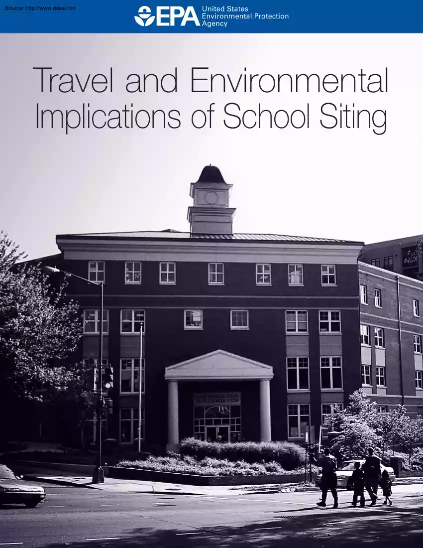
Source: http://www.doksinet Travel and Environmental Implications of School Siting Source: http://www.doksinet TRAVEL AND ENVIRONMENTAL IMPLICATIONS OF SCHOOL SITING U.S ENVIRONMENTAL PROTECTION AGENCY EPA 231-R-03-004 OCTOBER 2003 Source: http://www.doksinet UNITED STATES ENVIRONMENTAL PROTECTION AGENCY WASHINGTON, D.C 20460 Office of Policy, Economics, and Innovation Dear Reader: Over the next few decades, thousands of schools will be built or renovated. Decisions about the construction and renovation of these schools will have important implications for their adjoining communities. In making these decisions, communities will be challenged to meet multiple community goals – educational, environmental, economic and fiscal. For some time, there has been a trend toward construction of big schools and requirements for large sites. In many places, there is a policy bias in favor of constructing new schools rather than renovating existing ones. Requirements, recommendations,
and standards that encourage or require building large schools on new campuses are embedded in a variety of regulations and laws. Many states have school construction funding formulas that favor new construction over renovation; and some state and local governments have minimum acreage requirements that dictate the use of large, new campuses, while discouraging the use of smaller existing schools. Realizing that use of large, new campuses may have adverse consequences for the environment and a community’s quality of life, communities are beginning to re-evaluate the impact of existing requirements. Recently, South Carolina’s Governor Mark Sanford signed into law a bill that eliminates state-mandated acreage requirements for new schools and that makes it easier for existing buildings to be renovated. Milwaukee, Wisconsin is using similar flexibility to create its Neighborhood School Initiative – constructing six new schools, adding on to nineteen existing schools, and renovating
fifteen schools. In St. Paul, Minnesota, the newly renovated and expanded John A Johnson multi-story school building fits seamlessly into the community it serves while providing added space for playing fields. These changes exemplify a growing trend. Citizens, school administrators, and parents are recognizing that schools do more than house children for the day. They affect home-buying decisions and traffic patterns. They present opportunities to create neighborhood centers for education and civic life This study provides important information about the effect of school location on how children get to school. It shows that school siting and design can affect traffic congestion, air pollution, school transportation budgets, and children’s health and obesity. We hope that this study will be a catalyst for sound school investment decisions that will lead to the kind of quality schools, neighborhoods, and futures we all desire. Sincerely, Jessica L. Furey Associate Administrator
Source: http://www.doksinet Travel and Environmental Implications of School Siting ACKNOWLEDGEMENTS This work was conducted under EPA contract 68-W-99-054 for the Development, Community, and Environment Division (DCED) of US EPA’s Office of Policy, Economics, and Innovation. DCED staff members Amber Levofsky and Christopher V. Forinash managed this project For their work conducting and documenting this research, EPA thanks Reid Ewing of the University of Maryland, and William Greene of New York University. EPA thanks the following members of the peer review and study advisory panel who commented on the study’s methodology and draft final report. • Dr. Robert Cervero, University of California at Berkeley • Dr. Larry Frank, University of British Columbia • Dr. Susan Handy, University of California at Davis • Rodney Sams, ICF Consulting To request additional copies of this report, call EPA’s National Service Center for Environmental Publications at (513) 891- 6561
and ask for publication number EPA 231-R-03-004. To access this report online, visit the Publications section of http://www.epagov/smartgrowth i Source: http://www.doksinet Travel and Environmental Implications of School Siting CONTENTS EXECUTIVE SUMMARY. 1 1 INTRODUCTION. 2 2 TRENDS IN SCHOOL LOCATION . 3 3 FACTORS INFLUENCING MODE OF TRAVEL TO SCHOOL . 4 4 MODEL SPECIFICATION AND STRUCTURE . 6 4.1 4.2 5 DATA SOURCES AND VARIABLES. 9 5.1 5.2 5.3 5.4 5.5 5.6 6 INDIVIDUAL CHOICE SETS . 18 VARIABLE SELECTION . 18 MODEL PARAMETERS . 19 TRAVEL TIME INFLUENCES . 20 BUILT ENVIRONMENT INFLUENCES . 21 SOCIOECONOMIC INFLUENCES . 21 OMITTED VARIABLES . 22 ENVIRONMENTAL IMPACTS . 22 7.1 7.2 8 TRAVEL DATA . 9 TRAVEL TIME AND DISTANCE DATA . 10 SOCIOECONOMIC DATA . 11 SCHOOL DATA . 12 BUILT ENVIRONMENT DATA . 12 DATA SUMMARY . 15 MODEL ESTIMATION AND RESULTS. 18 6.1 6.2 6.3 6.4 6.5 6.6 6.7 7 FULLY SPECIFIED MODELS . 6 ALTERNATIVE MODEL STRUCTURES . 6 EMISSIONS FOR TWO SAMPLED
SCHOOLS IN GAINESVILLE . 22 SIMULATION OF EMISSIONS FOR NEIGHBORHOOD SCHOOLS . 24 CONCLUSIONS . 25 8.1 8.2 SCHOOL LOCATION AND THE BUILT ENVIRONMENT MATTER . 26 MORE RESEARCH WOULD HELP COMMUNITIES BETTER UNDERSTAND WHAT WORKS . 26 ii Source: http://www.doksinet Travel and Environmental Implications of School Siting EXECUTIVE SUMMARY Over the next few decades, thousands of schools will be built or renovated. The planning decisions around that construction and renovation will have important implications for education and community quality of life. Recent trends in travel to school have raised concerns at federal, state, and local levels. In 2001, less than 15 percent of students between the ages of five and 15 walked to or from school, and 1 percent biked. In 1969, 48 percent of students walked or biked to school. In response, governments at every level have launched a variety of policy initiatives. These include state and local “Safe Routes to School Programs,” and a federal
KidsWalk-to-School Campaign. In addition, a variety of initiatives are helping schools stay or locate at the center of communities. This study evaluates the travel and environmental implications of these latter initiatives, and of trends toward constructing schools that are not located at the center of communities, and are not reachable by walking or bicycling. In short, it seeks to find the implications of school location for travel and the environment. This study is the first to empirically examine the relationship between school location, the built environment around schools, mode choices for trips to school, and air emissions impacts of those choices. It finds that: 1. School proximity to students matters Students with shorter walk and bike times to or from school are more likely to walk and bike. 2. The built environment influences travel choices Students traveling through higher-quality environments are more likely to bicycle and walk. 3. Because of travel behavior differences,
school location has an impact on air emissions Centrally located schools that can be reached by walking and bicycling reduce air pollution. The results suggest that actions to improve students’ walking environments, and to support communities that wish to locate schools in neighborhoods, will result in increases in student walking and biking to school. Increased walking and biking can reduce emissions related to auto travel and improve environmental quality. 1 Source: http://www.doksinet Travel and Environmental Implications of School Siting 1 INTRODUCTION Communities across the United States will, in the next few decades, need to accommodate substantial new student enrollment. Thousands of schools will need to be built or renovated in order to respond to the predicted increase in school age children. This expected boom in school construction and renovation, and the planning decisions around that construction and renovation, will have important implications for education,
travel, human health and the environment. For instance, to the extent that this construction encourages increases in driving it has the potential to exacerbate already serious air quality issueswith health implications for adults and children alike. Increased auto travel contributes to unhealthy air. Nationwide, mobile sources emit approximately 30 percent of the ozone precursors nitrogen oxides and hydrocarbons, but these proportions increase in automobile-dependent metropolitan areas. There is overwhelming evidence linking ozone and other air pollutants to respiratory ailments in children, including upper respiratory infections and asthma. Almost five million children in the U.S suffer from asthma, causing 14 million lost school days per year1 Over the last 25 years, rates of asthma have increased 160 percent in children up to age 4 years and 74 percent in children ages 5 to 14 years.2 The traffic generated by auto travel to school exacerbates traffic congestion and contributes to
the health impacts of auto emissions. The estimate by Gene Benton, city traffic engineer for Santa Rosa, California, that the number of cars on the road between 7:15 a.m and 8:15 a.m jumps 30 percent during the school year,3 is typical Yet, there is strong evidence that reducing air pollution from automobile use can protect children’s health. For example, during the 1996 Atlanta Olympic Games, when driving was reduced and ambient ozone levels fell by 27.9 percent, emergency room visits for asthma dropped by 416 percent These results suggest that replacing some car trips with walking, biking and transit will reduce vehicle miles and associated pollutants. However, if future schools follow recent trends, additional schools will likely contribute to the problem. Increases in car travel to school are significant. According to the recently released 2001 National Household Travel Survey (NHTS), less than 15 percent of students between the ages of five and 15 walked to or from school, and 1
percent biked.4 In 1969, at the time of the first Nationwide Personal Transportation Survey (predecessor to NHTS), 48 percent of students walked or biked to school.5 A survey by the Centers for Disease Control and Prevention (CDC) found that even children living close to school were not walking or biking in large numbers; only 31 percent of children ages five to 15 who lived within a mile of school walked or biked.6 In 1969, the comparable figure was close to 90 percent7 1 Centers for Disease Control and Prevention, National Center for Chronic Disease Prevention and Health Promotion, “Adolescent & School Health”, available at www.cdcgov/nccdphp/dash/healthtopics/ 2 Centers for Disease Control and Prevention, “Surveillance for AsthmaUnited States, 1960-1995: CDC Surveillance Summaries, April 24, 1998,” MMWR Morbidity and Mortality Weekly Report, Vol. 47 (SS-1), 1998, pp 1-27 3 Ann Dubay, “See Dick and Jane Sit in Traffic,” The Press Democrat, September 7, 2003 4
Bureau of Transportation Statistics, National Household Travel Survey, NHTS Version 1.0 CD (Preliminary Release), January 2003. 5 This figure applies to students in elementary and intermediate grades, the closest counterparts to the 5-15 age range reported for 2001. Federal Highway Administration (FHWA), “Transportation Characteristics of School Children,” Report No. 4, Nationwide Personal Transportation Study, Washington, DC, July 1972, derived from Table 1 6 A.M Dellinger and CE Staunton, “Barriers to Children Walking and Bicycling to SchoolUnited States, 1999,” Morbidity and Mortality Weekly, Vol. 51, No 32, 2002, pp 701-704 2 Source: http://www.doksinet Travel and Environmental Implications of School Siting Why the decline in walking and biking to school? In the CDC survey, parents cited long distances as a primary barrier to their children walking or biking to school.8 Yet even the majority of short school trips are made by auto or bus, indicating that other factors
were also at work. One goal of this study is to shed light on what those other factors are. A poor walking environment is linked to auto dependence in the general population, and would be expected to discourage walking and cycling to school. “Poor walking environment” in this case means a built environment that has low densities, little mixing of land uses, long blocks, incomplete sidewalks, and other hallmarks of our current patterns of development.9 A wide variety of institutions and governments are responding to the decrease in biking and walking to school by paying more attention to the factors they believe make a difference, including the quality of the walking environment. Numerous states and localities have launched “Safe Routes to School Programs”10 With the State of California leading the way, these programs provide funding for sidewalks, bike lanes, and other infrastructure improvements to encourage more walking and biking by school children. Some also provide funding
for police enforcement of traffic laws around schools. The US Department of Health and Human Services and CDC have started a Kids-Walk-to-School Campaign, citing rising rates of childhood obesity, diabetes, and asthma.11 In sum, there is both growing attention to improving children’s walking environment, and growing interest in the effects of school location on a range of community values, including student’s ability to walk to school. However, the literature on the impact of walking environment, school location, and other factors that may influence travel choices, remains slim. This study develops a model of travel to school choices in an attempt to add to that literature and inform policymaking and community discussions. This study is the first to empirically examine the relationship between school mode choice, household socioeconomic characteristics, school attributes, and built environment and modal variables. We hope that this study adds to the developing literature on school
location and design and helps foster discussion about appropriate responses to school travel trends. Gainesville, FL was chosen as the study area for two reasons: first, the availability of two regional travel diary surveys which, combined, offered a relatively large sample of trips to analyze; second, the availability of many variables characterizing the built environment in Gainesville, which can be used as independent variables in explaining mode choice. 2 TRENDS IN SCHOOL LOCATION For some time, there has been a trend toward bigger schools and requirements for larger sites. Nationwide since World War II, the number of schools declined 70 percent while average size grew fivefold, from 127 7 FHWA, op. cit 8 Dellinger and Stauton, op. cit 9 Reid Ewing and Robert Cervero, “Travel and the Built Environment,” Transportation Research Record 1780, 2001, pp. 87-114 10 Transportation Alternatives, The 2002 Summary of Safe Routes to School Programs in the United States, New York,
available at www.transactorg/PDFs/sr 2002pdf 11 National Center for Chronic Disease Prevention and Health Promotion, “KidsWalk-to-School”, available at www.cdcgov/nccdphp/dnpa/kidswalk/ 3 Source: http://www.doksinet Travel and Environmental Implications of School Siting to 653.12 Many states have school construction funding formulas that favor new construction over renovation of existing schoolsor which simply do not allow money to be used for renovation. Minimum acreage requirements adopted at the state and local level imply that schools not meeting these thresholds are inadequate. In fact, schools with high levels of academic achievement exist on both very small and very large sites. Communities are beginning to re-evaluate the need for and impacts of “one-size-fits-all” acreage standards on education and community quality of life. Communities are increasingly concerned about congestion, air pollution, school transportation budgets, and children’s health and obesity.
More broadly, citizens, school administrators, and parents recognize that schools can and do have multiple roles and influences in the community. Schools can anchor neighborhoods, and be centers of learning and community. They drive home-buying decisions and traffic patterns. School size, location, and the design of the school’s neighborhood affect most of these roles and influences. As a result, states and communities have been looking for and finding alternatives to a one-sizefits-all approach For example: • In Milwaukee, Wisconsin the Neighborhood School Initiative is constructing 6 new schools, adding on to 19 existing schools, and renovating 15 schools. While adding 750,000 square feet of academic space, all schools remain in walkable neighborhoods, and more students can now go to school in their own neighborhood. The new school designs encourage community use of library, gym, cafeteria, parent center, art and music rooms. • In St. Paul, Minnesota, the newly renovated and
expanded John A Johnson Achievement Plus Elementary School brings an outstanding academic environment to compact, multi-story building that fits seamlessly into the community it serves. Space saved by the traditional multi-story design increased the number of playing fields, and additional buildings are planned to accommodate future student increases. • In July 2003, South Carolina eliminated minimum acreage requirements for schools and allowed waivers in school square footage -- two steps that Governor Mark Sanford said will encourage more neighborhood schools.13 States and communities are already taking action, but there are few quantitative studies to help them understand which changes will have the greatest impact. 3 FACTORS INFLUENCING MODE OF TRAVEL TO SCHOOL A review of the literature on travel to school found only two empirical studies examining the relationship between children walking or biking to school and school design and/or location. In the first, Kouri found
that the percentage of students walking to school was four times higher for schools built before 1983 than those built after (an average of 16 percent walking to older schools vs. 4 percent to newer schools)14 12 Between 1940 and 1990, the number of elementary and secondary schools decreased from 200,000 to 62,000 despite a 70 percent rise in population. Local Government Commission, “Schools”, available at www.lgcorg/transportation/schoolshtml 13 Allison L. Bruce, “In visit to Moultrie Middle, Sanford signs school acreage bill”, Charleston Post and Courier, July 17, 2003. 14 Christopher Kouri, Wait for the Bus: How Low Country School Site Selection and Design Deter Walking to School and Contribute to Urban Sprawl, South Carolina Coastal Conservation League, Duke University – Terry Sanford Institute of Public Policy, 1999. 4 Source: http://www.doksinet Travel and Environmental Implications of School Siting School age is a questionable proxy for the range of factors
that distinguish schools in walkable neighborhoods from others, so results of this study must be considered suggestive rather than definitive. McMillan focused on the effect of urban form on the trip to school, and found that walking or biking to school was more likely when a home was within a mile of school.15 Walking or biking was less likely when a household had more licensed drivers to provide rides. These were found to be the primary influences on school travel mode choice. Also influencing travel behavior, but of secondary importance were certain pedestrian-friendly design features such as the presence of street trees, short block lengths, and mixed land uses. The limitation of the study to only six school sites meant that there was little variance in built environmental conditions across survey respondents, and the significance of these variables was accordingly limited. Given a limited literature on travel to school specifically, we looked to the substantial general literature
on travel choice and impacts of land use on travel choice to provide a basis for developing a model of travel to school choice. That literature suggested a wide range of variables within the general classes of: Travel time/distance by mode Density and diversity of land uses near the school and on the route to school pedestrian-friendliness of the school and the route to school auto ownership and availability Household income With only two quantitative studies to draw on, we also reviewed recent qualitative literature for variables to be tested for relationships to school mode choice. Rather than singling out travel to school, this literature treated travel to school as one of a variety of outcomes affected by school size and location.16 Small neighborhood schools are said to: foster a better learning environment and higher student achievement, promote neighborhood cohesion and pride, discourage sprawl and preserve farmland, lower busing costs
and student parking requirements, encourage children to walk or bike to school (with health and other benefits). The last of these posited benefits is the subject of this report, and the qualitative literature contains much anecdotal evidence that the five classes of variables mentioned above are also relevant to travel to school. 15 Tracy E. McMillan, “The Influence of Urban Form on a Child’s Trip to School,” paper presented at the Association of Collegiate Schools of Planning Annual Conference, Baltimore, 2002. 16 Kouri, op. cit; Constance E Beaumont and Elizabeth G Pianca, Historic Neighborhood Schools in the Age of Sprawl: Why Johnny Can't Walk to School, National Trust for Historic Preservation, Washington, D.C, 2000; Stacy Mitchell, “Jack and the Giant School,” The New Rules, Summer 2000; Edward T. McMahon, “School Sprawl,” Planning Commissioners Journal, Vol. 39, Summer 2000, pp 16-18; Sam Passmore, Education and Smart Growth: Reversing School Sprawl
for Better Schools and Communities, Funders’ Network for Smart Growth and Livable Communities, 2002. 5 Source: http://www.doksinet Travel and Environmental Implications of School Siting From these claims and anecdotes comes a list of variables to test against student mode choice: school size school centeredness within neighborhoods school location within the metro area school proximity to other activity generators pedestrian-friendliness of surroundings 4 MODEL SPECIFICATION AND STRUCTURE 4.1 Fully Specified Models Transportation modeling usually treats mode choice as an application of consumer choice theory, grounded in the notion that people choose among alternativessuch as means of getting to work or brands of ice creamto maximize personal utility, or net benefit to themselves.17 After deciding to go between points A and B, people weigh the comparative travel times, costs, and other attributes of competing modes. Traveler characteristics (e.g,
income) also influence mode selection These two attribute setscharacteristics of trip interchanges and characteristics of travelersare used by transportation modelers to explain mode choices. Travel behavior research by land-use analysts reveals a different approach to the same subject. While the effects of income and other traveler characteristics are captured in much the same way as in travel modeling, the focus is not on trip interchanges, but rather on trips endsspecifically, the characteristics of origins and destinations. Thus, those interested in how traditional neighborhood designs (TNDs) influence mode choices concentrate mainly on the densities, land-use mixes, and walking environments at the origin and/or destination ends of trips. Too often, how competing modes fare in terms of travel time and cost is ignored Model mis-specification leads analysts to read too much or too little into estimated relationships. Statistically, the influences of omitted variables get soaked up by
the modeled variableswhich means transportation modelers end up overstating or understating the importance of travel time and cost, while land use researchers end up misinterpreting the importance of the built environment. In the case of school trips, the literature suggests that mode choice may additionally depend on school location (more or less accessible), school size, and grade level. Hence the utility function in a school mode choice model will ideally include: characteristics of trips, travelers, schools, and built environments at each end of the trip. 4.2 Alternative Model Structures McFadden developed the multinomial logit (MNL) model to explain choices made among alternatives when attributes of the alternatives themselves, and attributes of decision makers, both influence outcomes.18 In the choice of travel mode for trips to school, the attributes of alternative modes such as travel time, and attributes of students and their households such as income, would be expected to
17 This discussion draws upon the work of Robert Cervero, “Built Environments and Mode Choice: Toward a Normative Framework,” Transportation Research Part D, Vol. 7, 2002, pp 265-284 18 Daniel McFadden, “Econometric Models of Probabilistic Choice,” in Structural Analysis of Discrete Data Using Econometric Applications, C. Manski and D McFadden, eds MIT Press, Cambridge, MA, 1981 6 Source: http://www.doksinet Travel and Environmental Implications of School Siting influence choices. This is a classic application of McFadden’s MNL model The mode choice model assumes the structure in Figure 1. Figure 1: Multinomial Logit Structure of Mode Choice Mode choice Car Bus Walk Bike McFadden extended his discrete choice model to include situations in which certain alternatives share important, unobservable qualities. In these cases, the application of MNL violates of one of the basic assumptions, called the Independence of Irrelevant Alternatives (IIA), upon which the MNL is
built. This leads to odd and erroneous predictions of discrete choice probabilities. A nested logit model structure overcomes the IIA problem. The structure in Figure 2 has an upper level nest with car and non-car modes as available choices, and the lower level nest with school bus, walk, and bike as available choices, conditioned on a non-car choice occurring at the higher level. The behavioral assumption is the students or their parents first choose between the private passenger car and all other modes, and once having chosen the latter, then make the choice among the three other modes. This structure might arise if, for example, school bus, walk, and bike modes all raise child security concerns for parents, while the private car does not. Other nesting combinations are possible as well, and we tested all combinations19 19 Nested logit models were estimated using the full information maximum likelihood (FIML) method, which makes use of all the information at once, instead of the
sequential estimation procedure, which estimates the lower nests and the upper nest separately. For this reason, FIML gives more efficient estimates compared to the sequential estimation 7 Source: http://www.doksinet Travel and Environmental Implications of School Siting Figure 2: Nested Logit Structure of Mode Choice Mode Choice Car Other Bus Walk Bike The mathematical form of the nested logit model is characterized by the appearance in the model of “inclusive values”20 in the probabilities of the alternatives. In order for the nested logit model to be consistent with an underlying theory of utility maximization, the coefficients of the inclusive values must be between zero and one. Models with coefficient estimates outside this range are inconsistent with the underlying theory. The most plausible structure considered, the one in the figure above, had a coefficient estimate of 1.14 with a standard error of 024 This value is not significantly different from one, which
suggests that the MNL is preferred, especially in the absence of strong evidence of shared unobservable attributes. We have thus retained the MNL model as our preferred specification A well-specified multinomial model of school mode choice would take the form: Pk = exp(Uk)/[Σl∈K exp(Ul)] where Pk is the probability of choosing mode k for a school trip and Uk is the utility function for mode k as defined below: U k = α k + βTkij + γSE m + θSC n + δBE i + ωBE j + ε k Tkij and β are trip characteristics and corresponding parameter vectors for trips from i to j by mode k including travel time; 20 Where school bus, walk, and bike modes share unobservables, the inclusive value in a nested logit model is given by: I nonauto = ∑ log(eU bus + eU walk + eU bike ) 8 Source: http://www.doksinet Travel and Environmental Implications of School Siting SE m and γ are socioeconomic characteristics and corresponding parameter vectors for traveler m characteristics such as income
and automobile ownership; SC n and θ are school characteristics such as enrollment and corresponding parameter vectors for school n; BE i and δ are built environment and corresponding parameter vectors for origin i, with i being a neighborhood, census tract, traffic analysis zone, or other small areathe vector may include measures of density, land-use mix, walking quality, and site design; BE j and ω are built environment and corresponding parameter vectors for destination j; and ε k is an extreme-value error vector specific to mode k. Given the requisite data, a logit model can be estimated that assigns a probability to person m, traveling between origin i and destination j, choosing mode k for the trip to school n. The multinomial logit model will capture most of the variables that affect the utility, or benefit, of choosing a particular mode for the school trip in question. 5 DATA SOURCES AND VARIABLES 5.1 Travel Data Two travel diary surveys were conducted at
approximately the same time in Alachua County, Florida, home of Gainesville and the University of Florida. The first was a survey during the first half of 2001 under the auspices of the Gainesville Metropolitan Transportation Planning Organization (MTPO). It was a standard travel survey, beginning with telephone interviews to screen and recruit households, followed by a mail-in travel survey with demographic questions and travel diaries, and concluding with inputting, geocoding, and editing of survey responses. A second survey was conducted in the last half of 2000 by the Florida Department of Transportation (FDOT). This survey involved a much larger sample and had a much higher response rate than the first It too involved a screener survey to recruit participants, and a mail-in travel diary survey with demographic questions. There was enough overlap in study area and survey content to permit the two surveys to be combined, thereby yielding a larger sample of usable responses. Table 1
summarizes sample data for the two surveys. A total of 15,980 trips were reported, from which school trips could be extracted and mode choices analyzed. Table 1. Sample Data for the Two Gainesville Surveys Households Persons Trips MPTO Survey 374 726 3,073 FDOT Survey 1,766 3,089 12,907 In both surveys, we wanted to identify all K-12 school trips, and only K-12 school trips. The FDOT survey includes two variables that should have made it easy to do so. One variable classifies respondents 9 Source: http://www.doksinet Travel and Environmental Implications of School Siting by main activity, one of which is “student.” The other classifies trips by main purpose, one of which is “school” trip. If all personal and travel data were reported correctly, identifying school trips would be a simple matter of selecting trips by students to or from school. Several factors complicated the identification of school trips: (1) Households did not always report trips by children. While
the travel diary instructions called on participating households to report all trips, a surprising number simply disregarded children’s trips. We added “phantom” trips to the database where adult members of households made trips to or from school and three other conditions were met: the household had members under 16 years; the adult was accompanied on the trip by other people, and the number traveling together dropped on the next leg of the adult’s trip, implying a drop off at school (or increased following the school trip, implying a pickup). (2) Respondents did not always identify their main activity. If someone in the first two age categories (under 16 years) made a trip to or from school, he or she was assumed to be a student making a school trip whether student status was properly reported or not. (3) Students making school trips were not always in the K-12 age range, not surprising for a university town. Trips were dropped from the database if travelers began or ended
their trips in a traffic analysis zone (TAZ) belonging to an institution of higher learning. About half of all school trips were to or from TAZs on the University of Florida campus. Other institutions with trips that had to be dropped from the sample were Santa Fe Community College and City College. The MPTO survey had more information on trips and travelers than the FDOT survey, but identifying school trips was still not easy. One variable identified “students”; another listed respondents' main activity, of which “other school” (non-college) was one alternative; a third variable listed trip purposes, two of which were relevant to school trips (school trips and pickup/drop off trips); and fourth and fifth variables listed trips’ start place and end place, some of which were named schools. Several factors complicated the identification of school trips: (1) Households did not always report trips by children. While the travel diary instructions called on participating
households to report all trips by persons 5 years or older, many disregarded children’s trips. “Phantom” trips were added to the database where adult members of households had a pickup/dropoff as their trip purpose, traveled with at least one other person, made trips to or from a named school, but didn’t include student records of trips. (2) Respondents did not always list themselves as students, even when they clearly were. If both of the following conditions were met, respondents were reclassified as students and trips were classified as school trips: the trip was made by someone whose main activity was “other school” and whose origin or destination was a K-12 school. (3) Students making school trips were not always in the K-12 age range. Trips were dropped from the database if travelers’ start or end place was an institution of higher learning. 5.2 Travel Time and Distance Data Interzonal travel times were obtained from the Gainesville regional travel model, a
conventional four-step travel demand model. The model generates travel time “skims,” or minimum travel times from zone to zone, as inputs to trip distribution. Skims were available for all travel modes modeled in the four-step 10 Source: http://www.doksinet Travel and Environmental Implications of School Siting process, which in this case meant automobiles and transit. They were not available for walking or bicycling since these modes are not modeled in Gainesville. To estimate walk and bicycle travel times between (and within) zones, we extracted minimum path distances from zone-to-zone highway skims, and applied nominal speeds of travel to each. Typical walking speed of children was assumed to be 3 mph, while typical biking speed was set at 12 mph. School bus travel times could only have been determined with great effort. We would have needed to know the distance from home to pick up point, routing from pickup point to school, routing from school to drop off point, and
distance from drop off point to home. We would have also needed to know the number of school bus stops along the way and, from that, average running speed for each route. It is not even clear that the choice of school bus as a mode of travel is sensitive to travel time, given other considerations such as parental convenience and service availability. This gave us the following set of travel time variables: estimated automobile drive time between zones by minimum path estimated walk time between zones by minimum path estimated bicycling time between zones by minimum path We would assume that the longer the travel times by walking and biking relative to the automobile, the lower the utility of these modes. As for school bus travel, we would assume that beyond the threshold distance from home to school, where bus service becomes available to students, the utility of school bus travel is independent of travel time. This hypothesis was not testable with the current dataset,
and a literature search uncovered no evidence one way or another on this point. This became an issue for future research 5.3 Socioeconomic Data As this study drew on two different surveys, only where equivalent questions were asked in both surveys could data be used. The FDOT survey, for example, asked about bicycle ownership, while the MPO survey asked about rainfall on the date of travel. These variables could not be used to explain school mode choices for lack of complete datasets.21 Data that overlapped between the two surveys were: number of household members number of household motor vehicles number of vehicles per household member annual household income driver’s license owned by student, 1 if yes, 0 otherwise The number of vehicles per household member was the only measure of vehicle supply relative to demand available for both surveys. Vehicle availability would have been better represented by vehicles per driver or vehicles per driving age
household member. 21 Though weather conditions generally could have been determined for the FDOT date of travel from historical weather reports, they would not necessarily apply to a particular time and place of travel within the Gainesville area. 11 Source: http://www.doksinet Travel and Environmental Implications of School Siting Regarding the driver's license variable, this was available for all reported student trips from both surveys. However, for unreported “phantom” trips, we had to assume that the students involved were without drivers’ licenses. The utility of walking, biking, and school bus riding was expected to decline with vehicle availability, possession of a driver’s license, and perhaps with household income. 5.4 School Data School enrollment data for public schools were obtained from the Alachua County School District. For private schools, it was necessary to contact schools individually. Schools were located by TAZ from their addresses with the
help of MAPQUEST and a Gainesville TAZ map. For FDOT survey respondents, matching school trips to specific schools proved tricky. Rather than the usual travel diary method of asking respondents for the addresses of destinations or closest cross streets, and geocoding the results, this survey provided respondents with a TAZ map of Alachua County and asked the respondents themselves to identify the TAZs of origin and destination. For about half of all school trips, respondents chose TAZs with schools in them, and the match was obvious. For the other half of trips, the generalized nature of the map left respondents with only a generalized idea of where trips began or ended. They were often off by a TAZ or two from the closest school location Matches were made in these cases based on closeness of the TAZ to the one reported by the respondent, and based on the grade level of the respondent which corresponded to the grade levels of the school. For the MTPO survey, matching school trips to
schools was pro forma, since respondents nearly always provided the names of places where trips started and ended. Schools were identified by name, and were already located within known TAZs. Two data elements were included in the data set: school enrollment level high school, 1 if yes, 0 otherwise The utility of walking and biking was expected to decline with enrollment, as schools would be drawing from larger areas. Whether this variable would be significant after controlling for travel time to and from school was debatable. It is certainly possible that school size would have an additional negative effect on walking and bicycling due to, for example, the tendency for larger schools to be placed in remote locations, and thus inaccessible by walking and bicycling. On the other hand, older large high schools located in or near town centers may have considerable residential density proximate to the school despite large enrollment. 5.5 Built Environment Data The final set of
variables related to the built environment around the school and home or other trip end. Many land use-travel studies have represented the built environment in sophisticated, multidimensional ways.22 However, to our knowledge, the Gainesville database characterizes the built environment more completely than any to date, quantifying more qualities of the built environment. 22 See the literature survey by Ewing and Cervero, op. cit 12 Source: http://www.doksinet Travel and Environmental Implications of School Siting Data on the built environment were available from multiple sources. All variables were estimated for TAZs in the Gainesville metropolitan area. A subset of available variables was tested, those that held the most promise of explaining walk and bike trips. From socioeconomic input data files for the Florida Standard Urban Transportation Model Structure (FSUTMS), Gainesville’s conventional four-step model, came three data elements: overall density = (residents +
jobs)/area which measures the overall density of a TAZ in terms of people either living or working within the TAZ. The use of a combined measure of density is desirable when the amount of land devoted to individual uses is unknown, as in Gainesville TAZs. jobs-residents balance = 1 – [ABS (jobs - a*residents)/(jobs + aresidents)] which measures the degree of land-use balance between jobs and residents at the TAZ level. ABS is the absolute value of the expression in parentheses. a is the regional ratio of jobs to residents This variable assumes a value of 1 when a TAZ has the same ratio of jobs to residents as the region as a whole and a value of 0 when a TAZ has only jobs or residents, not both. It assumes intermediate values when TAZs have both jobs and residents, but one predominates. job mix = -[commercial jobs * LN (commercial jobs) + industrial jobs LN (industrial jobs) + service jobs * LN (service jobs)] / LN (3) which measures the degree of land-use mixing at the
TAZ level. LN is the natural logarithm of the expression in parentheses. Values of job mix range from zero when all jobs in a given TAZ are concentrated in one sector, to 1 when jobs are evenly divided among the three employment sectors represented in the FSUTMS database. This functional form is commonly known as an entropy variable. From the Property Appraiser’s database (parcel layer in the county’s geographic information system) came the following land-use intensity variable for commercial properties: commercial FAR = commercial floor area / (43,560*commercial land area) The constant 43,560 converts acres of land into square feet which, when divided into square feet of floor area, yields a floor area ratio. Only pedestrian-oriented commercial uses were included in the calculation, specifically, retail uses; finance, insurance, and real estate offices; general office buildings; and commercial lodging. From the county’s bicycle and pedestrian LOS (level-of-service)
database came the following data elements. proportion of street miles with bike lanes or paved shoulders proportion of street miles with sidewalks average sidewalk width These variables were available only for arterial and collector streets. 13 Source: http://www.doksinet Travel and Environmental Implications of School Siting From the county’s geographic information system (GIS) came: street density = centerline street miles per square mile This variable measures street network density, including local streets as well as arterials and collectors. Characterizing a TAZ’s location within the larger region are regional accessibility indices. Conventional four-step models such as Gainesville’s automatically generate regional accessibility indices as inputs to trip distribution. Regional accessibility indices, which appear as the denominator of a conventional gravity model, are computed by multiplying the number of trip attractions for each attracting zone by a
“friction factor” inversely related to travel time from the trip producing zone to the attracting zone, summed over all attracting zones. The more attractions nearby, the higher the accessibility index of a producing zone accessibilityip = ∑j∈J attractionsjp*friction factorijp where accessibilityip is the accessibility index of zone i for trip purpose p, attractionsjp is the number of trip attractions in zone j for the particular trip purpose, and friction factorijp is the interzonal friction factor for trips from zone i to zone j, again, for said trip purpose. Accessibility indices are available for five primary trip purposes in the Gainesville model, two of which are based on broad measures of trip attraction: accessibility index for home-based other trips (which includes school trips) accessibility index for non-home-based trips Both accessibility indices were normalized on a scale of 0 to 1 by dividing absolute values by the highest value for the entire urbanized
area. Many variables characterizing the built environment are highly correlated with one another. The problem of multicollinearity was addressed by running principal components analysis on the full set of variables, and then running it again on the five variables that loaded most heavily on the first principal component. In the second run, the principal component that captured the largest proportion of the common variance among the five variables became our overall measure of “pedestrian-friendliness.” That this component represents pedestrian friendliness is apparent from the factor loadings on this component (in Table 2). It is highly correlated with overall density, commercial FAR, sidewalk coverage, sidewalk width, and street network density. The pedestrian-friendliness factor, a weighted combination of the five variables, explains 60 percent of the total variance the dataset, equivalent of three of the underlying variables combined. Because this component captures the majority
of the combined variance, no additional components were considered. Table 2. Loadings on the Pedestrian-Friendliness Factor Variable Overall density Commercial FAR Sidewalk coverage Average sidewalk width Street network density Eigenvalue Variance explained Loading .719 .604 .839 .825 .851 2.99 60% From the land use-travel literature, we would expect the utility of walking, and perhaps bicycling, to increase with virtually all of the built environment variables defined in this section. 14 Source: http://www.doksinet Travel and Environmental Implications of School Siting 5.6 Data Summary The original dataset contained 819 K-12 school trips for which origin and destination TAZs were known. Four cases were dropped because the mode of travel was transit bus, another seven because the mode was “other.” Samples were too small to model these mode choices separately Two cases were missing school enrollment data. Ten cases were missing household size and vehicle ownership data,
resulting in undefined per capita vehicle ownership. These cases were dropped to maintain a full complement of independent variables for subsequent analysis. The greatest loss of cases was due to unknown household income. As is often the case in travel surveys, household income went unreported by a large number of respondents. We could have maintained the sample size at 792 observations by excluding household income, but instead opted for a smaller sample and more complete set of variables. From a theoretical perspective, household income was too important to be omitted from our mode choice analysis. From a practical standpoint, the independence of household income from other explanatory variables including vehicle ownership per capita (r=0.11) meant that household income was bringing something unique to the analysis. Eighty-one cases had to be dropped for lack of income data, but only three cases were in the underrepresented categories of walking and biking. Two additional cases were
lost when walk and bike modes were removed from all choice sets in which estimated travel times by these modes exceeded one hour (see below for a discussion of restricted choice sets). In these two anomalous cases, the bike mode was chosen even though estimated interzonal travel time by bike exceeded one hour. In all other cases, when either walk or bike was chosen, estimated travel times by these modes were less than an hour. Complete datasets, including all variables defined previously, were available for the remaining 709 school trips. We checked for the possibility that systematic bias had been introduced by dropping cases Comparing the mean values of variables contained in the original and reduced samples indicated no such bias. Table 3 reports mode of travel for the final sample of school trips. Table 4 lists the independent variables in the dataset with their descriptive statistics. Figure 3 shows the built environments of two Gainesville high schools with contrasting mode
splits. Table 3. Travel Modes for School Trips from Gainesville Surveys Mode Car School Bus Walk Bike Total Count 548 105 32 24 709 15 Source: http://www.doksinet Travel and Environmental Implications of School Siting Table 4. Descriptive Statistics for Independent Variables in the Database (n=709) Variable Descriptive Statistics Mean S.D Min Max Travel distance by minimum path 4.82 4.49 0.15 24.4 Travel time for the trip by automobile 11.78 7.99 2.5 48 Travel time for the trip by walking* 29.1 17.3 3 60 Travel time for the trip by biking* 19.3 14.7 0.75 58.5 Number of household members 4.08 1.23 1 9 Number of household vehicles 2.45 0.99 0 8 Number of vehicles per household member 0.631 0.271 0.2 2.67 Household income 62,221 31,444 12,500 130,000 Driver’s license indicator (1 if student owns a license, 0 otherwise) 0.228 0.420 0 1 School enrollment 895.8 750.2 71 2549 High school indicator (1 if the school is a high
school, 0 otherwise) 0.231 0.422 0 1 Overall density in the school TAZ 1905.3 1683.5 21.5 7569.2 Overall density in the other TAZ 2208.5 3550.2 0 42796.3 Job-resident balance in the school TAZ 0.458 0.284 0 0.950 Job-resident balance in the other TAZ 0.353 0.295 0 0.998 Job mix in the school TAZ 0.499 0.388 0 0.993 Job mix in the other TAZ 0.536 0.361 0 0.998 Commercial FAR in the school TAZ 0.138 0.216 0 1.277 Commercial FAR in the other TAZ Proportion of street miles with bike lanes or paved shoulders in the school TAZ Proportion of street miles with bike lanes or paved shoulders in the other TAZ Proportion of street miles with sidewalks in the school TAZ 0.165 0.275 0 1.629 0.380 0.364 0 1 0.372 0.362 0 1 0.743 0.345 0 1 Proportion of street miles with sidewalks in the other TAZ 0.582 0.391 0 1 Average sidewalk width in the school TAZ 4.49 1.30 0 7.00 Average sidewalk width in the other TAZ 4.03 1.83 0 7.17
Street network density in the school TAZ 10.11 4.49 2.69 21.24 Street network density in the other TAZ 9.69 5.28 0.63 34.97 Accessibility index for home-based other trips in the school TAZ 0.339 0.303 0.0007 1.000 Accessibility index for home-based other trips in the other TAZ 0.275 0.280 0.0003 1.000 Accessibility index for non-home-based trips in the school TAZ 0.485 0.283 0.0068 1.000 Accessibility index for non-home-based trips in the other TAZ 0.437 Pedestrian-friendliness factor for the school TAZ, calculated as 0.097 the weighted sum of overall density, commercial floor area ratio, sidewalk coverage, sidewalk width and street density Pedestrian-friendliness factor for the other TAZ, calculated as -0.050 above * Restricted to cases in which estimated travel time is 60 minutes or less. 0.327 0.0011 1.000 0.394 -1.122 0.653 0.536 -1.183 1.828 16 Source: http://www.doksinet Travel and Environmental Implications of School Siting Figure 3:
Sampled Schools-Gainesville High School and Eastside High School (same scale) Sampled Trips Auto trips 38 (85%) Walk trips 6 (13%) Bike trips 1 ( 2%) Average auto trip length: 4.24 miles Sampled Trips Auto trips 19 (100%) Average auto trip length: 8.42 miles 17 Source: http://www.doksinet Travel and Environmental Implications of School Siting 6 MODEL ESTIMATION AND RESULTS All multinomial logit and nested logit mode choice models were estimated using full information maximum likelihood and the LIMDEP/NLOGIT software. The “universal choice set” for the student population studied included four travel modes: automobile, school bus, walking, and biking. 6.1 Individual Choice Sets Practically speaking, certain modes were unavailable to certain students, and their choice sets had to be restricted. For school trips in our sample, estimated walk times ranged up to 488 minutes, while estimated bike times were as high as 122 minutes. No student could be expected to walk or bike
this far Therefore, a cutoff value of 60 minutes was established for travel times by these modes. Walk and bike modes were removed from the choice sets for trips having travel times in excess of the cutoff value. Literally hundreds of school trips in our sample were restricted to two or three modes. Yet, nearly all of these trips were by auto or school bus anyway, so removing walk and/or bike modes from the choice sets did not deplete the sample appreciably. The model was estimated with these choices eliminated from the available choice set for these individuals.23 The opposite situation applied to school bus trips. To qualify for school bus service, students in the Alachua County School District generally must live two or more miles from school. Accordingly, the school bus mode was initially removed from the choice sets for school trips of less than two miles. However, this restriction was later lifted due to the large number of school bus trips lost to the sample. A review of the
School District’s policy indicated that exceptions to the minimum distance rule are made when a student faces hazardous walking conditions, qualifies for “courtesy” busing by virtue living along a bus route, or for various other reasons. 6.2 Variable Selection The automobile was treated as the base mode. The utilities of other modes were modeled relative to the automobile. Having selected the automobile as the base mode, the next decision was whether to include estimated auto time between zones as the sole variable in the automobile utility function, as is sometimes done in mode choice modeling; or alternatively, to set automobile utility equal to zero and add variables to other equations to achieve a similar fit. No model raised the significance of auto travel time to the conventional .05 level (though some came close) For this reason, and to simplify interpretation, automobile utility was zeroed out in our final model. Travel time estimates were included in the utility
functions of walk and bike modes. As there was no reason to assume that time spent walking and biking would have the same disutility, travel time coefficients were estimated independently for the walk and bike modes. Travel time was left out of the school bus utility function, for lack of any credible estimate of travel time by that mode. All plausible combinations of socioeconomic, school, and built environment variables were tested as explanatory variables in the utility functions of the walk, bike, and school bus modes. Variables were retained only if they proved significant at the .05 probability level 23 Only two bike trips exceeded the cutoff value, and were lost to the sample. No walk trips exceeded the cutoff value, and none were lost to the sample. 18 Source: http://www.doksinet Travel and Environmental Implications of School Siting 6.3 Model Parameters The best-fit model is presented in Tables 5 through 7. These tables present the same basic information in different
forms. In Table 5, coefficient values and t-statistics indicate the effects of independent variables on mode choice probabilities. The convergence of the MNL model was found to be satisfactory The log likelihood at convergence was –425, and the log likelihood with constants only in the utility function was –494. The pseudo-R square of the model was thus [1 – (-425/-494)] or 014 relative to the model with only constants. In Table 6, the marginal effects of independent variables on mode choice probabilities are expressed as elasticities, that is, as percentage changes in probabilities associated with a one percent change in the independent variables. Elasticities are commonly used in travel research to summarize relationships between travel outcomes and explanatory variables. The values presented are point elasticities at the mean values of the independent variables. In Table 7, the results of simulations are presented. In each simulation, values of one independent variable were
lowered by 25 percent across the board. Given the new values of the one variable, new probabilities of mode choice were computed. The mode choices for the sample are computed by summing the probabilities and multiplying by the number of individuals. The difference between the original mode shares, and the simulated mode shares, represents the effect of the change in this one variable. Table 5: Multinomial Logit Model Parameters for School Bus, Walk, and Bike Modes, with Auto as Base Mode Bus Variable Constant Annual household income (in thousand dollars) Per capita household auto ownership License ownership indicator (1 if the individual holds a drivers license, 0 otherwise) Walk time for the trip (minutes) Bike time for the trip (in minutes) Average sidewalk coverage for origin and destination TAZs Average home-based other accessibilities for origin and destination TAZs Restricted log-likelihood Log-likelihood with constants only Log-likelihood at convergence pseudo-R2 Number of
observations Walk Bike Coeff. t-stat Coeff. t-stat Coeff t-stat -1.054 -6.44 2.385 2.40 -1.301 -3.87 -0.0334 -3.33 -4.570 -3.61 -0.0527 -3.98 -0.1504 -4.07 -2.513 -4.23 1.480 -1.130 2.09 -2.37 -982.9 -493.9 -425.4 0.139 709 19 Source: http://www.doksinet Travel and Environmental Implications of School Siting Table 6: Point Elasticity Estimates from the Multinomial Logit Model Variable Bus Walk Annual household income (in thousand dollars) -0.84 Per capita auto ownership for the household -1.16 License ownership indicator (1 if the individual holds a drivers license, 0 otherwise) Bike -0.91 Walk time for the trip (in minutes) -0.66 -2.63 Bike time for the trip (in minutes) Average sidewalk coverage for origin and destination TAZs Average home-based other accessibilities for origin and destination TAZs 0.42 -0.31 Table 7: Base Mode Share/Simulated Mode Share with a 25 Percent Change in Each Independent Variable Variable Change Car Annual
household income 77.3/762 -25% (in thousand dollars) Per capita auto ownership for 77.3/758 -25% the household Walk time for the trip (in 77.3/765 -25% minutes) Bike time for the trip (in 77.3/765 -25% minutes) Average sidewalk coverage for origin and destination 77.3/779 -25% TAZs Average home-based other accessibilities for origin and 77.3/765 -25% destination TAZs Values may not sum to 100 percent due to rounding. 6.4 Bus Walk Bike 14.8/146 4.5/59 3.4/32 14.8/145 4.5/65 3.4/32 14.8/147 4.5/55 3.4/33 14.8/147 4.5/45 3.4/44 14.8/149 4.5/37 3.4/35 14.8/157 4.5/45 3.4/34 Travel Time Influences As expected, students with shorter walk and bike times to or from school were more likely to walk and bike, respectively. The probability of biking was particularly sensitive to travel time for reasons that are unclear; an elasticity value of –2.63 means that students are averse to even small increases in travel time by bike. The probability of walking was less sensitive
to travel time, but still significantly affected by it In the simulations, a 25 percent across-the-board reduction in walk time (to a mean of 21.8 minutes) resulted in a 1.0 percent increase in walk mode share, from 45 to 55 percent of school trips in our 20 Source: http://www.doksinet Travel and Environmental Implications of School Siting sample. A 25 percent reduction in bike time also resulted in a 10 percent increase in bike mode share, from 3.4 to 44 percent of school trips Put another way, if the average walk time falls 25% (in distance terms, from 1.5 miles to 11 miles), for every 100 students, one more student walks to school These increases sound small, but from small bases they represent large percentage increases: from 3.4 to 4.4 percent is a 29 percent increase in bike mode share Results indicate that students must live close to school before they are likely walk or bike in more significant numbers. How large a school can be and still allow significant walking and
biking depends in part on the density of the neighborhoods from which it draws, of course, but in general this result suggests that walking and biking will be much more prevalent at smaller neighborhood schools than at large schools that draw from larger areas. 6.5 Built Environment Influences Of the many built environment variables, the proportion of arterials and collectors with sidewalks along them proved to be the most significant influence on walking. Values of sidewalk coverage for origin and destination zones were highly correlated for walk trips, precluding the use of both variables in the same utility function. Instead, values of sidewalk coverage for the origin and destination zones were averaged, and the average was then used as an explanatory variable. The probability of walking to school had an elasticity of 0.42 with respect to average sidewalk coverage In the simulation, a 25 percent across-theboard reduction in sidewalk coverage resulted in a 08 percent decrease in
walk mode share, from 45 to 3.7 percent of trips Interestingly, the built environment did not have a significant effect on bicycling. Even the proportion of arterials and collectors with bike lanes or paved shoulders along them proved insignificant. The arterials and collectors with paved shoulders tend to be in less developed areas, so this particular variable may not reflect the general bicycle-friendliness of the area. One built environment variableregional accessibility for home-based other tripswas related to school bus use. The more accessible the location, the less attractive the school bus relative to other modes, including the automobile. School buses may be serving as a mode of last resort for parents, chosen when parents cannot provide rides themselves due to excessive distances between home and school. As with sidewalk coverage, home-based other accessibilities were correlated for origin and destination zones, and therefore were averaged to create a single variable that
reflected conditions at both origin and destination. The probability of taking a school bus had an elasticity of –0.31 with respect to average regional accessibility. In the simulation, a 25 percent across-the-board reduction in regional accessibility resulted in a 0.9 percent increase in school bus mode share, from 148 to 157 percent of sampled school trips 6.6 Socioeconomic Influences Students from households with higher incomes and more vehicles per capita were less likely to walk to school compared to taking a car, school bus, or bicycle. The probability of walking was most strongly related to vehicles per capita; its elasticity was –1.16 Less strongly related was household income, with an elasticity of –0.84 It is obvious why greater vehicle availability would make walking less attractive relative to car travel. It is less obvious why greater vehicle availability would make walking less attractive relative to other modes, or why higher income would have this effect
independent of vehicle availability. These two variables individually and together may have a strong enough influence on mode choice to overwhelm other factors favoring walk trips, such as a short distance to and from school. Students holding drivers’ licenses were less likely to take a school bus than those without drivers’ licenses. This makes perfect sense Students living too far from school to walk or bike are prime 21 Source: http://www.doksinet Travel and Environmental Implications of School Siting candidates for school bus service until they reach driving age, at which time they became prime candidates for driving themselves if their families’ financial situation permits it. 6.7 Omitted Variables Notably absent from the utility functions of different modes were school variables. Enrollment did not prove significant after controlling for travel time between home and school. Larger schools may draw students from larger areas, increasing travel time and thereby
indirectly affect mode choices. But school size does not appear to have a direct effect on mode choices. Also absent from the utility functions were land use variables such as density and mix. The travel behavior literature emphasizes the importance of such variables in travel decision-making. It is not clear from this study whether school trips are different. On the one hand, they tend to be unlinked to other activities, thus reducing the need for proximity to other land uses. They are mandatory, which may render the walking environment less important than with discretionary travel. And they involve children, who may be less sensitive to walking conditions than are their adult counterparts. On the other hand, density and use mix affect travel choices in large measure by bringing destinations closer together and thus reducing travel time. As with school size, it may be that after controlling for travel time, any additional impacts of use mix and density were not strong enough to be
modeled given the data limitations in this case. 7 ENVIRONMENTAL IMPACTS Travel behavior has important impacts on environmental quality, especially air quality, so as a final step we estimated the air emissions impacts of differences in school locations and resulting travel choices. An analysis of emissions impacts must ask “compared to what?” Typical approaches to this question include a “build/no-build” comparison and “build it here or build it there” comparison, neither of which is strictly relevant in this case. Nationally, schools will either be built or renovated, so there is no no-build scenario, although there are certainly build/renovate scenarios in individual places. Similarly, although there are and will be many individual cases of “build it here or build it there” for school districts across the country, conducting such a case study is beyond the scope of this paper. Rather, we illustrated the emissions impacts of school location and the built
environment in two ways. First, we estimated emissions for two schools in the Gainesville sample. While this illustration did not constitute a “build it here or build it there” case study, it usefully illustrated the impacts of differences in location and built environment using two schools for which data were readily available. Second, we used the best-fit logit model to simulate the travel and emissions differences between the Gainesville sample and an alternative consisting of neighborhood schools. We believe that these two illustrations will be mutually supportive 7.1 Emissions for Two Sampled Schools in Gainesville In Section 4, we gave as examples two high schools. One school, Gainesville High School, is centrally located and surrounded by development. The other school, Eastside High School, is located at the edge of the urbanized area amidst undeveloped land. In our sample, Gainesville High School had a mode split of auto, 85%, walk, 13%, and bicycle, 2%. Eastside High
School had 100% auto use What if Eastside’s mode split and average auto trip length matched Gainesville’s? We emphasize that this example is illustrative; we do not suggest that the two schools are identical in other respects. 22 Source: http://www.doksinet Travel and Environmental Implications of School Siting For each school: Automobile: Average trip to school distance multiplied by average national emissions/mile for 2002 auto fleet. We assumed one child per car Given the limitations of the travel data, it was not possible to analyze carpool trips separately. Instead, carpool trips were lumped in with other automobile trips Source: 2002 national data from MOBILE 6, using the national light-duty fleet mix for 2002. School bus: For the two high schools in question, our sample contained no school bus trips. While clearly each school has school bus trips, for the purpose of this example we did not calculate school bus emissions. See below for a discussion of how this affects
the validity of this example Enrollment: Gainesville High School: 1914, Eastside High School, 1739 We normalized simply by using the higher enrollment of Gainesville High School. The calculation, then, is: Enrollment * auto mode split average trip length emissions/mile 2 trips/day = emissions/day Table 8: Emissions for Travel to or from Two High Schools Mode Auto Gainesville Eastside Eastside/ Gainesville 85% 100% 1.18 Trip length Non-auto 15% Average auto, mi. Emissions/day, grams VOC CO NOx 12,894 5,936,186 30,123 13,868,670 4.24 8.42 15,472 36,147 191,931 448,408 1.98 2.34 2.34 2.34 CO2 2.34 While the small sample sizes limit the ability to generalize, one can observe that: 1. Both longer auto trips and higher auto mode shares contribute to higher emissions (more than twice as high) for sampled Eastside students compared to their Gainesville counterparts, and 2. the Eastside students’ much longer trip lengths (twice as long) contribute much more to the
higher emissions of Eastside students than does their higher auto mode split. The limitations of this brief example are numerous. Our inability to account for school bus and carpool trips should have minimal effect on relative emission levels. School bus and carpool mode shares are likely to be small for both schools, and trips by each mode are certain to be appreciably longer for suburban Eastside High School. Use of MOBILE’S average emissions rates per mile will understate emissions associated with short unlinked trips, and this underestimate will be greater for Gainesville High School with its shorter automobile trips. However, many of the automobile trips to both schools are part of longer linked trip tours by parents dropping off or picking up their children, and for these trips, emissions estimates should be reliable. To move to the next level of analysis one would have to know something about both school bus trip lengths and loads per bus, difficult to obtain for individual
schools, and about carpool shares, which would require another travel survey. 23 Source: http://www.doksinet Travel and Environmental Implications of School Siting 7.2 Simulation of Emissions for Neighborhood Schools A second way to illustrate the emissions impacts of school location and resulting travel choices is through simulation. Using the best-fit logit model, we simulated mode choice probabilities for a scenario of neighborhood schools and walkable streets, and compared the results to actual mode choices for the Gainesville sample. In the neighborhood schools scenario, walk time to school was set at 10 minutes, corresponding to a half-mile trip at a speed of 3 miles per hour. Bike time to school was set at 2.5 minutes, which corresponds to a half-mile trip at a speed of 12 miles per hour All arterials and collectors were assumed to have sidewalks, raising sidewalk coverage to a uniform value to 1.0 All other variables were held constant at their base values. Mode choice
results are reported in Table 9. The reductions in walk and bike times, and increase in sidewalk coverage, cause a significant shift in mode shares. The percentage of students walking to school more than doubles, from 4.5 to 103 percent of all trips The percentages of students biking to school almost triples, from 3.4 to 111 percent Together, the non-motorized modes increase from 79 to 21.4 percent These results are consistent with the earlier simulations reported in Section 54; the mean walk and bike times for the Gainesville data are so high that even 25% reductions will not bring kids close enough to school to see a substantial effect on numbers. However, with the larger travel time changes inherent in the neighborhood schools scenario, we see substantial change. Gainesville students’ travel preferences, as revealed in their current travel choices, are such that they will bike and walk in substantial numbers if walk and bike distances are reasonable. Table 9: Base Mode Shares,
Simulated Mode Shares, and Mode Share Changes with a Neighborhood Schools Scenario Variable Base Simulation Simulation/ base Car 77.3% 66.0% 85% School Bus 14.8% 12.7% 86% Walk 4.5% 10.3% 229% Bike 3.4% 11.1% 326% Values may not sum to 100 percent due to rounding. In order to estimate the emissions impacts of such a shift, we use national values for school bus average trip length (6.8 miles, 1995 NPTS) and student loads (25) School bus emissions are also national averages from MOBILE 6. Automobile trip distances were set at the Gainesville sample average, 4.82 miles Finally, we assumed an enrollment of 400 for a neighborhood school, although this assumption makes no difference to the relative results. Emissions are thus estimated for a set of travel outcomesbike/walk distances of a half mile, mean auto trip of ~4 miles, and ~7 mile mean school bus tripconsistent with a variety of compact development patterns, although we did not strictly model any one in
particular.24 24 The closest might be Clarence Perry’s “neighborhood unit”, which explicitly located the school in the center of the neighborhood. Perry, “The Neighborhood Unit”, in Neighborhood and Community Planning, Volume VII of The Regional Survey of New York and Its Environs, 1929. 24 Source: http://www.doksinet Travel and Environmental Implications of School Siting Table 10: Emissions Levels for Base Case and Neighborhood Schools Simulation VOC Sample mean Simulation Simulation/ Sample mean 3,907 3,338 0.85 Emissions/day, grams CO NOx 43,202 13,043 36,894 0.85 11,180 0.86 CO2 2,599,545 2,225,186 0.86 The simulated neighborhood school reduces emissions by 14 to 15%. The reductions are not uniform because of the different emissions profile of school buses and personal vehicles. This simulation likely substantially underestimates the change in emissions, however, because it assumes fixed auto and bus trip distances. That is, although we simulated shorter
distances for biking and walking, we did not do so for the motorized modes because, as explained in Section 5.2, the auto and school bus travel times did not enter the chosen model specification. As a result, the emissions difference between scenarios is not as dramatic as between Eastside and Gainesville High Schools, because most of the difference between the high schools came from shorter auto trip lengths. Not accounting for auto and school bus trip lengths with smaller tripsheds of neighborhood schools may overstate the impact of a change in land use patterns on nonmotorized travel. On the other hand, it may be that the chosen model specification is on target. The auto and school bus may be default modes of travel, relatively insensitive to travel time. Shortening walking and biking trips may simply make these modes viable for a higher proportion of trips. For the purposes of examining the emissions impacts of neighborhood schools, however, this analysis puts a floor under the
likely size of the difference. If auto and school bus trip lengths were to be introduced into the analysis, any change in mode shares from the current simulation result would be more than offset in emissions terms by the decrease in trip lengths, increasing the emissions advantage of the simulated neighborhood schools over the base. As expected, the two illustrations support each other. The neighborhood schools simulation includes school bus emissions and draws on the whole sample. It provides the most credible estimates of emissions impacts of different school locations and built environments. However, due to the structure of the model, it cannot account for the emissions impacts of shorter auto trips to school and therefore tends to understate the advantage of neighborhood schools. The two schools comparison, despite relying on a small sample that does not include any school bus trips, adds very important information about the significance of auto trip length in determining
emissions: first, auto trip length is not fixed between schools with different locations and built environments. Second, changes in auto trip length in response to differences in location and built environment can produce the majority of the emissions difference between two schools. 8 CONCLUSIONS According to the US Department of Education, student enrollment is expected to increase by one million from 2000 to 2006. In addition, many older and historic schools need to be modernized to meet today’s educational and technology requirements. To meet this enrollment demand, communities will need to build new schools and renovate older and historic schools. Increasingly, communities recognize that the decisions school districts make with respect to size, design and location of new and renovated schools 25 Source: http://www.doksinet Travel and Environmental Implications of School Siting will have a visible impact on a community’s education, environmental and physical health, as
well as community character, traffic congestion, and neighborhood vitality. In response, many states and communities are looking for ways to keep schools in their neighborhoods, close to students and the communities they serve. Further, even communities not facing school construction questions are increasingly concerned about the decline in walking and biking to school. In response, the goal of this study was to provide to communities information on influences on travel to school. 8.1 School location and the built environment matter This study’s findings show that school location and the quality of the built environment between home and school affect how children get to school. As a result, schools located closer to their students help improve public health, not only by helping children stay active, but also by reducing traffic and automobile emissions. Improving the quality of the built environment around schools, and between homes and school also reduces driving and improves
environmental quality. Schools built close to students, in walkable neighborhoods, can be called neighborhood schools. We conclude that compared to our sample from existing schools, neighborhood schools would reduce traffic, produce a 13 % increase in walking and biking and a reduction of at least 15% in emissions of concern. Numerous state and local initiatives are responding to the health and environmental impacts of school location. We hope this study is the first of many efforts that add to our understanding of how school location and design can support educational, civic, health, and environmental goals. 8.2 More research would help communities better understand what works This study also points to the need for more investigation of these effects. To advance understanding of school travel decision-making and impacts, advances will need to be made in both the conceptual modeling of these decisions and in the quality of data available to test and refine models. Some future
research needs are detailed in previous sections of this report, and others are described here. As described in Section 4 above, this study assembled data from several sources. Observations of modechoice came from household-interview surveys that had previously been conducted for general transportation-planning purposes. As a result, the number of school trips, while sufficient for this analysis, could not support much more detailed analyses. A special-purpose survey, or emphasis in other surveys on this population, would help further research. Such surveys should collect more detailed information on the characteristics of the student and household, as well as on the choices they face for school travel. For example, do both parents work? Is a school bus available? Is an older sibling in the household who can walk the younger to a shared school? In addition to travel data, detailed descriptions of the physical environment need to inform model development. This study used data available
at or aggregated to the “transportation analysis zone”, or TAZ. A TAZ is typically a large area and cannot support detailed street-network and other land-use information required to convey some decision-influencing factors to the choice models. Some metropolitan areas have significantly upgraded their detailed land-use databases. In future research, this information can be used to better describe factors affecting the travel of students and their families. As described in Sections 2 and 3 of this report, the transportation planning community has not developed a full understanding of the decision processes affecting school travel. This study presents one likely element of that understanding, a single logit model describing the choice of mode. Nested logit model structures, as discussed in Section 2.2, may better capture what may well be a nested decision-making 26 Source: http://www.doksinet Travel and Environmental Implications of School Siting process, but would require
deeper samples. Additional research should develop a more comprehensive framework, incorporating a range of related choices and factors affecting those choices. For example: • How does the work or school status of the parent(s) affect the choice of mode to school? • Who actually makes the decision? • Do young and older students make decisions the same way? The value of additional research notwithstanding, the results of this study solidly suggest that the actions currently being taken to improve students’ walking environments, and to support communities that wish to locate schools in neighborhoods, will result in increases in student walking and biking to school. This benefit can be added to the others found in the literature for neighborhood schools. 27 Source: http://www.doksinet United States Environmental Protection Agency Development, Community, and Environment Division (1808T) EPA 231-R-03-004 September 2003 Recycled/Recyclable Printed with Vegetable Oil-Based
Inks on Recycled Paper (Minimum 50% Postconsumer) Process Chlorine Free
 Írásunkban a műelemzések készítésének módszertanát járjuk körül. Foglalkozunk az elemzés főbb fajtáival, szempontjaival és tanácsokat adunk az elemzés legfontosabb tartalmi elemeivel kapcsolatban is. Módszertani útmutatónk főként tanulók számára készült!